Contributory members are able to log private notes and comments about each site
Sites sumdoood has logged. View this log as a table or view the most recent logs from everyone
St Michael's Grave
Date Added: 22nd May 2016
Site Type: Chambered Cairn
Country: Scotland (Isle of Bute)
Visited: Yes on 15th May 2016. My rating: Condition 2 Ambience 4 Access 3
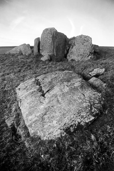
St Michael's Grave submitted by butephoto on 18th Mar 2006. St. Michael's Grave, chambered cairn.
www.butephotography.com for more.
(View photo, vote or add a comment)
Log Text: This is a 4km return walk, if you park at the "P" on the OS map. To drive onward is do-able in a 2WD family car, but though the route is flattish, it is *very* bumpy. There is no tarmac.
Colmac Bridge
Date Added: 21st May 2016
Site Type: Standing Stone (Menhir)
Country: Scotland (Isle of Bute)
Visited: Yes on 15th May 2016. My rating: Condition 3 Ambience 3 Access 4
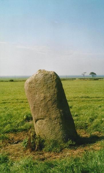
Colmac Bridge submitted by Bladup on 15th Feb 2013. Colmac Bridge Standing stone.
(View photo, vote or add a comment)
Log Text: Not the most exciting stone, unless I missed something!
Dunagoil hillfort
Date Added: 18th May 2016
Site Type: Vitrified Fort
Country: Scotland (Isle of Bute)
Visited: Yes on 14th May 2016. My rating: Condition 3 Ambience 4 Access 3
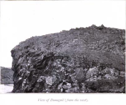
Dunagoil hillfort submitted by durhamnature on 17th Sep 2012. 1843 photo from "The Isle of Bute in Olden Times" by J K Hewison, via archive.org
Site in Isle of Bute Scotland
(View photo, vote or add a comment)
Log Text: Much of its ambience comes from the Arran backdrop, but it's an intriguing site, including the near surroundings, and about all of which I'm sure there is much more to be learnt.
Stravanan Bay
Date Added: 18th May 2016
Site Type: Stone Row / Alignment
Country: Scotland (Isle of Bute)
Visited: Yes on 14th May 2016. My rating: Condition 3 Ambience 3 Access 3
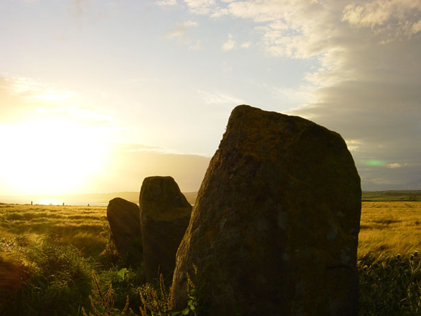
Stravanan Bay submitted by RMG on 11th Jul 2003. Stravanan Bay, Isle of Bute
(View photo, vote or add a comment)
Log Text: Named as Largizean Standing Stones and signposted from the farm at the roadside. Two fields length of walking required. (I took the van, but prob shouldn't've).
Fanum d´Oisseau-le-Petit
Date Added: 3rd May 2016
Site Type: Ancient Temple
Country: France (Pays de la Loire:Sarthe (72))
Visited: Yes on 1st Jan 2005. My rating: Condition 4 Ambience 3 Access 5
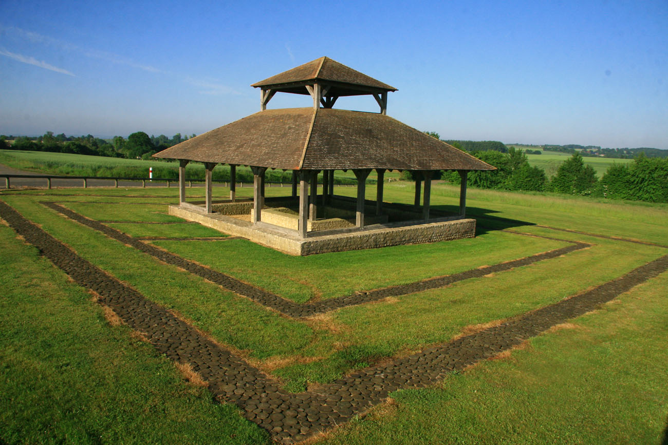
Fanum d´Oisseau-le-Petit submitted by KaiHofmann on 3rd May 2016. Site in Pays de la Loire:Sarthe (72) France
wikipedia image taken by Christophe Bazile, in may 2010. CC BY-SA 3.0
By Christophe Bazile (Own work) [CC BY-SA 3.0], via Wikimedia Commons
(View photo, vote or add a comment)
Log Text: Not all that exciting really.
Stanwick Hillfort
Date Added: 16th Mar 2016
Site Type: Hillfort
Country: England (Yorkshire (North))
Visited: Yes on 12th Mar 2016. My rating: Condition 3 Ambience 4 Access 5
Stanwick Hillfort submitted by rich32 on 2nd Oct 2006. Stanwick is one huge site, if you could walk round the ramparts you’d cover about 4miles & internally you’ve got 750 acres to get lost in.
The earliest evidence dates the fortifications from the mid to late Iron Age, with occupation waning towards the end of the 1st century AD. It’s likely to have been an important stronghold for the Brigantes & may have been the home of queen Cartimandua, who ruled at the time those chaps from Rome visited.
Theres bundles of evidence from other per...
(View photo, vote or add a comment)
Log Text: HUGE site. To reach the middle of the site I still had more than a mile to drive when I stopped to ask a young couple what a line of ancient-looking earthworks might be. I was very surprised to be told it was all part of the same huge site. I drove around, then I walked around, and I came to an excavated section of wall so wide, so high, and so well built that, oh, the shame of it, I assumed I'd made a mistake and it was Roman. But it isn't - it's proper Iron Age British!
Roulston Scar Camp
Date Added: 12th Mar 2016
Site Type: Hillfort
Country: England (Yorkshire (North))
Visited: Yes on 12th Mar 2016. My rating: Condition 2 Ambience 3 Access 4
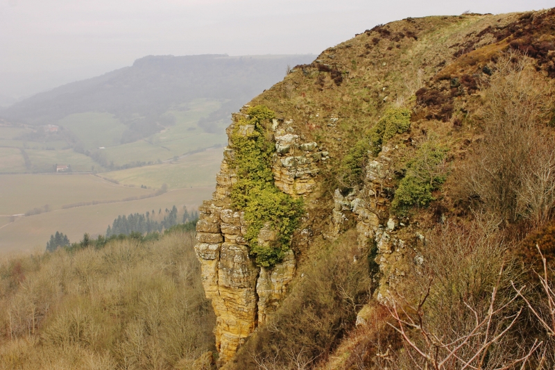
Roulston Scar Camp submitted by SumDoood on 17th Mar 2016. I approached from the N and parked in the car park in the SE corner near the top of the steep descent of Low Town Bank Road, then walked anticlockwise around the western half of the site. I had no map with me so neither looked for, nor noticed any specific ancient features, assuming, perhaps wrongly, that low banks and short ditches were relatively recent. This view is of the steepest and highest of the crumbly-looking cliffs on the west side looking towards the extraordinarily steep main road k...
(View photo, vote or add a comment)
Log Text: Perhaps I missed something. The scenery is impressive as it's just a little way south of the mighty Sutton Bank. Some aerials views would help and there's a gliding club pretty much on top of the site.
Dun Ringill
Date Added: 4th Mar 2016
Site Type: Broch or Nuraghe
Country: Scotland (Highlands)
Visited: Yes on 26th Feb 2016. My rating: Condition 3 Ambience 3 Access 3
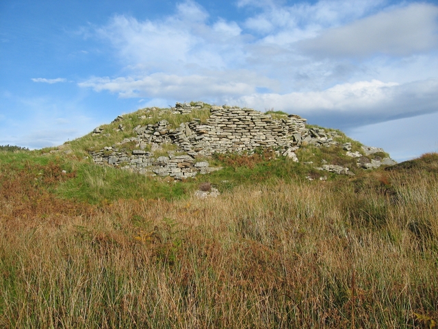
Dun Ringill submitted by Andy B on 3rd Nov 2010. View from the south showing the construction of the wall. It is of much smaller stones than most of the duns on Skye.
Copyright John Allan and licensed for reuse under the Creative Commons Licence
(View photo, vote or add a comment)
Log Text: Don't expect a conventional broch - this one seems to have been much altered. It must have been an important area, there are three other Duns before you reach the southern tip of the peninsula, and there is a large round cairn, a good stone circle, and other sites nearby.
Balnuaran of Clava Centre
Date Added: 29th Feb 2016
Site Type: Ring Cairn
Country: Scotland (Highlands)
Visited: Yes on 27th Feb 2016. My rating: Condition 3 Ambience 4 Access 5
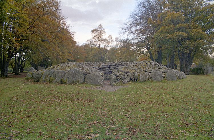
Balnuaran of Clava Centre submitted by Klingon on 27th Feb 2006.
(View photo, vote or add a comment)
Log Text: Re: the central ring cairn, I've been looking through Burl's Stone Circles and have as yet failed to find an explanation for what seems to be a large stone (or two) apparently missing and the resultant space filled in with rocks.
Isn't it odd that had a passage started where such stones might be missing, then it would logically(?) have continued in the same direction, i.e. towards the midwinter sunset, as do the passages in the other two cairns, i.e. passage cairns, on the site.
Wet Withens
Date Added: 17th Feb 2016
Site Type: Stone Circle
Country: England (Derbyshire)
Visited: Yes on 16th Feb 2016. My rating: Condition 3 Ambience 4 Access 3
Wet Withens submitted by TimPrevett on 22nd Jun 2010. Solstice Sunset 2010 at Wet Withens.
(View photo, vote or add a comment)
Log Text: I was there late evening, a rushed visit due to the next day's weather forecast being so unpleasant. I'm glad I went. Perhaps it's because dusk was upon me that the ambience was quite impressive, and the site's structure is unusual. I'm dead against grouse shoooting, but it would be sort-of helpful good if the heather in and around the circle were burnt again! V diff to photograph without a wide lens (and a long pole).
Standing Stone of Bagbie
Date Added: 28th Dec 2015
Site Type: Standing Stone (Menhir)
Country: Scotland (Dumfries and Galloway)
Visited: Yes on 1st Jan 2014. My rating: Condition 3 Ambience 2 Access 3

Standing Stone of Bagbie submitted by vicky on 29th Oct 2002. This single standing stone sits in a field at NX498562 but to the south of, and part of, a complex containing a cairn, four poster stone circle and stone pair.
The Standing Stone of Bagbie is blade-like (as many of the standing stones in this area are) and has no formal access although it can be seen from the lane that runs from the A75(T) in a NE direction in to the hills towards Cambret.
This area is right on the edge of OS Explorer Map 311 (Wigtown, Whithorn & The Machars) and full navi...
(View photo, vote or add a comment)
Log Text: None
Claughreid
Date Added: 21st Nov 2015
Site Type: Stone Circle
Country: Scotland (Dumfries and Galloway)
Visited: Yes on 1st Jan 2013. My rating: Condition 3 Ambience 4 Access 2
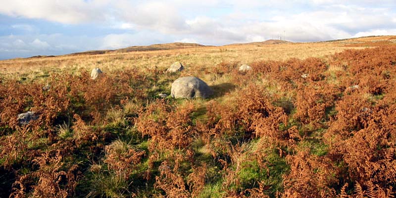
Claughreid submitted by stu on 17th Jul 2004. NX517560.
Similar to the Glenquickan circle just over the hill, here though the centre stone has fallen.
(View photo, vote or add a comment)
Log Text: None
Maen Mawr
Date Added: 13th Nov 2015
Site Type: Stone Row / Alignment
Country: Wales (Powys)
Visited: Yes on 11th Nov 2015. My rating: Condition 3 Ambience 4 Access 3
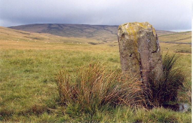
Maen Mawr submitted by AngieLake on 8th Aug 2005. This view of Maen Mawr looks north towards the even-shaped flat-topped mountain that blocks the north aspect of this lovely symmetrical valley. The larger Fan Brycheiniog mountain is out of sight to the NW of this view. Behind me is Cerrig Duon circle, overlooking the alternate E/W folds either side of the southern slopes of the valley from the semi-circular south end of this platform.
(View photo, vote or add a comment)
Log Text: None
Pen Y Beacon
Date Added: 28th Oct 2015
Site Type: Stone Circle
Country: Wales (Powys)
Visited: Yes on 1st Jan 1966. My rating: Condition 2 Ambience 2 Access 5
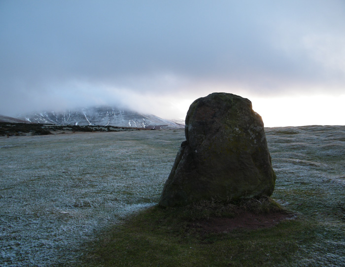
Pen Y Beacon submitted by cerrig on 31st Jan 2010. This is looking South West,towards Twmpa(Lord Herefords Knob)
(View photo, vote or add a comment)
Log Text: None
Maen Llia
Date Added: 25th Oct 2015
Site Type: Standing Stone (Menhir)
Country: Wales (Powys)
Visited: Yes on 1st Jan 1967. My rating: Condition 4 Ambience 4 Access 4
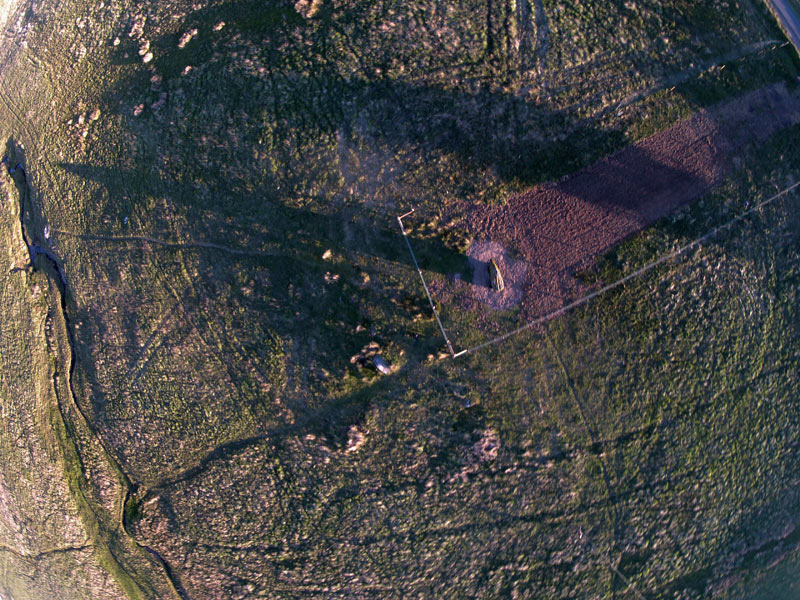
Maen Llia submitted by cerrig on 23rd Jun 2015. A real life manifestation of the stone 'going down to the stream for a drink' - or its shadow at least! Not quite the solstice , a couple of days late . Kite aerial photo of the sunset shadow , and Maen Llia's new enclosure . No expense was wasted on the planning or erecting , a very frugal venture .
(View photo, vote or add a comment)
Log Text: Impressive.
Ribe VikingeCenter
Date Added: 25th Oct 2015
Site Type: Museum
Country: Denmark (Syddanmark)
Visited: Yes on 1st Jan 2008. My rating: Condition 4 Ambience 4 Access 5
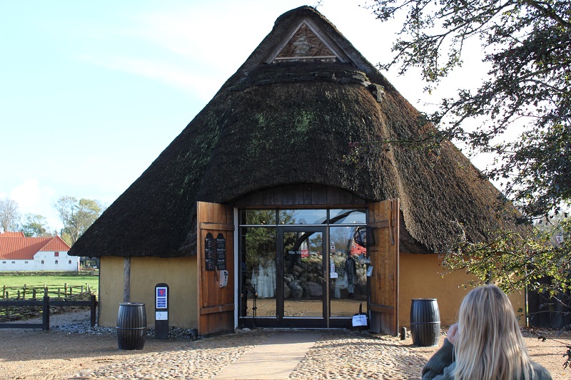
Ribe VikingeCenter submitted by Boeddel on 25th Oct 2015. October 2010
(View photo, vote or add a comment)
Log Text: None
Penrhos-Feilw
Date Added: 25th Oct 2015
Site Type: Standing Stones
Country: Wales (Anglesey)
Visited: Yes on 28th Jul 2015. My rating: Condition 4 Ambience 3 Access 4
Penrhos-Feilw submitted by DrewParsons on 28th Oct 2010. The lovely pair of standing stones photographed on a fine day in late September 2010. The stones are located behind some houses along a short track from the roadside sign. September 2010.
(View photo, vote or add a comment)
Log Text: Thoughtless siting of power lines to north and south of the stones detract somewhat.
Loch Buie Stone Circle
Date Added: 24th Oct 2015
Site Type: Stone Circle
Country: Scotland (Isle of Mull)
Visited: Yes on 1st Sep 2000. My rating: Condition 3 Ambience 4 Access 3
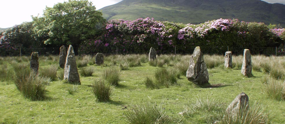
Loch Buie Stone Circle submitted by Tom_Bullock on 27th Feb 2005. Photo used by kind permission of Tom Bullock. More details of this location are to be found on his Stone Circles and Rows CD-ROM.
(View photo, vote or add a comment)
Log Text: None
Mitchell's Fold
Date Added: 21st Sep 2015
Site Type: Stone Circle
Country: England (Shropshire)
Visited: Yes on 1st Jan 2010. My rating: Condition 3 Ambience 4 Access 4

Mitchell's Fold submitted by PaulM on 22nd Jan 2002. Mitchell's Fold in the snow on New Year's Day 2002.
(View photo, vote or add a comment)
Log Text: None
Liddel 2 Burnt Mound
Date Added: 19th Sep 2015
Site Type: Ancient Village or Settlement
Country: Scotland (Orkney)
Visited: Yes on 1st Sep 2015. My rating: Condition 3 Ambience 3 Access 3
Isbister: Bronze Age House submitted by howar on 10th Apr 2007. site viewed from track coming down
(View photo, vote or add a comment)
Log Text: None
