Contributory members are able to log private notes and comments about each site
Sites sumdoood has logged. View this log as a table or view the most recent logs from everyone
Balnuaran of Clava Centre
Date Added: 29th Feb 2016
Site Type: Ring Cairn
Country: Scotland (Highlands)
Visited: Yes on 27th Feb 2016. My rating: Condition 3 Ambience 4 Access 5
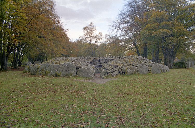
Balnuaran of Clava Centre submitted by Klingon on 27th Feb 2006.
(View photo, vote or add a comment)
Log Text: Re: the central ring cairn, I've been looking through Burl's Stone Circles and have as yet failed to find an explanation for what seems to be a large stone (or two) apparently missing and the resultant space filled in with rocks.
Isn't it odd that had a passage started where such stones might be missing, then it would logically(?) have continued in the same direction, i.e. towards the midwinter sunset, as do the passages in the other two cairns, i.e. passage cairns, on the site.
Dun Ringill
Date Added: 4th Mar 2016
Site Type: Broch or Nuraghe
Country: Scotland (Highlands)
Visited: Yes on 26th Feb 2016. My rating: Condition 3 Ambience 3 Access 3
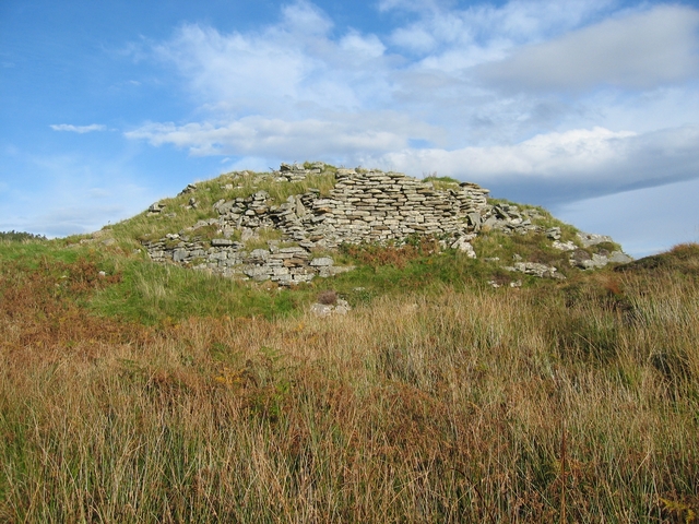
Dun Ringill submitted by Andy B on 3rd Nov 2010. View from the south showing the construction of the wall. It is of much smaller stones than most of the duns on Skye.
Copyright John Allan and licensed for reuse under the Creative Commons Licence
(View photo, vote or add a comment)
Log Text: Don't expect a conventional broch - this one seems to have been much altered. It must have been an important area, there are three other Duns before you reach the southern tip of the peninsula, and there is a large round cairn, a good stone circle, and other sites nearby.
Wet Withens
Date Added: 17th Feb 2016
Site Type: Stone Circle
Country: England (Derbyshire)
Visited: Yes on 16th Feb 2016. My rating: Condition 3 Ambience 4 Access 3
Wet Withens submitted by TimPrevett on 22nd Jun 2010. Solstice Sunset 2010 at Wet Withens.
(View photo, vote or add a comment)
Log Text: I was there late evening, a rushed visit due to the next day's weather forecast being so unpleasant. I'm glad I went. Perhaps it's because dusk was upon me that the ambience was quite impressive, and the site's structure is unusual. I'm dead against grouse shoooting, but it would be sort-of helpful good if the heather in and around the circle were burnt again! V diff to photograph without a wide lens (and a long pole).
Slwch Camp
Date Added: 16th Mar 2017
Site Type: Hillfort
Country: Wales (Powys)
Visited: Yes. My rating: Condition 3 Ambience 3 Access 3
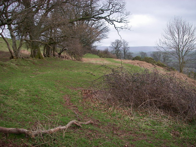
Slwch Camp submitted by Andy B on 27th Feb 2011. Slwch Tump
This level bench in the hillside is the southern edge of the hillfort which sits above and immediately east of Brecon/Aberhonddu. It is one of three hillforts which surround the town. Slwch Tump and nearby Pen-y-crug are accessible by public rights of way.
Copyright Alan Bowring and licensed for reuse under the Creative Commons Licence.
(View photo, vote or add a comment)
Log Text: Much overgrown in summer and not spectacular, but the views are *enormous*.
Maen Mawr
Date Added: 13th Nov 2015
Site Type: Stone Row / Alignment
Country: Wales (Powys)
Visited: Yes on 11th Nov 2015. My rating: Condition 3 Ambience 4 Access 3
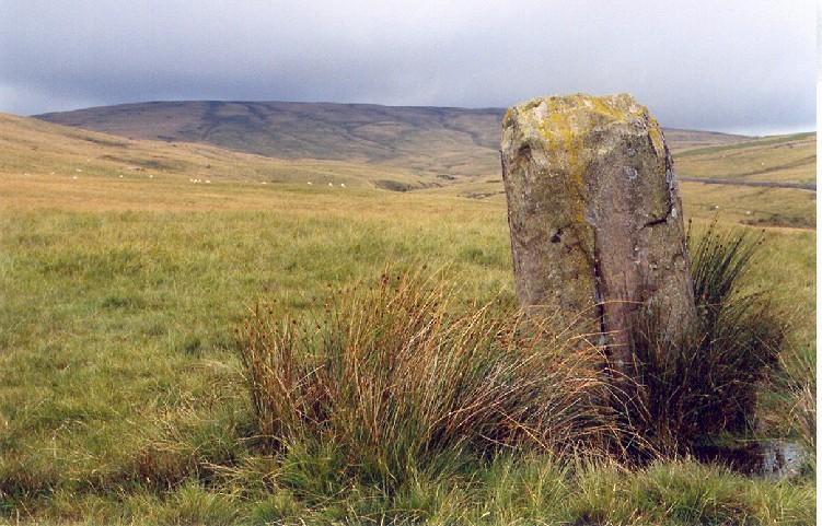
Maen Mawr submitted by AngieLake on 8th Aug 2005. This view of Maen Mawr looks north towards the even-shaped flat-topped mountain that blocks the north aspect of this lovely symmetrical valley. The larger Fan Brycheiniog mountain is out of sight to the NW of this view. Behind me is Cerrig Duon circle, overlooking the alternate E/W folds either side of the southern slopes of the valley from the semi-circular south end of this platform.
(View photo, vote or add a comment)
Log Text: None
Liddel 2 Burnt Mound
Date Added: 19th Sep 2015
Site Type: Ancient Village or Settlement
Country: Scotland (Orkney)
Visited: Yes on 1st Sep 2015. My rating: Condition 3 Ambience 3 Access 3
Isbister: Bronze Age House submitted by howar on 10th Apr 2007. site viewed from track coming down
(View photo, vote or add a comment)
Log Text: None
South Yarrows Broch
Date Added: 20th Aug 2015
Site Type: Broch or Nuraghe
Country: Scotland (Caithness)
Visited: Yes on 17th Aug 2015. My rating: Condition 2 Ambience 4 Access 3
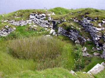
South Yarrows Broch submitted by howe on 11th Jun 2009. South Yarrows Broch. View of the interior looking towards the entrance
(View photo, vote or add a comment)
Log Text: Good one, with a varied history:
http://canmore.org.uk/event/845495
Achavanich
Date Added: 26th Nov 2016
Site Type: Stone Circle
Country: Scotland (Highlands)
Visited: Yes on 1st Aug 2015. My rating: Condition 3 Ambience 4 Access 4
submitted by on .
(View photo, vote or add a comment)
Log Text: None
Four Stones (Powys)
Date Added: 30th Jul 2017
Site Type: Stone Circle
Country: Wales (Powys)
Visited: Yes on 30th Jul 2015. My rating: Condition 3 Ambience 4 Access 4
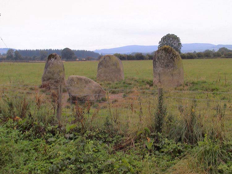
Four Stones (Powys) submitted by vicky on 13th Sep 2002. The Four Stones Stone Circle in Powys. Photo taken by Cassian Hall.
(View photo, vote or add a comment)
Log Text: Well worth a visit. Ambience varies depending on the crops being grown around the site.
Penrhos-Feilw
Date Added: 25th Oct 2015
Site Type: Standing Stones
Country: Wales (Anglesey)
Visited: Yes on 28th Jul 2015. My rating: Condition 4 Ambience 3 Access 4
Penrhos-Feilw submitted by DrewParsons on 28th Oct 2010. The lovely pair of standing stones photographed on a fine day in late September 2010. The stones are located behind some houses along a short track from the roadside sign. September 2010.
(View photo, vote or add a comment)
Log Text: Thoughtless siting of power lines to north and south of the stones detract somewhat.
Roughting Linn Rock Art
Date Added: 23rd Jul 2015
Site Type: Rock Art
Country: England (Northumberland)
Visited: Yes on 20th Jun 2015. My rating: Condition 3 Ambience 3 Access 4
Roughting Linn Rock Art submitted by TimPrevett on 25th Apr 2015. BBC Countryfile will have a feature with Roughting Linn on 3rd May 2015 - at least that's what they told us when we stumbled upon them filming there during the Easter Holidays. An emphasis on the sound at Rock Art sites in their feature explains the nice parabolic microphone!
(View photo, vote or add a comment)
Log Text: A fine site to visit. I remain perplexed by the "hillfort" and suspect that the walls and ditches might have formed a processional way. I found that water flows N, S, E & W from the adapted cup and similar marks at the highest point of the rock mass.
Roughting Linn Hillfort
Date Added: 27th Jun 2015
Site Type: Promontory Fort / Cliff Castle
Country: England (Northumberland)
Visited: Yes on 20th Jun 2015. My rating: Condition 3 Ambience 4 Access 4
Roughting Linn Hillfort submitted by TimPrevett on 18th May 2010. These ramparts defining an Iron Age promontory fort are very easy to find - just off the track leading up to Goatscrag Hill, and near the more visited Neolithic Rock Art - from where they are clearly visible. 10/04/10
(View photo, vote or add a comment)
Log Text: What makes us think that this is a hillfort?
I visited in the 3rd week of June when the vegetation was coming on strong, but I walked up, down and along four ditches and walls all parallel-ish and on the west side only. What's "hillfort" about such a structure? Are there walls / ditches on the N, S or E sides?
The ends of the walls slope down in such a way as to be rather less than defendable, I suggest, and I got the impression that the purpose of these earthworks might have been to guide, but also to slow down and build suspense for, a procession of visitors approaching from the west who could have walked an S-shaped route along the ditches towards the sun rising over the art.
Your thoughts?
Ötzi Village
Date Added: 19th Jul 2016
Site Type: Museum
Country: Austria
Visited: Yes on 19th Jun 2015. My rating: Condition 3 Ambience 3 Access 5

Ötzi Village submitted by Klingon on 19th Jul 2016. A replica of a menhir statue.
(View photo, vote or add a comment)
Log Text: It's worth a visit, but in 2015 the buildings and items on display were looking a bit tired.
Moel Arthur
Date Added: 25th May 2015
Site Type: Hillfort
Country: Wales (Denbighshire)
Visited: Yes on 23rd May 2015. My rating: Condition 3 Ambience 4 Access 3
Moel Arthur submitted by andcampbell on 3rd Jul 2011. Moel Arthur from the air looking east
(View photo, vote or add a comment)
Log Text: None
Birkrigg Common Round Cairn 2
Date Added: 17th May 2015
Site Type: Round Cairn
Country: England (Cumbria)
Visited: Yes on 17th May 2015. My rating: Condition 3 Ambience 3 Access 4
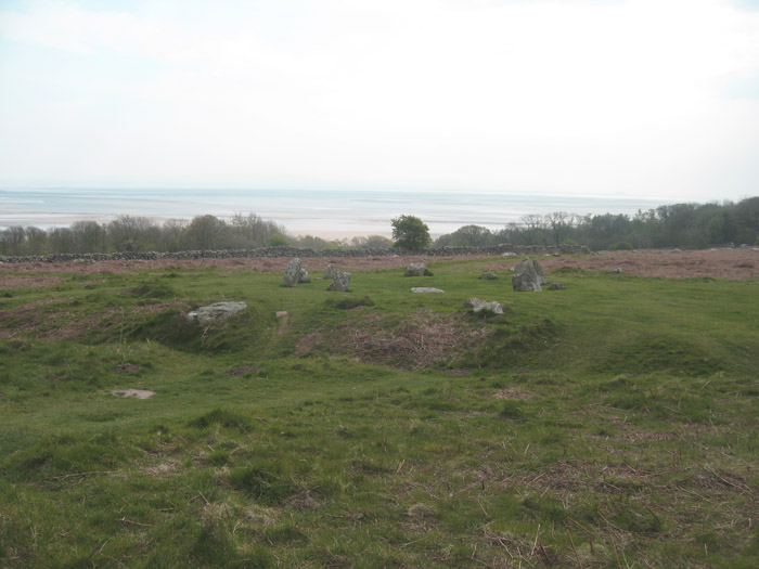
Druids Temple (Cumbria) submitted by Alphasmam on 17th May 2014. Yet another view of Birkrigg Stone Circle showing its double rings of limestone.
The reference to it being a Druidic Temple seems to stem from folk lore and is mentioned in "Mannix and Co. History, Topography and Directory of Westmorland" 1851.
Clearly it is not a Druid circle.
That being said there are references in local folk lore of a well in the woods surrounding the Common where Druids met.Wells I believe were places of early ritual and there is a Well Wood adjoining the Common. Ofte...
(View photo, vote or add a comment)
Log Text: None
Belinac Menhir
Date Added: 26th Apr 2015
Site Type: Standing Stone (Menhir)
Country: France (Midi:Lot (46))
Visited: Yes on 26th Apr 2015. My rating: Condition 3 Ambience 3 Access 5
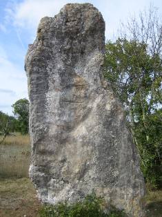
Belinac Menhir submitted by MichelDRN on 20th Oct 2005. I suggest to rename Livernon Menhir as Belinac Menhir, its local name.
From Livernon (Lot, 46), heading SE towards the road joining Cahors and Figeac towns, a sign indicates Belinac Menhir on the right side. 600 meters and this outstanding monolith appears.
It is 3.50 meters high, 0.40 m wide, and large from 1.50m (base), to 1.90 m (middle) and 1.00m (top).
(View photo, vote or add a comment)
Log Text: None
Castlehowe Scar Stone Circle
Date Added: 28th Mar 2015
Site Type: Stone Circle
Country: England (Cumbria)
Visited: Yes on 22nd Mar 2015. My rating: Condition 2 Ambience 3 Access 5
Castlehowe Scar Stone Circle submitted by baz on 3rd May 2003. Castlehowe Scar Stone Circle (NY587155).
Ten stones form this small stone circle which is now huddled up against a drystone wall, in a field with a locked gate. On the other side of the wall, there appears to be a stone row.
(View photo, vote or add a comment)
Log Text: Dull really, but the stones (rows) leading south across open ground into the shallow valley might cause you some thought.
Summerhouse Hill
Date Added: 22nd Mar 2015
Site Type: Modern Stone Circle etc
Country: England (Lancashire)
Visited: Yes on 21st Mar 2015. My rating: Condition 2 Ambience 3 Access 4
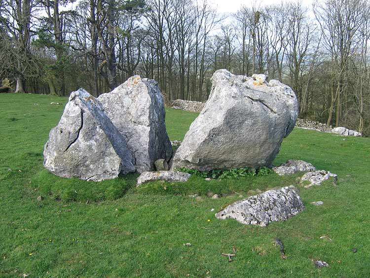
Summerhouse Hill submitted by LivingRocks on 12th Apr 2005. The northerly split stone.
(View photo, vote or add a comment)
Log Text: None
Giants Grave, Kirksanton
Date Added: 10th Mar 2015
Site Type: Standing Stones
Country: England (Cumbria)
Visited: Yes on 10th Mar 2015. My rating: Condition 3 Ambience 4 Access 4
Giants Grave, Kirksanton submitted by Unknown on 21st Jun 2003. Unfortunately the name of the poster and description have been lost. If this is your image please leave the details as a comment below.
(View photo, vote or add a comment)
Log Text: With Black Combe behind them, I was reminded of similar stones at Machrie Moor on Mull.
Borve Stone Row
Date Added: 3rd Mar 2015
Site Type: Stone Row / Alignment
Country: Scotland (Isle of Skye)
Visited: Yes on 2nd Mar 2015. My rating: Condition 4 Ambience 4 Access 5
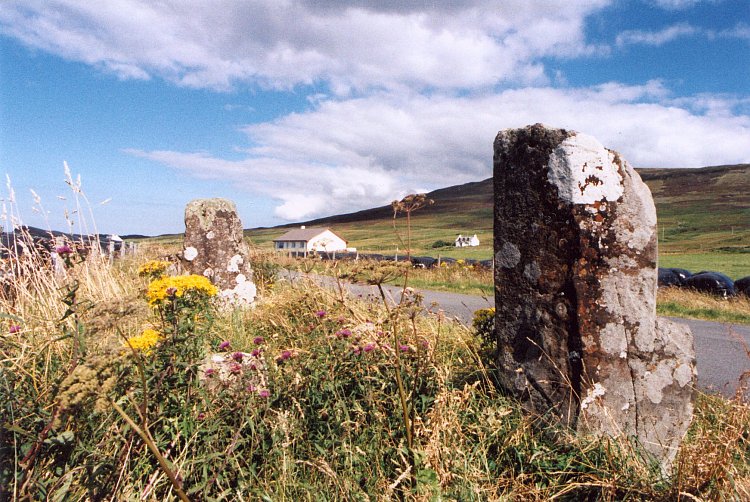
Borve Stone Row submitted by Andy B on 24th Nov 2010. Borve Stone Row taken in about 1997
(View photo, vote or add a comment)
Log Text: When is a row also an alignment? Or not?
