Contributory members are able to log private notes and comments about each site
Sites markj99 has logged. View this log as a table or view the most recent logs from everyone
Bombie 3
Date Added: 25th May 2021
Site Type: Rock Art
Country: Scotland (Dumfries and Galloway)
Visited: Yes on 24th May 2021. My rating: Condition 3 Ambience 5 Access 3
Bombie 3 submitted by SolarMegalith on 13th Oct 2016. A general view of Bombie 3 panel (photo taken on September 2016).
(View photo, vote or add a comment)
Log Text: Bombie 3 is easier to find than Bombie 2 due to its proximity to the pond fenced off in the NE corner of the field. Bombie 3 is located beside a gorse bush c. 10 yards N from the SW corner of the electric fence round the pond. The rock art panel is at the base of a gorse bush within several yards of the fence. There is a large cup and multiple rings marking centrally placed on a roughly triangular panel. Smaller fainter cup and ring markings in the bottom apexes are covered in turf. I left them covered to protect them.
Bombie 2
Date Added: 25th May 2021
Site Type: Rock Art
Country: Scotland (Dumfries and Galloway)
Visited: Yes on 24th May 2021. My rating: Condition 3 Ambience 5 Access 3
Bombie 2 submitted by SolarMegalith on 13th Oct 2016. Cup-and-ring marks on Bombie 2c panel (photo taken on September 2016).
(View photo, vote or add a comment)
Log Text: Bombie 2 is located on a gorse covered ridge on a SSW-NNE Axis at NX 72517 49733. This is different from the listed grid reference, a mistake copied from Canmore ID 64436. It is difficult to find in rough terrain broken up by beef cattle. The Bombie 2 panels were largely hidden under turf on my recent visit.
Castlecreavie Settlement
Date Added: 25th May 2021
Site Type: Ancient Village or Settlement
Country: Scotland (Dumfries and Galloway)
Visited: Yes on 24th May 2021. My rating: Condition 3 Ambience 4 Access 4
Castlecreavie Settlement submitted by SolarMegalith on 4th Oct 2016. Outline of the rampart in the NE part of the settlement (photo taken on September 2016).
(View photo, vote or add a comment)
Log Text: Castlecreavie Settlement is situated on the road to Castlecreavie Farm between Kirkcudbright and Dundrennan. There is room to park at NX 72424 49258, c. 500 yards up the narrow road to Castlecreavie Farm. There is a style leading up to Castlecreavie Settlement. The natural hillock has an enclosure measuring c. 75 yards NE-SW and 40 yards NW-SE. There are remains of a c. 4 feet rampart on the SW and NE of the enclosure. There are steep slopes all round except for the SW which slopes away at a shallow angle. There is a prominent terrace from c. 12 to 15 feet wide round the settlement, except on the SW side.
Boleigh Fogou
Date Added: 21st May 2021
Site Type: Souterrain (Fogou, Earth House)
Country: England (Cornwall)
Visited: Yes on 23rd Mar 2013. My rating: Condition 3 Ambience 5 Access 4

Boleigh Fogou submitted by ocifant on 3rd Oct 2004. The entrance to the fogou.
(View photo, vote or add a comment)
Log Text: Rosemerryn house owners were kind enough to allow access to Boleigh Fogou. It was my first visit to a subterranean site but I enjoyed it immensely.
Milton Hill
Date Added: 20th May 2021
Site Type: Standing Stones
Country: Scotland (Dumfries and Galloway)
Visited: Yes on 7th Feb 2009. My rating: Condition 4 Ambience 5 Access 3
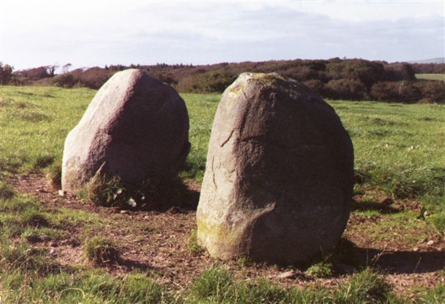
Milton Hill submitted by cosmic on 7th Oct 2004. Along the Line
(View photo, vote or add a comment)
Log Text: There is something magical about a perfectly matched pair of standing stones. The Blairbuy Stones are almost perfectly matched in shape and size. They could be the portal to another world.
Blairbuy 5
Date Added: 20th May 2021
Site Type: Rock Art
Country: Scotland (Dumfries and Galloway)
Visited: Yes on 12th Nov 2011. My rating: Condition 3 Ambience 5 Access 3
Blairbuy 5 submitted by SolarMegalith on 6th Sep 2015. Blairbuy 5 - cup with single ring is the only motif on this panel (photo taken on June 2015).
(View photo, vote or add a comment)
Log Text: Blairbuy 5 is a small deep-cut cup and ring marking on a rock ledge in whins c. 200 yards ESE from the summit cairn of Fell of Barhullion. (Canmore ID 62770)
Blairbuy 3
Date Added: 20th May 2021
Site Type: Rock Art
Country: Scotland (Dumfries and Galloway)
Visited: Yes on 12th Nov 2011. My rating: Condition 3 Ambience 5 Access 3
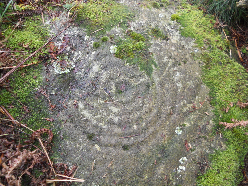
Blairbuy 3 submitted by markj99 on 27th Mar 2019. Blairbuy 3, 5 concentric rings clearly visible.
(View photo, vote or add a comment)
Log Text: Blairbuy 3 was hidden by whins however it was a large cup & 6 rings marking. It was less worn than the Rock Art lying prone in the fields probably due to it's sheltered location.
Blairbuy 2
Date Added: 20th May 2021
Site Type: Rock Art
Country: Scotland (Dumfries and Galloway)
Visited: Yes on 27th Aug 2011. My rating: Condition 3 Ambience 5 Access 3
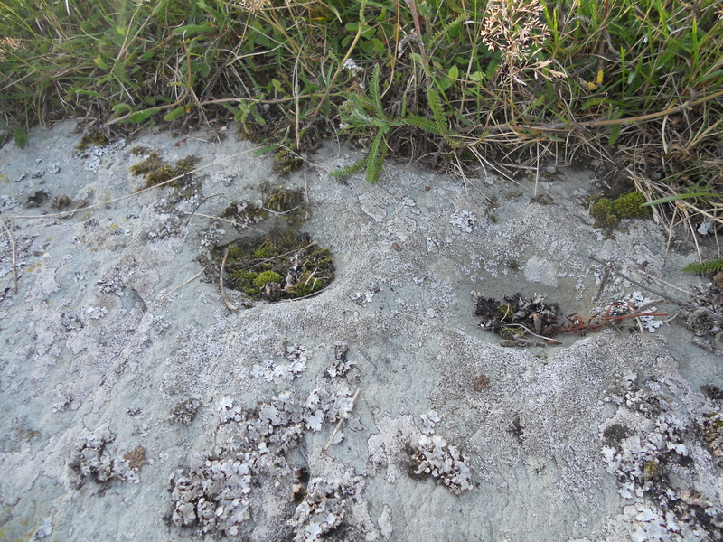
Blairbuy 2 submitted by markj99 on 27th Mar 2019. Blairbuy 2, 2 cup marks top right hand side of rock panel.
(View photo, vote or add a comment)
Log Text: The cup and ring markings on the panel were faint but there were several large cup markings visible.
Bladnoch
Date Added: 20th May 2021
Site Type: Standing Stone (Menhir)
Country: Scotland (Dumfries and Galloway)
Visited: Yes on 15th Sep 2018. My rating: Condition 4 Ambience 3 Access 5
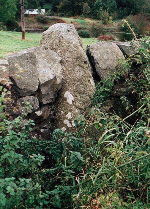
Bladnoch Standing Stone submitted by PaulM on 29th Oct 2002. This standing stone is marked on the OS Explorer Map 311 (Wigtown, Whithorn & The Machars) and can be found in the drystone wall flanking the A714 and directly opposite the house called Ashleigh in Bladnoch. The whisky distillery is only a short stagger away.
NGR: NX 423542.
(View photo, vote or add a comment)
Log Text: The stone lies opposite no 18 in Bladnoch main street. It is an irregular stone prominent above the regular wall. It's true nature can be seen from the field side of the wall where the breadth of the stone is visible. There is an entrance into the field c. 75 yards W of the standing stone.
Bencallen Hill
Date Added: 19th May 2021
Site Type: Chambered Cairn
Country: Scotland (South Ayrshire)
Visited: Yes on 19th May 2021. My rating: Condition 2 Ambience 5 Access 3
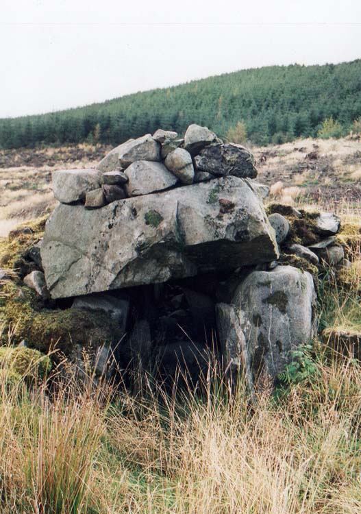
Bencallen Hill submitted by PaulM on 29th Oct 2002. Shiel Bridge/Bencallen chambered tomb
Good navigation is needed to find this cairn as the landscape is pretty featureless (NX33779440). Luckily for us the conifers had been recently cleared. There is parking (just) but the lane is very quiet. I dived up the slope and headed in the vague general direction but struck lucky.
Another strange site as the cairn cover has been robbed for drystone walls which all seemed to have been built to hem in the chamber or perhaps as sheepfolds. All t...
(View photo, vote or add a comment)
Log Text: Bencallen Cairn lies c. 3.75 miles E from Barr Village in S Ayrshire. It is difficult to get to but the splendid isolation of this site more than compensates. Only one large chamber of the cairn remains built into the N wall of a sheepfold. Presumably the stones from Bencallen Cairn were used in the construction of the sheepfold. The ground round about and inside the sheepfold has been deforested so it is rough and rutted.
Billy Marshall's Cave
Date Added: 16th May 2021
Site Type: Cave or Rock Shelter
Country: Scotland (Dumfries and Galloway)
Visited: Yes on 16th May 2009. My rating: Condition 5 Ambience 5 Access 1
Billy Marshall's Cave submitted by markj99 on 14th Sep 2020. Entrance to Billy Marshall''s Cave.
(View photo, vote or add a comment)
Log Text: It has been more than ten years since I last visited Billy Marshall's Cave. I wonder how many people have visited it since then. There was a geocache box in it so maybe that would have increased its popularity.
White Cairn, Beoch Hill
Date Added: 16th May 2021
Site Type: Cairn
Country: Scotland (Dumfries and Galloway)
Visited: Yes on 7th Sep 2019. My rating: Condition 2 Ambience 4 Access 1
White Cairn, Beoch Hill submitted by markj99 on 11th Sep 2019. Looking W to Loch Ryan from White Cairn, Beoch Hill.
(View photo, vote or add a comment)
Log Text: It is illogical to put so much effort into such a small hidden cairn. Then again, when did common sense influence the antiquarian seeking a new target. I have an unfortunate attraction to remote sites.
Beoch Hill Cairn
Date Added: 16th May 2021
Site Type: Cairn
Country: Scotland (Dumfries and Galloway)
Visited: Yes on 7th Sep 2019. My rating: Condition 2 Ambience 4 Access 1
Beoch Hill Cairn submitted by markj99 on 11th Sep 2019. Looking NE across hollow centre of Beoch Hill cairn.
(View photo, vote or add a comment)
Log Text: It is illogical to put so much effort into such a small hidden cairn. Then again, when did common sense influence the antiquarian seeking a new target. I have an unfortunate attraction to remote sites.
Beinn Ghott
Date Added: 15th May 2021
Site Type: Cairn
Country: Scotland (Isle of Tiree)
Visited: Yes on 29th Aug 2019. My rating: Condition 2 Ambience 4 Access 3
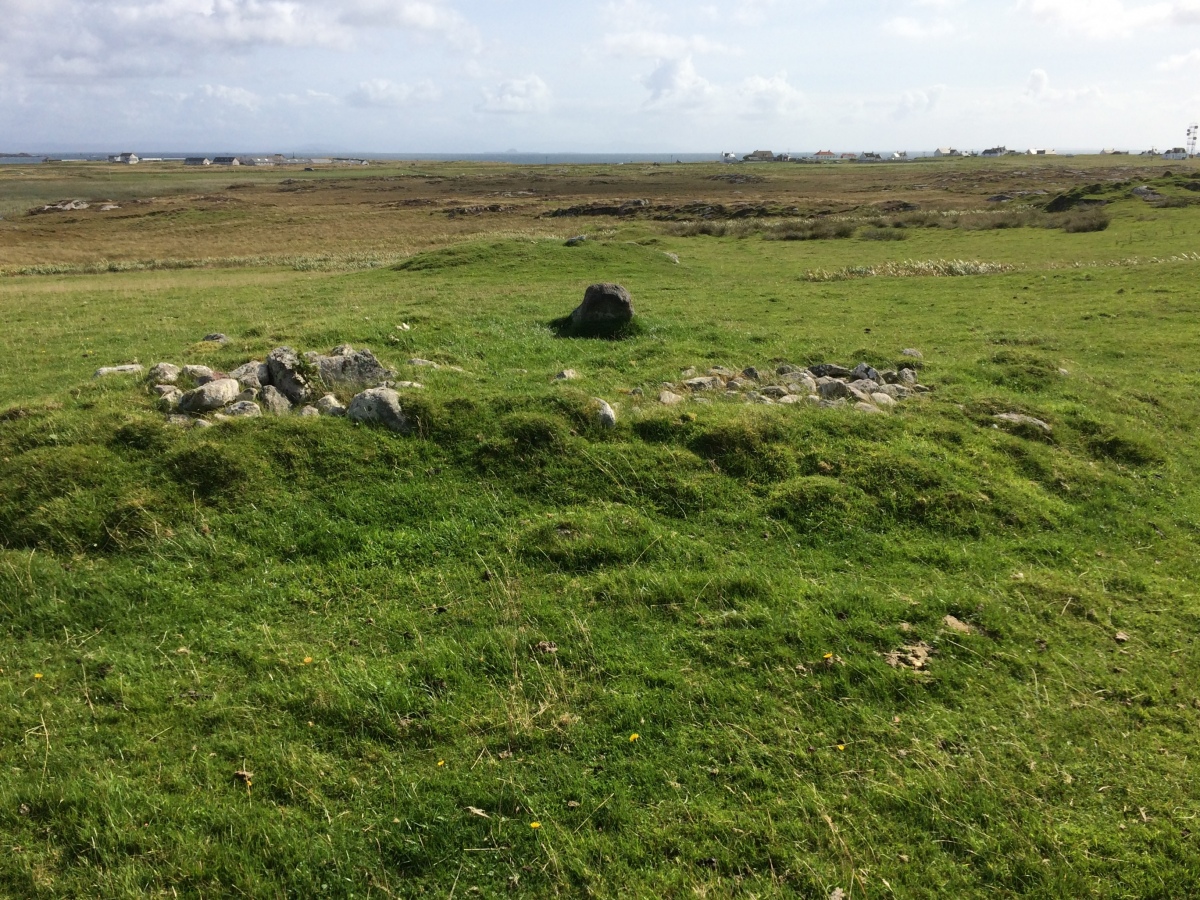
Beinn Ghott submitted by markj99 on 15th May 2021. Approaching Beinn Ghott Cairn from NW.
(View photo, vote or add a comment)
Log Text: Beinn Ghott Cairn is a small compact cairn which will not appeal to all antiquarians. However if you are on Tiree for an extended stay there is no good reason not to visit it.
Salachary
Date Added: 14th May 2021
Site Type: Stone Row / Alignment
Country: Scotland (Argyll)
Visited: Yes on 30th Apr 2010. My rating: Condition 3 Ambience 5 Access 3
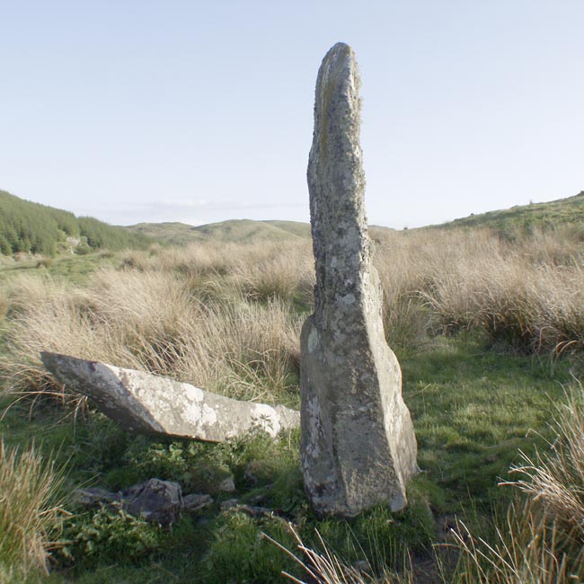
Salachary submitted by Tom_Bullock on 28th Feb 2005. Photo used by kind permission of Tom Bullock. More details of this location are to be found on his Stone Circles and Rows CD-ROM.
(View photo, vote or add a comment)
Log Text: Salachary Stone Row is c. 3 miles N of Kilmartin in open moorland. The three stone row consists of a standing stone, a leaning stone and an embedded recumbent stone on a N-S Axis measuring c. 15 feet.
Travel c. 5 miles N to a lay-by at an abandoned quarry on the L at NM 8420 0450. Walk W along the road for c. 150 yards to a grass track on the L. Follow this track S for c. 0.5 mile. It ends at NM 83981 04031. Salachary Stone Row is c. 80 yards E of this point.
The remote location of this stone row amplifies the ambience of the site making it an enjoyable experience.
Barpa Langais
Date Added: 14th May 2021
Site Type: Chambered Tomb
Country: Scotland (North Uist)
Visited: Yes on 1st Jul 2011. My rating: Condition 4 Ambience 5 Access 4
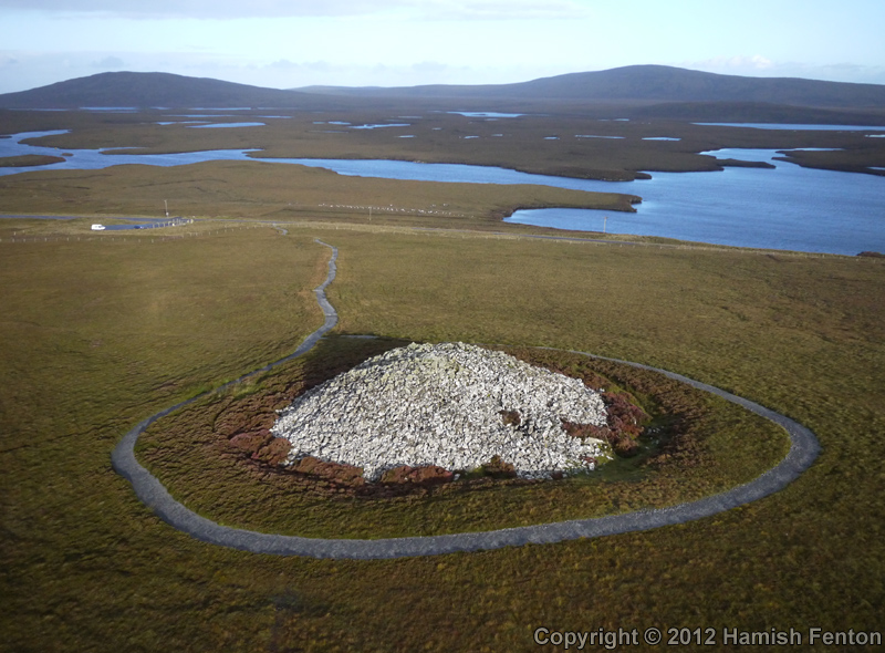
Barpa Langais submitted by h_fenton on 25th Sep 2012. Barpa Langais photographed from the South East.
Kite Aerial Photograph
16 September 2012 @ 7.54am
(View photo, vote or add a comment)
Log Text: The survival of Barpa Langais in its almost intact state is due to its location on an isolated island. It is most unusual to have a dedicated car park and path leading to a well preserved chambered cairn. Barpa Langais was a highlight on my Hebridean tour.
Barnhouse Stone
Date Added: 13th May 2021
Site Type: Standing Stone (Menhir)
Country: Scotland (Orkney)
Visited: Yes on 7th Aug 2012. My rating: Condition 4 Ambience 4 Access 3
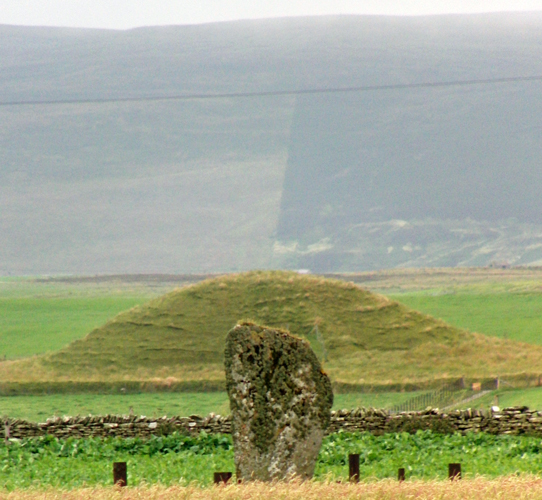
Barnhouse Stone submitted by howar on 30th Jul 2010. stone with Maes Howe aligned, Setter tumuli on Syra Dale behind Maes Howe continuing line
(View photo, vote or add a comment)
Log Text: Barnhouse Stone is surrounded by the Stones of Stenness, the Watch Stone and Maeshowe. This is tough company to compete with. It also implies it could be important to be erected in such an important area. The c. 10 feet tall stone slab stand in splendid isolation in an arable field c. 0.5 mile SE of the Stones of Stenness. It deserves to be visited.
Barnhouse Settlement
Date Added: 13th May 2021
Site Type: Ancient Village or Settlement
Country: Scotland (Orkney)
Visited: Yes on 7th Aug 2012. My rating: Condition 3 Ambience 4
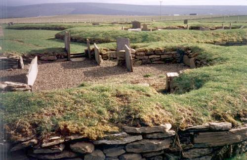
Barnhouse Settlement submitted by steveco on 24th Feb 2002. Barnhouse Settlement HY306127. Probably in use around the same time of Skara Brae.
(View photo, vote or add a comment)
Log Text: Barnhouse Settlement is the closest habitation to the Stones of Stenness marking it as an important site. The site is easy to visit from Stenness. It presents reconstructed floorplans of multiple buildings in the settlement making it easier to imagine how the original may have looked.
Clachaneasy Bridge
Date Added: 13th May 2021
Site Type: Cairn
Country: Scotland (Dumfries and Galloway)
Visited: Yes on 11th May 2021. My rating: Condition 2 Ambience 4 Access 1
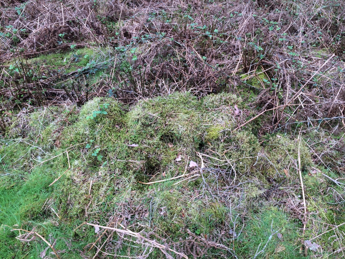
Clachaneasy Bridge submitted by markj99 on 12th May 2021. A row of moss-covered stones on Clachaneasy Bridge Cairn summit.
(View photo, vote or add a comment)
Log Text: I was intending to visit Glenhapple Cairn but was prevented by a no admission sign. I stumbled onto Clachaneasy Bridge Cairn by accident on my GPS. The cairn is located in dense forestry N of Clachaneasy Bridge. It is probably not worth visiting unless you are some kind of cairn completist.
Bardennoch
Date Added: 13th May 2021
Site Type: Cairn
Country: Scotland (Dumfries and Galloway)
Visited: Yes on 17th Sep 2020. My rating: Condition 2 Ambience 5 Access 2
Bardennoch submitted by markj99 on 19th Sep 2020. Bardennoch Cairn SE Third of Cairn Circle.
(View photo, vote or add a comment)
Log Text: I am always amazed that anyone should deliberately chose to build a dry stane dyke directly across an ancient site. To rub salt into the wounds, Bardennoch Cairn probably provided the raw materials for the dyke's constuction. That said, it is a worthwhile visit especially if you continue on to the Braidenoch Cross Slabs.
