Contributory members are able to log private notes and comments about each site
Sites markj99 has logged. View this log as a table or view the most recent logs from everyone
Kermaillard Menhir
Date Added: 27th Sep 2023
Site Type: Standing Stone (Menhir)
Country: France (Bretagne:Morbihan (56))
Visited: Yes on 15th Sep 2023. My rating: Condition 4 Ambience 5 Access 4
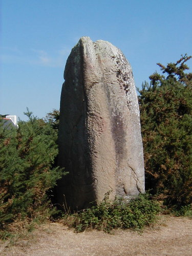
Kermaillard menhir submitted by stollentroll on 21st May 2006. Kermaillard menhir, around 4 metres tall. The menhir shows engravings and cup-marks.
(View photo, vote or add a comment)
Log Text: Menhir de Kermaillard is a massive standing stone, sub-rectangular in cross section, measuring c. 1.7m long and 1.2m wide. This dressed pillar rises to a point at c. 4m. There is a square measuring c. 0.6m and a crescent carved in bas-relief on the base of the WSW face. A small axe carved on the left of the square is no longer visible. Proposed carvings on the ENE face are not visible in bright light.
Kermané Dolmen
Date Added: 2nd Oct 2023
Site Type: Burial Chamber or Dolmen
Country: France (Bretagne:Morbihan (56))
Visited: Yes on 17th Sep 2023. My rating: Condition 3 Ambience 3
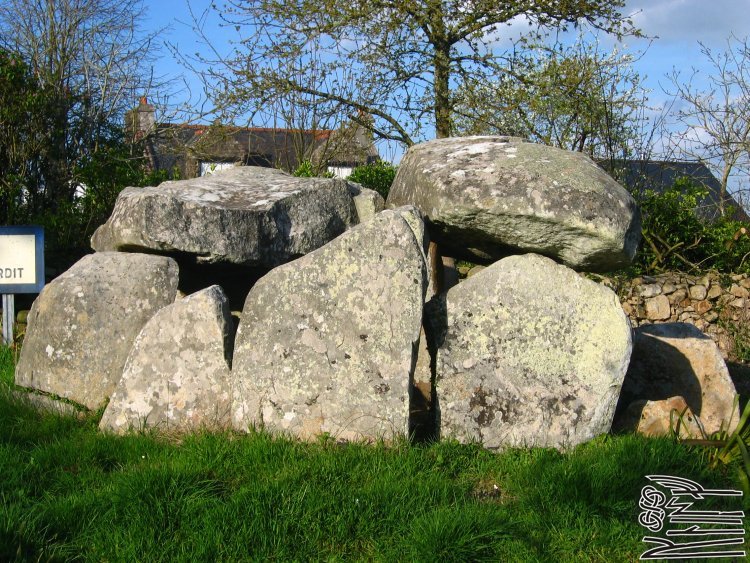
Kermané dolmen submitted by Ogneslav on 25th May 2008. Site in Bretagne: Morbihan (56)
(View photo, vote or add a comment)
Log Text: There is a hidden dolmen c. 450m SW of the Le Chat Noir roundabout on the D781. A cul-de sac signed to Kerganoff is 300m SW of the roundabout. Follow the narrow lane for c. 200m to a dead-end. Dolmen de Kermané is on the left in a private garden. I was limited to taking pictures from outside the fence.
Kermario Alignements
Date Added: 2nd Oct 2023
Site Type: Multiple Stone Rows / Avenue
Country: France (Bretagne:Morbihan (56))
Visited: Yes on 16th Sep 2023. My rating: Condition 4 Ambience 5 Access 5
Kermario alignements submitted by rw1 on 20th Jan 2008. 09/2007
(View photo, vote or add a comment)
Log Text: The Alignements de Kermario were the most impressive of the Carnac Alignments due to the length of the stone rows and the impressive height of the megaliths forming the rows. Unfortunately I had to be content with external views of the stones as access was restricted. The best views were to be had from the Old Windmill platform.
Kermario Dolmen
Date Added: 2nd Oct 2023
Site Type: Burial Chamber or Dolmen
Country: France (Bretagne:Morbihan (56))
Visited: Yes on 16th Sep 2023. My rating: Condition 3 Ambience 4 Access 4
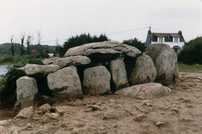
Kermario Dolmen submitted by thecaptain on 18th Oct 2004. Kermario Dolmen, north of Carnac, Brittany.
View of the Kermario Dolmen which is right at the southwest corner of the Kermario Alignements, and right in the corner of the road which skirts the site.
This picture was taken in 1987 when people were free to wander amongst the stones as they pleased. The terrible erosion caused by all the visitors is only too obvious.
(View photo, vote or add a comment)
Log Text: Dolmen de Kermario is located in the SW corner of Alignement de Kermario, c. 40m SW from the nearest stone. It has the appearance of an Allee Couverte.
Kermarquer Dolmen
Date Added: 11th Oct 2023
Site Type: Burial Chamber or Dolmen
Country: France (Bretagne:Morbihan (56))
Visited: Yes on 18th Sep 2023. My rating: Condition 3 Access 4

Kermarquer dolmen submitted by TheCaptain on 8th Nov 2007. This monument is still mostly contained within its mound, and all very overgrown, making photographs very difficult.
(View photo, vote or add a comment)
Log Text: There is room to park beside a hedge at 47.596867, -3.038629 just off the D186 in Kermarquer. Walk c. 120m NE along the D186. Climb up a steep bank on the left-hand side of the road. Dolmen de Kermarquer is located in a clearing.
Kerpenhir Menhir
Date Added: 25th Sep 2023
Site Type: Standing Stone (Menhir)
Country: France (Bretagne:Morbihan (56))
Visited: Yes on 14th Sep 2023. My rating: Condition 4 Ambience 5 Access 4
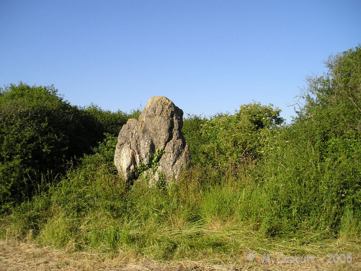
Kerpenhir menhir submitted by thecaptain on 29th May 2008. Splendidly positioned beside the sea near to the Pointe de Kerpenhir, this 3.5 metres tall menhir can be seen in the far hedge of a field, overlooking the entrance to the gulf of Morbihan.
(View photo, vote or add a comment)
Log Text: Menhir de Kerpenhir is a massive irregular standing stone on the coast c. 200m N of Société Nautique de Locmariaquer (Locmariaquer Sailing Club). The menhir is c. 3.5m high by 2.5m wide. It is orientated ENE-WSW on its broad faces.
There is a large car park off Route de Kerpenhir on Pointe de Kerpenhir, c. 2km SSE of Locmariaquer. Walk c. 40m N from the Car Park to reach a closed gate on the right. Follow a track W round the coast. After c. 350m turn left along a path. Follow this path W for c. 100m to reach Menhir de Kerpenhir.
Kerroc'h Dolmen
Date Added: 8th Oct 2023
Site Type: Burial Chamber or Dolmen
Country: France (Bretagne:Morbihan (56))
Visited: Yes on 18th Sep 2023. My rating: Condition 3 Ambience 4 Access 5
Kerroc'h dolmen submitted by TheCaptain on 19th Feb 2011. A capstone sits one end in the air on two supports, while the other side is on the ground. There is one more bit of large stone here, which may be a support, or may be a broken bit of capstone.
(View photo, vote or add a comment)
Log Text: Dolmen de Kerroc'h is located c. 1.2km S of Plouharnel in the hamlet of Kerroc'h. It is located on a patch of grass in the centre of Kerroc'h. The naked dolmen is small but worth a small diversion.
Take the Rue de Kerhueno (Stop Andouilles) turn off the D781 between Carnac and Plouharnel. Follow the road for c. 0.75km to reach a stop sign. Turn left for 150m to reach Dolmen de Kerroc'h.
Kerroc’h cromlech
Date Added: 8th Oct 2023
Site Type: Stone Circle
Country: France (Bretagne:Morbihan (56))
Visited: Yes on 18th Sep 2023. My rating: Condition 1 Ambience 3 Access 5
Kerroc’h cromlech submitted by TheCaptain on 19th Feb 2011. Oppsite to the dolmen, the gently arced wall around the house (a strange large gatewayed studio) is made up using many large stones. Was there once some sort of cromlech here, like that at Crucuny?
(View photo, vote or add a comment)
Log Text: Having read the TheCaptain's account of a possible cromlech I took some pictures of the wall enclosing 42 Route de Kerroch. There does seem to be
visible evidence of this. There are similar stones incorporated into a wall adjacent to an old cross at 40 Route de Kerroch.
Kerzerho Alignements
Date Added: 13th Oct 2023
Site Type: Multiple Stone Rows / Avenue
Country: France (Bretagne:Morbihan (56))
Visited: Yes on 19th Sep 2023. My rating: Condition 3 Ambience 4 Access 5
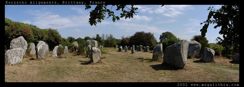
Kerzerho Alignements submitted by ermine on 1st Jul 2004. Kerzerho Alignments
Brittany, Morbihan
47.634690N 3.148402W GPS onsite
You can still walk among the stones at Kerzerho (in 2002 at east) which are near Carnac but not quite so busy. Head up the D781 to Erdeven. You can park nearby, and from there you can also take the path to the large stones of the Table du Sacrifice
(View photo, vote or add a comment)
Log Text: Kerzerho Alignements may not be as extensive as Carnac Alignments but anyone is free to wander amongst the unfenced stones without restrictions. This freedom should be celebrated.
Kilchoan
Date Added: 24th Mar 2023
Site Type: Chambered Cairn
Country: Scotland (Argyll)
Visited: Yes on 30th Apr 2010. My rating: Condition 2 Ambience 4 Access 2
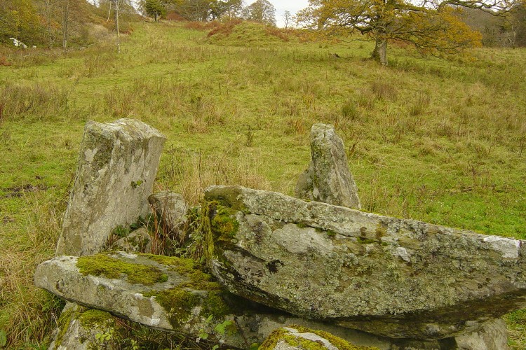
Kilchoan submitted by mickm on 14th Apr 2005. Detail of the top of the chamber looking towards the entrance at the NE showing the displaced capstone over a lintel covering the central compartment. The side slabs of the front compartment are visible beyond.
(View photo, vote or add a comment)
Log Text: Kilchoan Chambered Cairn is located c. 150 yards NW of Kilchoan Lodge. On my visit there was a herd of bullock around the cairn, churning the grass to mud. The jumble of large stones become a large passage and chamber with time and imagination. The site is off the beaten track but more than rewards the expenditure of energy.
Kildoon Hillfort
Date Added: 13th Jul 2022
Site Type: Hillfort
Country: Scotland (South Ayrshire)
Visited: Yes on 10th Jul 2022. My rating: Condition 3 Ambience 4 Access 3
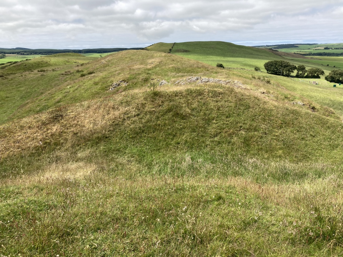
Kildoon Hillfort submitted by markj99 on 12th Jul 2022. Outer Rampart & Ditch of W Flank of Kildoon Fort viewed from E.
(View photo, vote or add a comment)
Log Text: There is a farm track for the first 0.5 mile followed by 0.25 mile along an undulating ridge to Kildoon Fort. There are extensive views in all directions from the fort.
Kilfeddar Farm
Date Added: 9th Feb 2024
Site Type: Cairn
Country: Scotland (Dumfries and Galloway)
Visited: Yes on 1st Feb 2024. My rating: Condition 2 Ambience 4 Access 3
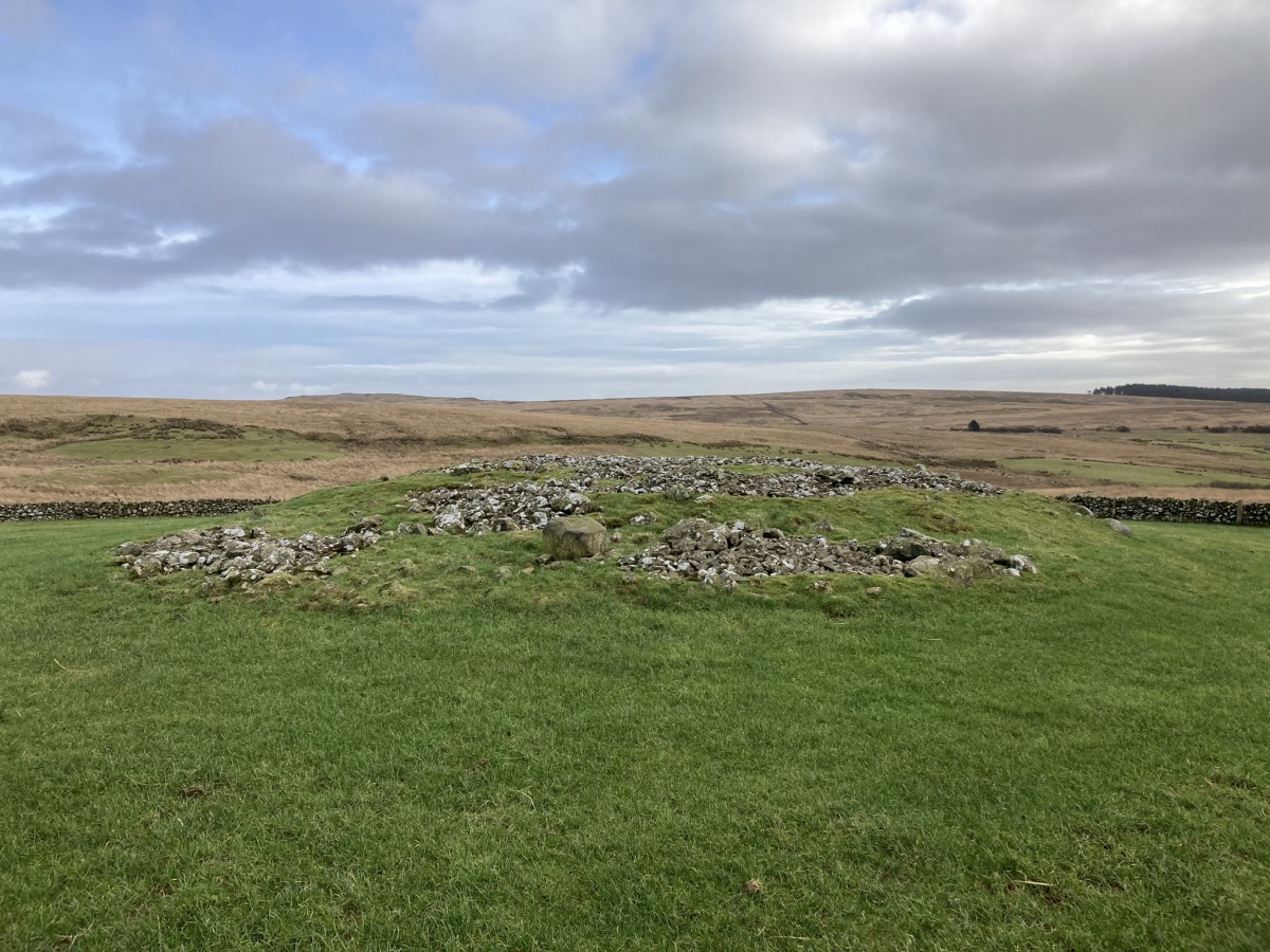
Kilfeddar Farm submitted by markj99 on 9th Feb 2024. Kilfeddar Farm Cairn viewed from W.
(View photo, vote or add a comment)
Log Text: There are three cairns accessed via the path to Kilfeddar Farm: Barlure Cairn, Altigoukie Burn Cairn and Kilfeddar Farm Cairn. See individual site pages for details. The path is muddy so wellies are recommended.
Kilhern SE
Date Added: 10th May 2022
Site Type: Cairn
Country: Scotland (Dumfries and Galloway)
Visited: Yes on 22nd Jun 2021. My rating: Condition 3 Ambience 4 Access 3
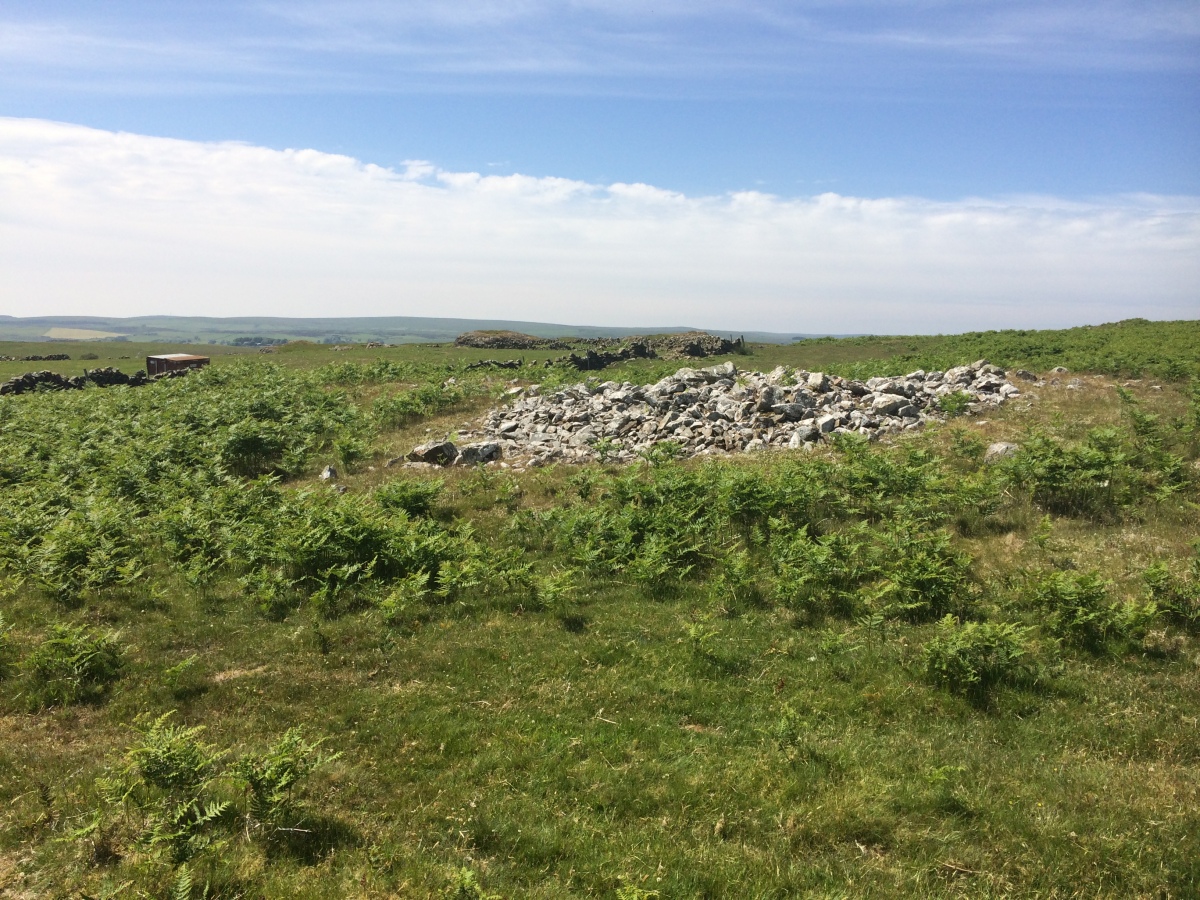
Kilhern SE submitted by markj99 on 26th Jun 2021. Kilhern SE Cairn viewed from SE.
(View photo, vote or add a comment)
Log Text: The ruin of Kilhern Farm is on the Southern Upland Way. Follow the dry stane dyke on the N flank of the farm c. 200 yards up a slope then follow the dyke SE for c. 100 yards to reach the stony cairn. It is best visited in Autumn to Spring in low vegetation.
Kilhern Spa Well (New Luce)
Date Added: 12th Apr 2025
Site Type: Holy Well or Sacred Spring
Country: Scotland (Dumfries and Galloway)
Visited: Yes on 11th Apr 2025. My rating: Condition 3 Ambience 4 Access 3
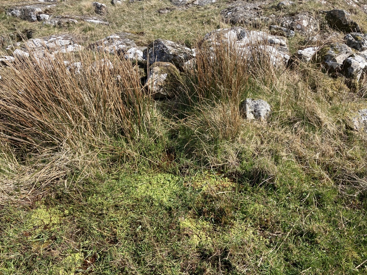
Kilhern Spa Well (New Luce) submitted by markj99 on 12th Apr 2025. Kilhern Spa Well viewed from W.
(View photo, vote or add a comment)
Log Text: I visited Kilhern Spa Well after an extended dry spell. Most of the boggy areas on the moorland had dried out, however there was a waterlogged marshy area W of Kilhern Spa Well. I was probably the first visitor in a long time despite its proximity to the Southern Upland Way and the Caves of Kilhern.
Killantringan Bay
Date Added: 21st Oct 2022
Site Type: Stone Fort or Dun
Country: Scotland (Dumfries and Galloway)
Visited: Yes on 16th Oct 2022. My rating: Condition 2 Ambience 4 Access 3
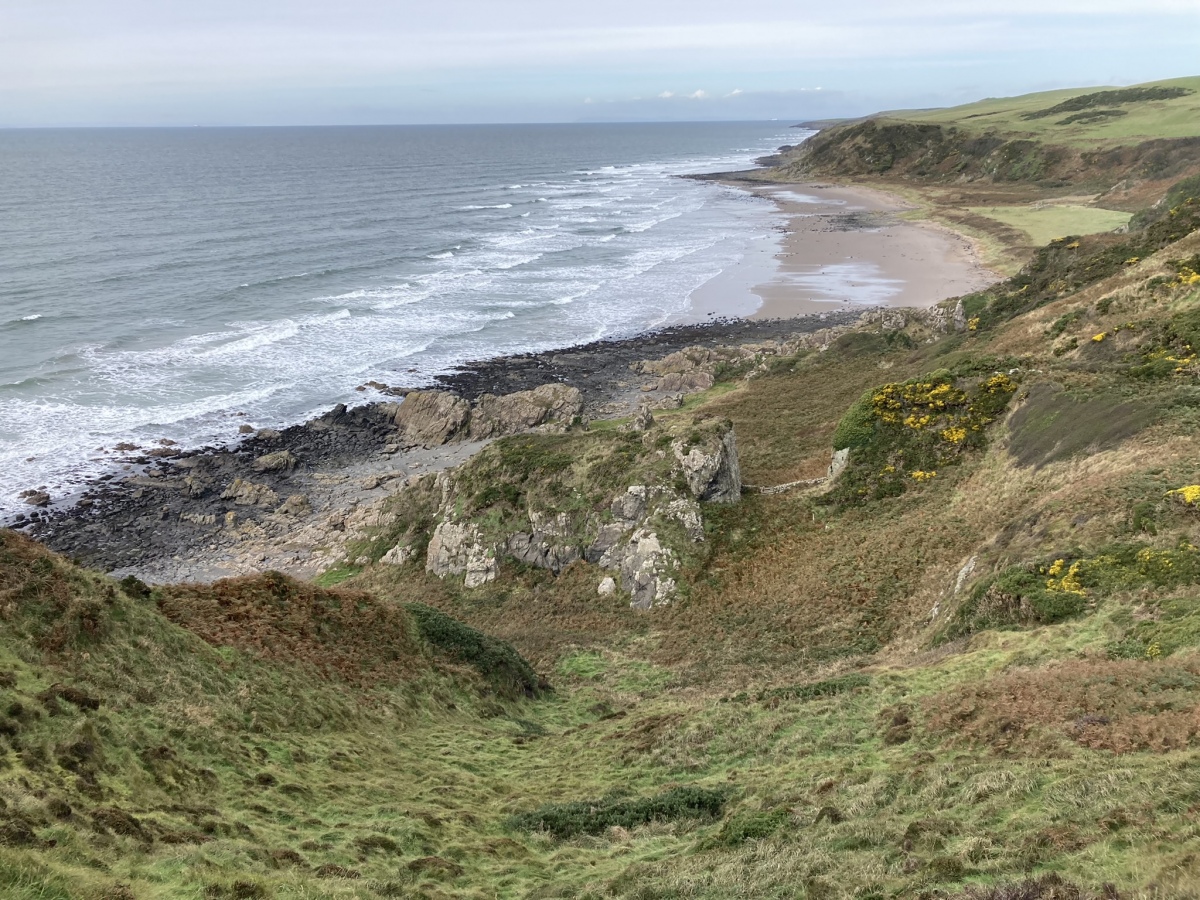
Killantringan Bay submitted by markj99 on 21st Oct 2022. Killantringan Bay Dun viewed from SE.
(View photo, vote or add a comment)
Log Text: I wanted to access Killantringan Bay Dun from the Killantringan Bay car park however, even at low tide the beach route was inaccessible. I improvised a rough route along the top of the escarpment, heading N. A rough scramble down a steep slope led me to Killantringan Bay Dun.
Killantringan Bay
Date Added: 21st Oct 2022
Site Type: Stone Fort or Dun
Country: Scotland (Dumfries and Galloway)
Visited: Yes on 20th Oct 2022. My rating: Condition 2 Ambience 4 Access 3

Killantringan Bay submitted by markj99 on 21st Oct 2022. Killantringan Bay Dun viewed from SE.
(View photo, vote or add a comment)
Log Text: I wasn't happy with my route to Killantringan Bay Dun from Killintringan Bay car park, so I studied OS Mapping to find a user-friendly alternative. I parked up at Knock Farm ruin just off the road. Since the route was unknown to me, I wore wellies. This was fortunate as the rough farm track to the House of Knock had several flooded sections. Just before the House of Knock gate a grassy track wound down the hill past Knock Bay House to Knock Bay. The tide was low, so it was a pleasure to walk S along the beach towards Killantringan Bay Dun. The going underfoot was tricky round the point but this route is preferable to my previous one.
Kilmar Tor North Propped Stone
Date Added: 17th Jun 2023
Site Type: Natural Stone / Erratic / Other Natural Feature
Country: England (Cornwall)
Visited: Yes on 8th Jun 2023. My rating: Condition 5 Ambience 4 Access 3
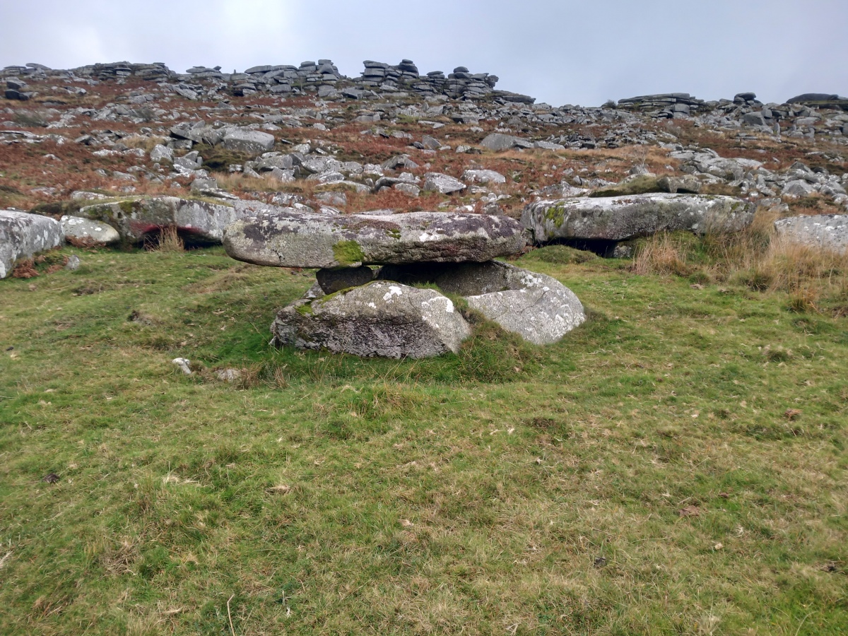
Kilmar Tor North Propped Stone submitted by dooclay on 24th Oct 2022. Site in England, Kilmar Tor N possible Propped Stone
(View photo, vote or add a comment)
Log Text: With so many random stones scattered on Kilmar Tor, one could easily walk past this stone setting. I'm leaning towards the man-made monument rather than natural stone arrangement.
King Arthur Stone
Date Added: 3rd Feb 2023
Site Type: Early Christian Sculptured Stone
Country: England (Cornwall)
Visited: Yes on 18th Oct 2013. My rating: Condition 3 Ambience 4 Access 4
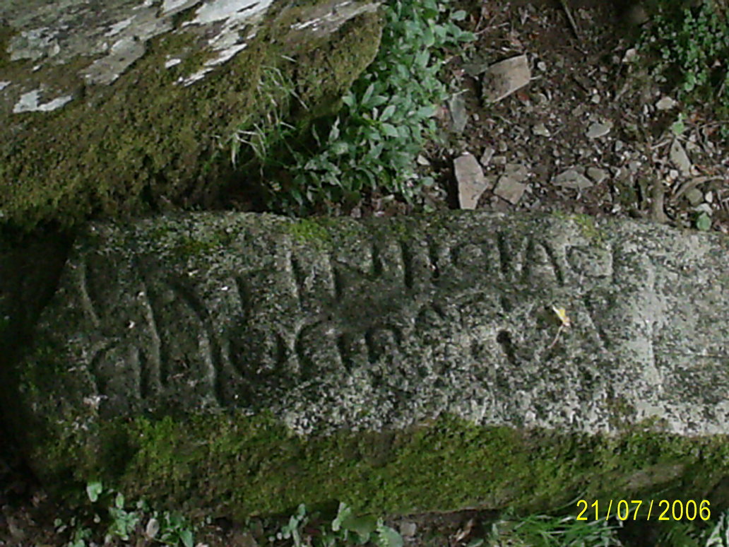
King Arthur Stone submitted by Maeg on 27th Aug 2012. A view of the 6th century inscribed stone at Slaughterbridge, as seen from the adjacent footpath. The script is both latin and ogham and reads "Latini [h]ic iacit fili Macari" = Latinus son of Macarus lies here. Latinus is thought to have been a local celtic chief (according to Wikipedia at least).
(View photo, vote or add a comment)
Log Text: King Arthur Stone lies prone on the W bank of the Camel River at SX 10916 85690. I accessed the stone from a path within the The Vale of Avalon Visitor Centre near Camelford.
King Arthur's Bed
Date Added: 15th Apr 2021
Site Type: Natural Stone / Erratic / Other Natural Feature
Country: England (Cornwall)
Visited: Yes on 17th Mar 2014. My rating: Condition 4 Ambience 5 Access 3

King Arthur's Bed submitted by markj99 on 8th Mar 2021. A view from within King Arthur's Bed.
(View photo, vote or add a comment)
Log Text: King Arthur's Bed is located on the summit of Trewortha Tor, c. 1 mile W of the Twelve Men's Moor Car Park. If you stay on the ridge Hawk's Tor proposed mini Stone Row is c. 1 mile ENE from King Arthur's Bed.
King Arthur's Down NW
Date Added: 27th Sep 2022
Site Type: Stone Circle
Country: England (Cornwall)
Visited: Yes on 11th Sep 2022. My rating: Condition 2 Ambience 4 Access 3
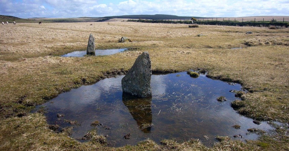
King Arthur's Down NW submitted by SandyG on 19th Jun 2015. View from west (8th April 2009).
(View photo, vote or add a comment)
Log Text: The stone circles are easy to find but difficult to interpret. I was able to get a reasonable grasp of the site after wandering around for half an hour. The NW Circle is more complete the SE Circle.
