Contributory members are able to log private notes and comments about each site
Sites markj99 has logged. View this log as a table or view the most recent logs from everyone
Barhoise
Date Added: 22nd Apr 2021
Site Type: Cairn
Country: Scotland (Dumfries and Galloway)
Visited: Yes on 21st Apr 2021. My rating: Condition 2 Ambience 3 Access 4
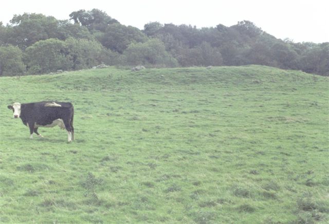
Barhoise submitted by cosmic on 17th Oct 2004. One of many cairn remnants!
(View photo, vote or add a comment)
Log Text: Barhoise Cairn is not in a great state of preservation. The interior of the the cairn is entirely robbed out with a deposit of field clearance stones dumped on the N quadrant. However it is still recognisably a cairn and worth visiting while in the area.
Bagbie Wall Stone
Date Added: 27th Apr 2021
Site Type: Standing Stone (Menhir)
Country: Scotland (Dumfries and Galloway)
Visited: Yes on 27th Apr 2021. My rating: Condition 4 Ambience 4 Access 4

Bagbie Wall Stone submitted by markj99 on 27th Apr 2021. Bagbie Wall Stone, centre picture, in the dry stane dyke.
(View photo, vote or add a comment)
Log Text: I have made multiple visits to Bagbie Cairn and its surroundings. There are many sites to visit in a small area. There is a view of the sea from Bagbie Cairn which may have influenced its location.
Bagbie cairn
Date Added: 27th Apr 2021
Site Type: Cairn
Country: Scotland (Dumfries and Galloway)
Visited: Yes on 27th Apr 2021. My rating: Condition 2 Ambience 4 Access 4
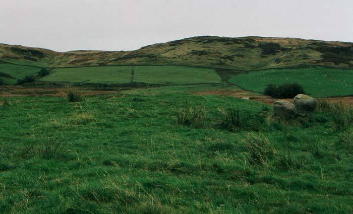
Bagbie Cairn submitted by vicky on 31st Dec 2002. The Bagbie Cairn with a pair of associated standing stones.
(View photo, vote or add a comment)
Log Text: I have made multiple visits to Bagbie Cairn and its surroundings. There are many sites to visit in a small area. There is a view of the sea from Bagbie Cairn which may have influenced its location.
Standing Stone of Bagbie
Date Added: 27th Apr 2021
Site Type: Standing Stone (Menhir)
Country: Scotland (Dumfries and Galloway)
Visited: Yes on 27th Apr 2021. My rating: Condition 3 Ambience 4 Access 3

Standing Stone of Bagbie submitted by vicky on 29th Oct 2002. This single standing stone sits in a field at NX498562 but to the south of, and part of, a complex containing a cairn, four poster stone circle and stone pair.
The Standing Stone of Bagbie is blade-like (as many of the standing stones in this area are) and has no formal access although it can be seen from the lane that runs from the A75(T) in a NE direction in to the hills towards Cambret.
This area is right on the edge of OS Explorer Map 311 (Wigtown, Whithorn & The Machars) and full navi...
(View photo, vote or add a comment)
Log Text: I have made multiple visits to Bagbie Cairn and its surroundings. There are many sites to visit in a small area. There is a view of the sea from Bagbie Cairn which may have influenced its location.
Bagbie Four Poster
Date Added: 27th Apr 2021
Site Type: Stone Circle
Country: Scotland (Dumfries and Galloway)
Visited: Yes on 27th Apr 2021. My rating: Condition 3 Ambience 4 Access 4
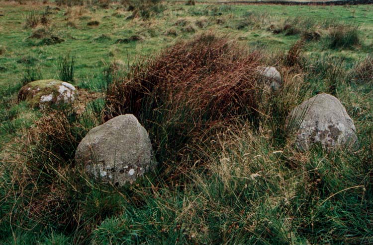
Bagbie Four Poster submitted by PaulM on 29th Oct 2002. This is a small four poster with stones no larger than 1.2m in height. It stands on the NE edge of a cairn and only three or four metres from a similarly sized stone pair. The grid reference is NX49815642.
This area is right on the edge of OS Explorer Map 311 (Wigtown, Whithorn & The Machars) and full navigation will require the next map over (Map 312 - Kirkcudbright & Castle Douglas).
(View photo, vote or add a comment)
Log Text: I have made multiple visits to Bagbie Cairn and its surroundings. There are many sites to visit in a small area. There is a view of the sea from Bagbie Cairn which may have influenced its location.
Bagbie stones
Date Added: 27th Apr 2021
Site Type: Standing Stones
Country: Scotland (Dumfries and Galloway)
Visited: Yes on 27th Apr 2021. My rating: Condition 2 Ambience 4 Access 4

Bagbie stones submitted by PaulM on 29th Oct 2002. The stone pair are closely associated with the cairn, four poster stone circle and standing stone.
(View photo, vote or add a comment)
Log Text: I have made multiple visits to Bagbie Cairn and its surroundings. There are many sites to visit in a small area. There is a view of the sea from Bagbie Cairn which may have influenced its location.
Clachaneasy Bridge
Date Added: 13th May 2021
Site Type: Cairn
Country: Scotland (Dumfries and Galloway)
Visited: Yes on 11th May 2021. My rating: Condition 2 Ambience 4 Access 1
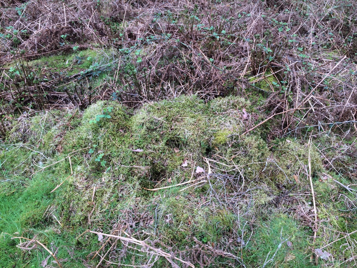
Clachaneasy Bridge submitted by markj99 on 12th May 2021. A row of moss-covered stones on Clachaneasy Bridge Cairn summit.
(View photo, vote or add a comment)
Log Text: I was intending to visit Glenhapple Cairn but was prevented by a no admission sign. I stumbled onto Clachaneasy Bridge Cairn by accident on my GPS. The cairn is located in dense forestry N of Clachaneasy Bridge. It is probably not worth visiting unless you are some kind of cairn completist.
Bencallen Hill
Date Added: 19th May 2021
Site Type: Chambered Cairn
Country: Scotland (South Ayrshire)
Visited: Yes on 19th May 2021. My rating: Condition 2 Ambience 5 Access 3
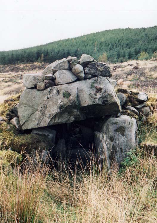
Bencallen Hill submitted by PaulM on 29th Oct 2002. Shiel Bridge/Bencallen chambered tomb
Good navigation is needed to find this cairn as the landscape is pretty featureless (NX33779440). Luckily for us the conifers had been recently cleared. There is parking (just) but the lane is very quiet. I dived up the slope and headed in the vague general direction but struck lucky.
Another strange site as the cairn cover has been robbed for drystone walls which all seemed to have been built to hem in the chamber or perhaps as sheepfolds. All t...
(View photo, vote or add a comment)
Log Text: Bencallen Cairn lies c. 3.75 miles E from Barr Village in S Ayrshire. It is difficult to get to but the splendid isolation of this site more than compensates. Only one large chamber of the cairn remains built into the N wall of a sheepfold. Presumably the stones from Bencallen Cairn were used in the construction of the sheepfold. The ground round about and inside the sheepfold has been deforested so it is rough and rutted.
Castlecreavie Settlement
Date Added: 25th May 2021
Site Type: Ancient Village or Settlement
Country: Scotland (Dumfries and Galloway)
Visited: Yes on 24th May 2021. My rating: Condition 3 Ambience 4 Access 4
Castlecreavie Settlement submitted by SolarMegalith on 4th Oct 2016. Outline of the rampart in the NE part of the settlement (photo taken on September 2016).
(View photo, vote or add a comment)
Log Text: Castlecreavie Settlement is situated on the road to Castlecreavie Farm between Kirkcudbright and Dundrennan. There is room to park at NX 72424 49258, c. 500 yards up the narrow road to Castlecreavie Farm. There is a style leading up to Castlecreavie Settlement. The natural hillock has an enclosure measuring c. 75 yards NE-SW and 40 yards NW-SE. There are remains of a c. 4 feet rampart on the SW and NE of the enclosure. There are steep slopes all round except for the SW which slopes away at a shallow angle. There is a prominent terrace from c. 12 to 15 feet wide round the settlement, except on the SW side.
Bombie 2
Date Added: 25th May 2021
Site Type: Rock Art
Country: Scotland (Dumfries and Galloway)
Visited: Yes on 24th May 2021. My rating: Condition 3 Ambience 5 Access 3
Bombie 2 submitted by SolarMegalith on 13th Oct 2016. Cup-and-ring marks on Bombie 2c panel (photo taken on September 2016).
(View photo, vote or add a comment)
Log Text: Bombie 2 is located on a gorse covered ridge on a SSW-NNE Axis at NX 72517 49733. This is different from the listed grid reference, a mistake copied from Canmore ID 64436. It is difficult to find in rough terrain broken up by beef cattle. The Bombie 2 panels were largely hidden under turf on my recent visit.
Bombie 3
Date Added: 25th May 2021
Site Type: Rock Art
Country: Scotland (Dumfries and Galloway)
Visited: Yes on 24th May 2021. My rating: Condition 3 Ambience 5 Access 3
Bombie 3 submitted by SolarMegalith on 13th Oct 2016. A general view of Bombie 3 panel (photo taken on September 2016).
(View photo, vote or add a comment)
Log Text: Bombie 3 is easier to find than Bombie 2 due to its proximity to the pond fenced off in the NE corner of the field. Bombie 3 is located beside a gorse bush c. 10 yards N from the SW corner of the electric fence round the pond. The rock art panel is at the base of a gorse bush within several yards of the fence. There is a large cup and multiple rings marking centrally placed on a roughly triangular panel. Smaller fainter cup and ring markings in the bottom apexes are covered in turf. I left them covered to protect them.
Lamford Burn
Date Added: 9th Jun 2021
Site Type: Cairn
Country: Scotland (Dumfries and Galloway)
Visited: Yes on 6th Jun 2021. My rating: Condition 2 Ambience 3 Access 4
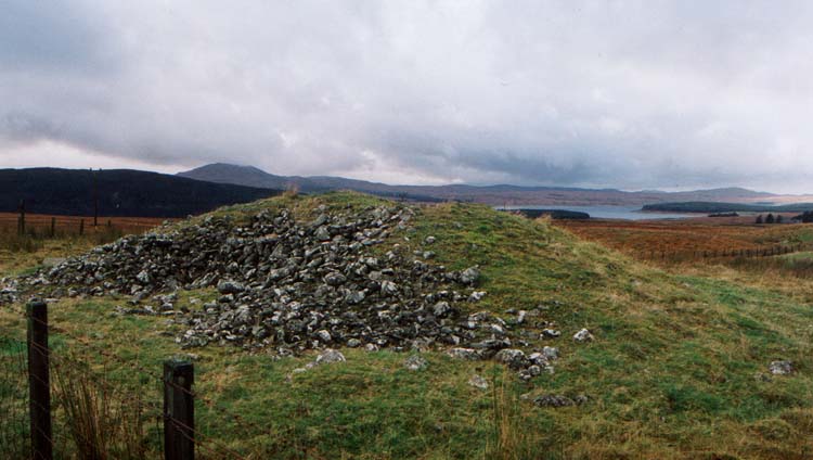
Lamford Burn Cairn submitted by vicky on 30th Oct 2002. Lamford Burn cairn
Another inclusion in the regions’ Archaeosights leaflet - this laneside cairn is typical of many in the region. Located at NX52829915 the stone built cairn is enclosed behind a wire fence but has spectacular views over the surrounding mountains.
(View photo, vote or add a comment)
Log Text: The low lying remains of Lamford Burn Cairn are not overly impressive however it is possible to view the footprint of a substantial cairn. Parking is available on the verge directly beside the cairn. Easy to visit if heading for Brownhill Burn & Water of Deugh Cairns.
Water of Deugh
Date Added: 9th Jun 2021
Site Type: Chambered Cairn
Country: Scotland (Dumfries and Galloway)
Visited: Couldn't find on 6th Jun 2021
Water of Deugh submitted by markj99 on 22nd Nov 2020. Water of Deugh S Chamber
(View photo, vote or add a comment)
Log Text: Water of Deugh cairn is inside a restricted access construction zone for a wind farm. There was no completion date posted so it may be some time before Water of Deugh is accessible. Having been denied access by Red Tape I decided to approach Water of Deugh from another angle. It is possible to approach Water of Deugh by parking up in a passing place at NS 55614 01036 on the dead-end lane. Water of Deugh Cairn lies c. 250 yards WNW from this point. Unfortunately it is a stiff walk up a tree felled No Man's Land slope to reach the edge of the forest. On reaching the forest edge to look for a suitable forest ride I found multiple fallen trees forming an impenetrable barrier. At this point I took the hint and gave up.
Brownhill Burn
Date Added: 9th Jun 2021
Site Type: Cairn
Country: Scotland (Dumfries and Galloway)
Visited: Yes on 6th Jun 2021. My rating: Condition 2 Ambience 5 Access 3
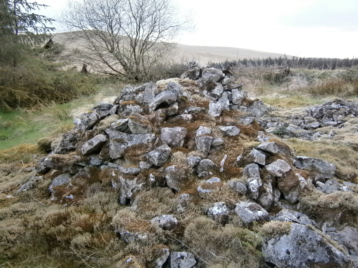
Brownhill Burn submitted by markj99 on 6th Jun 2021. Lush patches of green moss on Brownhill Burn Cairn.
(View photo, vote or add a comment)
Log Text: There is a minor unsigned turn off the A713 halfway between Dalmellington and Carsphairn at NX 51747 99760. It leads past Lamford Farm to a dead end in forestry beside the Water of Deugh. After c. 1 mile you will pass Lamford Burn cairn on the L. After another c. 0.5 miles take the L fork. After c. 1.5 miles there is a newly constructed road signed for Water of Deugh Circular on the L. After c. 0.2 miles there is a large lay-by on the R. Walk up the road c. 120 yards, looking R to see Brownhill Burn Cairn with a Spruce sapling growing in the middle of the cairn c. 50 yards W of the road.
Cairnderry
Date Added: 25th Mar 2025
Site Type: Chambered Cairn
Country: Scotland (Dumfries and Galloway)
Visited: Yes on 11th Jun 2021. My rating: Condition 3 Ambience 5 Access 4
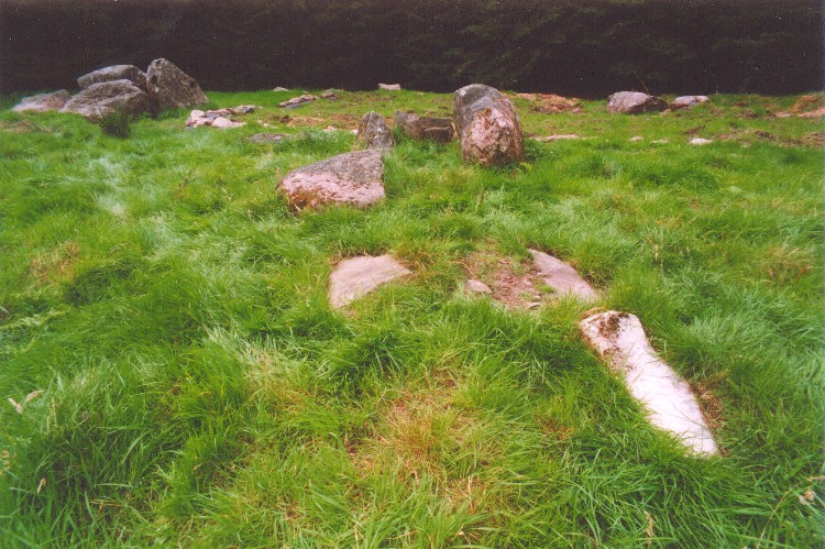
Cairnderry submitted by mickm on 17th Mar 2005. View of the cairn looking eastsoutheast up the passage to the northeast chamber. The south chamber is visible to top left and the outline of the 2002 excavations in the quadrant around the northwest chamber can be made out at the top of the picture.
(View photo, vote or add a comment)
Log Text: On my first visit to Cairnderry Cairn the perimeter and the chambers of the cairn were obscured by vegetation making interpretation difficult.
Caves of Kilhern
Date Added: 10th May 2022
Site Type: Chambered Cairn
Country: Scotland (Dumfries and Galloway)
Visited: Yes on 22nd Jun 2021. My rating: Condition 3 Ambience 5 Access 3
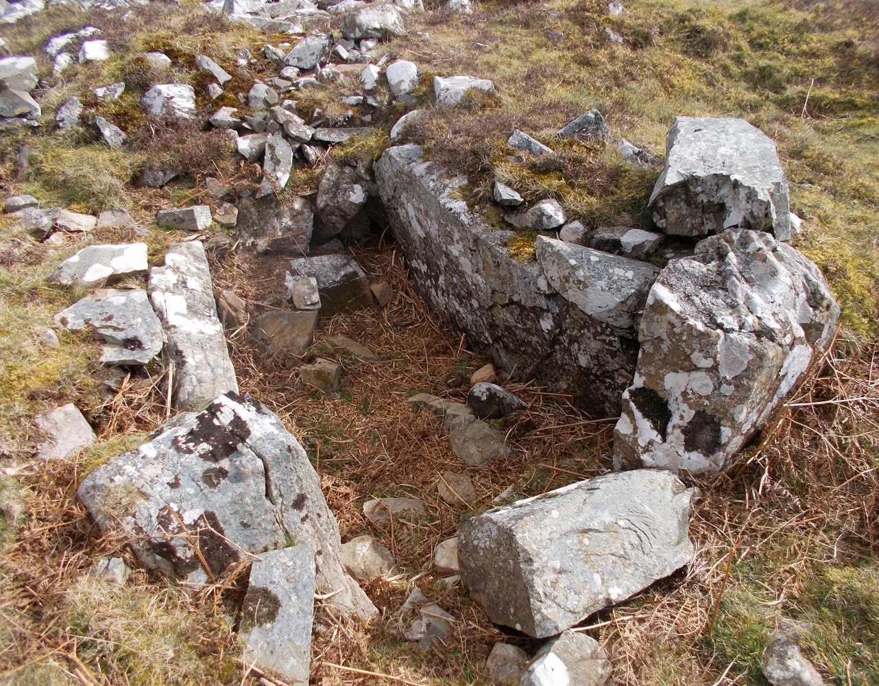
Caves of Kilhern submitted by drolaf on 3rd Apr 2022. SW cist
(View photo, vote or add a comment)
Log Text: The Caves of Kilhern Chambered Cairn is accessed via the Southern Upland Way path. A short detour from the path is signed. The Long Cairn has four exposed chambers making a detour from the SUW essential.
Kilhern SE
Date Added: 10th May 2022
Site Type: Cairn
Country: Scotland (Dumfries and Galloway)
Visited: Yes on 22nd Jun 2021. My rating: Condition 3 Ambience 4 Access 3
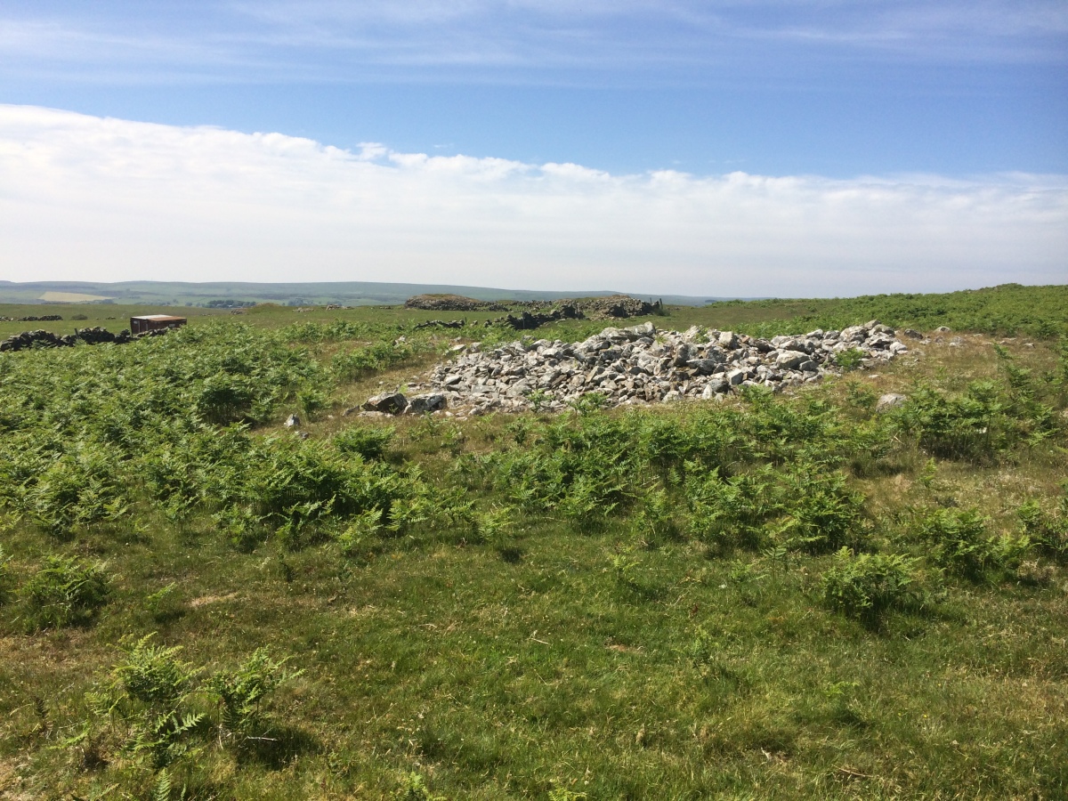
Kilhern SE submitted by markj99 on 26th Jun 2021. Kilhern SE Cairn viewed from SE.
(View photo, vote or add a comment)
Log Text: The ruin of Kilhern Farm is on the Southern Upland Way. Follow the dry stane dyke on the N flank of the farm c. 200 yards up a slope then follow the dyke SE for c. 100 yards to reach the stony cairn. It is best visited in Autumn to Spring in low vegetation.
Cuff Hill
Date Added: 5th May 2023
Site Type: Chambered Cairn
Country: Scotland (North Ayrshire)
Visited: Yes on 14th Jul 2021. My rating: Condition 3 Ambience 4 Access 3
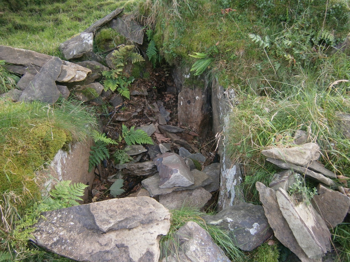
Cuff Hill submitted by markj99 on 15th Jul 2021. Central W Chamber of Cuff Hill Cairn viewed from NE.
(View photo, vote or add a comment)
Log Text: Cuff Hill Cairn is not easy to find, however there are extensive stone chamber and passage remains making your efforts worthwhile. Detailed directions to the cairn are posted in a comment on the site page.
Chapel Finian Well
Date Added: 20th Jun 2025
Site Type: Holy Well or Sacred Spring
Country: Scotland (Dumfries and Galloway)
Visited: Yes on 15th Jul 2021. My rating: Condition 3 Ambience 3 Access 4
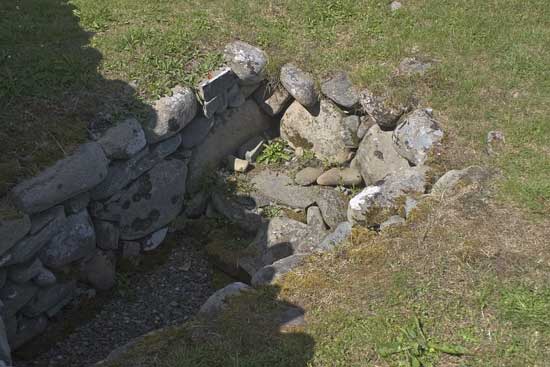
Chapel Finian Well submitted by kelpie on 13th Jul 2004. The well is housed in the ruins of what was a small chapel probably erected by pilgrims to the nearby home of St. Ninian.
The well was dry on my visit and there was no sign that it had been any different for some time.
(View photo, vote or add a comment)
Log Text: When I visited Chapel Finian there was a shallow pool of water in the stone hollow.
Drannandow Chambered Cairn
Date Added: 1st Sep 2025
Site Type: Chambered Cairn
Country: Scotland (Dumfries and Galloway)
Visited: Yes on 19th Jul 2021. My rating: Condition 3 Ambience 5 Access 3
Drannandow Chambered Cairn submitted by rogerkread on 1st May 2013. Drannandow chambered cairn showing its proximity to Napper's Cottage.
(View photo, vote or add a comment)
Log Text: Drannandow Chambered Cairn is located c. 50 yards NNW of Nappers Cottage in the Moor of Drannandow. The long cairn has been extensively robbed on the E half leaving only an exposed chamber orientated E-W. The W half has scattered stones and remains of 4 lateral chambers in varying states of preservation. It is likely that Nappers Cottage was constructed from robbed cairn stones.
