Contributory members are able to log private notes and comments about each site
Sites markj99 has logged. View this log as a table or view the most recent logs from everyone
Tayandock
Date Added: 23rd Mar 2023
Site Type: Standing Stone (Menhir)
Country: Scotland (Isle of Islay)
Visited: Yes on 23rd Aug 2019. My rating: Condition 2 Ambience 3 Access 3
Tayandock submitted by markj99 on 6th Sep 2019. Tayandock stone nestled in the ferns.
(View photo, vote or add a comment)
Log Text: When I visited Islay I found Tayandock stone by searching in long grass on the margin of a field at a OS Grid Reference from Canmore.
Ballinaby
Date Added: 8th May 2021
Site Type: Stone Row / Alignment
Country: Scotland (Isle of Islay)
Visited: Yes on 23rd Aug 2019. My rating: Condition 4 Ambience 5 Access 3
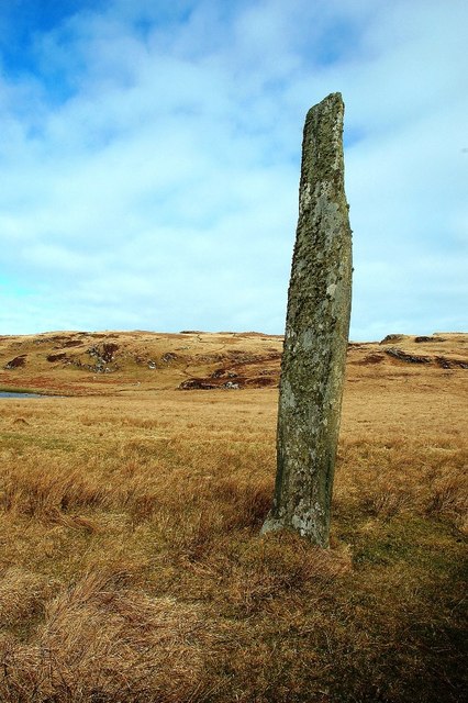
Ballinaby submitted by Andy B on 13th Jun 2011. Standing Stone Near Ballinaby
This tall stone is clearly visible from the road to the north of Loch Gorm, but is hidden from view on the path leading in from Saligo Bay. It's worth the walk. There's a second smaller stone in the next square, just visible in the left-hand side of this shot below a rocky outcrop.
Copyright Mary and Angus Hogg and licensed for reuse under the Creative Commons Licence.
(View photo, vote or add a comment)
Log Text: Ballinaby 1 is unsignposted off a minor road N of Loch Gorm. There is a lay-by c. 200 yards W of Ballinaby farm. Walk up the farm road to a gate, head NNW towards a junction of dry stane dykes. Ballinaby 1 is c. 50 yards SW from here adjacent to the N side of the dyke. Ballinaby 2 lies c.350 yards NNE of Ballinaby 1 across rough ground.
Ballinaby 1 is one of the most striking standing stones I have ever visited. The apparent fragility of this tall thin slab is belied by its survival despite being exposed to Islay's wild weather for millennia.
Ballinaby 2 is less impressive in its current state though it may have been as tall as Ballinaby 1 originally.
Beinn Ghott
Date Added: 15th May 2021
Site Type: Cairn
Country: Scotland (Isle of Tiree)
Visited: Yes on 29th Aug 2019. My rating: Condition 2 Ambience 4 Access 3
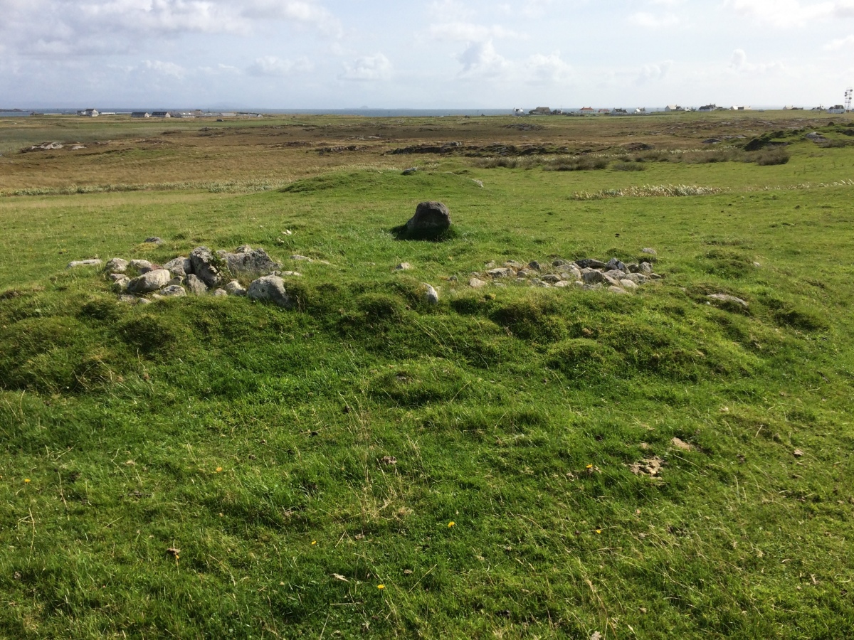
Beinn Ghott submitted by markj99 on 15th May 2021. Approaching Beinn Ghott Cairn from NW.
(View photo, vote or add a comment)
Log Text: Beinn Ghott Cairn is a small compact cairn which will not appeal to all antiquarians. However if you are on Tiree for an extended stay there is no good reason not to visit it.
Beoch Hill Cairn
Date Added: 16th May 2021
Site Type: Cairn
Country: Scotland (Dumfries and Galloway)
Visited: Yes on 7th Sep 2019. My rating: Condition 2 Ambience 4 Access 1
Beoch Hill Cairn submitted by markj99 on 11th Sep 2019. Looking NE across hollow centre of Beoch Hill cairn.
(View photo, vote or add a comment)
Log Text: It is illogical to put so much effort into such a small hidden cairn. Then again, when did common sense influence the antiquarian seeking a new target. I have an unfortunate attraction to remote sites.
White Cairn, Beoch Hill
Date Added: 16th May 2021
Site Type: Cairn
Country: Scotland (Dumfries and Galloway)
Visited: Yes on 7th Sep 2019. My rating: Condition 2 Ambience 4 Access 1
White Cairn, Beoch Hill submitted by markj99 on 11th Sep 2019. Looking W to Loch Ryan from White Cairn, Beoch Hill.
(View photo, vote or add a comment)
Log Text: It is illogical to put so much effort into such a small hidden cairn. Then again, when did common sense influence the antiquarian seeking a new target. I have an unfortunate attraction to remote sites.
Kirkmaiden Old Church
Date Added: 8th Sep 2019
Site Type: Ancient Cross
Country: Scotland (Dumfries and Galloway)
Visited: Yes on 8th Sep 2019. My rating: Condition 2 Ambience 4 Access 4
Kirkmaiden Old Church submitted by markj99 on 8th Sep 2019. Kirkmaiden Churchyard (St Medan)
(View photo, vote or add a comment)
Log Text: St Medan Golf Club is one of the most scenic views in the South West. I have visited Kirkmaiden Church often before I read about the cross.
There is a new combination padlock on the railed-off church so someone must have custodial access to the church.
Knock Rock Art (4)
Date Added: 18th Jul 2023
Site Type: Rock Art
Country: Scotland (Dumfries and Galloway)
Visited: Yes on 8th Sep 2019. My rating: Condition 4 Ambience 4 Access 3
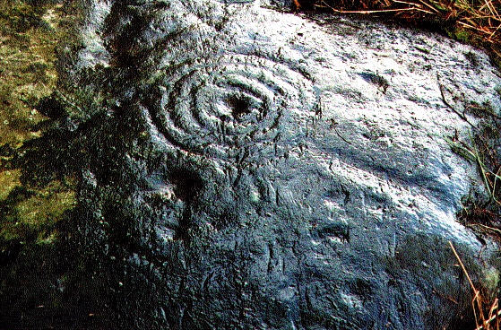
Knock Rock Art submitted by Gus on 12th Sep 2001. Knock Rock Art (4), Clarksburn Wood Cup and Rings
A nice motif on an outcrop in a field East of Monreith. A cup and four rings and some faint cups on a smooth surface. First reported by C. Jackson in 1978. Rock Art near the Sea; Come and See!
(View photo, vote or add a comment)
Log Text: I walked past this stone twice before I spotted the stone in long grass on the margin of the field. Luckily I had a bottle of water to bring out the depth of the ring mark.
Lang Stane o' Craigearn
Date Added: 11th Aug 2022
Site Type: Standing Stone (Menhir)
Country: Scotland (Aberdeenshire)
Visited: Yes on 19th Sep 2019. My rating: Condition 4 Ambience 3
Lang Stane o' Craigearn submitted by cosmic on 7th Mar 2004. Lang Stane o' Craigearn is at NJ723149. It is a very tall thin standing stone - at least 10 feet high. It is situated on top of a grassed mound behind a house.
(View photo, vote or add a comment)
Log Text: I approached the Langstane o' Craigearn from N. Access to the stone is restricted. It appears to be enclosed in a private garden.
Candle Hill
Date Added: 19th Apr 2025
Site Type: Stone Circle
Country: Scotland (Aberdeenshire)
Visited: Yes on 20th Sep 2019. My rating: Condition 2 Ambience 3 Access 3
Candle Hill submitted by cosmic on 20th Aug 2005. The only stone left standing
(View photo, vote or add a comment)
Log Text: It is difficult to access Candle Hill Stone Circle: It is protected by an enclosure and vigorous shrubs. It is best to enter the enclosure on the SE corner adjacent to the remains of the circle. The circle is located c. 30 yards ESE of the centre of the knoll. The most obvious feature is the Candle Stone, a standing stone c. 15 feet W of a thorn tree. A grassy cairn is situated c. 6 feet S in the centre of the circle. Walk S round the cairn to reach the fallen recumbent stone and flankers on the S Arc of the circle. It is possible to find the fallen N,ENE,W and NW stones by walking round the perimeter of the circle, starting from the NNE Standing Stone. The N,ENE,W are largely buried in the turf with only a small area visible from above. The NW stone is hidden in gorse on the NW Arc.
Black Loch Crannog
Date Added: 13th May 2023
Site Type: Crannog
Country: Scotland (Dumfries and Galloway)
Visited: Yes on 30th Sep 2019. My rating: Condition 2 Ambience 3 Access 4
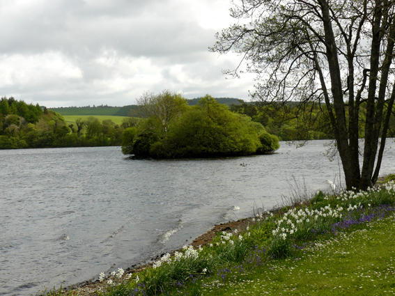
Black Loch Crannog submitted by Creative Commons on 17th Jul 2013. Crannog within the Castle Kennedy estate
Copyright Norman Caesar and licensed for reuse under the Creative Commons Licence.
(View photo, vote or add a comment)
Log Text: A path runs along the W bank of Black Loch in the grounds of Lochinch Castle Estate. There is in truth not much to see beyond a wooded island however there is plenty to explore in Castle Kennedy Gardens.
Carlungie
Date Added: 24th May 2025
Site Type: Souterrain (Fogou, Earth House)
Country: Scotland (Angus)
Visited: Yes on 18th Nov 2019. My rating: Condition 3 Ambience 3 Access 4
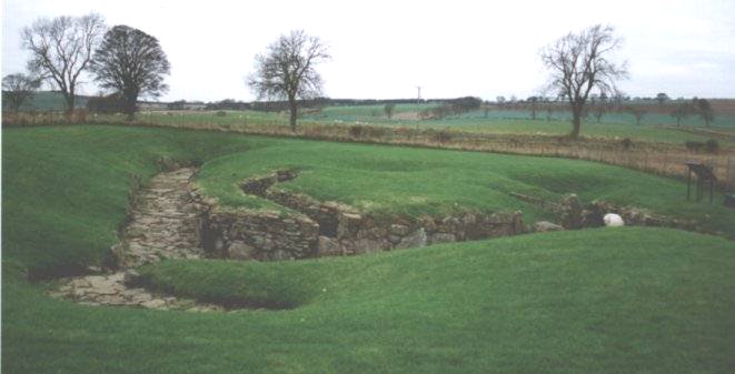
Carlungie submitted by Nick on 5th Nov 2002. Looking ESE across the site
(View photo, vote or add a comment)
Log Text: Carlungie Souterrain is easily visited via the A92. I found the site to be over-restored and lacking in atmosphere.
Ardestie
Date Added: 12th Apr 2021
Site Type: Souterrain (Fogou, Earth House)
Country: Scotland (Angus)
Visited: Yes on 18th Nov 2019. My rating: Condition 3 Ambience 3 Access 4
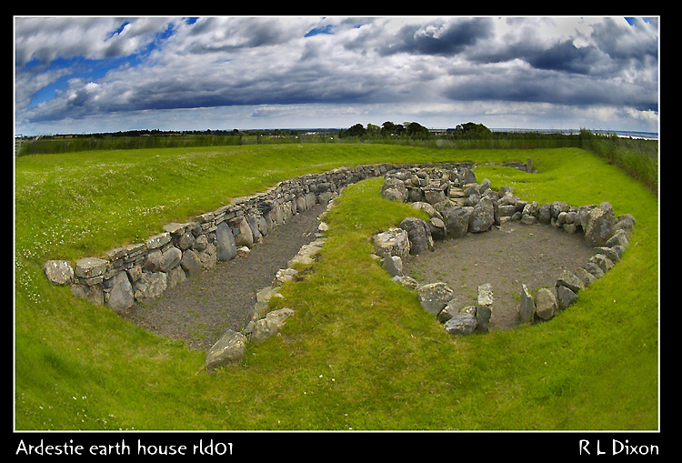
Ardestie submitted by rldixon on 14th May 2009. Ardestrie Earth House july 2006
(View photo, vote or add a comment)
Log Text: Ardestie Souterrain is easy to visit but it is a little over-restored and airy for my taste. I prefer a more subterranean experience in keeping with the original site.
Colmeallie
Date Added: 8th Jul 2025
Site Type: Stone Circle
Country: Scotland (Angus)
Visited: Yes on 19th Nov 2019. My rating: Condition 2 Ambience 4 Access 4
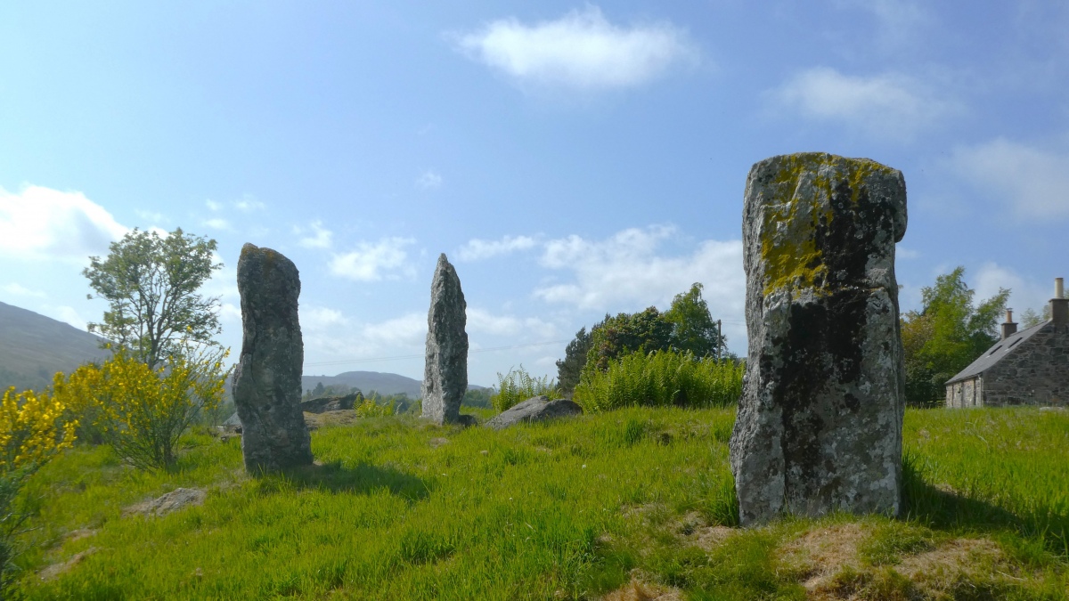
Colmeallie submitted by PeteCrane5 on 31st Dec 2023. "A stunning location" ... "A classic, if rather mauled recumbent stone circle" .. looking back at 2023 Colmeallie in the GlenEsk is one of my favourites
(View photo, vote or add a comment)
Log Text: The three standing stones on the SE arc of the stone circle give a sense of scale and structure to the jumbled remains of this monument.
Cairn Kenny
Date Added: 6th May 2025
Site Type: Passage Grave
Country: Scotland (Dumfries and Galloway)
Visited: Yes on 8th Dec 2019. My rating: Condition 3 Ambience 5 Access 1
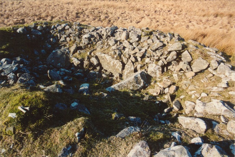
Cairn Kenny submitted by mickm on 17th Mar 2005. A view of the ravaged interior of this single-chambered Bargrennan type cairn, showing the visible remains of the chamber and passage, most of which is concealed by redeposited cairn material. The chamber is aligned west to east with the passage entered from the east. There was a peristalith of closely spaced stones around the cairn, a few of which remain visible on the northeast side. There has evidently been some antiquarian excavation and according to the RCAHMS the cairn was subject to distu...
(View photo, vote or add a comment)
Log Text: Cairn Kenny is located in isolated moorland c. 2 miles from the nearest road: it is doubtful that it was worth the trouble to visit a ruined cairn.
Mains of Larg cairn
Date Added: 20th Nov 2022
Site Type: Cairn
Country: Scotland (Dumfries and Galloway)
Visited: Yes on 13th Jan 2020. My rating: Condition 2 Ambience 4 Access 4
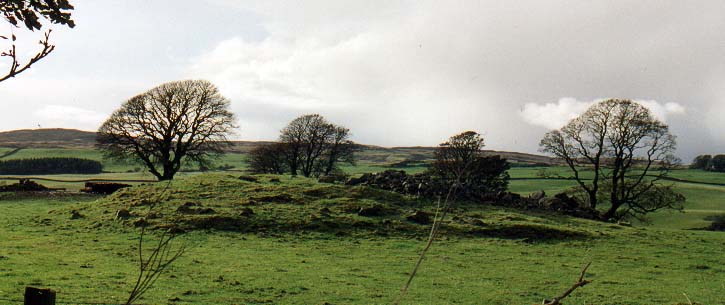
Mains of Larg cairn submitted by PaulM on 30th Oct 2002. Mains of Larg cairn
An easily visible cairn near the Mains of Larg Farm at NX166639. Not anything special - just easy to see and typical of many of the cairns in the area.
(View photo, vote or add a comment)
Log Text: This cairn is classified under Milton of Larg on Canmore. It is easy to park in an adjacent gateway to visit the cairn, provided there are no beef cattle in the field. It would have been wonderful if the cairn was better preserved, however Milton of Larg cairn is still worth a visit.
Torhouseskie South West Standing Stones
Date Added: 24th Dec 2023
Site Type: Standing Stones
Country: Scotland (Dumfries and Galloway)
Visited: Yes on 20th Feb 2020. My rating: Condition 1 Ambience 3 Access 3
Torhouseskie South West Standing Stones submitted by markj99 on 21st Feb 2020. Candidates for Torhosekie Stones SW?
(View photo, vote or add a comment)
Log Text: I conducted a field walk around the Grid Reference given by Canmore but found only flat pasture land. However I noticed two stones around 100 yards SW. They are on a natural knoll with a feed trough. The larger stone is around 5 feet with an irregular X or cross visible on the exposed top surface. The OSGR is NX 38117 56372, approximately 200 yards SW of the circle.
Ballach-a-Heathry
Date Added: 1st May 2021
Site Type: Cairn
Country: Scotland (Dumfries and Galloway)
Visited: Yes on 8th Mar 2020. My rating: Condition 2 Ambience 3 Access 4
Ballach-a-Heathry submitted by markj99 on 25th Mar 2020. Field clearance stones on Ballach-a-Heathry cairn.
(View photo, vote or add a comment)
Log Text: Any ancient site which can be easily visited in passing is usually a worthwhile stop. The remains of Ballach-a-Heathry are overlooked by the recent addition of wind turbines.
Coffin Stone (Glenluce)
Date Added: 7th Jul 2025
Site Type: Natural Stone / Erratic / Other Natural Feature
Country: Scotland (Dumfries and Galloway)
Visited: Yes on 15th Mar 2020

Coffin Stone (Glenluce) submitted by markj99 on 12th May 2021. Coffin Stone (Glenluce) viewed from W.
(View photo, vote or add a comment)
Log Text: The Coffin Stone was once adjacent to the A75 but the section of road in now disused. The stone is located on the W edge of marshy ground N of the road. There are precise directions on the main page.
Barclye Cairn
Date Added: 13th May 2021
Site Type: Cairn
Country: Scotland (Dumfries and Galloway)
Visited: Yes on 11th Jul 2020. My rating: Condition 2 Ambience 3
Barclye Cairn submitted by markj99 on 12th Jul 2020. Barclye Cairn looking S to Barclye Farm.
(View photo, vote or add a comment)
Log Text: As with many cairns built in farmland the temptation to borrow the stones for a more practical purpose has proved too great so we are left with the footprint of the original cairn. It is easy to visit from the minor road between Newton Stewart and RSPB Wood of Cree Reserve.
Bruce's Stone (Clatteringshaws)
Date Added: 7th Jun 2021
Site Type: Natural Stone / Erratic / Other Natural Feature
Country: Scotland (Dumfries and Galloway)
Visited: Yes on 2nd Aug 2020. My rating: Condition 4 Ambience 4 Access 4
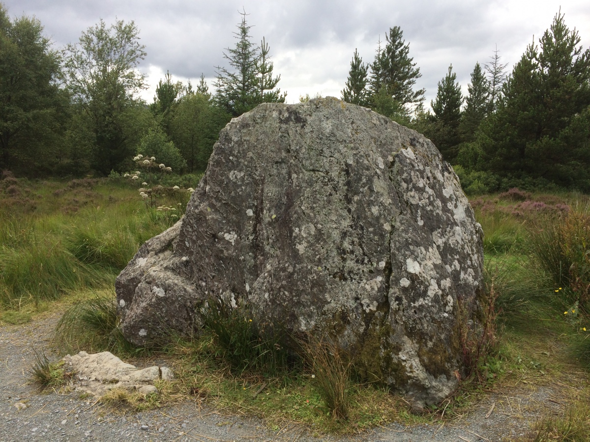
Bruce's Stone (Clatteringshaws) submitted by markj99 on 10th May 2021. Bruce's Stone (Clatteringshaws) (02.08.20).
(View photo, vote or add a comment)
Log Text: You can combine a family friendly visit to Bruce's Stone (Clatteringshaws) with a visit to the cafe at the visitor centre.
