Contributory members are able to log private notes and comments about each site
Sites markj99 has logged. View this log as a table or view the most recent logs from everyone
Ashlar Chair 01
Date Added: 15th Apr 2021
Site Type: Rock Outcrop
Country: England (Yorkshire (West))
Visited: Yes on 21st Jan 2009. My rating: Condition 3 Ambience 5 Access 2
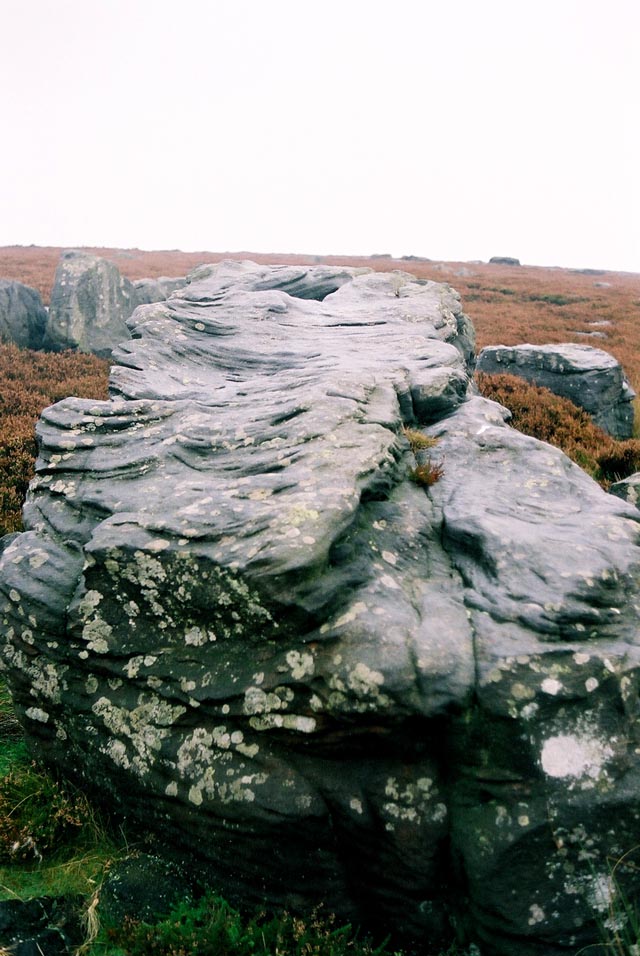
Ashlar Chair 01 submitted by andy_h on 17th Nov 2003. This heavily weathered rock lays at the meeting point of four moors. Ilkley Moor, Burley Moor, Morton Moor and Bingley Moor. Cup and ring carvings were recorded in the 19th C, but these have now weathered away and no trace remains.
Paul Bennett describes the rock as an 'Omphalus' or a universal centre. It's name probably comes from it's use by medieval masons. It was also used as a meeting point for the Pendle Witches.
SE1208 4483
(View photo, vote or add a comment)
Log Text: I have an attraction to sites which are difficult to reach. I would rather walk several miles over bleak moorland to find a random stone than walk 10 yards on a footpath to a more spectacular site by the roadside. Therefore Ashlar Chair was too tempting to ignore, a rough diamond in unforgiving terrain. I gained a great deal of satisfaction in finding Ashlar Chair, unspectacular as it is.
Aspers Field
Date Added: 16th Apr 2021
Site Type: Standing Stone (Menhir)
Country: England (Cumbria)
Visited: Yes on 28th Dec 2013. My rating: Condition 3 Ambience 4 Access 3
Aspers Field submitted by baz on 26th Apr 2003. This stone (at NY558152) lies in the next field to the more well known Goggleby Stone (NY559151), from which I took this picture (with zoom). Both of these stones form a part of the Shap Stone Avenue.
(View photo, vote or add a comment)
Log Text: I have mixed feelings about the Shap stones. I am grateful for the stones that have been preserved but I regret that Shap Avenue has been effectively dismantled. I would love to have seen the avenue as it was meant to have been seen.
Auchensoul Hill
Date Added: 8th Jan 2025
Site Type: Cairn
Country: Scotland (South Ayrshire)
Visited: Yes on 29th Dec 2024. My rating: Condition 2 Ambience 5 Access 3
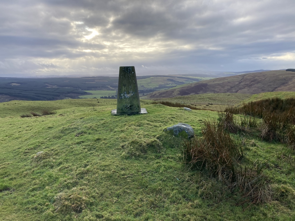
Auchensoul Hill submitted by markj99 on 7th Jan 2025. Auchensoul Hill Cairn viewed from NNE.
(View photo, vote or add a comment)
Log Text: Auchensoul Hill is located c. 0.8 mile WNW of Barr. You can park in the centre of the village then walk W to cross the Stinchar Bridge. Follow the road N to reach a signed footpath on the left. The vague path heads W uphill through moorland grass. Trees have been recently planted on the E slopes of Auchensoul Hill, surrounded by a deer fence. Continue W along the line of the deer fence until you reach a gate in the deer fence. Go through the gate into rough green pasture. Head NW up a steep slope towards the summit of Auchensoul Hill. It is a rocky knoll surmounted by an OS Trig Point at NX 26391 94548.
The vague path up to Auchensoul Hill is steep through boggy moorland ground,
requiring sturdy boots and GPS navigation ideally.
Auchmantle Fell (The Muckle Cairn)
Date Added: 9th Jan 2025
Site Type: Cairn
Country: Scotland (Dumfries and Galloway)
Visited: Yes on 14th Dec 2024. My rating: Condition 2 Ambience 4 Access 3
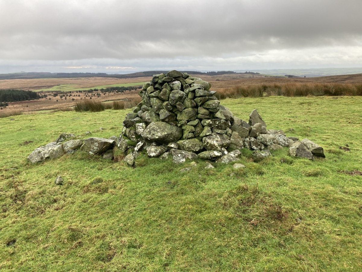
Auchmantle Fell (The Muckle Cairn) submitted by markj99 on 8th Jan 2025. Auchmantle Fell (The Muckle Cairn) viewed from N.
(View photo, vote or add a comment)
Log Text: Auchmantle Fell (The Muckle Cairn) is the more visible cairn of the pair of ruined cairns on Auchmantle Fell . A modern cairn c. 4 feet high dominates the small grassy platform. See main page for directions.
Auchmantle Fell (The Wee Cairn)
Date Added: 9th Jan 2025
Site Type: Cairn
Country: Scotland (Dumfries and Galloway)
Visited: Yes on 14th Jan 2024. My rating: Condition 2 Ambience 4 Access 3

Auchmantle Fell (The Wee Cairn) submitted by markj99 on 8th Jan 2025. NW Earth Bank of Auchmantle Fell (The Wee Cairn).
(View photo, vote or add a comment)
Log Text: Auchmantle Fell (The Wee Cairn) is the more difficult to locate cairn of the pair of ruined cairns on Auchmantle Fell . If you visit The Muckle Cairn first then head S for c. 135 yards across boggy moorland look out for a grassy circle in the moor with a prominent earth bank c. 1.5 feet high on the NW arc. See directions on Auchmantle Fell (The Muckle Cairn) main page.
Auld Wife's Grave
Date Added: 17th Apr 2021
Site Type: Chambered Cairn
Country: Scotland (Dumfries and Galloway)
Visited: Yes on 6th Nov 2011. My rating: Condition 2 Ambience 5 Access 1
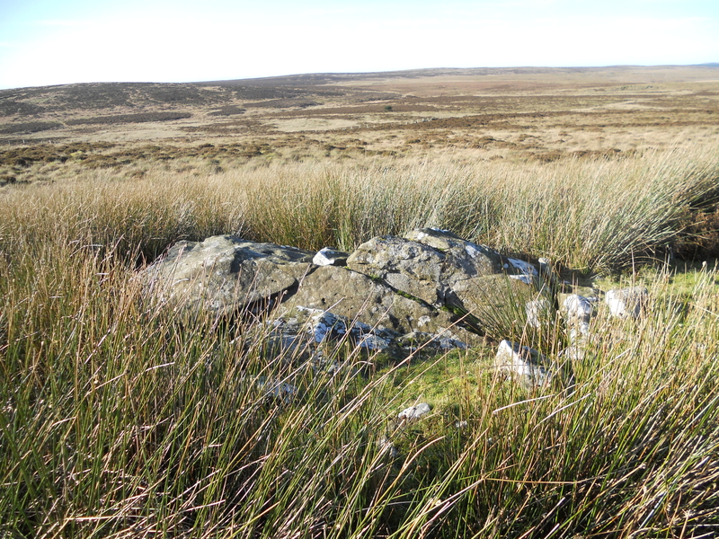
Auld Wife's Grave submitted by markj99 on 12th Sep 2018. Approaching the Auld Wife's Grave
(View photo, vote or add a comment)
Log Text: Auld Wife's Grave is difficult to find in open moorland. However, if you can get to Cairnscarrow Trig Point at NX 13626 64802 there is a clear path bearing NNW from here. Follow it for c. 200m straight to Auld Wife's Grave.
Auldearn Stone Row
Date Added: 27th Apr 2025
Site Type: Stone Row / Alignment
Country: Scotland (Highlands)
Visited: Yes on 21st Mar 2012. My rating: Condition 1 Ambience 3 Access 3
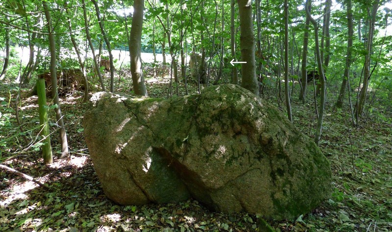
Auldearn Stone Row submitted by SandyG on 3rd Jan 2019. Looking south east along the row. Stone 1 in the foreground, Stone 2 beyond and Stone 3 indicated by the white arrow.
(View photo, vote or add a comment)
Log Text: I manage to locate 3 stones on the SE end of the row, ending on the edge of a private garden. The stones are hidden in trees. I failed to investigate the NW end of the stone row and the cairn. I will rectify this if I return to the area.
Avebury
Date Added: 17th Apr 2021
Site Type: Stone Circle
Country: England (Wiltshire)
Visited: Yes on 18th Aug 2009. My rating: Condition 3 Ambience 4 Access 5
Avebury Aerial 0507 submitted by JJ on 4th Nov 2003. Here's my theory: As you can see, the shadows cast on the western side of the circle point to the exact spot for the next stone in line. Perhaps this is why Avebury is more hexagonal in shape than round.
Based on this assumption, then it would be easy to work out the heights of the missing stones without too much difficulty. Maybe the distance between each stone along this side was calculated not by 'linear measurement' but rather set by the preceding stone and shadow cast.
Obviousl...
(View photo, vote or add a comment)
Log Text: I enjoyed my visit to Avebury Circle but i have two reservations:
1) I found the scale of the circle too large to take in as a whole. It was difficult to imagine the overall plan. Subsequent views of aerial shots have given me a better impression of the monument.
2) The construction of houses and a road within the henge spoiled the antiquity of the site for me. I would have liked to have seen the circle in its original condition.
Avebury - The Cove
Date Added: 17th Apr 2021
Site Type: Standing Stones
Country: England (Wiltshire)
Visited: Yes on 2nd Jan 2010. My rating: Condition 3 Ambience 4 Access 4
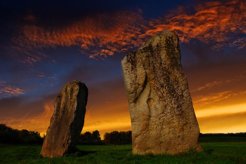
Avebury - The Cove submitted by jackdaw1 on 26th Aug 2008. Cove sundown.
(View photo, vote or add a comment)
Log Text: The stones in Avebury Cove are two of the most impressive in the Avebury Complex.
Aveline's Hole
Date Added: 17th Apr 2021
Site Type: Cave or Rock Shelter
Country: England (Somerset)
Visited: Yes on 23rd Mar 2010. My rating: Condition 4 Ambience 5 Access 4

Aveline's Hole submitted by Andy B on 14th Aug 2007. Artists reconstruction of Britain's Earliest Cemetery - Aveline's Hole in the Mendip Hills Somerset is approximately 10,000 years old. Image by Judith Dobie, English Heritage, used with permission.
(View photo, vote or add a comment)
Log Text: It is amazing that such an important archaeological site is so easily visited. I am a troglodyte at heart so I always enjoy visiting a cave.
Avening burial chambers
Date Added: 17th Apr 2021
Site Type: Burial Chamber or Dolmen
Country: England (Gloucestershire)
Visited: Yes on 11th Jan 2014. My rating: Condition 2 Ambience 3 Access 3
Avening burial chambers submitted by theCaptain on 20th Apr 2010. The entrance stones of the SE chamber.
No remains of the supposed porthole entrance can be seen, its now buried below ground level after the hillslide.
(View photo, vote or add a comment)
Log Text: The burial chambers have been artfully placed in the rectory garden in Avening, however, in principle I do not agree with people removing parts of an ancient monument for their own gratification. The original site is devalued and the new site is questionable at best.
Avielochan
Date Added: 18th Apr 2021
Site Type: Chambered Tomb
Country: Scotland (Highlands)
Visited: Yes on 20th Mar 2012. My rating: Condition 3 Ambience 4 Access 3
Avielochan submitted by cosmic on 25th Sep 2006. Chamber from North.
(View photo, vote or add a comment)
Log Text: Avielochan Clava Cairn is sandwiched between the A95 and the railway line. Despite this the site has a peaceful ambience, promoted by the ring of mature trees which surround the cairn. The kerb is delineated by c. 10 trees and intermittent large stones. The interior has been robbed out exposing a stone lined passage to a central chamber.
I prefer this somewhat neglected Clava cairn to the over-restored cairns at Balnuaran.
Aviemore
Date Added: 18th Apr 2021
Site Type: Stone Circle
Country: Scotland (Highlands)
Visited: Yes on 3rd Jan 2004. My rating: Condition 2 Ambience 3 Access 5
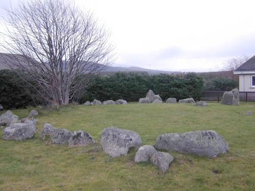
Aviemore submitted by steveco on 24th Feb 2002. Aviemore Ring Cairn NH897134. The surviving parts of a Cairn & Stone Circle in the Ski resort of Aviemore.
(View photo, vote or add a comment)
Log Text: I appreciate that conserving the circle in some way is better than removing it, however, surrounding the circle by a modern housing estate has negated any air of antiquity that the stone circle may have possessed.
Badnabay
Date Added: 27th Apr 2025
Site Type: Chambered Cairn
Country: Scotland (Highlands)
Visited: Yes on 3rd Sep 2021. My rating: Condition 2 Ambience 4 Access 4
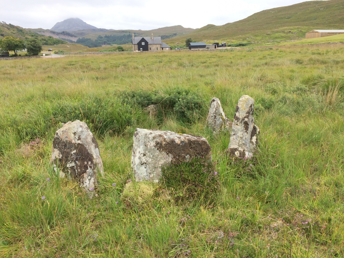
Badnabay submitted by markj99 on 14th Sep 2021. Badnabay Chambered Cairn viewed from N, Ben Stack on the horizon.
(View photo, vote or add a comment)
Log Text: Badnabay Cairn is located c. 80 yards SW of the A894 on the NC500. It is obscured by moor grass c. 150 yards WNW of Badnabay farm, adjacent to a narrow track leading to Badnabay farm.
Badristrane 3
Date Added: 17th Jun 2025
Site Type: Rock Art
Country: Scotland (Dumfries and Galloway)
Visited: Yes on 3rd Jun 2025. My rating: Condition 3 Ambience 4 Access 3
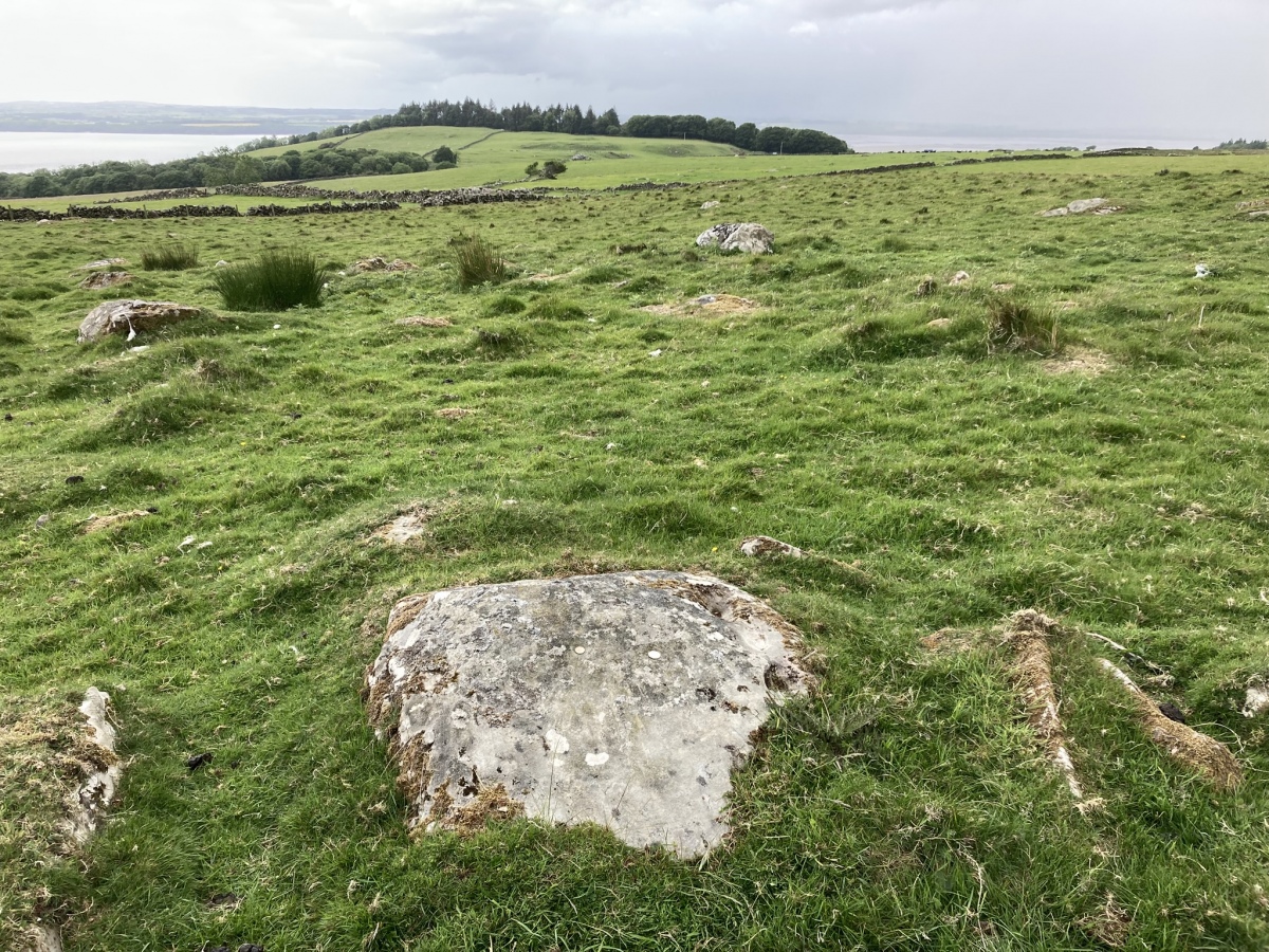
Badristrane 3 submitted by markj99 on 11th Jun 2025. Bardristane 3 Carved Stone viewed from ENE. (03.06.25)
(View photo, vote or add a comment)
Log Text: It is some kind of miracle that these cup carvings were discovered in a rocky field c. 0.5 mile N of Bardristane Farm: Maarten van Hoek was systematically searching for Rock Art on Bardristane in 1993 when he found these eroded cup carvings. They are unimpressive but they exist as remnants of ancient people.
Bagbie cairn
Date Added: 27th Apr 2021
Site Type: Cairn
Country: Scotland (Dumfries and Galloway)
Visited: Yes on 27th Apr 2021. My rating: Condition 2 Ambience 4 Access 4
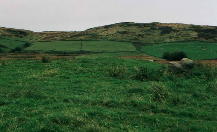
Bagbie Cairn submitted by vicky on 31st Dec 2002. The Bagbie Cairn with a pair of associated standing stones.
(View photo, vote or add a comment)
Log Text: I have made multiple visits to Bagbie Cairn and its surroundings. There are many sites to visit in a small area. There is a view of the sea from Bagbie Cairn which may have influenced its location.
Bagbie Four Poster
Date Added: 27th Apr 2021
Site Type: Stone Circle
Country: Scotland (Dumfries and Galloway)
Visited: Yes on 27th Apr 2021. My rating: Condition 3 Ambience 4 Access 4
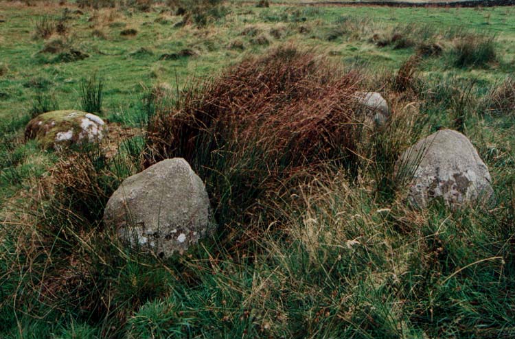
Bagbie Four Poster submitted by PaulM on 29th Oct 2002. This is a small four poster with stones no larger than 1.2m in height. It stands on the NE edge of a cairn and only three or four metres from a similarly sized stone pair. The grid reference is NX49815642.
This area is right on the edge of OS Explorer Map 311 (Wigtown, Whithorn & The Machars) and full navigation will require the next map over (Map 312 - Kirkcudbright & Castle Douglas).
(View photo, vote or add a comment)
Log Text: I have made multiple visits to Bagbie Cairn and its surroundings. There are many sites to visit in a small area. There is a view of the sea from Bagbie Cairn which may have influenced its location.
Bagbie stones
Date Added: 27th Apr 2021
Site Type: Standing Stones
Country: Scotland (Dumfries and Galloway)
Visited: Yes on 27th Apr 2021. My rating: Condition 2 Ambience 4 Access 4

Bagbie stones submitted by PaulM on 29th Oct 2002. The stone pair are closely associated with the cairn, four poster stone circle and standing stone.
(View photo, vote or add a comment)
Log Text: I have made multiple visits to Bagbie Cairn and its surroundings. There are many sites to visit in a small area. There is a view of the sea from Bagbie Cairn which may have influenced its location.
Bagbie Wall Stone
Date Added: 27th Apr 2021
Site Type: Standing Stone (Menhir)
Country: Scotland (Dumfries and Galloway)
Visited: Yes on 27th Apr 2021. My rating: Condition 4 Ambience 4 Access 4

Bagbie Wall Stone submitted by markj99 on 27th Apr 2021. Bagbie Wall Stone, centre picture, in the dry stane dyke.
(View photo, vote or add a comment)
Log Text: I have made multiple visits to Bagbie Cairn and its surroundings. There are many sites to visit in a small area. There is a view of the sea from Bagbie Cairn which may have influenced its location.
Bailiehill Fort
Date Added: 1st May 2021
Site Type: Hillfort
Country: Scotland (Dumfries and Galloway)
Visited: Yes on 19th May 2012. My rating: Condition 2 Ambience 4 Access 3
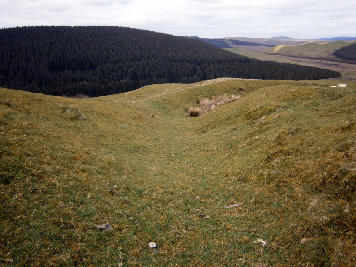
Bailiehill Fort submitted by markj99 on 1st May 2021. Inside a defensive rampart and ditch defense of Bailiehill Fort.
(View photo, vote or add a comment)
Log Text: Baliehill Fort is located between Lockerbie and Langholm in a rural setting. It is situated atop a steep climb up Camp Hill from a lay-by at NY 25315 90657. The remnants of the forts defenses are visible on the slope of the hill but the enclosures are relatively featureless.
