Contributory members are able to log private notes and comments about each site
Sites markj99 has logged. View this log as a table or view the most recent logs from everyone
Stannon cairn
Date Added: 20th Aug 2025
Site Type: Cairn
Country: England (Cornwall)
Visited: Yes on 19th Mar 2014. My rating: Condition 3 Ambience 4 Access 4
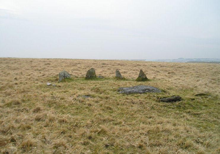
Stannon cairn submitted by TheCaptain on 27th Mar 2005. Cairn circle just east of Stannon Circle on Bodmin Moor.
View looking south westwards at this cairn circle which I found while walking back to my car from Fernacre. A fine set of teeth it has.
(View photo, vote or add a comment)
Log Text: If you are visiting Stannon Stone Circle why not walk c. 400 yards ESE to locate Stannon Kerbed Cairn, a small cairn with 4 prominent kerb stones and a possible undisturbed cist in the centre?
Bowerman's Nose
Date Added: 29th May 2021
Site Type: Rock Outcrop
Country: England (Devon)
Visited: Yes on 21st Mar 2014. My rating: Condition 4 Ambience 5 Access 3
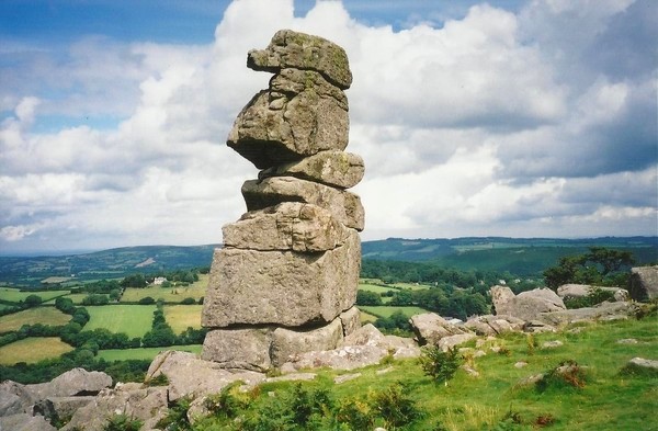
Bowerman's Nose submitted by Bladup on 25th Apr 2013. Bowerman's Nose.
(View photo, vote or add a comment)
Log Text: Bowerman's Nose is one of those splendid oddities which don't have an explanation. They are happy accidents. They don't need to be explained they just exist.
Robin Hood's Stone
Date Added: 10th Jan 2023
Site Type: Standing Stone (Menhir)
Country: England (Merseyside)
Visited: Yes on 4th Apr 2014. My rating: Condition 3 Ambience 3 Access 5
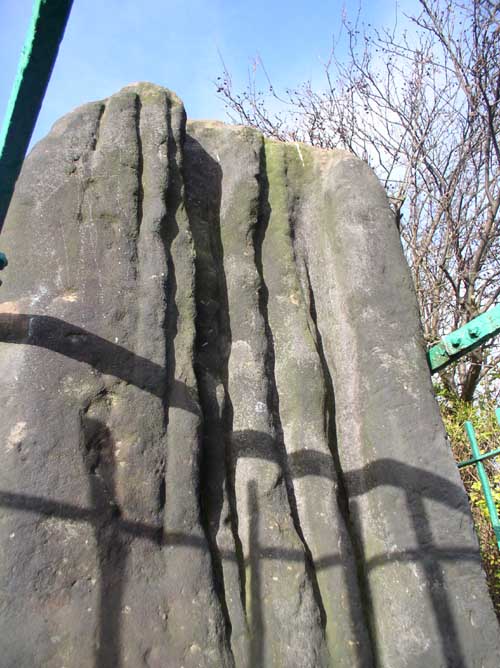
Robin Hood's Stone submitted by vicky on 24th Jan 2004. A close up of Robin Hood's stone showing the weathering grooves.
(View photo, vote or add a comment)
Log Text: Robin Hood's Stone is the definitive example of an anachronism, a standing stone in an urban environment. The green iron railings which imprison the standing stone emphasise it's alienation.
Yordas cave
Date Added: 1st Jun 2024
Site Type: Cave or Rock Shelter
Country: England (Yorkshire (North))
Visited: Yes on 6th Apr 2014. My rating: Condition 4 Ambience 4 Access 4
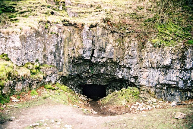
Yordas Cave submitted by andy_h on 27th Apr 2004. Previously a Victorian Showcave in which evidence of early human habitation was found. A wonderful place to spend an afternoon exploring with a torch. The highlight being the underground waterfall chamber at the back of the cave.
(View photo, vote or add a comment)
Log Text: The troglodyte in me can never pass up a chance to explore a cave. Yordas Cave is easily accessible with a bonus waterfall.
Apron Full of Stones
Date Added: 11th Apr 2021
Site Type: Ring Cairn
Country: England (Yorkshire (North))
Visited: Yes on 6th Apr 2014. My rating: Condition 3 Ambience 4 Access 3
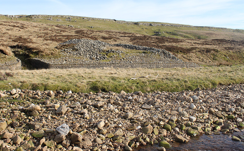
Apron Full of Stones submitted by Blingo_von_Trumpenstein on 27th Mar 2017. Apron Full Of Stones ring cairn. Very obvious placement facing the gorge that contains Yordas cave.
(View photo, vote or add a comment)
Log Text: There is a convenient lay by c. 100ft WNW of Apron Full of Stones at SD7065578918. If Kingsdale Beck is in spate there is a bridge c. 200ft N of a lay-by at SD7023078010. The cairn is c. 0.5 mile walk by the river from this point.
Apron Full of Stones is a much reduced cairn however there is sufficient original structure to suggest how impressive it would have been in its low lying landscape. The proximity of Yordas Cave is a bonus.
Lligwy Burial Chamber
Date Added: 15th Apr 2021
Site Type: Chambered Tomb
Country: Wales (Anglesey)
Visited: Yes on 28th Apr 2014. My rating: Condition 3 Access 4
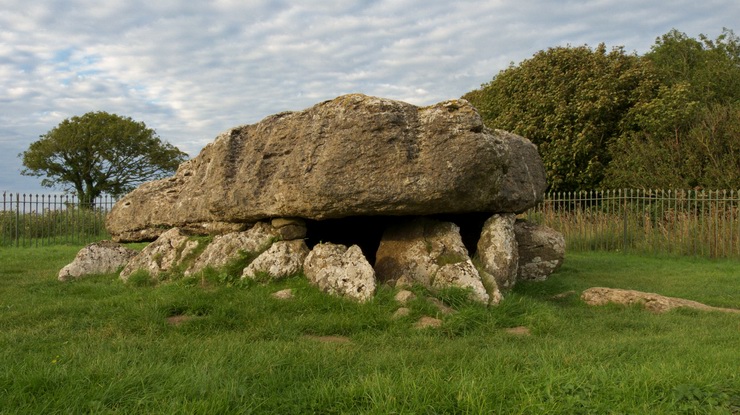
Lligwy Burial Chamber submitted by Jimwithnoname on 8th Sep 2011. Amazing dolmen and very unnerving sat underneath the 25 ton capstone. It's perched on very little it seems on the one side. The warden approached us as we sat eating at the site. He asked if we were thinking of stopping the night, which we were, but as he said. that's a no no. We respected him and moved on after our picnic. He was quite pleasant and only doing his job. Many people wild camp as he said, and set fire to crops or drive through hedges!
(View photo, vote or add a comment)
Log Text: Lligwy Burial Chamber has one of the most impressive capstones in the British Isles. The cuboid shape is different from the slab like capstones found in Cornwall.
Guidebest
Date Added: 19th May 2024
Site Type: Stone Circle
Country: Scotland (Highlands)
Visited: Yes on 25th Jun 2014. My rating: Condition 2 Ambience 4 Access 3
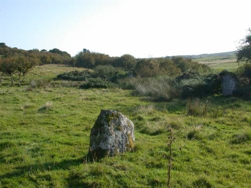
Guidebest submitted by steveco on 24th Feb 2002. Guidebest Stone Circle ND181351. A GPS was very helpful in finding this one.
(View photo, vote or add a comment)
Log Text: It is difficult to capture Guidebest Stone Circle in one photo due to its scale and the shrubs in the circle. Is it a coincidence that there is a large split stone in the circle, similar to the split stone at Latheron?
Carn Liath (Trantlemore)
Date Added: 29th May 2025
Site Type: Broch or Nuraghe
Country: Scotland (Sutherland)
Visited: Yes on 25th Jun 2014. My rating: Condition 2 Ambience 4 Access 4
Carn Liath (Trantlemore) submitted by markj99 on 28th May 2025. Carn Liath (Trantlemore) Broch viewed from S.
(View photo, vote or add a comment)
Log Text: There are many good reasons to take the A897 N out of Helmsdale: Amazing Scenery, 14 Brochs listed on TMP, 36 Sites listed on TMP and last but not least 0.95 Sites per Mile.
My favourite site is The Borg, a broch c. 1 mile S of Carn Liath (Trantlemore).
The Borg
Date Added: 29th May 2025
Site Type: Broch or Nuraghe
Country: Scotland (Sutherland)
Visited: Yes on 25th Jun 2014. My rating: Condition 3 Ambience 5 Access 3
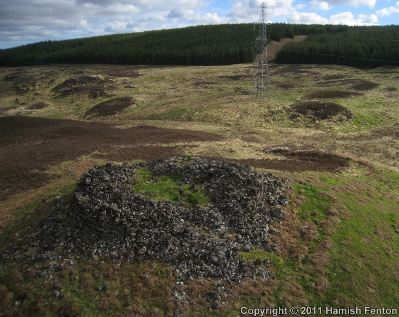
The Borg submitted by h_fenton on 30th Nov 2011. The Borg (Broch), viewed from the southwest.
Kite Aerial Photograph
11 May 2011
(View photo, vote or add a comment)
Log Text: The Borg Broch is c. 250 yards E of a passing place at NC 89715 50993 on the A897. Probably due to its isolation, substantial remains of the broch have been preserved.
Carn Liath, Shurrery
Date Added: 30th May 2025
Site Type: Cairn
Country: Scotland (Highlands)
Visited: Yes on 25th Jun 2014. My rating: Condition 2 Ambience 3 Access 3
Carn Liath, Shurrery submitted by markj99 on 25th Sep 2020. An orthostat on Carn Liath, Shurrery.
(View photo, vote or add a comment)
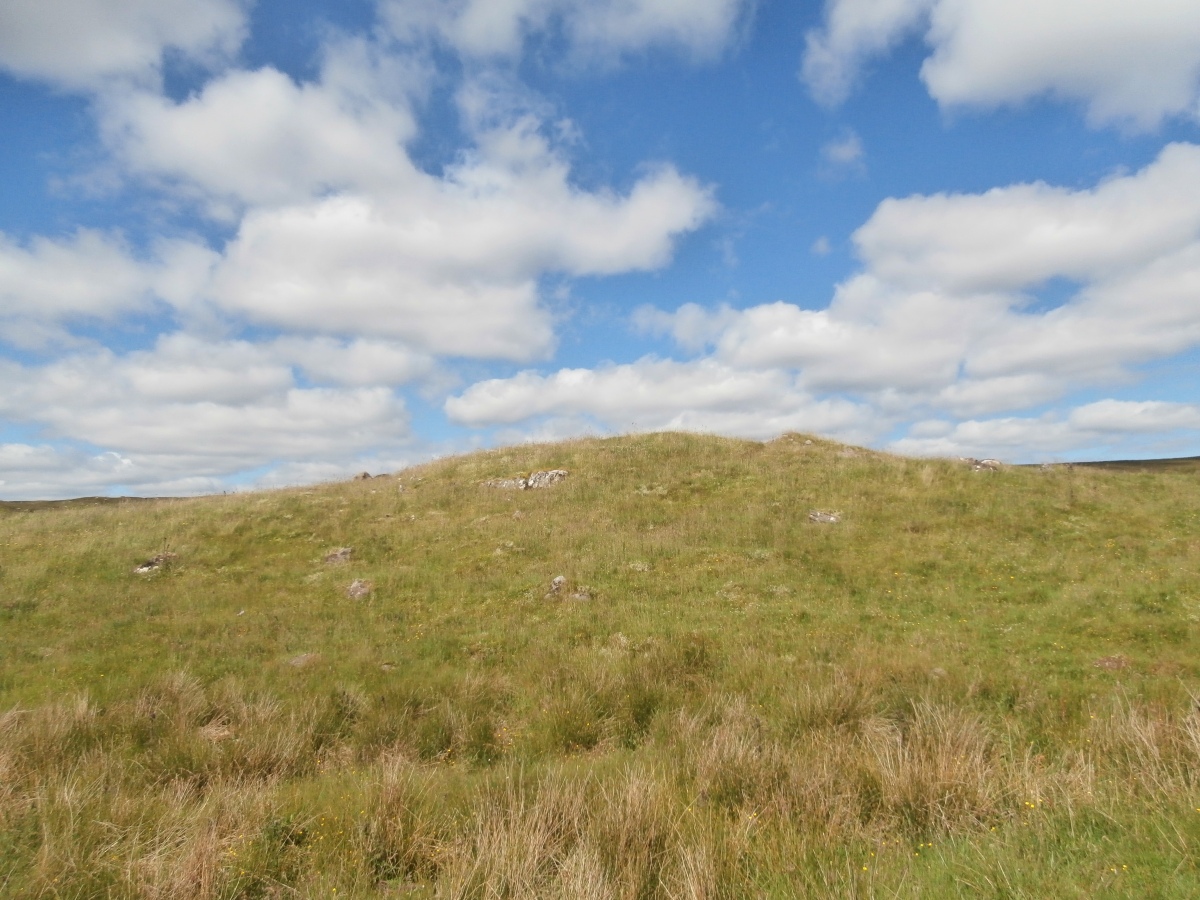
Log Text: Carn Liath (Shurrery) is located on the E bank of Forss Water, c. 400 yards W of a dead-end track leading to Loch Shurrery. The terrain is uneven and marshy making the walk challenging. The unspectacular mound is grassy with a scattering of stones protruding through the surface. I would not recommend a visit.
Lower Camster Stones
Date Added: 18th Apr 2025
Site Type: Standing Stones
Country: Scotland (Highlands)
Visited: Yes on 25th Jun 2014. My rating: Condition 3 Ambience 4 Access 3
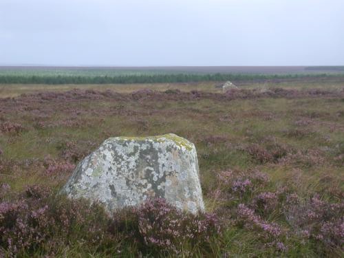
Lower Camster Stones submitted by steveco on 24th Feb 2002. Camster Stone Circle ND260459. Remains of Lower Camster Stone Circle.
(View photo, vote or add a comment)
Log Text: Lower Camster Standing Stone are a curious contrast to the Grey Cairns of Camster located c. 1 mile N of the Cairns in flat moorland. The N and S Standing Stones are now dwarfed by Wind Turbines but they still retain a sense of antiquity. The W stone which is adjacent to the road is somewhat less convincing.
Coetan Arthur Dolmen
Date Added: 15th Apr 2021
Site Type: Chambered Tomb
Country: Wales (Pembrokeshire)
Visited: Yes on 27th Jul 2014. My rating: Condition 3 Ambience 5 Access 3
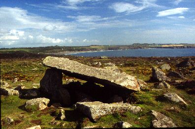
Coetan Arthur Dolmen submitted by Johnny on 25th Aug 2001. Coetan Arthur, St. David's Head, Dyfed
(SM725 281):
Impressively situated on the hillside close to St. David's Head, Coetan Arthur is the collapsed chamber of what is presumed to be a passage grave which also has a round barrow. The massive capstone measures approximately 5.9 meters by 2.6 meters and is supported on one side by an orthostat approximately 1.5 meters in height.
(View photo, vote or add a comment)
Log Text: Coetan Arthur Dolmen is in a superb coastal setting on St David's Head. The dolmen is perfectly proportioned. The capstone lies at a pleasing 20 degrees angle from horizontal.
This site is just picture perfect.
Din Lligwy
Date Added: 19th Aug 2025
Site Type: Ancient Village or Settlement
Country: Wales (Anglesey)
Visited: Yes on 24th Aug 2014
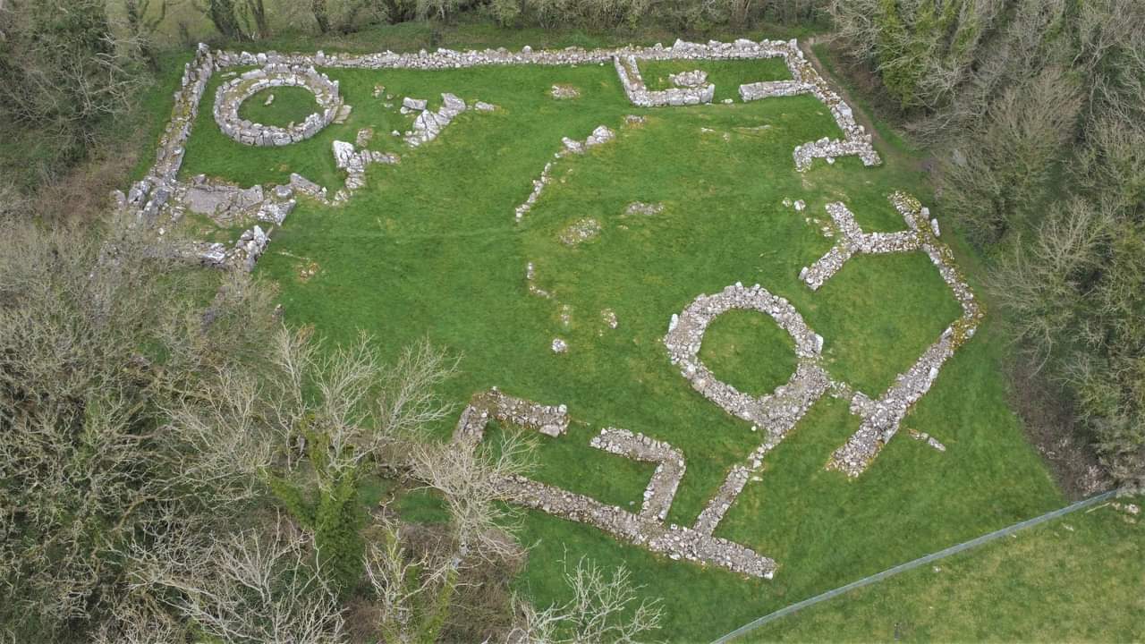
Din Lligwy submitted by TAlanJones on 21st Dec 2023. Aerial view of Din Lligwy.
(View photo, vote or add a comment)
Log Text: There is a small car park at SH 50018 86252 on the narrow lane providing access to the Lligwy monuments. A path starting at the car park heads W for c. 400 yards to Din Lligwy village.
Arthur's Stone
Date Added: 15th Apr 2021
Site Type: Chambered Tomb
Country: England (Herefordshire)
Visited: Yes on 25th Aug 2014. My rating: Condition 3 Ambience 3 Access 5
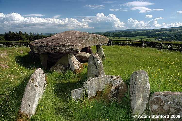
Arthur's Stone submitted by Adam Stanford on 21st Jul 2006. Taken during recent work to investigate the full extent of the covering mound for this monument. Cheers AS.
(View photo, vote or add a comment)
Log Text: There is no logical reason that the amount of effort required to reach a site should affect your interpretation of the site. However I have found that I undervalue sites adjacent to the roadside in comparison with sites in the middle of nowhere. That said, the remains of Arthur's Stone are quite impressive.
Mynydd Cefn Amlwch
Date Added: 15th Apr 2021
Site Type: Chambered Tomb
Country: Wales (Gwynedd)
Visited: Yes on 25th Aug 2014. My rating: Condition 3 Ambience 4 Access 4
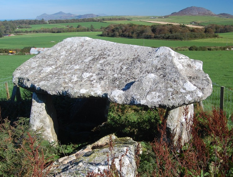
Mynydd Cefn Amlwch submitted by pab on 16th Oct 2007. On a wonderfully clear day in October, looking north east up the Lleyn Peninsula.
The location is noted on COFLEIN as also being known as Coetan Arthur, their ref being NPRN: 93509, at GR SH22973456.
(View photo, vote or add a comment)
Log Text: Mynydd Cefn Amlwch is in a pastoral setting protected from livestock by a wooden fence. It is a classic tripod dolmen. I enjoyed the quiet ambience of the site.
Carwynnen Quoit
Date Added: 14th Jun 2025
Site Type: Portal Tomb
Country: England (Cornwall)
Visited: Yes on 26th Aug 2014. My rating: Condition 4 Ambience 4 Access 4
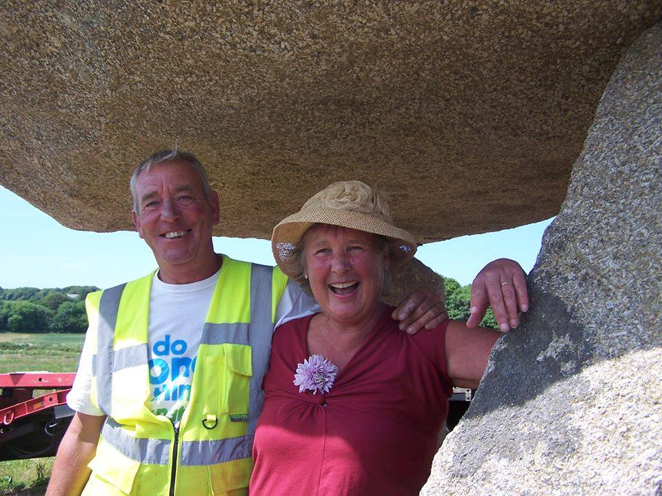
Carwynnen Quoit submitted by Andy B on 28th Jun 2016. RIP Sustrust's Founder and Heroine Pip Richards.
Beverley Hollyoake wrote: Pip a much loved wife, mother and grandmother passed away peacefully at Mount Edgecombe Hospice surrounded by the love of her family on Saturday 7th May 2016 aged just sixty five. Her family are deeply saddened by their loss, Pip was the bright spark in all their lives.
They draw some comfort at this difficult time in the knowledge that Pip had lived a rich and full life on her own terms whilst enriching the liv...
(View photo, vote or add a comment)
Log Text: I visited Carwynnen Quoit 2 months after its reconstruction by a local group. The impressive restoration of this site gives hope for the future of many ruined sites.
Crousa Common
Date Added: 23rd Jul 2025
Site Type: Standing Stones
Country: England (Cornwall)
Visited: Yes on 26th Aug 2014

Crousa Common submitted by Bladup on 1st Jun 2023. Crousa Common Standing Stones
(View photo, vote or add a comment)
Log Text: In common with many Cornish Sites, it is difficult to park close to Crousa Common Stones. The closest safe parking stot is a picnic spot at St Keverne Beacon, 100 yards off the B3293. My walking route to the stones is viewable on Crousa Common Stones/a>.
Carreg Coetan Arthur
Date Added: 13th Jun 2025
Site Type: Burial Chamber or Dolmen
Country: Wales (Pembrokeshire)
Visited: Yes on 27th Aug 2014. My rating: Condition 3 Ambience 3 Access 4
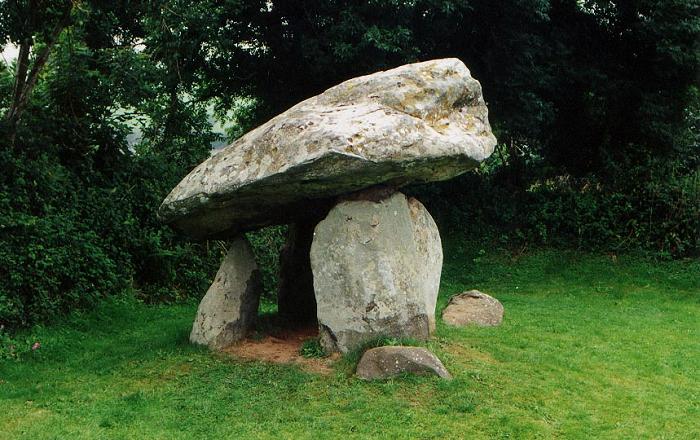
Carreg Coetan Arthur submitted by PaulM on 24th Aug 2001. CARREG COETAN ARTHUR TRIPOD DOLMEN
NGR: SN06093930 (Landranger map 145/Outdoor Leisure North Pembrokeshire map (No 35))
Located close to the centre of Newport in Pembrokeshire with public access. Although called a tripod dolmen four uprights exist - only two of which support the capstone (which is said to replicate the summit of Carn Ingli to the south).
Excavations have revealed cremated bone, Beaker and Grooved ware sherds.
(View photo, vote or add a comment)
Log Text: Carreg Coetan Arthur Dolmen is enclosed by a hedge in Newport. It's survival in an urban development is against the odds so the existence of this small dolmen should be celebrated.
The Devil's Quoit
Date Added: 15th Aug 2025
Site Type: Burial Chamber or Dolmen
Country: Wales (Pembrokeshire)
Visited: Yes on 28th Aug 2014. My rating: Condition 2 Ambience 4 Access 4
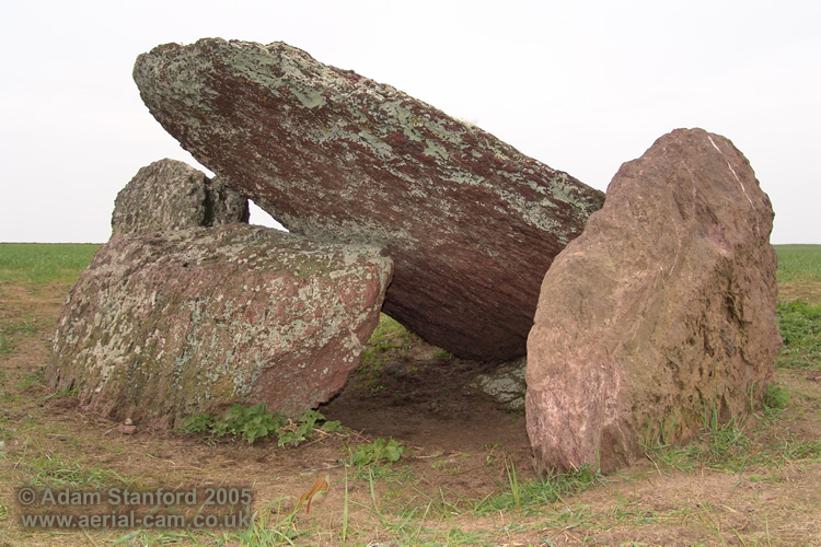
The Devil's Quoit submitted by Adam Stanford on 16th Nov 2006. Devils Quoit (PEM 25) also known as Broomhill Barrows near Freshwater West. I would suggest this is a collapsed burial chamber rather than earthfast (as stated by Nash 2006, Daniel 1950 and others). I say this because of what looks like a large collapsed orthostat that is now visible and that the capstone rests on. The monument consists of five visible stones. 1 capstone, 2 orthosatats, 1 collapsed or horizontal stone and another vertical stone resting on the eastern side of the capstone. I woul...
(View photo, vote or add a comment)
Log Text: Fortunately the field was in grass when I visited so I was able to get close to The Devil's Quoit. It appears to be a collapsed chamber, the sole remnant of a chambered cairn. The chamber is orientated on a NE-SW axis.
Devil's Quoit (St Twynnells)
Date Added: 16th Aug 2025
Site Type: Standing Stone (Menhir)
Country: Wales (Pembrokeshire)
Visited: Yes on 28th Aug 2014. My rating: Condition 4 Ambience 4 Access 4
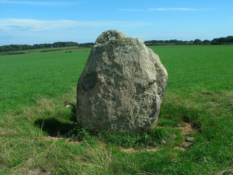
Devil's Quoit (St Twynnells) submitted by Bladup on 13th Sep 2013. Devil's Quoit (St Twynnells).
(View photo, vote or add a comment)
Log Text: Devil's Quoit (St Twynnells) is located in a field S of the B4319 c. 500 yards W of Sampson Farm. The standing stone is an impressive slab c. 6 feet high aligned NE-SW on its long axis.
