Contributory members are able to log private notes and comments about each site
Sites markj99 has logged. View this log as a table or view the most recent logs from everyone
Warehouse Standing Stone
Date Added: 6th Jul 2023
Site Type: Standing Stone (Menhir)
Country: Scotland (Caithness)
Visited: Yes on 6th Jul 2011. My rating: Condition 4 Ambience 5 Access 3
Warehouse Standing Stone submitted by SolarMegalith on 2nd Oct 2011. The stone is 1,7 m high and 0,2 m thick (photo taken on July 2011).
(View photo, vote or add a comment)
Log Text: I set off on the South Yarrows Archaeological Trail without any great expectations. I found the walk and variety of the sites a very pleasant surprise.
Warehouse West
Date Added: 6th Jul 2023
Site Type: Cairn
Country: Scotland (Caithness)
Visited: Yes on 6th Jul 2011. My rating: Condition 3 Ambience 5 Access 3
Warehouse West submitted by SolarMegalith on 27th Jul 2011. Central part of Warehouse West cairn (photo taken on July 2011).
(View photo, vote or add a comment)
Log Text: I set off on the South Yarrows Archaeological Trail without any great expectations. I found the walk and variety of the sites a very pleasant surprise.
Warehouse South
Date Added: 6th Jul 2023
Site Type: Chambered Cairn
Country: Scotland (Caithness)
Visited: Yes on 6th Jul 2011. My rating: Condition 4 Ambience 5 Access 3
Warehouse South submitted by SolarMegalith on 27th Jul 2011. Warehouse South chamebred cairn seen from the north (photo taken on July 2011).
(View photo, vote or add a comment)
Log Text: I set off on the South Yarrows Archaeological Trail without any great expectations. I found the walk and variety of the sites a very pleasant surprise.
Strichen House
Date Added: 19th Mar 2023
Site Type: Stone Circle
Country: Scotland (Aberdeenshire)
Visited: Yes on 7th Jul 2011. My rating: Condition 3 Ambience 4 Access 4

Strichen House submitted by Krautrock on 7th Jan 2009. July 2008
(View photo, vote or add a comment)
Log Text: Given its chequered history I was unsure about visiting Strichen House Stone Circle. I was pleasantly surprised by the gravitas of this small stone circle.
Creebridge Cairn
Date Added: 19th Jul 2025
Site Type: Cairn
Country: Scotland (Dumfries and Galloway)
Visited: Yes on 30th Jul 2011. My rating: Condition 3 Ambience 3 Access 4

Creebridge Cairn submitted by PaulM on 30th Oct 2002. Creebridge cairn
This cairn is located on the outskirts of Minnigaff/Newton Stewart and is superbly preserved. It could be associated with a number of cairns in this area.
To find it drive along the B7079 from Minnigaff towards the A75 - the cairn is in a roadside clearing at NX41706560 and stands at least 4m tall. The noticeboard is informative.
(View photo, vote or add a comment)
Log Text: I had driven past Creebridge Cairn many times before I became aware of its existence: it is screened from the road by vegetation and street furniture. There is no signage marking this ancient monument. The grassy mound is relatively intact.
Torhousekie N
Date Added: 25th Dec 2023
Site Type: Cairn
Country: Scotland (Dumfries and Galloway)
Visited: Yes on 30th Jul 2011. My rating: Condition -1 Ambience 3 Access 4
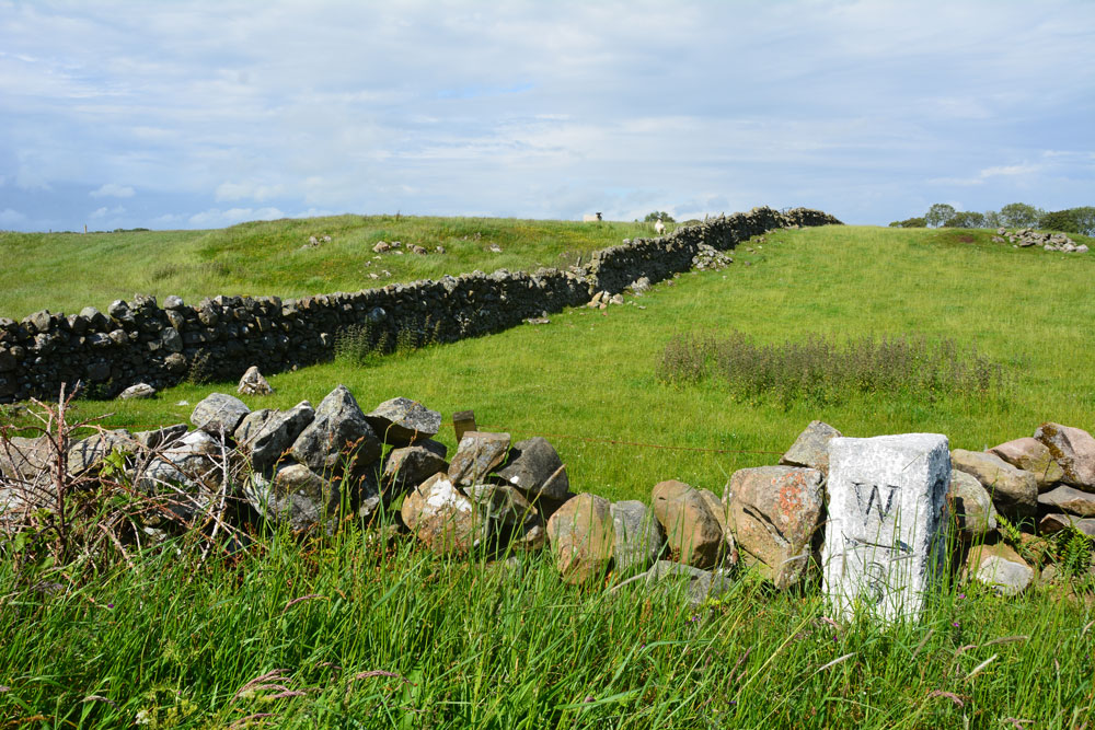
Torhousekie N submitted by Anne T on 25th Jun 2019. Part of this 240ft diameter cairn appears over the dry stone wall as you walk west from the stone circle, on the northern part of the road. Canmore tells us that most of it has been removed to build walls, but it is still a reasonably substantial mound. It lies some 60m north of the milestone. I was left wondering if the area to the centre right was field clearance, or the eastern side of the 240ft circumference cairn.
(View photo, vote or add a comment)
Log Text: I looked for this cairn adjacent to the stone circle. The remains of the stone robbed mound may be bisected by the dry stane dyke, constructed using the cairn stones. I thought the E cluster of stones were field clearance stones.
Torhouse North Side Cairn
Date Added: 25th Dec 2023
Site Type: Cairn
Country: Scotland (Dumfries and Galloway)
Visited: Yes on 30th Jul 2011. My rating: Condition -1 Ambience 3 Access 4
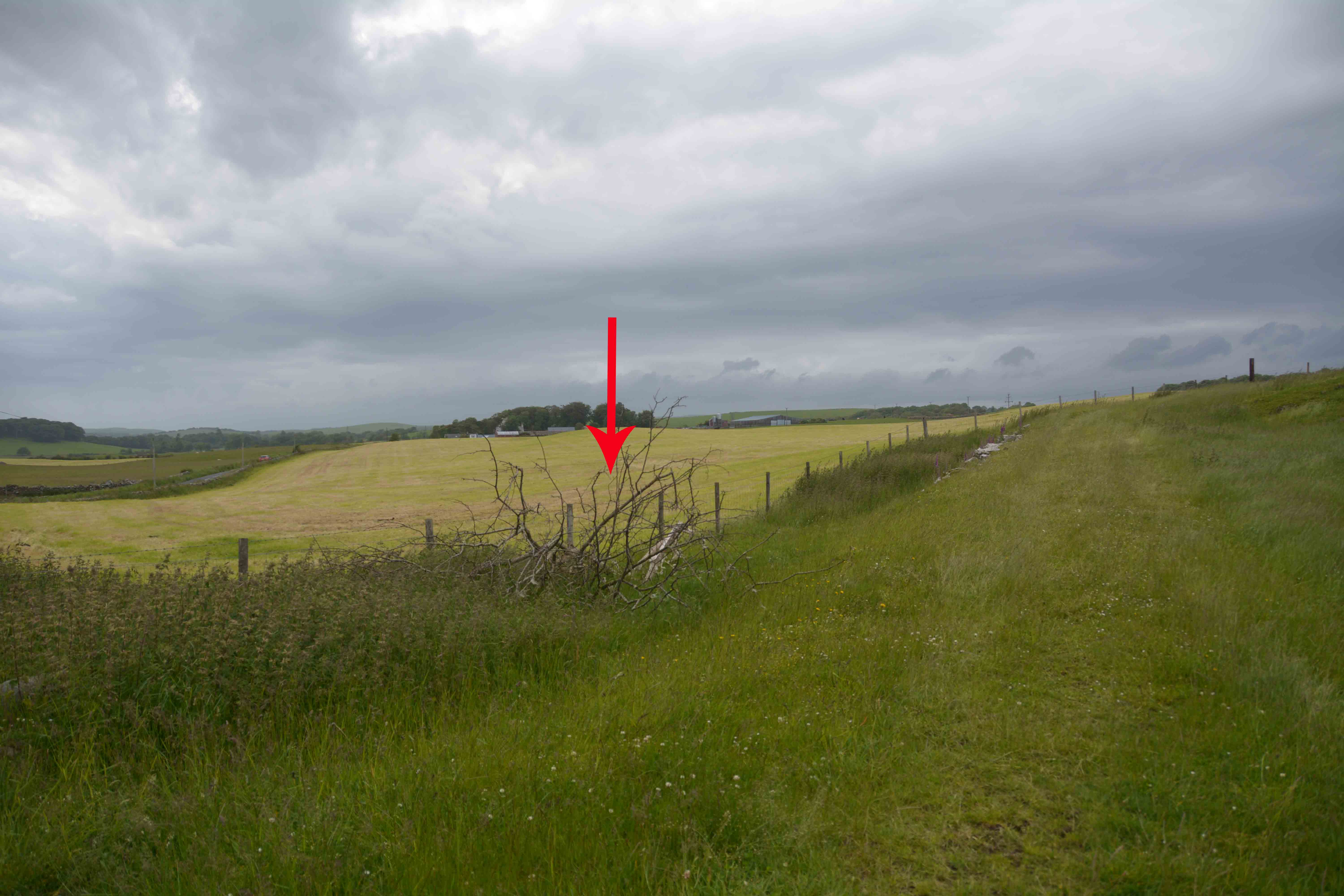
Torhouse North Side Cairn submitted by Anne T on 25th Jun 2019. Armed with the GPS, the location is exactly as described by SumDoood, although we couldn't find any trace of field clearance stones in this field - it appeared to be improved pasture land. The red arrow marks the spot where the cairn should be (although there is a brighter green central 'button' just to its left, behind the fence line which might possibly be it?)
(View photo, vote or add a comment)
Log Text: I scanned the area indicated by the grid reference but like Anne T, I failed to discern the shape of a cairn. Perhaps I need to revisit in twilight like SumDoood.
Torhouse North Cairn
Date Added: 25th Dec 2023
Site Type: Cairn
Country: Scotland (Dumfries and Galloway)
Visited: Yes on 30th Jul 2011. My rating: Condition -1 Ambience 3 Access 4
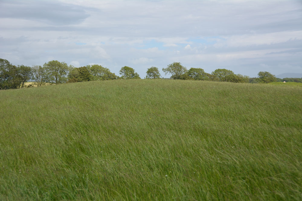
Torhouse North Cairn submitted by Anne T on 26th Jun 2019. Nothing to see now, but the site of the cairn, now destroyed, would have been at the top of the 'hump' of this natural knoll. The stone row is 200m to the north east and the stone circle 180m to the south.
(View photo, vote or add a comment)
Log Text: While visiting Torhouse Stone Circle on a fine day I resolved to investigate the speculative destroyed cairns NW of the circle. I followed a grass track towards the northernmost cairn. The site is now a grassy round hill with no trace of any stones. It is such a shame that this area rich in antiquities has been altered by modern farming.
Torhousekie Farm Cairn
Date Added: 25th Dec 2023
Site Type: Cairn
Country: Scotland (Dumfries and Galloway)
Visited: Yes on 30th Jul 2011. My rating: Condition 3 Ambience 4 Access 3
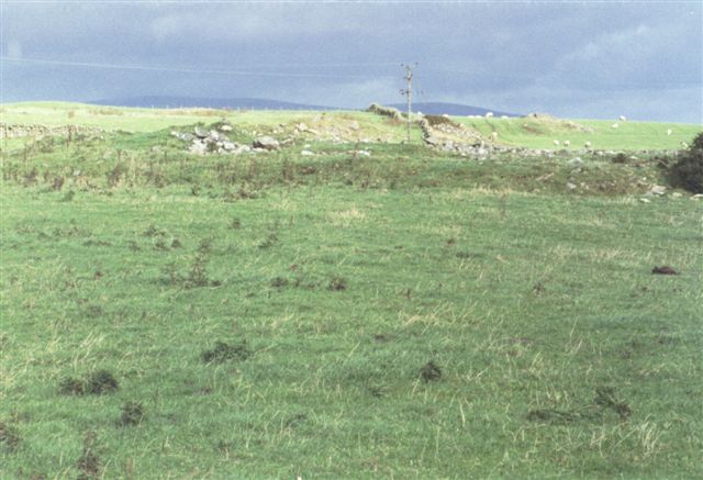
Torhousekie Farm Cairn submitted by cosmic on 17th Oct 2004. Remains of Cairn near Torhousekie Farm
(View photo, vote or add a comment)
Log Text: Torhousekie Farm Cairn has survived in better condition than the E cairns which have been erased from the landscape. The overall footprint of the cairn is intact and there are original stones scattered on the centre of the low mound.
It is possible to park in a gateway on the B733 at NX 3790 5669. Head N across the field for c. 130 yards to a gate in the dry stane dyke. Torhousekie Farm Cairn is c. 70 yards SW of here parallel to the dry stane dyke. My route is viewable on Torhouse Farm Cairn.
Carn Liath (Kensaleyre)
Date Added: 28th May 2025
Site Type: Chambered Cairn
Country: Scotland (Isle of Skye)
Visited: Yes on 9th Aug 2011. My rating: Condition 3 Ambience 4 Access 3
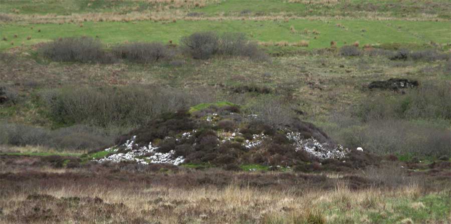
Carn Liath (Kensaleyre) submitted by jeffrep on 25th Jul 2013. The Carn Liath Chambered Cairn is located in a field off the A87 just south of Kensaleyre opposite the turn off to Rhenetra on the Isle of Skye, Highland, Scotland. It is the largest of a cluster of cairns here, and is easy to see from a distance, because the stones from which it is constructed are covered with such white lichen that they appear to have been painted.
(View photo, vote or add a comment)
Log Text: There are two difficulties in visiting Carn Liath (Kensaleyre): the lack of parking and the lack of a path. My best compromise was to park in the Church of Scotland Car Park, walk c. 300 yards along the A87 then take a cross country route c. 650 yards WSW across rough boggy ground to Carn Liath (Kensaleyre). My walking route can be viewed on Carn Liath (Kensaleyre).
Tote, Skye
Date Added: 23rd Jun 2025
Site Type: Class I Pictish Symbol Stone
Country: Scotland (Isle of Skye)
Visited: Yes on 9th Aug 2011. My rating: Condition 3 Ambience 3 Access 5
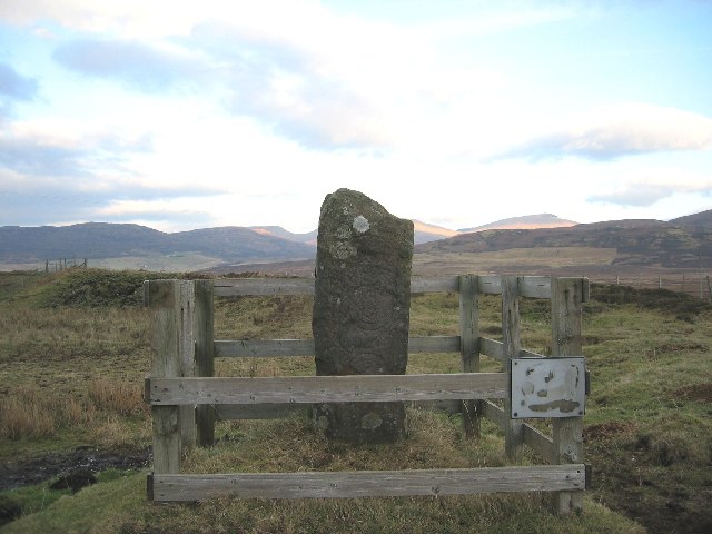
Tote, Skye submitted by Andy B on 13th Apr 2010. Probably the only standing stone on Skye that has (barely) visible Pictish carving. The fence is an abomination.
Copyright John Allan and licensed for reuse under this Creative Commons Licence.
(View photo, vote or add a comment)
Log Text: The Pictish Stone at the small settlement of Tote is only 5 miles NW of Portree. It is accessed via the A87 NW of Portree, turning left onto the A850 Dunvegan. After 1.3 miles turn right for Peinmore/Tote. Stay on the narrow road for c. 0.3 mile to reach the left dead end turn for Tote. Clach Ard is c. 350 yards W of the junction on the right enclosed by a wooden fence.
Kensalyre Stone
Date Added: 3rd Apr 2021
Site Type: Standing Stone (Menhir)
Country: Scotland (Isle of Skye)
Visited: Yes on 9th Aug 2011. My rating: Condition 3 Ambience 4 Access 4

Kensalyre Stone submitted by Creative Commons on 14th Apr 2010. Not as imposing as the two in Kensaleyre, the stone is much larger. This view is looking back towards Little Loch Snizort
Copyright John Allan and licensed for reuse under the Creative Commons Licence.
(View photo, vote or add a comment)
Log Text: There is a c. 3.5 foot stone in moorland around 50 feet SE of Kensaleyre Cairns, a pair of cairns on the E edge of the A87 to Portree. It seems probable that this stone had a relationship to the nearby cairns. It is listed under Canmore ID 11325 along with Kensaleye Cairns.
Borve Stone Row
Date Added: 28th May 2021
Site Type: Stone Row / Alignment
Country: Scotland (Isle of Skye)
Visited: Yes on 9th Aug 2011. My rating: Condition 3 Ambience 4
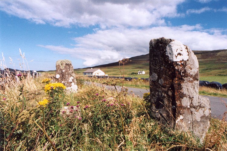
Borve Stone Row submitted by Andy B on 24th Nov 2010. Borve Stone Row taken in about 1997
(View photo, vote or add a comment)
Log Text: There is a slight curve to the 3 stones in this row lending some weight to the argument that they were once part of a stone circle. The construction of a road through a stone circle could have occurred in the past.
Clach na h'Annait
Date Added: 25th Jun 2025
Site Type: Standing Stone (Menhir)
Country: Scotland (Isle of Skye)
Visited: Yes on 11th Aug 2011. My rating: Condition 4 Ambience 4 Access 4
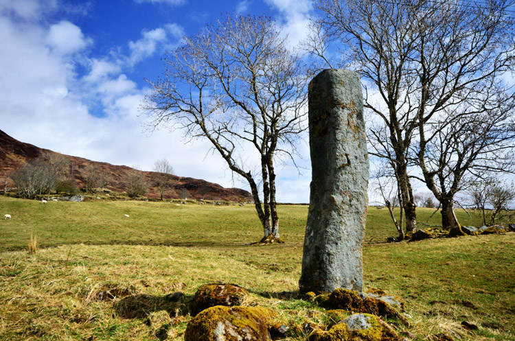
Clach na h'Annait submitted by megalithicmatt on 1st May 2013. Looking northeast.
(View photo, vote or add a comment)
Log Text: It is possible to park up at NG 5947 2006 on the B8083. Walk c. 130 yards W to a junction with Kilbride House Private Road. Walk c. 130 yards down the private road to Kilbride House. There is a gateway on the right leading into a field. Walk W into the field for c. 50 yards then NW for 50 yards towards the standing stone near two trees.
Cnocan nan Gobhar
Date Added: 6th Jul 2025
Site Type: Round Cairn
Country: Scotland (Isle of Skye)
Visited: Yes on 11th Aug 2011
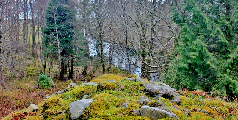
Cnocan nan Gobhar submitted by SumDoood on 3rd Mar 2016. Assuming trees had been removed, the cairn would have been very visible to anyone entering the bay by boat
(View photo, vote or add a comment)
Log Text: If you are going to visit Dun Ringill it is easy to take a c. 400 yard detour N to Cnocan nan Gobhar Cairn. There is an small exposed cist high up on the SW arc of the grassy mound. When I visited there was significant fern cover on the W arc of the cairn but the cist was clear of vegetation. I have added a route to Cnocan nan Gobhar Cairn on the main page.
Suardal
Date Added: 10th Apr 2021
Site Type: Chambered Cairn
Country: Scotland (Isle of Skye)
Visited: Yes on 11th Aug 2011. My rating: Condition 2 Ambience 3 Access 4
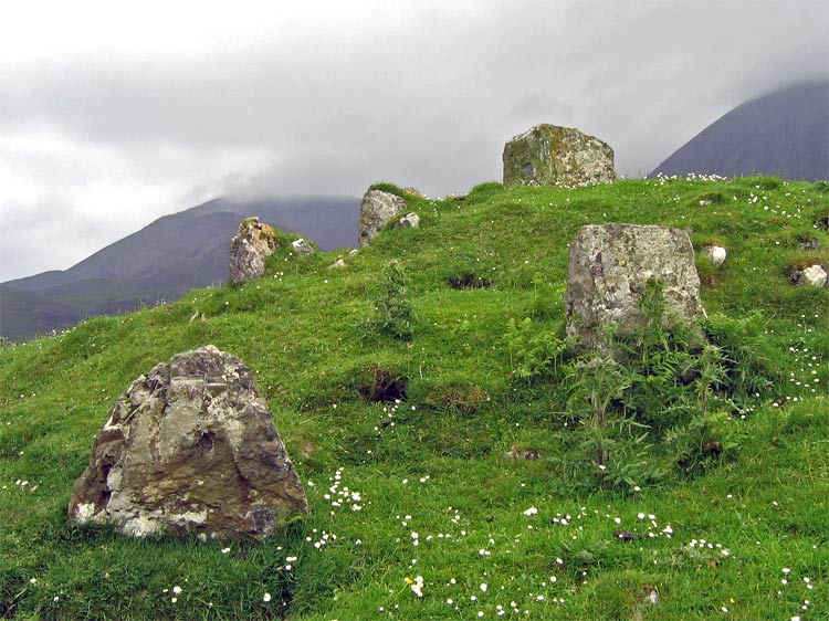
Suardal submitted by LivingRocks on 27th Jul 2005. The remains of the chamber.
(View photo, vote or add a comment)
Log Text: Suardal is an unspectacular cairn in a spectacular situation adjacent to the B8083 Elgol c. 2 miles out of Broadford. It's easy to visit in passing.
Carr Brae
Date Added: 13th Jun 2025
Site Type: Rock Art
Country: Scotland (Highlands)
Visited: Yes on 12th Aug 2011. My rating: Condition 3 Ambience 4 Access 3
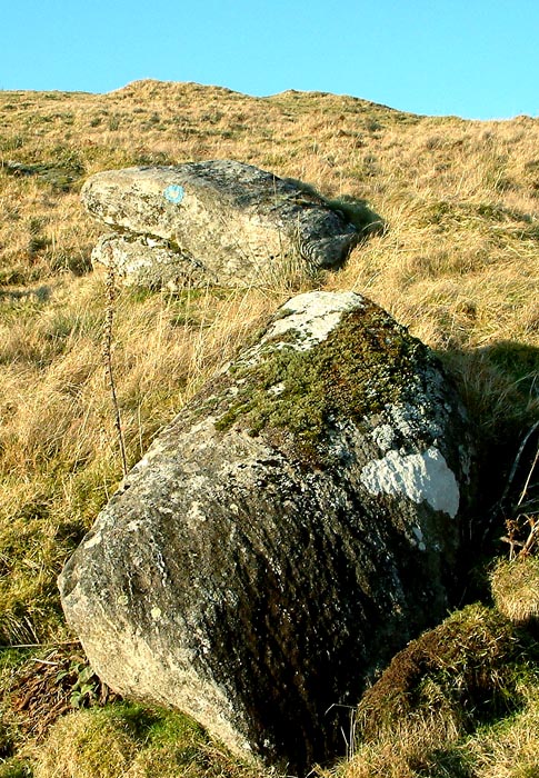
Carr Brae submitted by uisdean on 8th Feb 2007. Carr Brae (NG89782451). Cup marked boulder.
(View photo, vote or add a comment)
Log Text: I found Carn Brae Carved Stone on a steep hillside c. 120 yards S of Carr Brae single track road which runs parallel to the A87 near Eilean Donan Castle. Take the right turn for Carr Brae (Viewpoint) off the A87 c. 0.4 mile N of Inverate Petrol Station. Follow the single track road for c. 1.8 miles to a lay-by at NG 8962 2463. Walk W for c. 200 yards to reach a croft on the right. Head S through rough pasture for c. 120 yards to Carn Brae Carved Stone at NG 89780 24509.
Osmigarry
Date Added: 5th Aug 2023
Site Type: Standing Stone (Menhir)
Country: Scotland (Isle of Skye)
Visited: Yes on 12th Aug 2011
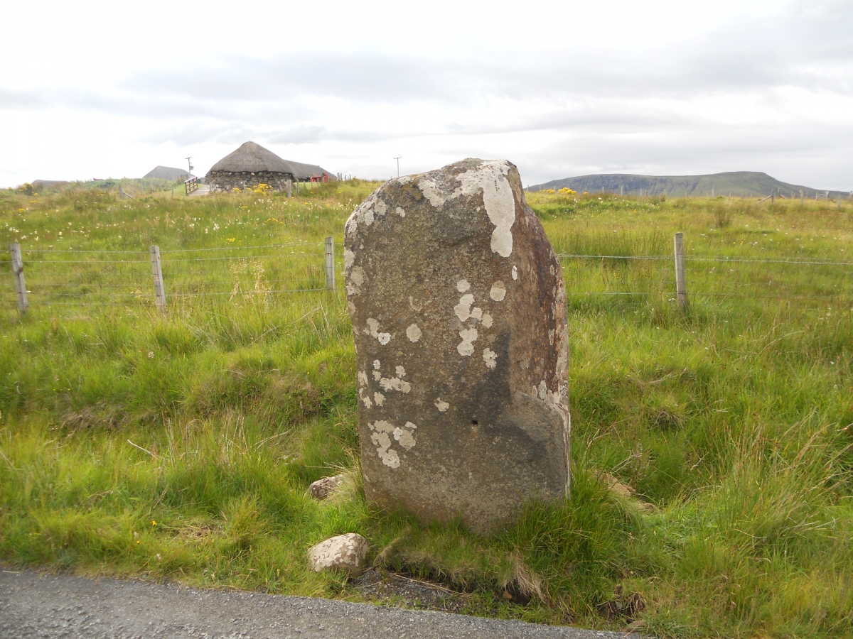
Osmigarry submitted by markj99 on 15th Dec 2022. Osmigarry Standing Stone viewed from W.
(View photo, vote or add a comment)
Log Text: It is a pleasant change to find a standing stone conveniently located on the roadside close to a lay-by. Look out for a recumbent stone on the opposite side of the road.
Balvraid Chambered Cairn
Date Added: 12th May 2021
Site Type: Chambered Cairn
Country: Scotland (Highlands)
Visited: Yes on 13th Aug 2011. My rating: Condition 3 Ambience 4 Access 4
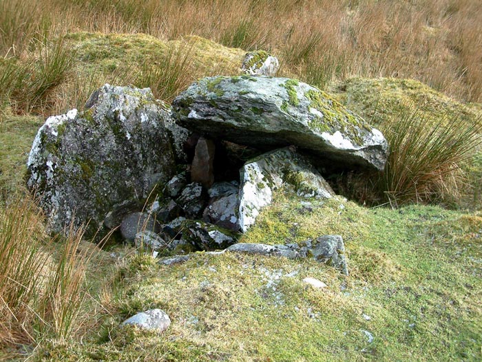
Balvraid Chambered Cairn submitted by uisdean on 25th Feb 2007. NG845166
Bavraid Chambered Cairn. Rge capstone and chamber
(View photo, vote or add a comment)
Log Text: When visiting Dun Telve and Dun Troddan most people turn around but if you continue c. 1 mile to the end of the road you will drive past Balvraid Chambered Cairn and reach a path to Dun Grugaig. Balvraid Chambered Cairn is a robbed chambered cairn with a large capstone and exposed chamber.
Knock Rock Art (1)
Date Added: 18th Jul 2023
Site Type: Rock Art
Country: Scotland (Dumfries and Galloway)
Visited: Yes on 27th Aug 2011. My rating: Condition 3 Ambience 4 Access 4

Knock Rock Art (1) submitted by rockartuk on 7th Nov 2002. Knock 1, Wigtownshire, Dumfries and Galloway.
Grid Ref: NX 3645 4012.
Take the small road from the A747, 1km ESE of Monreith, to Golfcourse 'The Lag'. On the right side, just after the cattlegrid, there is a rocky hillock with an Otter statue on top. The motifs are just below the statue on a small ledge. There is public access.
A single left hand spiral, 17cm in diameter and a 'grid' comprising 6 near-rectangular squares of 16 x 13 cm. It is claimed that these motifs are the nearest (12...
(View photo, vote or add a comment)
Log Text: The cup marked rock is much easier to spot than the hidden markings on the otter stone plinth. I hadn't noticed them on several previous visits.
