Contributory members are able to log private notes and comments about each site
Sites markj99 has logged. View this log as a table or view the most recent logs from everyone
Glac A` Charraigh
Date Added: 5th Sep 2019
Site Type: Standing Stone (Menhir)
Country: Scotland (Isle of Islay)
Visited: Would like to visit
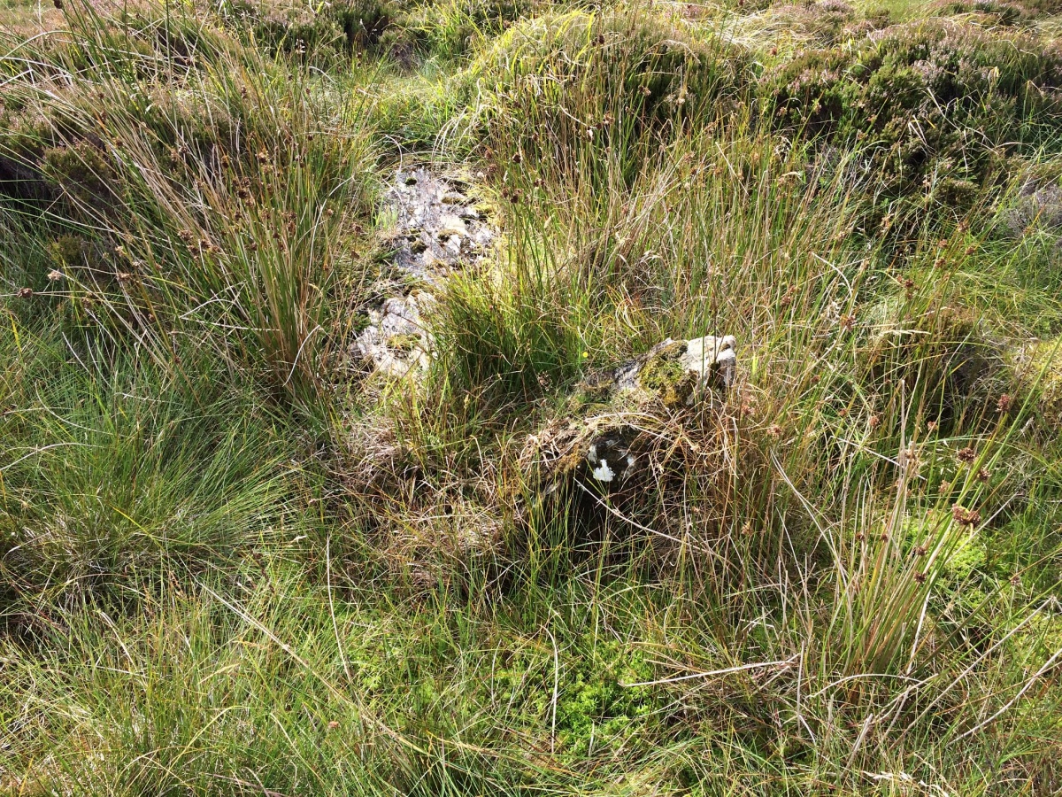
Glac A` Charraigh submitted by markj99 on 5th Sep 2019. Glac A’ Charraigh choke stone
(View photo, vote or add a comment)
Lingdowey Burn S
Date Added: 20th Feb 2022
Site Type: Cairn
Country: Scotland (Dumfries and Galloway)
Visited: Yes

Lingdowey Burn S submitted by markj99 on 20th Feb 2022. Summit of Lingdowey Burn S Cairn viewed from N.
(View photo, vote or add a comment)
Log Text: Lingdowey Burn S Cairn is one of the Cairnerzean Fell Cairn Group on open moorland. The cairns vary in states of preservation from entirely robbed out to relatively intact. Lingdowey Burn S Cairn is similar to its neighbour, Lingdowey Burn N Cairn. It has a scatter of stones over the entire cairn however the addition of a modern cairn and shelter in the centre of the cairn have reduced its authenticity.
Clach an t-Sagairt (Clachan Sands)
Date Added: 30th Jun 2025
Site Type: Early Christian Sculptured Stone
Country: Scotland (North Uist)
Visited: Yes

Clach an t-Sagairt (Clachan Sands) submitted by markj99 on 23rd Jun 2025. Inscribed Cross in NE Quadrant of S Face of Clach an t-Sagairt Carved Stone.
(View photo, vote or add a comment)
Log Text: I visited North Uist on a Calmac Hopscotch trip to the Inner Hebrides. My itinerary was as follows: Oban to Barra (ferry), Barra to Eriskay (ferry), Eriskay to South Uist (causeway), South Uist to Benbecula (causeway), Benbecula to North Uist (causeway), North Uist to Berneray (causeway), Berneray to Harris (ferry), Harris to Lewis (road), Lewis to Ullapool (ferry). I would recommend this route to anyone wishing to explore the Inner Hebrides by car.
It is easy to find Clach an t-Sagairt once you are on North Uist. Clachan Sands is on the B893, c. 3.2 miles S of the Berneray Causeway between North Uist & Berneray Take the signed Clachan Sands Cemetary turn. After c. 130 yards it is possible to park up carefully at the entrance to Clachan Lodge. Walk 100 yards NW along the road then head N through machair grass for c. 60 yards to reach Clach an t-Sagairt Inscribed Stone.
Aviemore
Date Added: 18th Apr 2021
Site Type: Stone Circle
Country: Scotland (Highlands)
Visited: Yes on 3rd Jan 2004. My rating: Condition 2 Ambience 3 Access 5
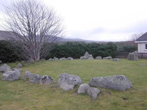
Aviemore submitted by steveco on 24th Feb 2002. Aviemore Ring Cairn NH897134. The surviving parts of a Cairn & Stone Circle in the Ski resort of Aviemore.
(View photo, vote or add a comment)
Log Text: I appreciate that conserving the circle in some way is better than removing it, however, surrounding the circle by a modern housing estate has negated any air of antiquity that the stone circle may have possessed.
Corrimony
Date Added: 11th Jul 2025
Site Type: Clava Cairn
Country: Scotland (Highlands)
Visited: Yes on 3rd May 2006. My rating: Condition 3 Ambience 4 Access 4
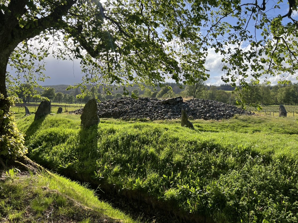
Corrimony submitted by Amouquesoy on 22nd Jun 2025. Taken from the entrance of the site (May 27th 2025 in the evening)
(View photo, vote or add a comment)
Log Text: Corrimony Clava Cairn has been excavated at least twice: first in 1830, then again in 1952. The central chamber was covered in 1830 but it is now open to the sky. Trove.scot Place 12256 states that 4 of the 11 outer stones are modern additions and 2 stones have been reset in modern times. With all this interference there is some doubt as to the authenticity of the clava cairn in its current form.
Grand Menhir de Counozouls
Date Added: 8th Jul 2025
Site Type: Standing Stone (Menhir)
Country: France (Languedoc:Aude (11))
Visited: Yes on 23rd Sep 2007. My rating: Condition 5 Ambience 4 Access 4
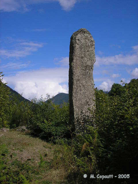
Grand Menhir de Counozouls submitted by thecaptain on 15th Nov 2005. Le Grand Menhir de Counozouls, at nearly 9 metres high, one of the tallest in France, stands on the side of a steep valley in the Pyrenees.
(View photo, vote or add a comment)
Log Text: I was based in Mosset for a French Holiday. After an ascent of the Col de Jau I continued along the D84 randomly. There was a sign for the Grand Menhir de Counozouls by the roadside. The massive standing stone was an unexpected surprise.
Champ des Roches
Date Added: 19th Jun 2025
Site Type: Multiple Stone Rows / Avenue
Country: France (Bretagne:Côtes-D'Armor (22))
Visited: Yes on 26th Jun 2008. My rating: Condition 3 Ambience 4 Access 4

Champ des Roches submitted by thecaptain on 2nd Jul 2005. About 70 big white quartz stones arranged in 5 lines, perhaps 6, which are not quite parallel as they converge towards the east.
(View photo, vote or add a comment)
Log Text: Champ des Roches Stone Rows are also known as "Cimetière des druides" is located on the S edge of Pléslin, a village in Brittany. There is a car park at the end of "Rue des Mégalithes at 48.52984, -2.05905. Walk S for c. 100m then turn left into the "Alignement de mégalithes". According to the the information board there are 65 white quartz stones arranged in 5 lines. I enjoyed my stroll along this grove of trees with various boulders and standing stones dotted along it.
Pancake Rock
Date Added: 19th Dec 2022
Site Type: Rock Art
Country: England (Yorkshire (West))
Visited: Yes on 21st Jan 2009. My rating: Condition 3 Ambience 4 Access 3
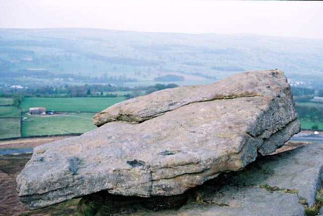
Pancake Stone, Ilkley Moor, West Yorkshire submitted by andy_h on 15th May 2003. The Pancake Stone is a weathered outcrop, perched ominously overlooking the Cow & Calf Hotel. The top is covered in Cup and Ring marks, but is now very worn.
(View photo, vote or add a comment)
Log Text: Pancake Rock is located in an area rich with rock art. The multiple cup marks may not be spectacular but a visit is worthwhile.
Cow and Calf Rocks
Date Added: 19th Dec 2022
Site Type: Rock Outcrop
Country: England (Yorkshire (West))
Visited: Yes on 21st Jan 2009. My rating: Condition 4 Ambience 4 Access 4
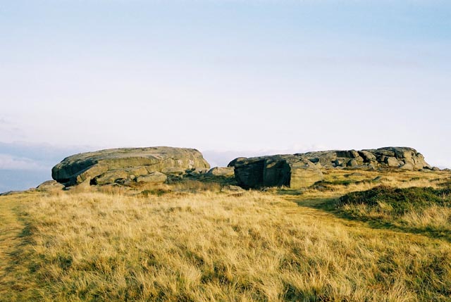
Cow and Calf Rocks submitted by andy_h on 10th Nov 2003. The most prominent landmark for miles around. There are no visible megalithic remains at this huge rock outcrop, but local folklore refers to this being a place worthy of strong consideration.
I've always found it a little strange that as the most prominent landmark for miles around, the Cow n' Calf didn't bear any cup n' ring marks as they can be found both to the left and the right of the outcrop. It is possible that any that may have been on the rock could have been lost under the onslaugh...
(View photo, vote or add a comment)
Log Text: They may not have a strong megalithic connection but the Cow and Calf Rocks have a massive presence, and are located close to Ilkley Moor Car Park.
Idol Stone
Date Added: 19th Dec 2022
Site Type: Rock Art
Country: England (Yorkshire (West))
Visited: Yes on 21st Jan 2009. My rating: Condition 4 Ambience 5 Access 3
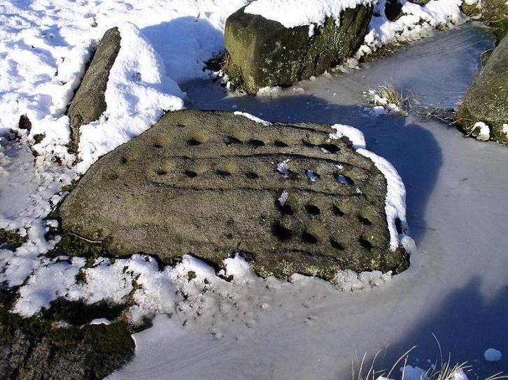
Idol Stone submitted by andyb456 on 22nd Nov 2004. This stone is beautiful and need no description.
(View photo, vote or add a comment)
Log Text: The singular markings on the Idol Stone are a must visit for anyone interested in rock art.
Doubler Stones
Date Added: 19th Dec 2022
Site Type: Rock Art
Country: England (Yorkshire (West))
Visited: Yes on 21st Jan 2009. My rating: Condition 4 Ambience 5 Access 2
Doubler Stones submitted by DavidRaven on 18th May 2003. Two large rocks, weathered into curious forms. The upper surface of one has distinct cup-and-ring carvings. Even when the moor is teeming
with visitors, this backwater is usually empty of folk.
(View photo, vote or add a comment)
Log Text: These curious rocks are located on the edge of moorland. They are best accessed from the W via a track starting at SE 06585 46318 off Light Bank Lane.
Two Eggs (N) 02
Date Added: 21st Dec 2022
Site Type: Rock Art
Country: England (Yorkshire (West))
Visited: Yes on 21st Jan 2009. My rating: Condition 3 Ambience 4 Access 3
Two Eggs (N) 02 submitted by Rich32 on 2nd Aug 2019. This photo shows the 'Two Eggs' as found identified on the Ordnance Survey Maps. Both stones have cup-like natural depressions on the upper surface.
It's worth noting, whilst Ilkley Archaeology Group gave the same OS coordinates for the Two Eggs, they photographed completely different stones. Interestingly the stones they photographed are more 'egg-like' in shape. Maybe OS assigned the name to the wrong stones.
Image captured 10 May 2013.
Image Credit: Carved Stone Investigations...
(View photo, vote or add a comment)
Log Text: These two erratic boulders are significant presences on desolate moorland. They are a worthwhile visit despite the lack of visible rock art.
Ashlar Chair 01
Date Added: 15th Apr 2021
Site Type: Rock Outcrop
Country: England (Yorkshire (West))
Visited: Yes on 21st Jan 2009. My rating: Condition 3 Ambience 5 Access 2
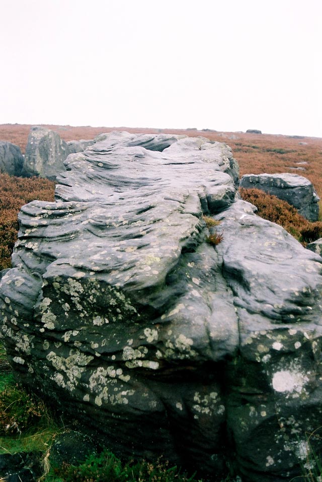
Ashlar Chair 01 submitted by andy_h on 17th Nov 2003. This heavily weathered rock lays at the meeting point of four moors. Ilkley Moor, Burley Moor, Morton Moor and Bingley Moor. Cup and ring carvings were recorded in the 19th C, but these have now weathered away and no trace remains.
Paul Bennett describes the rock as an 'Omphalus' or a universal centre. It's name probably comes from it's use by medieval masons. It was also used as a meeting point for the Pendle Witches.
SE1208 4483
(View photo, vote or add a comment)
Log Text: I have an attraction to sites which are difficult to reach. I would rather walk several miles over bleak moorland to find a random stone than walk 10 yards on a footpath to a more spectacular site by the roadside. Therefore Ashlar Chair was too tempting to ignore, a rough diamond in unforgiving terrain. I gained a great deal of satisfaction in finding Ashlar Chair, unspectacular as it is.
Two Eggs (S) 01
Date Added: 21st Dec 2022
Site Type: Rock Art
Country: England (Yorkshire (West))
Visited: Yes on 21st Jan 2009. My rating: Condition 3 Ambience 4 Access 3
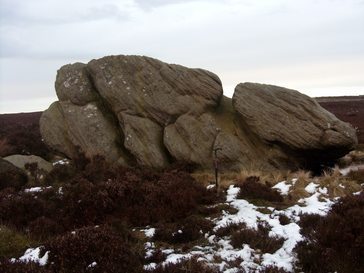
Two Eggs (S) 01 submitted by markj99 on 15th Apr 2021. Two Eggs (S) pictured with a c. 1m walking stick for scale.
(View photo, vote or add a comment)
Log Text: These two erratic boulders are significant presences on desolate moorland. They are a worthwhile visit despite the lack of visible rock art.
Peter's Stone
Date Added: 23rd Dec 2022
Site Type: Natural Stone / Erratic / Other Natural Feature
Country: England (Derbyshire)
Visited: Yes on 22nd Jan 2009. My rating: Condition 5 Ambience 5 Access 4
Peter's Stone submitted by markj99 on 19th Jan 2021. The vertical cliffs of Peter's Stone.
(View photo, vote or add a comment)
Log Text: Peter's Stone is a spectacular natural stone, easily visited from a path leading from a path leading from a lay-by at SK 17290 75427 on Mires Lane.
Nine Ladies
Date Added: 14th Dec 2022
Site Type: Stone Circle
Country: England (Derbyshire)
Visited: Yes on 22nd Jan 2009. My rating: Condition 3 Ambience 3
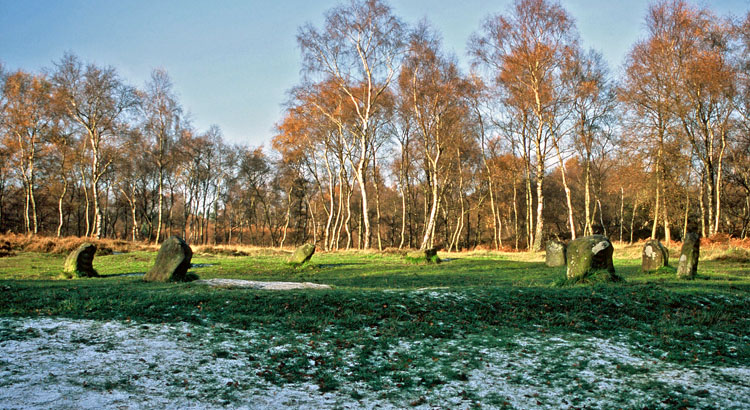
Nine Ladies submitted by Infinite_Fate on 31st Dec 2005. Looking North one November day showing banking (or, the Ladies' skirts).
(View photo, vote or add a comment)
Log Text: I was somewhat underwhelmed by the Nine Ladies of Stanton Moor. The scale of the circle was smaller than I expected.
Cork Stone
Date Added: 10th Jul 2025
Site Type: Natural Stone / Erratic / Other Natural Feature
Country: England (Derbyshire)
Visited: Yes on 22nd Jan 2009. My rating: Condition 3 Ambience 4 Access 3

Cork Stone submitted by Vicky on 13th Nov 2001. The Cork Stone, Stanton Moor, Derbyshire GR: SK245628
The Cork Stone is one of a number of impressive natural outcrops on Stanton Moor. Composed of weathered sandstone it resembles a huge mushroom or cork. As with the Andle Stone nearby it is covered in graffiti from the 19th and 20th centuries and has steps carved into the side to allow access to the top.
(View photo, vote or add a comment)
Log Text: Additions to a site are normally detrimental however the steps and iron rungs added to the Cork Stone are an exception. The base of the stone is sturdy enough to allow people (myself included) to climb onto the top. There is a round rock basin on the flat top of the Cork Stone.
Andle Stone (Stanton Moor)
Date Added: 10th Apr 2021
Site Type: Natural Stone / Erratic / Other Natural Feature
Country: England (Derbyshire)
Visited: Yes on 22nd Jan 2009. My rating: Condition 3 Ambience 4 Access 3
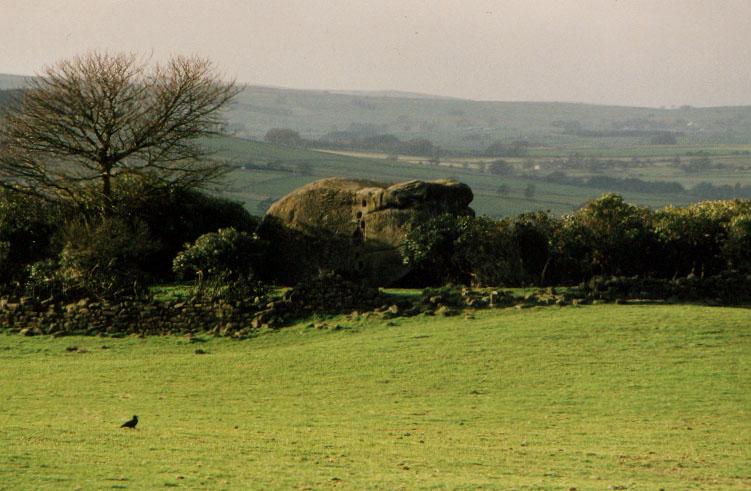
Andle Stone (Stanton Moor) submitted by PaulM on 1st Sep 2001. The Andle Stone, near Doll Tor Stone Circle, Stanton Moor, Derbyshire GR: SK241630
The Andle Stone or Oundle Stone is a dominating outcrop of sandstone, standing alone in the middle of a field, surrounded by a dry-stone wall and a mass of rhododendrons. Approximately 5m high by 4.5m wide, the rock is supposedly carved with ancient cupmarks on the, modern graffiti, a relatively recent inscription and climbing holes on the sides.
(View photo, vote or add a comment)
Log Text: The massive Andle Stone is impressive and the climb onto the top of the stone is challenging.
Gorse Stone
Date Added: 22nd Jul 2022
Site Type: Rock Outcrop
Country: England (Derbyshire)
Visited: Yes on 22nd Jan 2009. My rating: Condition 4 Ambience 3 Access 3
Gorse Stone submitted by stu on 17th Jun 2002.
(View photo, vote or add a comment)
Log Text: I found the Gorse Stone by accident when visiting the Cork Stone. It is less impressive than the Cork Stone however it is a bonus to find it adjacent to a path.
The Bridestones (Todmorden)
Date Added: 2nd Jun 2021
Site Type: Natural Stone / Erratic / Other Natural Feature
Country: England (Yorkshire (West))
Visited: Yes on 23rd Jan 2009. My rating: Condition 3 Ambience 5 Access 4
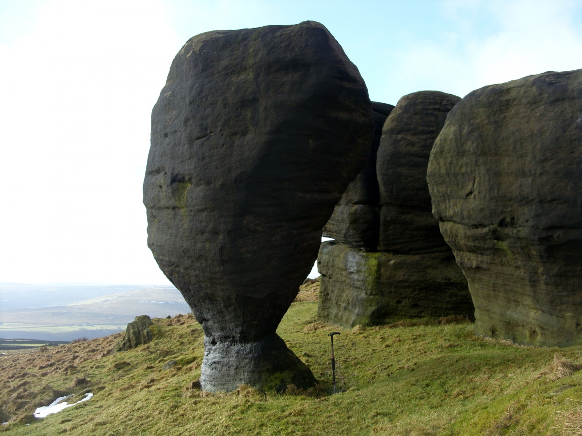
The Bridestones (Todmorden) submitted by markj99 on 2nd Jun 2021. The Bride Stone tapers to a narrow column at its base (c. 1m walking stick for scale).
(View photo, vote or add a comment)
Log Text: There is a large lay-by at SD 93769 26809 on Eastwood Road from Todmordern. A path starts here leading to the Bridestones after c. 500 yards on a muddy path (stout footwear recommended). The Bridestones are far enough away from the road to give the unusual weathered stones an isolated special ambiance. The Bride Stone herself is the star attraction, the Groom Stone lies broken by her side.
