Contributory members are able to log private notes and comments about each site
Sites cliffrich has logged. View this log as a table or view the most recent logs from everyone
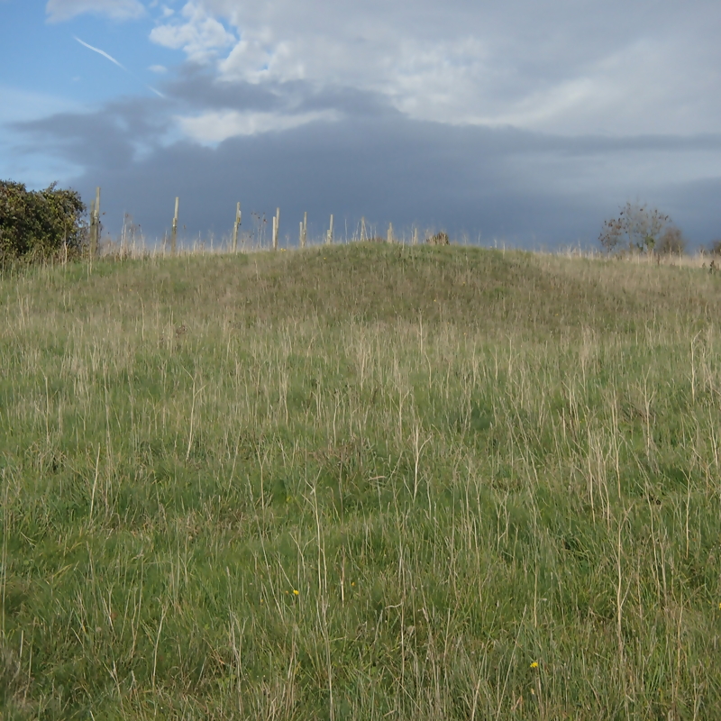
Arreton Bowl Barrow II
Date Added: 18th Mar 2019
Site Type: Barrow Cemetery
Country: England (Isle of Wight)
Visited: Yes on 7th Dec 2018

Arreton Bowl Barrow II submitted by cliffrich on 7th Dec 2018. In a field next to the chalk pit but footpaths traverse the field so appears to have public access
(View photo, vote or add a comment)
Log Text: This one wasn't marked on this site so I asked the site owner to add it. This barrow is situated at the end of the chalk pit in the adjacent field, literally a few meters from the chalk pit. It is listed with Historic England: https://historicengland.org.uk/listing/the-list/list-entry/1010009.
See video - https://youtu.be/gYPKFJpOmhw
See also: https://historicengland.org.uk/listing/the-list/list-entry/1010009
Arreton Downs
Date Added: 18th Mar 2019
Site Type: Round Barrow(s)
Country: England (Isle of Wight)
Visited: Yes on 6th Nov 2018. My rating: Condition 3 Ambience 4 Access 4
Arreton Downs submitted by RingPaw on 16th Jul 2006. Large barrow just to the east of Hare & Hounds PH, a few yards south of the ridge-top road to Brading. Short walk from the pub (watch the traffic).
(View photo, vote or add a comment)
Log Text: Once you have found the site the barrow is easy to see. Roughly 3mtrs high and approx 10mtrs diameter. Hidden behind a roadside hedge on the chalk pit side of the road, near the Hare and Hounds pub. There is another barrow several hundred yards away towards the end of the chalk pit and in a field, but this is difficult to see at first. Also known as Michael Morey's Hump. A gallows used to be placed in the center of the Hump from which a grandfather was hanged for killing his grandson C19.
See video - https://youtu.be/zVpFduukZqo?t=21.
See also: https://historicengland.org.uk/listing/the-list/list-entry/1010008
Culver Down I
Date Added: 18th Mar 2019
Site Type: Round Barrow(s)
Country: England (Isle of Wight)
Visited: Yes on 11th Nov 2018. My rating: Condition 3 Ambience 4 Access 4
Culver Down I submitted by PaulM on 29th Aug 2003. By the gun battery - see main site entry.
(View photo, vote or add a comment)
Log Text: A short walk from the lower car park at the end of Culver Down. This barrow is quite noticeable if you look where you wouldn't expect to see it! It was overgrown and hidden away by some trees and brambles when I visited. It is situated adjacent to a concrete wartime gun emplacement. The video include other lumps and bumps and a listed barrow next to the monument.
See video - https://youtu.be/zfY5iaxRgMQ?t=2
See also: https://historicengland.org.uk/listing/the-list/list-entry/1012716
Nunwell Down
Date Added: 18th Mar 2019
Site Type: Round Barrow(s)
Country: England (Isle of Wight)
Visited: Yes on 22nd Oct 2018. My rating: Condition 3 Ambience 3 Access 4
Nunwell Down submitted by vicky on 26th Aug 2003. Nunwell Down barrow - see main site entry for further details.
(View photo, vote or add a comment)
Log Text: You'll have to know what to look for in order to recognise this site. It is not formally preserved, instead just a mound in a farmer's field which he seems to circumnavigate with his machinery. No fences or protective environment for the barrow. Sad to see it's uncared for. Also known as The Devil's Punch Bowl and seems to be well know locally. See video - https://youtu.be/44WlKNaEzxE?list=PLTlO3UNiWb31re9wQfjfMfebYbLfQ8fhF&t=9. Also see: https://historicengland.org.uk/listing/the-list/list-entry/1012719
Shanklin Down Barrows
Date Added: 17th Mar 2019
Site Type: Round Barrow(s)
Country: England (Isle of Wight)
Visited: Yes on 22nd Nov 2018. My rating: Condition 3 Ambience 3 Access 2
Shanklin Down Barrows submitted by RingPaw on 2nd Nov 2006. Barrow in foreground; towns of Shanklin & Sandown, white Culver Cliff + Portsmouth and the South Downs beyond.
(View photo, vote or add a comment)
Log Text: A long walk from the Ventnor Road but once there the views are well worth it! If you know what you're looking for you will find the nearly flattened barrows but tell-tale mounds are there to be seen. Mounds can be seen all over this area which makes me think that it is a cemetery rather than just a couple barrows - I've asked the IWCC if this is the case and they've told me that the other lumps could be from mining or as other unconfirmed barrows or pillow mounds. The trig mark is only obvious once you're in the field but no sooner.
See video - https://youtu.be/VmVQ-JwC2fg?t=1
Mersley Down
Date Added: 17th Mar 2019
Site Type: Round Barrow(s)
Country: England (Isle of Wight)
Visited: Yes on 30th Nov 2018. My rating: Condition 1 Ambience 1 Access 3
Mersley Down submitted by RingPaw on 16th Jul 2006. This seems to have been almost totally ploughed out. There is a definite platform with lumps & bumps at the top of a small hill which is probably the barrow site (here in foreground). View north to Portsmouth & South Downs.
(View photo, vote or add a comment)
Log Text: Only recognisable by very slightly raised ground that could be confused with the many other lumps in the ground. I could not be certain of the exact location in the field due to the numerous similar lumps in the ground. The video is of the site according to an OS map/gps coordinates but disappointed not to find any significant mounds. There are other earth features in the field which may/may not be significant. Ambience is not present hence: '1 - Awful'.
See video - https://youtu.be/NdezfJTLToY
Sud Moor
Date Added: 17th Mar 2019
Site Type: Round Barrow(s)
Country: England (Isle of Wight)
Visited: Yes on 1st Jan 2019. My rating: Condition 2 Ambience 2 Access 4
Sud Moor submitted by RingPaw on 17th Sep 2006. General view of the site (feature to the left). Shows footbridge to the right and walkers on the coastal footpath, on the horizon.
(View photo, vote or add a comment)
Log Text: You need to explore for an access to this site then keep a close eye across the stream/drainage channel. The barrow is situated on the other side of the stream/drainage ditch near a bend in the stream. If the grass is high you won't be able to see it. Look for the ditch around the circumference of the barrow which will give it's location away. Ringpaw's description is good.
See video - https://youtu.be/d9qGqt5Wdn8
Castle Hill, Mottistone
Date Added: 17th Mar 2019
Site Type: Hillfort
Country: England (Isle of Wight)
Visited: Yes on 9th Jan 2019. My rating: Condition 2 Ambience 3 Access 3
Castle Hill, Mottistone submitted by ringpaw on 27th Aug 2007. View from below - perhaps gives an idea of the squared-off nature of the fort. The fencing on the horizon is related to a small modern reservoir at the south-east corner of the feature.
(View photo, vote or add a comment)
Log Text: If you know what you're looking for it can be recognised, however it could be confused with farm earth movements. A distinctive square-ish earth structure comprising of built up earth mounds around perimeter, but nothing else to identify it. Look out for the fenced manhole cover at the South East corner.
See video - https://youtu.be/xESs83VUFaU?t=1
Long Stone (IOW)
Date Added: 17th Mar 2019
Site Type: Standing Stone (Menhir)
Country: England (Isle of Wight)
Visited: Yes on 9th Jan 2019. My rating: Condition 2 Ambience 3 Access 3

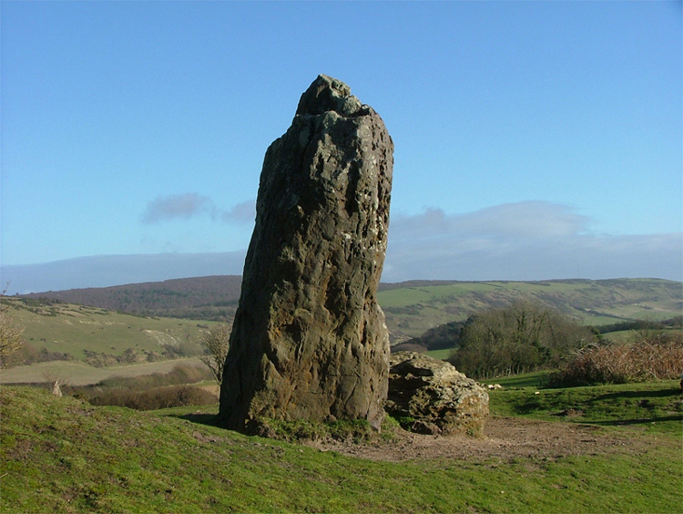
Long Stone (IOW) submitted by Avaloniaspirit on 17th Oct 2007. The Long Stone is a place that I have visited on many occasions and I have taken shed loads of photos but this one is probably one of my favs...lol though it does look a bit phallic looking from this angle!
The closest village is Mottistone and unlless you are up to a hike then I wouldn't park by Mottistone Manor. The best place to go is up Strawberry lane(theres a interesting house on the corner which is actually the National Trusts office) Go past the driveway for the house and a little wa...
(View photo, vote or add a comment)
Log Text: A locally well known site which is used by various Pagan groups. The two stones (one standing, the other toppled) mark the Eastern end of the Longbarrow (presumeably the entrance). The barrow itself has been almost ruined by previous excavations and is difficult to pick out. Ditches around the barrow mark the sites from which material was moved to build the barrow. A local myth tells of St Catherine and the Devil who threw the two stones from St Catherine's Down and the furthest stone to land was the ruler of the Island - St Catherine won with the larger standing stone.
See video - https://youtu.be/94FoJCCGqzg
Shorwell 1
Date Added: 17th Mar 2019
Site Type: Round Barrow(s)
Country: England (Isle of Wight)
Visited: Yes on 23rd Feb 2019. My rating: Condition 1 Ambience 3 Access 2
Shorwell 1 submitted by RingPaw on 20th May 2006. Long view of site. This is where the barrow is according to evidence of field boundaries, etc. Spectacular views all round, village of Shorwell in background.
(View photo, vote or add a comment)
Log Text: I think I walked past this several times during the 2hrs looking for it! Having found the map reference site I continued to look for it. This one is the worst condition barrow that I have found so far. It is unrecognisable as a round barrow, possibly due to ploughing and a general lack of preservation :(. I found RingPaw's description accurate. No ambience, and no tell-tale mound to speak of. There are a few lumps in the ground but nothing else however, a few meters away I found a likely looking earthwork further towards Chillerton but not at the map co-ordinates. All-in-all disappointing :o
See video - https://youtu.be/L7jTxUYCZkA
