Featured: Hare and Tabor T Shirts for discerning antiquarians

Hare and Tabor T Shirts for discerning antiquarians

Stone Circles, a Modern Builder's Guide to the Megalithic Revival

Stone Circles, a Modern Builder's Guide to the Megalithic Revival

Who's Online

There are currently, 316 guests and 3 members online.

You are a guest. To join in, please register for free by clicking here

Sponsors

<< Our Photo Pages >> Long Stone (IOW) - Standing Stone (Menhir) in England in Isle of Wight

Submitted by Jim_Champion on Wednesday, 20 April 2011  Page Views: 35844

Neolithic and Bronze AgeSite Name: Long Stone (IOW)
Country: England County: Isle of Wight Type: Standing Stone (Menhir)
Nearest Town: Totland  Nearest Village: Mottistone
Map Ref: SZ40718422  Landranger Map Number: 196
Latitude: 50.656242N  Longitude: 1.425457W
Condition:
5Perfect
4Almost Perfect
3Reasonable but with some damage
2Ruined but still recognisable as an ancient site
1Pretty much destroyed, possibly visible as crop marks
0No data.
-1Completely destroyed
3 Ambience:
5Superb
4Good
3Ordinary
2Not Good
1Awful
0No data.
4 Access:
5Can be driven to, probably with disabled access
4Short walk on a footpath
3Requiring a bit more of a walk
2A long walk
1In the middle of nowhere, a nightmare to find
0No data.
3 Accuracy:
5co-ordinates taken by GPS or official recorded co-ordinates
4co-ordinates scaled from a detailed map
3co-ordinates scaled from a bad map
2co-ordinates of the nearest village
1co-ordinates of the nearest town
0no data
4

Internal Links:
External Links:

I have visited· I would like to visit

cliffrich visited on 9th Jan 2019 - their rating: Cond: 2 Amb: 3 Access: 3 A locally well known site which is used by various Pagan groups. The two stones (one standing, the other toppled) mark the Eastern end of the Longbarrow (presumeably the entrance). The barrow itself has been almost ruined by previous excavations and is difficult to pick out. Ditches around the barrow mark the sites from which material was moved to build the barrow. A local myth tells of St Catherine and the Devil who threw the two stones from St Catherine's Down and the furthest stone to land was the ruler of the Island - St Catherine won with the larger standing stone. See video - https://youtu.be/94FoJCCGqzg

MartinJEley visited on 10th Sep 2014 - their rating: Cond: 3 Amb: 4 Access: 3 It was well worth the walk up the hill to see the stones and their view of the surrounding countryside.

Ogham visited on 21st Dec 2011 - their rating: Cond: 2 Amb: 4 Access: 3 It is a good place to visit as part of a circular walk taking in the sites on the downs above Mottistone.

Rubytuesday visited on 27th May 2010 - their rating: Amb: 4 Access: 4

goxethee visited Was there just the other day. Check out the rabbit burrows for small flints :)


Average ratings for this site from all visit loggers: Condition: 2.33 Ambience: 3.75 Access: 3.25
Long Stone (IOW)
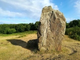
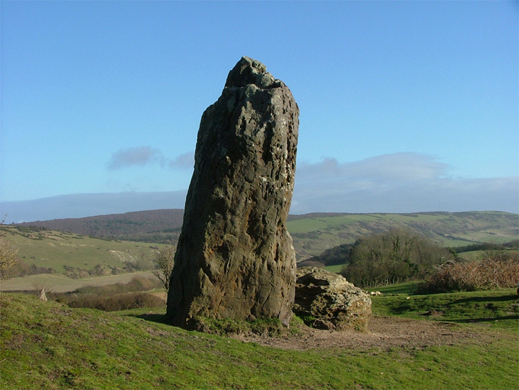
Long Stone (IOW) submitted by Avaloniaspirit : The Long Stone is a place that I have visited on many occasions and I have taken shed loads of photos but this one is probably one of my favs...lol though it does look a bit phallic looking from this angle! The closest village is Mottistone and unlless you are up to a hike then I wouldn't park by Mottistone Manor. The best place to go is up Strawberry lane(theres a interesting house on the cor... (Vote or comment on this photo)
Standing Stone on the Isle of Wight

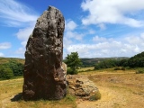
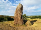
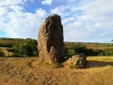
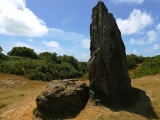
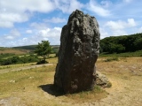
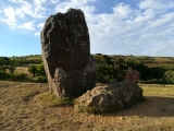
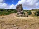
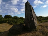
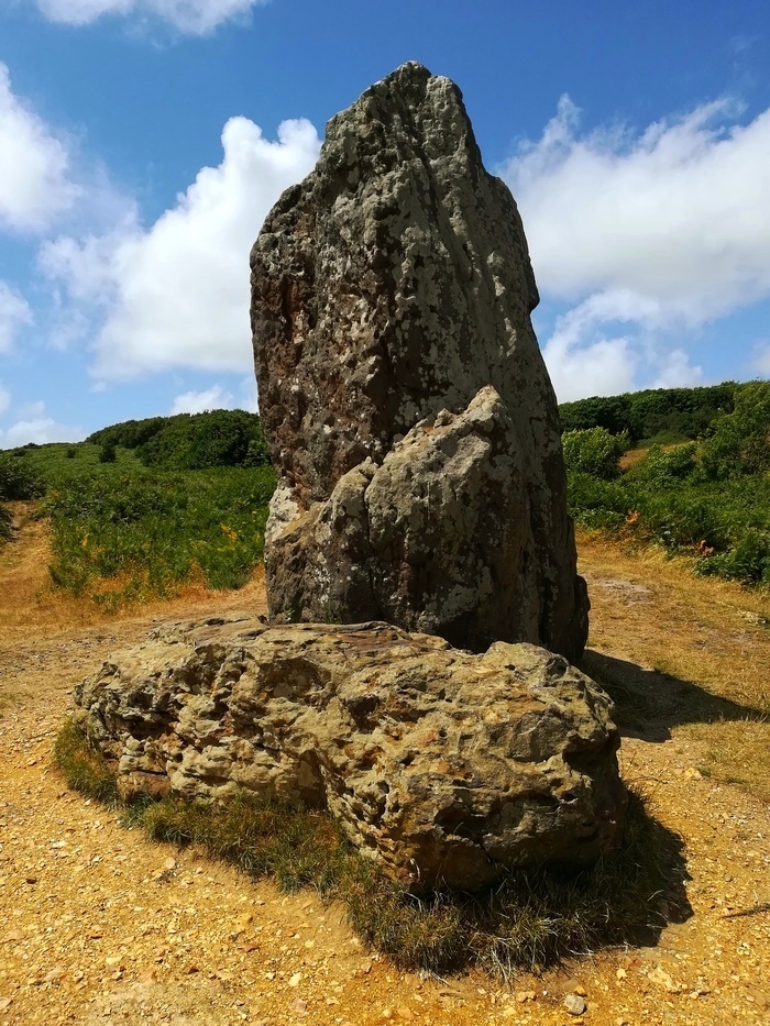
The Longstone is actually two stones - the larger one standing and the other lying next to it. Both are thought to have originally been at the eastern end of the adjacent (destroyed) long barrow on this downland overlooking the south-west coast of the Isle of Wight. There is an National Trust interpretation board nearby to the east which describes the known history of the stones and barrow, and the nearby Iron Age enclosure on Castle Hill.

The village of Mottistone gets its name from the Longstone - apparently the stone was the location of a Saxon moot, hence 'moot stone'.

Access The stones are on the National Trust's Mottistone Estate, on Access Land to the north of Mottistone Manor. Most visitors will park at the free NT car park in Mottistone and then make the short but steep walk up the public footpath from the car park (signposted Longstone and Mottistone Downs). Where the path forks, the right fork to the stones is signposted.
You may be viewing yesterday's version of this page. To see the most up to date information please register for a free account.

Long Stone (IOW)
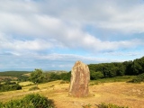
Long Stone (IOW) submitted by JimChampion : April 2011. The two stones at the Longstone site. Destroyed long barrow was behind the stones, to the left. Splendid views of the southwest coast of the Isle of Wight in the opposite direction. (Vote or comment on this photo)

Long Stone (IOW)
Long Stone (IOW) submitted by Bladup : The Long Stone of Mottistone (Vote or comment on this photo)

Long Stone (IOW)
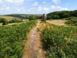
Long Stone (IOW) submitted by JimChampion : April 2011. Approaching the Longstone along the footpath from Mottistone village. Convenient free National Trust car park at the bottom end of the footpath, although I don't know if it is open when Mottistone Manor gardens are shut (Fridays and Saturdays). (Vote or comment on this photo)

Long Stone (IOW)
Long Stone (IOW) submitted by eeveyb : Long Stone, SZ404839 I believe to be the only Standing Stone on the Isle. Through the village of Mortistone there is a sign post that takes you onto private land , but no guided signs to take you up to the stone. A steady climb of 30 min's or so amid heathers and teasles (of which I had to cut myself a bunchful to bring home) and overlooking lovely views of Brighstone Down. The Stone itself standi... (2 comments - Vote or comment on this photo)

Long Stone (IOW)
Long Stone (IOW) submitted by Bladup : The Long Stone of Mottistone, Wonderful Site

Long Stone (IOW)
Long Stone (IOW) submitted by Bladup : The Long Stone of Mottistone (4 comments)

Long Stone (IOW)
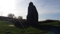
Long Stone (IOW) submitted by cliffrich : The Longstone from the South. Shot taken from top of barrow. St Catherine's Down behind where there are surviving round/bowl barrows.

Long Stone (IOW)
Long Stone (IOW) submitted by martinjeley : Showing the Long Stone in bright sunlight

Long Stone (IOW)
Long Stone (IOW) submitted by Bladup : The Long Stone of Mottistone

Long Stone (IOW)
Long Stone (IOW) submitted by Bladup : The Long Stone of Mottistone, Showing the mound it's on

Long Stone (IOW)
Long Stone (IOW) submitted by Bladup : The Long Stone of Mottistone

Long Stone (IOW)
Long Stone (IOW) submitted by Bladup

Long Stone (IOW)
Long Stone (IOW) submitted by Bladup

Long Stone (IOW)
Long Stone (IOW) submitted by Bladup : The Long Stone of Mottistone, I loved it here

Long Stone (IOW)
Long Stone (IOW) submitted by Bladup : The Long Stone of Mottistone

Long Stone (IOW)
Long Stone (IOW) submitted by Bladup : The Long Stone of Mottistone and the Sun

Long Stone (IOW)
Long Stone (IOW) submitted by Bladup : The Long Stone of Mottistone

Long Stone (IOW)
Long Stone (IOW) submitted by Bladup : The Wonderful Long Stone of Mottistone

Long Stone (IOW)
Long Stone (IOW) submitted by Bladup : The Long Stone of Mottistone on it's mound

Long Stone (IOW)
Long Stone (IOW) submitted by Bladup : The Long Stone of Mottistone

Long Stone (IOW)
Long Stone (IOW) submitted by Bladup

Long Stone (IOW)
Long Stone (IOW) submitted by Bladup

Long Stone (IOW)
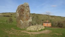
Long Stone (IOW) submitted by cliffrich : The Longstone from the West. Barrow to the right

Long Stone (IOW)
Long Stone (IOW) submitted by cliffrich : The Longstone from the East. Barrow to the left

These are just the first 25 photos of Long Stone (IOW). If you log in with a free user account you will be able to see our entire collection.

Do not use the above information on other web sites or publications without permission of the contributor.
Click here to see more info for this site

Nearby sites

Click here to view sites on an interactive OS map

Key: Red: member's photo, Blue: 3rd party photo, Yellow: other image, Green: no photo - please go there and take one, Grey: site destroyed

Download sites to:
KML (Google Earth)
GPX (GPS waypoints)
CSV (Garmin/Navman)
CSV (Excel)

To unlock full downloads you need to sign up as a Contributory Member. Otherwise downloads are limited to 50 sites.


Turn off the page maps and other distractions

Nearby sites listing. In the following links * = Image available
 224m ESE 123° Castle Hill, Mottistone* Hillfort (SZ409841)
 298m WNW 284° Mottistone Common Bowl Barrow* Round Barrow(s) (SZ40428429)
 478m N 350° Mottistone Down* Barrow Cemetery (SZ40628469)
 788m E 92° Black Barrow* Round Barrow(s) (SZ415842)
 861m NNW 330° Chessell Down - Coombe Plantation* Round Barrow(s) (SZ4027684964)
 1.2km ENE 72° East Westover Down - Tennyson Trail* Round Barrow(s) (SZ41868461)
 1.3km NW 315° Pay Down* Barrow Cemetery (SZ398851)
 1.7km SSW 208° Sud Moor* Round Barrow(s) (SZ399827)
 1.9km NW 313° Shalcombe Manor* Round Barrow(s) (SZ393855)
 2.0km WNW 300° Brook Down Five Barrows* Barrow Cemetery (SZ390852)
 2.0km ENE 66° Brighstone Forest 1* Barrow Cemetery (SZ4252285049)
 2.1km NW 307° Shalcombe Down* Round Barrow(s) (SZ3902285453)
 2.8km NE 56° Pitts Down Field System* Ancient Village or Settlement (SZ4301885795)
 3.1km WNW 292° Compton Down (IOW)* Barrow Cemetery (SZ3779685360)
 3.2km ENE 75° Brighstone Forest 2* Barrow Cemetery (SZ438851)
 3.4km ENE 56° Newbarn Combe Enclosures Ancient Village or Settlement (SZ435861)
 3.5km ENE 74° Brighstone Forest Enclosure / Moot* Misc. Earthwork (SZ44088520)
 3.6km ENE 71° Gallibury Hump* Round Barrow(s) (SZ441854)
 3.8km E 90° Cheverton Farm* Round Barrow(s) (SZ4450984220)
 4.3km ENE 73° Newbarn Down Barrows* Round Barrow(s) (SZ44858552)
 5.0km NE 53° Round Copse* Round Barrow(s) (SZ447873)
 5.7km WNW 286° Afton Down* Barrow Cemetery (SZ352857)
 5.8km ESE 104° Shorwell 1* Round Barrow(s) (SZ464828)
 6.1km ENE 61° Bowcombe Down* Round Barrow(s) (SZ461872)
 6.7km ESE 103° Shorwell 2* Round Barrow(s) (SZ473827)
View more nearby sites and additional images

<< Lake Hoton Standing Grave Stones

Cala Sant Vincenc >>

Please add your thoughts on this site

Towers in the North: The Brochs of Scotland

Towers in the North: The Brochs of Scotland

Sponsors

Auto-Translation (Google)

Translate from English into:

"Long Stone (IOW)" | Login/Create an Account | 8 News and Comments
  
Go back to top of page    Comments are owned by the poster. We aren't responsible for their content.
Re: Long Stone (IOW) by 4seasonbackpacking on Sunday, 24 March 2019
(User Info | Send a Message)
[ Reply to This ]

Hole through the Long Stone by Andy B on Thursday, 28 April 2011
(User Info | Send a Message)
Enjaytom writes:

The Long Stone on the Isle of Wight featured in your Portal News Summary appears to have indentations or even a hole right through the column. If there is a hole through, it may be the Long Stone could be a "Good Health'' stone like the Men-a-Tol in Cornwall, the Hoar Stone in Northern Ireland and many others in Britain.

Linked to most are legends about health in one form or another. Would on-site viewers of the Long Stone please inspect the stone for that feature and also seek evidence of local stories about health.
[ Reply to This ]

Re: Long Stone (IOW) by JimChampion on Wednesday, 20 April 2011
(User Info | Send a Message)
Description from Jerry Anderson (February 2001):

I recently visited the Isle of Wight and was surprised to see that there was a standing stone on the Downs on the South side of the Island at a hamlet called Mottistone, apparently named after the long stone presumably.
Standing on National Trust land, it is accessible (although a bit of a hike), through the woods and Downland surrounding it. There are no signs to guide you as you trudge along, which was quite nice really although not very helpful!
When I reached the Longstone, it is approx.. 13 feet tall and is standing at an approx.. angle of 80 degrees. The stone itself seems to be very high in iron content and is indigenous to the area. On the ground is another large stone, around 8 feet in length which I felt was not actually part of the main Longstone i.e: It had not been an original piece of the standing stone, although it was the same geologically.
[ Reply to This ]

Re: Long Stone (IOW) by Anonymous on Friday, 09 May 2008
I used your SZ OS coordinates to find the Long Stone and it was not there! It was however at SZ 40719 84224 next to a hillfort, please adjust your coordinates. Many thanks.

PS this is a great site and helped me find many of the splendid sights to be seen on the Isle. Richard
[ Reply to This ]

Re: Long Stone (IOW) by Lenny on Saturday, 28 August 2004
(User Info | Send a Message)
The Isle of wight was connected to the main land less than 10k years ago. What is now Spithead off the portsmouth coast was originaly the mouth of the river Itchen. So you could walk from Weymouth across to what is now Cowes. In fact if I remember right Marine archaeologists found the remains of human habitation in southampton water a number of years ago.
[ Reply to This ]

Re: Long Stone (IOW) by Vicky on Saturday, 24 July 2004
(User Info | Send a Message)
Lovely pair of stones in a lovely location - the weather certainly helped. A yellowhammer used the main stone as a song post and we noticed that part of the main stone is hollo (perhaps due to a hidden crack).

[ Reply to This ]

Re: Long Stone (IOW) by Vicky on Tuesday, 20 July 2004
(User Info | Send a Message)
The 2004 edition of the "Isle of Wight Holiday News" newspaper contains a picture of adult walkers enjoying the Long Stone by climbing on it!
[ Reply to This ]

Re: Long Stone (IOW) by Ailim on Tuesday, 09 September 2003
(User Info | Send a Message)
I visited the Isle of Whight August 2003 and set out to find the longstone at Mottistone. The stone stands at the head of the downs, the landscape falling gently away inland. the paths up to the stone are steeper, covered in brush and woodland on the coast side. After getting abit lost and running up the hill I came abruptly upon the stone! I found the stone and its surroundings peaceful magical and never to be forgotten. Next day I drew the scene in my diary. Go see:) Ailim
[ Reply to This ]

Your Name: Anonymous [ Register Now ]
Subject:


Add your comment or contribution to this page. Spam or offensive posts are deleted immediately, don't even bother

<<< What is five plus one as a number? (Please type the answer to this question in the little box on the left)
You can also embed videos and other things. For Youtube please copy and paste the 'embed code'.
For Google Street View please include Street View in the text.
Create a web link like this: <a href="https://www.megalithic.co.uk">This is a link</a>  

Allowed HTML is:
<p> <b> <i> <a> <img> <em> <br> <strong> <blockquote> <tt> <li> <ol> <ul> <object> <param> <embed> <iframe>

We would like to know more about this location. Please feel free to add a brief description and any relevant information in your own language.
Wir möchten mehr über diese Stätte erfahren. Bitte zögern Sie nicht, eine kurze Beschreibung und relevante Informationen in Deutsch hinzuzufügen.
Nous aimerions en savoir encore un peu sur les lieux. S'il vous plaît n'hesitez pas à ajouter une courte description et tous les renseignements pertinents dans votre propre langue.
Quisieramos informarnos un poco más de las lugares. No dude en añadir una breve descripción y otros datos relevantes en su propio idioma.