Contributory members are able to log private notes and comments about each site
Sites cazzyjane has logged. View this log as a table or view the most recent logs from everyone
Fenton Luna
Date Added: 7th Dec 2011
Site Type: Holy Well or Sacred Spring
Country: England (Cornwall)
Visited: Yes
Fenton Luna submitted by Thorgrim on 15th May 2004. Fenton Luna is such a curious name! What does it mean? The well is found in Fenton Luna Lane which winds steeply uphill from the centre of Padstow. The well is behind the low cupboard and a later pump has been added. Both now redundant.
(View photo, vote or add a comment)
Log Text: None
St Mawgan's Holy Well
Date Added: 7th Dec 2011
Site Type: Holy Well or Sacred Spring
Country: England (Cornwall)
Visited: Yes

St Mawgan's Holy Well submitted by AngieLake on 19th Jul 2005. Looking along the leaf-strewn 'slipway' into the ancient Holy Well of St Mawgan (in Pydar). Situation, just inside church Lych Gate, look left.
(View photo, vote or add a comment)
Log Text: None
St Peter's Well (Bradworthy)
Date Added: 10th Aug 2011
Site Type: Holy Well or Sacred Spring
Country: England (Devon)
Visited: Yes
St Peter's Well (Bradworthy) submitted by KiwiBetsy on 11th Sep 2006. The well gives the impression of being forgotten as it sits in a hedge bank in a back lane of Bradworthy …. well, almost forgotten but not by the elderly gentleman who not only knew it’s location but, despite considerable difficulty in walking, insisted on accompanying us to the well. It was used as a water supply in the past and water still runs from it and into the lane. The door is locked and an ageing metal plate proclaims it as “St Peter’s Well”.
(View photo, vote or add a comment)
Log Text: None
Our Lady of Nance
Date Added: 7th Dec 2011
Site Type: Holy Well or Sacred Spring
Country: England (Cornwall)
Visited: Yes
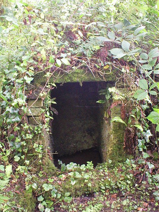
Our Lady of Nance submitted by theendlessbreeze on 11th Jun 2004. Grid Ref: SW870604
Location: Near Mountjoy, Cornwall
As in the case of many holy wells, this one was difficult to find!
From Newquay take the A392 to St Columb Road, past Quintrell Downs and then take the turning to the left just before Mountjoy to Lady Nance. Follow this road and take the first turning to the right down a lane. Here you will find a collection of cottages.
The well is located in some undergrowth just off the lane, to the right of the first house you see.
(View photo, vote or add a comment)
Log Text: None
Oxenham Arms
Date Added: 24th Feb 2013
Site Type: Standing Stone (Menhir)
Country: England (Devon)
Visited: Yes
Oxenham Arms submitted by TheCaptain on 26th Apr 2004. Oxenham Arms, South Zeal, Devon SX651935.
An enormous and magnificent menhir built into the wall of a tremendous pub on the main street in the village of South Zeal, Devon.
In fact, the pub is believed to have been built by monks in the twelfth century around the menhir. As the pub website says "A very interesting part of the house is the small lounge behind the bar. In this room, set in the wall, is a monolith and the theory of archaeologists is that the monastic builders placed the...
(View photo, vote or add a comment)
Log Text: None
Boscregan Cairns
Date Added: 30th Nov 2013
Site Type: Cairn
Country: England (Cornwall)
Visited: Yes
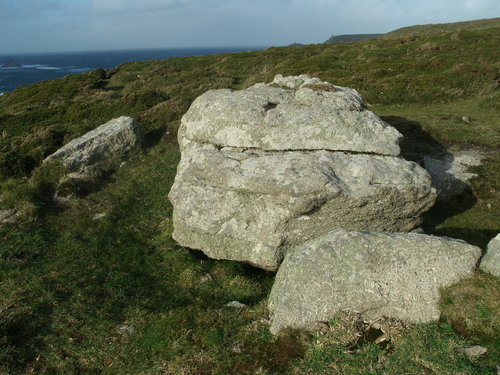
Boscregan Cairns submitted by Bladup on 10th Nov 2012. Carn Creis southern kerb cairn, only 7m across, it yielded an astonishing range of finds. This had been a kerbed ring mound raised around a natural boulder 1.2m high, and within it were four urns, three of them dating from the middle bronze Age, along with other fragments of pottery, a perforated stone, a leaf-shaped arrowhead, shale discs, pieces of glass, a steatite button and number of segmented faience beads.”
(View photo, vote or add a comment)
Log Text: None
Fice's Well
Date Added: 16th May 2012
Site Type: Holy Well or Sacred Spring
Country: England (Devon)
Visited: Yes
Fice's Well submitted by KiwiBetsy on 23rd Sep 2006. The well stands surrounded by a low stone wall which was built by convicts (it’s only a very short distance to the prison) in the 19th century. We found Fice’s Well on a very murky Dartmoor day and were probably lucky not to suffer the same fate as John Fitz and his wife. One day they were riding on the moor when the piskies conjured up a thick, impenetrable mist which resulted in the couple being hopelessly lost. For hours they rode in circles unable to find their way off the moor. The ...
(View photo, vote or add a comment)
Log Text: None
Goodaver
Date Added: 1st May 2013
Site Type: Stone Circle
Country: England (Cornwall)
Visited: Yes
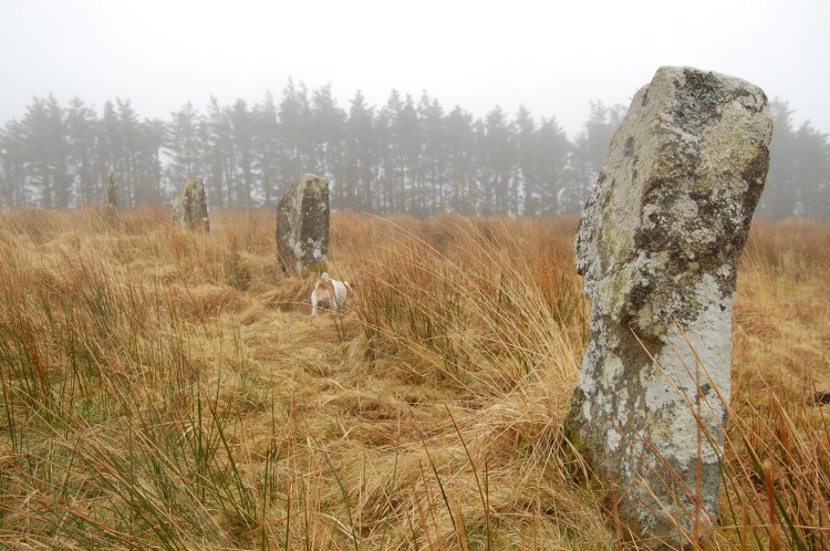
Goodaver submitted by mattimpey on 9th Mar 2009. Several of the stones appear to have an undercut, whether this is due to weathering, the stones being re-errected upside down, or a feature of the circle I do not know.
(View photo, vote or add a comment)
Log Text: None
St Guron's Well House
Date Added: 27th Feb 2013
Site Type: Holy Well or Sacred Spring
Country: England (Cornwall)
Visited: Yes
St Guron's Well House submitted by KiwiBetsy on 4th Oct 2006. St Guron’s Well lies a short distance from the wellhouse at the foot of the steps that lead up to St Petroc’s Church. The water runs from the mouths of two gargoyles and falls into a trough. The date 1545 is carved into the stonework.
(View photo, vote or add a comment)
Log Text: None
St Petroc's Holy Well
Date Added: 27th Feb 2013
Site Type: Holy Well or Sacred Spring
Country: England (Cornwall)
Visited: Yes
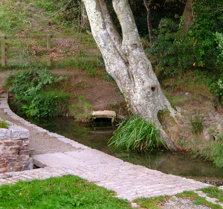
St Petroc's Holy Well submitted by Rory on 1st May 2006. St Petroc's Holy Well in Bodmin.
(View photo, vote or add a comment)
Log Text: None
Maen Cadoar
Date Added: 11th Aug 2011
Site Type: Standing Stone (Menhir)
Country: England (Cornwall)
Visited: Yes
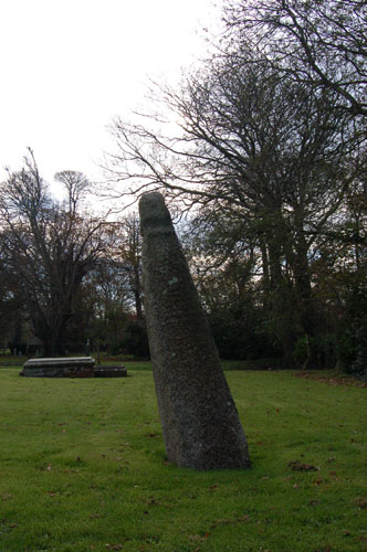
Maen Cadoar submitted by maengurta on 2nd May 2007. This view shows the lean.
(View photo, vote or add a comment)
Log Text: None
St Clether Crosses
Date Added: 26th Sep 2012
Site Type: Ancient Cross
Country: England (Cornwall)
Visited: Yes
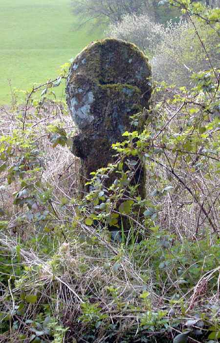
St Clether Crosses submitted by Thorgrim on 5th Nov 2004. This cross by the River Inney is difficult to find but worth the effort as it is one of only two slate crosses in Cornwall. There are four ancient crosses around St Clether which is more famous for its Holy Well.
(View photo, vote or add a comment)
Log Text: None
St Neot's Well (Poundstock)
Date Added: 6th Apr 2011
Site Type: Holy Well or Sacred Spring
Country: England (Cornwall)
Visited: Yes
St Neot's Well (Poundstock) submitted by KiwiBetsy on 16th Oct 2006. The wellhouse sits within a small stone wall enclosure. There are Latin mottoes carved into the edge of the roof and a latticed wooden door. On the front of the wellhouse to the left of the door is a fish that perhaps relates to the legend at St Neot’s other well behind the church in the Cornish village which bears his name (see St Neot's Well (St Neot)). To the right of the door is a Chi Rho symbol, one of the earliest cruciform symbols used by Christians. I have been told that the true d...
(View photo, vote or add a comment)
Log Text: None
St Anne's Well (Whitstone)
Date Added: 6th Apr 2011
Site Type: Holy Well or Sacred Spring
Country: England (Cornwall)
Visited: Yes
St Anne's Well (Whitstone) submitted by KiwiBetsy on 7th Oct 2006. The well is to the left and just below the church as you approach on foot. from the church.
(View photo, vote or add a comment)
Log Text: None
Nine Stones (Belstone)
Date Added: 14th Mar 2012
Site Type: Stone Circle
Country: England (Devon)
Visited: Yes
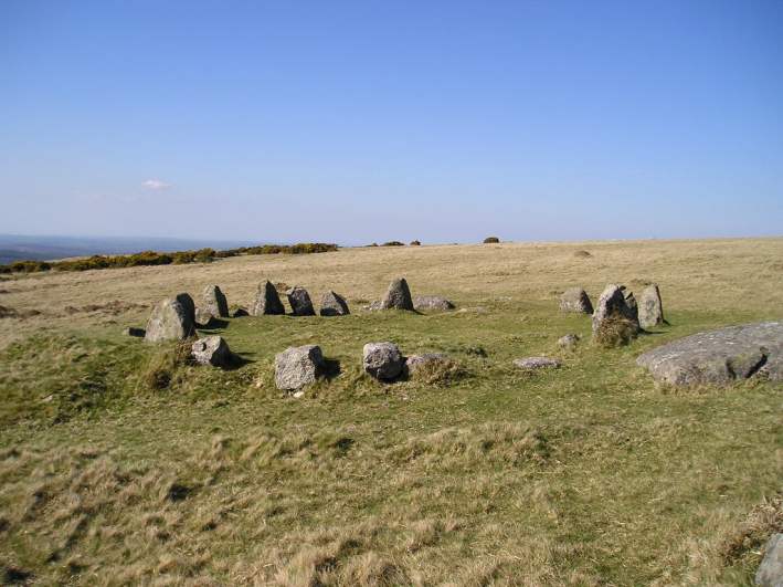
Nine Stones (Belstone) submitted by TheCaptain on 27th Apr 2004. Belstone Nine Stones, Belstone Common, Devon SX612928.
A nice neat little stone circle on the moors below Belstone Tor on the common to the south of the village of Belstone, Devon. This circle is almost certainly the remains of a round burial cairn, and traces of the burial chamber can be seen within the circle.
This is a view looking north
(View photo, vote or add a comment)
Log Text: None
Holy Well (Belstone)
Date Added: 14th Mar 2012
Site Type: Holy Well or Sacred Spring
Country: England (Devon)
Visited: Yes
Holy Well (Belstone) submitted by KiwiBetsy on 29th Aug 2006. This is a curative spring located near St Mary’s Church. The spring is protected by several large granite rocks.
(View photo, vote or add a comment)
Log Text: None
Merrivale Menhir
Date Added: 2nd Oct 2010
Site Type: Standing Stone (Menhir)
Country: England (Devon)
Visited: Yes
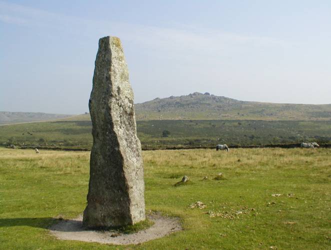
Merrivale Menhir submitted by Dal_gCais on 1st Oct 2003. Merrivale Menhir SX554748 Devon
(View photo, vote or add a comment)
Log Text: None
Stalldon Row
Date Added: 29th Jun 2011
Site Type: Stone Row / Alignment
Country: England (Devon)
Visited: Yes
Stalldon Row submitted by thecaptain on 22nd Sep 2006. The northern end of the row has 4 wonderful large (2 metres plus) stones still standing, which can be seen from miles away all over the southern moor, and look in many ways like walkers on the hilltop.
Seen here looking to the north, the wild moorland stretches off into the distance.
(View photo, vote or add a comment)
Log Text: None
Fitz's Well
Date Added: 14th Mar 2012
Site Type: Holy Well or Sacred Spring
Country: England (Devon)
Visited: Yes
Fitz's Well submitted by KiwiBetsy on 23rd Sep 2006. The spring itself is now covered with slabs of granite but the surrounding area is quite marshy. The well became popular as a magic well and was said to be able to predict the future of those who visited at Easter.
(View photo, vote or add a comment)
Log Text: None
Sourton Green Saxon Cross
Date Added: 23rd May 2012
Site Type: Ancient Cross
Country: England (Devon)
Visited: Yes
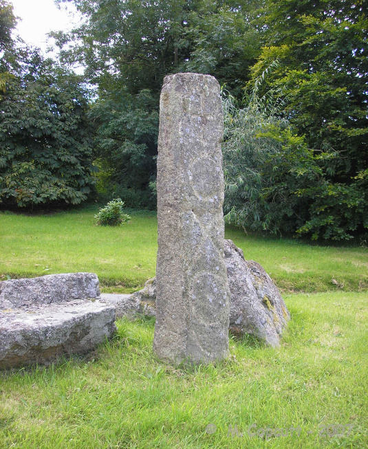
Sourton Green Saxon Cross submitted by TheCaptain on 10th Sep 2007. The Oxo stone has been identified as an early Christian, Saxon relic, and it has Os and Xs engraved onto two of its faces.
(View photo, vote or add a comment)
Log Text: None
