Contributory members are able to log private notes and comments about each site
Sites bat400 has logged. View this log as a table or view the most recent logs from everyone
Bighorn Medicine Wheel
Date Added: 28th Feb 2012
Site Type: Stone Circle
Country: United States (The Northwest Mountains)
Visited: Yes on 1st Jan 0000

Bighorn Medicine Wheel submitted by bat400 on 26th Aug 2006. This sun wheel cairn arrangement is in the Bighorn National Forest, on Medicine Mountain. The fencing discourages casual vandals. Many visitors leave offerings.
Photo by bat400, June 2001.
(View photo, vote or add a comment)
Log Text: From a parking area, you'll need to walk nearly a mile (one way) over a saddleback to where the structure stands on a flat area on the slope of the mountain. The walk is on a graveled roadway, and is not difficult. However, be prepared for wind, sun, and the altitude, which can be taxing for many people.
Pictograph Caves
Date Added: 28th Feb 2012
Site Type: Rock Art
Country: United States (The Northwest Mountains)
Visited: Yes on 1st Jan 1989. My rating: Condition 2 Ambience 4 Access 4
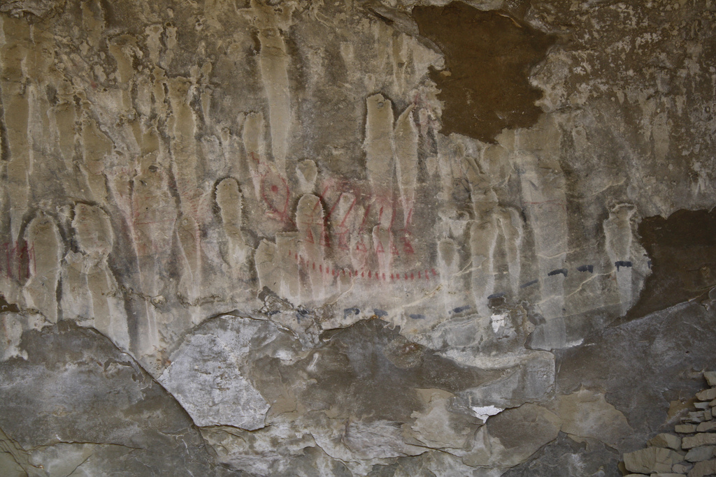
Pictograph Caves submitted by Flickr on 15th Jul 2015. Pictograph_Cave_09 Image copyright: koloth440, hosted on Flickr and displayed under the terms of their API.
(View photo, vote or add a comment)
Log Text: See the site listing. It's not possible to get close to the pictographs, so bring binoculars.
Yellowstone Lake
Date Added: 28th Feb 2012
Site Type: Ancient Village or Settlement
Country: United States (The Northwest Mountains)
Visited: Yes on 1st Jun 2002. My rating: Condition 4 Ambience 5 Access 4

Yellowstone Lake submitted by Flickr on 28th Jul 2015. Yellowstone Lake Sunrise at yellowstone Lake facing Lake Hotel. Image copyright: aland67 (Aland), hosted on Flickr and displayed under the terms of their API.
(View photo, vote or add a comment)
Log Text: Strikingly beatuiful lake. No visible sign of the prehistoric occupation.
Red Elk Rock Shelter
Date Added: 28th Apr 2017
Site Type: Rock Art
Country: United States (The Northwest Mountains)
Visited: Would like to visit on 1st Jan 0000
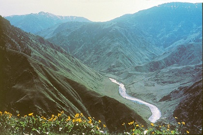
Red Elk Rock Shelter submitted by bat400 on 21st Jun 2012. Photo for News article Illustration.
w:Hells Canyon in Idaho. Photo obtained from CD containing 2003 version of program map brochure, supplied by Ken Petty of FHWA.
Source: http://library.byways.org/view_details.html?MEDIA_OBJECT_ID=44834
http://www.google.com/imgres?imgurl=http://upload.wikimedia.org/wikipedia/commons/thumb/3/36/OR_hells_canyon.jpg/
This image is a work of a United States Department of Transportation employee, taken or made during the course of an employee's offici...
(View photo, vote or add a comment)
Common Fields
Trip No.2 Entry No.13 Date Added: 23rd Apr 2017
Site Type: Artificial Mound
Country: United States (The Plains)
Visited: Yes on 18th Oct 2007. My rating: Condition 3 Ambience 3 Access 4
Common Fields submitted by bat400 on 18th Oct 2007. Common Fields Site just south east of Ste Genevieve, MO. This mound is all that is left of a small Mississippian village. This view is from the railroad grade just west of the mound.
Photo by bat400, 13 Oct 2007.
(View photo, vote or add a comment)
Log Text: None
Spiro Mounds Archaeological Park
Date Added: 5th Jan 2016
Site Type: Ancient Village or Settlement
Country: United States (The Plains)
Visited: Would like to visit
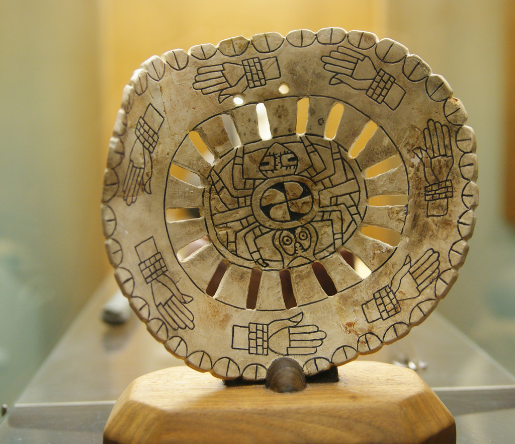
Spiro Mounds Archaeological Park submitted by Flickr on 25th Dec 2018. Woolaroc Spiro Mounds artifacts Spiro mound artifacts on display at Woolaroc Museum, near Bartlesville. Image copyright: imarcc (Marc Carlson), hosted on Flickr and displayed under the terms of their API.
(View photo, vote or add a comment)
Sugarloaf Mound, Missouri
Date Added: 23rd Apr 2017
Site Type: Artificial Mound
Country: United States (The Plains)
Visited: Yes on 1st Jun 2009. My rating: Condition 2 Ambience 2
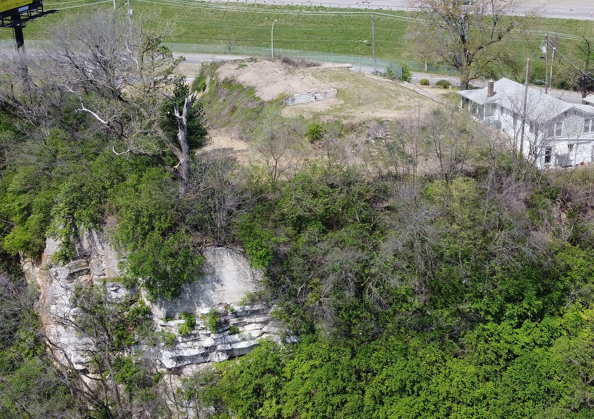
Sugarloaf Mound, Missouri submitted by AKFisher on 9th Aug 2023.
"Sugar Loaf Mound" in St. Louis, Missouri, the only remaining mound of what was a huge mound complex along the Mississippi River in what is today downtown St. Louis. [Wiki: Teeks99]
Photo courtesy Dr Greg Little, author of the Illustrated Encyclopedia of Native American Indian Mounds & Earthworks (2016).
(View photo, vote or add a comment)
Log Text: It's easy to view this mound from Ohio street.
Badger Hole (Oklahoma)
Date Added: 28th Apr 2017
Site Type: Ancient Mine, Quarry or other Industry
Country: United States (The Plains)
Visited: Would like to visit on 1st Jan 0000
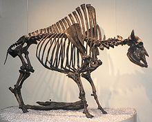
Badger Hole (Oklahoma) submitted by bat400 on 9th Jul 2012. Bison antiquus, La Brea Tar Pits
7 August 2007
Photo - David Monniaux
Own work, copyleft: Multi-license with GFDL and Creative Commons CC-BY-SA-2.5 and older versions (2.0 and 1.0)
I, the copyright holder of this work, hereby publish it under the following licenses:
Permission is granted to copy, distribute and/or modify this document under the terms of the GNU Free Documentation License, Version 1.2 or any later version published by the Free Software Foundation; with no Invariant ...
(View photo, vote or add a comment)
Common Fields
Date Added: 25th Aug 2017
Site Type: Artificial Mound
Country: United States (The Plains)
Visited: Yes on 21st Aug 2017. My rating: Condition 3 Ambience 3
Common Fields submitted by bat400 on 18th Oct 2007. Common Fields Site just south east of Ste Genevieve, MO. This mound is all that is left of a small Mississippian village. This view is from the railroad grade just west of the mound.
Photo by bat400, 13 Oct 2007.
(View photo, vote or add a comment)
Log Text: Used the mound as a backdrop for a series of photographs I took leading up to the total solar eclipse at 1318, 21 Aug 2017. On a previous visit it appeared that a farm road north of the mound was the closest access point (one could drive as far as the railroad,) but the county road south of the mound is a far better view point.
Old Stone Fort
Date Added: 12th Sep 2010
Site Type: Hillfort
Country: United States (The South)
Visited: Yes on 30th Jul 2006

Old Stone Fort submitted by bat400 on 30th Jul 2006. Entrance to "Old Stone Fort."
Twin earthen mounds flanked a rectangular earth and stone work enclosure. This enclosure opened into the interior of the "Fort" to the left at the far end. You can see the back wall of the entry "room." These enclosure walls were much higher when first built. Portions of the ground were paved as for a walkway.
Stitched Photo by bat400, 13 Jul 2006.
(View photo, vote or add a comment)
Log Text: None
Russell Cave
Date Added: 12th Sep 2010
Site Type: Cave or Rock Shelter
Country: United States (The South)
Visited: Yes on 30th Jul 2006
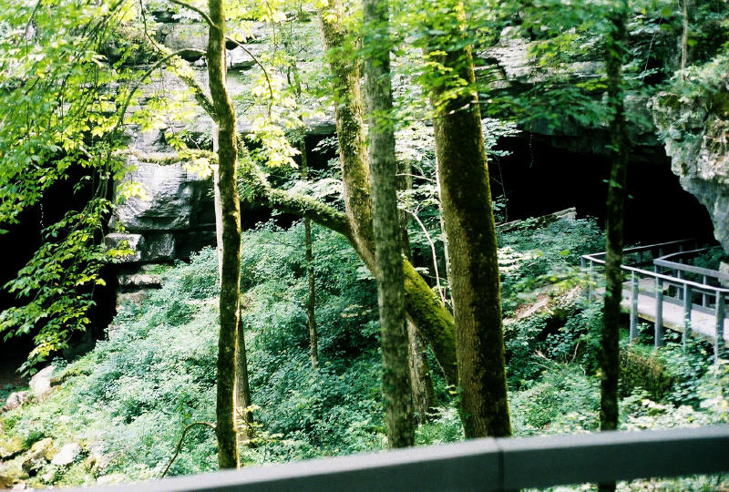
Russell Cave submitted by bat400 on 30th Jul 2006. Occupied for 9000 years. The twin entrances to Russell Cave, Jackson County, Alabama. The large entrance shelter is at right; a boardwalk prevents erosion and damage. A portion of the sheltered area was excavated to a depth of 40 feet, showing artifacts from human use all the way down. Dry Creek runs into the entrance at left, and showing the current stream bed to be a good 20 feet lower than the current cave floor in the sheltered, dry area. Photo by bat400, July 13, 2006
(View photo, vote or add a comment)
Log Text: None
Russell Cave Mound
Date Added: 12th Sep 2010
Site Type: Artificial Mound
Country: United States (The South)
Visited: Yes on 30th Jul 2006
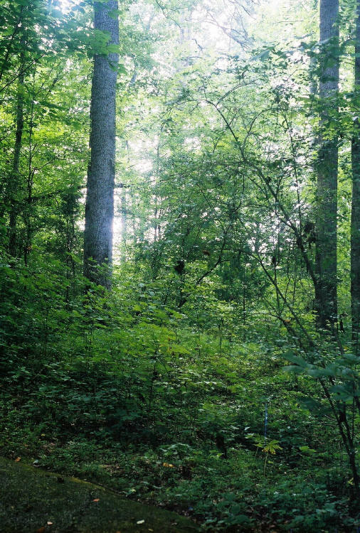
Russell Cave Mound submitted by bat400 on 30th Jul 2006. Russell Cave Mound, Jackson County, Alabama.
This Woodland era burial mound is a short distance from the entrance to Russell Cave. A magnificent poplar tree grows from the edge of the mound - a beautiful natural marker.
Photo by bat400, July 13, 2006
(View photo, vote or add a comment)
Log Text: None
Hampson
Date Added: 12th Sep 2010
Site Type: Museum
Country: United States (The South)
Visited: Yes on 16th Apr 2007

Hampson submitted by bat400 on 16th Apr 2007. Stone shovel and hoe heads made by the Nodena culture. The largest of these stone tools is about nine to 10 inches long.
Hampson Archaeological Museum Park. Photo by bat 400 April 2007.
(View photo, vote or add a comment)
Log Text: None
Toltec Mounds
Date Added: 12th Sep 2010
Site Type: Misc. Earthwork
Country: United States (The South)
Visited: Yes on 16th Apr 2007

Toltec Mounds submitted by bat400 on 16th Apr 2007. Toltec Mounds Archaeological Park. Stitched photo taken from entrance to site. (Left to right) Mound C, Mound A and Moun B. Photo by bat400 April 2007.
(View photo, vote or add a comment)
Log Text: None
Toltec Mounds - Mound B
Date Added: 12th Sep 2010
Site Type: Pyramid / Mastaba
Country: United States (The South)
Visited: Yes on 21st Apr 2007
Toltec Mounds - Mound B submitted by bat400 on 21st Apr 2007. Mound B, the Temple Pyramid. 40 feet tall. Photo by bat400, April 2007.
(View photo, vote or add a comment)
Log Text: None
Toltec Mounds - Mound C
Date Added: 12th Sep 2010
Site Type: Barrow Cemetery
Country: United States (The South)
Visited: Yes on 21st Apr 2007
Toltec Mounds - Mound C submitted by bat400 on 21st Apr 2007. Mound C and Mound A (l to r) at Toltec Mounds. Mound C is a burial Mound. Mound A, at 50 feet tall is the largest Mound in Arkansas. Photo by bat400, April 2007.
(View photo, vote or add a comment)
Log Text: None
Toltec Mounds - Mound A
Date Added: 12th Sep 2010
Site Type: Artificial Mound
Country: United States (The South)
Visited: Yes on 21st Apr 2007
Toltec Mounds - Mound A submitted by bat400 on 21st Apr 2007. Toltec Mounds - Mound A. Photo by bat400, April 2007.
(View photo, vote or add a comment)
Log Text: None
Toltec Mounds - Embankment
Date Added: 12th Sep 2010
Site Type: Misc. Earthwork
Country: United States (The South)
Visited: Yes on 21st Apr 2007
Toltec Mounds - Embankment submitted by bat400 on 21st Apr 2007. Remaining portion of the Embankment at the Toltec Mounds site. This can be made out, barely, through the trees. Unfortunately, it is not accessible to a visitor. Photo by bat400, April 2007.
(View photo, vote or add a comment)
Log Text: None
Fewkes
Trip No.3 Date Added: 28th Apr 2017
Site Type: Artificial Mound
Country: United States (The South)
Visited: Yes on 4th Aug 2007. My rating: Condition 2 Ambience 4 Access 4
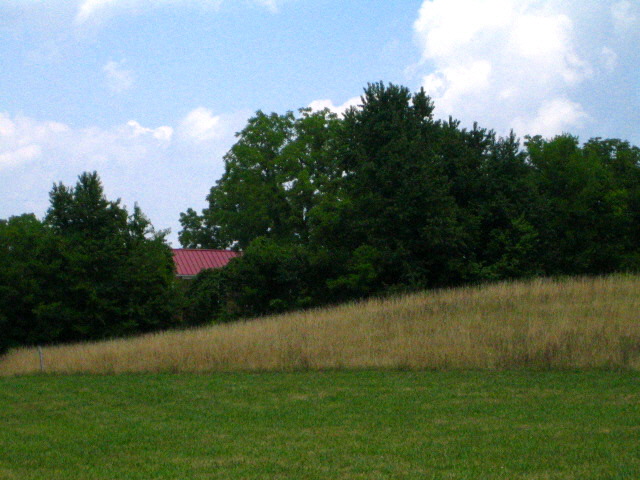
Fewkes submitted by bat400 on 4th Aug 2007. Fewkes Site, Tennessee. Mound 2. Photo by bat400, July 2007.
(View photo, vote or add a comment)
Log Text: Four visible mounds. They are believed to have been flat topped mounds for building sites, but they have been degraded over the years by plowing that only one is remotely of the classic four sided platform. The other three are rounded off and relatively low.
Placards describe the site briefly.
Old Town (Williamson)
Trip No.3 Date Added: 23rd Apr 2017
Site Type: Ancient Village or Settlement
Country: United States (The South)
Visited: Yes on 25th Aug 2007. My rating: Condition 2 Ambience 4 Access 4
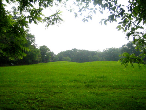
Old Town (Williamson) submitted by bat400 on 25th Aug 2007. The visible remains of Old Town's mounds can be seen in this pasture on the Natchez Trace just outside of Nashville, Tennessee.
Photo by bat 2004 June 2007.
(View photo, vote or add a comment)
Log Text: None
