Contributory members are able to log private notes and comments about each site
Sites TimPrevett has logged. View this log as a table or view the most recent logs from everyone
The Bargain Stone
Date Added: 18th Sep 2010
Site Type: Holed Stone
Country: England (West Midlands)
Visited: Yes on 28th Jul 2007

The Bargain Stone submitted by TimPrevett on 28th Jul 2007. The holed Bargain Stone outside St Peter's in Wolverhampton City Centre. It is believed bargains, probably deals on wool traded from the Welsh Marches, would have been sealed with a handshake through this stone. It is thought to be a well weathered and broken gargoyle, with the hole having been the drainage. Don't miss the huge Anglo Saxon cross shaft nearby.
(View photo, vote or add a comment)
Log Text: None
West Park (Wolverhampton)
Date Added: 18th Sep 2010
Site Type: Natural Stone / Erratic / Other Natural Feature
Country: England (West Midlands)
Visited: Yes on 1st Sep 2008
West Park (Wolverhampton) submitted by TimPrevett on 1st Sep 2008. The huge glacial erratic from the Arenigs, part of the central arc of the Cambrian Mountains NW of Bala, found in Oak St in 1881 in Wolverhampton. Now pretty much in the centre of West Park, Wolverhampton.
(View photo, vote or add a comment)
Log Text: None
Castle Ring (Staffordshire)
Date Added: 18th Sep 2010
Site Type: Hillfort
Country: England (Staffordshire)
Visited: Yes on 5th Jan 2004
Castle Ring (Staffordshire) submitted by TimPrevett on 5th Jan 2004. Castle Ring SK045128
On the NW side looking to the W; there has been extensive clearance of trees and invading rhododendron around the ring; unfortunately, despite it being the highest part of Cannock Chase, the only part with a panoramic view, looks towards (Rugeley?) Power Station!
Castle Ring was actually recommended to me by a colleague at work who does not know of my stones / pre-history interest; she grew up in the Cannock area, and given we were making a trip to Stafford anyway, I'd...
(View photo, vote or add a comment)
Log Text: None
Webb Stone
Date Added: 18th Sep 2010
Site Type: Standing Stone (Menhir)
Country: England (Staffordshire)
Visited: Yes on 5th Jan 2004
Webb Stone submitted by TimPrevett on 5th Jan 2004. The Webb Stone
SJ881177
There is not one stone in Bradley (pronounced Braid-lee), not two, but three! In the parish church of All Saints (which is on the highest part of the village, and is thought likely to be a Christianised pagan site), there is a local guidebook, "A Chronicle of Bradeley - The Story of an English Village 1000-2000AD" by William & Anne Wilkinson. Despite its subtitle, page 5 does have entries on its monuments prior to 1000AD.
These stones are in fact "glacial erratics...
(View photo, vote or add a comment)
Log Text: None
Bury Bank (Staffordshire)
Date Added: 18th Sep 2010
Site Type: Hillfort
Country: England (Staffordshire)
Visited: Yes on 20th May 2006
Bury Bank (Staffordshire) submitted by TimPrevett on 20th May 2006. The inner platform with trees following the arc of the rampart. Courses of pebbles can also be traced, forming what must have been walls at some period. See main entry for details.
(View photo, vote or add a comment)
Log Text: None
Thor's Cave
Date Added: 18th Sep 2010
Site Type: Cave or Rock Shelter
Country: England (Staffordshire)
Visited: Yes on 29th Jul 2006
Thor's Cave submitted by TimPrevett on 29th Jul 2006. The magnificent, awe inspiring Thor's Cave, looking out. Only a visit in person can convey the size of the place, and the ambience of looking into the Manifold Valley.
(View photo, vote or add a comment)
Log Text: None
Sevenways Cave
Date Added: 18th Sep 2010
Site Type: Cave or Rock Shelter
Country: England (Staffordshire)
Visited: Yes on 29th Jul 2006
Sevenways Cave submitted by TimPrevett on 29th Jul 2006. The view when one descends from the ridge around the west side, and find the first obvious entrance to the cave.
Seven Ways cave - so named because of 7+ entrances into it. Sited above and to the west of Thor's Cave, it is accessed by returning to the path just before the last descent to access Thor's Cave, and then heading up! Be careful - the drops come up unexpectedly, and there are some *big* drops. Also minor shafts and limestone fissures are not infrequent, so consider your route to a...
(View photo, vote or add a comment)
Log Text: None
Elder Bush Cave
Date Added: 18th Sep 2010
Site Type: Cave or Rock Shelter
Country: England (Staffordshire)
Visited: Yes on 29th Jul 2006
Elder Bush Cave submitted by TimPrevett on 29th Jul 2006. A view of the entrance with the crags to the east above Sevenways and Thor's caves showing. Elder Bush Cave had animal remains from Pleistocene period (exactly when is not given - not that helpful considering the length of the Pleistocene), with Upper Paleolithic, Mesolithic, Neolithic, Bronze & Iron Ages, and Roman human activity all noted. Humans have been using these shelters for a long time, and animals even longer. On my visit, I did not enter the cave, as it was being used by a nest of bee...
(View photo, vote or add a comment)
Log Text: None
Ossom's Crag Shelter
Date Added: 18th Sep 2010
Site Type: Cave or Rock Shelter
Country: England (Staffordshire)
Visited: Yes on 30th Jul 2006
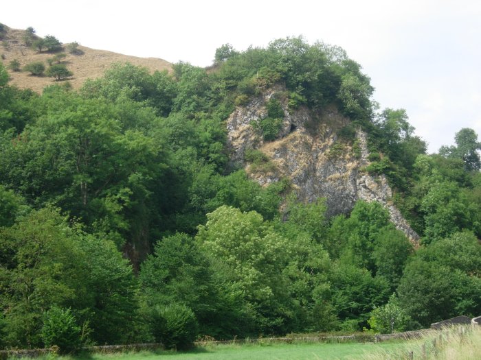
Ossom's Crag Shelter submitted by TimPrevett on 30th Jul 2006. Ossom's Eyrie Cave, high up on the crag; the main Ossom's Cave is not easily visible, but is below this cave. Viewed from the parking area in the valley having descended from Wetton.
Paleolithic, possible Neolithic and Roman finds have been noted.
(View photo, vote or add a comment)
Log Text: None
Wetton Low
Date Added: 18th Sep 2010
Site Type: Round Barrow(s)
Country: England (Staffordshire)
Visited: Yes on 30th Jul 2006

Wetton Low submitted by TimPrevett on 30th Jul 2006. Wetton Low - bowl barrow. Many of the barrows in this area are heavily depleted, with field boundaries running over them. This is one of the easier barrows to spot, courtesy largely of the trig point.
(View photo, vote or add a comment)
Log Text: None
Long Low
Date Added: 18th Sep 2010
Site Type: Long Barrow
Country: England (Staffordshire)
Visited: Yes on 30th Jul 2006

Long Low submitted by TimPrevett on 30th Jul 2006. Looking to the NNE of Long Low, new styal over the wall. Two interesting things about Long Low: 1) It is the only long barrow in Staffordshire, and 2) It has rounded ends, which are either described as two round barrows, or as rounded terminals. This is very reminiscent of the Broadmayne Bank Barrow in Dorset. Drystone walling intersects it in several places, and I styal is incorporated into one of the western side walls.
(View photo, vote or add a comment)
Log Text: None
Wetton Mill Rock Shelter
Date Added: 18th Sep 2010
Site Type: Cave or Rock Shelter
Country: England (Staffordshire)
Visited: Yes on 4th Aug 2006

Wetton Mill Rock Shelter submitted by TimPrevett on 4th Aug 2006. Wetton Mill Rock Shelter (to the upper right quarter) as visible from Thor's Cave entrance, looking north.
(View photo, vote or add a comment)
Log Text: None
Saint Bertram's Cave
Date Added: 18th Sep 2010
Site Type: Cave or Rock Shelter
Country: England (Staffordshire)
Visited: Yes on 7th Aug 2006

Saint Bertram's Cave submitted by TimPrevett on 7th Aug 2006. The situation of St Bertram's Cave - under the massif of Beeston Tor, and only accessible when the river bed has dried out. This photo is taken having walked about 1/2 mile along the riverbed. The cave is to the right (not visible here; other photos coming), but is easily missed. Speaking with a Brummie chap who's been coming to the area for some time, and my having left the area, his description of the cave I found didn't match. However, even the Trent & Peak Archaeological Trust couldn't agree...
(View photo, vote or add a comment)
Log Text: None
Hanley Stone Circle
Date Added: 18th Sep 2010
Site Type: Modern Stone Circle etc
Country: England (Staffordshire)
Visited: Yes on 3rd Sep 2006

Hanley Stone Circle submitted by TimPrevett on 3rd Sep 2006. A modern stone circle next to the Potteries Car Park (visible to rear) in Hanley, Stoke on Trent. I have found no explanation as to who why where or when for this, yet!
(View photo, vote or add a comment)
Log Text: None
Potteries Museum & Art Gallery
Date Added: 18th Sep 2010
Site Type: Museum
Country: England (Staffordshire)
Visited: Yes on 25th Sep 2006

Potteries Museum & Art Gallery submitted by TimPrevett on 25th Sep 2006. The Potteries Museum & Art Gallery. It does have a good section on prehistory, from the cave shelters, round barrows, Neolithic tools, Iron Age torc, and the only known cup and ring marked stone in Staffordshire.
(View photo, vote or add a comment)
Log Text: None
Saxon's Lowe
Date Added: 18th Sep 2010
Site Type: Round Barrow(s)
Country: England (Staffordshire)
Visited: Yes on 24th Oct 2006
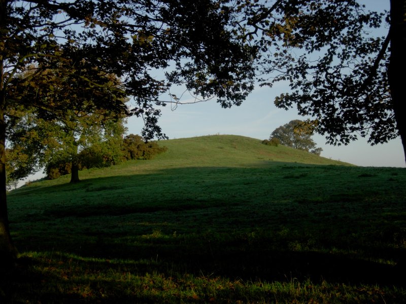
Saxon's Lowe submitted by TimPrevett on 24th Oct 2006. Saxon's Lowe on Tittensor Chase, between Newcastle Under Lyme and Stone. See main entry for details.
(View photo, vote or add a comment)
Log Text: None
Bawd Stone
Date Added: 18th Sep 2010
Site Type: Natural Stone / Erratic / Other Natural Feature
Country: England (Staffordshire)
Visited: Yes on 31st Oct 2006

Bawd Stone submitted by TimPrevett on 31st Oct 2006. The Bawd Stone, situated to the left ridge of the picture. Hen Cloud is the hill to the right on the magnificent Roaches.
(View photo, vote or add a comment)
Log Text: None
The Winking Man
Date Added: 18th Sep 2010
Site Type: Natural Stone / Erratic / Other Natural Feature
Country: England (Staffordshire)
Visited: Yes on 5th Nov 2006
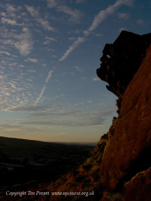
The Winking Man submitted by TimPrevett on 5th Nov 2006. The Winking Man - a natural convincing anthropomorphic rock formation on Ramshaw Rocks at SK 02021 62362. This is in North Staffordshire on the west side of the Leek - Buxton Road. The route immediately below the rock outcrops is on a Roman Road, and remains one of the most accident prone deadly A roads in the country. Parking is to west of the Rocks (good layby at SK 01746 62012), then a fairly easy walk up to near the summit, and the Winking Man is on the east side. Tripping hazards and drops...
(View photo, vote or add a comment)
Log Text: None
Berry Ring
Date Added: 18th Sep 2010
Site Type: Hillfort
Country: England (Staffordshire)
Visited: Yes on 7th Mar 2007
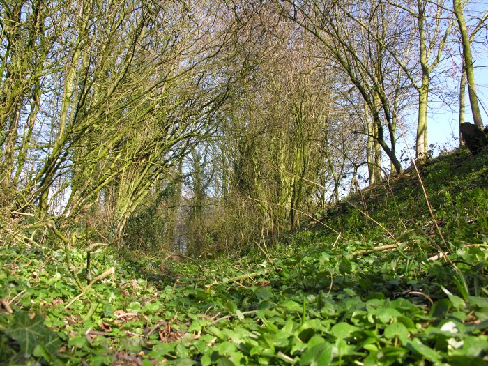
Berry Ring submitted by TimPrevett on 7th Mar 2007. Between the western ramparts, accessible from the adjoining lane, looking north.
(View photo, vote or add a comment)
Log Text: None
The Bald Stone
Date Added: 18th Sep 2010
Site Type: Natural Stone / Erratic / Other Natural Feature
Country: England (Staffordshire)
Visited: Yes on 5th Apr 2007
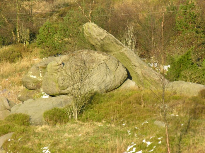
The Bald Stone submitted by TimPrevett on 5th Apr 2007. A striking natural outcrop resembling a vast collapsed dolmen, on private land with no access, to the east of the road. Easily visible from there.
(View photo, vote or add a comment)
Log Text: None
