



Contributory members are able to log private notes and comments about each site
Sites TheCaptain has logged on trip number: 206 (View all trips)
View this log as a table or view the most recent logs from everyone
Menhir de la Demoiselle de Bracqueville
Trip No.206 Entry No.5 Date Added: 25th Mar 2020
Site Type: Standing Stone (Menhir)
Country: France (Normandie:Calvados (14))
Visited: Yes on 28th Sep 2006. My rating: Condition 3 Ambience 3 Access 4
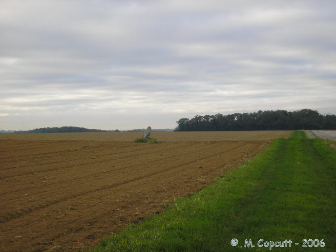
Menhir de la Demoiselle de Bracqueville submitted by thecaptain on 11th Oct 2006. To visit this stone, find your way from Beny-sur-Mer to the south along small tracks to Bracqueville farm. Park near to the farm, and walk about 500 metres along the track which passes in front of the farm till you get to a junction of trackways. Take the grassy track to the left, and the menhir is a further 500 metres along and just into the field on the left.
(View photo, vote or add a comment)
Log Text: Found this at last, on probably my third attempt. Find your way from Beny-sur-Mer to the south along small tracks to Bracqueville farm. Park near to the farm, and walk about 500 metres along the track which passes in front of the farm till you get to a junction of trackways. Take the grassy track to the left, and the menhir is a further 500 metres along and just into the field on the left.
Its about 1.4 metres tall, 0.7 metres wide and 0.3 metres thick, and leaning towards the north. The farmer has left very little room around it, and it has some very recent scrapes and damage done to it, no doubt from farm machinery. It is likely that this menhir often gets obscured by crops in the summer. Nice to have found it, its a nice stone. Stupidly I forgot to take my gps with me to get a proper position.
Menhir dit Pierre Debout (Reviers)
Trip No.206 Entry No.6 Date Added: 25th Mar 2020
Site Type: Standing Stone (Menhir)
Country: France (Normandie:Calvados (14))
Visited: Yes on 28th Sep 2006. My rating: Condition 2 Ambience 3 Access 4

Menhir dit Pierre Debout (Reviers) submitted by thecaptain on 29th Dec 2005. Reviers menhir.
Just inland from the D-Day beaches can be found (when the crops are down) the sad remains of this menhir.
(View photo, vote or add a comment)
Log Text: As I am right here and passing by, thought I may as well stop and take a look in the daylight. The crops in the field are growing, or more likely its been left fallow, but the ploughs have been right up to the stone and its fairly difficult to spot, even with this small growth. The poor stone is in a very sorry state, and could do with some TLC. Shame its so woefully looked after, so close to the well maintained large barrow.
Colombiers-sur-Seulles tumulus
Trip No.206 Entry No.7 Date Added: 16th Aug 2026
Site Type: Chambered Tomb
Country: France (Normandie:Calvados (14))
Visited: Yes on 28th Sep 2006. My rating: Condition 4 Ambience 4 Access 5
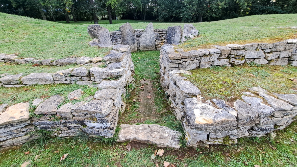
Colombiers-sur-Seulles tumulus submitted by stonetracker on 20th Oct 2025. Entrance to the main chamber, which originally had a corbelled roof. Partially broken and charred bones were found in here and dated to circa 4000 BCE.
(View photo, vote or add a comment)
Log Text: Again, as I am passing, thought I may as well pop in for a look. Its all very well looked after, and has a new car park and a nice new sign with lots of wxplanations, pictures etc written in both French and English. It’s a very good addition, and I took lots of pictures of the sign ! It even has a map showing other megaliths in the Caen region, which gives me some more ideas for menhirs etc in the area to search out. I suspect that this should move up to a 4/5 for condition now. A lovely well looked after place. It states on the sign that it dates to 4000 BC. I didnt stop at the menhir just half a mile away.
Luc-sur-Mer menhir
Trip No.206 Entry No.9 Date Added: 16th Aug 2026
Site Type: Standing Stone (Menhir)
Country: France (Normandie:Calvados (14))
Visited: Yes on 29th Dec 2006. My rating: Condition 2 Ambience 2 Access 5
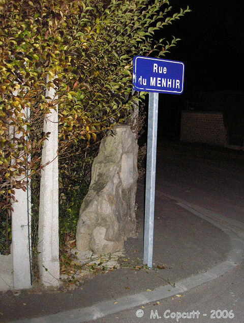
Luc-sur-Mer menhir submitted by thecaptain on 29th Dec 2006. Remains of a menhir about a metre tall, which can be found beside a garden hedge at the eastern end of Rue du Menhir.
(View photo, vote or add a comment)
Log Text: Remains of a menhir about a metre tall, which can be found beside a garden hedge at the eastern end of Rue du Menhir.
Les Pierres Branlantes
Trip No.206 Entry No.10 Date Added: 16th Aug 2026
Site Type: Chambered Tomb
Country: France (Normandie:Calvados (14))
Visited: Yes on 27th Dec 2006. My rating: Condition 2 Ambience 2 Access 3
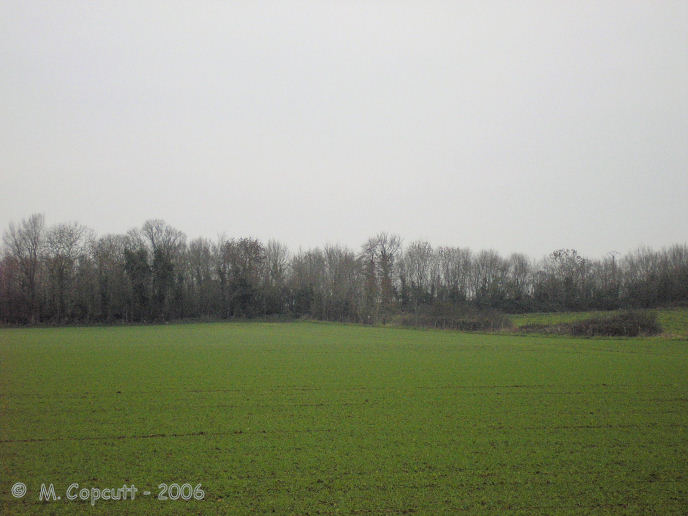
Les Pierres Branlantes submitted by thecaptain on 15th Jan 2007. The situation of Les Pierres Branlantes seen from the farm track to the southeast. They are just inside the wood directly at the end of the hedge crossing the field.
It looks to me as though some of the original mound which covered them survives, as can be seen by the raise in the ground at the corner of the field.
(View photo, vote or add a comment)
Log Text: Just a couple of kilometres to the west of Pegasus Bridge, over the river Orne between Caen and the port of Ouistreham, can be found the sad remains of what was obviously once a spectacular megalithic structure. It is to be found in the woods at the end of the quarry along the end of the Rue des Deux Pierres from Beuville, but is more easily found by walking half a kilometre along the farm track to the southeast, and then following the path west at the edge of the field along the hedge, and then just inside the wood directly at the end of the hedge. Two massive stone slabs are to be found standing upright and set at 90° to each other, and are obviously the remains of a once massive chamber. Possibly once facing towards the northeast, the western slab is 4 metres in length and almost 2 metres in height. The companion stone is again 4 metres in length, but this time only about 1.6 metres high. Both slabs are about 40 cm thick, and are carefully fitted together with an almost perfect right angle between them. It is possible that the stones have a few cupmarks cut into them, as do many of the megalithic stones around here, but I could not tell if they were natural or man made. Apart from the two massive slabs, there is no obvious remains of anything else, and the ground around here has been much mutilated over the past centuries. The fields have all been flattened and ploughed, while the nearby quarry has also done much damage. The tracks through the woods and quarry here are used by motorcyclists for trails riding, and bumps and jumps have been created, further altering any original features. At the other side of the field to the east is a large rectangular area of unploughed land, which is generally higher than that surrounding, with its longitudinal axis northwest to southeast. I wondered if this was also the remains of a once prehistoric barrow or suchlike, so went for a look. The ground is obviously very disturbed, and all lumpy, but with no obvious structure. Within this area can be seen some large slabs of stone, but whether the remains of some megalithinc structure or field clearance I could not tell. At the northwestern end of the mound is some broken reinforced concrete. Perhaps its the remains of a wartime bunker. But whatever it is, there must be some reason it hasn't all been ploughed flat.