Contributory members are able to log private notes and comments about each site
Sites TheCaptain has logged. View this log as a table or view the most recent logs from everyone
The Hurlers causeway
Date Added: 9th Sep 2025
Site Type: Ancient Trackway
Country: England (Cornwall)
Visited: Yes on 21st Sep 2013. My rating: Condition 2 Ambience 4 Access 4

The Hurlers causeway submitted by theCaptain on 22nd Sep 2013. the "quartz pavement" starting to become visible on a vile wet and windy moorland day, Saturday morning, 21 Sept 2013.
(View photo, vote or add a comment)
Log Text: During an unrecorded dig in about 1936, a "crystal causeway" was found and uncovered between the central and northern stone circles of The Hurlers, near Minions on Bodmin Moor. When a photo of this causeway was accidentally rediscovered, a new archaeological dig was organised by the local community and archaeologists to refind this causeway, and hopefully be able to discover more about it. This investigation happened to coincide with the last few days of our holiday in Padstow, and so it was decided to come and visit the site on the Saturday morning on the way home. It was a horrible grey wet morning, with typical Cornish horizontal moorland drizzle, which varied between almost dry and torrential. The place was very busy, and the first carpark was full when we arrived at about 11:15, so parking in the second car park, we visited the Moorland visitor centre in the old mining engine house first, which had a little exhibition all about the various features to be found on the moor here, and also a good little display about the current investigations of the Hurlers Circles, for both the astronomical observations and the intended dig. I was most intrigued to see mention of a possible "newfound stone circle" stated to be north of the three known circles, and also a possible new "avenue" of two roughly parallel stone rows to be found some distance away to the north of the circles, features identified by amongst others Peter Herring, the well known Bodmin Moor survey and write up chap. After that I took Dad to see the Rillaton Barrow, and the stone lined chamber in the side from where the famous gold cup was found. Now quite wet, and both with soaking feet, we now walked south to the Hurlers circles, on the way stopping to look at some of the mining pits, granite quarrying pits and then when nearing the circles also at a couple of large flat stones which just might have been standers once, and I was trying to imagine if there was once a circle here. I was not 100% convinced. Further on and between the middle and northern circles was a large fenced off area within which the archaeological investigations were being conducted. There was a large "trench" cut between the two circles, with the turfs all carefully stacked up along the outside, while about 20 diggers were active on the inside, scraping away at the clearly seen causeway, which was only a couple of inches below ground level. At this stage it was all very brown and muddy, and not at all like the gleaming "crystal causeway" as seen in the old photographs. From what I saw, I would estimate it was about a metre in width, and stretched for about 10 metres, not reaching to the circles at either end. The stones looked to me to be the regular moorland granite rather than quartz, ranging in size from a couple of inches up to about a foot in diameter. The causeway had clearly been deliberately made, with fairly regular edges, and the top surface was overall quite level, although locally very uneven, and would not have been particularly easy to have walked on. I found a lady archaeologist who was discussing things with some people and went to have listen to see what she was saying, and then had a quick discussion about it and we were told that a couple of flint tools had already been found within the makeup of the causeway, so probably dating it to the bronze age. They were hoping to uncover a lot more before the end of the investigation on monday, and also to clean it up for photographs, hopefully to a fairly gleaming state, although she said it was mostly granite and not the hoped for quartz. I took the opportunity to ask about the recently found "possible new stone circle" to the north, and the "possible avenue / two stone rows". After Dad told her who I was (I said I help run the megalithic portal) the lady seemed fairly keen to discuss these with me and very helpfully showed me some scale plans which she had, from which I could estimate their supposed whereabouts and where I was likely to find them. She said that they were very difficult to find, and that an experienced eye was needed to find anything, along with an "eye of faith" to be able to interpret them ! Well, if that wasn't a challenge to me, I don't know what is, even in this horrid weather. There were many other people around hoping to ask her stuff, so I didn't want to keep her long, and said that I would go off and look for these possible new features, parting to a response along the lines of good luck, it would be nice to know your thoughts. Pacing out from the north circle, I soon lost count and had to estimate my position, which was not the easiest thing to do in the mist, completely unable to recognise any features away from the local moorland! I found the stones I had had a look at on the way to the circles, but thought they were perhaps a bit to near to the circles, but was unable to find anything else in the vicinity. Now having an idea of what I was looking for, I was still not sure I had found the correct site, but using my best imagination, then yes, possibly there was a circle here once. Now off across the rough and wet moorland into the murk, and tring to mentally triangulate between the three circles (thankfully visible due to the fencing and dig equipment), Rillaton Barrow on its hilltop position, and down into the little valley with the trackway was a nice challenging task, and I soon realised I was in the wrong position and then had to tramp out further away, now losing any visibility of the circles! Dad was wondering what on Earth we were doing walking out here, and commented not only about getting wet, but getting totally lost, turning round and not having any idea where we were or what way we were facing!. But my instincts and internal navigation mode was working well for me, and a little break in the gloom allowing a glimpse of Stowes Hill and the Cheesewring confirmed where I was. Right, they must be somewhere about here, running in that direction, and just about 10 metres away, there I could see three stones standing proud of the long moorland grass, lined up and evenly spaced. A closer look, and yes, I am sure this is it, then another little gap in the mist allowed Stowes hill to be seen again, and confirmed that the row is aligned to the west of that, and perhaps aligned on Kilmar Tor in the distance, as the archaeologist lady had said. Looking around further, and yes, it looks like a second row is there about 10 metres to the right, slightly up slope, again with three stones to be seen aligned in about the same direction, and spacing beween the stones about the same. Walking along the upper row, and yes, more and perhaps more stones are there which could be considered as part of the same row, with an even spacing, until they ran into much rougher ground and ferns, getting completely lost. This seemed to be true for both of the rows of stones, which I thought were easy to find from the south, but would be pretty impossible to find from the north or any other direction. So, yes, I am totally convinced about these rows / avenue, and have found much lesser monuments elsewhere on my moorland treks! Dad was now asking about the miners cave he had read about, so I told him I was sure I could find that if he wanted, but it was very wet, and getting late for lunch, so we decided to give up and return to the car and go get lunch. On the way we called bac to the circles and the dig, which was now in lunch mode, with the lead lady and others sat around with thermos flasks and lunch. I called over to her, and said that I liked the rows, and was pretty certain thet these really existed, but not sure that I found the circle, following which we sort of agreed that sometimes you could find these things, and sometimes not, it all depends upon the lighting, direction you approach from, combined with an experienced eye for these things and a lot of luck! As we parted, she said it was good to have another experienced opinion on them, and then I heard her telling her companions that I was from The Megalithic Portal, and it was good that we were there having a look and reporting on their dig! Before getting much further, I overheard a large bloke I had seen as part of the dig discussing how to find the Craddock Moor stone circle with a lady and her dog, both saying that they had often looked for it but not been able to find it, the archaeologist chap saying he'd looked for it 5 times, but only been able to find it once, although one time he had the handicap of the moor being snow covered! I had to butt in and light heartedly say that it was easy to find, walk out along the tracl to the barrow, then turn left and head out over the moor for a while, and the circle was easy to find as there was a large bush right by it! We then agred that it all depended on what the conditions were at the time, and whether the circle wanted to be found or not, again agreeing that it was preferable that these sites can retain their secrets and mysteries, and not let just anyone find them! Another stop off on the way back to the car was the digging teams base, where there were some tents with equipment in, and many of the digging team inside out of the bad weather having lunch, so we did not interfere with them anymore. There was also a lady discussing how to skin animals and turn the skins into hide, but we decided to get on, as time is getting on and we dont want to miss lunch. Got back to the car about 1:45, and dropped down off hte moor to Upton Cross and the Caradon Inn, which I haven't been to in nearly 30 years, which was thankfully still open and doing a good lunch.
The Long Stone (Minions)
Date Added: 8th Sep 2025
Site Type: Standing Stone (Menhir)
Country: England (Cornwall)
Visited: Yes on 20th Sep 2009. My rating: Condition 5 Ambience 4 Access 5
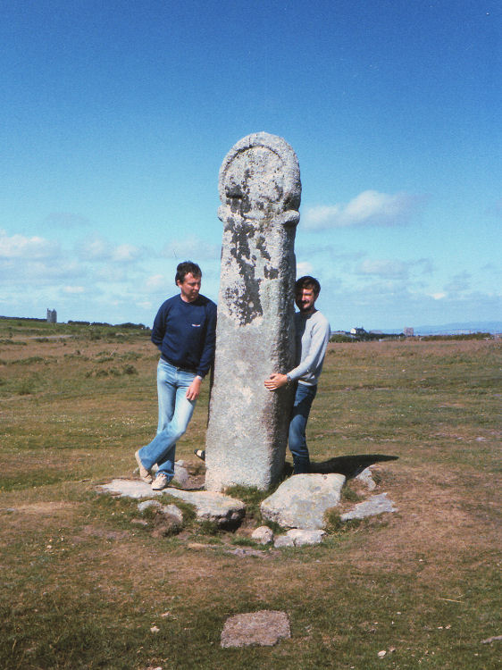
The Long Stone (Minions) submitted by thecaptain on 31st Aug 2008. Long Tom, near Minions.
Picture from about 1980.
(View photo, vote or add a comment)
Log Text: What a fantastic stone this is. As for the Hurlers, it is decades since I was last here, and it is bigger and better shaped than I remember. It is 2.6 metres tall and very slender, and covered in some beautiful lichens. With the sun dropping down in the sky, the golden light on this stone is superb. Only problem is the vehicle tracks all around it, having churned up the grass of the moor. What is up with these people who seem to feel the need to mess everything up?
Rillaton Barrow
Date Added: 8th Sep 2025
Site Type: Round Barrow(s)
Country: England (Cornwall)
Visited: Yes on 21st Sep 2013. My rating: Condition 4 Ambience 3 Access 4
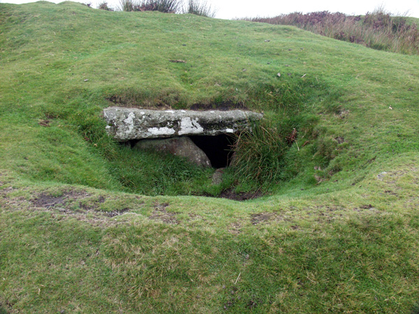
Rillaton Barrow submitted by ocifant on 3rd Oct 2004.
(View photo, vote or add a comment)
Log Text: On a horrible grey wet morning in Minions, with typical Cornish horizontal moorland drizzle which varied between almost dry and torrential, we visited the Moorland visitor centre in the old mining engine house first, which had a little exhibition all about the various features to be found on the moor here, and also a good little display about the current investigations of the Hurlers Circles. From here I took Dad to see the Rillaton Barrow, and the stone lined chamber in the side from where the famous gold cup was found. Somewhat to my surprise, Dad remembered seeing the cup in the British Museum, and also the crushed one from Kent. We didn’t spend too long out here in this wet!
Rillaton Barrow
Date Added: 8th Sep 2025
Site Type: Round Barrow(s)
Country: England (Cornwall)
Visited: Yes on 20th Sep 2009. My rating: Condition 4 Ambience 3 Access 4
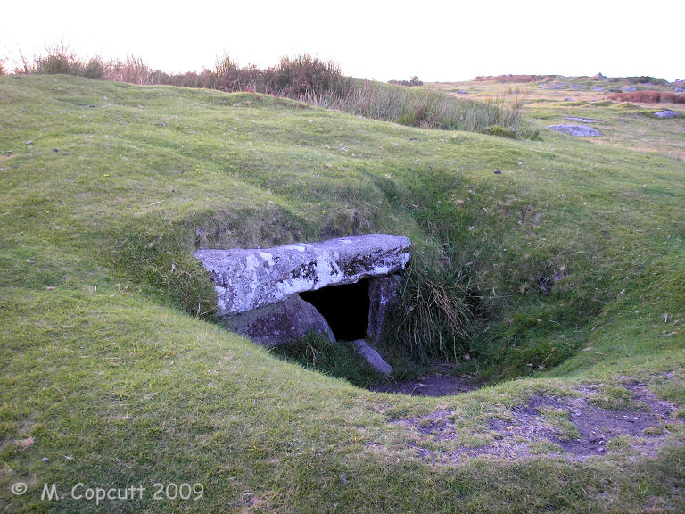
Rillaton Barrow submitted by thecaptain on 24th Oct 2009. The chamber is halfway up the eastern side, in a separate depression of its own, and cannot be seen as you pass, so I suspect most people who pass this way do not realise it is there.
(View photo, vote or add a comment)
Log Text: The largest round barrow on Bodmin Moor, about 35 metres in diameter and almost 3 metres high. It is again bigger than I remember it, and at first I can’t find the chamber from where the Rillaton Gold Cup was found. After I have walked all around the barrow, I realise that the chamber is halfway up the eastern side, in a separate depression of its own, so I suspect most people who pass this way do not realise it is there. The top slab is clearly seen sitting on the side slabs, with a gap at one end through which the inside can be seen. Again the inside looks bigger than I remember, and it is very well lined with nicely smoothed and squared slabs. Some good stonework went into making this. I stick the camera inside to fire off a few photos. The top of the mound has been well dug into, and even after all this dry weather, there is a pond in it. It makes me wonder whether there are any more chambers in the mound just waiting to be found, and if there is just the single chamber, why is it somehow randomly placed near but not at one of the edges?
The Hurlers North
Date Added: 8th Sep 2025
Site Type: Stone Circle
Country: England (Cornwall)
Visited: Yes on 21st Sep 2013. My rating: Condition 1 Ambience 3 Access 4
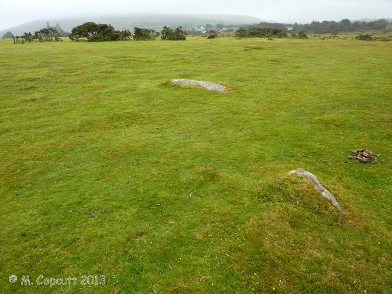
The Hurlers North submitted by theCaptain on 25th Jan 2014. Possible newly recognised fourth stone circle to the north of the three well known Hurlers circles.
A few stones slightly poke through the turf, with others hidden, and with an "eye of faith" a circle can be made out.
(View photo, vote or add a comment)
Log Text: Possible newly recognised fourth stone circle to the north of the three well known Hurlers circles. A few stones slightly poke through the turf, with others hidden, and with an "eye of faith" a circle can be made out. This circle is smaller than the main three Hurlers circles, but is in line with them, about the same distance north of the northern circle as the distance between the main three. Thanks to the people digging at The Hurlers for this information, first noted by Peter Herring in 2009.
The Hurlers Avenue
Date Added: 8th Sep 2025
Site Type: Multiple Stone Rows / Avenue
Country: England (Cornwall)
Visited: Yes on 21st Sep 2013. My rating: Condition 2 Ambience 3 Access 3

The Hurlers Avenue submitted by theCaptain on 25th Jan 2014. Possible remains of a newly discovered stone avenue, running in an approximately north to south direction, on the moor to the north of the Hurlers stone circles.
From what I saw the two approx parallel lines of stones are about 15 metres from each other, and stones can be found at about 10 metre spacings.
(View photo, vote or add a comment)
Log Text: Possible remains of a newly discovered stone avenue, running in an approximately north to south direction, on the moor to the north of the Hurlers stone circles. From what I saw (Sept 2013) the two approximately parallel lines of stones are (from memory) about 15 metres from each other, and stones can be found at about 10 metre spacings. The rows seemed fairly definite and "easy" to spot approaching from the south, and disappeared into the rougher and fern covered ground to the north. Thanks to the people digging at The Hurlers for this information, first noted by Peter Herring in 2009.
The Hurlers (S)
Date Added: 8th Sep 2025
Site Type: Stone Circle
Country: England (Cornwall)
Visited: Yes on 21st Sep 2013. My rating: Condition 3 Ambience 4 Access 4
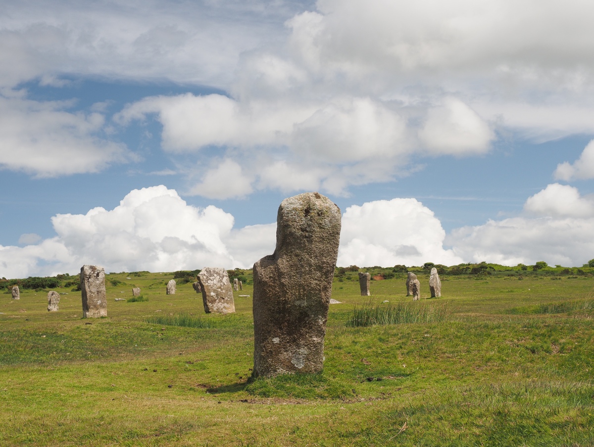
The Hurlers (S) submitted by Horatio on 22nd Jun 2024. The view looking from within the south circle towards the central and north circles.
(View photo, vote or add a comment)
Log Text: The southern of the three Hurlers stone circles is by far the least complete of the lot, and was probably not altered much during the restoration in the 1930's. The circle is 32.8 metres in diameter, with 9 stones remaining of a probable 28, of which 2 still stand, 7 are either stumps or fallen, the rest completely missing. The stones are generally of about 1.0 to 1.8 metres tall.
The Hurlers (C)
Date Added: 8th Sep 2025
Site Type: Stone Circle
Country: England (Cornwall)
Visited: Yes on 21st Sep 2013. My rating: Condition 4 Ambience 4 Access 4
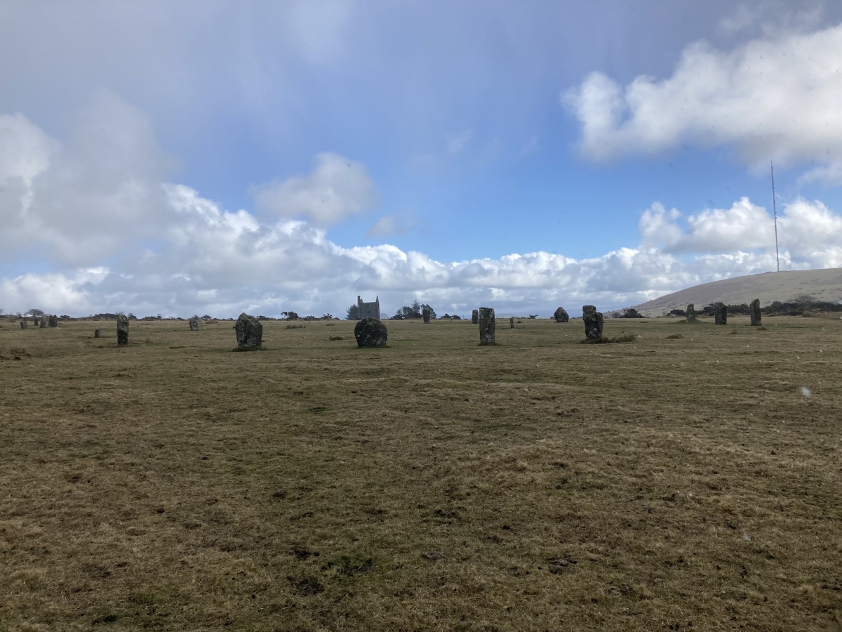
The Hurlers (C) submitted by markj99 on 7th Mar 2023. The Hurlers Central Stone Circle viewed from W.
(View photo, vote or add a comment)
Log Text: The central of the three Hurlers stone circles is perhaps the most complete of the lot, although this may be down to the restoration in the 1930's. The circle is an oval of 41 and 43 metres diameter, with 17 stones remaining of a probable 29, of which 14 still stand, 3 are either stumps or fallen, with other modern markers. The stones are generally of about 1.0 to 2.0 metres tall, and fairly well shaped and dressed, with their flat faces lined up to the centre of the circle.
The Hurlers (N)
Date Added: 8th Sep 2025
Site Type: Stone Circle
Country: England (Cornwall)
Visited: Yes on 21st Sep 2013. My rating: Condition 4 Ambience 4 Access 4
The Hurlers (N) submitted by hoya105 on 23rd Jul 2019. the northernmost stones..
(View photo, vote or add a comment)
Log Text: The northern of the three Hurlers stone circles is fairly complete, although this may be down to the restoration in the 1930's. The circle is 34.7 metres in diameter, with 16 stones remaining of a probable 28, of which 11 still stand, 5 are either stumps or fallen, with 9 modern markers and 3 completely missing. The stones are generally of about 1.0 to 1.8 metres tall, and fairly well shaped and dressed, with their flat faces lined up to the centre of the circle.
The Hurlers
Date Added: 8th Sep 2025
Site Type: Stone Circle
Country: England (Cornwall)
Visited: Yes on 20th Jun 2025. My rating: Condition 4 Ambience 4 Access 4
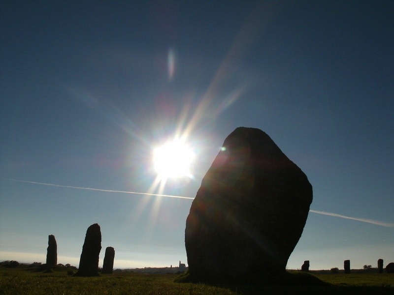
The Hurlers submitted by Bladup on 24th Sep 2013. The Hurlers and the Sun.
(View photo, vote or add a comment)
Log Text: Despite being hot, thirsty and very weary, I have a good look at all of the Hurlers stone circles on way back from Craddock Moor.
The Hurlers Pipers
Date Added: 8th Sep 2025
Site Type: Standing Stones
Country: England (Cornwall)
Visited: Yes on 20th Jun 2025. My rating: Condition 4 Ambience 4 Access 4
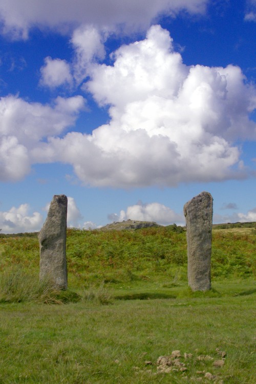
The Hurlers Pipers submitted by JimChampion on 24th Aug 2007. View through the 'goalposts' of the Pipers, neatly framing Stowe's Hill in the distance (home of the Cheesewring natural rock feature and the neolithic enclosure of Stowe's Pound). These two stones stand to the west of the Hurlers stone circles. The dung in the foreground is from the ponies that graze the moor.
(View photo, vote or add a comment)
Log Text: On way back from Craddock Moor, I stop for a look at The Pipers. Two nice stones, each standing about 2 metres tall, and about the same distance apart. Not too far away to the north is what initially looks like another one, but on closer inspection is some more modern memorial for something.
Craddock Moor circle
Date Added: 27th Aug 2025
Site Type: Stone Circle
Country: England (Cornwall)
Visited: Yes on 20th Jun 2025. My rating: Condition 3 Ambience 4 Access 3

Craddock Moor circle submitted by mattimpey on 9th Dec 2008. Three of the most prominant prostrate stones look East. The large bush is in the middle of the stone circle.
(View photo, vote or add a comment)
Log Text: Get to Minions eventually, but find that the Cheesewring pub has burned down and is all abandoned. Get a quick pasty at the Minions village shop, before setting off for a walk to the Craddock Moor stone circle, as I havent been there for ages. Its very hot and I am extremely weary, but I get there and manage to have a look amidst a large group of cows. It seems easier to find this time, with the stones more clear, possibly because its less overgrown.
Craddock Moor circle
Date Added: 27th Aug 2025
Site Type: Stone Circle
Country: England (Cornwall)
Visited: Yes on 20th Sep 2009. My rating: Condition 3 Ambience 4 Access 3
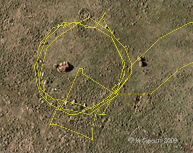
Craddock Moor circle submitted by thecaptain on 22nd Sep 2009. gps track plot of my wanderings round Craddock Moor stone circle on Sunday. Many of the stones can be seen in the picture.
I use an ageing Garmin etrex Venture pocket reciever, and the track is plotted out using GPSVisualizer, with only a few minutes fiddling.
I find it amazing the results that can now be obtained for things like this, using cheap, readily available technology, in a pocketsized device.
(View photo, vote or add a comment)
Log Text: After turning off the track near to the cairn, and heading out over the open moor, I found the circle easily, having headed straight to it from judging things looking at the map, and not using the GPS. I counted about 17 or 18 stones plus gaps on my first time round, but perhaps 19 or 20 next time round including lumps under tufts of grass. The circle is about 42 paces in diameter, with about 5 paces between each stone. When here, in September at the end of the summer, the grass and suchlike was very long, making most of the stones difficult to spot, so I first walked around the outside checking out what I could find. Then I walked around again taking photos, hence some excursions from the circle. I then went to the middle to survey the scene as a whole before looking for somewhere to sit and eat my pasty for lunch, which I would have liked to be the middle of the circle, but there was only long grass there, so a convenient and comfortable looking stone at the southeast did the job. I looked at my gps and was amazed at the nice circle on the screen, so thought I would "draw" another circle on it before I left !
Craddock Moor platform cairn
Date Added: 25th Aug 2025
Site Type: Cairn
Country: England (Cornwall)
Visited: Yes on 20th Jun 2025. My rating: Condition 3 Ambience 4 Access 3
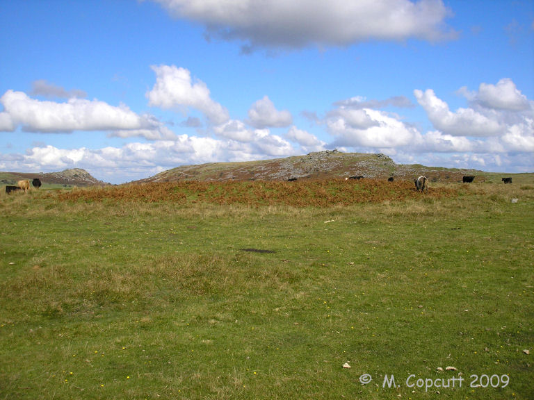
Craddock Moor platform cairn submitted by thecaptain on 1st Oct 2009. View east over Craddock Moor platform cairn and its berm.
Sharptor and Stowe's Hill in the background.
(View photo, vote or add a comment)
Log Text: I get to Minions eventually, but find that the Cheesewring pub has burned down and is all abandoned. Get a quick pasty at the Minions village shop, before setting off for a walk to the Craddock Moor stone circle, as I havent been there for ages. Its very hot and I am extremely weary, but I get there and manage to have a look amidst a large group of cows. Before the circle is the platform cairn which is clear to see all covered in ferns, and is quite a big but low flat circle, probably up to a metre high above the surrounding moor.
Craddock Moor platform cairn
Date Added: 25th Aug 2025
Site Type: Cairn
Country: England (Cornwall)
Visited: Yes on 20th Sep 2009. My rating: Condition 3 Ambience 4 Access 3

Craddock Moor platform cairn submitted by thecaptain on 1st Oct 2009. View northeast over Craddock Moor platform cairn, and right across the middle of Bodmin Moor.
Cornwall's very own mountain Brown Willy is in the distance.
(View photo, vote or add a comment)
Log Text: Following the track out towards Golddiggings quarry, there is a cairn marked at about the top of the local moorland, about where I need to head off southwest to find the stone circle. The cairn is clear to see, and is quite a big but low flat circle, probably up to a metre high above the surrounding moor. Much of it is covered by ferns, and this morning is surrounded by guard cows, some with vicious looking horns, which kept me away on the way out. The views from here are superb, with Brown Willy to be seen off to the northwest, and Sharptor and Stowes Pound very clear to the northeast. It is beautiful out here on the open moor. Turns out this is a circular platform cairn with peripheral berm, 24m in diameter for the cairn and up to 31m in diameter with its berm. English Heritage Scheduled Monument 15056 http://www.magic.gov.uk/rsm/15056.pdf
King Doniert's Stone
Date Added: 25th Aug 2025
Site Type: Ancient Cross
Country: England (Cornwall)
Visited: Yes on 20th Jun 2025. My rating: Condition 3 Ambience 3 Access 5
King Doniert's Stone submitted by cazzyjane on 14th Oct 2010. King Doniert's Stone.
(View photo, vote or add a comment)
Log Text: Now onwards to Minions, first looking at King Doniert's stone. This all took me ages, with some amazing traffic holdups behind sheep, tractors, busses, and best of all Highland Cattle sitting on a bridge. Donierts stone is looking splendid in the sun, but I feel I should head on as the road is chaos, with a school bus and lorry trying to pass each other.
Wenmouth Cross
Date Added: 25th Aug 2025
Site Type: Ancient Cross
Country: England (Cornwall)
Visited: Yes on 20th Jun 2025. My rating: Condition 3 Ambience 3 Access 5
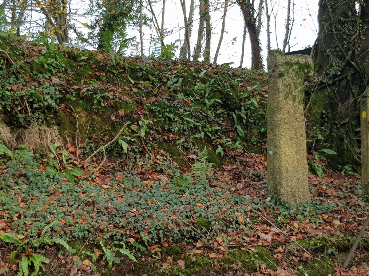
Wenmouth Cross submitted by dooclay on 2nd Dec 2024. A mutilated latin cross set up in 1932 at the Wenmouth cross roads.
(View photo, vote or add a comment)
Log Text: Heading south from Colliford Lake, I stop for a look at Wenmouth Cross. It stands at a shady spot by a road junction, its upper arms broken.
Searle’s Down
Date Added: 23rd Aug 2025
Site Type: Stone Row / Alignment
Country: England (Cornwall)
Visited: Yes on 20th Jun 2025. My rating: Condition 2 Ambience 3 Access 4
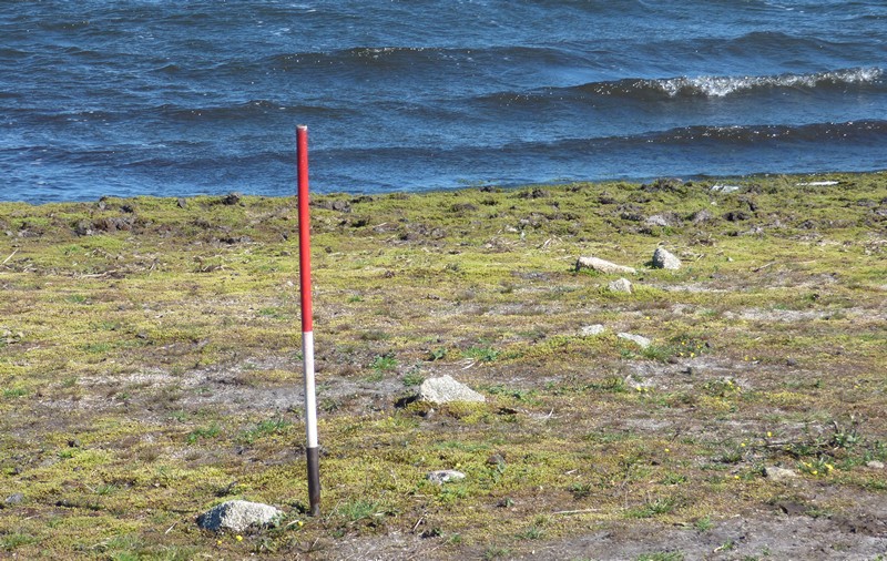
Searle’s Down submitted by SandyG on 19th Jan 2018. The stones nearest the reservoir. View from north west (Scale 1m).
(View photo, vote or add a comment)
Log Text: At Colliford Lake, I park and go for a walk around it's shores, trying to find the Searle’s Down stone row. Can't be sure I actually found anything, perhaps the remnants of an old wall, but I was certainly looking in the right place. Perhaps the main stones are below the water level, although it looks quite low. Now home and looking at Sandy's photographs, clearly what he has of the obvious row is below the level of the water when I was there, but it does look from a couple of the pictures that I did indeed see the top end of the row.
Treslea Cross
Date Added: 19th Aug 2025
Site Type: Ancient Cross
Country: England (Cornwall)
Visited: Yes on 20th Jun 2025. My rating: Condition 4 Ambience 4 Access 5
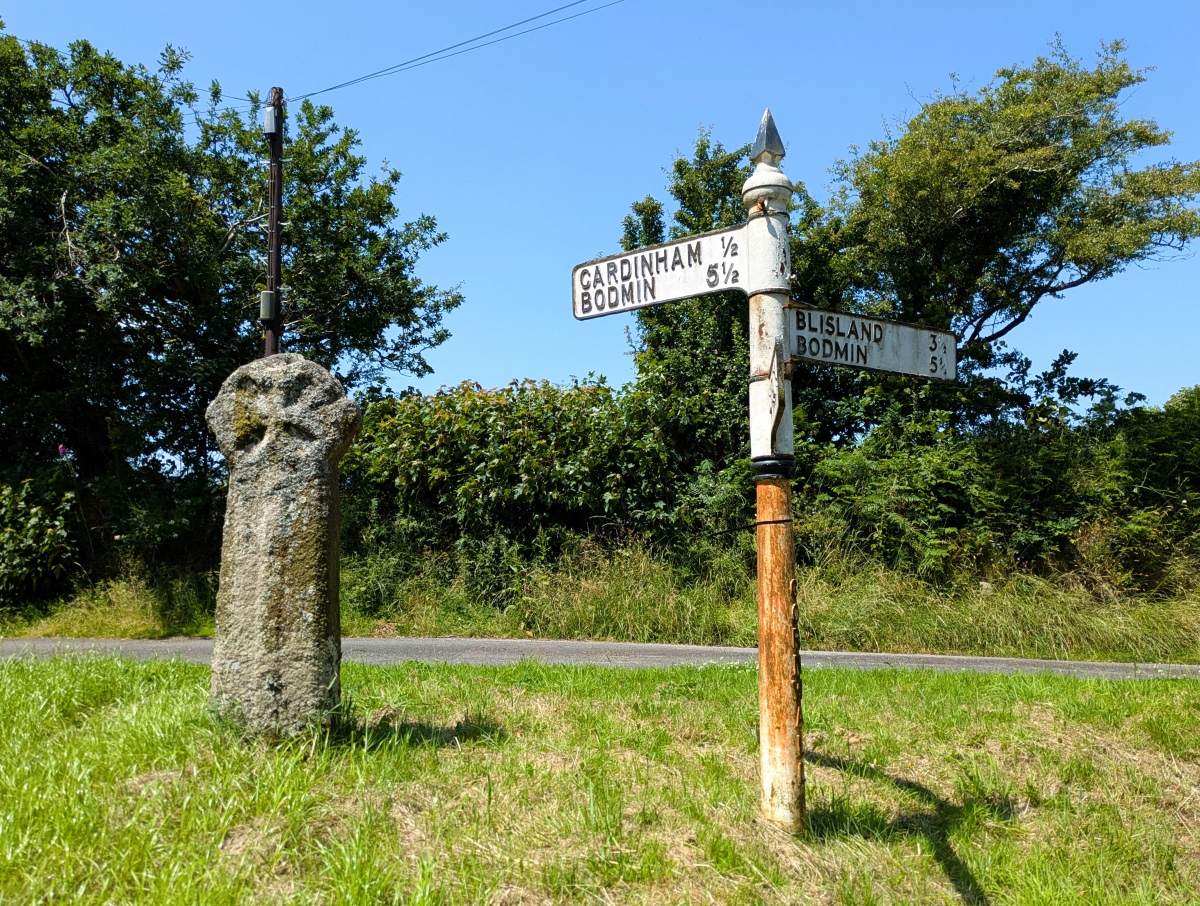
Treslea Cross submitted by TheCaptain on 19th Aug 2025. Treslea Cross, with its choice of ways to go to Bodmin. Personally, I'd choose Blisland as a destination.
(View photo, vote or add a comment)
Log Text: Now on to Treslea Cross, standing in a little green road junction triangle, with its splendid roadsign beside it. A choice of two ways to go to Bodmin, but I am tempted by Blisland.
Cardinham Churchyard
Date Added: 19th Aug 2025
Site Type: Ancient Cross
Country: England (Cornwall)
Visited: Yes on 20th Jun 2025. My rating: Condition 5 Ambience 4 Access 5
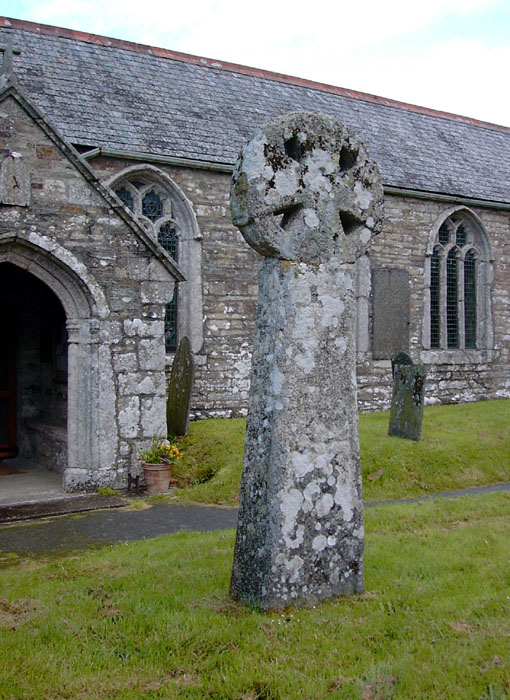
Cardinham Churchyard submitted by Thorgrim on 17th May 2004. This fine 10th century wheel-headed cross is the most southerly example of Scandinavian style ring-chain ornament.
(View photo, vote or add a comment)
Log Text: Leaving Penzance, I head to Bodmin Moor, with the intention of collecting some old sites and southern B101 squares on my way to Minions for a moorland walk. I started off at Cardinham with its two splendid old crosses. One is a carved head mounted on top of a huge pillar, the other round by the side is all complete and with carvings.
