

<< Our Photo Pages >> The Hurlers Avenue - Multiple Stone Rows / Avenue in England in Cornwall
Submitted by theCaptain on Monday, 23 September 2013 Page Views: 2655
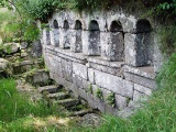
Neolithic and Bronze AgeSite Name: The Hurlers Avenue Alternative Name: Minions stone rowCountry: England County: Cornwall Type: Multiple Stone Rows / Avenue
Nearest Town: Liskeard Nearest Village: Minions
Map Ref: SX2576371864
Latitude: 50.520558N Longitude: 4.459271W
Condition:
| 5 | Perfect |
| 4 | Almost Perfect |
| 3 | Reasonable but with some damage |
| 2 | Ruined but still recognisable as an ancient site |
| 1 | Pretty much destroyed, possibly visible as crop marks |
| 0 | No data. |
| -1 | Completely destroyed |
| 5 | Superb |
| 4 | Good |
| 3 | Ordinary |
| 2 | Not Good |
| 1 | Awful |
| 0 | No data. |
| 5 | Can be driven to, probably with disabled access |
| 4 | Short walk on a footpath |
| 3 | Requiring a bit more of a walk |
| 2 | A long walk |
| 1 | In the middle of nowhere, a nightmare to find |
| 0 | No data. |
| 5 | co-ordinates taken by GPS or official recorded co-ordinates |
| 4 | co-ordinates scaled from a detailed map |
| 3 | co-ordinates scaled from a bad map |
| 2 | co-ordinates of the nearest village |
| 1 | co-ordinates of the nearest town |
| 0 | no data |
Internal Links:
External Links:
I have visited· I would like to visit
SandyG visited on 3rd May 2018 - their rating: Cond: 2 Amb: 5 Access: 4 Car parking is available at SX 25967 71126. From here follow the footpath to the three stone circles known as The Hurlers. Head north towards the Cheesewring and the row will be found adjacent to the footpath.
hevveh TheCaptain have visited here
")
From what I saw (Sept 2013) the two approximately parallel lines of stones are (from memory) about 15 metres from each other, and stones can be found at about 10 metre spacings. The rows seemed fairly definite and "easy" to spot approaching from the south, and disappeared into the rougher and fern covered ground to the north.
Thanks to the people digging at The Hurlers for this information, first noted by Peter Herring in 2009.
Update November 2019: This alignment is featured on the Stone Rows of Great Britain website - see their entry for Minions, which includes a description, a simplified plan of the row from surveys carried out in June 2017 and May 2018, photographs of the alignment and the individual stones, plus access information. The SRoGB tells us there are clearly definable visual links with the cairns on the summits of Brown Gelly, Brown Willy, the Cheesewring and the sea, and illustrates these links with photographs.
You may be viewing yesterday's version of this page. To see the most up to date information please register for a free account.
")
")
")
")
")
")
")
")
")
")
")
")
")
")
")
")
")
")
")
")
")
Do not use the above information on other web sites or publications without permission of the contributor.
Click here to see more info for this site
Nearby sites
Key: Red: member's photo, Blue: 3rd party photo, Yellow: other image, Green: no photo - please go there and take one, Grey: site destroyed
Download sites to:
KML (Google Earth)
GPX (GPS waypoints)
CSV (Garmin/Navman)
CSV (Excel)
To unlock full downloads you need to sign up as a Contributory Member. Otherwise downloads are limited to 50 sites.
Turn off the page maps and other distractions
Nearby sites listing. In the following links * = Image available
251m ENE 68° Rillaton N Cairn* Cairn (SX26007195)
260m ENE 78° Rillaton Barrow* Round Barrow(s) (SX26027191)
294m SSE 157° The Hurlers North* Stone Circle (SX25877159)
421m SSE 168° The Hurlers (N)* Stone Circle (SX25847145)
437m E 83° Minions Settlement* Ancient Village or Settlement (SX262719)
449m S 170° The Hurlers causeway* Ancient Trackway (SX25837142)
469m S 170° The Hurlers* Stone Circle (SX25837140)
477m S 171° The Hurlers (C)* Stone Circle (SX25827139)
517m S 184° The Hurlers Pipers* Standing Stones (SX25717135)
526m N 360° The Cheesewring* Natural Stone / Erratic / Other Natural Feature (SX25787239)
536m S 173° The Hurlers (S)* Stone Circle (SX25817133)
606m N 360° Stowe's Pound* Ancient Village or Settlement (SX25787247)
747m W 275° Craddock Moor platform cairn* Cairn (SX25027196)
774m S 177° Minions Platform Round Barrow* Cairn (SX25787109)
783m SSE 160° Minions Mound* Round Barrow(s) (SX26017112)
859m SW 223° Minions Round Cairns* Round Cairn (SX25157126)
891m W 266° Craddock Moor circle* Stone Circle (SX24877183)
983m SSW 210° Minions Kerbed Cairn Cairn (SX25247103)
1.0km SW 214° Minions Bronze Age round cairn. Cairn (SX25157103)
1.0km SW 217° Trewalla Farm Settlement* Ancient Village or Settlement (SX25117106)
1.1km WNW 290° Craddock Moor Stone Setting* Standing Stones (SX24747227)
1.2km SSW 198° Minions Cairns Cairn (SX25357073)
1.3km S 188° The Long Stone (Minions)* Standing Stone (Menhir) (SX25547055)
1.4km W 277° Craddock Moor embanked avenue* Misc. Earthwork (SX24377208)
1.5km WSW 251° Craddock Moor Cairn Cemetery* Barrow Cemetery (SX2435071429)
View more nearby sites and additional images


 We would like to know more about this location. Please feel free to add a brief description and any relevant information in your own language.
 Wir möchten mehr über diese Stätte erfahren. Bitte zögern Sie nicht, eine kurze Beschreibung und relevante Informationen in Deutsch hinzuzufügen.
 Nous aimerions en savoir encore un peu sur les lieux. S'il vous plaît n'hesitez pas à ajouter une courte description et tous les renseignements pertinents dans votre propre langue.
 Quisieramos informarnos un poco más de las lugares. No dude en añadir una breve descripción y otros datos relevantes en su propio idioma.