Contributory members are able to log private notes and comments about each site
Sites TheCaptain has logged. View this log as a table or view the most recent logs from everyone
The Langstane
Date Added: 29th Oct 2019
Site Type: Standing Stone (Menhir)
Country: Scotland (Aberdeenshire)
Visited: Yes on 12th Oct 2018
The Langstane submitted by TheCaptain on 12th Oct 2018. The Long Stone thought to have once been part of a stone circle, now presented in an alcove behind Burger King just off the main Aberdeen thoroughfare of Union Street, at the junction of Dee Street and Langstone Place.
The poor thing seems neglected amongst the bins and street signs, but at least it is still here.
(View photo, vote or add a comment)
Log Text: None
The Hurlers Pipers
Date Added: 8th Sep 2025
Site Type: Standing Stones
Country: England (Cornwall)
Visited: Yes on 20th Jun 2025. My rating: Condition 4 Ambience 4 Access 4
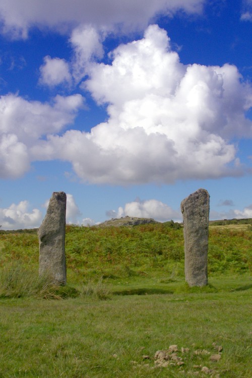
The Hurlers Pipers submitted by JimChampion on 24th Aug 2007. View through the 'goalposts' of the Pipers, neatly framing Stowe's Hill in the distance (home of the Cheesewring natural rock feature and the neolithic enclosure of Stowe's Pound). These two stones stand to the west of the Hurlers stone circles. The dung in the foreground is from the ponies that graze the moor.
(View photo, vote or add a comment)
Log Text: On way back from Craddock Moor, I stop for a look at The Pipers. Two nice stones, each standing about 2 metres tall, and about the same distance apart. Not too far away to the north is what initially looks like another one, but on closer inspection is some more modern memorial for something.
The Hurlers North
Date Added: 8th Sep 2025
Site Type: Stone Circle
Country: England (Cornwall)
Visited: Yes on 21st Sep 2013. My rating: Condition 1 Ambience 3 Access 4
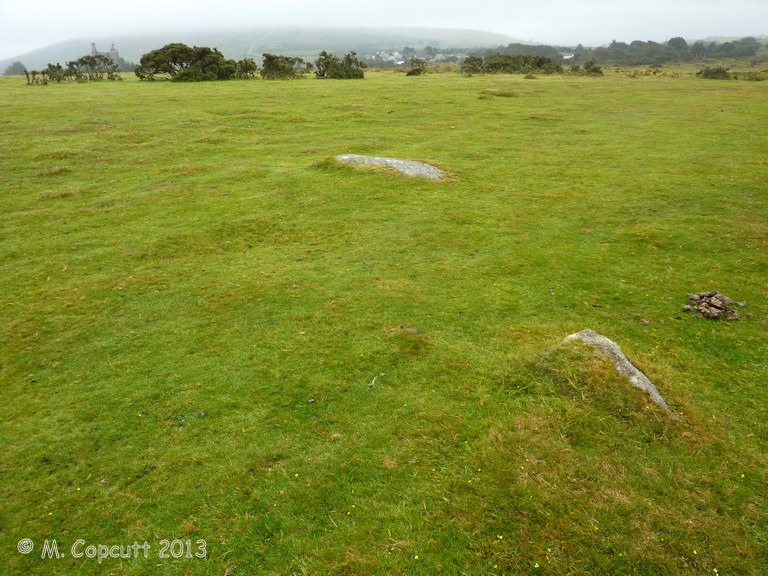
The Hurlers North submitted by theCaptain on 25th Jan 2014. Possible newly recognised fourth stone circle to the north of the three well known Hurlers circles.
A few stones slightly poke through the turf, with others hidden, and with an "eye of faith" a circle can be made out.
(View photo, vote or add a comment)
Log Text: Possible newly recognised fourth stone circle to the north of the three well known Hurlers circles. A few stones slightly poke through the turf, with others hidden, and with an "eye of faith" a circle can be made out. This circle is smaller than the main three Hurlers circles, but is in line with them, about the same distance north of the northern circle as the distance between the main three. Thanks to the people digging at The Hurlers for this information, first noted by Peter Herring in 2009.
The Hurlers causeway
Date Added: 9th Sep 2025
Site Type: Ancient Trackway
Country: England (Cornwall)
Visited: Yes on 21st Sep 2013. My rating: Condition 2 Ambience 4 Access 4

The Hurlers causeway submitted by theCaptain on 22nd Sep 2013. the "quartz pavement" starting to become visible on a vile wet and windy moorland day, Saturday morning, 21 Sept 2013.
(View photo, vote or add a comment)
Log Text: During an unrecorded dig in about 1936, a "crystal causeway" was found and uncovered between the central and northern stone circles of The Hurlers, near Minions on Bodmin Moor. When a photo of this causeway was accidentally rediscovered, a new archaeological dig was organised by the local community and archaeologists to refind this causeway, and hopefully be able to discover more about it. This investigation happened to coincide with the last few days of our holiday in Padstow, and so it was decided to come and visit the site on the Saturday morning on the way home. It was a horrible grey wet morning, with typical Cornish horizontal moorland drizzle, which varied between almost dry and torrential. The place was very busy, and the first carpark was full when we arrived at about 11:15, so parking in the second car park, we visited the Moorland visitor centre in the old mining engine house first, which had a little exhibition all about the various features to be found on the moor here, and also a good little display about the current investigations of the Hurlers Circles, for both the astronomical observations and the intended dig. I was most intrigued to see mention of a possible "newfound stone circle" stated to be north of the three known circles, and also a possible new "avenue" of two roughly parallel stone rows to be found some distance away to the north of the circles, features identified by amongst others Peter Herring, the well known Bodmin Moor survey and write up chap. After that I took Dad to see the Rillaton Barrow, and the stone lined chamber in the side from where the famous gold cup was found. Now quite wet, and both with soaking feet, we now walked south to the Hurlers circles, on the way stopping to look at some of the mining pits, granite quarrying pits and then when nearing the circles also at a couple of large flat stones which just might have been standers once, and I was trying to imagine if there was once a circle here. I was not 100% convinced. Further on and between the middle and northern circles was a large fenced off area within which the archaeological investigations were being conducted. There was a large "trench" cut between the two circles, with the turfs all carefully stacked up along the outside, while about 20 diggers were active on the inside, scraping away at the clearly seen causeway, which was only a couple of inches below ground level. At this stage it was all very brown and muddy, and not at all like the gleaming "crystal causeway" as seen in the old photographs. From what I saw, I would estimate it was about a metre in width, and stretched for about 10 metres, not reaching to the circles at either end. The stones looked to me to be the regular moorland granite rather than quartz, ranging in size from a couple of inches up to about a foot in diameter. The causeway had clearly been deliberately made, with fairly regular edges, and the top surface was overall quite level, although locally very uneven, and would not have been particularly easy to have walked on. I found a lady archaeologist who was discussing things with some people and went to have listen to see what she was saying, and then had a quick discussion about it and we were told that a couple of flint tools had already been found within the makeup of the causeway, so probably dating it to the bronze age. They were hoping to uncover a lot more before the end of the investigation on monday, and also to clean it up for photographs, hopefully to a fairly gleaming state, although she said it was mostly granite and not the hoped for quartz. I took the opportunity to ask about the recently found "possible new stone circle" to the north, and the "possible avenue / two stone rows". After Dad told her who I was (I said I help run the megalithic portal) the lady seemed fairly keen to discuss these with me and very helpfully showed me some scale plans which she had, from which I could estimate their supposed whereabouts and where I was likely to find them. She said that they were very difficult to find, and that an experienced eye was needed to find anything, along with an "eye of faith" to be able to interpret them ! Well, if that wasn't a challenge to me, I don't know what is, even in this horrid weather. There were many other people around hoping to ask her stuff, so I didn't want to keep her long, and said that I would go off and look for these possible new features, parting to a response along the lines of good luck, it would be nice to know your thoughts. Pacing out from the north circle, I soon lost count and had to estimate my position, which was not the easiest thing to do in the mist, completely unable to recognise any features away from the local moorland! I found the stones I had had a look at on the way to the circles, but thought they were perhaps a bit to near to the circles, but was unable to find anything else in the vicinity. Now having an idea of what I was looking for, I was still not sure I had found the correct site, but using my best imagination, then yes, possibly there was a circle here once. Now off across the rough and wet moorland into the murk, and tring to mentally triangulate between the three circles (thankfully visible due to the fencing and dig equipment), Rillaton Barrow on its hilltop position, and down into the little valley with the trackway was a nice challenging task, and I soon realised I was in the wrong position and then had to tramp out further away, now losing any visibility of the circles! Dad was wondering what on Earth we were doing walking out here, and commented not only about getting wet, but getting totally lost, turning round and not having any idea where we were or what way we were facing!. But my instincts and internal navigation mode was working well for me, and a little break in the gloom allowing a glimpse of Stowes Hill and the Cheesewring confirmed where I was. Right, they must be somewhere about here, running in that direction, and just about 10 metres away, there I could see three stones standing proud of the long moorland grass, lined up and evenly spaced. A closer look, and yes, I am sure this is it, then another little gap in the mist allowed Stowes hill to be seen again, and confirmed that the row is aligned to the west of that, and perhaps aligned on Kilmar Tor in the distance, as the archaeologist lady had said. Looking around further, and yes, it looks like a second row is there about 10 metres to the right, slightly up slope, again with three stones to be seen aligned in about the same direction, and spacing beween the stones about the same. Walking along the upper row, and yes, more and perhaps more stones are there which could be considered as part of the same row, with an even spacing, until they ran into much rougher ground and ferns, getting completely lost. This seemed to be true for both of the rows of stones, which I thought were easy to find from the south, but would be pretty impossible to find from the north or any other direction. So, yes, I am totally convinced about these rows / avenue, and have found much lesser monuments elsewhere on my moorland treks! Dad was now asking about the miners cave he had read about, so I told him I was sure I could find that if he wanted, but it was very wet, and getting late for lunch, so we decided to give up and return to the car and go get lunch. On the way we called bac to the circles and the dig, which was now in lunch mode, with the lead lady and others sat around with thermos flasks and lunch. I called over to her, and said that I liked the rows, and was pretty certain thet these really existed, but not sure that I found the circle, following which we sort of agreed that sometimes you could find these things, and sometimes not, it all depends upon the lighting, direction you approach from, combined with an experienced eye for these things and a lot of luck! As we parted, she said it was good to have another experienced opinion on them, and then I heard her telling her companions that I was from The Megalithic Portal, and it was good that we were there having a look and reporting on their dig! Before getting much further, I overheard a large bloke I had seen as part of the dig discussing how to find the Craddock Moor stone circle with a lady and her dog, both saying that they had often looked for it but not been able to find it, the archaeologist chap saying he'd looked for it 5 times, but only been able to find it once, although one time he had the handicap of the moor being snow covered! I had to butt in and light heartedly say that it was easy to find, walk out along the tracl to the barrow, then turn left and head out over the moor for a while, and the circle was easy to find as there was a large bush right by it! We then agred that it all depended on what the conditions were at the time, and whether the circle wanted to be found or not, again agreeing that it was preferable that these sites can retain their secrets and mysteries, and not let just anyone find them! Another stop off on the way back to the car was the digging teams base, where there were some tents with equipment in, and many of the digging team inside out of the bad weather having lunch, so we did not interfere with them anymore. There was also a lady discussing how to skin animals and turn the skins into hide, but we decided to get on, as time is getting on and we dont want to miss lunch. Got back to the car about 1:45, and dropped down off hte moor to Upton Cross and the Caradon Inn, which I haven't been to in nearly 30 years, which was thankfully still open and doing a good lunch.
The Hurlers Avenue
Date Added: 8th Sep 2025
Site Type: Multiple Stone Rows / Avenue
Country: England (Cornwall)
Visited: Yes on 21st Sep 2013. My rating: Condition 2 Ambience 3 Access 3

The Hurlers Avenue submitted by theCaptain on 25th Jan 2014. Possible remains of a newly discovered stone avenue, running in an approximately north to south direction, on the moor to the north of the Hurlers stone circles.
From what I saw the two approx parallel lines of stones are about 15 metres from each other, and stones can be found at about 10 metre spacings.
(View photo, vote or add a comment)
Log Text: Possible remains of a newly discovered stone avenue, running in an approximately north to south direction, on the moor to the north of the Hurlers stone circles. From what I saw (Sept 2013) the two approximately parallel lines of stones are (from memory) about 15 metres from each other, and stones can be found at about 10 metre spacings. The rows seemed fairly definite and "easy" to spot approaching from the south, and disappeared into the rougher and fern covered ground to the north. Thanks to the people digging at The Hurlers for this information, first noted by Peter Herring in 2009.
The Hurlers (S)
Date Added: 8th Sep 2025
Site Type: Stone Circle
Country: England (Cornwall)
Visited: Yes on 21st Sep 2013. My rating: Condition 3 Ambience 4 Access 4
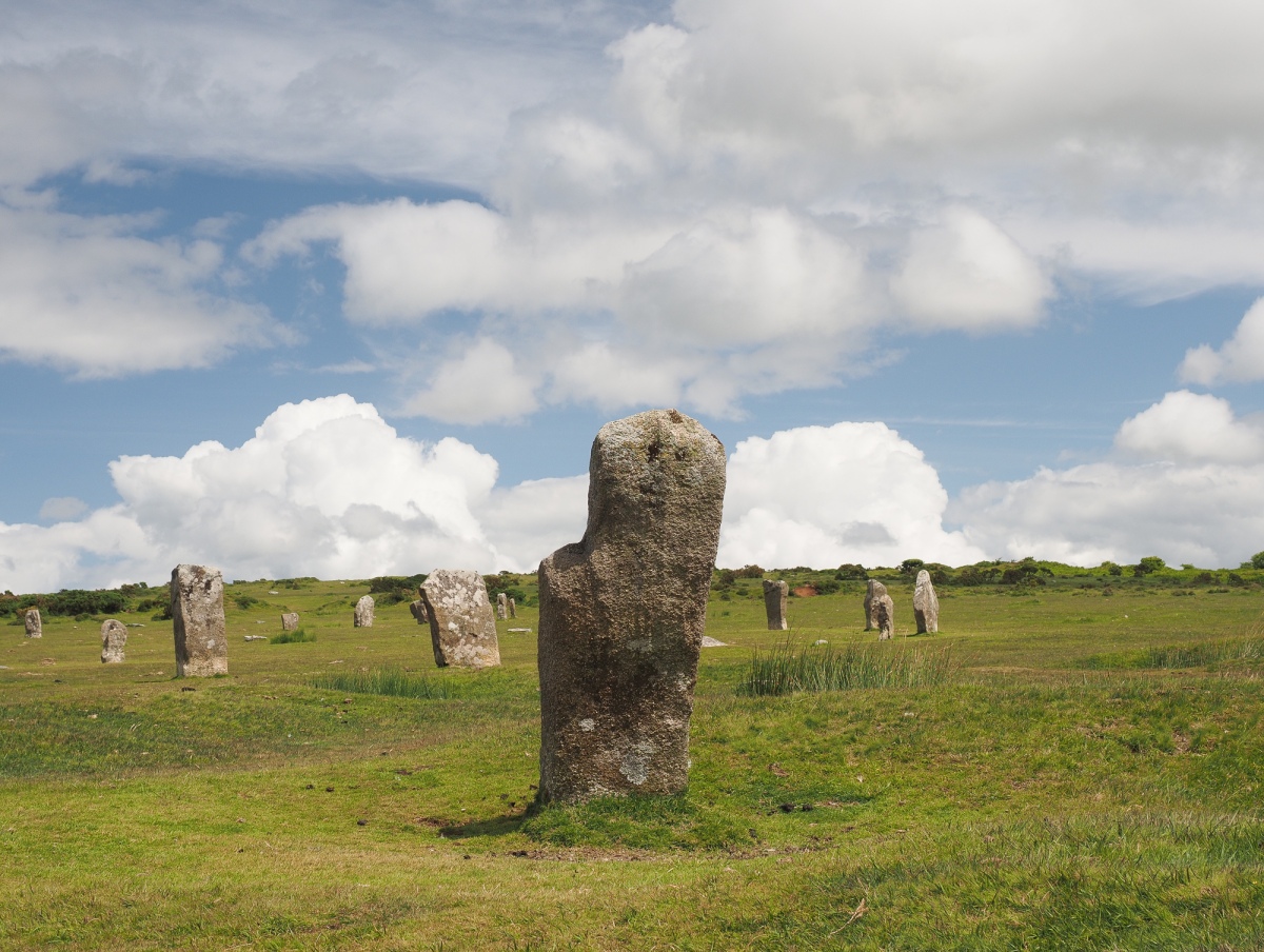
The Hurlers (S) submitted by Horatio on 22nd Jun 2024. The view looking from within the south circle towards the central and north circles.
(View photo, vote or add a comment)
Log Text: The southern of the three Hurlers stone circles is by far the least complete of the lot, and was probably not altered much during the restoration in the 1930's. The circle is 32.8 metres in diameter, with 9 stones remaining of a probable 28, of which 2 still stand, 7 are either stumps or fallen, the rest completely missing. The stones are generally of about 1.0 to 1.8 metres tall.
The Hurlers (N)
Date Added: 8th Sep 2025
Site Type: Stone Circle
Country: England (Cornwall)
Visited: Yes on 21st Sep 2013. My rating: Condition 4 Ambience 4 Access 4
The Hurlers (N) submitted by hoya105 on 23rd Jul 2019. the northernmost stones..
(View photo, vote or add a comment)
Log Text: The northern of the three Hurlers stone circles is fairly complete, although this may be down to the restoration in the 1930's. The circle is 34.7 metres in diameter, with 16 stones remaining of a probable 28, of which 11 still stand, 5 are either stumps or fallen, with 9 modern markers and 3 completely missing. The stones are generally of about 1.0 to 1.8 metres tall, and fairly well shaped and dressed, with their flat faces lined up to the centre of the circle.
The Hurlers (C)
Date Added: 8th Sep 2025
Site Type: Stone Circle
Country: England (Cornwall)
Visited: Yes on 21st Sep 2013. My rating: Condition 4 Ambience 4 Access 4
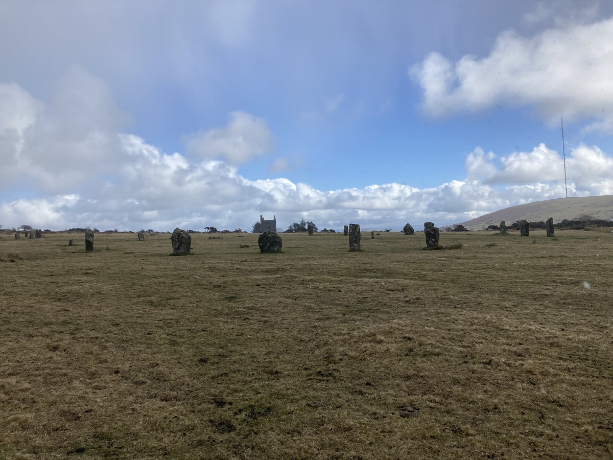
The Hurlers (C) submitted by markj99 on 7th Mar 2023. The Hurlers Central Stone Circle viewed from W.
(View photo, vote or add a comment)
Log Text: The central of the three Hurlers stone circles is perhaps the most complete of the lot, although this may be down to the restoration in the 1930's. The circle is an oval of 41 and 43 metres diameter, with 17 stones remaining of a probable 29, of which 14 still stand, 3 are either stumps or fallen, with other modern markers. The stones are generally of about 1.0 to 2.0 metres tall, and fairly well shaped and dressed, with their flat faces lined up to the centre of the circle.
The Hurlers
Date Added: 8th Sep 2025
Site Type: Stone Circle
Country: England (Cornwall)
Visited: Yes on 20th Jun 2025. My rating: Condition 4 Ambience 4 Access 4
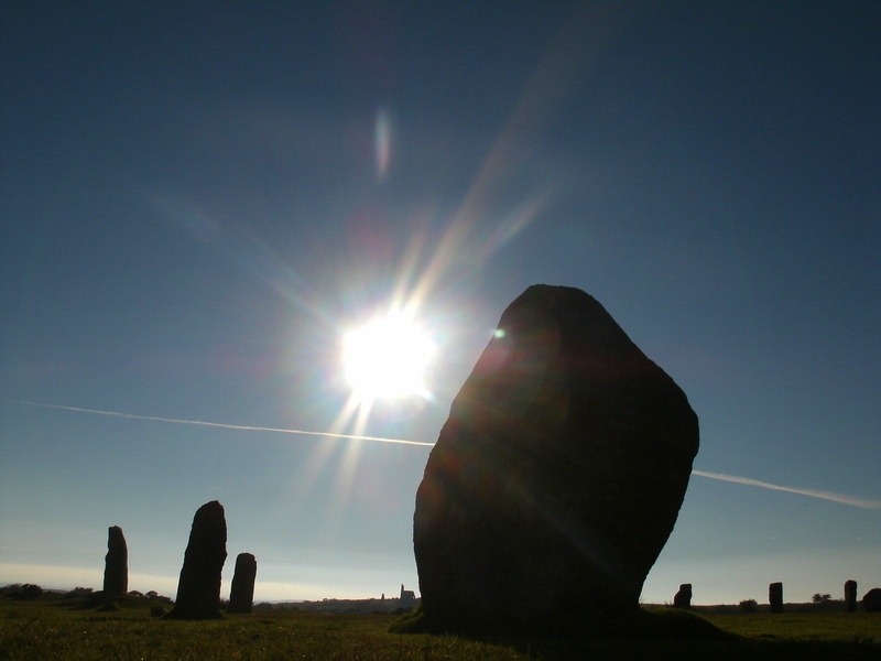
The Hurlers submitted by Bladup on 24th Sep 2013. The Hurlers and the Sun.
(View photo, vote or add a comment)
Log Text: Despite being hot, thirsty and very weary, I have a good look at all of the Hurlers stone circles on way back from Craddock Moor.
The Horestone (Lower Swell)
Date Added: 18th Sep 2010
Site Type: Standing Stone (Menhir)
Country: England (Gloucestershire)
Visited: Yes on 10th Jan 2007
The Horestone (Lower Swell) submitted by thecaptain on 10th Jan 2007. The Horestone stands in a field to the southwest of the village of Lower Swell.
Almost certainly once part of a burial chamber from within a longbarrow, it's about 2 metres long, less than a metre in height and varies in thickness.
(View photo, vote or add a comment)
Log Text: None
The Heath Stone
Date Added: 18th Sep 2010
Site Type: Standing Stone (Menhir)
Country: England (Devon)
Visited: Yes on 29th Jul 2006
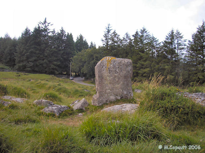
The Heath Stone submitted by thecaptain on 29th Jul 2006. The Heath Stone can be found not far from the road on the way to Fernworthy Reservoir, on the open moor just before you get to the forest.
(View photo, vote or add a comment)
Log Text: None
The Harp Stone
Date Added: 19th Oct 2021
Site Type: Standing Stone (Menhir)
Country: England (Dorset)
Visited: Yes on 17th Oct 2021. My rating: Condition 3 Ambience 3 Access 3
The Harp Stone submitted by JimChampion on 19th Apr 2008. The Harp Stone stands on a bank that divided the medieval manorial estates of Herpston and Hyde. On the far side of the stone is a hollow way, an old route down the hill from Kimmeridge that eventually led to Creech on the far side of the chalk ridge.
(View photo, vote or add a comment)
Log Text: Walking with friends from Swyre head to Kimmeridge. Up to the ridge again after lunch, where I went down the other side to look for the Harp Stone before returning to the ridge to join with the others who had waited. I was expecting to see the stone in the hedge at the far side of the field like the pictures on the portal, but no such luck, as the hedge was very overgrown. At first I found a tree stump, then a shiny pile of bracken but no sign of the stone. Up and down the hedge a couple of times, but before I gave up I got the gps out and the detailed OS map, giving me the best info I could have to find the stone. Eventually I saw it in the hedge, all overgrown and hiding behing a couple of vicious blackthorn bushes, which made me bleed as I was trying to get a picture of the stone between them. Only the top few feet of it could be seen, but it was still there. I had a very satisfied walk back across the field and up to the ridge to meet the others I was out walking with before returning to Swyre Head.
The Grickstone
Date Added: 6th Mar 2022
Site Type: Standing Stone (Menhir)
Country: England (Gloucestershire)
Visited: Yes on 13th Apr 2004. My rating: Access 4
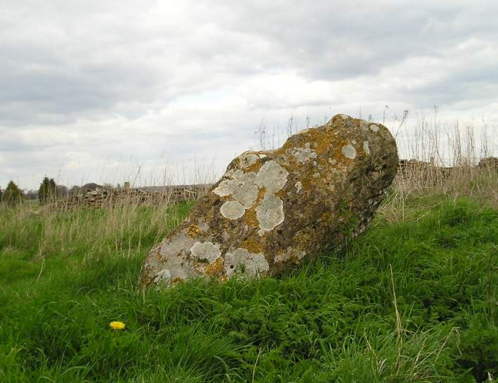
The Grickstone submitted by TheCaptain on 13th Apr 2004. Nice standing stone to the south of Grickstone farm, beside a footpath at the corner of a small wood. The stone has about 6 foot in length above ground, but due to the angle at which it leans, is only about 4 feet high. Nicely decorated with lichens. South Gloucestershire, ST777828.
(View photo, vote or add a comment)
Log Text: Nice standing stone to the south of Grickstone farm, beside a footpath at the corner of a wood. The stone is about 6 foot in height, but due to the angle at which it leans, is only about 4 feet high. Nicely decorated with lichens.
The Giant's Grave Mardon Down
Date Added: 28th Sep 2020
Site Type: Cairn
Country: England (Devon)
Visited: Yes on 26th Feb 2019. My rating: Condition 2 Ambience 3 Access 3
The Giant's Grave Mardon Down submitted by TheCaptain on 6th Mar 2019. At the top of Mardon Down is a fairly large cleared area, but the Giant's Grave cairn is very disappointing, being not much more than a large bumpy area of ground of about 20m diameter. It certainly doesn't live up to its name.
(View photo, vote or add a comment)
Log Text: At the top of the hill, and there is a fairly large cleared green area, but the Giant's Grave cairn is very disappointing, being not much more than a large bumpy area of ground, of about 20m diameter. It certainly doesn't live up to its name.
The Giant's Foot (Cumbria)
Date Added: 9th Oct 2022
Site Type: Standing Stone (Menhir)
Country: England (Cumbria)
Visited: Yes on 19th Sep 2022. My rating: Condition 3 Ambience 3 Access 4
The Giant's Foot (Cumbria) submitted by baz on 21st Mar 2004. The Giant's Foot at NY563148. This stone is a remnant of the Shap Stone Avenue and lies in a field behind the houses on the A6 in Shap.
(View photo, vote or add a comment)
Log Text: After a pint at the Kings arms I decide I have enough time to have a look for many of the Shap stones. First off is the Giant's Foot, which is just across a field behind the house at the back of the pub. It’s a large flat stone.
The Fiddler
Date Added: 5th Nov 2019
Site Type: Standing Stone (Menhir)
Country: England (Cornwall)
Visited: Yes on 28th Sep 2012. My rating: Condition 3 Ambience 4 Access 4
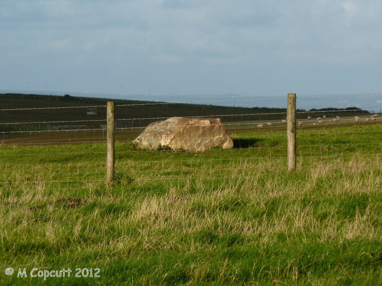
The Fiddler submitted by theCaptain on 3rd Jan 2013. Nowadays not much more than a large lump of stone laying in a field to the east of the A39 on the highpoint of land as the road passes over St Breock downs. It is positioned at a point where the line of the 9 Maidens would cross the top of the ridge.
(View photo, vote or add a comment)
Log Text: Nowadays not much more than a large lump of stone laying in a field to the east of the A39 on the highpoint of land as the road passes over St Breock downs. It is positioned at a point where the line of the 9 Maidens would cross the top of the ridge.
It is lovely light up here this afternoon, but the stone is across a fence from where I can walk to up the farm track, and the field full of livestock. It doesn't look that exciting, so I'll satisfy myself with taking pictures from the edge of the field. There is so much other large stone all around up here, that it is impossible to really tell what would be megalithic and what is field clearance.
The Cockpit
Date Added: 17th Mar 2023
Site Type: Stone Circle
Country: England (Cumbria)
Visited: Yes on 20th Sep 2022. My rating: Condition 4 Ambience 4 Access 3
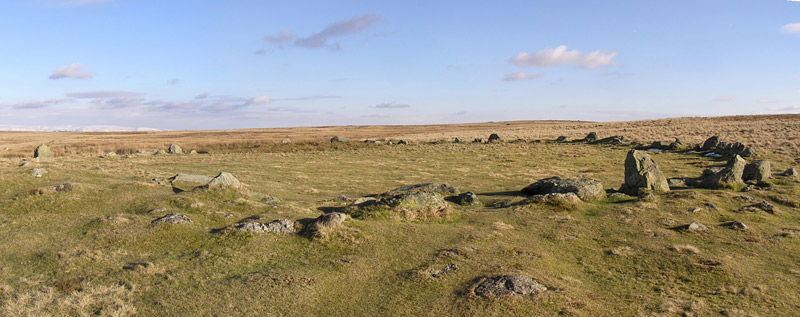
The Cockpit submitted by LivingRocks on 18th Mar 2005. A panoramic view of the Cockpit Stone Circle which according to Magicmap ‘includes a circular kerbed stone bank 2.8m -11.2m wide and up to 0.5m high which encloses an area approximately 27m in diameter. There are 27 (?) standing and recumbent stones set largely into the internal face of this bank, thereby creating the stone circle. The tallest standing stone measures about 0.95m high and some of the recumbent stones are up to 1.9m in length. Within the eastern side of the stone circle, abuttin...
(View photo, vote or add a comment)
Log Text: I have been meaning to visit The Cockpit for many many years, and I managed to do so in September 2022. From White Raise I head off towards the Cockpit, down to the major crossing of tracks, and then taking the way to the west, on what is now a largely rebuilt and upraised stone trackway across the boggy moorland. This has made what was probably difficult going into a very easy and pleasant walk. Just after a little ford over a stream, and there it is, looking all green inside and splendid. Its a large circular area of flat ground surrounded by a stone lined embankment, with a good set of quite large stones around the inner edge, another not so complete ring around the outside. There are a few little round cairn like structures spaced around its circumference, the largest being at the eastern side. Time for lunch, then I'd better head back. Having looked at the rough and marshy ground to the south, I decide to go back the way I came, and not to make up a loop walk across the open moorland to look for a few other cairns and "piles of stones" marked on the OS map.
The Butts (Godshill)
Date Added: 8th Feb 2022
Site Type: Round Barrow(s)
Country: England (Hampshire)
Visited: Yes on 2nd Feb 2022. My rating: Condition 2 Ambience 3 Access 3
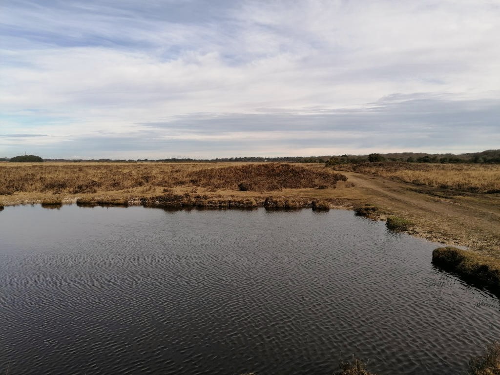
The Butts (Godshill) submitted by TheCaptain on 8th Feb 2022. The line of three can be seen beyond the pond
(View photo, vote or add a comment)
Log Text: Walk with friends in the New Forest over heathland through an old bombing range, hunting down a few tumuli, The Butts being first, three in line nearby a pond.
The Bulwarks (Monmouthshire)
Date Added: 31st Mar 2022
Site Type: Hillfort
Country: Wales (Monmouthshire)
Visited: Yes on 26th Mar 2022. My rating: Condition 3 Ambience 3 Access 5
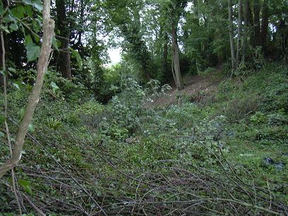
The Bulwarks (Monmouthshire) submitted by byll on 16th Aug 2010. Ditch/slope to the south of the Bulwarks
(View photo, vote or add a comment)
Log Text: Walking the Welsh Coast Path route from Chepstow to Caldicot. Remains of a hillfort / camp built by the Silures in the late Iron Age, overlooking the river Wye just to the south of Chepstow. Good views from the corner where the trees are cut back
The Bridestones (Cheshire)
Date Added: 30th Aug 2025
Site Type: Chambered Tomb
Country: England (Cheshire)
Visited: Would like to visit

The Bridestones (Cheshire) submitted by astronomer on 15th Apr 2011. Lifting the fallen monolith during the 1936-37 excavation.
Photo taken by the then land owner, Mr. G. Ech Roger Jnr. Previously unpublished image made available by the present owner of the glass negatives, Doug Pickford.
(View photo, vote or add a comment)
