Contributory members are able to log private notes and comments about each site
Sites TheCaptain has logged. View this log as a table or view the most recent logs from everyone
Beaupréau Dolmen
Trip No.204 Entry No.72 Date Added: 16th Jul 2020
Site Type: Burial Chamber or Dolmen
Country: France (Pays de la Loire:Maine-et-Loire 49)
Visited: Yes on 14th Jul 2005. My rating: Condition 4 Ambience 4 Access 4

Beaupréau Dolmen submitted by DrewParsons on 4th May 2010. View from the end of the lane leading to a small farming community to the NE of the village. Two furious dogs chased my car the length of that lane.
(View photo, vote or add a comment)
Log Text: About 600 metres walk round the back of the farm can be found this dolmen and its outlying menhir, which can clearly be seen from the road. The farmer was only too pleased to point it out to me. It's a fairly large Angevine dolmen, with chamber 4 metres by 3 metres, with a single capstone sitting on 2 large sidestones and a backstone. It opens to the east, and there are the usual couple of entry portals, although the northern one has fallen. Out the back is another smaller chamber, but this is falling down a bit, so it is difficult to make out where it would open to, probably to the south. Thirty metres to the west of the dolmen is a nice pointed menhir, probably about 3 metres high, but in a fenced off field with cows in, so I left it alone.
Dolmen de Romme
Trip No.204 Entry No.70 Date Added: 16th Jul 2020
Site Type: Burial Chamber or Dolmen
Country: France (Pays de la Loire:Maine-et-Loire 49)
Visited: Couldn't find on 14th Jul 2005
Log Text: I saw no evidence of this one, supposedly just to the northeast of the ruined chateau, beside the river Romme. The best option is that it is somewhere down a private and gated trackway.
Dolmen de la Colleterie
Trip No.204 Entry No.71 Date Added: 16th Jul 2020
Site Type: Burial Chamber or Dolmen
Country: France (Pays de la Loire:Maine-et-Loire 49)
Visited: Couldn't find on 14th Jul 2005
Log Text: I had no chance of finding this, although I tried very hard for quite some length of time. The roads around here are all barricaded off so that they can build the new motorway north of Angers. I don't think that the dolmen marked on my map will be in the path of the motorway. I had a long walk round all the tracks I could find which looked like it might be there, but it is probably in dense woodland. I found lots of bees and a deer though.
Beaupréau Menhir
Trip No.204 Entry No.73 Date Added: 16th Jul 2020
Site Type: Standing Stone (Menhir)
Country: France (Pays de la Loire:Maine-et-Loire 49)
Visited: Yes on 14th Jul 2005. My rating: Condition 3 Ambience 3 Access 4
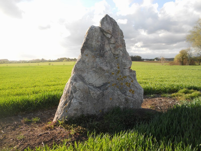
Beaupréau menhir submitted by irundarra on 19th Apr 2012. Site in Pays de la Loire:Maine-et-Loire 49 France
April 2012.
(View photo, vote or add a comment)
Log Text: Thirty metres to the west of the dolmen is a nice pointed menhir, probably about 3 metres high, but in a fenced off field with cows in, so I left it alone.
Dolmen du Champ-du-Ruisseau
Trip No.204 Entry No.69 Date Added: 16th Jul 2020
Site Type: Burial Chamber or Dolmen
Country: France (Pays de la Loire:Maine-et-Loire 49)
Visited: Yes on 14th Jul 2005. My rating: Condition 3 Ambience 2 Access 3
Dolmen du Champ-du-Ruisseau submitted by theCaptain on 7th Jan 2012. On a signposted village walk, just to the east of the village of Villemoisan can be found this dolmen. It is a little allée couverte about 6 metres long and still partly within a mound, and has four capstones still covering the passage.
(View photo, vote or add a comment)
Log Text: On a signposted village walk, just to the east of the village of Villemaison can be found this dolmen. It is a little allée couverte about 6 metres long and still partly within a mound, and has four capstones still covering the passage. There are also some entry blocking slabs.
I was just about to take a picture or two when a man shouted at me to get out of the field - its dangerous he said. He went on to say it was private property, and that as it was a monument historique it needed protecting which is why it was fenced off. Quite how planting trees on it helps in its protection I don't know, nor how the fact that a farm track has been driven over the top of it. What a terrible state it is getting into. It needs protecting from the people supposedly protecting it.
La Pierre Percée (La Chapelle-Basse-Mer)
Trip No.204 Entry No.63 Date Added: 16th Jul 2020
Site Type: Modern Stone Circle etc
Country: France (Pays de la Loire:Loire-Atlantique)
Visited: Yes on 14th Jul 2005. My rating: Ambience 3 Access 4
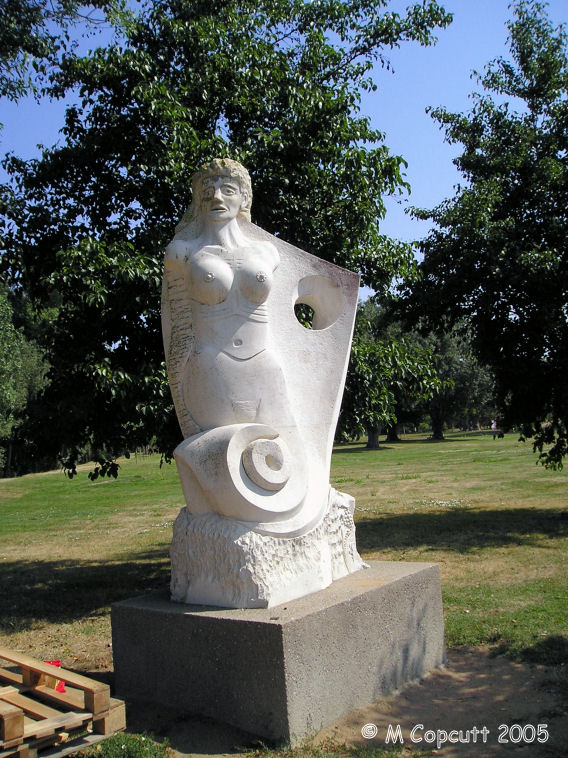
La Pierre Percée (La Chapelle-Basse-Mer) submitted by TheCaptain on 8th Jan 2012. I dont know whether there ever was an ancient menhir here, but today there is a modern sculpture of a woman (mermaid?) looking out over the river Loire, with a hole of course, and its rather nice.
(View photo, vote or add a comment)
Log Text: I dont know whether there ever was an ancient menhir here, but today there is a modern sculpture of a woman looking out over the Loire, with a hole of course, and its rather nice.
Menhir de Men Bihan
Trip No.204 Entry No.54 Date Added: 11th Jul 2020
Site Type: Standing Stone (Menhir)
Country: France (Bretagne:Morbihan (56))
Visited: Yes on 13th Jul 2005. My rating: Condition 3 Ambience 4 Access 3
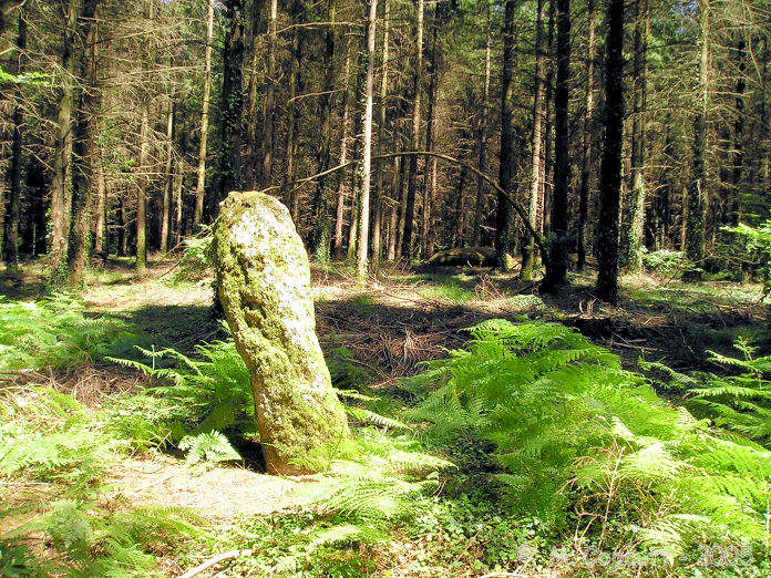
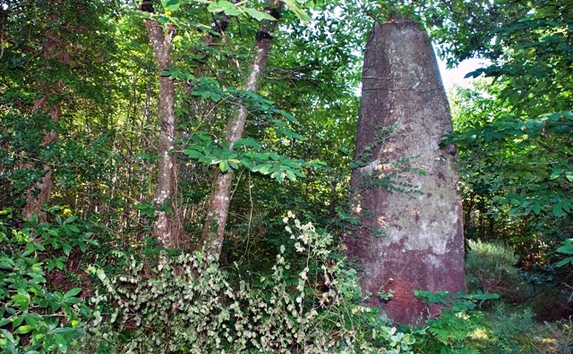
Men Bihan submitted by TheCaptain on 12th Aug 2007. Men Bihan, the "little stone", is about 1.8 metres tall, and a nice white granite all covered in moss. It is well hidden deep in the forest.
(View photo, vote or add a comment)
Log Text: The "little stone" is well hidden deep in the forest. I found it as much by luck as by good navigation using a detailed map and asking people. There are no signs or anything to help you, and it is 100 metres away from the nearest footpath. The menhir is about 1.8 metres tall, and a nice white granite all covered in moss. Its a nice stone to find, partially because of the difficulty in getting to it, with no gps or anything to go by.
Men-Bihan Allée Couverte
Trip No.204 Entry No.55 Date Added: 11th Jul 2020
Site Type: Passage Grave
Country: France (Bretagne:Morbihan (56))
Visited: Yes on 13th Jul 2005. My rating: Condition 2 Ambience 4 Access 3
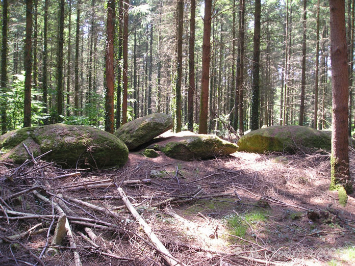
Men-Bihan allée couverte submitted by TheCaptain on 12th Aug 2007. About 50 metres from Men-Bihan is a line of 5 flat stones, looking very much like they have been placed there, although I am not 100% sure that this is a "proper" allée couverte.
There are many ruined allée couvertes hiding in this forest, and often the menhirs are marker stones for them.
(View photo, vote or add a comment)
Log Text: About 50 metres from Men-Bihan is a line of 5 flat stones, looking very much like they have been placed there. There might be remnants of stones underneath. The line is about 10 metres long, and is oriented roughly east to west. Is this the remains of an allée couverte, or just natural ?
Petit-Resto menhir
Trip No.204 Entry No.53 Date Added: 11th Jul 2020
Site Type: Standing Stone (Menhir)
Country: France (Bretagne:Morbihan (56))
Visited: Yes on 13th Jul 2005. My rating: Condition 3 Ambience 2 Access 5
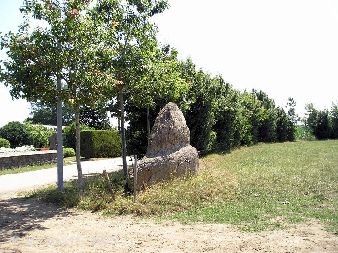
Petit-Resto menhir submitted by TheCaptain on 12th Aug 2007. This menhir can be seen at the edge of the road, and has weird weathering, looking like it has got a tide mark on it.
(View photo, vote or add a comment)
Log Text: This menhir can be seen at the edge of the road, but it is difficult to stop or turn round here. It is a sort of triangular stone, perhaps 2 metres high, just at the edge of a field. It has weird weathering, and looks like it has got a tide mark on it.
Men Braz menhir
Trip No.204 Entry No.56 Date Added: 11th Jul 2020
Site Type: Standing Stone (Menhir)
Country: France (Bretagne:Morbihan (56))
Visited: Yes on 13th Jul 2005. My rating: Condition 3 Ambience 5 Access 4
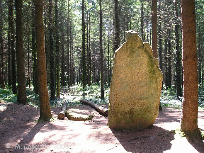
Men Braz menhir submitted by TheCaptain on 13th Aug 2007. Men Bras, the "big stone", is easy to find from the L'Etoiles roundabout. Take the forest track south for a couple of hundred metres, and then turn right at the signpost down a footpath, from where it is about 80 metres into the forest between the rows of trees.
(View photo, vote or add a comment)
Log Text: I wasted best part of an hour for this stone to clear of about 30 to 40 scouts having lunch and playing games here. Eventually they left so I could look at the stone on my own. It is easy to find from the L'Etoiles roundabout, where there is a few parking places. Take the forest track south for a couple of hundred metres, and then turn right at the signpost down a footpath, from where it is about 80 metres into the forest between the rows of trees. The "big stone" is about 3.8 metres tall, and looks lovely. Beside it is another fallen stone, perhaps even bigger.
Soldats-de-Saint-Cornély
Trip No.204 Entry No.52 Date Added: 11th Jul 2020
Site Type: Stone Row / Alignment
Country: France (Bretagne:Morbihan (56))
Visited: Yes on 13th Jul 2005. My rating: Condition 2 Ambience 2 Access 4

Soldats-de-Saint-Cornély submitted by TheCaptain on 3rd Sep 2013. At the east end of the rows are the remains of two tertre tumuli, which can just about be made out as raised mounds with a few stones protruding, but these have suffered terribly.
One has in fact had a sort of fairground sideshow built on it, while the other, with a large capstone still to be seen, has been surrounded with a fence, and a sort of oven, or fire made on top of it.
(View photo, vote or add a comment)
Log Text: This site consists of three parallel rows of stones, about 140 in all, running southeast to northwest, spaced at about 40 metres from each other, but what a terrible state these poor soldiers have fallen into. Not only has a road junction been built right into the middle of them, and a forest grown over them, but many of them have been taken away to ornament a garden in Lorient. What remains there are have become very overgrown and almost impossible to see, and one of the lines has been ploughed up. The only real way to tell where the stones are is by looking at the rows of hedges and trees.
The central row can be followed eastwards through the forest for about 100 to 200 metres until it gets to a clearing, within which a sort of Asterix the Gaul village complex has been built and abandoned, and is now decaying all around. At this end of the rows are the remains of two tertre tumuli, which can just about be made out as raised mounds with a few stones protruding, but these have suffered terribly. One has in fact had a sort of fairground sideshow built on it, while the other, with a large capstone still to be seen, has been surrounded with a fence, and a sort of oven, or fire made on top of it.
The poor Cornély army is very much in need of getting back into some sort of order. This is perhaps the monument most in need of some TLC and protection that I have ever seen.
Kornevec Alignement
Trip No.204 Entry No.61 Date Added: 11th Jul 2020
Site Type: Stone Row / Alignment
Country: France (Bretagne:Morbihan (56))
Visited: Yes on 13th Jul 2005. My rating: Condition 3 Ambience 3 Access 4
Kornevec alignement submitted by theCaptain on 3rd Jan 2012. The Kornevec alignement is a row of menhirs, now nearly all fallen, which runs for about 300 metres through the forest on a bearing of 065°. The stones are all about 3 metres in length, and are spaced at about 4 metre intervals.
(View photo, vote or add a comment)
Log Text: This alignement can be found just to the south of Loge Charlotte, and is signposted. The alignement is a row of menhirs, now nearly all fallen, which runs for about 300 metres through the forest on a bearing of 065°. The stones are all about 3 metres in length, and are spaced at about 4 metre intervals.
Over 200 stones have been found here. It would be nice to see these stood up again, at least the non broken ones, and also a bit better looked after, as it is all very overgrown. The site is not helped by there being new trees planted in amongst the stones.
Allée Couverte de Men Braz
Trip No.204 Entry No.57 Date Added: 11th Jul 2020
Site Type: Passage Grave
Country: France (Bretagne:Morbihan (56))
Visited: Yes on 13th Jul 2005. My rating: Condition 1 Ambience 4 Access 4
Log Text: In the vicinity of the Men-Braz are many other stones, which I am lead to believe are the remains of a much wrecked dolmen.
L'Etoile allée couverte
Trip No.204 Entry No.58 Date Added: 11th Jul 2020
Site Type: Passage Grave
Country: France (Bretagne:Morbihan (56))
Visited: Couldn't find on 13th Jul 2005
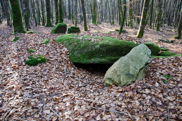
L'Etoile allée couverte submitted by Ogham on 19th Jan 2012.
The site is at 47 50.252N 003 00.745W taken with a hand held GPS.
(View photo, vote or add a comment)
Log Text: After all the time spent looking for the previous stones, I thought that I'd best not go on another long walk through the forest to try and find this one. My notes and books say that it is difficult to find, so I left it alone.
Toul Er Rest Dolmen
Trip No.204 Entry No.59 Date Added: 11th Jul 2020
Site Type: Burial Chamber or Dolmen
Country: France (Bretagne:Morbihan (56))
Visited: Couldn't find on 13th Jul 2005

Toul Er Rest dolmen submitted by Ogham on 20th Jan 2012. Not a good example of a dolmen.
(View photo, vote or add a comment)
Log Text: I had a quick look for this, now to be found somewhere in the outskirts and building land of Camors, but could see no signs or obvious place for it to be, so moved on.
Lann-er-Bein allée couverte
Trip No.204 Entry No.60 Date Added: 11th Jul 2020
Site Type: Passage Grave
Country: France (Bretagne:Morbihan (56))
Visited: Couldn't find on 13th Jul 2005
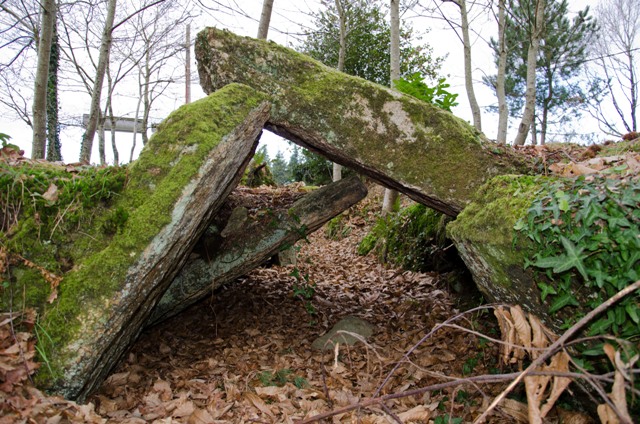
Lann-er-Bein allée couverte submitted by Ogham on 20th Jan 2012. You can sit in your car and look at this site.
(View photo, vote or add a comment)
Log Text: I had a quick look for this, now to be found somewhere in the outskirts and building land of Camors, but could see no signs or obvious place for it to be, so moved on.
L'Armoirie menhir
Trip No.204 Entry No.62 Date Added: 11th Jul 2020
Site Type: Standing Stone (Menhir)
Country: France (Bretagne:Morbihan (56))
Visited: Couldn't find on 13th Jul 2005

L'Armoirie menhir submitted by Ogham on 20th Jan 2012. Site in Bretagne:Morbihan (56) France
(View photo, vote or add a comment)
Log Text: I could not find the forest track which leads to this menhir, again there are no signposts obvious, and this stone is not even marked on the ign 1:25000 map, so I didn’t spend long looking.
Supposedly it’s a 1.5 metre tall menhir that has been broken, standing to the southwest of the alignement, between the D.779 and L'Armorie crossroads. So the menhir would be less imposing than most of the stones in the alignement.
Cosquéro Menhir
Trip No.204 Entry No.48 Date Added: 11th Jul 2020
Site Type: Standing Stone (Menhir)
Country: France (Bretagne:Morbihan (56))
Visited: Couldn't find on 12th Jul 2005
Cosquéro menhir submitted by Ogham on 9th Aug 2012.
The path is open now and well used from the road to the menhir.
(View photo, vote or add a comment)
Log Text: The trackway through to this menhir was barricaded off with private signs on it, so I didn’t get to the menhir. It is said to be the largest still standing menhir in Morbihan.
Kerherne-Bodunan dolmen
Trip No.204 Entry No.37 Date Added: 8th Jul 2020
Site Type: Passage Grave
Country: France (Bretagne:Morbihan (56))
Visited: Yes on 12th Jul 2005. My rating: Condition 3 Ambience 5 Access 3
Kerherne-Bodunan dolmen submitted by TheCaptain on 4th May 2011. This lovely monument is to be found in some lovely oak woodland high on top of a hill overlooking a stream. It is signposted from nearby, but there is nowhere really to park, and it’s a fair walk along a track and then up a woodland footpath. The monument is a strange one, which uses a natural rock outcrop as its base.
(View photo, vote or add a comment)
Log Text: This lovely monument is to be found in some lovely oak woodland high on top of a hill overlooking a stream. It is signposted from nearby, but there is nowhere really to park, and it’s a fair walk along a track and then up a woodland footpath.
The monument is a strange one, which uses a natural rock outcrop as its base. The first thing you reach is a massive chamber, 4 mtres long by 2.5 metres wide covered by a single massive slab. It would seem that the chamber has been made by splitting the rock outcrop and pushing some of it outwards, but leaving the top of the stone in place to act as its cover. The cover slab is 5.5 by 3.5 metres in size. To the north of this main chamber has been made a passage, running off for about 10 metres, and again using many natural rocks. A few cover stones are in place still, but most have fallen. Oddly it runs away from the large main chamber and I doubt the two would have originally connected on the inside. Perhaps its either two seperate chambers, or like the passage and antechamber in many other allée couvertes. Lovely, and well worth a visit.
La Moustoir stèle
Trip No.204 Entry No.36 Date Added: 8th Jul 2020
Site Type: Standing Stone (Menhir)
Country: France (Bretagne:Morbihan (56))
Visited: Yes on 12th Jul 2005. My rating: Condition 4 Ambience 4 Access 5
La Moustoir stèle submitted by TheCaptain on 5th May 2011. Just round the southwest side of the little chapel at Moustoir can be found this nice granite stele. Its about 2.3 metres tall and nicely shaped, with a flat face facing to the southeast. Onto this face has been carved a cross.
(View photo, vote or add a comment)
Log Text: Just round the southwest side of the little chapel at Moustoir can be found this nice granite stele. Its about 2.3 metres tall and nicely shaped, with a flat face facing to the southeast. Onto this face has been carved a cross.
