 with our Megalithic Portal iPhone app")


<< Text Pages >> Dolmen de la Colleterie - Burial Chamber or Dolmen in France in Pays de la Loire:Maine-et-Loire 49
Submitted by TheCaptain on Saturday, 16 April 2005 Page Views: 2968
Neolithic and Bronze AgeSite Name: Dolmen de la Colleterie Alternative Name: Dolmen de la Coltrie, Pierre des Fées, Maison des FéesCountry: France Département: Pays de la Loire:Maine-et-Loire 49 Type: Burial Chamber or Dolmen
Nearest Town: Angers Nearest Village: St-Lambert-la-Potherie
Latitude: 47.491142N Longitude: 0.664034W
Condition:
| 5 | Perfect |
| 4 | Almost Perfect |
| 3 | Reasonable but with some damage |
| 2 | Ruined but still recognisable as an ancient site |
| 1 | Pretty much destroyed, possibly visible as crop marks |
| 0 | No data. |
| -1 | Completely destroyed |
| 5 | Superb |
| 4 | Good |
| 3 | Ordinary |
| 2 | Not Good |
| 1 | Awful |
| 0 | No data. |
| 5 | Can be driven to, probably with disabled access |
| 4 | Short walk on a footpath |
| 3 | Requiring a bit more of a walk |
| 2 | A long walk |
| 1 | In the middle of nowhere, a nightmare to find |
| 0 | No data. |
| 5 | co-ordinates taken by GPS or official recorded co-ordinates |
| 4 | co-ordinates scaled from a detailed map |
| 3 | co-ordinates scaled from a bad map |
| 2 | co-ordinates of the nearest village |
| 1 | co-ordinates of the nearest town |
| 0 | no data |
Be the first person to rate this site - see the 'Contribute!' box in the right hand menu.
Internal Links:
External Links:
I have visited· I would like to visit
TheCaptain couldn't find on 14th Jul 2005 I had no chance of finding this, although I tried very hard for quite some length of time. The roads around here are all barricaded off so that they can build the new motorway north of Angers. I don't think that the dolmen marked on my map will be in the path of the motorway. I had a long walk round all the tracks I could find which looked like it might be there, but it is probably in dense woodland. I found lots of bees and a deer though.
You may be viewing yesterday's version of this page. To see the most up to date information please register for a free account.
Do not use the above information on other web sites or publications without permission of the contributor.
Nearby Images from Flickr
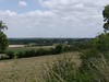
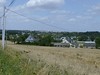
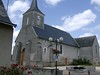

The above images may not be of the site on this page, but were taken nearby. They are loaded from Flickr so please click on them for image credits.
Click here to see more info for this site
Nearby sites
Click here to view sites on an interactive map of the areaKey: Red: member's photo, Blue: 3rd party photo, Yellow: other image, Green: no photo - please go there and take one, Grey: site destroyed
Download sites to:
KML (Google Earth)
GPX (GPS waypoints)
CSV (Garmin/Navman)
CSV (Excel)
To unlock full downloads you need to sign up as a Contributory Member. Otherwise downloads are limited to 50 sites.
Turn off the page maps and other distractions
Nearby sites listing. In the following links * = Image available
3.8km ESE 106° Menhir de Bois l'Abbé Standing Stone (Menhir)
4.7km NW 313° Dolmen de Fessine* Burial Chamber or Dolmen
4.8km W 274° Polissoir de la Chaussée Polissoir
8.1km ESE 106° Dolmen du Chateau (Angers)* Burial Chamber or Dolmen
9.1km ESE 102° Musée d'Histoire Naturelle Angers* Museum
11.7km W 263° Pierre du Ruisseau de la Planche Standing Stone (Menhir)
12.3km ENE 64° Polissoir des Fresnais Polissoir
13.3km WSW 244° Pierre des Trois Paroisses Standing Stone (Menhir)
14.1km NNE 19° Petit Menhir du Chene Standing Stone (Menhir)
14.4km N 351° Dolmen de l'Isle Briand 1 Burial Chamber or Dolmen
14.5km N 351° Dolmen de l'Isle Briand 2 Burial Chamber or Dolmen
15.4km E 81° Polissoir des Moulins Polissoir
16.2km ENE 62° La Pierre des Grands Pres Standing Stone (Menhir)
16.5km WSW 241° Dolmen de Romme Burial Chamber or Dolmen
18.1km NNE 21° Polissoir de la Chenaie Polissoir
18.3km W 259° Dolmen du Champ-du-Ruisseau* Burial Chamber or Dolmen
18.3km W 259° Champ-du-Ruisseau polissoir Polissoir
18.5km ESE 123° Saint Jean des Mauvrets dolmen Burial Chamber or Dolmen
18.7km WSW 242° Dolmen de la Boire de Champtocé Burial Chamber or Dolmen
19.4km ENE 67° Dolmen de la Pierre Burial Chamber or Dolmen
19.7km N 359° Dolmen de la Gouiniere Burial Chamber or Dolmen
20.1km ESE 121° La Pierre Fritte (St Saturnin) Standing Stone (Menhir)
20.2km ESE 122° Mont Rude dolmen Burial Chamber or Dolmen
20.3km ENE 65° Pierre couverte de Soucelles Burial Chamber or Dolmen
21.0km ESE 121° Dolmen Des Quatre Croix* Burial Chamber or Dolmen
View more nearby sites and additional images


 We would like to know more about this location. Please feel free to add a brief description and any relevant information in your own language.
 Wir möchten mehr über diese Stätte erfahren. Bitte zögern Sie nicht, eine kurze Beschreibung und relevante Informationen in Deutsch hinzuzufügen.
 Nous aimerions en savoir encore un peu sur les lieux. S'il vous plaît n'hesitez pas à ajouter une courte description et tous les renseignements pertinents dans votre propre langue.
 Quisieramos informarnos un poco más de las lugares. No dude en añadir una breve descripción y otros datos relevantes en su propio idioma.