Contributory members are able to log private notes and comments about each site
Sites TheCaptain has logged. View this log as a table or view the most recent logs from everyone
Lanacombe 3
Date Added: 18th Sep 2010
Site Type: Multiple Stone Rows / Avenue
Country: England (Somerset)
Visited: Yes on 31st Jul 2007
Lanacombe 3 submitted by TheCaptain on 31st Jul 2007. The first, and only obvious stone I found here at Lanacombe 3.
(View photo, vote or add a comment)
Log Text: None
Lanacombe 2
Date Added: 18th Sep 2010
Site Type: Stone Row / Alignment
Country: England (Somerset)
Visited: Yes on 17th Aug 2007

Lanacombe 2 submitted by TheCaptain on 17th Aug 2007. The third stone I found, I would estimate to be about 20–30 metres further up the hill, but it is leaning over or fallen, and well hidden in some marsh grass.
(View photo, vote or add a comment)
Log Text: None
Lanacombe 1
Date Added: 18th Sep 2010
Site Type: Multiple Stone Rows / Avenue
Country: England (Somerset)
Visited: Yes on 9th Dec 2007
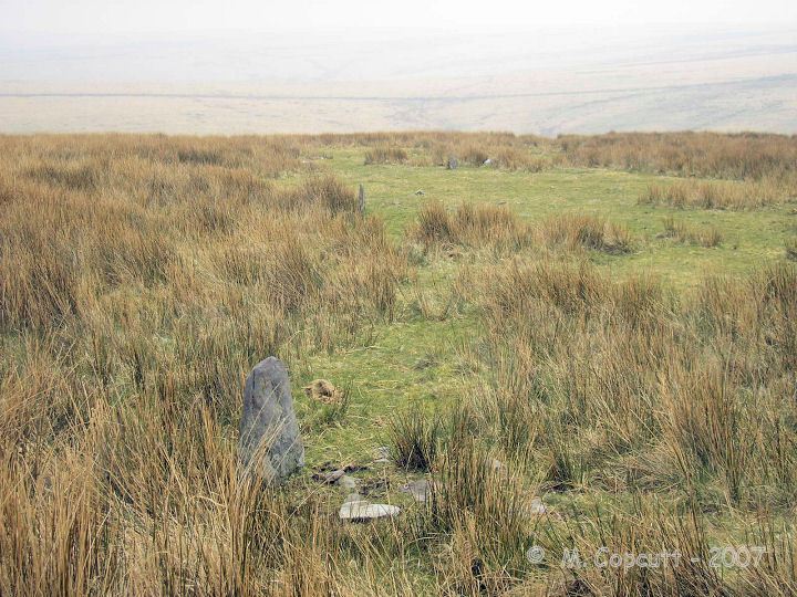
Lanacombe 1 submitted by thecaptain on 9th Dec 2007. This stone setting is more nearly on the ridgetop of Lanacombe Hill, with super views to the south and east.
Although the views when I was first here were shrouded in mist.
(View photo, vote or add a comment)
Log Text: None
Lakehead Hill W
Date Added: 27th Sep 2020
Site Type: Stone Row / Alignment
Country: England (Devon)
Visited: Yes on 18th Sep 2020. My rating: Condition 3 Ambience 3 Access 3

Lakehead Hill W submitted by simonsworn on 3rd Apr 2005. From the eastern end of the row, facing west
(View photo, vote or add a comment)
Log Text: I now head north to the top of the hill, where a single stone row of about a dozen stones heads east to west across the hilltop. There is no obvious cairn, but at the western end the stone is facing across the rline of the row as if to be a Blocking Stone.
Lakehead Hill E
Date Added: 27th Sep 2020
Site Type: Stone Row / Alignment
Country: England (Devon)
Visited: Yes on 18th Sep 2020. My rating: Condition 4 Ambience 4 Access 3
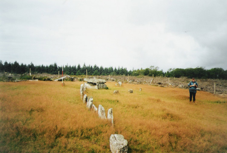
Lakehead Hill E submitted by simonsworn on 15th Mar 2005. After the surrounding plantation was cleared, facing NW, scale at 2m.
(View photo, vote or add a comment)
Log Text: Carry on northwards and then left in the scrubby gap between the forest trees to what the OS mark as "Cairn Circle & Cist". A path leads on westwards and then there it is, the coverstar of the Lakehead Hill sites. A short stone row leads westwards to a large rectangular box structure, all in a very nicely tended open area. I suspect this has all been "restored", but it does look very pretty in the afternoon sunshine. These days eleven stones make the row leading westwards to the cist, with a kink in the middle. The cist is a large box structure, much bigger than most of the cists on Dartmoor, and I think could be considered more of a burial chamber. This is partially surrounded by a circle of half a dozen small stones, although this has probably not been reconstructed very accurately. I like it.
Lakehead Hill Cairn 8
Date Added: 27th Sep 2020
Site Type: Cairn
Country: England (Devon)
Visited: Yes on 18th Sep 2020. My rating: Condition 3 Ambience 3 Access 3
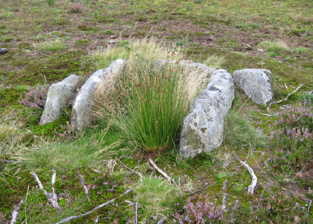
Lakehead Hill Cairn 8 submitted by AngieLake on 8th Dec 2009. The remaining cist from Cairn 8 on Lakehead Hill.
(See site notes for further info.)
(View photo, vote or add a comment)
Log Text: North to Lakehead Hill, and my first target is on the right of the forest track and marked as "Cist" on the map. It does what it says on the tin, and a decent cist is found within a large circular cairn.
Lakehead Hill Cairn 7
Date Added: 27th Sep 2020
Site Type: Cairn
Country: England (Devon)
Visited: Yes on 18th Sep 2020. My rating: Condition 3 Ambience 3 Access 3
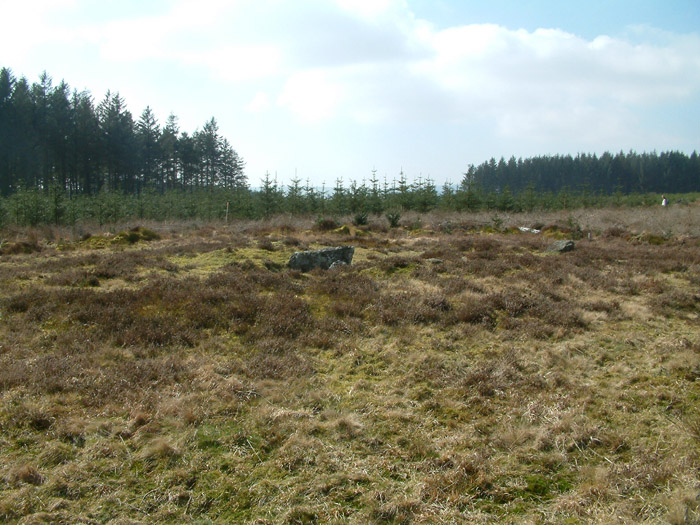
Lakehead Hill Cairn 7 submitted by simonsworn on 7th Apr 2005. Facing south
(View photo, vote or add a comment)
Log Text: Further north along the forest track and across the Lich Way, this next target is marked as "Cairn Circle & Cist" on the map. Down a little open trackway into a clearing in the forest, I find the remnants of a large cist in a large round cairn, but the remnants of a cairn circle elude me. Possibly once had a stone row associated, although that perhaps is for another cairn yet to be found within the forest.
Lakehead Hill 6
Date Added: 27th Sep 2020
Site Type: Cairn
Country: England (Devon)
Visited: Yes on 18th Sep 2020. My rating: Condition 4 Ambience 4 Access 3

Lakehead Hill 6 submitted by AngieLake on 4th Dec 2009. Looking NW up the slope from the cairn circle with cist towards the empty cairn circle (or Butler's site 5 on Lakehead Hill) .
(View photo, vote or add a comment)
Log Text: I now wander out onto the open hilltop and head soutwest towards carins 5 and 6 marked as "Cairn Circle and Cist" on the OS map, but am initially mislead by a large post which does not mark them before finding the pair of cairns with their small marker! The southern of the two cairn circles consists of 10 pale stones standing in a circle of about 6m diameter surrounding a fairly large flat stone, probably a capstone for a cist, but I can see nothing underneath. It once supposedly had a stone row leading away to the southeast.
Lakehead Hill 5
Date Added: 27th Sep 2020
Site Type: Stone Circle
Country: England (Devon)
Visited: Yes on 18th Sep 2020. My rating: Condition 4 Ambience 4 Access 3
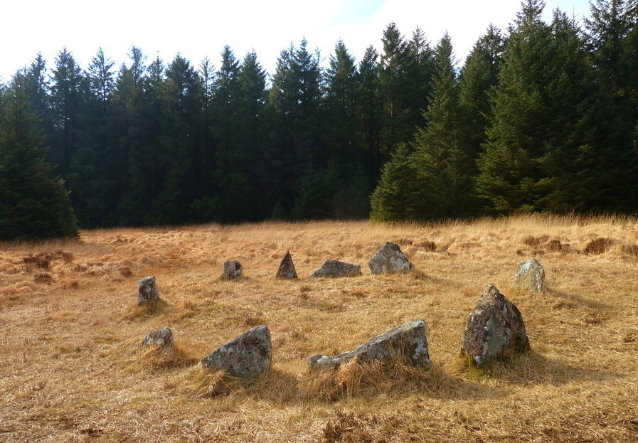
Lakehead Hill 5 submitted by Bladup on 12th May 2017. Lakehead Hill South Cairn Circle [5].
(View photo, vote or add a comment)
Log Text: Just to the north of Cairn 6 is Cairn 5, again a nice circle of 10 pale slabs with a diameter about 7m, slightly larger than cairn 6, as are the stones. There is no signs of a cist within the circle, but a few slabs to the southeast which may have made up part of a row to the cairn.
Lakehead Hill 2
Date Added: 27th Sep 2020
Site Type: Cist
Country: England (Devon)
Visited: Yes on 18th Sep 2020. My rating: Condition 2 Ambience 3 Access 3

Lakehead Hill 2 submitted by davep on 14th Jul 2011. Lakehead Hill Cairn 2 (Cist)
There are numerous sites in close proximity on Lakehead Hill. These are covered in detail in Butler's Atlas of Antiquities Vol 2. Map 27 Site 19 (see pp. 48-52). This cist is Butler's Cairn 2 marked with a Dartmoor National Park post 9A. The precise location is SX64267770
What follows is a description of how to locate it.
A short way southwards up the hill from Kraps Ring can be found cairn 1 which has a clear retaining circle of diameter 6m formed by...
(View photo, vote or add a comment)
Log Text: Head west from the stone row, and right at the edge of the forest is found Cairn 2, marked by the OS as "Cist". What I find is a fairly large cist box standing proud of the ground, with nothing too obvious of a cairn or circle surrounding it.
Lakehead Hill
Date Added: 27th Sep 2020
Site Type: Stone Row / Alignment
Country: England (Devon)
Visited: Yes on 18th Sep 2020. My rating: Condition 3 Ambience 3 Access 3
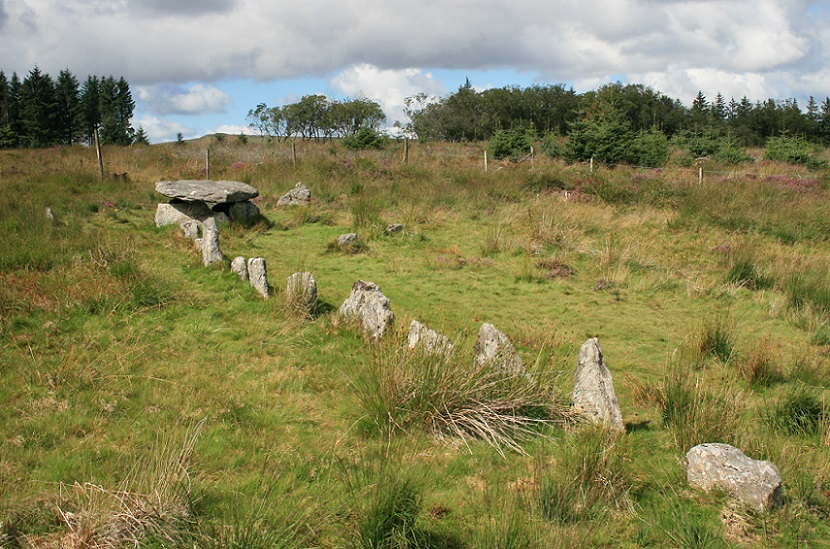
Lakehead Hill E submitted by postman on 31st May 2013. Stone row, stone circle and big cist, I never told my wife our weekend away was just so I could come here, don't think she would've been dead impressed.
(View photo, vote or add a comment)
Log Text: Day to Dartmoor for a lovely and sunny but tiring walk from Dunnabridge finding several cairns and cists on the way up and over Bellever Tor and on to Lakehead Hill with all its prehistoric remains. Down through Kraps Ring and the forest to Bellever, then up past Laughter Hole to the stone rows on the slopes of Laughter Tor then back to Dunnabridge. Pint at the Warren House Inn after. Lovely.
Lakehead Cairn Circle 1
Date Added: 27th Sep 2020
Site Type: Ring Cairn
Country: England (Devon)
Visited: Yes on 18th Sep 2020. My rating: Condition 3 Ambience 4 Access 3
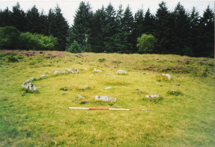
Lakehead Cairn Circle 1 submitted by simonsworn on 30th Mar 2005. Lakehead Cairn Circle 1. Earlier photo, facing southwest with 2m scale
(View photo, vote or add a comment)
Log Text: Heading back northeast, and after disturbing something fairly large within the forest edge, I proceed to what is marked as "Cairn Circle". I find a ring of 13 small pale stones, about 6 m in diameter. Nothing much to be found within the circle except for one other flat slab.
Lagatjar alignements
Trip No.203 Entry No.498 Date Added: 27th May 2020
Site Type: Stone Row / Alignment
Country: France (Bretagne:Finistère (29))
Visited: Yes on 19th Jun 2005. My rating: Condition 4 Ambience 4 Access 5
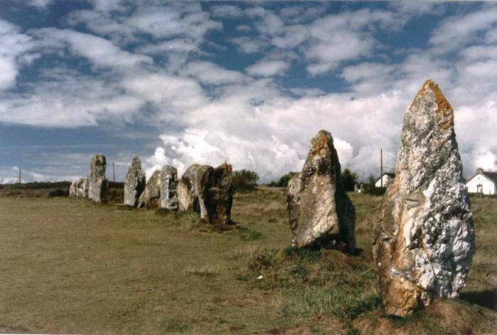
Lagatjar Alignements submitted by thecaptain on 18th Oct 2004. Lagatjar Alignements.
West of the fishing town of Camaret, in the far west of the Crozon Peninsula, Finisterre Brittany.
If memory serves me right, these stones form part of a sort of large stone square.
(View photo, vote or add a comment)
Log Text: The Lagatjar alignements are an intriguing arrangement of stones, mostly consisting of large white quartz blocks on open common land, just to the east of the fishing town of Camaret. There are probably over a hundred stones, mostly aligned into three lines, but there are some outliers as well.
The longest line is over 200 metres in length and has an orientation of 037°. From this line are two rows of larger blocks, heading off at right angles on bearing 317° for the northern row, which is approximately straight and 60 metres in length. The southern row is about 50 metres away, and heads off at 315°, but curves towards the west away from the baseline. Perhaps these two rows once joined up to form a horseshoe ?
South of the main line are three large grey stones, a single one at the west and a pair to the east. These three stones are aligned with each other. There are lots of orchids flowering here, which seems a bit late in the year.
Lagatjar alignements
Trip No.187 Entry No.71 Date Added: 27th May 2020
Site Type: Stone Row / Alignment
Country: France (Bretagne:Finistère (29))
Visited: Yes on 8th Sep 1987. My rating: Condition 4 Ambience 4 Access 5

Lagatjar Alignements submitted by thecaptain on 18th Oct 2004. Lagatjar Alignements.
West of the fishing town of Camaret, in the far west of the Crozon Peninsula, Finisterre Brittany.
If memory serves me right, these stones form part of a sort of large stone square.
(View photo, vote or add a comment)
Log Text: Cycling camping trip round Brittany day 9. Cycle from Telgruc all around Crozon peninsula.
Ladle Hill
Date Added: 18th Sep 2010
Site Type: Hillfort
Country: England (Hampshire)
Visited: Yes on 18th Jul 2007
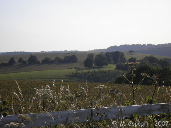
Ladle Hill submitted by TheCaptain on 18th Jul 2007. Ladle Hill hillfort seen here looking in a westerly direction along the top of the ridge of Watership Down.
(View photo, vote or add a comment)
Log Text: None
Lade Hill Brook Beehive Hut
Date Added: 5th Jun 2022
Site Type: Ancient Mine, Quarry or other Industry
Country: England (Devon)
Visited: Yes on 3rd May 2022. My rating: Condition 4 Ambience 4 Access 2
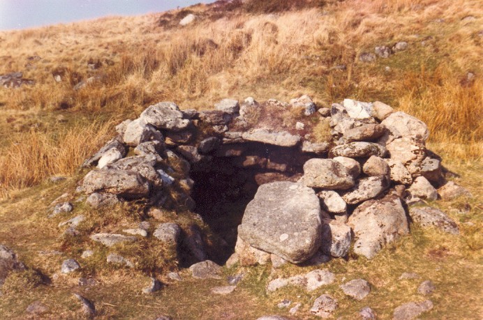
Lade Hill Brook Beehive Hut submitted by AngieLake on 25th Aug 2008. Lade Hill Brook Beehive Hut is situated on the east bank of the East Dart river. This photo was taken in the mid-1980s.
See site page for info.
(View photo, vote or add a comment)
Log Text: Getting down from White Ridge to the river and Beehive Hut is a bit tricky finding the way through the gorse here where it is very rough and largely overgrown, but once down it was easy to find. A splendid little construction and seeing it makes me think I have been here before, possibly on one of those mega expeditions in the 1980's, or perhaps I am confusing it with some of the similar orries in the Ariege Pyrénées. I see my only other person out here on the moors today, well camouflaged and fishing in the Dart, no doubt illegally as he looks very sheepish and hesitant to say hello.
Lacra
Date Added: 17th May 2023
Site Type: Stone Circle
Country: England (Cumbria)
Visited: Yes on 6th Apr 2002. My rating: Condition 2 Ambience 4 Access 3
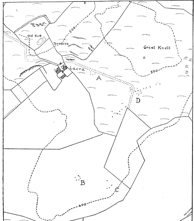
Lacra submitted by TheCaptain on 10th Nov 2017. Plan of the Lacra site.
From "Some Bronze Age burial circles at Lacra, near Kirksanton". By J. A. DIXON, with an excavation report by CLARE I. FELL.
(View photo, vote or add a comment)
Log Text: Visit after a week at Crossthwaite in the Lake District, before driving back to Bristol
Lacam de Rogues 2
Trip No.205 Entry No.175 Date Added: 24th Nov 2020
Site Type: Stone Circle
Country: France (Languedoc:Gard (30))
Visited: Yes on 19th Sep 2005. My rating: Condition 2 Ambience 5 Access 3

Lacam de Rogues 2 submitted by thecaptain on 6th Dec 2009. The central pillar is the only stone of this circle still standing, and it is not much more than a metre high.
The circle of stones around it is about 90 metres in diameter, and there are many stones remaining, but all fallen and crumbling, as is the wont of this fragile pale limestone.
(View photo, vote or add a comment)
Log Text: From the main road passing the village of Rogues, take the dirt track leading northwest from near the electrical transformer, opposite the road to the village. Walk about 600 metres along this track, always keeping to the right when there is a choice. There is then a little cultivated field in the valley to the right, go around this and to the top of the higher ground beyond it, and continue for another 300 metres.
At the highest point is a little tree growing, with the central pillar for this cromlech standing beside it. This central pillar is the only stone of this circle still standing, and it is not much more than a metre high. The circle of stones around it is about 90 metres in diameter, and there are many stones remaining, but all fallen and crumbling, as is the wont of this fragile pale limestone. I would imagine there to be bits of at least 30 stones still in evidence, most of them being in the northern half of the circle. The southern half is practically barren, and there has been a wall, or field clearance line of stones created where a big one of the circle would have been.
Apart from the cold wind blowing across this plateau, the clouds have now mostly cleared, and it is becoming a clear blue sky with great visibility. It really is special up here, with magnificent views all around over the Causse, with hills and mountains in the distance all around. The Cevennes to the north look particularly enchanting in the low golden sunlight.
Lacam de Rogues 1
Trip No.205 Entry No.174 Date Added: 24th Nov 2020
Site Type: Stone Circle
Country: France (Languedoc:Gard (30))
Visited: Yes on 19th Sep 2005. My rating: Condition 1 Ambience 2 Access 4

Lacam de Rogues 1 submitted by thecaptain on 3rd Dec 2009. The first Cromlech de Rogues.
There is not much here to be seen, but there are a few large lumps of stone laying around, and with an eye of faith, an arc can possibly be made out with some of them.
(View photo, vote or add a comment)
Log Text: From the main road passing the village of Rogues, take the dirt track leading northwest from near the electrical transformer, opposite the road to the village. After 300 metres walking down this track, there is a little mound on the right side, of which the centre has been dug out. To the other side of the track here are the remains of the first Cromlech de Rogues. There is not much here to be seen, but there are a few larger lumps of stone laying around, and with an eye of faith, an arc can possibly be made out with some of them.
Lacam de Peyrarines
Trip No.205 Entry No.162 Date Added: 15th Nov 2020
Site Type: Stone Circle
Country: France (Languedoc:Gard (30))
Visited: Yes on 19th Sep 2005. My rating: Condition 5 Ambience 5 Access 4
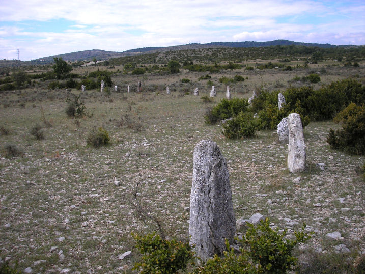
Lacam de Peyrarines submitted by thecaptain on 6th Oct 2005. Lacam de Peyrarines. A fantastic proper stone circle in France.
The stones arcing away in the southwest sector
(View photo, vote or add a comment)
Log Text: Take the road towards Blandas from Montdardier, and after a few kilometres there is a big junction of ways. About 600 metres down the road towards Blandas from the junction, and in the field to the right can be seen this tremendous cromlech.
This is a proper circle of stones, with 52 standing stones up to about 1.8 metres high making a circle of about 120 metres diameter. At the centre is a large menhir, well over two metres high. There are gaps in the circle, and several more stones which were possibly part of the circle are laying down. The stones which make up the circle are all different shapes and sizes, of this fragile and pockmarked limestone. There are tall thin ones, big rectangular stumps, short squat blocks, diamonds, triangles, slanted top stones and a few almonds.
Just sat at the centre of this circle looking at all the stones around me it feels wonderful. One of the stones has like a giant finger pointing upwards. One of them is full of holes (number 35 in my counting !). Most of them are very evenly spaced, but it is not all that way. This really is a special place. Most of the stones are of the local crumbly flaky pale limestone, but not all, as a few of the large stones are a dark brown gritty sort of rock.
