Contributory members are able to log private notes and comments about each site
Sites Stonetracker has logged. View this log as a table or view the most recent logs from everyone
Wyalusing Mounds
Date Added: 28th Jul 2024
Site Type: Artificial Mound
Country: United States (Great Lakes Midwest)
Visited: Yes on 1st Jul 2024. My rating: Condition 3 Ambience 4 Access 3
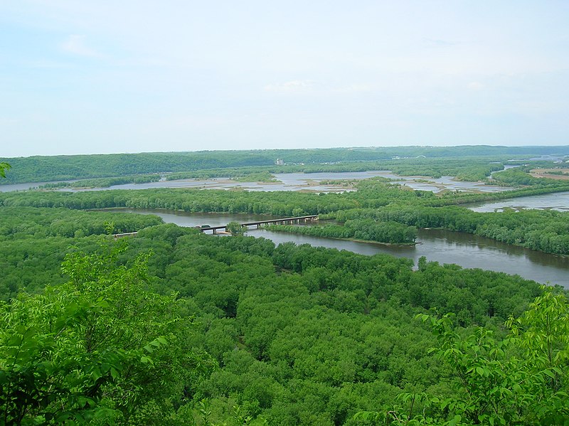
Wyalusing Mounds submitted by AKFisher on 9th Sep 2023. The Wisconsin River delta into the Mississippi River taken at Wyalusing State Park in Wisconsin. The Wisconsin flows from the near right to the Mississippi River. The Mississippi River flows from the right to the left. Iowa is visible in the distance on the other side of the Mississippi River, & Prairie du Chien is just out of view to the right. Photo credit: Wiki (Cindy-Flickr).
(View photo, vote or add a comment)
Log Text: There are 4-5 relatively accessible effigy mound groups according to the Wisconsin Mounds site. I was able to view several of them. As with most effigy mound sites, viewing conditions range from mowed and in good condition to either completely overgrown or eroded to the point of near invisibility. Even the best effigy mounds are difficult to photograph. I've provided some still shots or videos. Aerial LiDAR views frankly show these mounds better than any on the ground method so I hope to add those.
I was unable to access the Indoor Group Camp and Homestead Camp mound groups. They appear to require bushwhacks and both access points into the forest were occupied by campers.
Windsor Mounds
Date Added: 18th Nov 2023
Site Type: Artificial Mound
Country: United States (The South)
Visited: Yes. My rating: Condition 3 Ambience 3 Access 5
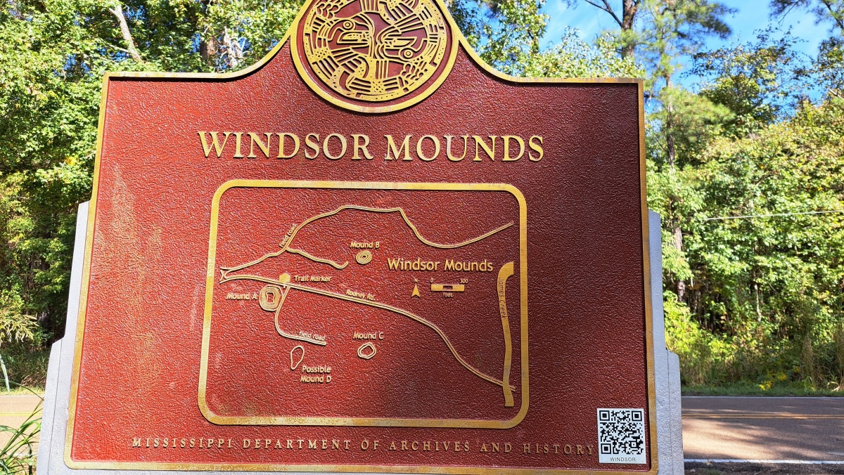
Windsor Mounds submitted by stonetracker on 19th Nov 2023. Site map
(View photo, vote or add a comment)
Log Text: This site has dedicated parking lot rather than a simple pulloff. The lot is just south of the main road and Mound A is right next to it (west of lot). Virtually drive by access when leaves are off the trees and a very short walk when they aren't.
Didn't have time to visit any of the other mounds, which are a forest hike from the lot. Next time. ;-)
Windsor Mounds
Date Added: 1st Mar 2025
Site Type: Artificial Mound
Country: United States (The South)
Visited: Yes on 1st Feb 2025. My rating: Condition 3 Ambience 5 Access 3

Windsor Mounds submitted by stonetracker on 19th Nov 2023. Mound A, the tallest. Site is very overgrown except in winter, so I had to approach closer than usual to get the shot. However it is only steps away from the parking area.
There are three other smaller mounds, all of them a hike, which I'll try on the next visit.
There was evidence uncovered of Mississippian occupation and artifacts on both Mounds A and B, plus later modern damage due to house and barn construction in the late 1700s. .
(View photo, vote or add a comment)
Log Text: Returned to this site and definitively located Mounds B and C (see photos and videos). Mound D is nearly indistinct in a large mowed field but fairly sure I found it based on earlier survey maps. D is located next to a field road several 100 yds south and east of Mound A. C is another 100-200 yds east of D, and is easily identified by its historic cemetery. Both are easy flat walks.
Mound B is a 100-200 yd bushwhack northeast of Mound A and north of Rodney Rd. Although there is no trail, it is an easy open walk in low vegetation seasons.
Windsor Mound
Date Added: 31st Oct 2023
Site Type: Artificial Mound
Country: United States (Great Lakes Midwest)
Visited: Yes. My rating: Ambience 3
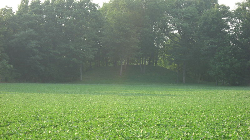
Windsor Mound submitted by bat400_photo on 15th Jul 2018. A view of Windsor Mound from a county road to the south.
"Southern side of the Windsor Mound, located off Windsor Road south of Parker City in Stoney Creek Township, Randolph County, Indiana, United States. Built by the prehistoric Adena culture, it is listed on the National Register of Historic Places."
"Date Taken on 11 July 2011"
"Source Own work"
"Author Nyttend"
"I, the copyright holder of this work, release this work into the public domain. This applies worldwide.
In...
(View photo, vote or add a comment)
Log Text: Visited in late Oct 2023. The mound is on private land (no access) in a wooded area at the rear of a cultivated field, approximately 200-300 yds north of the road. There are no parking pulloffs, but it is in a relatively unpopulated area with no traffic.
West Mounds
Date Added: 11th Mar 2024
Site Type: Artificial Mound
Country: United States (The South)
Visited: Yes on 1st Feb 2024. My rating: Condition 3 Ambience 3

West Mounds submitted by stonetracker on 11th Mar 2024. Mound A with house on top. An obvious rectangular platform mound with ramps. Unclear how much the mound was modified by the owner.
(View photo, vote or add a comment)
Log Text: Mounds A, B, and C are in reasonable shape and visible. There is no official parking pulloff or signage, but there are shoulders nearby where you can get at least partially off the road.
Mounds A and B face each other directly across the paved public road. Mound C is a few hundred yds south in a farm field near a derelict outbuilding. I parked in a grassy area near it. Mound D is not evident amongst the various farm buildings southeast of Mound A. But most experts have questioned whether it's a cultural feature.
Vieux-Moulin Alignement
Date Added: 30th Sep 2024
Site Type: Stone Row / Alignment
Country: France (Bretagne:Morbihan (56))
Visited: Yes on 1st Sep 2024. My rating: Condition 3 Ambience 4 Access 4
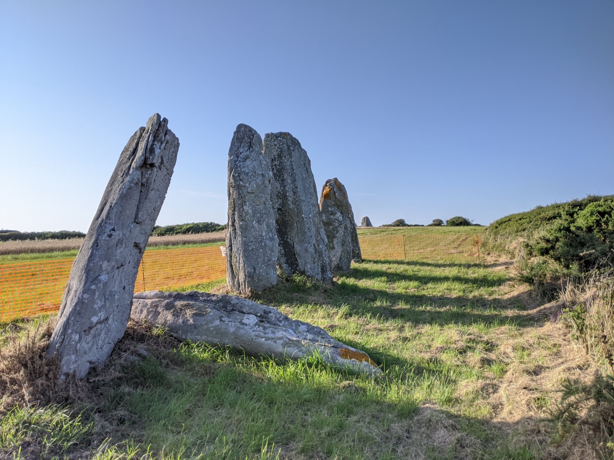
Vieux-Moulin Alignement submitted by aolson on 25th Jul 2020. As of July 2020, one of the stones seen leaning in earlier pictures has succumbed. The notice on the fencing basically states that the authorities are contemplating what to do next.
(View photo, vote or add a comment)
Log Text: I parked at the hill at Vieux Moulin Menhirs and walked on a path south maybe 200 m across a farm field to this site.
Upper Sand Island Rock Art
Date Added: 19th May 2025
Site Type: Rock Art
Country: United States (The Southwest)
Visited: Yes on 1st May 2025. My rating: Condition 3 Ambience 4 Access 3
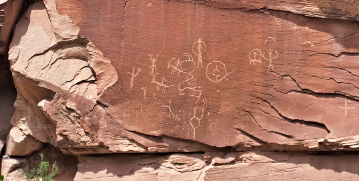
Upper Sand Island Rock Art submitted by stonetracker on 18th May 2025. One of the first panels you see along the trail. These look like typical Ancestral Pueblo or Fremont images of stick figures and bighorn sheep.
(View photo, vote or add a comment)
Log Text: A half mile's worth of intermittent ancient petroglyph panels, connected by a trail along the cliff face. To access the trailhead, take Route 191 west out of Bluff UT for approximately 4 miles. Turn left onto a gravel road with signage that indicates the Sand Island Recreational Area and boat ramp. At the bottom of the hill, take your first left onto another gravel road. This road leads 100-200 yds past the ranger buildings to a large parking lot next to a restroom. Unless you are an authorized camper, park here and walk another 200 yds east down the road to its end at the campground loop.
A trail leads from here to the cliff base and the panels. The panels are in some cases fenced off from the trail by as much as 80-100 feet to discourage defacement and further damage. Many are high up on the cliff face and much easier to see with binoculars.
Tumiac tumulus
Date Added: 28th Nov 2024
Site Type: Chambered Tomb
Country: France (Bretagne:Morbihan (56))
Visited: Yes on 1st Sep 2024. My rating: Condition 3 Ambience 3 Access 3
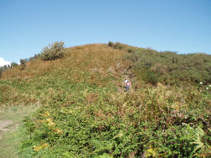
Tumiac tumulus submitted by AlexHunger on 2nd Nov 2004. Tumulus de Tumiac, otherwise known as Butte De Cesar is the first noticeable site on the southerly Presqu’ile de Rhuys, on the way to Arzon. No serious attempt has been to date this large pile of rocks, but it is largely in the state it was in 2050 years ago, when it was first mentioned. Gaius Julius Ceasar allegedly used it as a command post, from which to survey troop movements and fleets while concluding the Gallic wars but it predates his appearance by over 2,000 years. This is a somewhat ...
(View photo, vote or add a comment)
Log Text: This is another very old Carnacean tumulus covering a rather small stone burial vault at the bottom of the structure. The vault itself has been inaccessible to the public for quite some time, as was originally intended with these types of tombs.
As others have noted, access to the mound is via a several 100 m easy, maintained path from a parking layby that is easy to miss if you blink at the wrong time ;-). The same information sign is in the layby.
There is a field adjacent to the hedged path that allows clearer photography, so I approached the mound from here.
The tumulus is quite large, about 50 m in diameter by maybe 10-15 m high according to Burl, but it looked significantly longer to me. One thing I noticed in Sept 2024 is that much of the mound has been stripped of vegetation and surrounded by a modern wooden slat fence (see photos/videos). Further, the mound appears to be dug into or heavily slumped in spots. It's possible this is some kind of ongoing stabilization project, although I saw no signage to this effect.
Transylvania Mound
Date Added: 10th Mar 2025
Site Type: Artificial Mound
Country: United States (The South)
Visited: Saw from a distance on 1st Feb 2025. My rating: Condition 3 Ambience 3
submitted by on .
(View photo, vote or add a comment)
Log Text: This was originally a 12-mound site, but cultivation has completely leveled the smaller peripheral mounds. The site is now on a large private farm set well back from the road and only 5-6 mounds remain visible above the surface. The closest extant mound is about 500 ft south of LA State Highway 581 and the tallest mound is 1000 ft south of the roadway. As with many Louisiana mound sites, no dedicated parking is available so the only option is to pull off briefly on private field roads. There is one next to the interpretive sign for the site on Mound Rd. There are other field roads east and west of this location.
Tertre du Manio
Date Added: 10th Oct 2024
Site Type: Chambered Tomb
Country: France (Bretagne:Morbihan (56))
Visited: Yes on 1st Sep 2024
Tertre du Manio submitted by karolus on 9th Jan 2019. Le Manio 2 Menhir. The tumulus is much earlier than the alignments, which go right over it.
(View photo, vote or add a comment)
Log Text: I searched for this tertre at the location given and found nothing. The site is an unlikely one on a heavily wooded steep slope.
I could be wrong, but I suspect this record is in fact referring to Manio 1 (see Burl), a tertre that was overlaid later by the Kerloquet (Manio) alignments. The description here is nearly the same as that given in the Alignments of Kerloquet entry. Its coordinates are actually 47.60114, -3.05598.
Tendal Mound
Date Added: 9th Mar 2025
Site Type: Artificial Mound
Country: United States (The South)
Visited: Yes on 1st Feb 2025. My rating: Condition 3 Ambience 3 Access 5

Tendal Mound submitted by bat400 on 29th Aug 2012. Tendal Mound taken from the east side, showing how the modern house was built in the approximate center of this low platform mound.
Photo by bat400, Oct 2011.
(View photo, vote or add a comment)
Log Text: Tendal is a single rectangular platform mound site, located 50-100 ft north of US Route 80 and just west of the Tensas River. A currently occupied house was built on top of the mound and therefore the site is private. However you can park within 100 ft of it, at the corner of US Route 80 and Tendal Rd in the front lot of a currently unused commercial building. An interpretive sign is in the front yard of the residence.
Swan Lake Mounds
Date Added: 31st Oct 2023
Site Type: Artificial Mound
Country: United States (The South)
Visited: Yes. My rating: Condition 3 Ambience 3 Access 3

Swan Lake Mounds submitted by stonetracker on 31st Oct 2023. In contrast to Dr. Little's photo of Mound A, here is the same mound in Oct 2023. The mound itself is covered with vegetation and access to the mound was impossible due to heavy overgrowth surrounding it.
(View photo, vote or add a comment)
Log Text: Visited in late Oct 2023. The mounds are in the Yazoo National Wildlife Refuge, which is publicly accessible. Access roads in the refuge vary from very rough gravel (eastern side) to some paved (western side). Approaching from Foote village on the western side via the refuge road is probably the least punishing on a vehicle
Sun Point Pueblo
Date Added: 6th Aug 2025
Site Type: Ancient Village or Settlement
Country: United States (The Southwest)
Visited: Yes on 1st May 2025. My rating: Condition 3 Ambience 4 Access 4
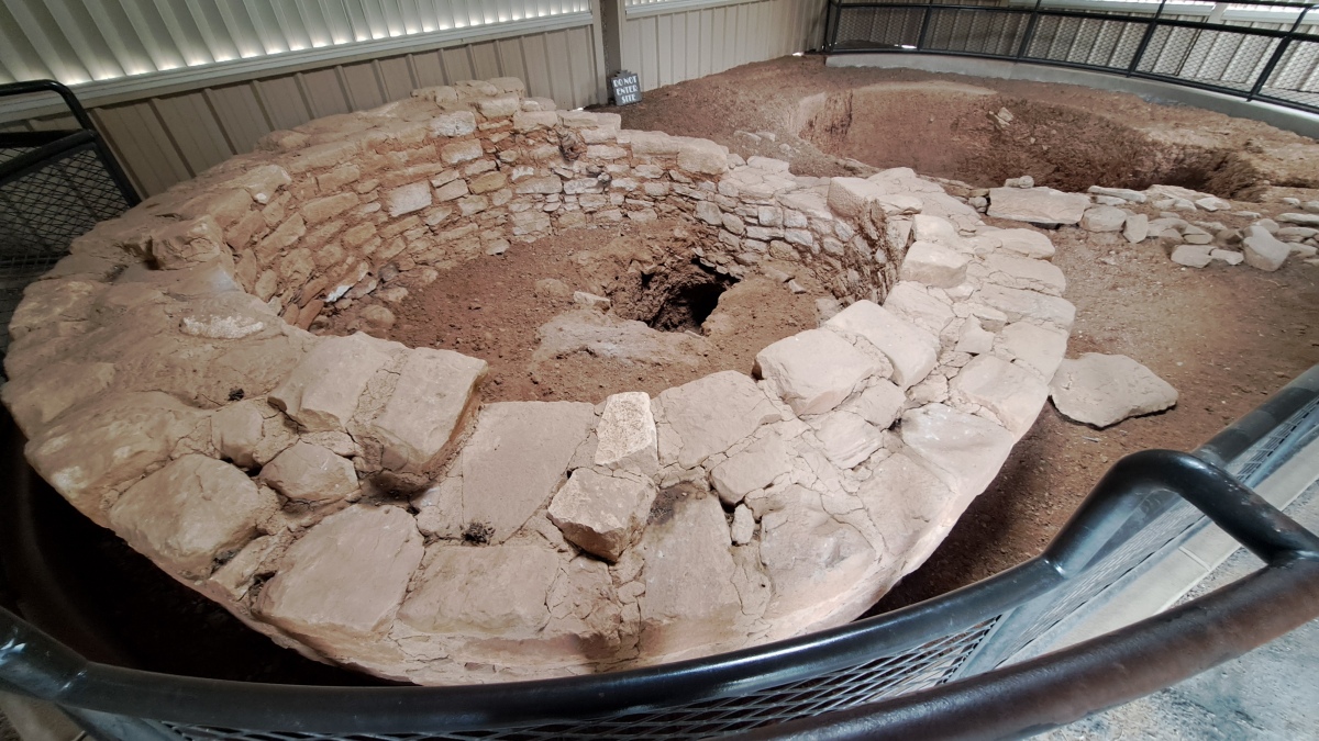
Sun Point Pueblo submitted by stonetracker on 6th Aug 2025. The tower in the foreground and the kiva behind it. Although there are varying theories, most experts feel that the hole in the floor of the tower is a tunnel connection to the kiva, purpose unknown.
(View photo, vote or add a comment)
Log Text: A late mesa-top Pueblo 2 small village site that was occupied for a short period of time before most of the inhabitants built and moved to the cliff dwellings. The remains of this site consist of a kiva and tower inside a metal shelter (for preservation). Foundations of the 30 or so room blocks surround the building.
Access is via a very short trail from a nearly parking pull-off on the Mesa Top Sites loop road.
Story Mound (Chillicothe)
Date Added: 25th Jan 2023
Site Type: Artificial Mound
Country: United States (Great Lakes Midwest)
Visited: Yes on 1st Apr 2021. My rating: Condition 4 Ambience 4 Access 5
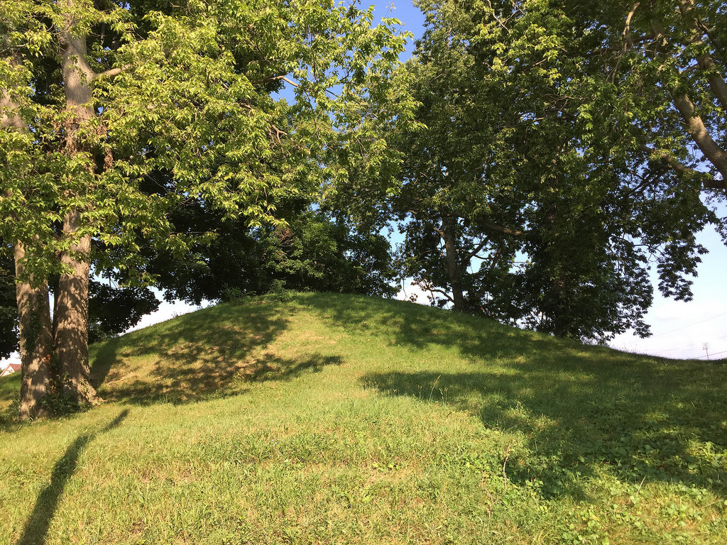
Story Mound (Chillicothe) submitted by Flickr on 29th Dec 2018. Story Mound Image copyright: Bitmapped (Brian Powell), hosted on Flickr and displayed under the terms of their API.
(View photo, vote or add a comment)
Log Text: A low chain link fence surrounds the site, preventing close access. However, the mound is easily seen from the parking area.
Stoneville Mounds
Date Added: 2nd Mar 2025
Site Type: Artificial Mound
Country: United States (The South)
Visited: Saw from a distance on 1st Feb 2025. My rating: Condition 3 Ambience 3

Stoneville Mounds submitted by stonetracker on 7th Dec 2023. Shaded relief layer of the topo showing the mound in the upper center.
(View photo, vote or add a comment)
Log Text: This Mississippian mound falls into the same category as a number of others that can only be viewed from long range, e.g. Leland, Stoneville, and Mayersville. All are privately owned and on either agricultural land or large compounds set far back from the nearest public road. Unless permission is secured by the landowner, be prepared to shoot photos or videos from several 100 ft or more away. The best viewing spot I found was about at the midpoint of Experiment Station Road which lies about 800 ft west of the mound. There are no shoulders for safe parking so I had to park on a nearby field (dirt) road and walk a short distance to a reasonable vantage point. The mound is on cultivated land and is in good condition.
St-Pierre-Quiberon Alignement
Date Added: 2nd Dec 2024
Site Type: Stone Row / Alignment
Country: France (Bretagne:Morbihan (56))
Visited: Yes on 1st Sep 2024. My rating: Condition 3 Ambience 5 Access 4
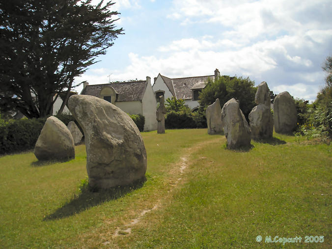
St-Pierre-Quiberon Alignement submitted by thecaptain on 12th Jun 2006. Out on the Quiberon Peninsula, near to the Kerbourgnec cromlech can be found a pleasant little park with the remains of these alignements in it.
The stones are of all shapes and sizes, up to 4 metres tall. There's a lovely curved "sharks fin" in front of me as I sat and wrote this, and a diamond to my right. These stones are wonderful, and its lovely to be able to just sit amongst them.
(View photo, vote or add a comment)
Log Text: Very picturesque site of approximately 25 stones aligned in 5 rows, in a public park in the midst of an attractive housing subdivision. It is not a long walk from the parking for the Kerbourgnec Cromlech, so I left the car there and set off north down the Rue de Cromlech. In maybe 100 meters, there is an obvious pedestrian trail on the right flanked by hedges which leads in roughly another 100 m to the park and the site.
Spirit Cave Ruins
Date Added: 19th Jun 2025
Site Type: Ancient Village or Settlement
Country: United States (The Southwest)
Visited: Yes on 1st May 2025. My rating: Condition 3 Ambience 5 Access 2
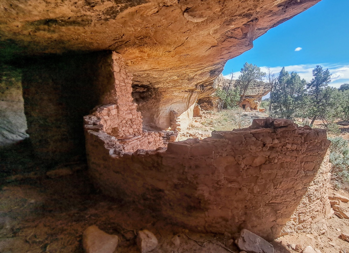
Spirit Cave Ruins submitted by stonetracker on 19th Jun 2025. Rear of the circular kiva wall looking out the alcove
(View photo, vote or add a comment)
Log Text: As is the case with Five Kiva Ruin nearby, you can either view the site from an overlook or take a roundabout "trail" around the lip of the top of the canyon and scramble down some ledges to the canyon floor. The ruins are a short walk from and at the same level as the canyon floor.
To get to the parking area from Blanding, head south on US-191 for 4 miles and turn west onto UT-95 toward Natural Bridges National Monument. From the US-191/UT-95 intersection, aka Shirttail Junction, measure 1.7 miles and turn right onto unpaved San Juan County Road 288 aka Warren Allen Rd. This road may not be marked with a sign!
Continue on CR 288 for 0.4 miles and turn right at the first road junction. From here the road gets a little rougher. Careful drivers in passenger vehicles might have little or no trouble but if in doubt there is a parking pulloff to the left at this intersection. Drive (or walk) another 0.3 mile to a large cleared area on the right. Park here. The coordinates for this spot are 37.58524, -109.51625.
Walk down the hill east to a big semicircular ledge. The alcove containing the ruins is under this bench. To view it remotely, simply walk to the right along the lip of the canyon about 100-200 yds and the ruins will come into view down inside the alcove on the left.
I chose to hike to the canyon floor and access the alcove and ruins at close range. There is no official trail to the canyon floor but a network of social paths that I would call easy to moderate. Walk to the left about 200-300 yds and follow the canyon lip around to the east. Take the easiest way down that you can find. There may be a small amount of scrambling needed around rocks but it is a very short descent to the bottom. At the canyon bottom, turn right and head west about 200 yds towards the alcove and the ruins.
Smith Creek Mounds
Date Added: 7th Mar 2025
Site Type: Artificial Mound
Country: United States (The South)
Visited: Yes on 1st Feb 2025. My rating: Condition 3 Ambience 3

Frogmore Mound submitted by AKFisher on 1st Aug 2023. The site of a series of ancient Native American earthworks (dating to 700-1200 AD)
Photo courtesy Dr Greg Little, author of the Illustrated Encyclopedia of Native American Indian Mounds & Earthworks (2016).
(View photo, vote or add a comment)
Log Text: This was somewhat disappointing for what is a pretty interesting mound complex. All of the mounds are on private property although you can get very close to Mound A as it's literally right next to the highway. There's not much of a shoulder but you can pull mostly off the road next to that mound. The other two mounds are across the road on a property filled with vehicles and a home. I was greeted by a pack of barking dogs when I pulled in but apparently the owner brought them inside and they calmed down enough that I could walk around a bit.
All of the mounds are completely overgrown and hard to photograph, even in late winter. The location coordinates given for Mound A are in fact correct, but Google Streetview won't show much because of overgrowth. I tried to capture an image of it myself with mixed results. Mound B is a little clearer, but only remote viewing is possible unless you get permission. Mound C is much reduced by erosion and too far away to get a decent image.
Short Woods Park Mound
Date Added: 19th Feb 2023
Site Type: Artificial Mound
Country: United States (Great Lakes Midwest)
Visited: Yes on 1st Oct 2021. My rating: Condition 3 Ambience 3 Access 2
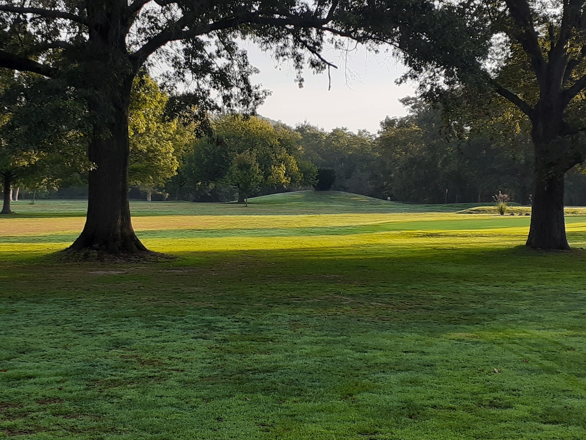
Short Woods Park Mound submitted by stonetracker on 19th Feb 2023. View of mound in distance from Fernbank Ave.
(View photo, vote or add a comment)
Log Text: Publicly viewable at a distance of 200-300 yds from residential roads, as the mound itself is on a private golf course.
Shiloh Indian Mounds
Date Added: 9th Apr 2024
Site Type: Ancient Village or Settlement
Country: United States (The South)
Visited: Yes on 1st Apr 2024. My rating: Condition 4 Ambience 5 Access 4
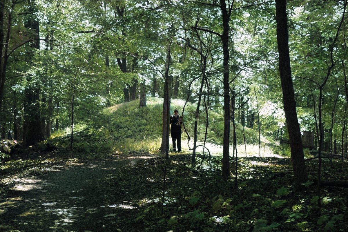
Shiloh Indian Mounds submitted by AKFisher on 2nd Aug 2023. Burial mound at the Shiloh, Tennessee mound complex & village area. The complex is dated to AD 1200.
Photo courtesy Dr Greg Little, author of the Illustrated Encyclopedia of Native American Indian Mounds & Earthworks (2016).
(View photo, vote or add a comment)
Log Text: The mound site is very compact and easily accessible along a National Park Service road or via a foot trail. Park at either the Shiloh Indian Mounds Visitor Kiosk or in a paved pullout area next to Mound F. The latter is the closest to the mound and plaza complex itself and most of the mounds are within a several hundred yard radius.
