


<< Our Photo Pages >> Short Woods Park Mound - Artificial Mound in United States in Great Lakes Midwest
Submitted by stonetracker on Sunday, 19 February 2023 Page Views: 434
Multi-periodSite Name: Short Woods Park MoundCountry: United States Region: Great Lakes Midwest Type: Artificial Mound
Nearest Town: Sayler Park OH
Latitude: 39.121380N Longitude: 84.69499W
Condition:
| 5 | Perfect |
| 4 | Almost Perfect |
| 3 | Reasonable but with some damage |
| 2 | Ruined but still recognisable as an ancient site |
| 1 | Pretty much destroyed, possibly visible as crop marks |
| 0 | No data. |
| -1 | Completely destroyed |
| 5 | Superb |
| 4 | Good |
| 3 | Ordinary |
| 2 | Not Good |
| 1 | Awful |
| 0 | No data. |
| 5 | Can be driven to, probably with disabled access |
| 4 | Short walk on a footpath |
| 3 | Requiring a bit more of a walk |
| 2 | A long walk |
| 1 | In the middle of nowhere, a nightmare to find |
| 0 | No data. |
| 5 | co-ordinates taken by GPS or official recorded co-ordinates |
| 4 | co-ordinates scaled from a detailed map |
| 3 | co-ordinates scaled from a bad map |
| 2 | co-ordinates of the nearest village |
| 1 | co-ordinates of the nearest town |
| 0 | no data |
Internal Links:
External Links:
I have visited· I would like to visit
stonetracker visited on 1st Oct 2021 - their rating: Cond: 3 Amb: 3 Access: 2 Publicly viewable at a distance of 200-300 yds from residential roads, as the mound itself is on a private golf course.
")
The Short Woods Park Mound is believed to have been built by people of the Adena culture. Measuring 38 feet (12 m) high, the mound is an ellipse, approximately 175 feet (53 m) long and 140 feet (43 m) wide.
The mound was excavated by the Cincinnati Museum of Natural History and Science, date unclear. Among the many artifacts recovered were grave goods and thirty-nine skeletons that were buried in log tombs. According to radiocarbon dating, the individuals buried in the mound lived approximately 2,000 years BP.
Location coordinates are for the mound summit. However the mound itself is on a private golf course and only viewable from 200-300 yds away. The closest public vantage point is the jct of Dahlia and Home City Aves. On-street parking is available. Another farther viewing point is from Fernbank Ave.
You may be viewing yesterday's version of this page. To see the most up to date information please register for a free account.
")
Do not use the above information on other web sites or publications without permission of the contributor.
Nearby Images from Flickr


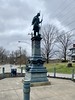


The above images may not be of the site on this page, but were taken nearby. They are loaded from Flickr so please click on them for image credits.
Click here to see more info for this site
Nearby sites
Click here to view sites on an interactive map of the areaKey: Red: member's photo, Blue: 3rd party photo, Yellow: other image, Green: no photo - please go there and take one, Grey: site destroyed
Download sites to:
KML (Google Earth)
GPX (GPS waypoints)
CSV (Garmin/Navman)
CSV (Excel)
To unlock full downloads you need to sign up as a Contributory Member. Otherwise downloads are limited to 50 sites.
Turn off the page maps and other distractions
Nearby sites listing. In the following links * = Image available
694m SE 135° Sayler Story Mound* Artificial Mound
7.2km WNW 294° Conrad Mound* Artificial Mound
9.9km W 269° Miami Fort* Misc. Earthwork
12.0km W 262° Jennison Guard Ancient Village or Settlement
19.6km WSW 238° River View Cemetery Mounds* Artificial Mound
19.6km N 10° Dunlap Works* Artificial Mound
22.1km ENE 76° Norwood Mound* Artificial Mound
24.9km ENE 71° Benham Mound* Artificial Mound
26.8km NE 54° Mathew Mound* Artificial Mound
28.3km NNE 18° Fortified Hill Works* Hillfort
29.3km E 89° Odd Fellows' Cemetery Mound* Artificial Mound
34.9km N 349° Reily Cemetery Mound* Artificial Mound
35.5km N 350° Enyart Mound* Artificial Mound
35.9km E 80° Millford Earthworks Circle Diverging Lines* Hill Figure or Geoglyph
37.3km NNE 28° Rentschler Park Hilltop Enclosure* Hillfort
60.9km ENE 58° Fort Ancient - Moorehead Circle* Timber Circle
61.0km ENE 58° Fort Ancient* Hillfort
66.7km NNE 32° Miamisburg Mound* Artificial Mound
75.2km ENE 60° Hillside Haven Mound* Artificial Mound
76.0km E 90° Fort Salem Misc. Earthwork
77.2km NNE 31° Sunwatch* Ancient Village or Settlement
79.6km NNE 32° Calvary Cemetery Hilltop Enclosure* Hillfort
84.7km NE 56° Keiter Mound* Artificial Mound
85.8km ENE 76° Ratcliffe Mound Artificial Mound
89.1km NNW 333° Cambridge City Henge Complex* Henge
View more nearby sites and additional images


 We would like to know more about this location. Please feel free to add a brief description and any relevant information in your own language.
 Wir möchten mehr über diese Stätte erfahren. Bitte zögern Sie nicht, eine kurze Beschreibung und relevante Informationen in Deutsch hinzuzufügen.
 Nous aimerions en savoir encore un peu sur les lieux. S'il vous plaît n'hesitez pas à ajouter une courte description et tous les renseignements pertinents dans votre propre langue.
 Quisieramos informarnos un poco más de las lugares. No dude en añadir una breve descripción y otros datos relevantes en su propio idioma.