Contributory members are able to log private notes and comments about each site
Sites Stonetracker has logged. View this log as a table or view the most recent logs from everyone
Mané-Groh Dolmen
Date Added: 9th Dec 2024
Site Type: Burial Chamber or Dolmen
Country: France (Bretagne:Morbihan (56))
Visited: Yes on 1st Sep 2024. My rating: Condition 3 Ambience 4 Access 4
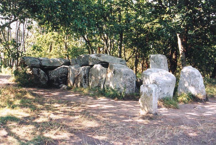
Mané-Groh dolmen submitted by JJ on 9th Nov 2002. Mané-Groh dolmen
(View photo, vote or add a comment)
Log Text: This passage grave is along the same road as the Crucuno Dolmen and about 1.5 km NE of the latter. There is a good sized parking area directly across the street from the site. From there it's a quick walk across the street and up a short 10 m path and there you are.
Currently there is a low rope fence around the dolmen and tumulus and, although there are no signs saying "Access Interdit," it's implied that visitors should tread carefully when approaching the dolmen.
Bynum
Date Added: 7th Dec 2024
Site Type: Barrow Cemetery
Country: United States (The South)
Visited: Yes on 1st Dec 2024. My rating: Condition 3 Ambience 4 Access 4
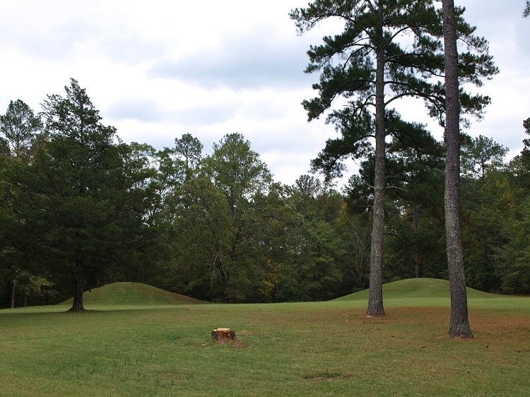
Bynum submitted by bat400 on 6th Sep 2012. Bynum Mounds and Village site. There were originally six burial mounds (the smaller ones much eroded by the plow.) All six were fully excavated and the two largest mounds were reconstructed .
Photo by bat400, Oct 2011.
(View photo, vote or add a comment)
Log Text: Bynum is one of a half dozen or so mound sites spread out along the Natchez Trace, an ancient animal, Native American, and Euro American trail (now a highway) that traverses much of the state of Mississippi and parts of Alabama and Tennessee. The Trace is managed by the National Park Service. Commercial and residential development is prohibited within roughly several hundred yards east and west of the route, resulting in a forever wild strip of land that runs for over 300 miles through the Deep South part of the US.
Access to Bynum is via a short circular driveway that runs to the east at about mile marker 232.4 of the Trace. The two remaining mounds are easily viewed at a distance from the parking area, but I believe a paved walkway gets very close to the mounds. So it's accessible to the mobility impaired. .
Owl Creek
Date Added: 7th Dec 2024
Site Type: Artificial Mound
Country: United States (The South)
Visited: Yes on 1st Dec 2024. My rating: Condition 3 Ambience 4 Access 5
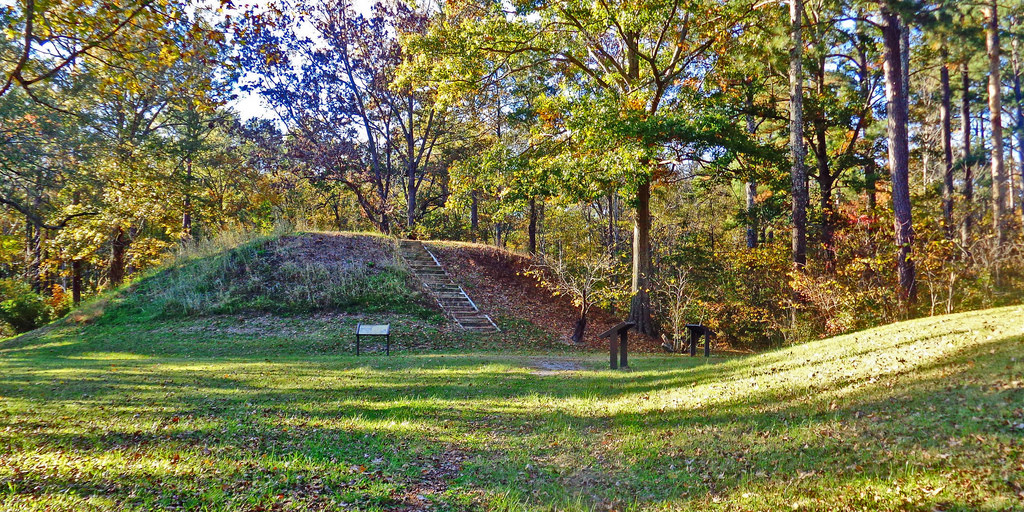
Owl Creek submitted by Creative Commons on 6th Jan 2019. Owl Creek Mounds The five Mississippian period platform mounds at this site were built between 1100 and 1200 A.D. The U.S. Forest Service owns two of the mounds including the largest 17-foot-high Mound I. Both are open to public visitation. Archeological excavations conducted at the site in 1991-1992 by Mississippi State University revealed the foundation remains of a ceremonial temple or elite residence that once stood atop Mound
www.nps.gov/nr/travel/mounds/owl.htm ...
(View photo, vote or add a comment)
Log Text: Site is as described. The portion managed by the Forest Service contains two extant mounds, including Mound 1 the largest in the group. Mound 1 is pretty close to its original rectangular platform shape. The adjacent Mound 2 looks like it has been damaged by plowing but still quite visible. I was unable to find any obvious evidence of the remaining 3 mounds across the street.
There is a parking lot right next to Mound 2 and Mound 1 is a very short distance away.
Petit Mont
Date Added: 2nd Dec 2024
Site Type: Chambered Tomb
Country: France (Bretagne:Morbihan (56))
Visited: Yes on 1st Sep 2024. My rating: Condition 3 Ambience 4 Access 3
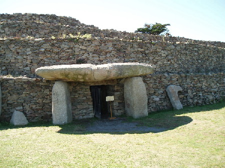
Petit Mont submitted by AlexHunger on 20th Dec 2004. Petit Mont in Arzon, dating to about 4600 BCE at the earliest, is one of the most significant Cairns in Britany, but unfortunately one of the most brutaly vandalized. In 1942, German troops built a bunker and Flak emplacement into the South East Corner of the cairn, which compeltely destroyed one of the chambers and caused the collapse of the second one pictured above, which has since been restored. The megalithic entrance is sought to be an addition from Gallo-Roman times. All pictures have be...
(View photo, vote or add a comment)
Log Text: An important Neolithic site with two extant passage graves in good condition and a large surrounding cairn. It has a complex construction and restoration history, and has suffered much use and abuse (particularly in WW2) over the millennia.
Entrance is via paid admission and guided tours are available in season but I was informed that they are only offered in French at the moment. However, unlike Gavrinis, I was allowed unescorted and unimpeded access to the bunker museum, the grounds, and the interior of both passage graves.
Parking and getting to the site was a little tricky, as construction was going on in the parking lot and there was no obvious signage pointing the way to the site from there. But there is a 300m trail in the back of the lot that leads to the ticket office and information kiosk. The parking area is located at the end of the Rue du Petit Mont.
Kerbourgnec Alignements
Date Added: 2nd Dec 2024
Site Type: Stone Row / Alignment
Country: France (Bretagne:Morbihan (56))
Visited: Yes on 1st Sep 2024. My rating: Ambience 5 Access 3

Kerbourgnec Alignements submitted by thecaptain on 12th Jun 2006. There seemed to me to be several very clear lines of rocks stretching out into the sea in parallel rows. I believe I could see at least seven rows of rocks from where I sat on the bottom of the steps down to the beach.
Fantastic!
(View photo, vote or add a comment)
Log Text: The beach where these sea-based rows were located is a short walk down an alley directly east from the St. Pierre Quiberon alignments.
Alas, timing is everything and the tide was simply too high to spot much, but the beach is very scenic. I've seen aerial views that certainly suggest there are multiple rows extending out into the ocean, plus they've been confirmed by sonar and other studies.
St-Pierre-Quiberon Alignement
Date Added: 2nd Dec 2024
Site Type: Stone Row / Alignment
Country: France (Bretagne:Morbihan (56))
Visited: Yes on 1st Sep 2024. My rating: Condition 3 Ambience 5 Access 4
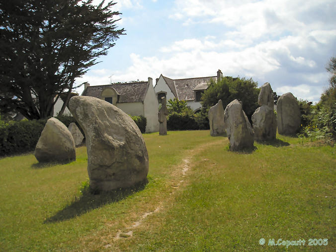
St-Pierre-Quiberon Alignement submitted by thecaptain on 12th Jun 2006. Out on the Quiberon Peninsula, near to the Kerbourgnec cromlech can be found a pleasant little park with the remains of these alignements in it.
The stones are of all shapes and sizes, up to 4 metres tall. There's a lovely curved "sharks fin" in front of me as I sat and wrote this, and a diamond to my right. These stones are wonderful, and its lovely to be able to just sit amongst them.
(View photo, vote or add a comment)
Log Text: Very picturesque site of approximately 25 stones aligned in 5 rows, in a public park in the midst of an attractive housing subdivision. It is not a long walk from the parking for the Kerbourgnec Cromlech, so I left the car there and set off north down the Rue de Cromlech. In maybe 100 meters, there is an obvious pedestrian trail on the right flanked by hedges which leads in roughly another 100 m to the park and the site.
Kerbougnec Cromlech
Date Added: 1st Dec 2024
Site Type: Stone Circle
Country: France (Bretagne:Morbihan (56))
Visited: Yes on 1st Sep 2024. My rating: Condition 3 Ambience 4 Access 5
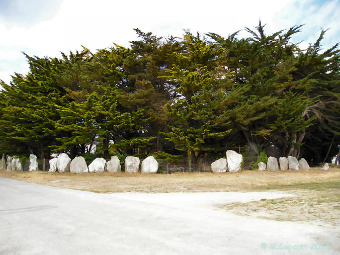
Kerbougnec Cromlech submitted by thecaptain on 12th Jun 2006. Found in amongst the houses of St-Pierre-Quiberon, this is nowadays a large semi circle of about 40 contiguous stones, average height about 1.8 metres.
(View photo, vote or add a comment)
Log Text: This cromlech is now an arc of about 40 large closely spaced standing stones that possibly was much larger once upon a time. However, the entire site is smack in the middle of the densely housed village of Kerbourgnec on the Quiberon Peninsula, so undoubtedly that has taken a toll on the original site.
Parking for me at least was a breeze, as empty spaces were available on Rue de Cromlech right next to the site. For the mobility impaired, this site can probably be viewed without having to leave the vehicle. The site itself is in a small public park.
Bilgroix allée couverte
Date Added: 28th Nov 2024
Site Type: Passage Grave
Country: France (Bretagne:Morbihan (56))
Visited: Yes on 1st Sep 2024. My rating: Condition 3 Ambience 4 Access 5

Bilgroix allée couverte submitted by dt44 on 21st Mar 2010.
(View photo, vote or add a comment)
Log Text: This is an allee couverte just to the northwest of Arzon and close to the end of Boulevard de Bilgroix. It is in a small park nestled among local residences. You could probably park right next to it on the street (an option for mobility-impaired visitors), but I chose to park about 100 m farther in a big lot at the point and make the easy walk back to the site.
Tumiac tumulus
Date Added: 28th Nov 2024
Site Type: Chambered Tomb
Country: France (Bretagne:Morbihan (56))
Visited: Yes on 1st Sep 2024. My rating: Condition 3 Ambience 3 Access 3
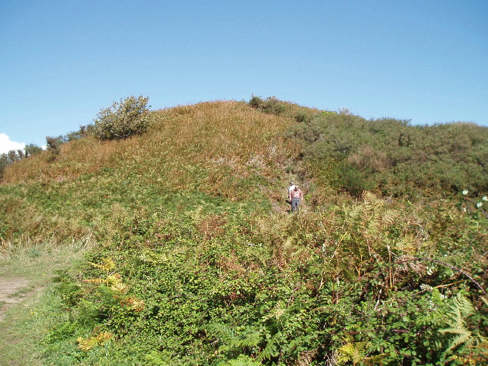
Tumiac tumulus submitted by AlexHunger on 2nd Nov 2004. Tumulus de Tumiac, otherwise known as Butte De Cesar is the first noticeable site on the southerly Presqu’ile de Rhuys, on the way to Arzon. No serious attempt has been to date this large pile of rocks, but it is largely in the state it was in 2050 years ago, when it was first mentioned. Gaius Julius Ceasar allegedly used it as a command post, from which to survey troop movements and fleets while concluding the Gallic wars but it predates his appearance by over 2,000 years. This is a somewhat ...
(View photo, vote or add a comment)
Log Text: This is another very old Carnacean tumulus covering a rather small stone burial vault at the bottom of the structure. The vault itself has been inaccessible to the public for quite some time, as was originally intended with these types of tombs.
As others have noted, access to the mound is via a several 100 m easy, maintained path from a parking layby that is easy to miss if you blink at the wrong time ;-). The same information sign is in the layby.
There is a field adjacent to the hedged path that allows clearer photography, so I approached the mound from here.
The tumulus is quite large, about 50 m in diameter by maybe 10-15 m high according to Burl, but it looked significantly longer to me. One thing I noticed in Sept 2024 is that much of the mound has been stripped of vegetation and surrounded by a modern wooden slat fence (see photos/videos). Further, the mound appears to be dug into or heavily slumped in spots. It's possible this is some kind of ongoing stabilization project, although I saw no signage to this effect.
Gavrinis Cairn
Date Added: 24th Nov 2024
Site Type: Chambered Cairn
Country: France (Bretagne:Morbihan (56))
Visited: Yes on 1st Sep 2024. My rating: Condition 4 Ambience 4 Access 4
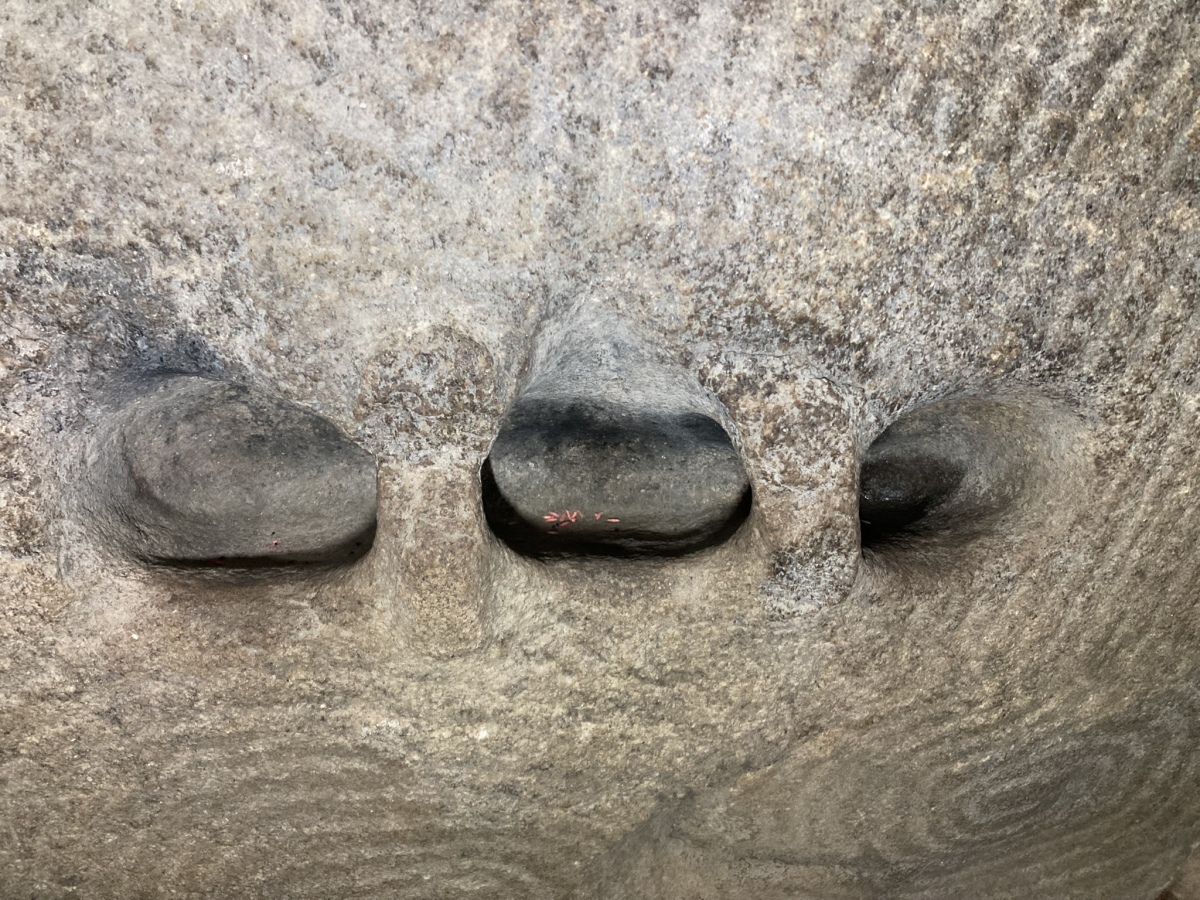
Gavrinis Cairn submitted by markj99 on 26th Sep 2023. Carved recesses in a carved stone in the chamber of Cairn de Gavrinis viewed from South-East.
(View photo, vote or add a comment)
Log Text: This is probably the most famous and best preserved decorated Neolithic passage grave in Europe. Not much to add regarding visit details that others have not already mentioned. The site is only accessible via boat and a guided tour. Boats leave regularly during the summer and early fall months from various port around the Gulf. I happened to embark from Larmor Baden and there is a large free parking lot next to the ticket office. The boat ride to the island is about 15 minutes. From the dock on the island, it's a brief climb up the hill to a small visitors center where a less brief lecture is given by the guide, primarily in French, although I was able to ask a few questions in English. From there, the small group walked around the cairn and was allowed 5-10 minutes to view the passage and chamber. Photography is allowed, but be prepared to work fast !
Mané-er-Hroëck tumulus
Date Added: 22nd Nov 2024
Site Type: Chambered Tomb
Country: France (Bretagne:Morbihan (56))
Visited: Yes on 1st Sep 2024. My rating: Condition 3 Ambience 4 Access 4
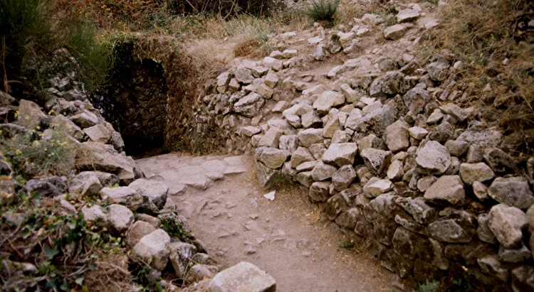
Mané-er-Hroëck tumulus submitted by greywether on 30th Jun 2005. The modern entrance to this underground chamber.
(View photo, vote or add a comment)
Log Text: This is one of the large Carnacean tumuli (see St Michel Tumulus and Tumiac for similar structures). Like Tumiac, the mound covers a rather modest stone burial vault which was originally covered, never meant to be re-opened. Except that it was, in the 20th century, when a stone passage and stairway were added to access the vault.
Unfortunately, official state notice was posted at the vault stairway in February or March of 2024 that access into the passage is now "interdit" (forbidden) due to safety concerns and potential rock slides. It is not roped off, but you now enter at your own risk, legal and otherwise. I didn't bother ;-). There is little to see other than the tumulus itself, which is impressive, and at least one menhir a short distance away from the mound on the side opposite the entrance.
There is a parking pulloff very close to a signposted trail head which leads in about 100 m to the tumulus. The entrance is a few more meters to the right beyond an information sign.
Menhirs de Mané er Hroëck
Date Added: 22nd Nov 2024
Site Type: Standing Stone (Menhir)
Country: France (Bretagne:Morbihan (56))
Visited: Yes on 1st Sep 2024. My rating: Condition 3 Ambience 4 Access 4

Menhirs de Mané er Hroëck submitted by regina on 17th Nov 2014. Standing menhir
(View photo, vote or add a comment)
Log Text: I looked for the two menhirs described in the text and at the location given. Didn't definitively find either of them. However I did find a standing (actually leaning) menhir about 60 mtrs south of the location that didn't really look the same as the original photo (see my photo). The whole site looks quite different now with extensive lawn mowing and clearing of the grounds, so it's still possible that it's the original standing menhir with a lot of the overgrowth removed.
Pierres Plates (Locmariaquer)
Date Added: 20th Nov 2024
Site Type: Burial Chamber or Dolmen
Country: France (Bretagne:Morbihan (56))
Visited: Yes on 1st Sep 2024. My rating: Condition 3 Ambience 4 Access 4
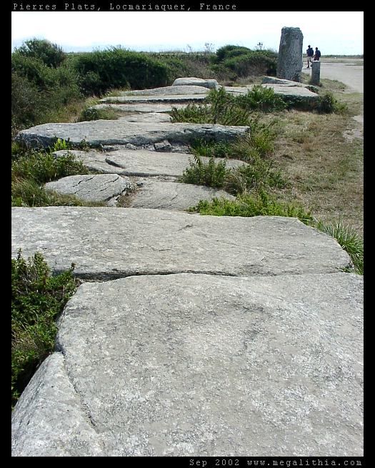
Pierres Plates (Locmariaquer) submitted by ermine on 27th Jun 2004. Les Pierres Plates
(View photo, vote or add a comment)
Log Text: This is an allee coudee (angled passage grave) with a number of unique decorated stones. It sits on a bluff overlooking the sea, which becomes an extensive shellfish flat when the tide goes out.
Sadly, nothing much has changed regarding interior access. A low rope and sign discourage interior access to the passage and chamber, although they don't outright forbid it. Moreover, this is a very popular beach and there are always people milling around even during the off season. Had there been less "people presence", I might have been tempted to sneak inside, but I behaved myself.
Parking is at a beach lot maybe 200-300 yds away. A trail leads from there to the bluff edge, and it is a short walk to the right to the site.
Menhir La Motte de Beurre
Date Added: 19th Nov 2024
Site Type: Standing Stone (Menhir)
Country: France (Bretagne:Morbihan (56))
Visited: Yes on 1st Sep 2024. My rating: Condition 3 Ambience 3 Access 3
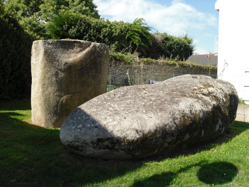
Menhir La Motte de Beurre submitted by regina on 12th Nov 2014. Site in Bretagne:Morbihan (56) France
(View photo, vote or add a comment)
Log Text: Parking is problematic as the menhir is located in a small park squeezed in between two houses in a densely packed residential alley. My solution was to park farther south where the alley widens to a real street near the Chapelle St Michel with on-street spaces. It is not a long walk from there to either Mane Rethuel Dolmen or the menhir.
The menhir is broken with the base still in the ground and the other half recumbent. It was originally 7.4 m in length, including the part below ground level. One face of the base has engravings but they are darkened with age and hard to see.
Mane-Rethuel Dolmen
Date Added: 18th Nov 2024
Site Type: Burial Chamber or Dolmen
Country: France (Bretagne:Morbihan (56))
Visited: Yes on 1st Sep 2024. My rating: Condition 3 Ambience 3 Access 3

Mane-Rethuel dolmen submitted by AlexHunger on 21st Sep 2004. Dolmen de Mane-Rithual in central Locmariaquer viewed from North. Entrance is at oposite end.
(View photo, vote or add a comment)
Log Text: This site is accessible via a short signposted trail west off of the Ruelle du Bronzo. The bigger challenge is finding a spot to park as the street (more like an alley) is densely residential and narrow with very limited parking. If you proceed farther south on the same road, the street widens with more parking spaces near the Chapelle Saint Michel. I parked here and walked back along the alley to the signposted trail (and later to visit the Motte de Beurre site nearby)
Unfortunately, as others have noted, the passage grave is fenced off for safety reasons and can only be viewed from the outside. It is not clear if or when the interior will be stabilized sufficiently to re-open the site.
Grand Menhir Brisé
Date Added: 17th Nov 2024
Site Type: Standing Stone (Menhir)
Country: France (Bretagne:Morbihan (56))
Visited: Yes on 1st Sep 2024. My rating: Condition 3 Ambience 4 Access 4
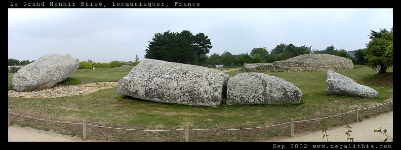
Grand Menhir Brisé submitted by ermine on 27th Jun 2004. Grand Menhir Brisé, Locmariaquer.
A megalithic tragedy.
(View photo, vote or add a comment)
Log Text: The 4 broken sections of this massive menhir are lying on the ground very close to the Table des Marchands cairn. Access is via a short walking trail from the visitor's center (paid admission). The presumed socket holes of the 19 standing stones are laid out in a line of discrete gravel patches pointing towards the Er -Grah tumulus.
La Table des Marchands
Date Added: 14th Nov 2024
Site Type: Burial Chamber or Dolmen
Country: France (Bretagne:Morbihan (56))
Visited: Yes on 1st Sep 2024. My rating: Condition 4 Ambience 5 Access 4
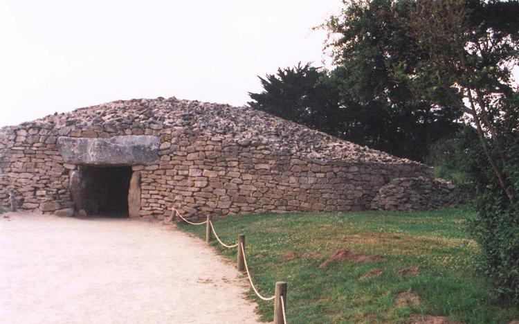
La Table des Marchands submitted by JJ on 9th Nov 2002. La Table des Marchands
(View photo, vote or add a comment)
Log Text: One of a triad of megalithic sites, all accessible via the Site des Megalithes Visitor Centre in Locmariaquer for a small admission fee. Like the Er-Grah Tumulus, parts of this passage grave were nearly buried or damaged but completely restored in the 1990s to what is thought to be its original appearance. Unlike Er-Grah, the passage and end chamber are open to the public and illuminated. Certain of the chamber pillars and capstone are covered with well preserved artwork.
Er-Grah tumulus
Date Added: 13th Nov 2024
Site Type: Chambered Tomb
Country: France (Bretagne:Morbihan (56))
Visited: Yes on 1st Sep 2024. My rating: Condition 3 Ambience 4 Access 4
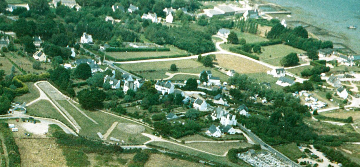
Er-Grah tumulus submitted by JJ on 8th Oct 2003. Er Grah tumulus, Grand Menhir Brisé, and La Table des Marchands, Locmariaquer.
Aerial photo copyright JJ Evendon
(View photo, vote or add a comment)
Log Text: Er-Grah Tumulus is one of a triad of major Neolithic sites in Locmariaquer, all accessed via a visitor's center/museum for a small admission fee (although on the day I visited, the entry fee was waived for some reason). Plenty of parking is available in an adjacent gravel lot. The original burial vault and tumulus were built very gradually in several stages over the course of the 5th millenium BCE. It was subjected to significant and often harsh damage over the centuries since and what you see today is a complete modern restoration. Wide gravel paths flank the tumulus closely, but the cairn and vault are off-limits and not accessible.
Mane Lud Dolmen
Date Added: 17th Oct 2024
Site Type: Chambered Cairn
Country: France (Bretagne:Morbihan (56))
Visited: Yes on 1st Sep 2024. My rating: Condition 3 Ambience 5 Access 4
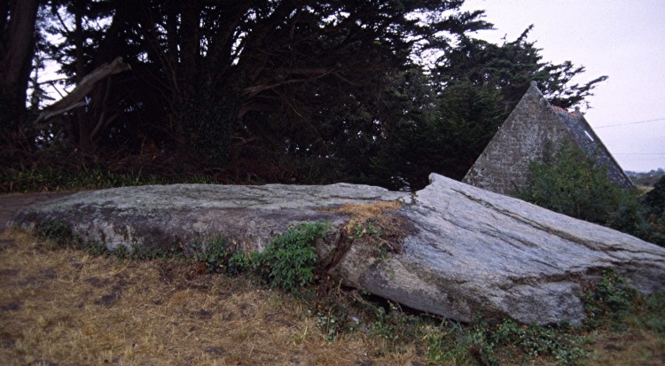
Mane Lud dolmen submitted by greywether on 30th Jun 2005. The massive broken granite capstone over the chamber (8.5 x 4.9m).
(View photo, vote or add a comment)
Log Text: This is currently one of the few passage graves/dolmens in the Locmariaquer area that you can get inside... at least legally. Several others have been fenced off and posted with official government warning signs urging visitors to keep out for safety reasons and view from a distance.
As for access, I parked at a public layby and lot located at 47.57362, -2.95311 off the Voie des Megalithes and walked a signposted dirt trail about 200 m east to what looks like a private paved driveway. Turn left here and walk a few more meters east on the driveway. The large knoll to the right is the tumulus. Walk up the hill and the huge chamber capstone should appear shortly, next to a Camping Interdit sign.
Le Petit Ménec
Date Added: 17th Oct 2024
Site Type: Multiple Stone Rows / Avenue
Country: France (Bretagne:Morbihan (56))
Visited: Yes on 1st Sep 2024. My rating: Condition 3 Ambience 5 Access 3
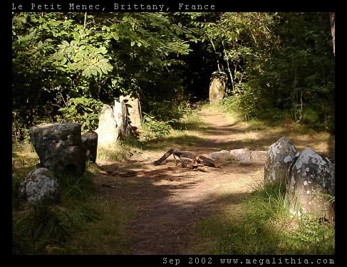
Le Petit Ménec submitted by ermine on 6th Aug 2004. Confusingly, Petit-Menéc is in fact at the opposite, eastern end of the alignments to le Menéc village at the western end. You need to turn left onto the D186 main road after continuing from Kerlescan. After about 250m turn right into a minor road going past a forest, there is a clearing where you can park after about 400m. The menhirs are in the forest on your right, arranged in a gentle curve. You don't get the same clear overview of the alignments since the view is obscured by the trees, bu...
(View photo, vote or add a comment)
Log Text: Could be my favorite stone alignment site in the Carnac area, as it is secluded in a forest and not on the heavily traveled tourist track. Serene atmosphere for sure.
This is also one of the few major alignment sites that is still unfenced and you can walk freely anywhere. Much like Kerzerho.
Directions to the site are as described.
