Contributory members are able to log private notes and comments about each site
Sites Stonetracker has logged. View this log as a table or view the most recent logs from everyone
Dunn Mounds
Date Added: 12th Mar 2024
Site Type: Artificial Mound
Country: United States (The South)
Visited: Saw from a distance on 1st Feb 2024. My rating: Condition 3 Ambience 3
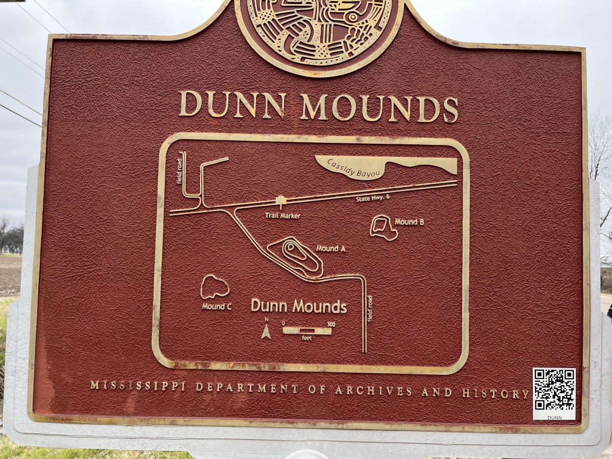
Dunn Mounds submitted by AKFisher on 10th Aug 2023. Dunn Mounds historical marker on site.
Photo courtesy Dr Greg Little, author of the Illustrated Encyclopedia of Native American Indian Mounds & Earthworks (2016).
(View photo, vote or add a comment)
Log Text: All of the mounds are on private residential property and farm land, so viewing is only possible from a distance. There is a parking pulloff next to the interpretive sign about 200 yds north of Mound A and considerably farther away from the other mounds.
Mound A is easily visible although quite overgrown, even in winter. A house sits on a very low rise which is presumably Mound B. I was unable to locate Mound C in the farm field.
Dominguez Pueblo
Date Added: 10th May 2025
Site Type: Ancient Village or Settlement
Country: United States (The Southwest)
Visited: Yes on 1st Apr 2025. My rating: Condition 2 Ambience 3 Access 4

Dominguez Pueblo submitted by stonetracker on 7th May 2025. Remains of the four rooms of the unit pueblo
(View photo, vote or add a comment)
Log Text: The ruin is right next to the Canyons of the Ancients Visitor Center/Museum and just steps away from the parking lot and building. I believe wheelchair access is possible from the sidewalk about 50 ft from the site.
Dixon Mound
Date Added: 6th Feb 2023
Site Type: Artificial Mound
Country: United States (Great Lakes Midwest)
Visited: Yes on 1st Apr 2022. My rating: Condition 4 Ambience 4 Access 4
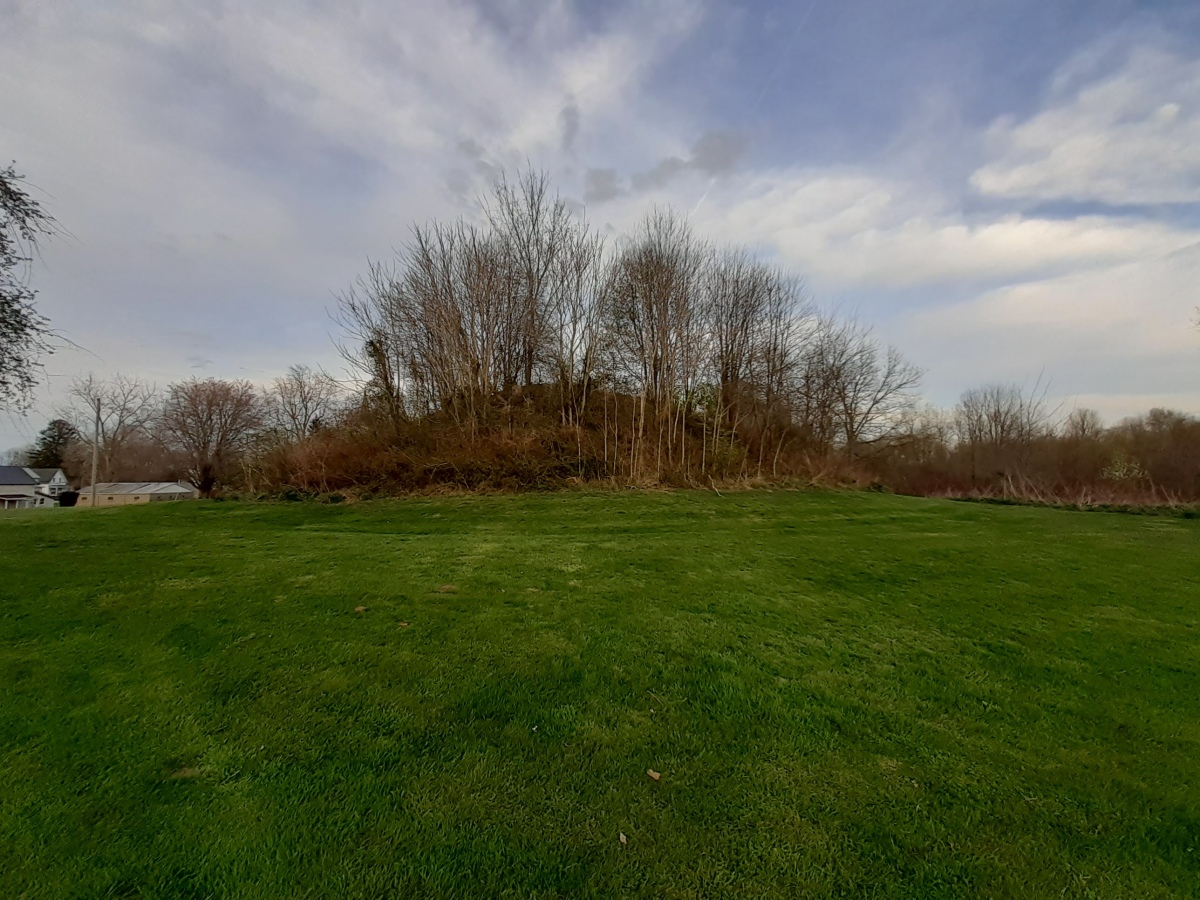
Dixon Mound submitted by stonetracker on 6th Feb 2023. Long view of mound
(View photo, vote or add a comment)
Log Text: Other accounts have described access to this mound as "private" and "no trespassing." But I encountered no such issues on a recent visit. Parked in a nearby lot for town offices, walked in back and the mound was maybe 100 ft to the left in a field not far from a baseball diamond. The mound property was not posted, but the possible enclosure referred to in the description is posted as private.
Devil's Lake Mounds
Date Added: 29th Jul 2024
Site Type: Artificial Mound
Country: United States (Great Lakes Midwest)
Visited: Yes on 1st Jul 2024. My rating: Condition 3 Ambience 4 Access 4
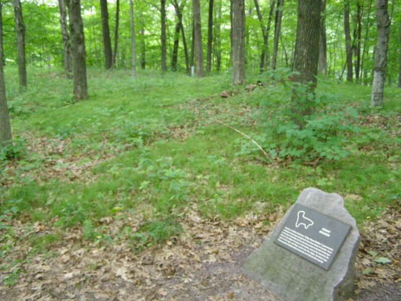
Devil''s Lake Mounds submitted by AKFisher on 3rd Sep 2023. Lynx Mound at Devil's Lake State Park, Wisconsin. Photo credit: Wiki (Chris Light).
(View photo, vote or add a comment)
Log Text: Wisconsin's largest state park is very popular, particularly in summer. There were plenty of visitors when I was there. Interesting geology, which I really didn't have time to explore.
As for the effigy mounds, most are well preserved with one or two exceptions and all were built during the Late Woodland period. There are four groups of them remaining, three on the North side of the lake and one single large bird effigy mound on the South end. All easy walk-in access and close to parking. See the official park map and the Wisconsin Mounds web site for locations.
DePrato Mounds
Date Added: 5th Mar 2025
Site Type: Artificial Mound
Country: United States (The South)
Visited: Yes on 1st Feb 2025. My rating: Condition 2 Ambience 3
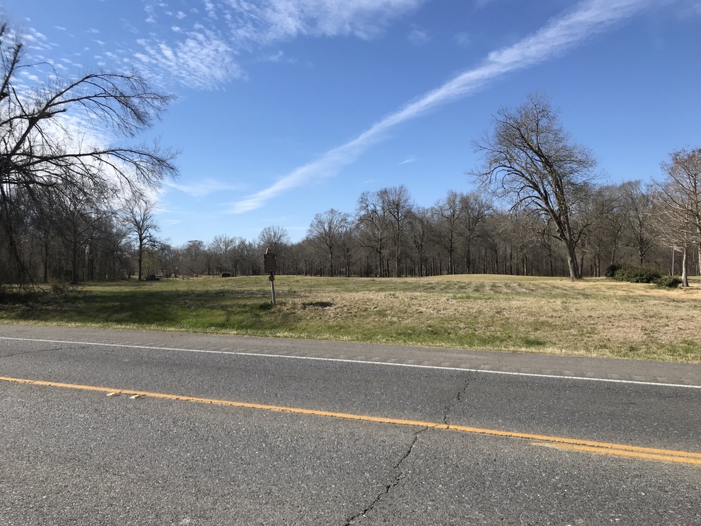
DePrato Mounds submitted by AKFisher on 5th Aug 2023.
Deprato Mounds in Louisiana. There are 5 barely distinguishable mounds there as so much sediment from flooding has covered them. It was the center of a large village established around AD 600.
Photo courtesy Dr Greg Little, author of the Illustrated Encyclopedia of Native American Indian Mounds & Earthworks (2016).
(View photo, vote or add a comment)
Log Text: Like many Louisiana mound sites, this site is on private land near a residential tract. It is just north of busy US Highway 84. There is no off-road parking area, so you must park on the shoulder of the highway and view it from there. It originally consisted of five mounds, but only three are barely discernable due to centuries of river flooding and sediment buildup. One was destroyed for highway construction and a house was built on the other, leveling it in the process. It is on the Louisiana Ancient Mounds Trail, so the state erected an interpretive sign near the site.
Cutler Mound Group
Date Added: 27th Jul 2024
Site Type: Artificial Mound
Country: United States (Great Lakes Midwest)
Visited: Yes on 1st Jul 2024. My rating: Condition 3 Ambience 3 Access 4
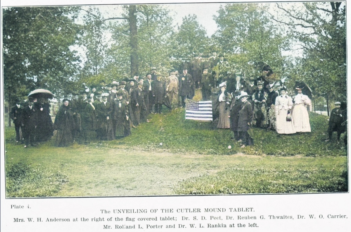
Cutler Mound Group submitted by AKFisher on 14th Oct 2023. Ceremony at the Cutler Mound where the Waukesha, Wisconsin Women's Club placed a bronze marker at the mound in 1906. The city had 55 mounds and the county had 411 mounds. Photo courtesy Dr Greg Little, author of the Illustrated Encyclopedia of Native American Indian Mounds & Earthworks (2016).
(View photo, vote or add a comment)
Log Text: Public parking is available in a lot next to the Waukesha Public Library near the corner of Maple and West Park Ave. The 3 mounds are maybe a 200 yd easy walk north over a manicured lawn area and obvious.
The site is as described, with a 7-8 foot high conical mound flanked by two smaller ones. Orange cones and "Keep Off" signs are in place to discourage people from walking on the mounds. Not aesthetic but needed in my opinion. The mounds are also covered with higher vegetation than the surrounding mowed lawn to prevent further erosion.
Crucuno Dolmen
Date Added: 30th Sep 2024
Site Type: Burial Chamber or Dolmen
Country: France (Bretagne:Morbihan (56))
Visited: Yes on 1st Sep 2024. My rating: Condition 5 Ambience 4 Access 5
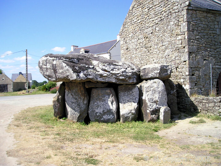
Crucuno dolmen submitted by thecaptain on 22nd Dec 2007. View of the southern side of this massive dolmen, showing clearly its proximity to the farmhouse.
On the right are the last remaining capstone and pair of stones from the long entrance passageway.
(View photo, vote or add a comment)
Log Text: Still there and unfenced. Outside of the Carnac alignments this dolmen drew the biggest tourist crowds, even in the supposed off-season. Saw several tour buses pull in on a couple of visits a day apart. Solitude, if any, will be short lived.
Crucuno Cromlech
Date Added: 13th Dec 2024
Site Type: Stone Circle
Country: France (Bretagne:Morbihan (56))
Visited: Yes on 1st Sep 2024. My rating: Condition 3 Ambience 5 Access 3
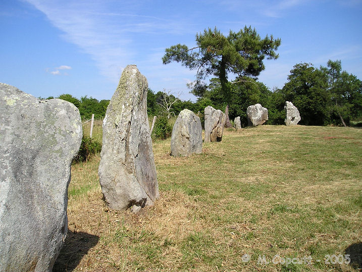
Crucuno cromlech submitted by thecaptain on 21st Dec 2007. There are 22 remaining stones, on average 2 metres in height, arranged in a rectangle measuring about 33 metres by 25 metres.
(View photo, vote or add a comment)
Log Text: This is a restored rectangular cromlech in good condition. It is not far from the much more frequented Crucuno Dolmen. If you want to lose the crowd, park near the dolmen and proceed down the dirt lane just to its left for 300-400 meters. Take the first trail to the right (avoid the residential abutters driveway!) and in another 100 m you will see a "Quadrilatere" sign on the right pointing out the short path to the site.
The area is quiet and secluded. There was no one there during my visit.
Cromlech du Menec-Est
Date Added: 7th Oct 2024
Site Type: Stone Circle
Country: France (Bretagne:Morbihan (56))
Visited: Yes on 1st Sep 2024. My rating: Condition 2 Ambience 3 Access 4
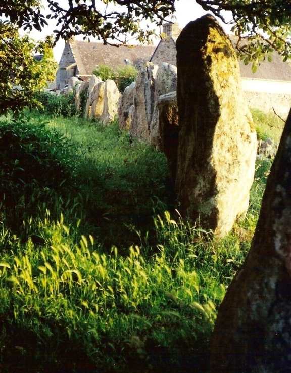
Cromlech du Menec-est submitted by postman on 29th Dec 2012. Very overshadowed by the multiple rows of stones the remains of this once large stone circle now partly inhabit some locals garden. jammy begger.
(View photo, vote or add a comment)
Log Text: It's a short walk west from the parking lot near the jct of the D119 and D196 (see visit log for Toulchignan Alignments for details). Like Toulchignan, the site is fenced off. I was (I think) able to make out some of the western stones of the cromlech. The stones are clearly closer together and oriented more north-south than the alignments.
Courthouse Wash Rock Art
Date Added: 5th Jun 2025
Site Type: Rock Art
Country: United States (The Southwest)
Visited: Yes on 1st May 2025. My rating: Condition 2 Ambience 4 Access 2
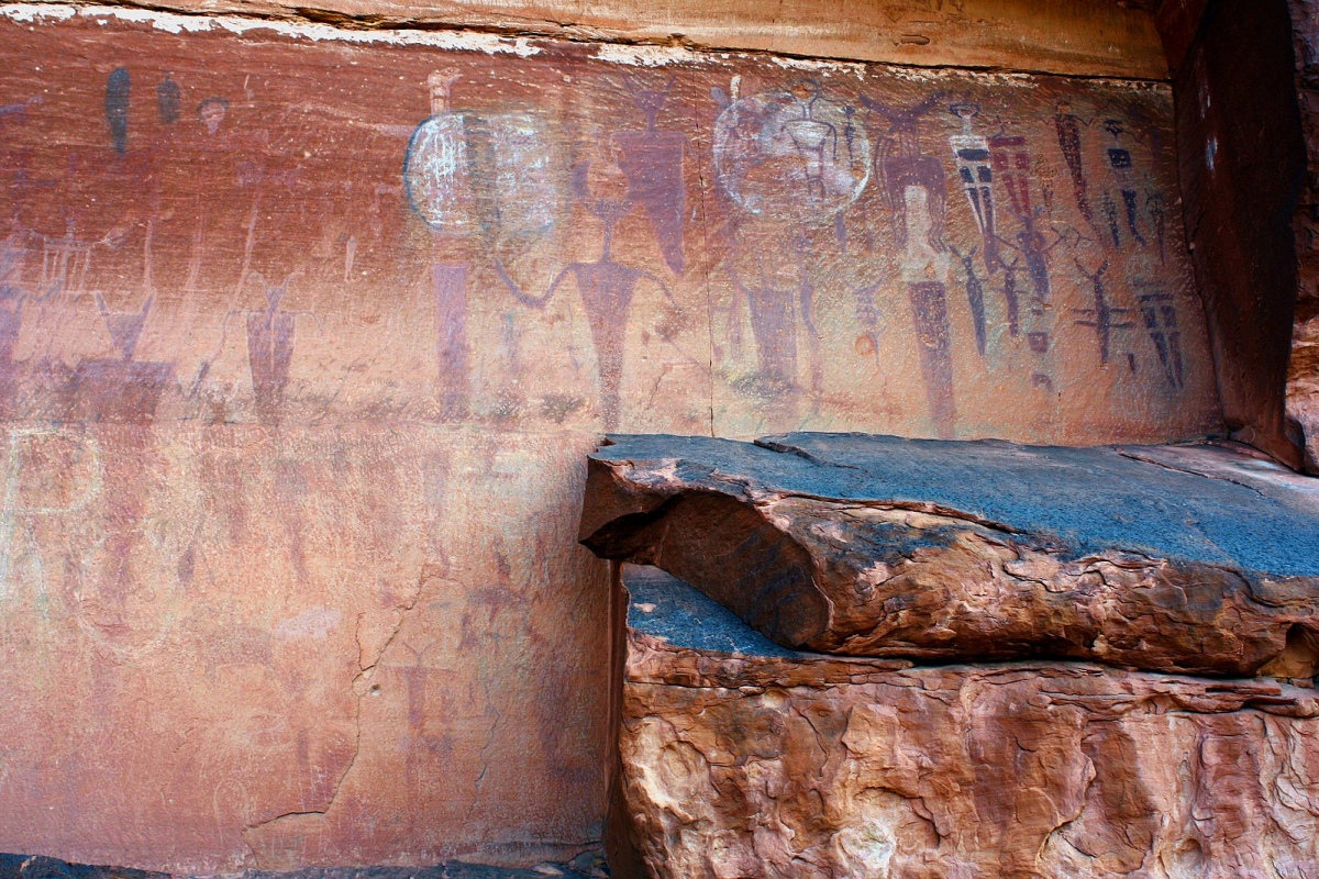
Courthouse Wash Rock Art submitted by AKFisher on 11th Aug 2023. Petroglyphs at Courthouse Wash near Moab, Utah. Wiki: MoralMoney, https://commons.wikimedia.org/wiki/File:CourthouseWash.jpg.
(View photo, vote or add a comment)
Log Text: An Archaic period pictograph rock art site with other more recent petroglyphs nearby. The biggest challenge is finding the site, as it is way up on a cliff face that overlooks the confluence of Courthouse Wash and the Colorado River and the "trail" to it is rather indistinct once you get up on the slope. The entire hike is 1.2 miles round trip from the parking lot. I recommend you bring binoculars (see below).
The paved parking area is right off of Route 191 about 0.6 miles north of the Colorado River bridge just north of Moab. This provides access to a paved bike and walking path. Follow this path east and cross the bridge over Courthouse Wash. Immediately after the bridge, take the dirt path north for about 200 yds downhill until you see an easy-to-miss sign for the Courthouse Panel. Take a right onto this fork and follow it uphill to the east for a few hundred yards. Eventually you will see a tilted NPS signboard on a stand. Stop here, face north and uphill towards the cliff base, and scan the vertical face with binoculars. You should eventually spot the pictograph panel, but be advised that it is very faded and small.
That is your destination, assuming you decide to go farther. There is no trail per se to reach it other than some random paint splotches on the ledges, so you'll pretty much have to find your own route. There are some boulders to scramble around and sloped ledges to climb for about 200 to 300 yds before reaching the panel. A very rough coordinate for the panel itself is 38.6072, -109.58124.
Conrad Mound
Date Added: 31st Oct 2023
Site Type: Artificial Mound
Country: United States (Great Lakes Midwest)
Visited: Yes. My rating: Condition 3 Ambience 3
submitted by on .
(View photo, vote or add a comment)
Log Text: Visited late Oct 2023. On private property. Can be viewed 200-300 yds from the west via on-street parking on Rittenhouse Rd or from a side street to the south in a residential subdivision at 2709 Rittenhouse.
Commerce Mounds
Date Added: 25th Mar 2024
Site Type: Artificial Mound
Country: United States (The South)
Visited: Saw from a distance on 1st Feb 2024. My rating: Condition 3
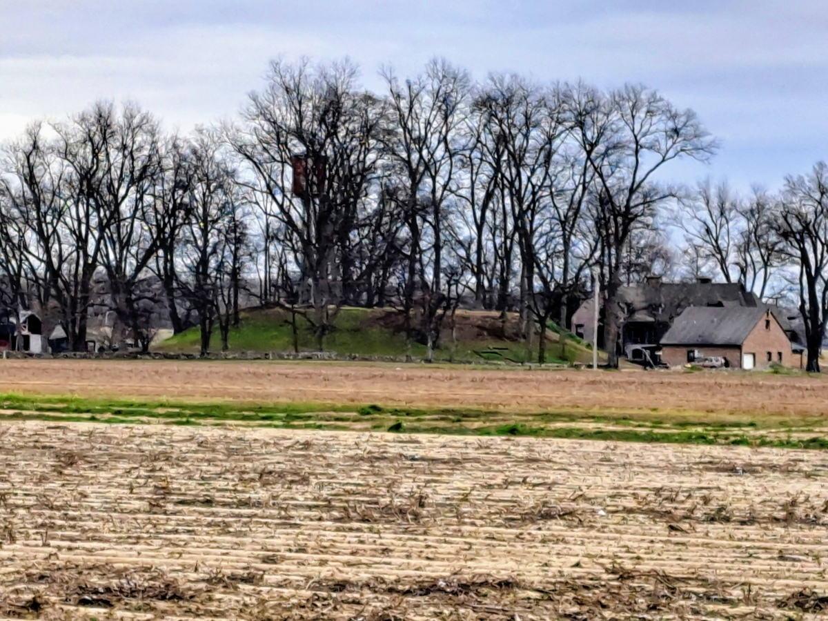
Commerce Mounds submitted by stonetracker on 8th Mar 2024. View of the one remaining large platform mound. Site is on private property, so the closest approach is about 1000 ft.
(View photo, vote or add a comment)
Log Text: This is on a large private farm with no close access and no safe on-street parking. There are private pkg lots across the main paved road about 1000 ft from the site where remote viewing is possible with some walking.
Coker Ford Site
Date Added: 12th Feb 2023
Site Type: Ancient Village or Settlement
Country: United States (The South)
Visited: Would like to visit
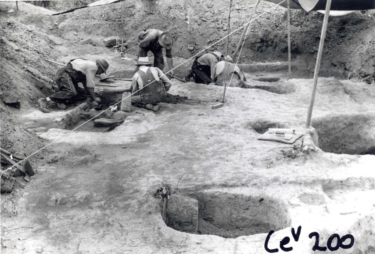
Coker Ford Site submitted by stonetracker on 17th Feb 2023. Archaelogical dig at Coker Ford site, date unknown. Source: https://alabamamoundtrail.org/mound-site/coker-ford-mound/. Sponsor: University of Alabama.
(View photo, vote or add a comment)
Chucalissa Prehistoric Indian Village
Date Added: 8th Mar 2024
Site Type: Museum
Country: United States (The South)
Visited: Yes on 1st Feb 2024. My rating: Condition 4 Ambience 4 Access 4
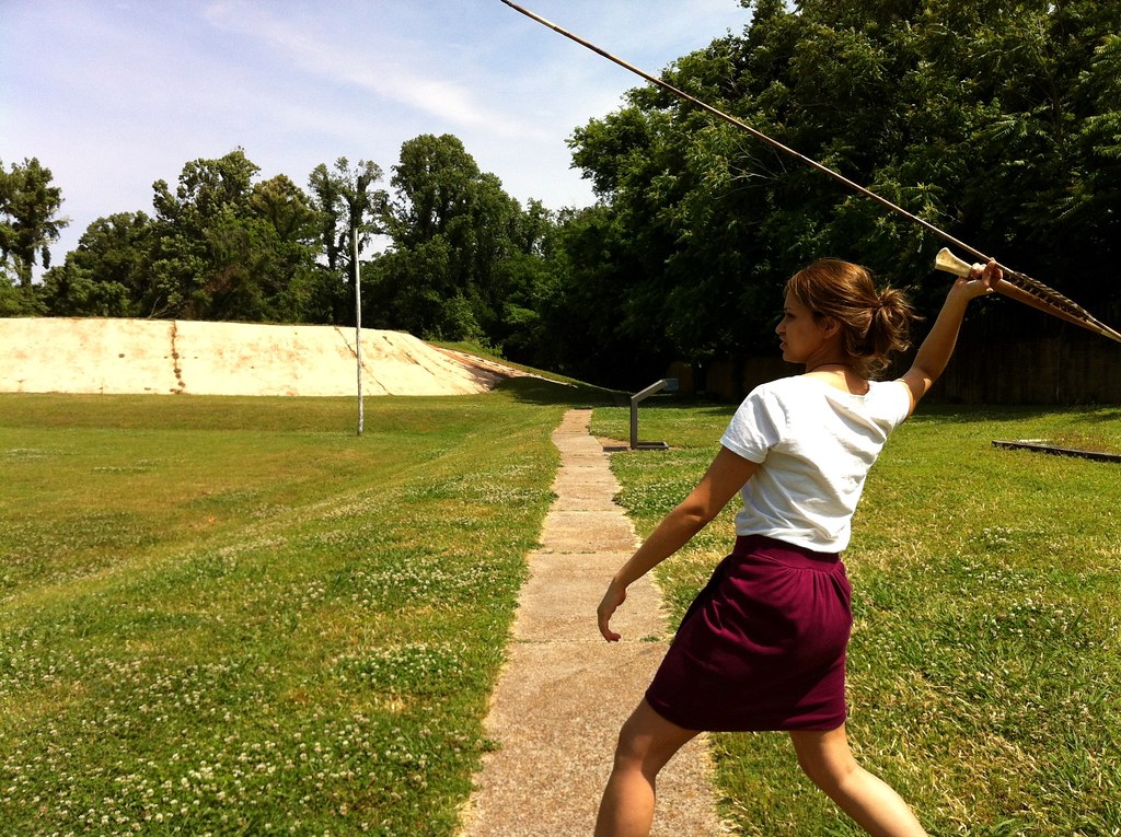
Chucalissa Prehistoric Indian Village submitted by Dodomad on 17th Aug 2023. C.H. Nash Museum employee Kiran Riar demonstrates how to throw a spear with an atlatl at Chucalissa.
Image copyright: ilovememphis (Memphis CVB), hosted on Flickr and displayed under the terms of their API.
(View photo, vote or add a comment)
Log Text: Site is as described including the Nash Museum. Some additional notes:
* The temple mound appears to be partially reconstructed, not unusual for mound builder sites. In particular, a tan clay facing has been applied to the front of the mound. It is thought that this is the way it appeared in late Mississippian times.
* There is another smaller mound adjacent to the temple mound. As far as I can tell, this is the only other extant mound in the park.
* There is a nice replica of a village house behind the temple mound.
* There is also a replica of a segment of palisade enclosure, using wattle and daub construction.
* Nature trails behind the temple mound traverse borrow pits and archeological excavation trenches of habitation sites.
Chrysler Enclosure
Date Added: 31st Oct 2023
Site Type: Henge
Country: United States (Great Lakes Midwest)
Visited: Yes. My rating: Condition 3 Ambience 3 Access 5

Chrysler Enclosure submitted by bat400 on 15th Jan 2007. Chrysler Enclosure, Henry County, IN.
Circular Earthwork Enclosure.
An earthen ring thrown up on the outside of a circular ditch, about 30 ft dia. The ditch is broken by an entry way sited to align the center of the enclosure with the winter solstice sunrise.
Photo by bat400 Oct 2006.
(View photo, vote or add a comment)
Log Text: Visited late Oct 2023. Fairly well preserved earthwork in a traffic circle next to a public school. Lots of parking nearby in a town park, easy access.
Christmas Mound
Date Added: 7th Apr 2024
Site Type: Artificial Mound
Country: United States (The South)
Visited: Yes on 1st Apr 2024. My rating: Condition 3 Ambience 3
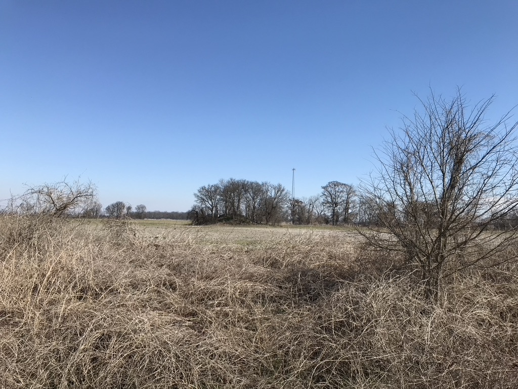
Christmas Mound submitted by AKFisher on 10th Aug 2023. Christmas Mound in Mississippi. It started as a midden mound in AD 400 and was enlarged to 10-feet in height in a small window of time. There are many similar mounds all over the southeast, most of which are unmarked. Photo courtesy Dr Greg Little, author of the Illustrated Encyclopedia of Native American Indian Mounds & Earthworks (2016).
(View photo, vote or add a comment)
Log Text: Mound is as described about 200 yds east of the parking pulloff in a private cultivated area. Only remote viewing is possible.
Choccolocco Creek Mounds
Date Added: 12th Feb 2023
Site Type: Artificial Mound
Country: United States (The South)
Visited: Would like to visit
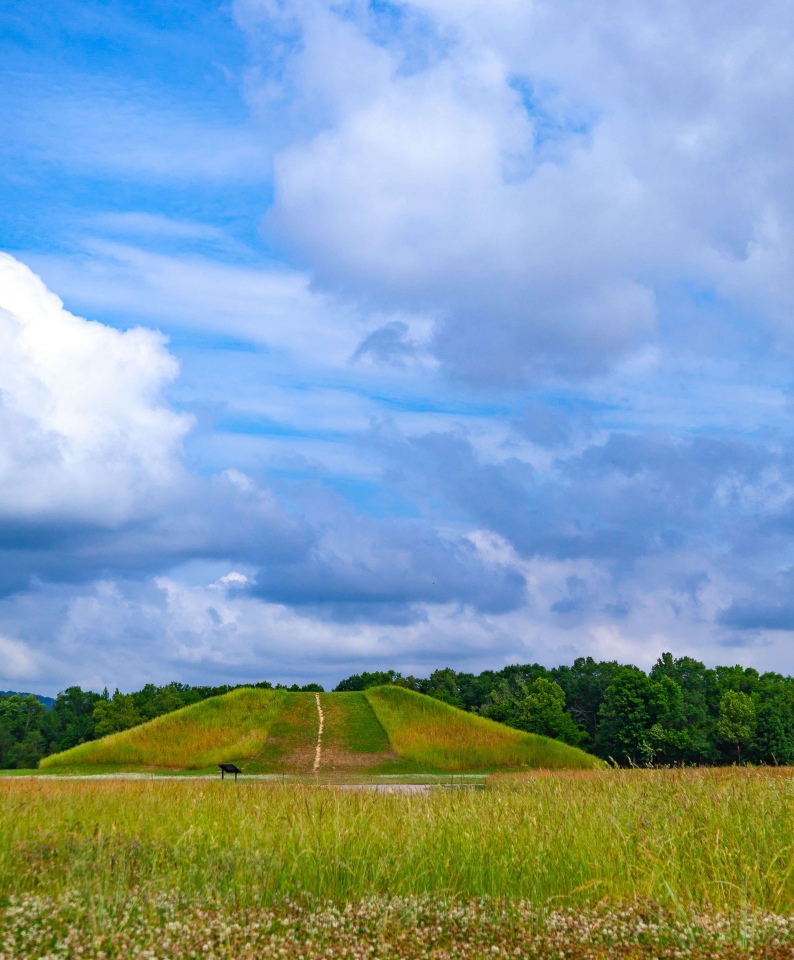
Choccolocco Creek Mounds submitted by stonetracker on 16th Feb 2023. Reconstructed large mound. Same photo source as above.
(View photo, vote or add a comment)
Chickasaw Heritage Park
Date Added: 7th Mar 2024
Site Type: Artificial Mound
Country: United States (The South)
Visited: Yes on 1st Feb 2024. My rating: Condition 4 Ambience 4 Access 4
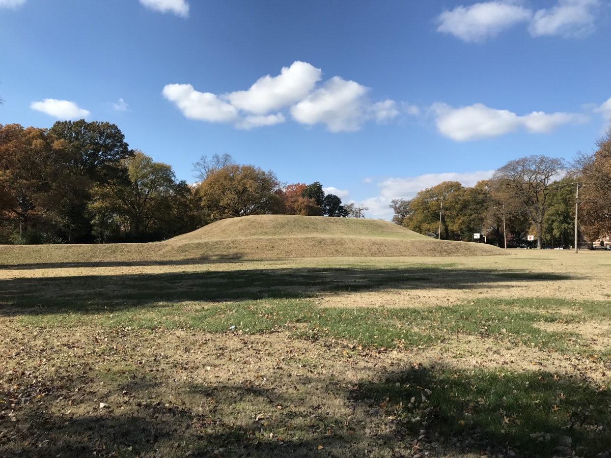
Chickasaw Heritage Park submitted by AKFisher on 14th Aug 2023. This is a really well formed platform mound, one of two at the site, in downtown Memphis, Tennessee next to the Mississippi River. It is thought by some to be the site where Hernando de Soto first saw the Mississippi River. Photo courtesy Dr Greg Little, author of the Illustrated Encyclopedia of Native American Indian Mounds & Earthworks (2016).
(View photo, vote or add a comment)
Log Text: Site remains as described. The only change I noticed was the tunnel leading to the Civil War magazine in the mound next to the river has been bricked up and blocked.
Cheatham Mound
Date Added: 9th Mar 2024
Site Type: Artificial Mound
Country: United States (The South)
Visited: Yes on 1st Feb 2024
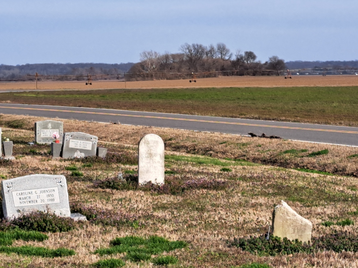
Cheatham Mound submitted by stonetracker on 9th Mar 2024. A cemetery is as close as I could park to this mound. The mound is maybe a 1/2 mile away on a large farm tract.
(View photo, vote or add a comment)
Log Text: Very little information out there, but this is listed as a known single-mound Walls phase site. The only reasonable, safe parking was about 1/2 mile west of the site in a nearby cemetery. The mound appears to be fairly intact but impossible to confirm from this distance.
Cave Pueblo Ruin
Date Added: 14th May 2025
Site Type: Ancient Village or Settlement
Country: United States (The Southwest)
Visited: Yes on 1st May 2025. My rating: Condition 2 Ambience 4
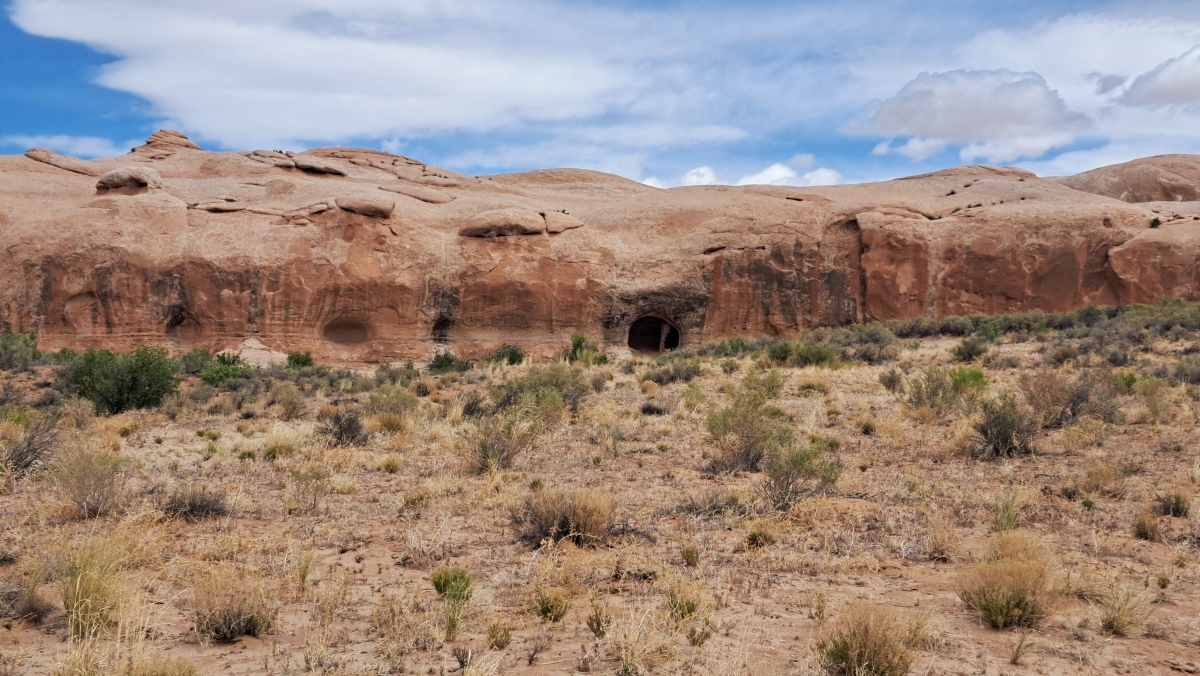
Cave Pueblo Ruin submitted by stonetracker on 14th May 2025. The ruin is in the large cave just to the right of the center in the photo.
(View photo, vote or add a comment)
Log Text: There is no close access to the site due to a barbed wire fence and wired off gate. But you can easily spot the cave and ruin from a parking pulloff ~ 3 miles east of Bluff UT. There are also a number of rock art sites along the same route west from this point to Bluff. I was able to visit some, not all.
