Contributory members are able to log private notes and comments about each site
Sites Stonetracker has logged. View this log as a table or view the most recent logs from everyone
Pikes Peak State Park Effigy Mounds
Date Added: 1st Aug 2024
Site Type: Artificial Mound
Country: United States (Great Lakes Midwest)
Visited: Yes on 1st Jul 2024. My rating: Condition 3 Ambience 4 Access 3
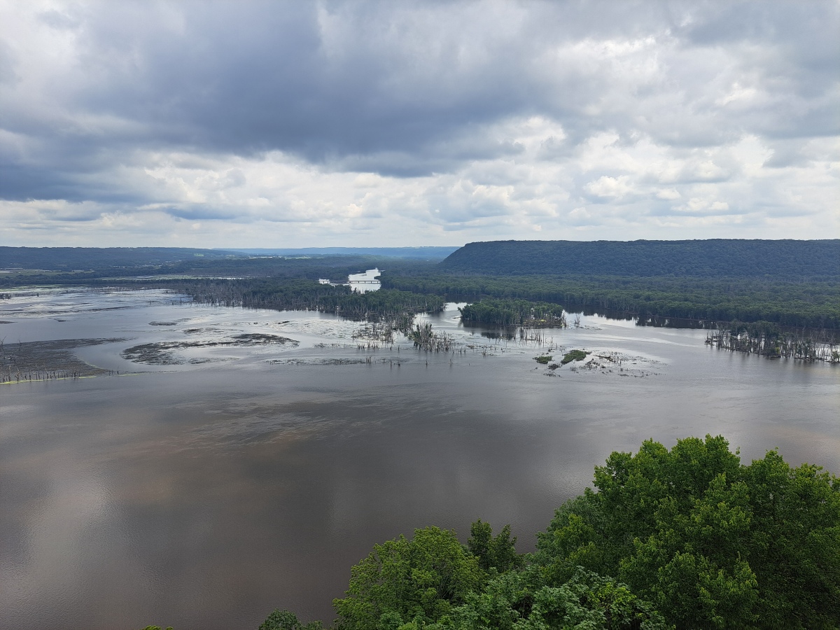
Pikes Peak State Park Effigy Mounds submitted by stonetracker on 31st Jul 2024. Closeup of the river confluence. The flat ridge to the right is the location of the Sentinel Ridge effigy mounds in Wyalusing State Park in Wisconsin.
(View photo, vote or add a comment)
Log Text: There are 5-6 clusters of effigy mounds scattered on ridges throughout the park.
Two of them are relatively short hikes from the main south entrance parking lot: Hickory Ridge (via Hickory Ridge Trail) and Deer Ridge (behind the campground or via the southern part of the Bridal Veil Trail). Additionally a bear mound and small conical are visible about 200 yds north of the park concession booth via a paved walkway. These are the only ones I was able to visit on this trip as the others are a longer hike.
Most of the mounds in the park are linear or conical. Unfortunately there is no official printed map showing mound locations. However, you can get a copy of a hand-marked map from the visitor center at Effigy Mounds NM.
Governor Nelson State Park Effigy Mounds
Date Added: 5th Aug 2024
Site Type: Artificial Mound
Country: United States (Great Lakes Midwest)
Visited: Yes on 1st Jul 2024. My rating: Condition 3 Ambience 2 Access 3
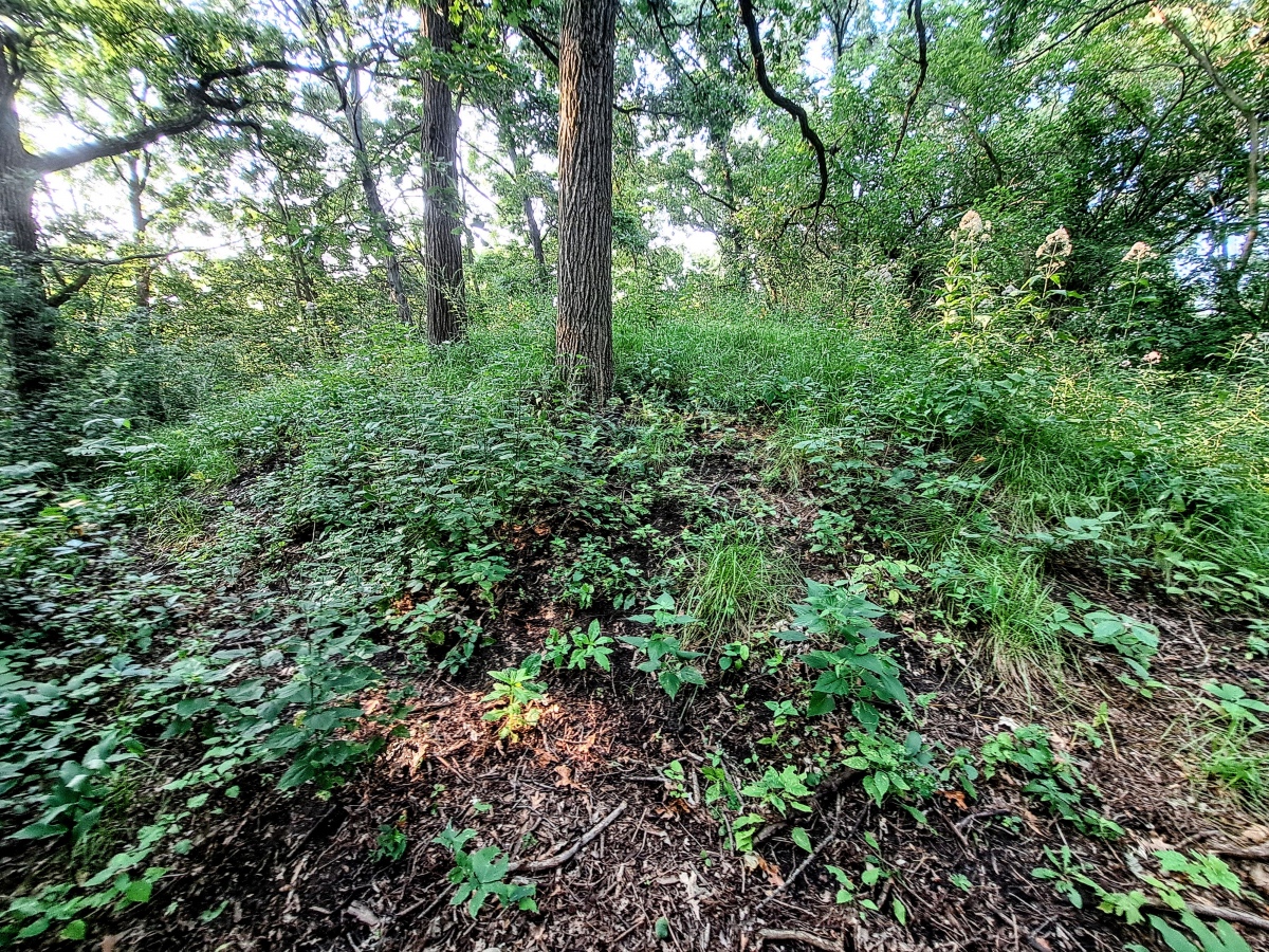
Governor Nelson State Park Effigy Mounds submitted by stonetracker on 2nd Aug 2024. One of the conical mounds right on the Woodland Trail. I was able to locate 3 of them.
Unfortunately none of the mounds is well maintained and large trees have been allowed to grow on some of them. Invasive plants will likely overwhelm the rest without a change in policy. In fairness, the park has a history of vandalism, including stolen signs and broken fencing, which makes preservation challenging.
(View photo, vote or add a comment)
Log Text: This Late Woodland site is in a state park on the west shore of Lake Mendota near Madison WI. Parking and trail access at the south entrance near Borchers Beach Rd. There are two sites. The conical mounds are 1000 ft north of parking on the Woodland Trail. The large panther effigy is maybe 100 yds north of the conicals.
At least some of the conicals are visible but being rapidly consumed by invasive plants. The panther mound is completely overgrown in summer and I wasn't able to see much. Maybe in fall or winter? There was another restored panther at Camp Wakanda but I was unable to find it.
Aztalan State Park
Date Added: 9th Aug 2024
Site Type: Ancient Village or Settlement
Country: United States (Great Lakes Midwest)
Visited: Yes on 1st Jul 2024. My rating: Condition 4 Ambience 5 Access 4
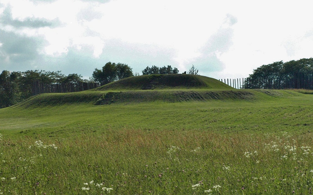
Aztalan State Park submitted by bat400 on 31st Mar 2013. The largest mound at Aztalan is a "stepped" pyramidal structure in the southwest corner of the stockade surround.
This is a partial reconstruction of the site as found in the early 1800's. By the 1920's there had been substantial plowing of the site and significant damage by "pot hunters" and those simply "quarrying" the mounds for fill dirt and the remains of burnt wattle and daub from the original stockade.
Photo by bat400, July 2010.
(View photo, vote or add a comment)
Log Text: A very well-maintained hybrid Late Woodland-Mississippian prehistoric site in Aztalan State Park, Aztalan WI. There are two parking lots. One at the south end of the "marker mounds" at the state park entrance provides short and easy trail access to the northwest platform mound. The other larger lot is accessible via a paved road past the main park entrance and is located close to the southwest "temple" mound via a short trail.
The Princess Mound (which I did not visit) is located behind the museum north of the main park entrance.
Picnic Point Effigy Mounds
Date Added: 6th Aug 2024
Site Type: Artificial Mound
Country: United States (Great Lakes Midwest)
Visited: Yes on 1st Jul 2024. My rating: Ambience 3 Access 3
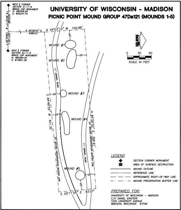
Picnic Point Effigy Mounds submitted by stonetracker on 6th Aug 2024. Map showing layout of the five-mound main group
(View photo, vote or add a comment)
Log Text: The mounds are on a peninsula in Lake Mendota on conservation land owned by the Univ of Wisc. They are accessible via the Lakeshore Trail. Parking is available at the trailhead for a fee. The first group of 5 mounds is about a 1/4 mile level walk from the lot, next to and just north of the trail. The last conical mound is another 600 ft east along the trail and just to its south.
Unfortunately site maintenance seems to be cyclical at best. I was unable to find or positively identify any of the mounds due to summer overgrowth, suggesting that non growing seasons may present better viewing opportunities. There was also no obvious interpretation signage. However, Andrew Khitsun (the owner of the Wisconsin Mounds site) has posted a few photos with most of the overgrowth and some trees removed from the mounds. They are undated but I assume they are at least post-2000.
Obviously they have been better maintained in the past than currently.
Nitschke Mounds State Park
Date Added: 6th Aug 2024
Site Type: Artificial Mound
Country: United States (Great Lakes Midwest)
Visited: Yes on 1st Jul 2024. My rating: Condition 2 Ambience 4 Access 4
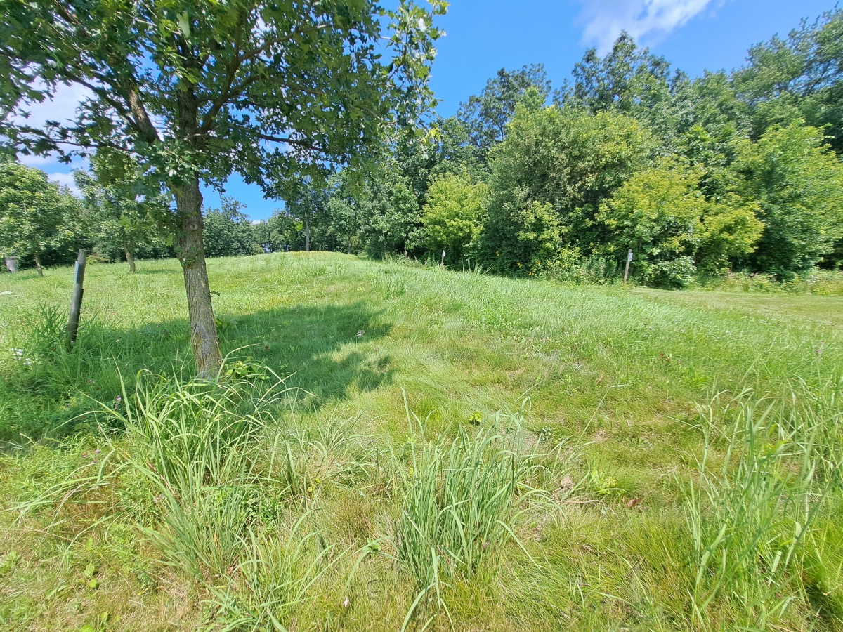
Nitschke Mounds State Park submitted by stonetracker on 7th Aug 2024. Mound 9 - Buffalo or Bear. The head and forelegs are in the foreground.
(View photo, vote or add a comment)
Log Text: The effigy mounds are in a county park just 200 yds north of the paved road. Ample parking in a dirt lot with a picnic shelter and interpretation kiosk.
Considering that the park is maintained mostly by volunteers, the condition of the site is surprisingly good. About 2/3rds of the mounds are at least somewhat visible and cleared of trees and shrubs. Native long grass has been left on the mounds to discourage walking over them. A short trail system weaves in and out among the mounds and is regularly maintained by mowing. The remaining 1/3 of the mounds still need to be cleared off and the trail system extended to include them. They are mostly in a wooded area at present. Interpretation and signage at each mound is sparse, so I assume this is a work in progress. There is a bit more information at the entrance kiosk.
Effigy mounds by their very nature tend to be low profile and hard to photograph. This is particularly the case at Nitschke where erosion has really taken its toll. So my photos and videos are limited to just a few of the biggest and most visible mounds.
Mendota Mental Health Institute Effigy Mounds
Date Added: 27th Aug 2024
Site Type: Artificial Mound
Country: United States (Great Lakes Midwest)
Visited: Yes on 1st Jul 2024. My rating: Condition 3 Ambience 5 Access 4

Mendota Mental Health Institute Effigy Mounds submitted by stonetracker on 22nd Aug 2024. At the far western edge of the Central Mound group is an unusual panther effigy on a rise of land with a curved, upturned tail.
Difficult to photograph, but the forelegs and hindlegs are on the left and right respectively. Head and tail out of view.
(View photo, vote or add a comment)
Log Text: As far as I know, public access to the Mendota Mental Health Institute grounds is allowed without permission, although it is recommended that one stop by the Administration Bldg to check in.
To access the Central Group of mounds, park in the large lot northeast of the intersection of Main Drive & Cinder Drive. It is 200 yd walk from there to the bird effigy mounds (see map) via a paved walkway. The upper panther mound is set apart from the others on Cinder Drive. However, there is no parking at that site and the Cinder Drive lot was under construction as of 2024. But it is a relatively easy walk to the upper panther mound from Main Drive or from the other effigies in this group.
To access the Western Group, continue on Main Drive heading west and take a left onto Memorial Drive. The large conical mounds are about 1000 ft further next to the road on the left at Farwell's Pt. I could only find on-street parking, but there was little or no traffic in that area.
Foxborough Perched Boulder (2)
Date Added: 14th Jan 2023
Site Type: Natural Stone / Erratic / Other Natural Feature
Country: United States
Visited: Yes on 1st Jan 2016. My rating: Condition 5 Ambience 4 Access 3
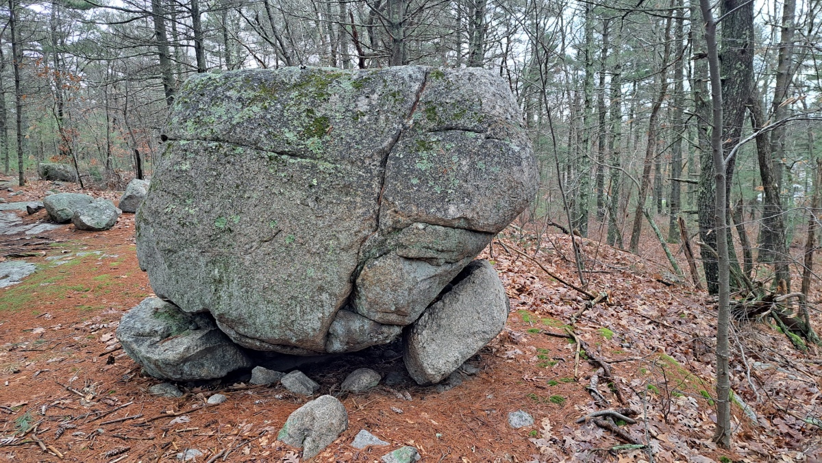
Foxborough Perched Boulder (2) submitted by stonetracker on 27th Jan 2023. Photo from 01/2023. There appear to be two prop stones for this boulder.
(View photo, vote or add a comment)
Log Text: On an unnamed side trail that runs east of Megley trail. Several structures are on this side trail.
Foxborough Perched Boulder (1)
Date Added: 12th Jan 2023
Site Type: Natural Stone / Erratic / Other Natural Feature
Country: United States
Visited: Yes on 1st Jan 2016. My rating: Condition 4 Ambience 4 Access 3

Foxborough Perched Boulder (1) submitted by stonetracker on 12th Jan 2023. Propped boulder on ledge. Site A on archive.org map.
(View photo, vote or add a comment)
Log Text: Right next to High Rock Trail but a bit of a walk from High Rk pkg area
Foxborough Prayer Seat (2)
Date Added: 13th Jan 2023
Site Type: Cairn
Country: United States
Visited: Yes on 1st Feb 2016. My rating: Condition 5 Ambience 4 Access 3
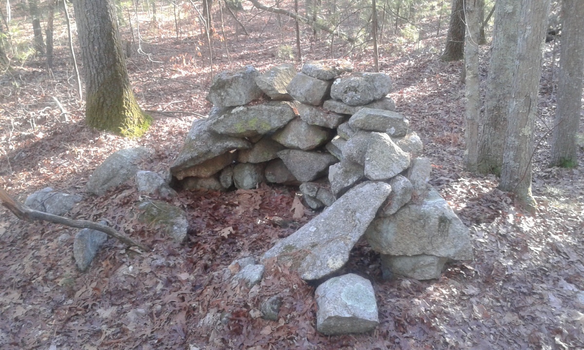
Foxborough Prayer Seat (2) submitted by stonetracker on 12th Jan 2023. Horseshoe-shaped stone structure.
(View photo, vote or add a comment)
Log Text: Horseshoe-shaped wall of rocks, conventionally referred to as a "prayer seat." A bit of a bushwhack to find off the trail system.
Foxborough Cairn
Date Added: 24th Jan 2023
Site Type: Cairn
Country: United States
Visited: Yes on 1st Feb 2016. My rating: Condition 1 Ambience 4 Access 3
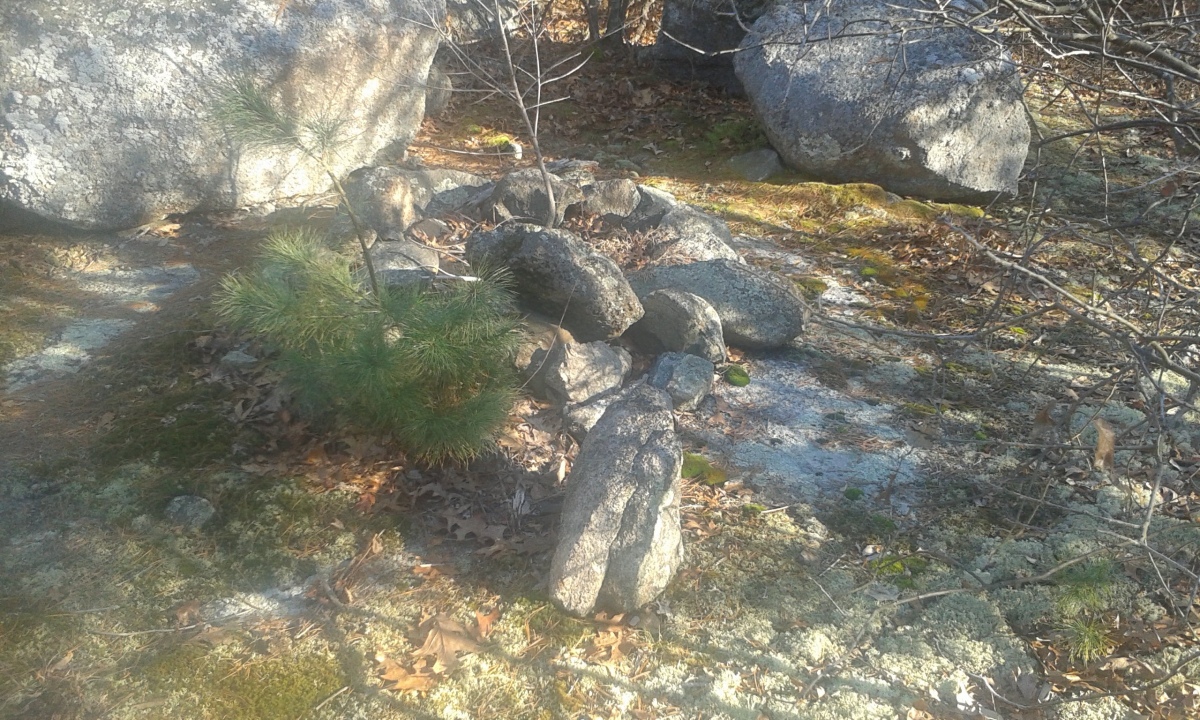
Foxborough Cairn submitted by stonetracker on 24th Jan 2023. The original published map showed a modern rock pile or cairn trail marker on a flat ledge. As of 2016, this was dismantled and re-built as a stone fire ring (shown in photo) with evidence of current use. So the original rock pile is gone.
(View photo, vote or add a comment)
Log Text: Park at Thurston St lot. This is on a high flat ledge on a side trail east of the Megley Trail.
Foxborough Prayer Seat (6)
Date Added: 19th Jan 2023
Site Type: Cairn
Country: United States
Visited: Yes on 1st Mar 2018. My rating: Condition 3 Ambience 4 Access 2
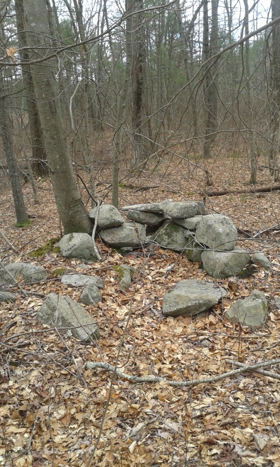
Foxborough Prayer Seat (6) submitted by stonetracker on 19th Jan 2023. Small horseshoe or u-shaped structure. Possibly a "prayer seat." Smaller than similar structures in the area and somewhat degraded condition.
(View photo, vote or add a comment)
Log Text: Site O on published map. This is a fair distance south of High Rock Rd trail and well southeast of Megley, about 50 ft off a side trail. Long walk from any of the parking lots.
Foxborough Standing Stone (4)
Date Added: 19th Jan 2023
Site Type: Marker Stone
Country: United States
Visited: Yes on 1st Mar 2018. My rating: Condition 4 Ambience 4 Access 3
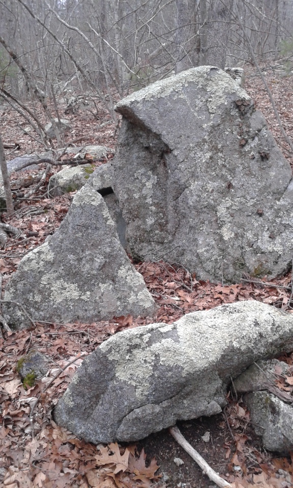
Foxborough Standing Stone (4) submitted by stonetracker on 19th Jan 2023. This is the triangular rock on the left side of the photo. My opinion is that this is natural, either a glacial artifact or a broken off piece of stone due to frost fracture or weathering.
(View photo, vote or add a comment)
Log Text: This is 500 ft or so east of Megley Trail near a side trail. Been a while but I recall this being a bushwhack to some extent. Long walk from any of the parking lots.
Foxborough Standing Stone (2)
Date Added: 21st Jan 2023
Site Type: Marker Stone
Country: United States
Visited: Yes on 1st Jun 2017. My rating: Condition 3 Ambience 3 Access 3
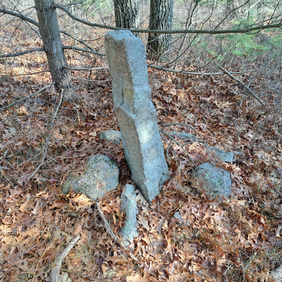
Foxborough Standing Stone (2) submitted by stonetracker on 31st Jan 2023. Another view.
(View photo, vote or add a comment)
Log Text: A short bushwhack north off of Megley Trail. Closest parking is the Thurston St lot.
Foxborough Prayer Seat (9)
Date Added: 21st Jan 2023
Site Type: Cairn
Country: United States
Visited: Yes on 1st Apr 2018. My rating: Condition 3 Ambience 3 Access 3

Foxborough Prayer Seat (9) submitted by stonetracker on 21st Jan 2023. A horseshoe or U-shaped stone structure. possibly a "prayer seat." The structure appears to be partly buried or the topsoil has filled in to some extent.
(View photo, vote or add a comment)
Log Text: Site X on published map. Access probably closest to the High Rock parking lot. Hike down High Rock Rd past the Megley Trail jct. Just before a waterhole, take a side trail north and walk 200 yards or so. The site is off trail about 30 ft on the left.
Foxborough Prayer Seat (7)
Date Added: 23rd Jan 2023
Site Type: Cairn
Country: United States
Visited: Yes on 1st Jun 2018. My rating: Condition 3 Ambience 4 Access 2
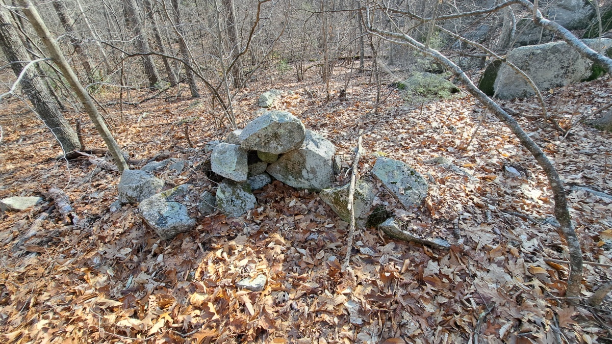
Foxborough Prayer Seat (7) submitted by stonetracker on 1st Feb 2023. Site T on published map.This prayer seat is in so-so shape. Either degraded or partially buried. Its twin, Foxborough Prayer Seat (8), is only 40-50 ft east in similar shape
(View photo, vote or add a comment)
Log Text: Site T on published map. Best accessed from Thurston St lot. There are a number of trails to get there (one being a side trail south off of Megley), all long, and with a roughly 300 ft bushwhack at the end from the nearest trail.
Foxborough Stone Ring
Date Added: 23rd Jan 2023
Site Type: Ring Cairn
Country: United States
Visited: Yes on 1st Feb 2017. My rating: Condition 4 Ambience 4 Access 2
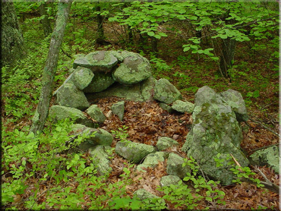
Foxborough Stone Ring submitted by kjsmith on 22nd Sep 2016. Foxboro State Forest
Accessable to the public
This is the stone ring listed on their website at this Lat/Long
There is another, but it isn't on Google Earth
(View photo, vote or add a comment)
Log Text: Thurston St lot the best for access. A bit of a long hike on the first side trail heading east off of Megley Trail, but one plus is that the same trail brings you right by several other sites. Last bit is a 200-300 ft bushwhack into woods and the enclosure is not easily spotted from a distance.
Foxborough Standing Stone (3)
Date Added: 24th Jan 2023
Site Type: Marker Stone
Country: United States
Visited: Yes on 1st Feb 2017. My rating: Condition 3 Ambience 3 Access 3
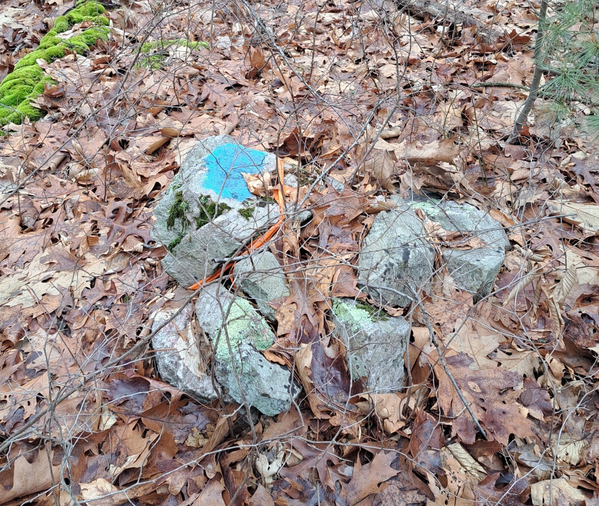
Foxborough Standing Stone (3) submitted by stonetracker on 28th Jan 2023. Small stone mound nearby witn same marking. Likely a state property boundary.
(View photo, vote or add a comment)
Log Text: Site L on published map. Best accessed via a long walk on a side trail east from Megley. The side trailhead is not far from the Thurston St lot. The standing stone is small, slightly off the trail, and rather inconspicuous.
Foxborough Prayer Seat (10)
Date Added: 24th Jan 2023
Site Type: Cairn
Country: United States
Visited: Yes on 1st Feb 2017. My rating: Condition 3 Ambience 4 Access 2
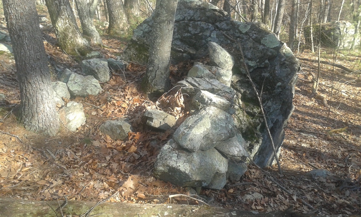
Foxborough Prayer Seat (10) submitted by stonetracker on 24th Jan 2023. This is a rather damaged U-shaped enclosure that utilizes an outcrop for its back wall. It is unclear whether the stones were placed by man or nature, but they do have what looks like a deliberate arrangement.
(View photo, vote or add a comment)
Log Text: Site Y on published map. Trail access and parking is the same as Foxborough Prayer Seat 3. The site is 400-500 ft SE of the latter, on an outcrop in relatively open woods. A bit difficult to spot.
Foxborough Stone Row (2)
Date Added: 25th Jan 2023
Site Type: Stone Row / Alignment
Country: United States
Visited: Yes on 1st Apr 2018. My rating: Condition 3 Ambience 3 Access 3
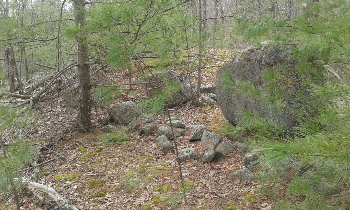
Foxborough Stone Row (2) submitted by stonetracker on 25th Jan 2023. Site now overgrown with pine saplings and difficult to see the entire six-boulder alignment. Several of the boulders are in this photo, flanked by a much smaller stone row segment.
(View photo, vote or add a comment)
Log Text: Probably most easily accessed from High Rock Rd parking lot. Site is not far from the jct of High Rock and Acorn Trails, on a 100 ft side trail off of Acorn Trail.
Foxborough Perched Boulder (6)
Date Added: 26th Jan 2023
Site Type: Natural Stone / Erratic / Other Natural Feature
Country: United States
Visited: Yes on 1st Jan 2023. My rating: Condition 5 Ambience 4 Access 3
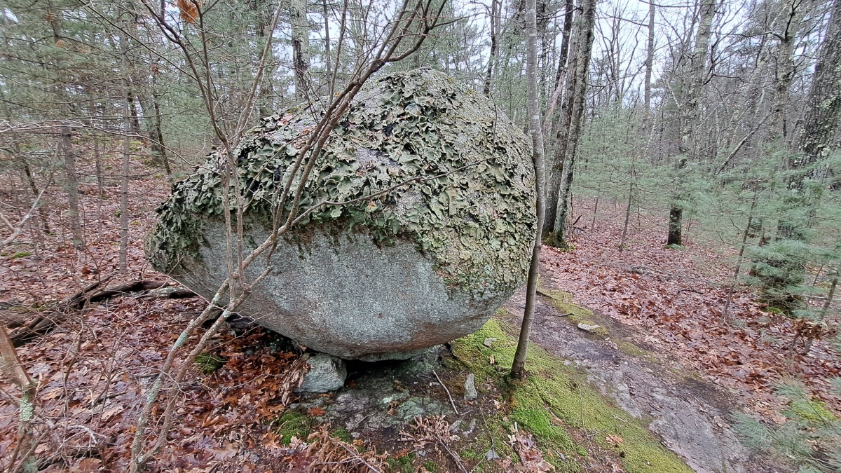
Foxborough Perched Boulder (6) submitted by stonetracker on 26th Jan 2023. Large boulder sitting on one prop stone. Could be an accident of nature except that the prop appears to have been inserted long after the boulder settled there.
(View photo, vote or add a comment)
Log Text: Site S on published map. Best accessed from the Thurston St parking lot. About 1/4 mile down a side trail that runs east from Megley Trail. Site is right next to the trail on the right.
