Contributory members are able to log private notes and comments about each site
Sites Serenstar has logged. View this log as a table or view the most recent logs from everyone
Carngoedog
Date Added: 23rd Nov 2013
Site Type: Ancient Mine, Quarry or other Industry
Country: Wales (Pembrokeshire)
Visited: Would like to visit

Carngoedog submitted by mountainman on 31st Aug 2008. Site in Wales: Carngoedog, now identified as the main source for the spotted dolerite bluestones found at Stonehenge
grid ref: SN 128332
(View photo, vote or add a comment)
Druids Circle (Penmaenmawr)
Date Added: 23rd Nov 2013
Site Type: Stone Circle
Country: Wales (Conwy)
Visited: Would like to visit
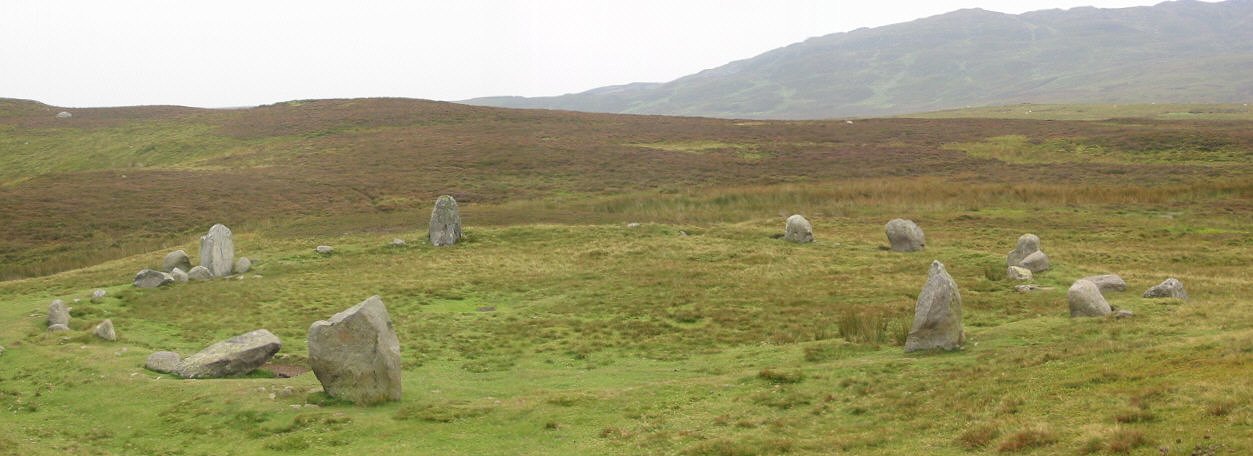
Druids Circle (Penmaenmawr) submitted by stu on 16th Oct 2002. Excellent circle with excellent views..
(View photo, vote or add a comment)
Bedd Arthur
Date Added: 23rd Nov 2013
Site Type: Stone Circle
Country: Wales (Pembrokeshire)
Visited: Would like to visit
Bedd Arthur submitted by PaulM on 8th Jun 2004. A close up of some of the stones in the setting known as Bedd Arthur, located close to the Bluestones outcrop of Carn Meini.
(View photo, vote or add a comment)
Carn Meini
Date Added: 23rd Nov 2013
Site Type: Ancient Mine, Quarry or other Industry
Country: Wales (Pembrokeshire)
Visited: Would like to visit
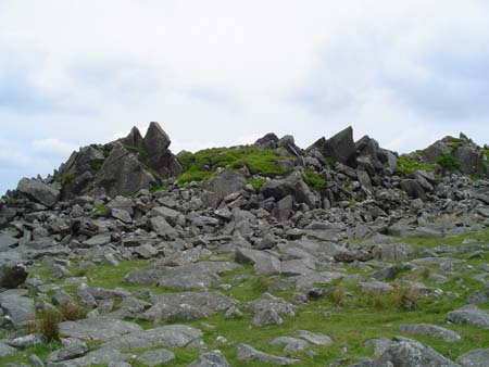
Carn Meini submitted by vicky on 7th Jun 2004. The Bluestones outcrop of Carn Meini as viewed from the top.
(View photo, vote or add a comment)
Old Oswestry Fort
Date Added: 24th Nov 2013
Site Type: Hillfort
Country: England (Shropshire)
Visited: Yes
Old Oswestry Fort submitted by andcampbell on 25th Oct 2010. Old Oswestry Fort from the air (looking south)
(View photo, vote or add a comment)
Log Text: None
Bury Ditches (Shropshire)
Date Added: 24th Nov 2013
Site Type: Hillfort
Country: England (Shropshire)
Visited: Yes
Bury Ditches (Shropshire) submitted by TimPrevett on 13th Feb 2006. A composite of 3 shots, looking south at the eastern entrance of Bury Ditches. John & Lynne K here help give a sense of scale.
(View photo, vote or add a comment)
Log Text: None
The Wrekin
Date Added: 24th Nov 2013
Site Type: Hillfort
Country: England (Shropshire)
Visited: Yes
The Wrekin submitted by TimPrevett on 2nd Jan 2005. Lookin to the North East, between the outer and inner ramparts of The Wrekin.
The path enters the inturned ramparts to the central area; the trig point and toposcope sit upon a Bronze Age Cairn, which is hardly in evidence.
Another, more slight rampart is visible to the left of the picture, before the hill becomes more rounded.
See main entry - click on the blue text to the left of the picture for more information.
(View photo, vote or add a comment)
Log Text: None
Mitchell's Fold
Date Added: 24th Nov 2013
Site Type: Stone Circle
Country: England (Shropshire)
Visited: Yes

Mitchell's Fold submitted by PaulM on 22nd Jan 2002. Mitchell's Fold in the snow on New Year's Day 2002.
(View photo, vote or add a comment)
Log Text: None
Bodbury Ring
Date Added: 24th Nov 2013
Site Type: Hillfort
Country: England (Shropshire)
Visited: Yes
Bodbury Ring submitted by TimPrevett on 24th Apr 2004. A small univallate hillfort, survivng from the Iron Age as a ring with a commanding view across the area. It possibly incorporates an earlier cross dyke.
The Ring immediately overlooks Carding Mill Valley, cared for by the National Trust, on the eastern edge of The Long Mynd, also under the NT's care.
Caer Caradoc (Church Stretton) and The Lawley are to its east, and The Wrekin is obvious on the skyline to the north-east. All these are also the sites of hillforts and settlements.
In the...
(View photo, vote or add a comment)
Log Text: None
Pole Cottage
Date Added: 24th Nov 2013
Site Type: Round Barrow(s)
Country: England (Shropshire)
Visited: Yes
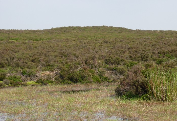
Pole Cottage submitted by TimPrevett on 24th Jan 2006. One of the more easy to spot barrows on The Long Mynd, just west of the Pole Cottage parking area.
(View photo, vote or add a comment)
Log Text: None
Caer Caradoc (Church Stretton)
Date Added: 24th Nov 2013
Site Type: Hillfort
Country: England (Shropshire)
Visited: Yes
Caer Caradoc (Church Stretton) submitted by TimPrevett on 28th Jun 2004. Caer Caradoc, taken from a northwest angle on a lovely summer's morning. Indeed, this offers some formidable defense. If this were the place of Caratacus' last stand against the Romans, this would have indeed been something difficult to conquer, even by Roman standards. However, there is no evidence to confirm this suggestion.
(View photo, vote or add a comment)
Log Text: None
The Stiperstones
Date Added: 24th Nov 2013
Site Type: Cairn
Country: England (Shropshire)
Visited: Yes
The Stiperstones submitted by TimPrevett on 28th Jun 2004. A cairn just north east of Manstone Rock.
"The Stiperstones" is the name for a hill on the far west reaches of Shropshire, well into The Welsh Marches, overlooking the Welsh border. It is the second highest hill in Shropshire, affording superb views in all directions, and having several bronze age cairns along its ridge.
The cairns themselves, excepting the largest, can be quite hard to locate. At a very reductionist level, they are basically piles of stone amidst a whole ridge of piles of...
(View photo, vote or add a comment)
Log Text: None
The Lawley (Summit)
Date Added: 24th Nov 2013
Site Type: Hillfort
Country: England (Shropshire)
Visited: Yes
The Lawley (Summit) submitted by TheWhiteRider on 12th Jun 2006. The summit of The Lawley.
(View photo, vote or add a comment)
Log Text: None
The Lawley (Northern)
Date Added: 24th Nov 2013
Site Type: Hillfort
Country: England (Shropshire)
Visited: Yes
The Lawley (Northern) submitted by TheWhiteRider on 12th Jun 2006. Cross Ridge Dyke and ditch at SW end, bisected by original causeway and entrance.
(View photo, vote or add a comment)
Log Text: None
Caer Caradoc Round Barrow
Date Added: 24th Nov 2013
Site Type: Round Barrow(s)
Country: England (Shropshire)
Visited: Yes
Caer Caradoc Round Barrow submitted by TheWhiteRider on 12th Jun 2006. Caer Caradoc Round Barrow with The Lawley and Hoar Ridge in the distance.
(View photo, vote or add a comment)
Log Text: None
Hope Bowdler Hill
Date Added: 24th Nov 2013
Site Type: Cairn
Country: England (Shropshire)
Visited: Yes
Hope Bowdler Hill submitted by TheWhiteRider on 29th May 2006. Bronze Age Cairn on Hope Bowdler Hill.
(View photo, vote or add a comment)
Log Text: None
Carn Ferched Standing Stones
Date Added: 24th Nov 2013
Site Type: Standing Stones
Country: Wales (Pembrokeshire)
Visited: Would like to visit
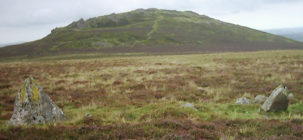
Carn Ferched Standing Stones submitted by Hurricane_Luis on 23rd Mar 2013. Carn Ferched Standing Stones, Preseli Hills, Pembrokeshire, Wales, United Kingdom
(View photo, vote or add a comment)
Crn Llwyd Stone
Date Added: 24th Nov 2013
Site Type: Standing Stone (Menhir)
Country: Wales (Pembrokeshire)
Visited: Yes
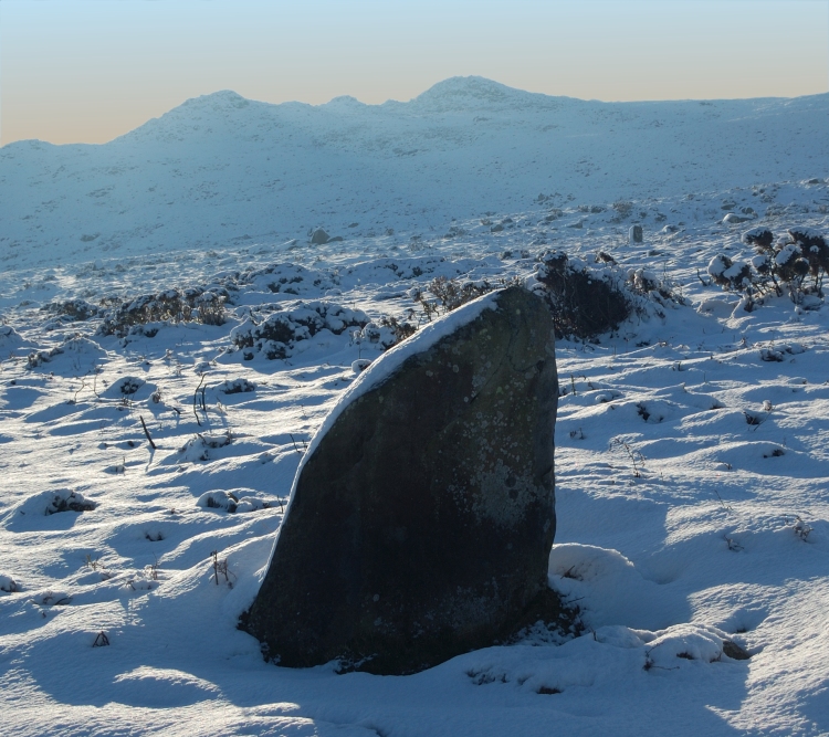
Crn Llwyd Stone submitted by pab on 24th Jan 2013. Looking over Crn Llwyd stone up to Carn Ingli.
24 January 2013
(View photo, vote or add a comment)
Log Text: None
Porth-y-Rhaw
Date Added: 24th Nov 2013
Site Type: Promontory Fort / Cliff Castle
Country: Wales (Pembrokeshire)
Visited: Would like to visit
Porth-y-Rhaw submitted by pattersa on 17th Oct 2011. View of the promontory fort at Porth-y-Rhaw from the coastal path from the east
(View photo, vote or add a comment)
Bedd Morris
Date Added: 24th Nov 2013
Site Type: Standing Stone (Menhir)
Country: Wales (Pembrokeshire)
Visited: Yes
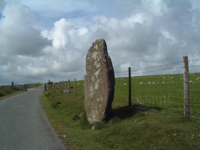
Bedd Morris submitted by enkidu41 on 3rd Jun 2004. SN 0382 3650
A 6'6" high menhir which tapers to a point.
(View photo, vote or add a comment)
Log Text: None
