Contributory members are able to log private notes and comments about each site
Sites SandyG has logged. View this log as a table or view the most recent logs from everyone
Butterdon East
Date Added: 29th Jan 2019
Site Type: Stone Row / Alignment
Country: England (Devon)
Visited: Yes on 4th May 2018. My rating: Condition 2 Ambience 4 Access 2
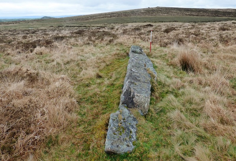
Butterdon East submitted by SandyG on 4th Jan 2019. Eastern stone. A substantial fallen pillar measuring 5m long stands up to 0.56m above the surrounding ground. View from west (Scale 1m).
(View photo, vote or add a comment)
Log Text: Car parking is available at SX 64338 59550. Follow the bridleway heading east for 1.4km then head south. There is plenty to see in this area.
Sharp Tor North East
Date Added: 11th Feb 2020
Site Type: Stone Row / Alignment
Country: England (Devon)
Visited: Yes on 4th May 2018. My rating: Condition 1 Ambience 5 Access 2
Sharp Tor North East submitted by SandyG on 11th Feb 2020. Stone 4 measures 0.28m long by 0.18m wide, stands 0.23m high and is orientated at 119°. View from south (Scale 1m).
(View photo, vote or add a comment)
Log Text: Car parking is available at SX 64338 59551. From here head east along the path to SX 65778 59971 then head north along the Two Moors Way to the site.
Fieldwork identified a short sinuous line of stones leading from near an irregular cluster of stones which could represent the much truncated remains of a cairn or even a stone circle. This line of stones is unlikely to be natural because there is no surface stone in the vicinity but interpretation as a stone row seems on the basis of the available evidence should be considered uncertain. The row seems rather sinuous for such a short length and there has clearly been much disturbance in the area. Future fieldwork under more sympathetic vegetation conditions may provide an opportunity for a re-interpretation.
Cut Hill Stone Row
Date Added: 24th Jan 2019
Site Type: Stone Row / Alignment
Country: England (Devon)
Visited: Yes on 6th May 2018. My rating: Condition 2 Ambience 5 Access 1
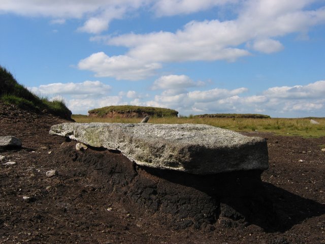
Cut Hill Stone Row submitted by Andy B on 10th Apr 2010. Granite Stone Row
Here is the roof of Dartmoor, from the top you can see right all across Dartmoor. In the picture is a piece of granite probably Megalithic in age and is in a series of stones running along the top of this hill. This row is unique within Dartmoor as it the only one with equal spacing within the row and above 600m, 100m above any other row in Dartmoor. The peat has washed away from around the stone but not from underneath, meaning the granite sticks out above the ground.
C...
(View photo, vote or add a comment)
Log Text: This is not an easy row to get to. It lies within the Okehampton Range and it is only possible to visit when live firing is not taking place. Details of firing times are available online. Access is difficult which ever direction it is approached from. After much thought, I decided that the south looked best. Car parking is available at Postbridge (SX 64667 78839). From here take the footpath leading north to SX 63444 79743. From here continue following the path to SX 62823 80230 and then along the western side of the East Dart River to SX 60837 82087. Follow the line of poles that separate the Okehampton and Merrivale Ranges to SX 59748 82645 then walk north to the row which is at the top of the hill. Allow a whole day and make sure you have map. My journey was eventful. At one point three sky larks attacked a cuckoo, another sky lark collided with me when being chased by a kestrel which then hovered for a few seconds within arms reach, in the middle of nowhere a group of people were partaking in what looked like a delicious cream tea and I was joined for part of the journey by a couple who made the final ascent pass without the expected pain.
Cut Hill Cairn
Date Added: 24th Jan 2019
Site Type: Cairn
Country: England (Devon)
Visited: Yes on 6th May 2018. My rating: Condition 4 Ambience 5 Access 1
Cut Hill Cairn submitted by Anne T on 20th Sep 2016. This cairn, at SX 59823 82745, marks the south terminal of the stone row.
Picture courtesy of Prehistoric Dartmoor Walks: "Barrow c20m overall diameter on the top of 'Cut Hill' at 603m OD was observed during a field visit by Tom Greeves in 2004. The 1.5m high circular mound has a military range pole set in it & surface erosion has exposed a turf/peat core with a few stones. The surrounding ditch is over 1m wide & nearly filled with waterlogged vegetation."
(View photo, vote or add a comment)
Log Text: None
Kenidjack Common holed stones
Date Added: 29th Jan 2019
Site Type: Stone Row / Alignment
Country: England (Cornwall)
Visited: Yes on 9th May 2018. My rating: Condition 3 Ambience 4 Access 3
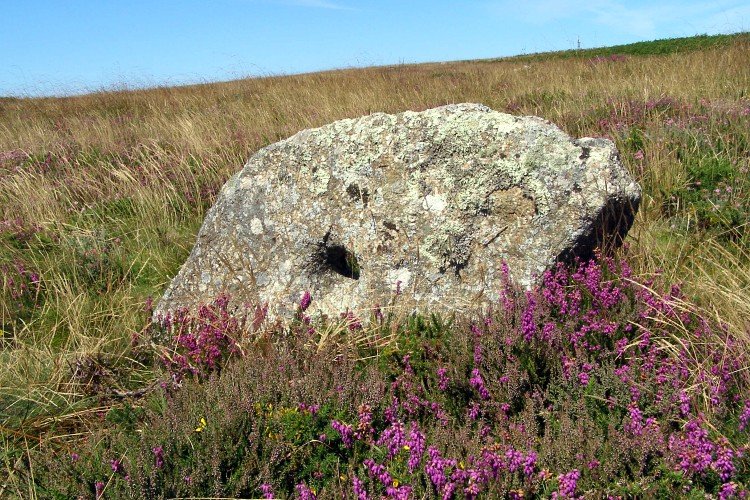
Kenidjack Common holed stones submitted by JimChampion on 24th Oct 2007. August 2007. One of the holed stones on Kenidjack Common, surrounded by flowering bell heather.
(View photo, vote or add a comment)
Log Text: Car parking is available at SW 39343 33369. From here walk west for a short distance along the highway to SW 39191 33324. Head south along the footpath to SW 39081 32899 and enter the common . Follow the track heading south west and then take the path to the south.
Gray Hill stone row
Date Added: 6th Jan 2019
Site Type: Standing Stone (Menhir)
Country: Wales (Monmouthshire)
Visited: Yes on 12th May 2018. My rating: Condition 3 Ambience 5 Access 2
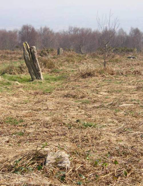
Gray Hill stone row submitted by TheCaptain on 2nd Apr 2004. Grey Hill or Gray Hill Stone Row, Monmouthshire, ST437936 - ST438935
Looking to the south down the hill, is a fairly reasonable alignment of 5 stones in a row, which sort of joins between the jumbled stone remains on the top of the hill and the stone circle.
(View photo, vote or add a comment)
Log Text: Car parking is available at ST 42871 93864. From here cross the road and follow the track that starts at ST 42884 93940. At ST 43270 93715 take the footpath leading up the very steep hill and follow this to ST 43641 93659. Head downhill from here to the row.
Gray Hill circle
Date Added: 6th Jan 2019
Site Type: Stone Circle
Country: Wales (Monmouthshire)
Visited: Yes on 12th May 2018. My rating: Condition 3 Ambience 5 Access 2
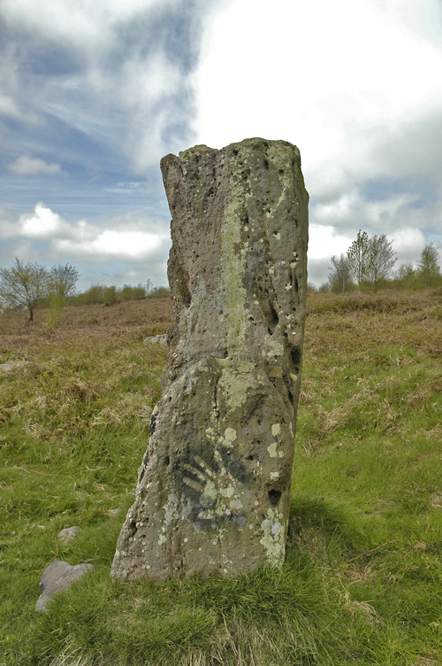
Gray Hill circle submitted by sem on 6th May 2013. Vandalism!
The idiot who sprayed this hand-print probably thought he was being very clever and somehow "enhancing" the work of his ancestors. The sane and sensible among us will view it for what it is, graffiti.
This has been reported to the relevant archaeo trust. Unfortunately I doubt the culprit will be found..... unless anyone knows of someone bragging on a social network site????
(View photo, vote or add a comment)
Log Text: Car parking is available at ST 42871 93864. From here cross the road and follow the track that starts at ST 42884 93940. At ST 43270 93715 take the footpath leading up the very steep hill and follow this to ST 43641 93659. Head downhill from here to the row. The kerbed cairn/stone circle can be found at the lower end of the row.
Gray Hill summit cairn
Date Added: 6th Jan 2019
Site Type: Round Cairn
Country: Wales (Monmouthshire)
Visited: Yes on 12th May 2018. My rating: Condition 3 Ambience 5 Access 2
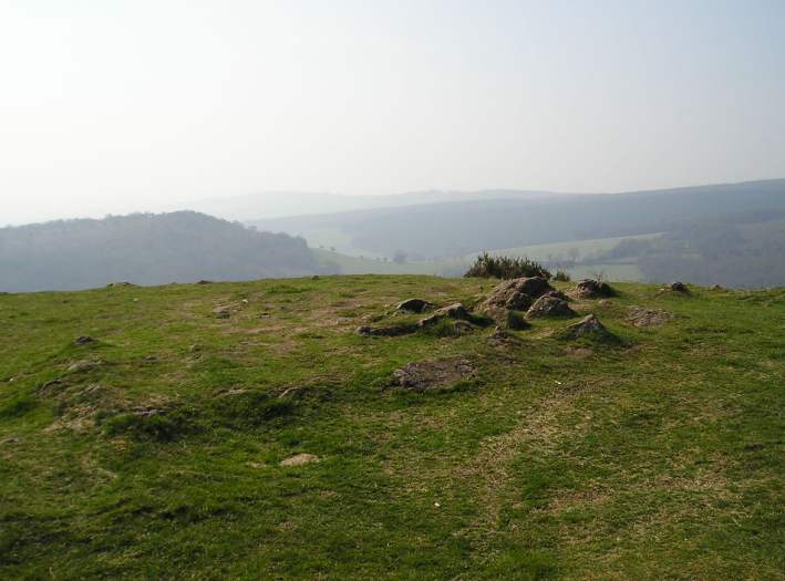
Gray Hill summit cairn submitted by TheCaptain on 2nd Apr 2004. Grey Hill or Gray Hill, Monmouthshire. Cairn atop hill at ST434936
Right on the top of the hill, with spectacular views all around is the remains of an ancient, but well worn cairn. I could have been imagining it, but did this cairn once have a kerbed ring around it, and some internal structures ?
(View photo, vote or add a comment)
Log Text: Car parking is available at ST 42871 93864. From here cross the road and follow the track that starts at ST 42884 93940. At ST 43270 93715 take the footpath leading up the very steep hill. You will know you have arrived when there is no more hill to climb.
Harolds Stones
Date Added: 6th Jan 2019
Site Type: Stone Row / Alignment
Country: Wales (Monmouthshire)
Visited: Yes on 19th May 2018. My rating: Condition 4 Ambience 3 Access 5
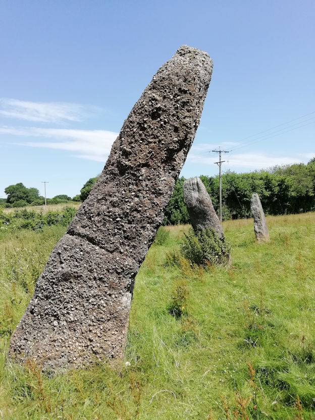
Harolds Stones submitted by TheCaptain on 5th Jul 2018. Harolds Stones, 3rd July 2018.
They are bigger than I remember them being - perhaps they have grown in this fine summer weather.
(View photo, vote or add a comment)
Log Text: Parking is available in the village at SO 50081 05283. From here walk carefully south along the road to the stones.
Burford Down (Tristis Rock)
Date Added: 4th Jan 2019
Site Type: Cairn
Country: England (Devon)
Visited: Yes on 25th May 2018. My rating: Condition 3 Ambience 5 Access 2
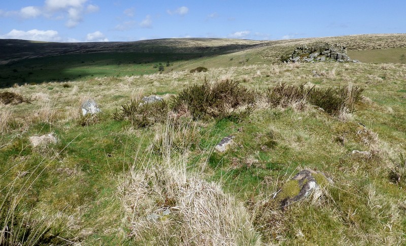
Burford Down (Tristis Rock) submitted by SandyG on 4th Jan 2019. View from west with Tristis Rock in the background.
(View photo, vote or add a comment)
Log Text: Very limited car parking is available at SX 62102 60910. Care should be taken to ensure that the highway is not restricted and access to the adjacent field is not obstructed. From here walk eastward up the lane and follow the footpath to the Erme Valley to SX 63582 61142. From here head south to the row passing the Stalldown SE stone row on the way.
Butterdon Hill Cist
Date Added: 4th Jan 2019
Site Type: Cist
Country: England (Devon)
Visited: Yes on 27th May 2018. My rating: Condition 3 Ambience 5 Access 2
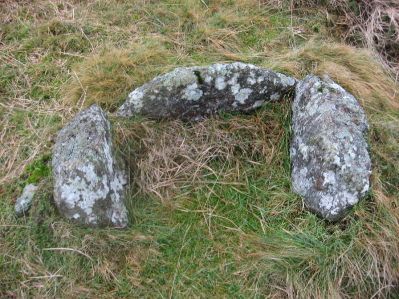
Butterdon Hill Cist submitted by Anne T on 15th Oct 2016. Butterdon Hill cist, submitted on behalf of Prehistoric Dartmoor Walks.
(View photo, vote or add a comment)
Log Text: Worth having a look at when visiting the nearby stone rows. Car parking is available at SX 64338 59550. Follow the bridleway heading east for 1.4km then head south. There is plenty to see in this area.
Five Kings
Date Added: 12th Jan 2019
Site Type: Stone Row / Alignment
Country: England (Northumberland)
Visited: Yes on 22nd Jun 2018. My rating: Condition 4 Ambience 3 Access 2

Five Kings submitted by Strider on 4th Feb 2003. Five Kings, Northumberland
NT955001
Alignment of four large, irregular stones - the fifth may have fallen but I could not be certain.
(View photo, vote or add a comment)
Log Text: Limited car parking is available at NT 95789 02379. From here follow the footpath south westward to the row. In common with most rows next to forestry watch out for ticks, but another hazard here was clouds of flies – fortunately of the non biting variety.
Standingstone Rigg
Date Added: 29th Jan 2019
Site Type: Stone Row / Alignment
Country: England (Northumberland)
Visited: Yes on 23rd Jun 2018. My rating: Condition 2 Ambience 4 Access 2
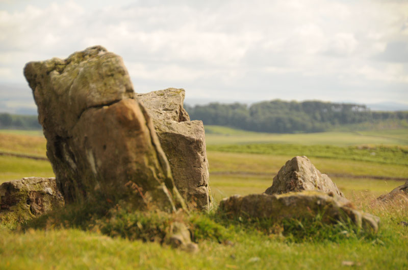
Standingstone Rigg submitted by Anne T on 15th Jul 2014. This photograph is taken from the top of Standingstone Rigg looking south east. The pairing of the stones is identifiable.
(View photo, vote or add a comment)
Log Text: Limited car parking is available at NY 83118 75082. From here follow the track south looking out for the small four-stone circle at NY 82942 74717. Follow the track past Great Lonbrough and onto the access land at NY 81612 73313. From here it is a short walk west to the stones.
There are a number of separate and connected reasons for doubting the prehistoric stone row interpretation of this site:-
In places there seems to be a rubble bank between the upright stones.
At one point near to the sheep fold there is a clear lynchet along the orientation of the feature
At the northern end, the feature descends a very steep slope. No other row is known to do this.
A line of lines at NY 81514 73328 suggests that the feature turns at a right angle and heads east from NY 81499 73317. Severe shifts of alignment such as this are not a characteristic of stone rows but are common in field boundaries
The spacing between the rows is inconsistent
The form of the feature is similar to prehistoric boundary walls
The southern part of the feature is orientated on a pronounced kink in a boundary bank.
On the basis of the available evidence it would therefore appear unlikely that this feature represents the remains of a prehistoric stone row and instead is more likely to be the partly robbed remains of a field boundary, probably of prehistoric date because historic boundaries in the vicinity appear to be of the ditch and bank type.
Goatstones Four-Poster
Date Added: 30th Jan 2019
Site Type: Stone Circle
Country: England (Northumberland)
Visited: Yes on 23rd Jun 2018. My rating: Condition 4 Ambience 4 Access 4
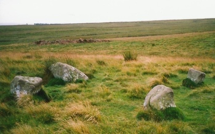
Goatstones Four-Poster submitted by Bladup on 20th Feb 2014. Goatstones Four-Poster.
(View photo, vote or add a comment)
Log Text: None
Whittondean Farm
Date Added: 10th Feb 2020
Site Type: Stone Row / Alignment
Country: England (Northumberland)
Visited: Yes on 24th Jun 2018. My rating: Condition 2 Ambience 4 Access 2
Whittondean Farm submitted by SandyG on 10th Feb 2020. The “stone alignment” scheduled by Historic England forms part of a field boundary or wall. View from west.
(View photo, vote or add a comment)
Log Text: Car parking is available at NZ 05267 98785. From here head north. There is plenty of rock art and some interesting prehistoric field boundaries to see.
Lordenshaw Hillfort
Date Added: 10th Feb 2020
Site Type: Hillfort
Country: England (Northumberland)
Visited: Yes on 24th Jun 2018. My rating: Condition 3 Ambience 4 Access 4
Lordenshaw Hillfort submitted by DrewParsons on 2nd Oct 2011. View of the second of the two entrances. September 2011.
(View photo, vote or add a comment)
Log Text: None
Threestoneburn
Date Added: 12th Jan 2019
Site Type: Stone Circle
Country: England (Northumberland)
Visited: Yes on 26th Jun 2018. My rating: Condition 3 Ambience 4 Access 1
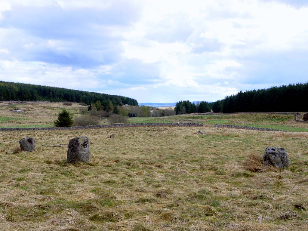
Threestoneburn submitted by Creative Commons on 19th May 2013. Also known as Ilderton Stone Circle. The view here is easterly, with your back to the forest fence, looking back down the valley towards Threestoneburn House.
Some of my friends taken on the long walk here would have said, "OK, it's a stone circle but it's hardly Stonehenge or Calanais, is it?".
No it's not Stonehenge or Calanais; it's a north-east stone circle. We do it differently up here. We put rough stones in a rough circle. Job done. Not for us this hacking great lumps of stone...
(View photo, vote or add a comment)
Log Text: This is not an easy row to get to and some might wonder whether the effort is worth it. Bridleways shown on Ordnance Survey maps do not exist and visiting it on the hottest day of the year is not recommended. Sadly in common with many rows next to forestry you will need to watch out for ticks. The route described below worked for me, but alternatives may exist. Park at NT 96325 23259. Cross the bridge and follow the footpath to NT 96195 22029. From here the best way is to follow the quad bike track on the southern side of the wall. This will take you to the access gate into Threestoneburn Wood at NT 96970 20964. From here follow the forest track to the row and circle.
The Shearers
Date Added: 12th Jan 2019
Site Type: Stone Row / Alignment
Country: Scotland (Scottish Borders)
Visited: Yes on 27th Jun 2018. My rating: Condition 3 Ambience 5 Access 3
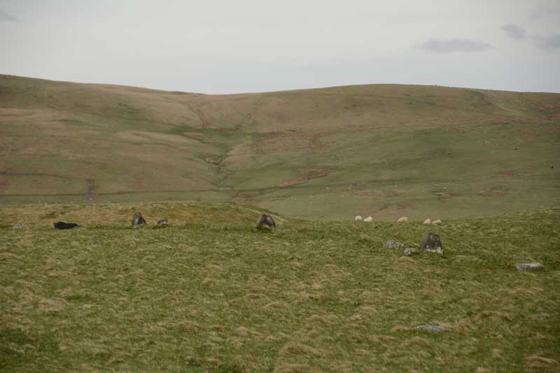
The Shearers submitted by Anne T on 8th May 2015. This was my first view of The Shearers, running across the centre/middle of the photograph from left to right.
(View photo, vote or add a comment)
Log Text: Limited car parking is available in Hownam village at NT 77872 19153. From here follow the track uphill to the east. There is a fine standing stone at NT 78747 18908 which is worth checking out. From here follow the track to NT 79205 19048 then head north. I would like to thank Anne and Andrew Tate for helping with the survey and for sharing such an enjoyable day in another special place.
Gallowhill Wood
Date Added: 10th Jan 2019
Site Type: Stone Row / Alignment
Country: Scotland (Perth and Kinross)
Visited: Yes on 6th Jul 2018. My rating: Condition 2 Ambience 1 Access 4
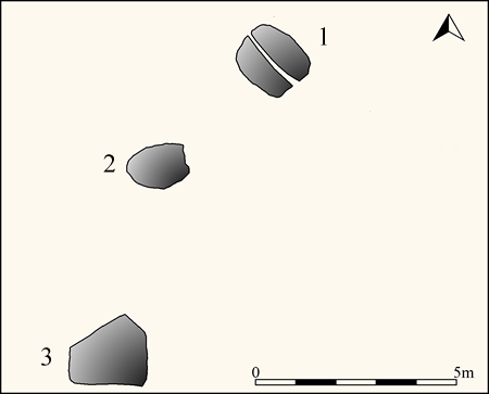
Gallowhill Wood submitted by SandyG on 10th Jan 2019. Plan of Gallowhill Wood stone row showing the position of the numbered stones (Source 1:100 survey by Sandy Gerrard).
(View photo, vote or add a comment)
Log Text: Limited car parking is available nearby at NO 16695 35933. Please ensure that you get permission from the owners of the adjacent house before leaving your car.
Commonbank
Date Added: 10th Jan 2019
Site Type: Stone Row / Alignment
Country: Scotland (Perth and Kinross)
Visited: Yes on 6th Jul 2018. My rating: Condition 2 Ambience 5 Access 3
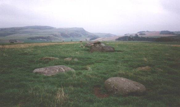
Commonbank submitted by Nick on 5th Nov 2002. Looking to the east over the row. Take the turning into Glencarse from the A90 between Perth and Dundee. Head NNW just after the hotel, and follow signs for Gouktoun. Take a right, then right again for Balthayock, and follow this road for about two miles. The stones lie within the farm lands of Commonbank Farm, lying to the west of the road. They are accessible via the farm road and through the fields, but permission should be sought from the farmer as stock are in the fields. I found the ...
(View photo, vote or add a comment)
Log Text: Car parking is available at Commonbank Farm (NO 17819 24560) but permission should be obtained before parking.
