Contributory members are able to log private notes and comments about each site
Sites SandyG has logged. View this log as a table or view the most recent logs from everyone
Picardy Stone
Date Added: 30th Jan 2019
Site Type: Class I Pictish Symbol Stone
Country: Scotland (Aberdeenshire)
Visited: Yes on 22nd Sep 2013. My rating: Condition 4 Ambience 2 Access 5

Picardy Stone submitted by SandyG on 2nd Jan 2015. Shame that the proximity of the protective fence makes it difficult to get decent photographs (22nd September 2013).
(View photo, vote or add a comment)
Log Text: None
Pig Hill (S)
Date Added: 12th Jan 2018
Site Type: Standing Stones
Country: England (Devon)
Visited: Yes on 22nd Jan 2017. My rating: Condition 3 Ambience 4 Access 4
Pig Hill (S) submitted by thecaptain on 18th Mar 2007. It is a great pity that one of the stones has recently been broken, possibly by somebody driving a 4x4 over the moor (the tracks are everywhere), perhaps horses, or perhaps maybe just wanton vandalism, as a pathway runs right past this stone.
(View photo, vote or add a comment)
Log Text: Car parking is available at SS 76006 44289. Take care when crossing the road.
Piles Hill NE
Date Added: 28th Jan 2019
Site Type: Multiple Stone Rows / Avenue
Country: England (Devon)
Visited: Yes on 9th Mar 2013. My rating: Condition 2 Ambience 4 Access 3
Piles Hill NE submitted by SandyG on 26th Feb 2015. All of the stones in this row are now recumbent. When standing this must have been spectacular indeed. (9th March 2013)
(View photo, vote or add a comment)
Log Text: Car parking location is available at SX 64342 59548. From here head east to the Two Moors Way at SX 65765 59965. Then follow the track north to SX 65388 61077 where it crosses the row.
Piles Hill W
Date Added: 6th Feb 2020
Site Type: Multiple Stone Rows / Avenue
Country: England (Devon)
Visited: Yes on 10th Sep 2019. My rating: Condition 2 Ambience 4 Access 2
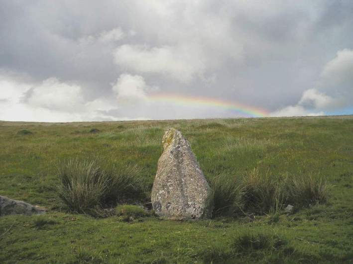
Piles Hill W submitted by TheCaptain on 30th Jun 2004. Piles Hill Avenue, Dartmoor, Devon SX651611 to SX659611
Rainbow over the western end terminal stone.
(View photo, vote or add a comment)
Log Text: Car parking location is available at SX 64342 59548. From here head east to the Two Moors Way at SX 65765 59965. Then follow the track north to SX 65388 61077 where it crosses the row.
Pillar of Eliseg
Date Added: 21st Feb 2015
Site Type: Early Christian Sculptured Stone
Country: Wales (Denbighshire)
Visited: Yes on 20th Feb 2015
Pillar of Eliseg submitted by SandyG on 20th Feb 2015. This photograph was taken in June 1980.
(View photo, vote or add a comment)
Log Text: None
Pin Hole Cave
Date Added: 25th Feb 2015
Site Type: Cave or Rock Shelter
Country: England (Derbyshire)
Visited: Yes on 24th Feb 2015
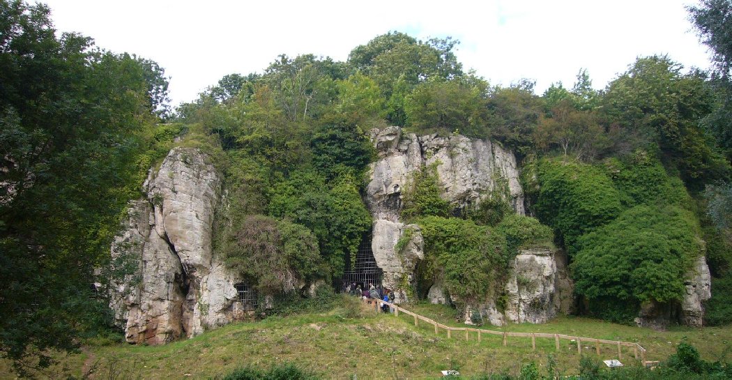
Pin Hole Cave submitted by SandyG on 24th Feb 2015. Pin Hole Cave (10th September 2008).
(View photo, vote or add a comment)
Log Text: None
Pitmudie
Date Added: 9th Jan 2019
Site Type: Stone Row / Alignment
Country: Scotland (Angus)
Visited: Yes on 3rd Dec 2016. My rating: Condition 2 Ambience 3 Access 4
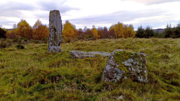
Pitmudie submitted by golux on 1st Nov 2010. View looking west.
I was surprised to find modern markings on one of the stones - see my other photo.
(View photo, vote or add a comment)
Log Text: Limited roadside car parking is available at NO 27022 56470. From here enter the forestry plantation to the north and follow the heavilly rutted track eastward and then northward. Once you arrive in the clearing at NO 27345 56470 head due east and the standing stone will soon become visible.
Plas-y-coed cairns
Date Added: 21st Jan 2015
Site Type: Barrow Cemetery
Country: Wales (Carmarthenshire)
Visited: Yes on 18th Jan 2015
Plas-y-coed cairns submitted by SandyG on 18th Jan 2015. The northern cairn. View from the east (16th January 2015).
(View photo, vote or add a comment)
Log Text: None
Pobull Fhinn
Date Added: 9th Feb 2019
Site Type: Stone Circle
Country: Scotland (North Uist)
Visited: Yes on 27th Aug 2015. My rating: Condition 4 Ambience 5 Access 4
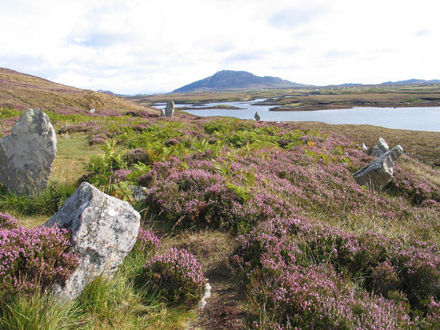
Pobull Fhinn submitted by jeffrep on 19th Feb 2008. Site in North Uist
Pobull Fhinn Overlooking Loch Langais with Ben Eval is the Distance, No. Uist, Western Isles, Scotland
(View photo, vote or add a comment)
Log Text: None
Pollachar
Date Added: 9th Feb 2019
Site Type: Standing Stone (Menhir)
Country: Scotland (South Uist)
Visited: Yes on 26th Aug 2015. My rating: Condition 3 Ambience 4 Access 5

Pollachar submitted by h_fenton on 20th Jul 2006. Pollachar standing stone, South Uist. view from south west, showing proximity to the Pollachar Inn behind
(View photo, vote or add a comment)
Log Text: None
Porlock Allotment NE
Date Added: 26th Jan 2018
Site Type: Standing Stones
Country: England (Somerset)
Visited: Yes on 4th Mar 2016. My rating: Condition 2 Ambience 4 Access 3
Porlock Allotment NE submitted by thecaptain on 2nd Nov 2006. What can be found is a large stone which looks like it might once have been standing. It’s a sort of triangular shape, 2.5 m long by 1.5 m wide.
I thought this was a lovely place above the conjugation of the two streams, all very atmospheric.
(View photo, vote or add a comment)
Log Text: Car parking is available at SS 84543 44569. From here walk northward along the roadside verge for about 50m, then cross the road and enter the field on you left using the gateway. Head westward passing the stone circle. Best visited in the winter or spring months when the bracken is not growing.
Porlock Allotment SW
Date Added: 22nd Jan 2019
Site Type: Multiple Stone Rows / Avenue
Country: England (Somerset)
Visited: Yes on 25th Apr 2018. My rating: Condition 2 Ambience 4 Access 3
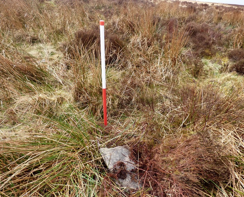
Porlock Allotment SW submitted by SandyG on 22nd Jan 2019. Stone 7 measures 0.48m long by 0.24m wide, stands 0.23m above the ground surface and is orientated at 160°. This stone has probably fallen eastwards. View from south east (Scale 1m).
(View photo, vote or add a comment)
Log Text: Limited car parking is available at SS 84543 44569. From here follow the track leading south west to SS 83567 43802. Then head west to the row.
Porlock Circle
Date Added: 15th Feb 2020
Site Type: Stone Circle
Country: England (Somerset)
Visited: Yes on 4th Mar 2016. My rating: Condition 2 Ambience 4 Access 4
Porlock Circle submitted by thecaptain on 10th Nov 2006. View roughly northwest across the circle, with the large prone stone in the foreground and the next largest stone on the western side in the distance.
The diameter is about 25 metres and I counted 16 stones, but many of these are just loose stones on the surface.
(View photo, vote or add a comment)
Log Text: None
Porlock Common North East
Date Added: 17th Jan 2019
Site Type: Stone Row / Alignment
Country: England (Devon)
Visited: Yes on 19th Apr 2018. My rating: Condition 2 Ambience 4 Access 4
Porlock Common North East submitted by SandyG on 17th Jan 2019. Western stone. View from south west (Scale 1m).
(View photo, vote or add a comment)
Log Text: Parking is available at SS 84541 46153. From here it is a short walk south west to the row.
Porlock Common SW
Date Added: 12th Jan 2018
Site Type: Multiple Stone Rows / Avenue
Country: England (Somerset)
Visited: Yes on 4th Mar 2016. My rating: Condition 4 Ambience 4 Access 4
Porlock Common SW submitted by thecaptain on 4th Nov 2006. Seen here looking west, towards the circle.
I found 5 tiny little stones in two parallel rows. There was one row of three stones, spaced about 1.5 metres apart. Adjacent to this is a second row consisting of one stone at the western end, and one more beyond the eastern end, which would seem to be from a fourth pair. The two rows are less than a metre apart. The largest stone is no more than 6 inches in height !
(View photo, vote or add a comment)
Log Text: Car parking is available at SS 84543 44569. From here walk northward along the roadside verge for about 50m then veer to the right and walk up the hill for about 50m. The row is not at all obvious and may take you a while to find.
Portheras Barrow
Date Added: 13th Feb 2020
Site Type: Round Barrow(s)
Country: England (Cornwall)
Visited: Yes on 17th Sep 2019. My rating: Condition 3 Ambience 4 Access 4
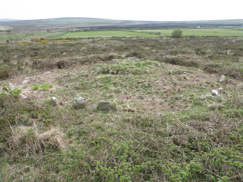
Portheras Barrow submitted by chris-b on 11th Jun 2010. Overview of the site
(View photo, vote or add a comment)
Log Text: None
Pump Maen (Five Stones)
Date Added: 11th Jan 2018
Site Type: Stone Row / Alignment
Country: Wales (Powys)
Visited: Yes on 19th Mar 2016. My rating: Condition 2 Ambience 4 Access 3

Pump Maen (Five Stones) submitted by sem on 25th Apr 2010. Pump Maen - Five Stones
The first four can be seen but a fifth lies hidden among the grey of rock outcrops.
The row points to a sixth stone on the horizon. This marks a route down a treacherous scree/cliff slope.
The row is aligned at the same angle as Carreg Cadnow Row, but as CC also points to a way down whether there is an Astronomical angle is debateable.
(View photo, vote or add a comment)
Log Text: Car parking is available at SN 85567 15530. From here walk north east along the waymarked path to SN 86267 15799. Head south east up the hill for about 400m.
It is always difficult to establish whether a line of boulders were deliberately placed or are instead the result of glacial or periglacial activity. Generally there must be a presumption in favour of natural origin, but occasionally some detail may hint at the possibility of human intervention. At Careg Lwyd a number of details support the possibility that this line of stones was created by people. The first is the three stone arrangement at the southern end and the second is the fact that the northern stone is prominent on the skyline when viewed from the southern end. Finally, and most convincingly is the evidence that at least one of the stones has been propped into position with trig stones. Together these details strongly suggest that this site was deliberately fashioned, but whether this happened in prehistoric times is less certain. On balance there is a sound possibility of this feature being a form of prehistoric stone row.
Pwll-y-Wythen Fach
Date Added: 2nd Jan 2015
Site Type: Ancient Village or Settlement
Country: Wales (Powys)
Visited: Yes on 29th Dec 2014
Pwll-y-Wythen Fach submitted by SandyG on 29th Dec 2014. Circular drystone building in the foot of a shake hole. The structure appears fresh in appearance, is unusual in form for a prehistoric dwelling and should therefore be considered more likely to be of historic date. Still an impressive location. To judge the scale note the figure on the rim of the shake hole above the structure. View from west (21st July 2014).
(View photo, vote or add a comment)
Log Text: None
Quinish (Stone Row)
Date Added: 6th Jan 2018
Site Type: Stone Row / Alignment
Country: Scotland (Isle of Mull)
Visited: Yes on 5th Jun 2016. My rating: Condition 2 Ambience 5 Access 1
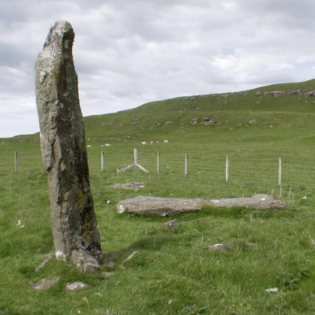
Quinish (Stone Row) submitted by Tom_Bullock on 27th Feb 2005. Photo used by kind permission of Tom Bullock. More details of this location are to be found on his Stone Circles and Rows CD-ROM.
(View photo, vote or add a comment)
Log Text: This is not an easy row to get to. The nearest car parking spot is at NM 43350 52269. From here you can either head northward along forest tracks or head back into the village of Dervaig and walk along the road that leads beside Loch a’Chumhainn. When visited in 2016 I chose to walk to the row through the forest and returned alongside the loch. The route via the village is probably the easiest. A map and or reliable GPS device is essential or else the chances of getting hopelessy lost are high.
Raddick Hill North
Date Added: 4th Oct 2014
Site Type: Ancient Village or Settlement
Country: England (Devon)
Visited: Yes on 4th Oct 2014
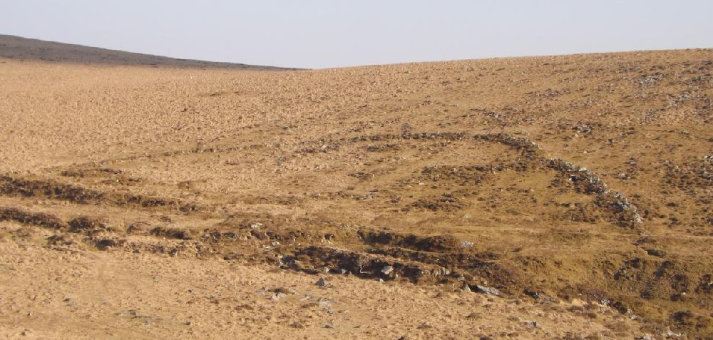
Raddick Hill North submitted by SandyG on 4th Oct 2014. Enclosure boundary and stone round houses at Raddick Hill North. View from north west.
(View photo, vote or add a comment)
Log Text: None
