Contributory members are able to log private notes and comments about each site
Sites SandyG has logged. View this log as a table or view the most recent logs from everyone
Dover Castle
Date Added: 28th Feb 2015
Site Type: Hillfort
Country: England (Kent)
Visited: Yes on 25th Feb 2015
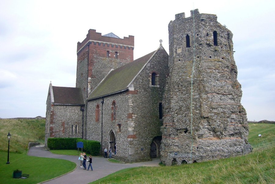
Dover Castle submitted by SandyG on 25th Feb 2015. Roman Pharos (lighthouse) next to the church. View from north west.
(View photo, vote or add a comment)
Log Text: None
Grime's Graves Flint Mines
Date Added: 26th Jun 2015
Site Type: Ancient Mine, Quarry or other Industry
Country: England (Norfolk)
Visited: Yes on 23rd Jun 2015
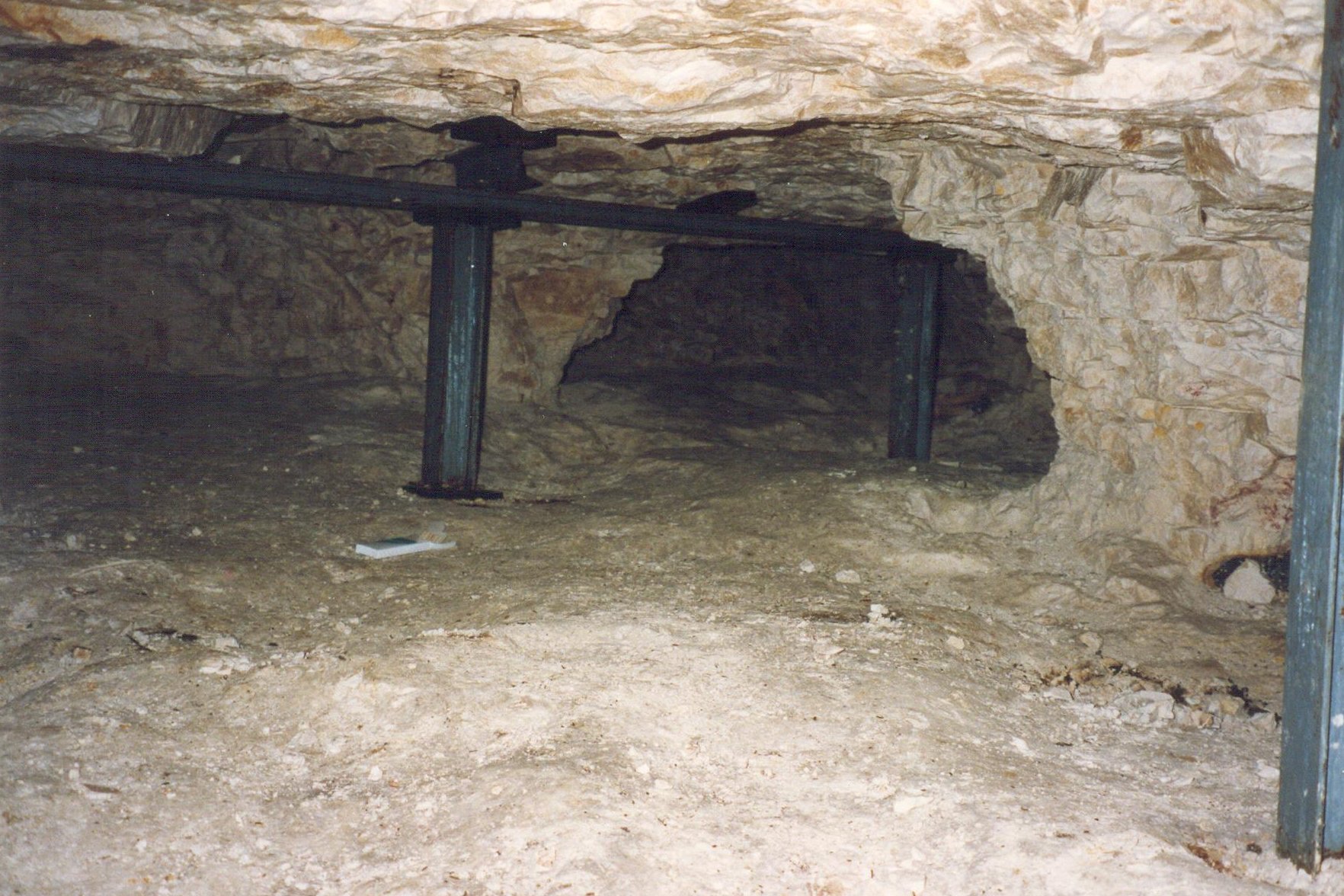
Grime's Graves Flint Mines submitted by SandyG on 23rd Jun 2015. Underground at Grimes Graves. Working conditions would have been dreadful and dangerous.
(View photo, vote or add a comment)
Log Text: None
Threestoneburn
Date Added: 12th Jan 2019
Site Type: Stone Circle
Country: England (Northumberland)
Visited: Yes on 26th Jun 2018. My rating: Condition 3 Ambience 4 Access 1
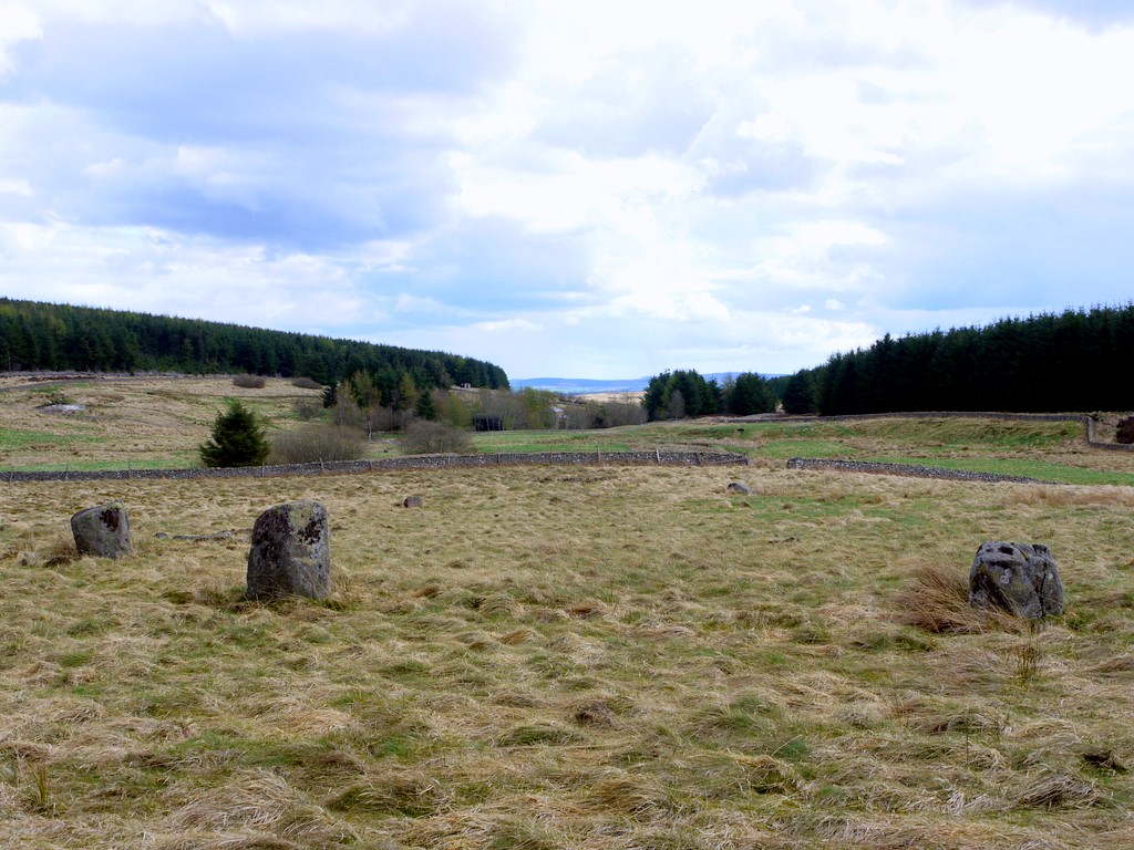
Threestoneburn submitted by Creative Commons on 19th May 2013. Also known as Ilderton Stone Circle. The view here is easterly, with your back to the forest fence, looking back down the valley towards Threestoneburn House.
Some of my friends taken on the long walk here would have said, "OK, it's a stone circle but it's hardly Stonehenge or Calanais, is it?".
No it's not Stonehenge or Calanais; it's a north-east stone circle. We do it differently up here. We put rough stones in a rough circle. Job done. Not for us this hacking great lumps of stone...
(View photo, vote or add a comment)
Log Text: This is not an easy row to get to and some might wonder whether the effort is worth it. Bridleways shown on Ordnance Survey maps do not exist and visiting it on the hottest day of the year is not recommended. Sadly in common with many rows next to forestry you will need to watch out for ticks. The route described below worked for me, but alternatives may exist. Park at NT 96325 23259. Cross the bridge and follow the footpath to NT 96195 22029. From here the best way is to follow the quad bike track on the southern side of the wall. This will take you to the access gate into Threestoneburn Wood at NT 96970 20964. From here follow the forest track to the row and circle.
Five Kings
Date Added: 12th Jan 2019
Site Type: Stone Row / Alignment
Country: England (Northumberland)
Visited: Yes on 22nd Jun 2018. My rating: Condition 4 Ambience 3 Access 2

Five Kings submitted by Strider on 4th Feb 2003. Five Kings, Northumberland
NT955001
Alignment of four large, irregular stones - the fifth may have fallen but I could not be certain.
(View photo, vote or add a comment)
Log Text: Limited car parking is available at NT 95789 02379. From here follow the footpath south westward to the row. In common with most rows next to forestry watch out for ticks, but another hazard here was clouds of flies – fortunately of the non biting variety.
Standingstone Rigg
Date Added: 29th Jan 2019
Site Type: Stone Row / Alignment
Country: England (Northumberland)
Visited: Yes on 23rd Jun 2018. My rating: Condition 2 Ambience 4 Access 2
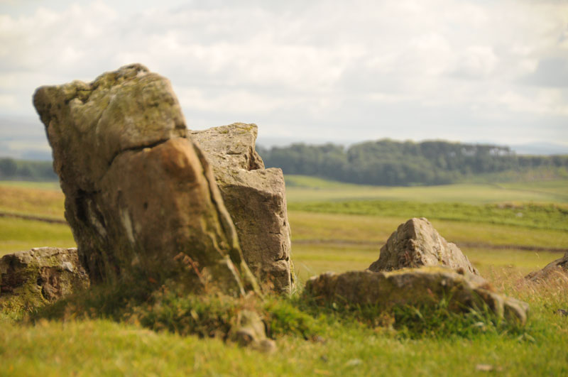
Standingstone Rigg submitted by Anne T on 15th Jul 2014. This photograph is taken from the top of Standingstone Rigg looking south east. The pairing of the stones is identifiable.
(View photo, vote or add a comment)
Log Text: Limited car parking is available at NY 83118 75082. From here follow the track south looking out for the small four-stone circle at NY 82942 74717. Follow the track past Great Lonbrough and onto the access land at NY 81612 73313. From here it is a short walk west to the stones.
There are a number of separate and connected reasons for doubting the prehistoric stone row interpretation of this site:-
In places there seems to be a rubble bank between the upright stones.
At one point near to the sheep fold there is a clear lynchet along the orientation of the feature
At the northern end, the feature descends a very steep slope. No other row is known to do this.
A line of lines at NY 81514 73328 suggests that the feature turns at a right angle and heads east from NY 81499 73317. Severe shifts of alignment such as this are not a characteristic of stone rows but are common in field boundaries
The spacing between the rows is inconsistent
The form of the feature is similar to prehistoric boundary walls
The southern part of the feature is orientated on a pronounced kink in a boundary bank.
On the basis of the available evidence it would therefore appear unlikely that this feature represents the remains of a prehistoric stone row and instead is more likely to be the partly robbed remains of a field boundary, probably of prehistoric date because historic boundaries in the vicinity appear to be of the ditch and bank type.
Goatstones Four-Poster
Date Added: 30th Jan 2019
Site Type: Stone Circle
Country: England (Northumberland)
Visited: Yes on 23rd Jun 2018. My rating: Condition 4 Ambience 4 Access 4
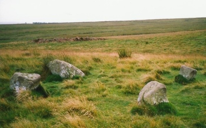
Goatstones Four-Poster submitted by Bladup on 20th Feb 2014. Goatstones Four-Poster.
(View photo, vote or add a comment)
Log Text: None
Whittondean Farm
Date Added: 10th Feb 2020
Site Type: Stone Row / Alignment
Country: England (Northumberland)
Visited: Yes on 24th Jun 2018. My rating: Condition 2 Ambience 4 Access 2
Whittondean Farm submitted by SandyG on 10th Feb 2020. The “stone alignment” scheduled by Historic England forms part of a field boundary or wall. View from west.
(View photo, vote or add a comment)
Log Text: Car parking is available at NZ 05267 98785. From here head north. There is plenty of rock art and some interesting prehistoric field boundaries to see.
Lordenshaw Hillfort
Date Added: 10th Feb 2020
Site Type: Hillfort
Country: England (Northumberland)
Visited: Yes on 24th Jun 2018. My rating: Condition 3 Ambience 4 Access 4
Lordenshaw Hillfort submitted by DrewParsons on 2nd Oct 2011. View of the second of the two entrances. September 2011.
(View photo, vote or add a comment)
Log Text: None
The King's Stone (Coldstream)
Date Added: 11th Nov 2024
Site Type: Standing Stone (Menhir)
Country: England (Northumberland)
Visited: Yes on 15th Sep 2024. My rating: Condition 5 Ambience 3 Access 3
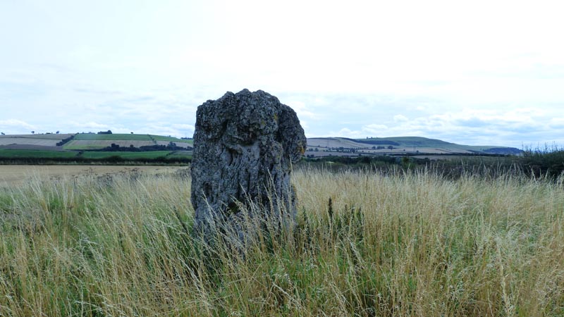
The King's Stone (Coldstream) submitted by bishop_pam on 22nd Aug 2017. The King's Stone, near Coldstream.
(View photo, vote or add a comment)
Log Text: None
Wayland's Smithy
Date Added: 15th Feb 2020
Site Type: Long Barrow
Country: England (Oxfordshire)
Visited: Yes on 21st Jan 1991. My rating: Condition 4 Ambience 4 Access 4
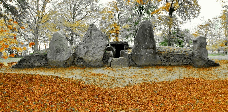
Wayland's Smithy submitted by StoneLee on 11th Jun 2015. Wayland's Smithy
(View photo, vote or add a comment)
Log Text: None
Stanton Drew NE Avenue
Date Added: 12th Jan 2018
Site Type: Multiple Stone Rows / Avenue
Country: England (Somerset)
Visited: Yes on 2nd Mar 2016. My rating: Condition 3 Ambience 4 Access 4
Stanton Drew NE Avenue submitted by TheCaptain on 11th Dec 2017. Looking along the NE Avenue to the NE circle at Stanton Drew, seen here in spring 2004
(View photo, vote or add a comment)
Log Text: Car parking is available at ST 59808 63260. From here follow the sign posts to the stone rows and circles. A fee for access is charged. In 2016 this was £1.
Stanton Drew NE Circle
Date Added: 12th Jan 2018
Site Type: Stone Circle
Country: England (Somerset)
Visited: Yes on 2nd Mar 2016. My rating: Condition 3 Ambience 4 Access 4

Stanton Drew NE Circle submitted by ogham on 12th Mar 2013. Interesting site to wander round and usually there no others with you.
(View photo, vote or add a comment)
Log Text: None
Stanton Drew - Avenue
Date Added: 12th Jan 2018
Site Type: Multiple Stone Rows / Avenue
Country: England (Somerset)
Visited: Yes on 2nd Mar 2016. My rating: Condition 3 Ambience 4 Access 4
Stanton Drew - Avenue submitted by TimPrevett on 18th Aug 2006. For evidence of the avenue, go past the NE circle, and look for the linear earthwork. The line is visible here on the LH corner of the picture; the group is on another part of the earthwork. Looking on the aerial pics, and on the ground, this can be traced from 3 o'clock to 12 o'clock outside the Great and NE circles. I did have an excellent picture of this from the ground, but have accidentally overwritten it!
(View photo, vote or add a comment)
Log Text: Car parking is available at ST 59808 63260. From here follow the sign posts to the stone rows and circles. A fee for access is charged. In 2016 this was £1.
Porlock Common SW
Date Added: 12th Jan 2018
Site Type: Multiple Stone Rows / Avenue
Country: England (Somerset)
Visited: Yes on 4th Mar 2016. My rating: Condition 4 Ambience 4 Access 4
Porlock Common SW submitted by thecaptain on 4th Nov 2006. Seen here looking west, towards the circle.
I found 5 tiny little stones in two parallel rows. There was one row of three stones, spaced about 1.5 metres apart. Adjacent to this is a second row consisting of one stone at the western end, and one more beyond the eastern end, which would seem to be from a fourth pair. The two rows are less than a metre apart. The largest stone is no more than 6 inches in height !
(View photo, vote or add a comment)
Log Text: Car parking is available at SS 84543 44569. From here walk northward along the roadside verge for about 50m then veer to the right and walk up the hill for about 50m. The row is not at all obvious and may take you a while to find.
Porlock Allotment NE
Date Added: 26th Jan 2018
Site Type: Standing Stones
Country: England (Somerset)
Visited: Yes on 4th Mar 2016. My rating: Condition 2 Ambience 4 Access 3
Porlock Allotment NE submitted by thecaptain on 2nd Nov 2006. What can be found is a large stone which looks like it might once have been standing. It’s a sort of triangular shape, 2.5 m long by 1.5 m wide.
I thought this was a lovely place above the conjugation of the two streams, all very atmospheric.
(View photo, vote or add a comment)
Log Text: Car parking is available at SS 84543 44569. From here walk northward along the roadside verge for about 50m, then cross the road and enter the field on you left using the gateway. Head westward passing the stone circle. Best visited in the winter or spring months when the bracken is not growing.
Culbone Hill
Date Added: 17th Jan 2019
Site Type: Stone Row / Alignment
Country: England (Somerset)
Visited: Yes on 25th Apr 2018. My rating: Condition 3 Ambience 2 Access 5
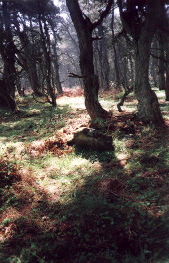
Culbone Hill submitted by TimPrevett on 5th Jul 2002. Culbone Hill Stone Row
SS832473
Date Visited Sunday 7th May 2000
Due to the explicit request not to go off the path, I did not get much evidence of the stone row. This was maddeningly frustrating, given its imminent proximity! However, having studied the map, I went back to where the car was parked, turned left further up the track, and then left up another track, where it intersects the stone row (fenced off with barbed wire). Two stones were just visible to my left through the dense ov...
(View photo, vote or add a comment)
Log Text: Limited car parking is available at SS 83350 47223. Access to the row itself is not currently freely available although the nearby Culbone Stone can be visited and at least two stones are visible from the permitted path that leads across the eastern length of the row.
Culbone Stone
Date Added: 17th Jan 2019
Site Type: Early Christian Sculptured Stone
Country: England (Somerset)
Visited: Yes on 25th Apr 2018. My rating: Condition 4 Ambience 4 Access 4
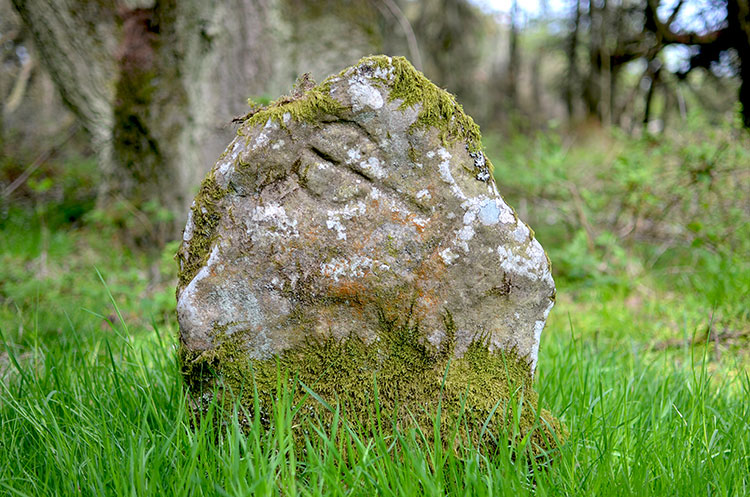
Culbone Stone submitted by PhilipGlastonbury on 23rd May 2013. Culbone Stone took ages to find, but it was worth it. The wood has an odd atmosphere, and the stone - when you eventually find it - seems to be waiting for you.
(View photo, vote or add a comment)
Log Text: Limited car parking is available at SS 83350 47223.
Porlock Allotment SW
Date Added: 22nd Jan 2019
Site Type: Multiple Stone Rows / Avenue
Country: England (Somerset)
Visited: Yes on 25th Apr 2018. My rating: Condition 2 Ambience 4 Access 3
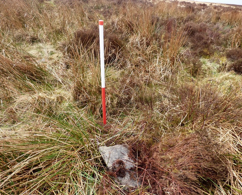
Porlock Allotment SW submitted by SandyG on 22nd Jan 2019. Stone 7 measures 0.48m long by 0.24m wide, stands 0.23m above the ground surface and is orientated at 160°. This stone has probably fallen eastwards. View from south east (Scale 1m).
(View photo, vote or add a comment)
Log Text: Limited car parking is available at SS 84543 44569. From here follow the track leading south west to SS 83567 43802. Then head west to the row.
Toms Hill
Date Added: 22nd Jan 2019
Site Type: Multiple Stone Rows / Avenue
Country: England (Somerset)
Visited: Yes on 23rd Apr 2018. My rating: Condition 3 Ambience 4 Access 2
Toms Hill submitted by TheCaptain on 15th Jun 2017. This stone setting in the wilds of Exmoor is a 6 stone rectangle, or two rows of three stones arranged like the dots on a domino.
(View photo, vote or add a comment)
Log Text: This is not an easy row to reach. Car parking is available at SS 83523 42234. From here follow the footpath west past the Madacombe stone row and then head west to SS 80073 43241. The row is a short distance to the east. Having made the effort it is worth having look at the nearby rows at East Pinford and Trout Hill.
Lanacombe 1
Date Added: 23rd Jan 2019
Site Type: Multiple Stone Rows / Avenue
Country: England (Somerset)
Visited: Yes on 13th Apr 2018. My rating: Condition 3 Ambience 4 Access 2

Lanacombe 1 submitted by thecaptain on 9th Dec 2007. One of the larger, but fallen stones, has some markings carved into it, possibly TD.
(View photo, vote or add a comment)
Log Text: Plenty of car parking is available at Brendon Two Gates at SS 76510 43254. From here head east across the moorland. The ground is uneven.
