Contributory members are able to log private notes and comments about each site
Sites SandyG has logged. View this log as a table or view the most recent logs from everyone
Eyre Stone Rows
Date Added: 6th Jan 2018
Site Type: Stone Row / Alignment
Country: Scotland (Isle of Raasay)
Visited: Yes on 4th Aug 2017. My rating: Condition 2 Ambience 4 Access 1
Eyre Stone Rows submitted by SandyG on 6th Jan 2018. Length of field boundary previously identified as a double stone row. View from south east (Scale 1m).
(View photo, vote or add a comment)
Log Text: The feature described in Canmore forms part of a field boundary that extends further west to NG 57452 34870. The length that was previously described is hidden by bracken making photography difficult in the summer months. The features described are however all discernible. The pairs of stones described are almost touching and represent two sides of an incomplete wall. Walls of this type are present in the vicinity and it was probably intended that the wall would have butted a nearby field boundary at around NG 57541 34821. This is definitely a field boundary and not a stone row.
Quinish (Stone Row)
Date Added: 6th Jan 2018
Site Type: Stone Row / Alignment
Country: Scotland (Isle of Mull)
Visited: Yes on 5th Jun 2016. My rating: Condition 2 Ambience 5 Access 1
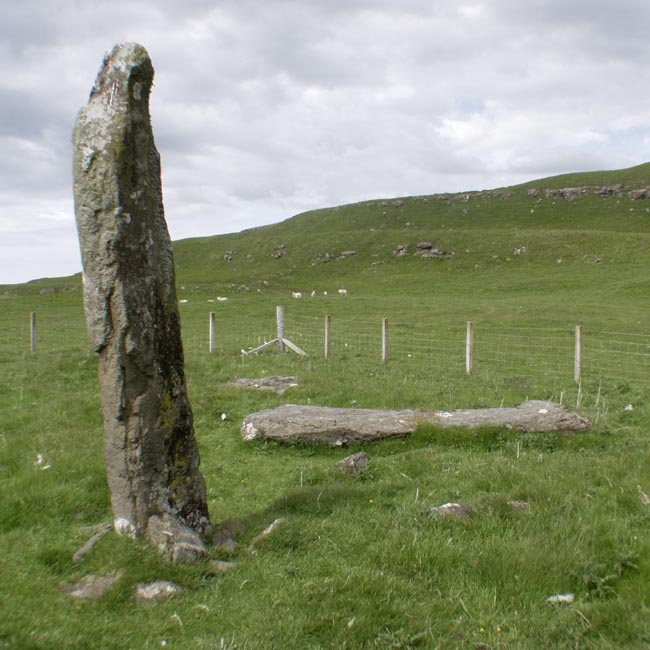
Quinish (Stone Row) submitted by Tom_Bullock on 27th Feb 2005. Photo used by kind permission of Tom Bullock. More details of this location are to be found on his Stone Circles and Rows CD-ROM.
(View photo, vote or add a comment)
Log Text: This is not an easy row to get to. The nearest car parking spot is at NM 43350 52269. From here you can either head northward along forest tracks or head back into the village of Dervaig and walk along the road that leads beside Loch a’Chumhainn. When visited in 2016 I chose to walk to the row through the forest and returned alongside the loch. The route via the village is probably the easiest. A map and or reliable GPS device is essential or else the chances of getting hopelessy lost are high.
Traigh Na Berie
Date Added: 6th Jan 2018
Site Type: Stone Row / Alignment
Country: Scotland (Isle of Lewis)
Visited: Yes on 8th Aug 2017. My rating: Condition 2 Ambience 4 Access 4
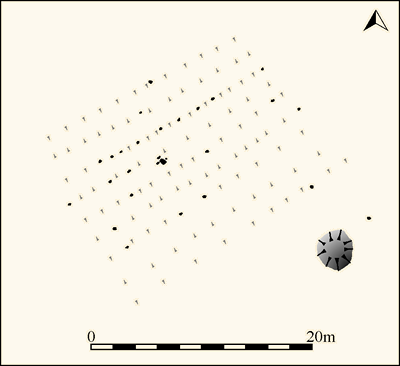
Traigh Na Berie submitted by SandyG on 6th Jan 2018. Plan of the stones and linear earthworks at Traigh Na Berie (Source: Survey at 1:200 by Sandy Gerrard).
(View photo, vote or add a comment)
Log Text: Parking is available at NB 09964 36016 and access to the field at NB 10019 35867.
The stones appear to denote the edges of narrow, parallel banks which are on the same alignment as the lazy beds in this area. Whilst the reason why the banks in this area were denoted with edge set stones is not clear, it is possible to be confident that this is not a prehistoric stone alignment. The adjacent cairn may be the result of field clearance.
Links of Noltland
Date Added: 6th Jan 2018
Site Type: Ancient Village or Settlement
Country: Scotland (Orkney)
Visited: Yes on 12th Jun 2015. My rating: Condition 4 Ambience 4 Access 4
Links of Noltland submitted by SandyG on 17th Jun 2015. Substantial wall forming part of the Neolithic settlement. Midden deposits visible in section to the right. (12th June 2015).
(View photo, vote or add a comment)
Log Text: None
Midhowe Broch
Date Added: 6th Jan 2018
Site Type: Broch or Nuraghe
Country: Scotland (Orkney)
Visited: Yes on 3rd Jun 2015. My rating: Condition 3 Ambience 4 Access 4
Midhowe Broch submitted by SandyG on 20th Sep 2015. Helpful sign makes it easy to find. (3rd June 2015).
(View photo, vote or add a comment)
Log Text: None
Langstane (Orkney)
Date Added: 6th Jan 2018
Site Type: Standing Stone (Menhir)
Country: Scotland (Orkney)
Visited: Yes on 3rd Jun 2015. My rating: Condition 4 Ambience 3 Access 5
Langstane (Orkney) submitted by SandyG on 17th Sep 2015. Given its proximity to the road and cottage what are the chances that this stone is prehistoric and if so that it is its original location particularly as it has clearly at some time been broken in half and put back together (3rd June 2015).
(View photo, vote or add a comment)
Log Text: None
Blackhammer
Date Added: 6th Jan 2018
Site Type: Chambered Tomb
Country: Scotland (Orkney)
Visited: Yes on 3rd Jun 2015. My rating: Condition 4 Ambience 5 Access 4
Blackhammer submitted by SandyG on 11th Aug 2015. View of the chambered cairn from the north with the Orkney mainland in the background. (3rd June 2015).
(View photo, vote or add a comment)
Log Text: None
Broomrigg A
Date Added: 7th Jan 2018
Site Type: Stone Row / Alignment
Country: England (Cumbria)
Visited: Yes on 2nd Aug 2017. My rating: Condition 1 Ambience 2 Access 4
Broomrigg A submitted by rich32 on 22nd Jul 2004. Broomrigg A, Cumbria (NY548467)
The Broomrigg sites are set in a pine plantation and are near to a track This image shows part of Broomrigg ‘A’, it was quite difficult to get more in the shot due to the trees. I also found Broomrigg ‘B’, but gave up on ‘C’ & ‘D’ due to eating too many flies (protein or no protein not nice) and a dodgy GPS signal.
(View photo, vote or add a comment)
Log Text: The stone row is in a working forest and access is therefore sensibly restricted on occasions. Parking is available at NY 54190 46783. From here walk along the forest tracks to the row.
Moor Divock
Date Added: 7th Jan 2018
Site Type: Multiple Stone Rows / Avenue
Country: England (Cumbria)
Visited: Yes on 8th Sep 2017. My rating: Condition 3 Ambience 4 Access 3
Moor Divock 4 submitted by SandyG on 7th Jan 2018. The row is situated near a fine kerbed cairn. The ranging rod is standing beside the row. View from north west (Scale 1m).
(View photo, vote or add a comment)
Log Text: Car parking is available at NY 50066 21704. From here walk along track leading west to the point where it joins the bridleway. Head north along the bridleway until you reach the row which is a short distance beyond the Askham Fell Cairn row.
Askham Fell Stone Row
Date Added: 7th Jan 2018
Site Type: Stone Row / Alignment
Country: England (Cumbria)
Visited: Yes on 8th Sep 2017. My rating: Condition 2 Ambience 4 Access 3
Askham Fell Stone Row submitted by SandyG on 7th Jan 2018. Stone row at NY 49246 22233. View from north west.
(View photo, vote or add a comment)
Log Text: Car parking is available at NY 50066 21704. From here walk along track leading west to the point where it joins the bridleway. Head north along the bridleway until you reach the row.
The Giant's Foot (Cumbria)
Date Added: 7th Jan 2018
Site Type: Standing Stone (Menhir)
Country: England (Cumbria)
Visited: Yes on 8th Sep 2017. My rating: Condition 2 Ambience 3 Access 4
The Giant's Foot (Cumbria) submitted by baz on 21st Mar 2004. The Giant's Foot at NY563148. This stone is a remnant of the Shap Stone Avenue and lies in a field behind the houses on the A6 in Shap.
(View photo, vote or add a comment)
Log Text: None
Goggleby Stone
Date Added: 7th Jan 2018
Site Type: Standing Stone (Menhir)
Country: England (Cumbria)
Visited: Yes on 8th Sep 2017. My rating: Condition 3 Ambience 4 Access 4
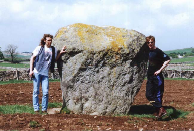
Goggleby Stone submitted by blingo on 30th Jan 2003. Goggleby stone near Shap.
(View photo, vote or add a comment)
Log Text: None
Aspers Field
Date Added: 7th Jan 2018
Site Type: Standing Stone (Menhir)
Country: England (Cumbria)
Visited: Yes on 8th Sep 2017. My rating: Condition 3 Ambience 4 Access 4
Aspers Field submitted by baz on 26th Apr 2003. This stone (at NY558152) lies in the next field to the more well known Goggleby Stone (NY559151), from which I took this picture (with zoom). Both of these stones form a part of the Shap Stone Avenue.
(View photo, vote or add a comment)
Log Text: None
Shap Avenue
Date Added: 7th Jan 2018
Site Type: Multiple Stone Rows / Avenue
Country: England (Cumbria)
Visited: Yes on 8th Sep 2017. My rating: Condition 1 Ambience 4 Access 4
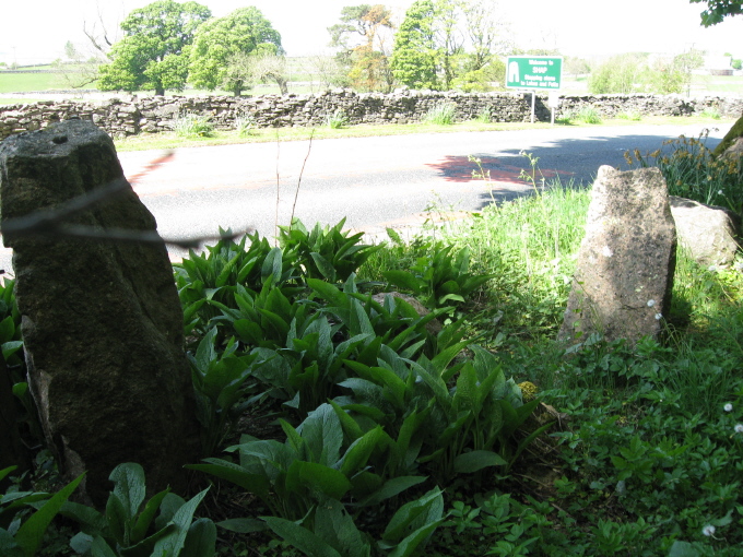
Shap Avenue submitted by AngieLake on 3rd Jun 2011. These were the most noticeable stones fringing the east side of the road, heading back towards the village after visiting Kemp Howe, that might have possibly come from the ancient monuments.
(View photo, vote or add a comment)
Log Text: Parking is available at NY 56358 15076. From here a network of public footpaths provides access to some of the stones. Others can be viewed from the paths and public road.
Noth Ings Bride Stones
Date Added: 7th Jan 2018
Site Type: Stone Row / Alignment
Country: England (Yorkshire (North))
Visited: Yes on 15th Sep 2017. My rating: Condition 3 Ambience 4 Access 3
Noth Ings Bride Stones submitted by johndhunter on 6th Oct 2017. Still continuing north , image taken March 2012
(View photo, vote or add a comment)
Log Text: Car parking is available at NZ 65681 10501. From here follow one of the footpaths leading north to the row.
Old Castle Hill
Date Added: 8th Jan 2018
Site Type: Stone Row / Alignment
Country: England (Yorkshire (North))
Visited: Yes on 15th Sep 2017. My rating: Condition 2 Ambience 4 Access 4
Old Castle Hill submitted by johndhunter on 2nd Oct 2017. Another close up view of the higher stone taken September 2017
(View photo, vote or add a comment)
Log Text: Car parking is available at NZ 67145 11618. The row is a short, but uneven walk from here.
Commondale Moor Stone Circle
Date Added: 8th Jan 2018
Site Type: Stone Circle
Country: England (Yorkshire (North))
Visited: Yes on 16th Sep 2017. My rating: Condition 2 Ambience 4 Access 2
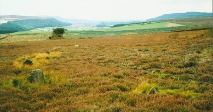
Commondale Moor Stone Circle submitted by Bladup on 27th Jan 2014. Commondale Moor stone circle.
(View photo, vote or add a comment)
Log Text: Car parking is available at NZ 65680 10498. From here walk along the public highway to NZ 64937 09833 and take the path leading north westward. Follow this to NZ 63949 11043 and then walk to the row a short distance to the south.
Swarth Howe Barrow, stone row and ring cairn
Date Added: 8th Jan 2018
Site Type: Stone Row / Alignment
Country: England (Yorkshire (North))
Visited: Yes on 20th Sep 2017. My rating: Condition 2 Ambience 3 Access 4
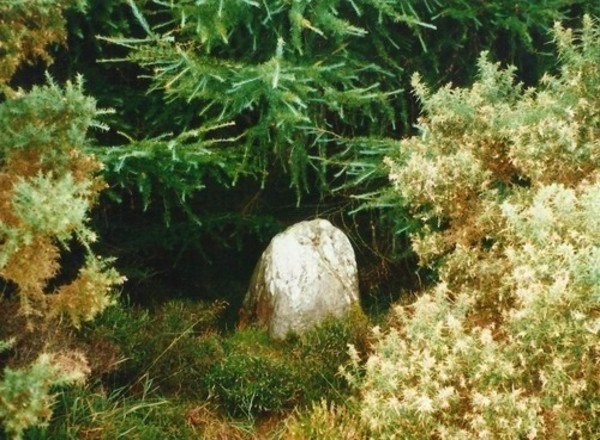
Swarth Howe Barrow, stone row and ring cairn submitted by Bladup on 27th Jan 2014. One of the stones of the row between Swarth Howe barrow and the ring cairn [where the trig point is].
(View photo, vote or add a comment)
Log Text: Car parking is available at NZ 84319 08785. Take care crossing the busy road.
There has been considerable confusion regarding this site over the years. Robert Knox describing the site in 1855 saw the two large stones as forming part of a double alignment than ran north to south with a further pair of stones (now destroyed) 110 yards further to north. A few years earlier in 1852 Samuel Anderson who excavated Swarth Howe claimed that the stones formed remains of a single row that extended between Swarth Howe and the cairn at NZ 84173 08932. The two additional stones found during fieldwork may lend some support to Anderson's interpretation, although both are of uncertain authenticity. On balance Anderson's interpretation is probably the more valid, but given the degree of uncertainty this row should be best considered as possible at best.
Crown End Alignment and Cross Dyke
Date Added: 8th Jan 2018
Site Type: Stone Row / Alignment
Country: England (Yorkshire (North))
Visited: Yes on 19th Sep 2017. My rating: Condition 3 Ambience 4 Access 4
Crown End Alignment and Cross Dyke submitted by johndhunter on 11th Oct 2017. This view was taken towards the end of the alignment where it runs down towards Baysdale Beck looking back up the Rigg. Photo taken in June 2013
(View photo, vote or add a comment)
Log Text: The nearest car parking is available at NZ 65234 07401. From here follow the road up the steep hill to NZ 65753 06988 and then follow the track to the row.
There is a slight chance that this represents the marking out for a cross dyke, but the fact that only a very short length of ditch survives means that it is much more likely to represent a stone row.
High Bridestones (Yorks)
Date Added: 8th Jan 2018
Site Type: Stone Circle
Country: England (Yorkshire (North))
Visited: Yes on 19th Sep 2017. My rating: Condition 2 Ambience 4 Access 5
High Bridestones (Yorks) submitted by JimChampion on 7th Dec 2007. August 2007. The High Bridestones, on the moor. Just one of the megaliths is still standing, with small change firmly wedged into its many crevices. A megalithic shambles indeed. The heather in bloom says that it is summer, although the temperature (and wind) on this day was more like winter!
(View photo, vote or add a comment)
Log Text: Limited car parking available next to the row at NZ 85048 04719.
Despite the problems associated with determining which stones are natural and which ones were placed it is probable that this is a stone row leading away from one of the two stone circles in this area. The presence of considerable quantities of surface stone means that without excavation it is not possible to be certain that this is a stone row.
