Contributory members are able to log private notes and comments about each site
Sites JimChampion has logged. View this log as a table or view the most recent logs from everyone
Ham Hill stone circle
Date Added: 19th Sep 2010
Site Type: Modern Stone Circle etc
Country: England (Somerset)
Visited: Yes on 22nd Aug 2005
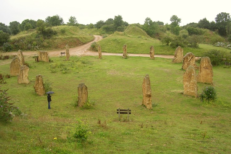
Ham Hill stone circle submitted by JimChampion on 22nd Aug 2005. The modern stone circle is surrounded by the old quarry's spoil heaps - this view, looking west, is from on top of one of these heaps. My umbrella-wielding assistant gives an idea of the scale, and an indication of the weather conditions.
(View photo, vote or add a comment)
Log Text: None
Halliggye
Date Added: 19th Sep 2010
Site Type: Souterrain (Fogou, Earth House)
Country: England (Cornwall)
Visited: Yes on 31st Dec 2004

Halliggye submitted by JimChampion on 31st Dec 2004. August 2004. View from within of the Victorian-era entrance to the fogou. If you want to see more than this then a torch is essential.
(View photo, vote or add a comment)
Log Text: None
Gussage Down (South)
Date Added: 19th Sep 2010
Site Type: Long Barrow
Country: England (Dorset)
Visited: Yes on 6th Apr 2005

Gussage Down (South) submitted by JimChampion on 6th Apr 2005. April 2005. Looking SW at the Gussage Down southern long barrow from the Jubilee Trail bridleway. The SE end (to the left) is the broadest and the fairly unusual U-shaped ditch is open the the NW end (to the right of the picture). The nearby long barrow which stood within the Dorset Cursus is aligned with this barrow to the NW.
(View photo, vote or add a comment)
Log Text: None
Gussage Down (North)
Date Added: 19th Sep 2010
Site Type: Long Barrow
Country: England (Dorset)
Visited: Yes on 5th Apr 2005
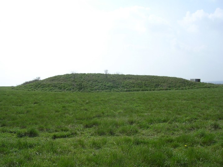
Gussage Down (North) submitted by JimChampion on 5th Apr 2005. April 2005. Looking SW at the long barrow from the bridleway with a lot of glare from the springtime afternoon sun. The midwinter sun would set behind it, possibly of significance to the neolithic designers of the Cursus which runs through this site.
(View photo, vote or add a comment)
Log Text: None
Gurnard's Head
Date Added: 19th Sep 2010
Site Type: Promontory Fort / Cliff Castle
Country: England (Cornwall)
Visited: Yes on 22nd Aug 2005
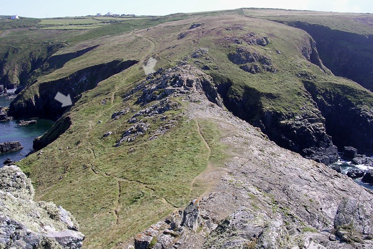
Gurnard's Head submitted by JimChampion on 22nd Aug 2005. Looking inland (south) towards Treen from high on the rocky outcrop of the Gurnard's Head promontory. The narrowest part of the promontory, and thus the most easily defended, has a ditch and bank with drystone wall. The ends of this are indicated by white arrows, just showing up as a dark line on this bright afternoon.
(View photo, vote or add a comment)
Log Text: None
Gun Rith
Date Added: 19th Sep 2010
Site Type: Standing Stone (Menhir)
Country: England (Cornwall)
Visited: Yes on 31st Dec 2004
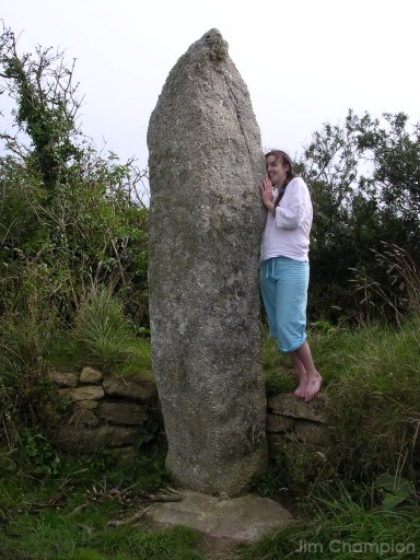
Gun Rith submitted by JimChampion on 31st Dec 2004. August 2004. The stone is still standing upright, with its base neatly set in concrete with a tidy wall supporting the earth bank behind. This may help to prevent toppling, but does give the site the ambience of a contemporary structure. About 3.5m tall, it is a particularly phallic menhir.
(View photo, vote or add a comment)
Log Text: None
Grey Mare Processional Way
Date Added: 19th Sep 2010
Site Type: Multiple Stone Rows / Avenue
Country: England (Dorset)
Visited: Yes on 17th Apr 2007
Grey Mare Processional Way submitted by JimChampion on 17th Apr 2007. June 2006. This stone lies alongside the footpath that approaches the Kingston Russell stone circle from the southeast, grid reference is approximately SY582873. It is possibly also called the "Goddess stone" (by Peter Knight) - this once is certainly moss covered. It would be easy to miss it in summer when the nettles etc. are high.
(View photo, vote or add a comment)
Log Text: None
Grey Mare and her Colts
Date Added: 19th Sep 2010
Site Type: Long Barrow
Country: England (Dorset)
Visited: Yes on 31st Dec 2004
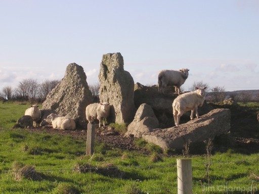
Grey Mare and her Colts submitted by JimChampion on 31st Dec 2004. Boxing Day 2004. Taken at noon over the wall/fence to the north of the barrow. One of several small concrete posts that surround the site is visible, presumably there to prevent any further ploughing of the monument. The arrangment of stones is like a smaller, more ramshackle, Waylands Smithy.
(View photo, vote or add a comment)
Log Text: None
Grans Barrow
Date Added: 19th Sep 2010
Site Type: Long Barrow
Country: England (Hampshire)
Visited: Yes on 30th May 2005
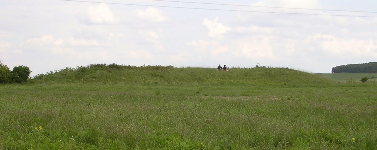
Grans Barrow submitted by JimChampion on 30th May 2005. May 2005. Looking SE at the Grans Barrow from the end of the nearby Knap Barrow. Two birdwatchers are in situ. The overhead power cables just make it into the picture.
(View photo, vote or add a comment)
Log Text: None
Gorley Hill
Date Added: 19th Sep 2010
Site Type: Hillfort
Country: England (Hampshire)
Visited: Yes on 13th Jun 2006
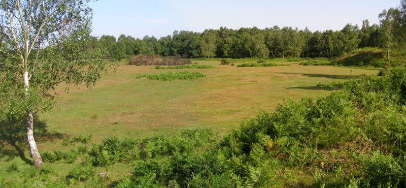
Gorley Hill submitted by JimChampion on 13th Jun 2006. Panoramic view of the southwest corner of Gorley Common, looking south. The hill fort once occupied this area, but gravel extraction in the 1950s and 1960s removed any evidence of the earthworks. A well-grazed plateau remains, surrounded on some sides by large embankments (the original ground level); the birch trees in the distance are growing on such a bank, and the corner of a bank protrudes from the right.
(View photo, vote or add a comment)
Log Text: None
Goonhilly tumuli
Date Added: 19th Sep 2010
Site Type: Round Barrow(s)
Country: England (Cornwall)
Visited: Yes on 26th Oct 2007
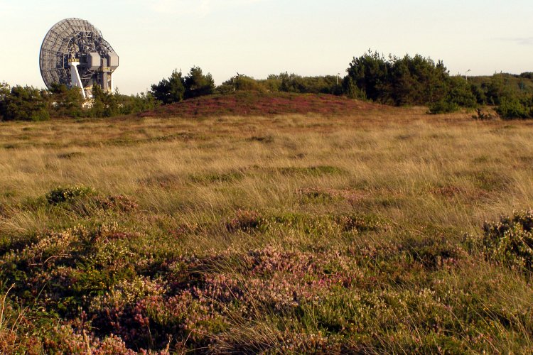
Goonhilly tumuli submitted by JimChampion on 26th Oct 2007. August 2007. In the distance, across the heath is a large heather-covered round barrow at grid reference SW72522158. I didn't get any closer as I was wearing shorts and the heath is covered with the evil cornish gorse that is ankle-high and very spiky. The dish in the background is "Arthur", the oldest of the satellite communication dishes at Goonhilly Satellite Earth Station.
(View photo, vote or add a comment)
Log Text: None
Glastonbury Tor
Date Added: 19th Sep 2010
Site Type: Ancient Village or Settlement
Country: England (Somerset)
Visited: Yes on 11th Aug 2006

Glastonbury Tor submitted by JimChampion on 11th Aug 2006. Panorama of the Tor bathed in summer evening sunlight. The concrete path isn't pretty, but necessary given the huge numbers of visitors to the summit. Archaeological excavations on the Tor (imagine having to carry the equipment up here every day) have not found evidence of settlement before the Dark Ages, but flint tools and a Neolithic polished axe (an offering?) were discovered.
(View photo, vote or add a comment)
Log Text: None
Glastonbury Lake Village Museum
Date Added: 19th Sep 2010
Site Type: Museum
Country: England (Somerset)
Visited: Yes on 9th Aug 2006

Glastonbury Lake Village Museum submitted by JimChampion on 9th Aug 2006. The rear courtyard at The Tribunal building - the Lake Village museum is upstairs and a preserved dugout canoe is just through the doorway on the left.
(View photo, vote or add a comment)
Log Text: None
Glastonbury Lake Village
Date Added: 19th Sep 2010
Site Type: Ancient Village or Settlement
Country: England (Somerset)
Visited: Yes on 9th Aug 2006
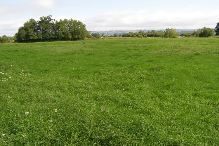
Glastonbury Lake Village submitted by JimChampion on 9th Aug 2006. A view across the field that is the site of the Glastonbury Lake Village (or Godney Lake Village as it was called during the original excavation). Not much to see these days, a few small bumps in a lush grassy field, surrounded by the ubiquitous drainage ditches.
(View photo, vote or add a comment)
Log Text: None
Giants Grave (Breamore)
Date Added: 19th Sep 2010
Site Type: Long Barrow
Country: England (Hampshire)
Visited: Yes on 30th May 2005

Giants Grave (Breamore) submitted by JimChampion on 30th May 2005. May 2005. Looking north at the Breamore Giant's Grave long barrow, with its new rabbit-proof-fence and sign which asks you to respect the monument and stay outside the perimeter fence. The axis of the barrow points uphill, which is unusual round these parts.
(View photo, vote or add a comment)
Log Text: None
Giant's Rock, Zennor
Date Added: 19th Sep 2010
Site Type: Natural Stone / Erratic / Other Natural Feature
Country: England (Cornwall)
Visited: Yes on 8th Sep 2006
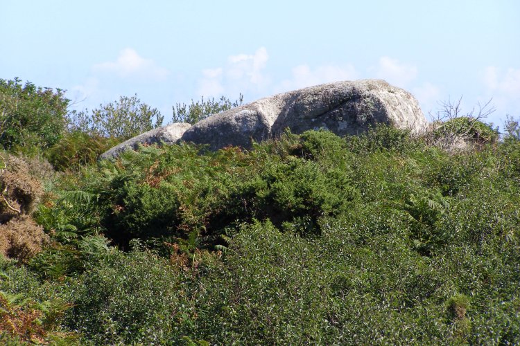
Giant's Rock, Zennor submitted by JimChampion on 8th Sep 2006. August 2006. View of the Giant's Rock, taken with camera held at arms length above head height. The right of way that leads to the rock from the village of Zennor is an unusual dead-end bridleway. The last 20 metres (or so) is now an impassable mass of brambles and bushes, preventing you from getting anywhere near the rock.
(View photo, vote or add a comment)
Log Text: None
Giant's Grave Sarsen Stone
Date Added: 19th Sep 2010
Site Type: Standing Stone (Menhir)
Country: England (Dorset)
Visited: Yes on 31st Jan 2005

Giant's Grave Sarsen Stone submitted by JimChampion on 31st Jan 2005. January 2005. The Giant's Grave sarsen stone (roughly 1 metre across), looking north towards Nordon Hill.
(View photo, vote or add a comment)
Log Text: None
Fritham Butt
Date Added: 19th Sep 2010
Site Type: Round Barrow(s)
Country: England (Hampshire)
Visited: Yes on 20th Jan 2006
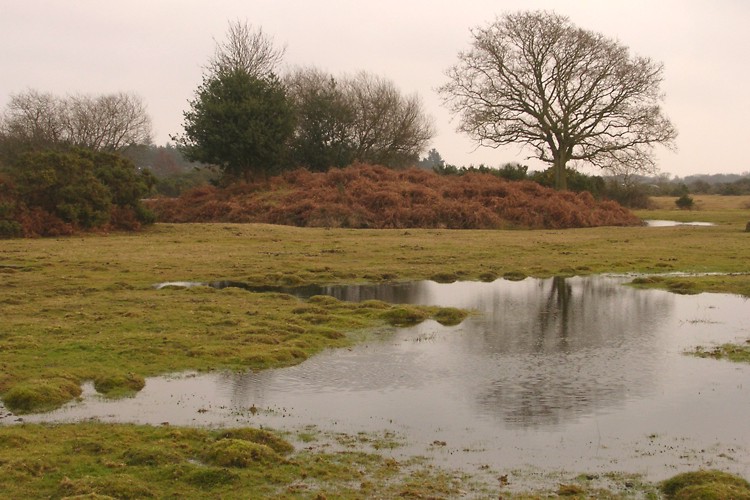
Fritham Butt submitted by JimChampion on 20th Jan 2006. Looking south at "The Butt" on soggy Janesmoor Plain. The mound of the barrow features several trees, including a young oak specimen and holly.
(View photo, vote or add a comment)
Log Text: None
Frankenbury
Date Added: 19th Sep 2010
Site Type: Hillfort
Country: England (Hampshire)
Visited: Yes on 10th Jun 2005
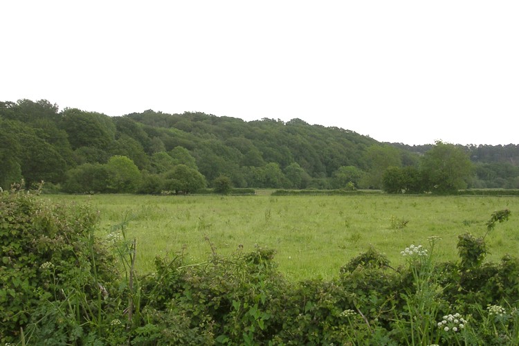
Frankenbury submitted by JimChampion on 10th Jun 2005. Looking southeast across the Avon floodplain at the tree-covered Frankenbury promontory. The trees restrict the view from the hillfort, but in Iron Age times the slopes would no doubt have been cleared for an improved view over the valley below.
(View photo, vote or add a comment)
Log Text: None
Flowerdown Barrows
Date Added: 19th Sep 2010
Site Type: Barrow Cemetery
Country: England (Hampshire)
Visited: Yes on 14th Jun 2005
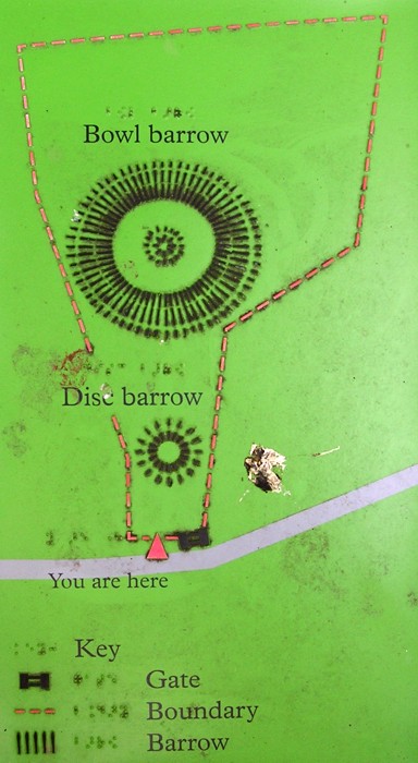
Flowerdown Barrows submitted by JimChampion on 14th Jun 2005. A plan of the Flowerdown barrows, courtesy of the English Heritage sign at the site. For the pedants reading this: the written labels on the barrows are the wrong way round (the large one is in fact the disc barrow). I've no idea if the braille labels are also incorrect.
(View photo, vote or add a comment)
Log Text: None
