Contributory members are able to log private notes and comments about each site
Sites JimChampion has logged. View this log as a table or view the most recent logs from everyone
Gun Rith
Date Added: 19th Sep 2010
Site Type: Standing Stone (Menhir)
Country: England (Cornwall)
Visited: Yes on 31st Dec 2004
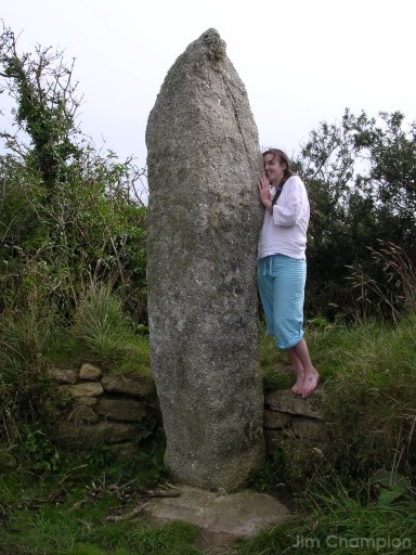
Gun Rith submitted by JimChampion on 31st Dec 2004. August 2004. The stone is still standing upright, with its base neatly set in concrete with a tidy wall supporting the earth bank behind. This may help to prevent toppling, but does give the site the ambience of a contemporary structure. About 3.5m tall, it is a particularly phallic menhir.
(View photo, vote or add a comment)
Log Text: None
Gurnard's Head
Date Added: 19th Sep 2010
Site Type: Promontory Fort / Cliff Castle
Country: England (Cornwall)
Visited: Yes on 22nd Aug 2005
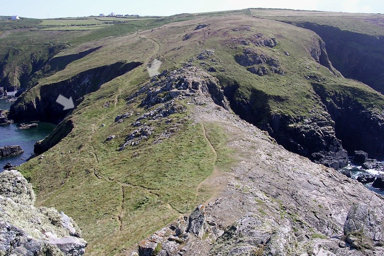
Gurnard's Head submitted by JimChampion on 22nd Aug 2005. Looking inland (south) towards Treen from high on the rocky outcrop of the Gurnard's Head promontory. The narrowest part of the promontory, and thus the most easily defended, has a ditch and bank with drystone wall. The ends of this are indicated by white arrows, just showing up as a dark line on this bright afternoon.
(View photo, vote or add a comment)
Log Text: None
Gussage Down (North)
Date Added: 19th Sep 2010
Site Type: Long Barrow
Country: England (Dorset)
Visited: Yes on 5th Apr 2005
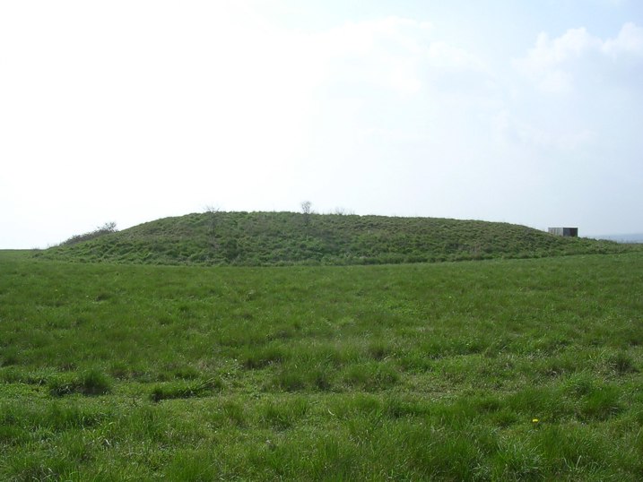
Gussage Down (North) submitted by JimChampion on 5th Apr 2005. April 2005. Looking SW at the long barrow from the bridleway with a lot of glare from the springtime afternoon sun. The midwinter sun would set behind it, possibly of significance to the neolithic designers of the Cursus which runs through this site.
(View photo, vote or add a comment)
Log Text: None
Gussage Down (South)
Date Added: 19th Sep 2010
Site Type: Long Barrow
Country: England (Dorset)
Visited: Yes on 6th Apr 2005

Gussage Down (South) submitted by JimChampion on 6th Apr 2005. April 2005. Looking SW at the Gussage Down southern long barrow from the Jubilee Trail bridleway. The SE end (to the left) is the broadest and the fairly unusual U-shaped ditch is open the the NW end (to the right of the picture). The nearby long barrow which stood within the Dorset Cursus is aligned with this barrow to the NW.
(View photo, vote or add a comment)
Log Text: None
Halliggye
Date Added: 19th Sep 2010
Site Type: Souterrain (Fogou, Earth House)
Country: England (Cornwall)
Visited: Yes on 31st Dec 2004

Halliggye submitted by JimChampion on 31st Dec 2004. August 2004. View from within of the Victorian-era entrance to the fogou. If you want to see more than this then a torch is essential.
(View photo, vote or add a comment)
Log Text: None
Ham Hill stone circle
Date Added: 19th Sep 2010
Site Type: Modern Stone Circle etc
Country: England (Somerset)
Visited: Yes on 22nd Aug 2005
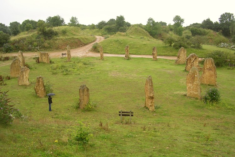
Ham Hill stone circle submitted by JimChampion on 22nd Aug 2005. The modern stone circle is surrounded by the old quarry's spoil heaps - this view, looking west, is from on top of one of these heaps. My umbrella-wielding assistant gives an idea of the scale, and an indication of the weather conditions.
(View photo, vote or add a comment)
Log Text: None
Hambledon Hill hillfort
Date Added: 19th Sep 2010
Site Type: Hillfort
Country: England (Dorset)
Visited: Yes on 10th Jan 2005
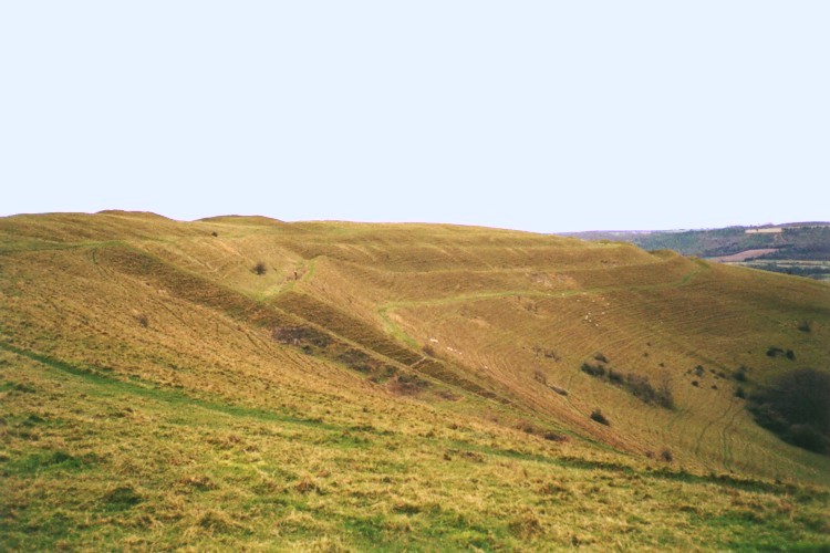
Hambledon Hill hillfort submitted by JimChampion on 10th Jan 2005. December 2002. Looking towards the south at the impressive west-facing flank of Hambledon hill. The ramparts are clearly visible in this picture, and the grazing sheep give a sense of scale. The ramparts in the foreground drop away sharply - presumably as the result of a landslip.
(View photo, vote or add a comment)
Log Text: None
Hambledon Hill south long barrow
Date Added: 19th Sep 2010
Site Type: Long Barrow
Country: England (Dorset)
Visited: Yes on 3rd Nov 2007

Hambledon Hill south long barrow submitted by JimChampion on 3rd Nov 2007. July 2007. Looking north along the reconstructed oval mound of this long barrow. It is just to the south of the neolithic enclosure on the summit of Hambledon Hill (in the background). There is a cross-dyke just to the south of the barrow that defends the approach to the summit from the Hanford spur of Hambledon Hill.
(View photo, vote or add a comment)
Log Text: None
Hampshire Jubilee Sculpture
Date Added: 19th Sep 2010
Site Type: Modern Stone Circle etc
Country: England (Hampshire)
Visited: Yes on 6th Apr 2006

Hampshire Jubilee Sculpture submitted by JimChampion on 6th Apr 2006. March 2006. View of the Hampshire Jubilee Sculpture which could be considered to be a "modern stone circle".
(View photo, vote or add a comment)
Log Text: None
Hampton Down
Date Added: 19th Sep 2010
Site Type: Stone Circle
Country: England (Dorset)
Visited: Yes on 1st Jan 2005
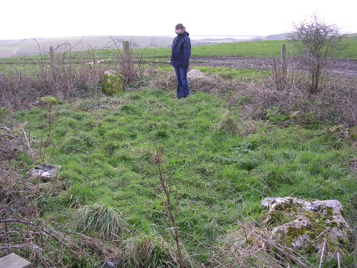
Hampton Down submitted by JimChampion on 1st Jan 2005. December 2004. The stones are disappearing from sight! Finding the circle in this state was an anticlimax after the splendid views from Hampton Down towards the sea. For access, park just off the "Bishops road" at SY587866 (where it has a sharp bend) and walk the SW coast path towards the east. Excellent views.
(View photo, vote or add a comment)
Log Text: None
Hampton Down row
Date Added: 19th Sep 2010
Site Type: Multiple Stone Rows / Avenue
Country: England (Dorset)
Visited: Yes on 1st Jan 2005

Hampton Down submitted by JimChampion on 1st Jan 2005. December 2004. The stones are disappearing from sight! Finding the circle in this state was an anticlimax after the splendid views from Hampton Down towards the sea. For access, park just off the "Bishops road" at SY587866 (where it has a sharp bend) and walk the SW coast path towards the east. Excellent views.
(View photo, vote or add a comment)
Log Text: None
Hellstone
Date Added: 19th Sep 2010
Site Type: Long Barrow
Country: England (Dorset)
Visited: Yes on 18th Sep 2006
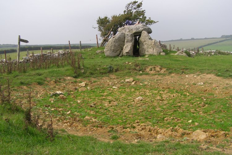
Hellstone submitted by JimChampion on 18th Sep 2006. September 2006. After a very dry summer the pond in front of the Hellstone is empty and grass is growing in its cracked bed.
(View photo, vote or add a comment)
Log Text: None
Hengistbury Head
Date Added: 19th Sep 2010
Site Type: Promontory Fort / Cliff Castle
Country: England (Dorset)
Visited: Yes on 21st Jan 2007
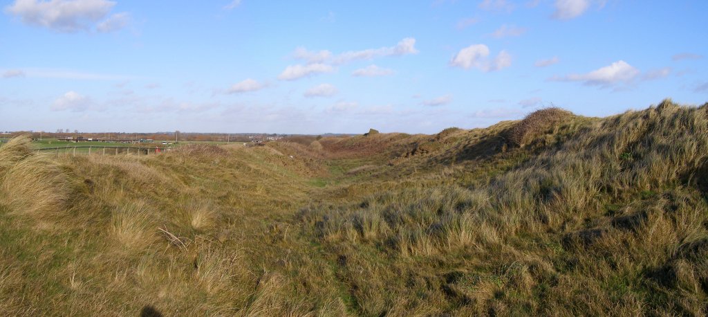
Hengistbury Head submitted by JimChampion on 21st Jan 2007. Two-photo composite of the double dykes, viewed from the beach end (rather than the Christchurch harbour end). The ditch has filled in somewhat in the intervening 2000 years. The dykes are now fenced off to reduce wear and tear from visitors' feet. There are some new information boards around the site as well.
(View photo, vote or add a comment)
Log Text: None
High Bridestones (Yorks)
Date Added: 19th Sep 2010
Site Type: Stone Circle
Country: England (Yorkshire (North))
Visited: Yes on 7th Dec 2007
High Bridestones (Yorks) submitted by JimChampion on 7th Dec 2007. August 2007. The High Bridestones, on the moor. Just one of the megaliths is still standing, with small change firmly wedged into its many crevices. A megalithic shambles indeed. The heather in bloom says that it is summer, although the temperature (and wind) on this day was more like winter!
(View photo, vote or add a comment)
Log Text: None
High Lea Farm
Date Added: 19th Sep 2010
Site Type: Barrow Cemetery
Country: England (Dorset)
Visited: Yes on 6th Jul 2008
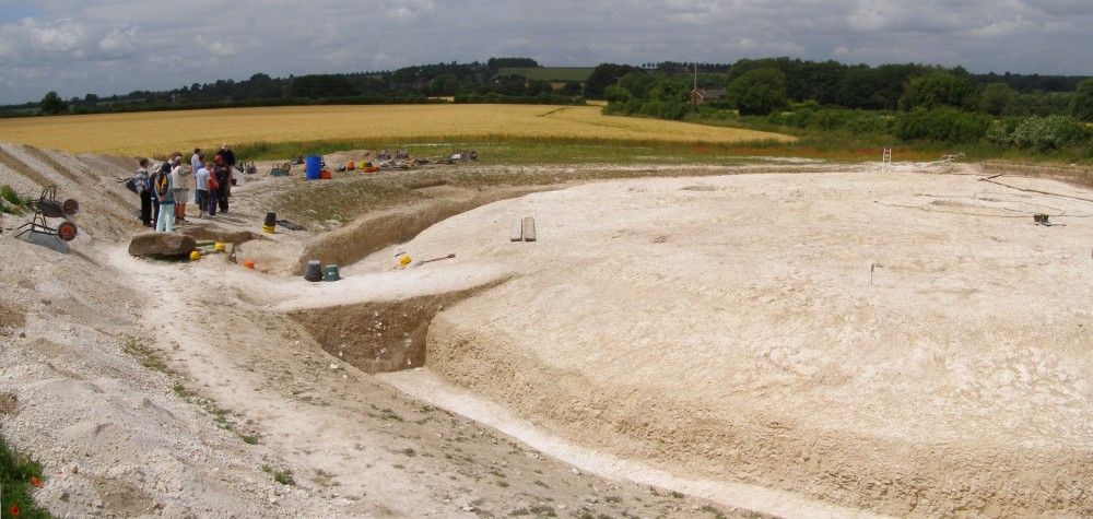
High Lea Farm submitted by JimChampion on 6th Jul 2008. The excavated round barrow at High Lea Farm, part of Bournemouth University's "Knowlton Prehistoric Landscape Project'. Seen from the spoil heap on the open day (Sunday 29 June 2008). The site was being prepared for mast-cam photographs two days later.
This is a composite image from two photographs.
(View photo, vote or add a comment)
Log Text: None
Highdown barrows
Date Added: 19th Sep 2010
Site Type: Round Barrow(s)
Country: England (Isle of Wight)
Visited: Yes on 5th Aug 2007

Highdown barrows submitted by JimChampion on 5th Aug 2007. Looking north at the pair of barrows, which are aligned north-aouth. Both mounds are around 10 metres in diameter and less than a metre high, the southern one being slightly smaller than the other.
Hurst Castle on Hurst Spit can be seen in the Solent to the north.
(View photo, vote or add a comment)
Log Text: None
Hinton Ampner tumuli
Date Added: 19th Sep 2010
Site Type: Round Barrow(s)
Country: England (Hampshire)
Visited: Yes on 27th Jun 2006
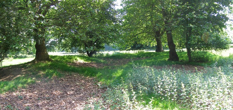
Hinton Ampner tumuli submitted by JimChampion on 27th Jun 2006. Looking south at the largest bowl barrow in Hinton Ampner Park (centred on grid reference SU59442784) on a very bright day. The barrow has a large central depression - usually a sign of robbing or antiquarian digging.
(View photo, vote or add a comment)
Log Text: None
Hod Hill
Date Added: 19th Sep 2010
Site Type: Hillfort
Country: England (Dorset)
Visited: Yes on 17th Sep 2006
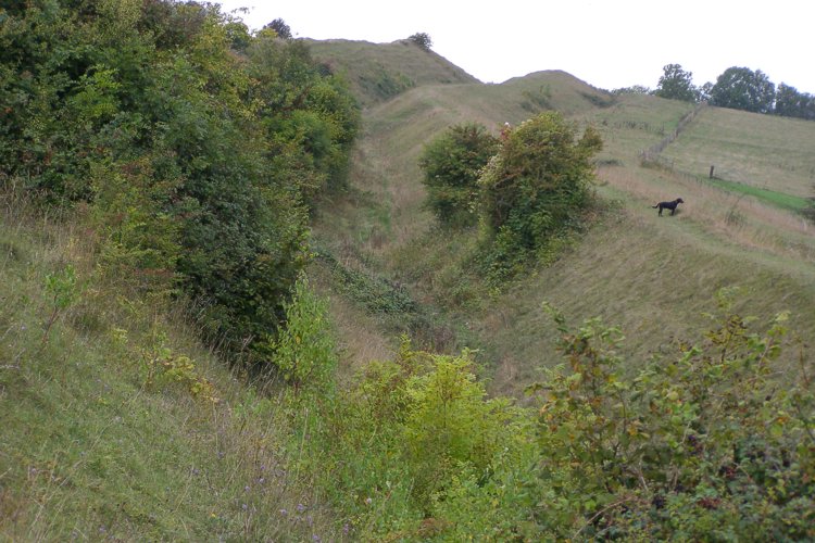
Hod Hill submitted by JimChampion on 17th Sep 2006. Looking west along the earthwork defences on the north side of the hillfort, from the top of the inner rampart at grid ref ST858108.
(View photo, vote or add a comment)
Log Text: None
Holdenhurst Long Barrow
Date Added: 19th Sep 2010
Site Type: Long Barrow
Country: England (Dorset)
Visited: Yes on 8th May 2005
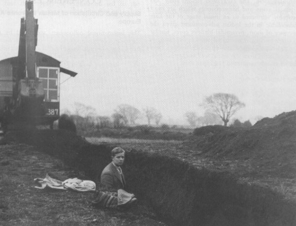
Holdenhurst Long Barrow submitted by JimChampion on 8th May 2005. January 1936. The first known deliberate use of a mechanical excavator to assist archaeological trench digging. The person in the picture is George Willmot, and the photo is believed to have been taken by Stuart Piggott who led the rescue work at the site. This photo is reproduced by the kind permission of David Allen, Senior Keeper of Archaeology with the Hampshire Museums service.
(View photo, vote or add a comment)
Log Text: None
Ibsley Common barrows
Date Added: 19th Sep 2010
Site Type: Barrow Cemetery
Country: England (Hampshire)
Visited: Yes on 10th Jun 2006
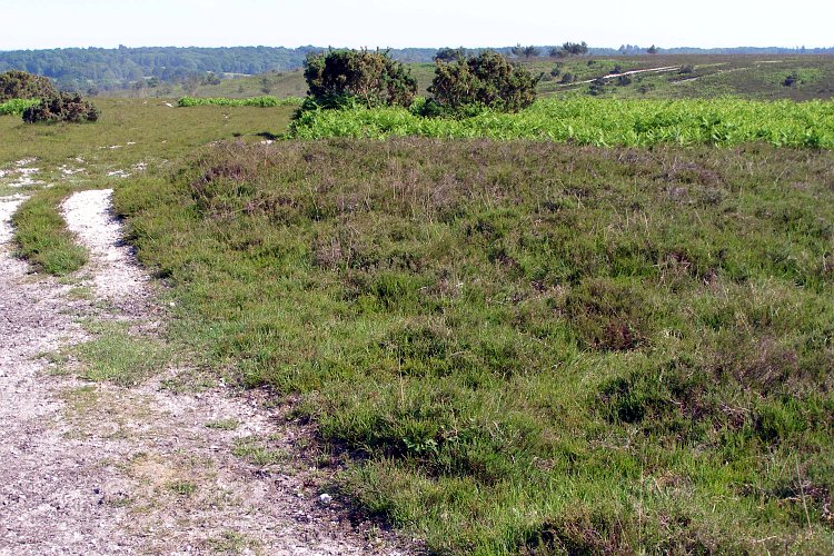
Ibsley Common barrows submitted by JimChampion on 10th Jun 2006. Honestly, its a bowl barrow. Located on Dorridge Hill at grid reference SU17881161, it is 12m in diameter and less than 1m high. Its northeast edge (on the left) is being worn away by users of this track across Ibsley Common. The English Heritage scheduling notes say that it is constructed of compacted gravel.
(View photo, vote or add a comment)
Log Text: None
