Contributory members are able to log private notes and comments about each site
Sites H_Fenton has logged. View this log as a table or view the most recent logs from everyone
Castle Folds
Date Added: 12th Jun 2011
Site Type: Ancient Village or Settlement
Country: England (Cumbria)
Visited: Yes on 23rd Apr 2011. My rating: Condition 2 Ambience 4 Access 2
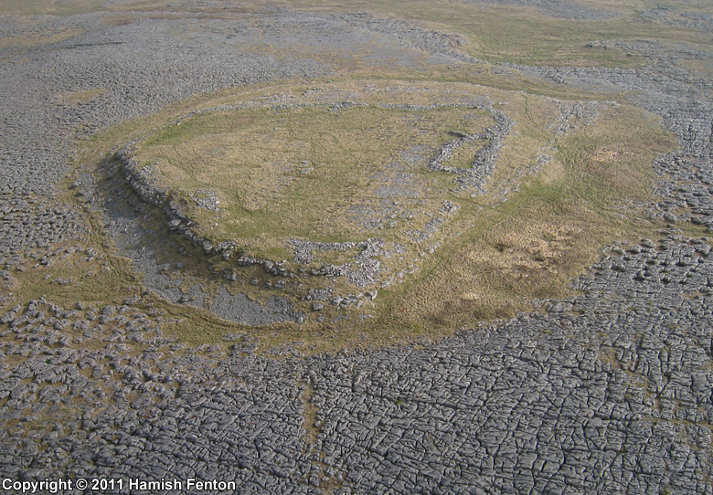
Castle Folds submitted by h_fenton on 12th Jun 2011. Castle Folds defended Romano-British settlement, viewed from the south west.
Kite Aerial Photgraph
23 April 2011 @ 8.53am
(View photo, vote or add a comment)
Log Text: This site is so remote and difficult to access, it makes you wonder what possessed people to have a settlement here
Pompey's Column
Date Added: 4th Apr 2011
Site Type: Sculptured Stone
Country: Egypt (Lower Egypt (North))
Visited: Yes on 7th Mar 2008
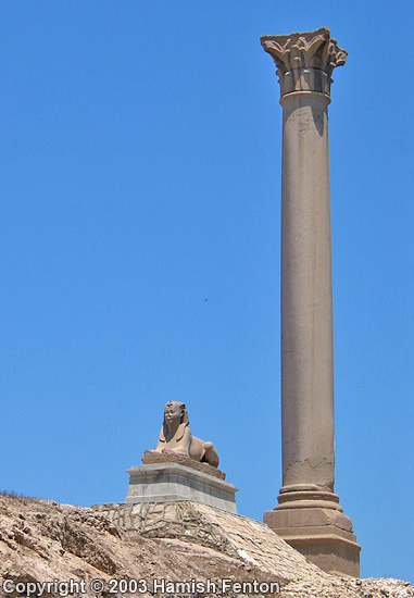
Pompey's Column submitted by h_fenton on 7th Mar 2008. Pompeys Pillar (stands 30metres high) at Serapeum at Alexandria
8 June 2003
(View photo, vote or add a comment)
Log Text: None
Tor of Craigoch
Date Added: 4th Apr 2011
Site Type: Hillfort
Country: Scotland (Dumfries and Galloway)
Visited: Yes on 14th Jan 2011
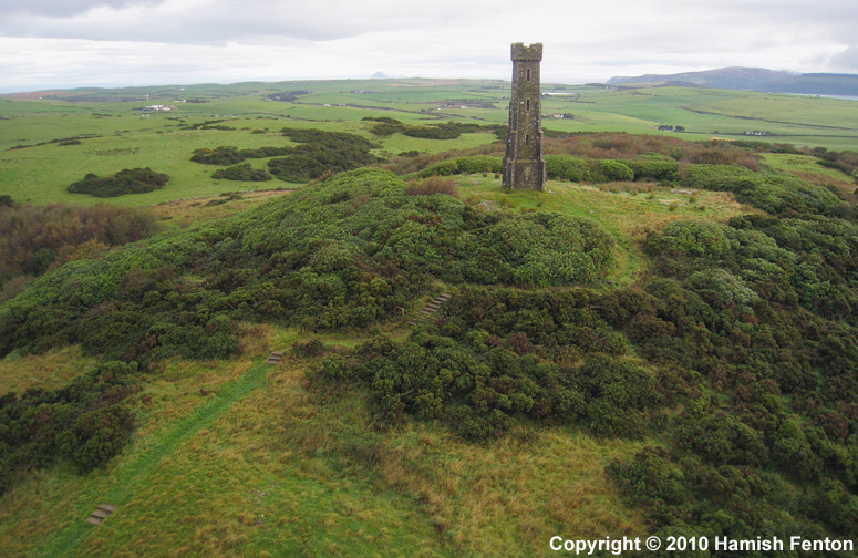
Tor of Craigoch submitted by h_fenton on 14th Jan 2011. A low-level oblique kite aerial photograph from the south of the hillfort 'Tor of Craigoch' with the Agnew Monument (built 1850) at its centre.
19 September 2010
(View photo, vote or add a comment)
Log Text: None
Snaip Hill
Date Added: 4th Apr 2011
Site Type: Hillfort
Country: Scotland (South Lanarkshire)
Visited: Yes on 14th Jan 2011
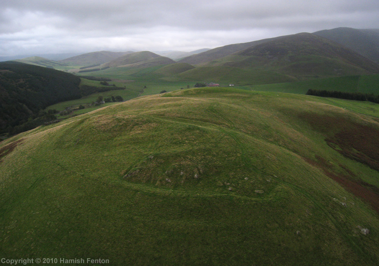
Snaip Hill submitted by h_fenton on 14th Jan 2011. A kite aerial photograph of Snaip Hill hillfort, viewed from the west.
22 September 2010
(View photo, vote or add a comment)
Log Text: None
Culterpark Hill
Date Added: 4th Apr 2011
Site Type: Hillfort
Country: Scotland (South Lanarkshire)
Visited: Yes on 14th Jan 2011

Culterpark Hill submitted by h_fenton on 14th Jan 2011. Culterpark Hill hillfort (amongst trees) viewed from Snaip Hill hillfort (looking northwest). The hill in the distance is Quothquan Law which also has a hillfort.
22 September 2010
(View photo, vote or add a comment)
Log Text: None
Nisbet
Date Added: 4th Apr 2011
Site Type: Hillfort
Country: Scotland (South Lanarkshire)
Visited: Yes on 15th Jan 2011
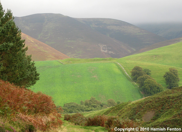
Nisbet submitted by h_fenton on 15th Jan 2011. Nisbet hillfort, viewed from roughly west. The hillfort is at the top of the green in the centre of the photograph.
22 September 2010
(View photo, vote or add a comment)
Log Text: None
Arsameia
Date Added: 4th Apr 2011
Site Type: Ancient Village or Settlement
Country: Turkey
Visited: Yes on 16th Jan 2011
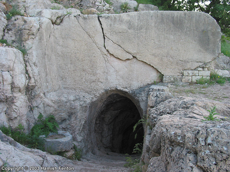
Arsameia submitted by h_fenton on 16th Jan 2011. The largest Greek inscription in Anatolia, at Arsameia, the inscription covers the flat area of rock above the tunnel/shaft entrance.
The shaft/tunnel descends 158metres at an angle into the hillside.
12 May 2003
(View photo, vote or add a comment)
Log Text: None
Painswick Beacon
Date Added: 4th Apr 2011
Site Type: Hillfort
Country: England (Gloucestershire)
Visited: Yes on 14th Feb 2011
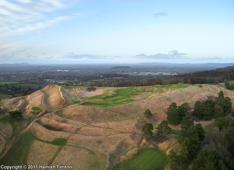
Painswick Beacon submitted by h_fenton on 14th Feb 2011. Painswick Beacon (hillfort) from the south, a Kite Aerial Photograph.
12 February 2011
(View photo, vote or add a comment)
Log Text: None
Isle Head
Date Added: 4th Apr 2011
Site Type: Promontory Fort / Cliff Castle
Country: Scotland (Dumfries and Galloway)
Visited: Yes on 15th Feb 2011
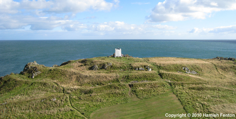
Isle Head submitted by h_fenton on 15th Feb 2011. Isle Head (Isle of Whithorn) Promontory Fort viewed from the north.
Kite Aerial Photograph
16 September 2010 @ 3pm
(View photo, vote or add a comment)
Log Text: None
Carnedd Tre'r Ceiri
Date Added: 4th Apr 2011
Site Type: Cairn
Country: Wales (Gwynedd)
Visited: Yes on 23rd Feb 2011
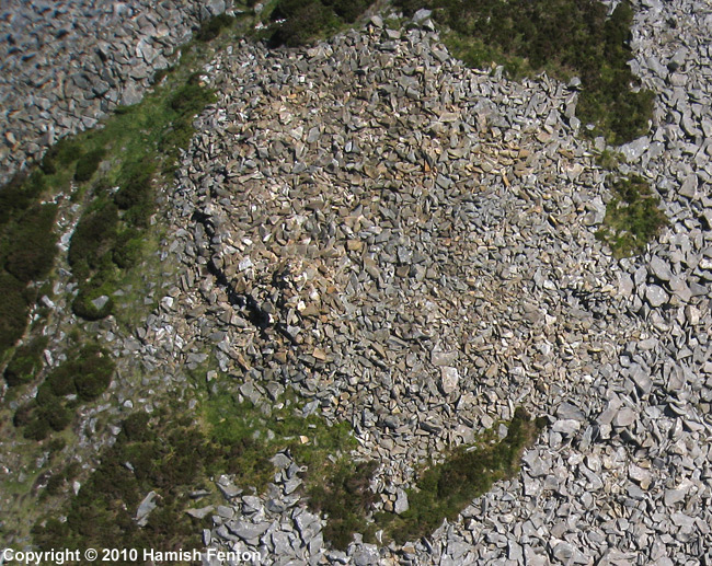
Carnedd Tre'r Ceiri submitted by h_fenton on 23rd Feb 2011. Cairn on the summit of Tre'r Ceiri hillfort.
Kite Aerial Photograph
30 May 2010
(View photo, vote or add a comment)
Log Text: None
Roche Rock
Date Added: 4th Apr 2011
Site Type: Rock Outcrop
Country: England (Cornwall)
Visited: Yes on 6th Mar 2011
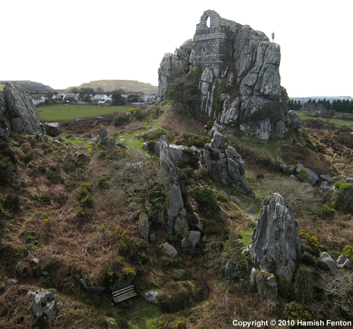
Roche Rock submitted by h_fenton on 6th Mar 2011. Roche Rock, Photographed from the northeast. There are climbers on the rock which help to indicate scale.
A low level, horizontal kite aerial photograph !
8 April 2010
(View photo, vote or add a comment)
Log Text: None
Tadmarton Camp
Date Added: 4th Apr 2011
Site Type: Hillfort
Country: England (Oxfordshire)
Visited: Yes on 7th Mar 2011
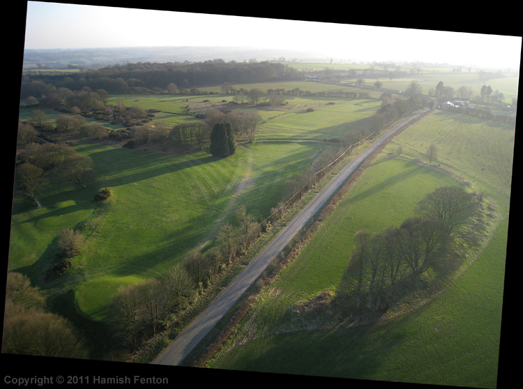
Tadmarton Camp submitted by h_fenton on 7th Mar 2011. Tadmarton Camp, Viewed from the North East.
Kite Aerial Photograph
7 March 2011
(View photo, vote or add a comment)
Log Text: None
Devils Quoits
Date Added: 4th Apr 2011
Site Type: Stone Circle
Country: England (Oxfordshire)
Visited: Yes on 13th Mar 2011
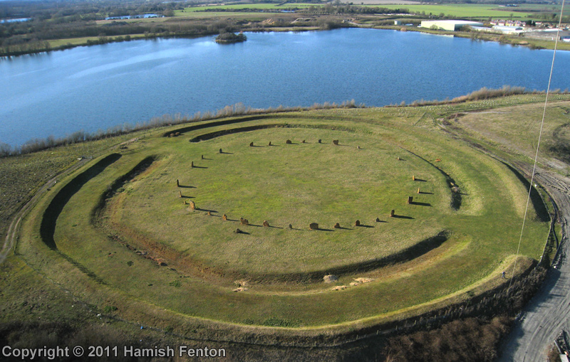
Devils Quoits submitted by h_fenton on 13th Mar 2011. The Devils Quoits, viewed from the south east.
Kite Aerial Photograph
13 March 2011
(View photo, vote or add a comment)
Log Text: None
Yr Eifl cairns
Date Added: 4th Apr 2011
Site Type: Cairn
Country: Wales (Gwynedd)
Visited: Yes on 15th Mar 2011
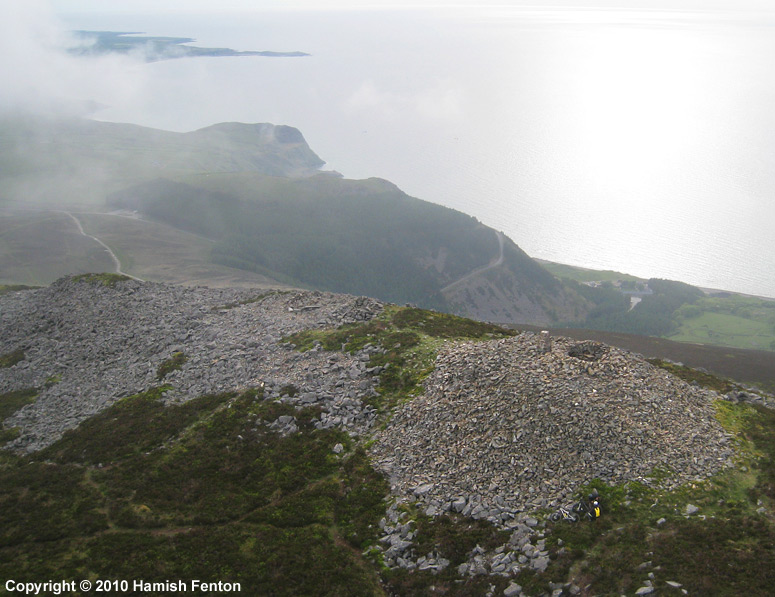
Yr Eifl cairns submitted by h_fenton on 15th Mar 2011. Yr Eifl cairns (564metres above sea level) viewed from roughly east.
Cairn 1 is on the right side of the photo, the OS trig point here is built of stone so it is difficult to see. just below the cairn is a small patch of yellow. this is the backpack of a mountainbiker who is sitting on the ground out of the wind, if you look very closely just to the left you can see his mountain bike for scale.
Cairn 2 is to the left of cairn 1 , but is difficult to see.
Kite Aerial Photograph
...
(View photo, vote or add a comment)
Log Text: None
Beacon Hill (Burghclere)
Date Added: 4th Apr 2011
Site Type: Hillfort
Country: England (Hampshire)
Visited: Yes on 20th Mar 2011
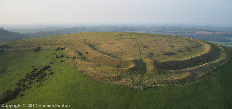
Beacon Hill (Burghclere) submitted by h_fenton on 20th Mar 2011. Beacon Hill from the south, showing the entrance to the hillfort.
I couldn't get a photo that showed the whole fort because it is rather an awkward shape.
Kite Aerial Photograph
20 March 2011
(View photo, vote or add a comment)
Log Text: None
Borson Barrows
Date Added: 4th Apr 2011
Site Type: Barrow Cemetery
Country: England (Berkshire)
Visited: Yes on 21st Mar 2011
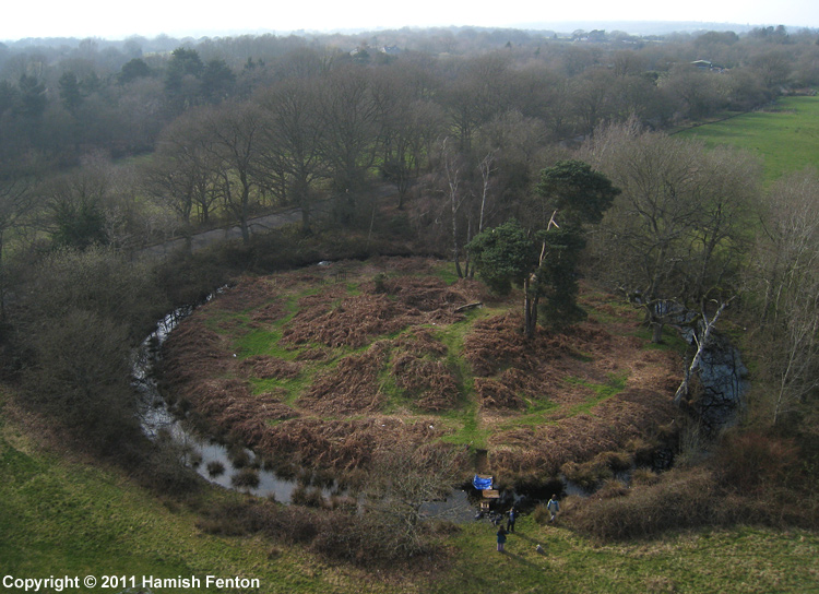
Borson Barrows submitted by h_fenton on 21st Mar 2011. A bell barrow at Grid Reference: SU 5739 6248. This is part of the Brimpton Common Barrow Cemetery / Borson Barrows / Baughurst Barrows. This barrow is in the corner of a school sports field. At the time of this visit the Barrow ditch was filled with water.
Kite Aerial Photograph.
20 March 2011
(View photo, vote or add a comment)
Log Text: None
Raven Hill
Date Added: 4th Apr 2011
Site Type: Promontory Fort / Cliff Castle
Country: England (Berkshire)
Visited: Yes on 23rd Mar 2011

Raven Hill submitted by h_fenton on 23rd Mar 2011. Looking along the earthwork of the bank and ditch from the north west.
20 March 2011
(View photo, vote or add a comment)
Log Text: None
Castle Crawford Farm Fort
Date Added: 4th Apr 2011
Site Type: Hillfort
Country: Scotland (South Lanarkshire)
Visited: Yes on 4th Apr 2011
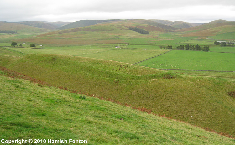
Castle Crawford Farm Fort submitted by h_fenton on 4th Apr 2011. Castle Crawford Farm Fort, photographed from the north west.
23 September 2010
(View photo, vote or add a comment)
Log Text: None
Brent Tor
Date Added: 28th Dec 2010
Site Type: Hillfort
Country: England (Devon)
Visited: Yes on 8th Apr 2010. My rating: Ambience 5 Access 4
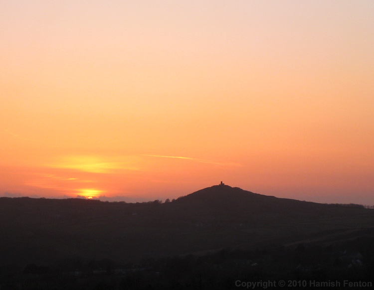
Brent Tor submitted by h_fenton on 28th Dec 2010. Brent Tor at sunset, viewed from the western edge of Dartmoor near Cudlipptown.
7 April 2010
(View photo, vote or add a comment)
Log Text: I was out on Brent Tor just before 7am as the sun rose from the clouds that shrouded Dartmoor to the east, the light gently warming the Devon landscape and the dewy grass glistening beneath my feet. Mist hung in some of the valleys. It was a wonderful sport to just stop and watch the world slowly waking up, the sound of dogs barking in a distant farmyard reached my lofty perch through seemingly very still air. I looked in the church which sits on the summit there was a stained glass window depicting St Michael at the east end with the sun directly behind making it glow.
Back outside the church there was the merest murmur of some wind, I carefully set my kite up, adjusting it to catch the most wind possible. the fabric of the kite whispered that there was just enough wind so I moved out of the churchyard and launched the kite. it slowly rose into the air with only a very small pull on the line. I attached the camera to the kite line and while there was enough wind to lift the kite there was only enough to maintain the height of the camera. I ran a little way down the hill trying to get the camera to lift higher, it quickly returned to the ground. returning to the launch spot I relaunched the kite and flew it as close to the church as was feasible attached the camera, set the camera running. With a little faith I ran down the hill letting the kite line roll off the reel as I went, over the ramparts slipping down the outer sides then continuing down the field - now gently pulling the line, pulling the kite higher and the camera into the air and away from the hill. Slowly the kite and camera came back towards me, I caught he camera, then landed the kite. so impressed with some of the photos I returned to the church and put most of the money I had on me into the collection box.
I flew again on the south side of the church, the wind was still slack, running and walking was again needed to maintain the kite in the air.
After all the kite flying it, the tor was still a wonderful spot just sit or stand and contemplate and view the landscape, I whiled away a few hours here until the ambience was interrupted by other visitors and their dogs.
Normangill Rig Cairn
Date Added: 28th Dec 2010
Site Type: Cairn
Country: Scotland (South Lanarkshire)
Visited: Yes on 30th Nov 2010
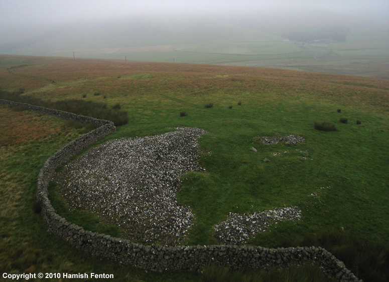
Normangill Rig Cairn submitted by h_fenton on 30th Nov 2010. Normangill Rig Cairn viewed from the south.
Kite Aerial Photograph
22 September 2010
(View photo, vote or add a comment)
Log Text: None
