Contributory members are able to log private notes and comments about each site
Sites H_Fenton has logged. View this log as a table or view the most recent logs from everyone
Beacon Hill (Burghclere)
Date Added: 4th Apr 2011
Site Type: Hillfort
Country: England (Hampshire)
Visited: Yes on 20th Mar 2011
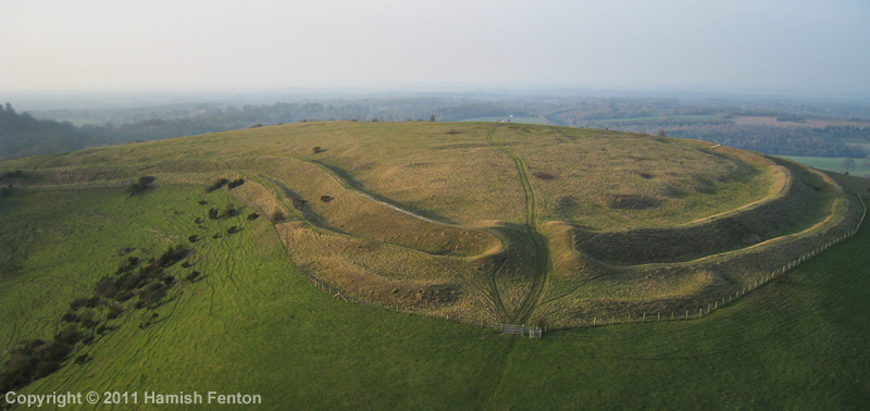
Beacon Hill (Burghclere) submitted by h_fenton on 20th Mar 2011. Beacon Hill from the south, showing the entrance to the hillfort.
I couldn't get a photo that showed the whole fort because it is rather an awkward shape.
Kite Aerial Photograph
20 March 2011
(View photo, vote or add a comment)
Log Text: None
Borson Barrows
Date Added: 4th Apr 2011
Site Type: Barrow Cemetery
Country: England (Berkshire)
Visited: Yes on 21st Mar 2011
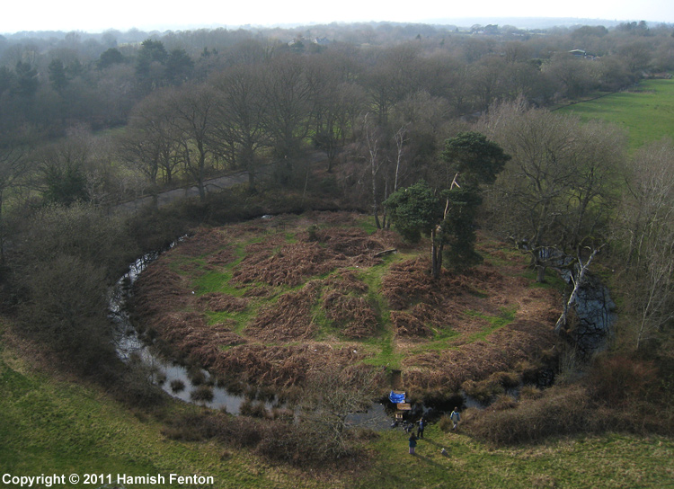
Borson Barrows submitted by h_fenton on 21st Mar 2011. A bell barrow at Grid Reference: SU 5739 6248. This is part of the Brimpton Common Barrow Cemetery / Borson Barrows / Baughurst Barrows. This barrow is in the corner of a school sports field. At the time of this visit the Barrow ditch was filled with water.
Kite Aerial Photograph.
20 March 2011
(View photo, vote or add a comment)
Log Text: None
Raven Hill
Date Added: 4th Apr 2011
Site Type: Promontory Fort / Cliff Castle
Country: England (Berkshire)
Visited: Yes on 23rd Mar 2011

Raven Hill submitted by h_fenton on 23rd Mar 2011. Looking along the earthwork of the bank and ditch from the north west.
20 March 2011
(View photo, vote or add a comment)
Log Text: None
Castle Crawford Farm Fort
Date Added: 4th Apr 2011
Site Type: Hillfort
Country: Scotland (South Lanarkshire)
Visited: Yes on 4th Apr 2011
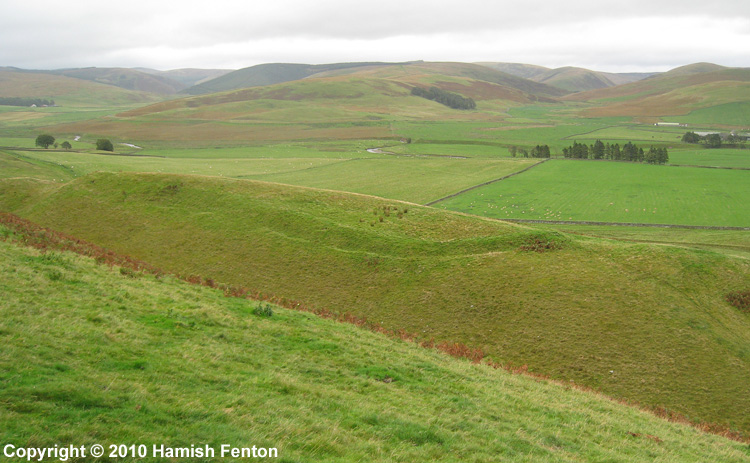
Castle Crawford Farm Fort submitted by h_fenton on 4th Apr 2011. Castle Crawford Farm Fort, photographed from the north west.
23 September 2010
(View photo, vote or add a comment)
Log Text: None
Brent Tor
Date Added: 28th Dec 2010
Site Type: Hillfort
Country: England (Devon)
Visited: Yes on 8th Apr 2010. My rating: Ambience 5 Access 4
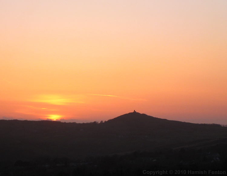
Brent Tor submitted by h_fenton on 28th Dec 2010. Brent Tor at sunset, viewed from the western edge of Dartmoor near Cudlipptown.
7 April 2010
(View photo, vote or add a comment)
Log Text: I was out on Brent Tor just before 7am as the sun rose from the clouds that shrouded Dartmoor to the east, the light gently warming the Devon landscape and the dewy grass glistening beneath my feet. Mist hung in some of the valleys. It was a wonderful sport to just stop and watch the world slowly waking up, the sound of dogs barking in a distant farmyard reached my lofty perch through seemingly very still air. I looked in the church which sits on the summit there was a stained glass window depicting St Michael at the east end with the sun directly behind making it glow.
Back outside the church there was the merest murmur of some wind, I carefully set my kite up, adjusting it to catch the most wind possible. the fabric of the kite whispered that there was just enough wind so I moved out of the churchyard and launched the kite. it slowly rose into the air with only a very small pull on the line. I attached the camera to the kite line and while there was enough wind to lift the kite there was only enough to maintain the height of the camera. I ran a little way down the hill trying to get the camera to lift higher, it quickly returned to the ground. returning to the launch spot I relaunched the kite and flew it as close to the church as was feasible attached the camera, set the camera running. With a little faith I ran down the hill letting the kite line roll off the reel as I went, over the ramparts slipping down the outer sides then continuing down the field - now gently pulling the line, pulling the kite higher and the camera into the air and away from the hill. Slowly the kite and camera came back towards me, I caught he camera, then landed the kite. so impressed with some of the photos I returned to the church and put most of the money I had on me into the collection box.
I flew again on the south side of the church, the wind was still slack, running and walking was again needed to maintain the kite in the air.
After all the kite flying it, the tor was still a wonderful spot just sit or stand and contemplate and view the landscape, I whiled away a few hours here until the ambience was interrupted by other visitors and their dogs.
Normangill Rig Cairn
Date Added: 28th Dec 2010
Site Type: Cairn
Country: Scotland (South Lanarkshire)
Visited: Yes on 30th Nov 2010
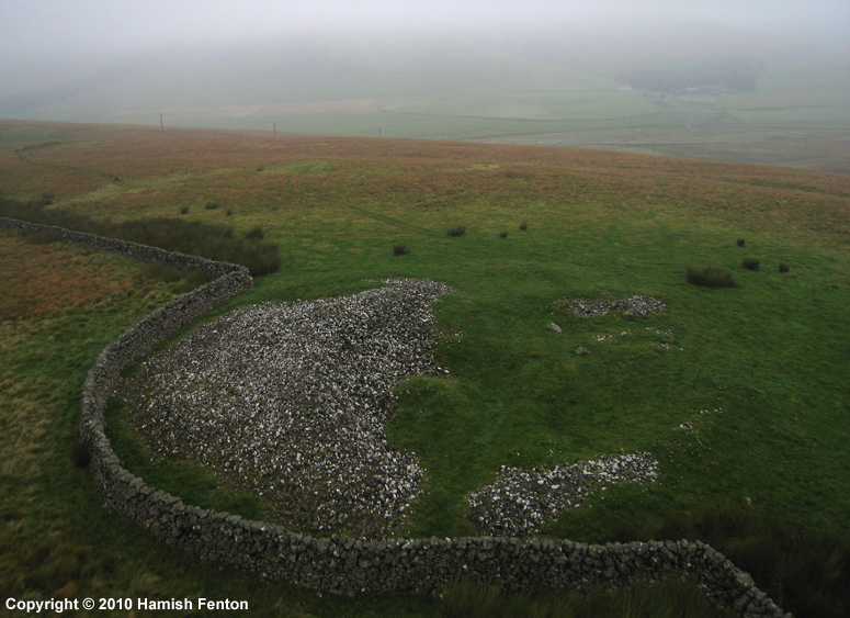
Normangill Rig Cairn submitted by h_fenton on 30th Nov 2010. Normangill Rig Cairn viewed from the south.
Kite Aerial Photograph
22 September 2010
(View photo, vote or add a comment)
Log Text: None
Normangill Henge
Date Added: 28th Dec 2010
Site Type: Henge
Country: Scotland (South Lanarkshire)
Visited: Yes on 30th Nov 2010
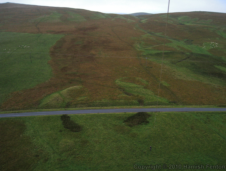
Normangill Henge submitted by h_fenton on 30th Nov 2010. A Kite Aerial Photograph of Normangill Henge viewed from the north. The south (uphill) side of the henge is the most clearly visible here because the ground is generally poorly drained while the banks are well drained resulting in a difference in vegetation.
There are drainage ditches alongside the road which stop the water making a vegetation difference on the north (downhill) side of the road. The internal ditches of the henge seem to be more prominent on the northern side.
On t...
(View photo, vote or add a comment)
Log Text: None
Dinas Dinlle
Date Added: 28th Dec 2010
Site Type: Hillfort
Country: Wales (Gwynedd)
Visited: Yes on 30th Nov 2010

Dinas Dinlle submitted by h_fenton on 30th Nov 2010. A Kite Aerial Photograph of Dinas Dinlle., viewed from the north. There was very little wind and it was difficult to get the camera into the air.
The kite was flown here outside the operating hours of nearby Caernarfon Airport.
30 May 2010 @ 7.52pm
(View photo, vote or add a comment)
Log Text: None
Merrivale circle
Date Added: 28th Dec 2010
Site Type: Stone Circle
Country: England (Devon)
Visited: Yes on 1st Dec 2010
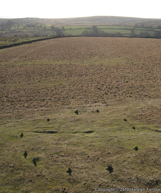
Merrivale circle submitted by h_fenton on 1st Dec 2010. Merrivale Circle, A Kite Aerial Photograph.
7 April 2010
(View photo, vote or add a comment)
Log Text: None
Merrivale Centre N
Date Added: 28th Dec 2010
Site Type: Cairn
Country: England (Devon)
Visited: Yes on 1st Dec 2010
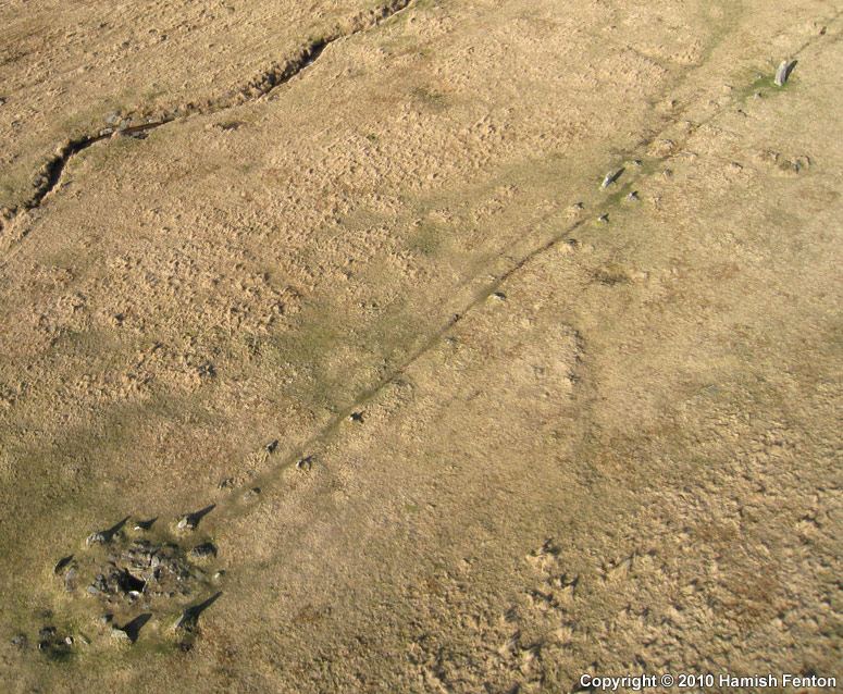
Merrivale Centre N submitted by h_fenton on 1st Dec 2010. Merrivale, cairn circle and cist in the middle of the southern (central) stone row.
Kite Aerial Photograph
7 April 2010
(View photo, vote or add a comment)
Log Text: None
Dinas Bran
Date Added: 28th Dec 2010
Site Type: Hillfort
Country: Wales (Denbighshire)
Visited: Yes on 1st Dec 2010
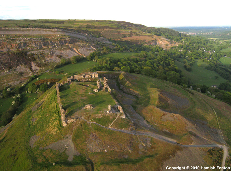
Dinas Bran submitted by h_fenton on 1st Dec 2010. A kite Aerial Photograph of Dinas Bran, the ruins of the medieval castle and the ramparts of the earlier Iron Age hillfort can be seen.
28 May 2010 @ 7.06pm
(View photo, vote or add a comment)
Log Text: None
Penarth
Date Added: 28th Dec 2010
Site Type: Chambered Tomb
Country: Wales (Gwynedd)
Visited: Yes on 10th Dec 2010
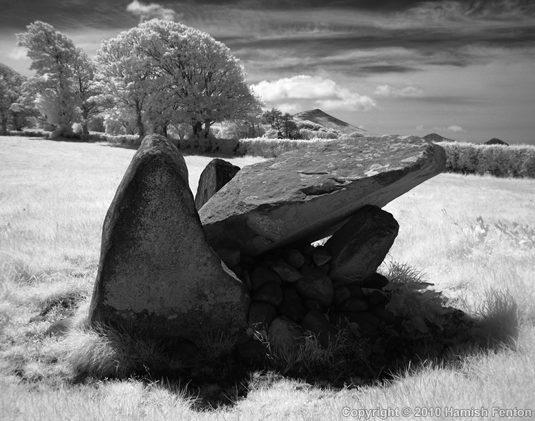
Penarth submitted by h_fenton on 10th Dec 2010. Penarth Chambered Tomb
Infrared - 760nm filter
30 May 2010
(View photo, vote or add a comment)
Log Text: None
Medinet Habu Temple of Ramses III
Date Added: 28th Dec 2010
Site Type: Ancient Palace
Country: Egypt (Upper Egypt (South))
Visited: Yes on 18th Dec 2010
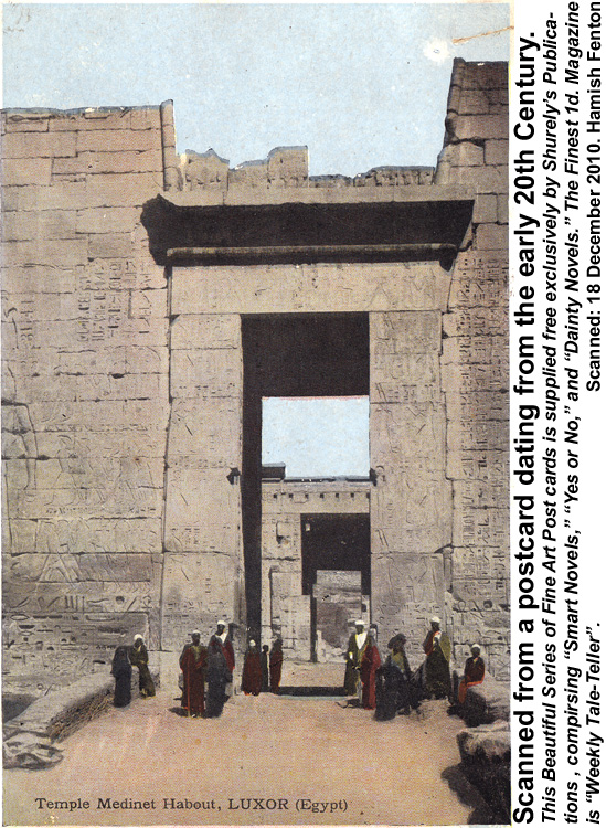
Medinet Habu Temple of Ramses III submitted by h_fenton on 18th Dec 2010. Old postcard of Medinet Habu (Habout) Temple.
(View photo, vote or add a comment)
Log Text: None
Barsalloch
Date Added: 28th Dec 2010
Site Type: Promontory Fort / Cliff Castle
Country: Scotland (Dumfries and Galloway)
Visited: Yes on 29th Nov 2010
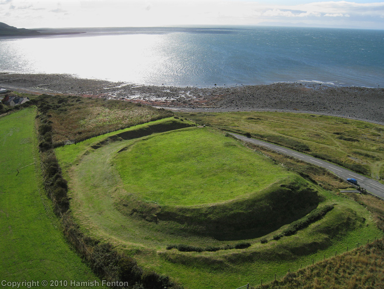
Barsalloch submitted by h_fenton on 29th Nov 2010. Barsalloch Promontory Fort viewed from roughly north.
Kite Aerial Photograph
17 September 2010
(View photo, vote or add a comment)
Log Text: None
Rispain Camp
Date Added: 28th Nov 2010
Site Type: Ancient Village or Settlement
Country: Scotland (Dumfries and Galloway)
Visited: Yes on 3rd Oct 2010
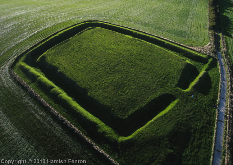
Rispain Camp submitted by h_fenton on 3rd Oct 2010. Rispain Camp, a Kite Aerial Photograph taken close to the end of the day, this view is from the east.
16 September 2010 @ 6.10pm
(View photo, vote or add a comment)
Log Text: None
Glastonbury Tor
Date Added: 28th Nov 2010
Site Type: Ancient Village or Settlement
Country: England (Somerset)
Visited: Yes on 4th Oct 2010
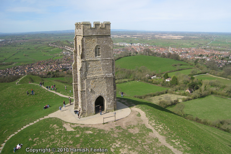
Glastonbury Tor submitted by h_fenton on 4th Oct 2010. The summit of Glastonbury Tor, looking down to the town of Glastonbury.
A kite aerial photograph.
11 April 2010
(View photo, vote or add a comment)
Log Text: None
Moor Divock 4
Date Added: 28th Nov 2010
Site Type: Stone Circle
Country: England (Cumbria)
Visited: Yes on 7th Oct 2010
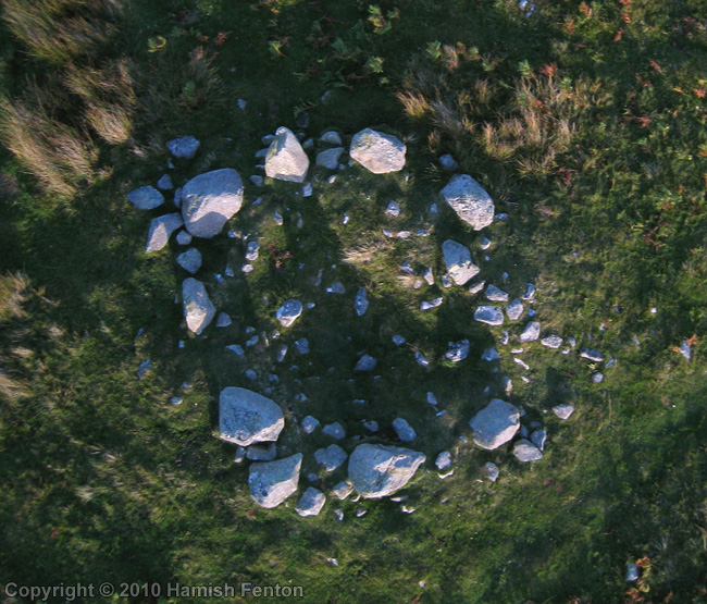
Moor Divock 4 submitted by h_fenton on 7th Oct 2010. A vertical Kite Aerial Photograph of 'Moor Divock 4' ring cairn.
11 September 2010
(View photo, vote or add a comment)
Log Text: None
Twyn-y-Gaer (Llanspyddid)
Date Added: 28th Nov 2010
Site Type: Hillfort
Country: Wales (Powys)
Visited: Yes on 12th Oct 2010
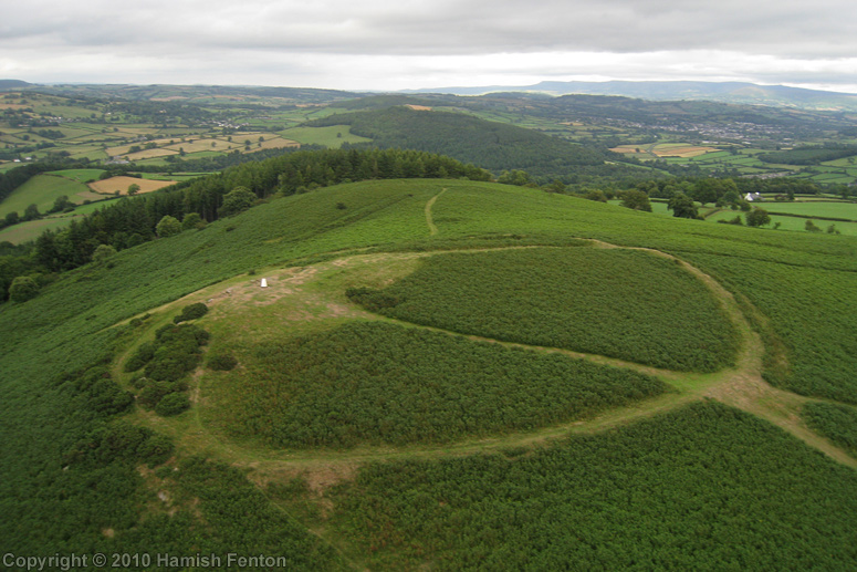
Twyn-y-Gaer (Llanspyddid) submitted by h_fenton on 12th Oct 2010. Twyn-y-Gaer hillfort, from the southwest.
Kite Aerial Photograph
31 July 2010
(View photo, vote or add a comment)
Log Text: None
Trencrom
Date Added: 28th Nov 2010
Site Type: Hillfort
Country: England (Cornwall)
Visited: Yes on 19th Oct 2010
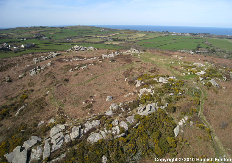
Trencrom submitted by h_fenton on 19th Oct 2010. Trencrom Hill from the south, a kite aerial photograph.
9 April 2010
(View photo, vote or add a comment)
Log Text: None
Valley of the Kings
Date Added: 28th Nov 2010
Site Type: Rock Cut Tomb
Country: Egypt (Upper Egypt (South))
Visited: Yes on 14th Nov 2010
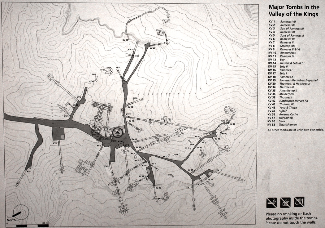
Valley of the Kings submitted by h_fenton on 14th Nov 2010. A map of the major tombs in the Valley of the Kings, this was photographed from an information board.
4 June 2003
(View photo, vote or add a comment)
Log Text: None
