Contributory members are able to log private notes and comments about each site
Sites Estrela has logged. View this log as a table or view the most recent logs from everyone
Eastside
Date Added: 7th Jun 2016
Site Type: Standing Stone (Menhir)
Country: Scotland (Orkney)
Visited: Would like to visit
Eastside submitted by howar on 27th May 2016. Now the stone is unencumbered by the fences, but be careful of your footing on the way to it.
(View photo, vote or add a comment)
Vestra Fiold
Date Added: 29th Feb 2016
Site Type: Chambered Cairn
Country: Scotland (Orkney)
Visited: Would like to visit
Cuween Hill
Date Added: 9th Aug 2014
Site Type: Chambered Cairn
Country: Scotland (Orkney)
Visited: Yes on 2nd Jun 2014. My rating: Condition 3 Ambience 4 Access 4
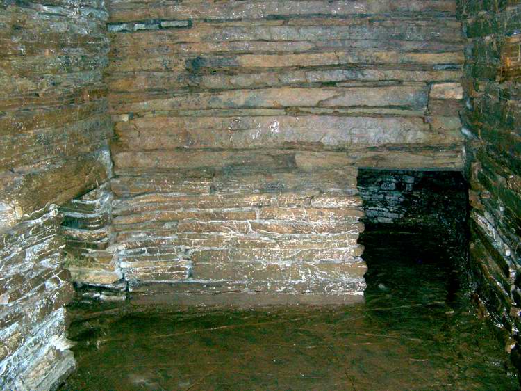
Cuween Hill submitted by Jon on 28th Dec 2003.
(View photo, vote or add a comment)
Log Text: Cuween is a cairn near Finstown where many dog skulls as well as human remains were found. My Spanish author friend links this to the entrance to hell, with the dogs guarding its entrance.
As the darkest mound with the lowest entrance we encountered, that seemed very appropriate. It is situated on a hill, and overlooks the Bay of Firth. There is a small cottage and a small parking area with a short footpath leading up to the cairn, which is ringfenced to protect it from grazing animals. There is an up and over ladder stile to access the site, with explanatory boards, and a box with a torch for use in the site which is otherwise unlit apart from the light from the very low entrance passageway.
We had taken a torch, but the provided one provided better illumination. All the skulls and bones have been removed, but it certainly is a chilly place and seldom visited, you are unlikely to encounter busloads of tourists at Cuween.
We were amused to find many small stone monuments erected on top of the mound, perhaps by visiting children and young people. Some show quite considerable architectural skill!
Comet Stone (Orkney)
Date Added: 9th Aug 2014
Site Type: Standing Stone (Menhir)
Country: Scotland (Orkney)
Visited: Yes on 29th May 2014
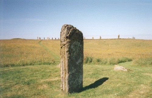
Comet Stone (Orkney) submitted by steveco on 24th Feb 2002. Comet Stone HY296132 standing 137mtrs SE from the Ring of Brodgar.
(View photo, vote or add a comment)
Log Text: Viewed this at the end of the Brodgar walk with Elaine Clark, the ranger. I mislabelled it at first, but AngieLake corrected me.
Ring of Brodgar
Date Added: 6th Jul 2014
Site Type: Stone Circle
Country: Scotland (Orkney)
Visited: Yes on 28th May 2014. My rating: Condition 3 Ambience 5 Access 4

Ring Of Brodgar submitted by Andy B on 18th Dec 2004. Image taken one evening in about 1995
(View photo, vote or add a comment)
Log Text: We were lucky enough to arrive at the Ring of Brodgar to have our picnic lunch 15 minutes before a scheduled free walk was to begin with one of the two rangers who do walks around both the megalithic sites and the wildlife havens in Orkney mainland.
The Ring of Brodgar is the most impressive site, even with stones fallen or missing. Its purpose is variously supposed to have been as a temple of the sun (with the Stones of Stenness as the temple of the moon) or as a gathering place showing the different clans that contributed each their own stone brought from their area of the islands. In the Neolithic the 60+ islands were mainly joined as two main islands, later separated and partially submerged by rising sea levels. The freshwater and seawater lochs which frame these megalithic structures seem to have had particular significance all over Europe, where water and swamp land were held to be special places.
The Ring is an enormous ring composed of stones from differing areas of Orkney perhaps aligned to their points of origin, as the stones are not perfectly upright, and tend to have sloped tops, perhaps acting as signposts, perhaps angled to reflect the angles of natural and constructed hills.
Knap of Howar
Date Added: 5th Jul 2014
Site Type: Ancient Village or Settlement
Country: Scotland (Orkney)
Visited: Yes on 31st May 2014. My rating: Condition 4 Ambience 5 Access 3

Knap of Howar submitted by PaulH on 19th Mar 2003.
(View photo, vote or add a comment)
Log Text: I thought we had missed the chance to visit the Knap of Howar. We had only 24 hours in Westray and the likelihood of getting to Papa Westray at the weekend seemed impossible. However on the ferry to Westray from Kirkwall I got talking to a local girl who was returning from college in Glasgow to play at a wedding in Papa Westray and stay with her grandparents. She said there would be a couple of extra ferries going over and to ask the bus driver. Michael phoned his boss who also ran the ferry to Papa Westray and it was arranged that we would leave our bags at our B&B whilst he waited and then took us straight round to the other ferry for the trip over.
So we landed in Papa Westray at 7 pm with no food, drink or coats, and walked from the pier at the south end of the island to the Knap of Howar, a couple of miles north to the Knap of Howar. We were lucky with weather and it was a light dry evening and only at about ten o'clock on our way back to catch the return ferry at 11.30 we began to get cold.
If we had flown in we would have been extremely close to the Knap of Howar at the airfield. It was a manageable walk for us oldies but that would depend on your health and fitness.
The site is stunning, along a footpath across a field, close to the shore. Part of the 'workshop' portion of the site was covered with a plastic tent and signs to keep out as it is being dug at present, although not when we were there in the evening. The site was unattended and we could go in through the low doorway and walk around in the house, and the near end of the workshop. I was impressed by the quality of the building work, with a curved outer wall and alcoves built into the walls. I imagine it may well have been roofed with flagstones, similar to the wall material. In many bays on Westray we saw the 'pavements' of stratified rock that splits easily and still is used to roof houses today, the flagstones outlasting even slate.
We passed such a cottage on our way to and from the Knap of Howar. It is amazing to think that many of the techniques used with stone building remain unchanged after 7,000 years. I am including a picture of the cottage with the flagstone roof.
We had encountered one near the Ring of Brodgar and the Stones of Stenness and had been told by the tenant that the roofer was resident on Westray.
At the time the Knap of Howar was built a thin causeway would still have connected Papa Westray to Westray island.
Castell Mawr (Pembrokeshire)
Date Added: 20th Sep 2013
Site Type: Hillfort
Country: Wales (Pembrokeshire)
Visited: Would like to visit
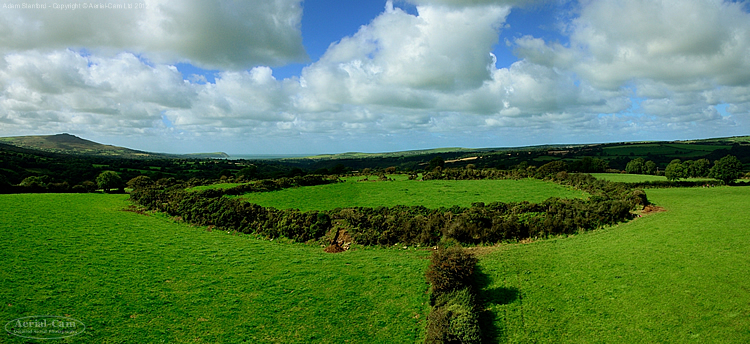
Castell Mawr (Pembrokeshire) submitted by Adam Stanford on 26th Nov 2012. The later prehistoric enclosure or hillfort that may have been a much earlier henge originally - Castell Mawr in Pembrokeshire, with a view over it to Carningli, Dinas Head and the bay at Newport.
(View photo, vote or add a comment)
Msoura
Date Added: 17th Sep 2013
Site Type: Stone Circle
Country: Morocco
Visited: Would like to visit
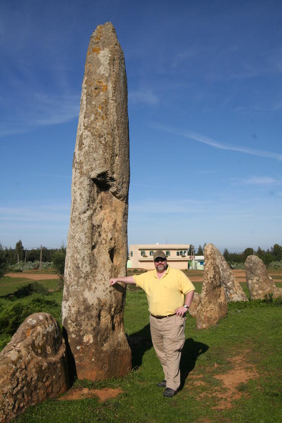
Msoura submitted by kengelma on 10th Jan 2007. Msoura, a stone circle that is located between Asilah and Larache (not far from Sidi el Yamani) in Morocco. The tallest stone is referred to as El Uted (the Pointer).
(View photo, vote or add a comment)
Wiltshire Heritage Museum
Date Added: 12th Sep 2013
Site Type: Museum
Country: England (Wiltshire)
Visited: Yes
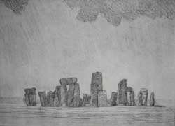
Stonehenge. submitted by WiltshireHeritage on 19th Jun 2008. Dave Gunning Retrospective - Stonehenge - engraving on steel
(View photo, vote or add a comment)
Log Text: We intended to visit the museum in Salisbury in September 2013 whilst visiting Avebury and Stonehenge. I particularly wanted to see the Amesbury Archer. However when we got to the Devizes museum the Bronze Age display had been removed as a new display is being arranged. The manager of the Devizes museum gave me an August 2013 copy of trilithon the newsletter of the Wiltshire Arcaeological and Natural History Society, which says "Our new Prehistoric Wiltshire Galleries open on Monday 14th October" "There are four galleries"- I believe that is the Devizes museum part, but may also refer to Salisbury museum, where the new Archaeology of Wessex Gallery is due to open in Spring 2014. We will have to return.
Windmill Hill Barrows
Date Added: 12th Sep 2013
Site Type: Round Barrow(s)
Country: England (Wiltshire)
Visited: Yes on 3rd Sep 2013
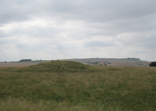
Windmill Hill Barrows submitted by Estrela on 12th Sep 2013. Barrow on Windmill Hill, September 2013.
(View photo, vote or add a comment)
Log Text: It was a long trek for us to Windmill Hill. We turned back several times as we had been told the metalled road was the best route and it was unmarked and not easy to follow at the village end. Originally my husband pointed us in the wrong direction - I know he can't navigate why did I listen to him? We did get there but very footsore. We came back across the fields footpath which suited us much better, being used to walking on grass. There is a good view of the whole landscape up there, but another time I would walk the Avenue and Overton Hill, West Kennet Long Barrow and Silbury Hill route in preference. A number of barrow mounds are visible up there and wildflower meadows planted by the metalled track.
Overton Down
Date Added: 12th Sep 2013
Site Type: Barrow Cemetery
Country: England (Wiltshire)
Visited: Yes on 3rd Sep 2013
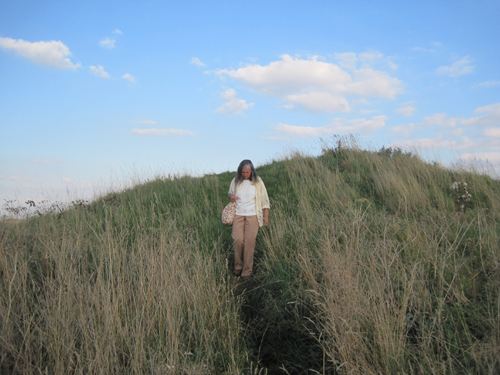
Overton Down submitted by Estrela on 12th Sep 2013. "Estrela" at Seorfen barrows
(View photo, vote or add a comment)
Log Text: Site well marked from road with small off-road parking area.
Woodhenge (Wiltshire)
Date Added: 11th Sep 2013
Site Type: Henge
Country: England (Wiltshire)
Visited: Yes on 5th Sep 2013
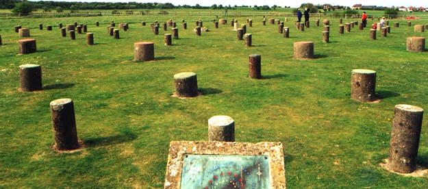
Woodhenge (Wiltshire) submitted by vicky on 25th Apr 2002. The Site of Woodhenge near Amesbury at GR: SU150434
(View photo, vote or add a comment)
Log Text: This was well-signed from the road, unlike Durrington Walls. Having found a link here for Durrington Walls an information board is shown which appears to be just where we looked for information unsuccessfully. Local walkers and villagers in Durrington also seemed to have no idea where it was! Woodhenge has concrete markers distinguishing between different sized posts, which I find useful. The cairn marks the spot where a skeleton of a 3 year old child with split skull was found, taken to London for investigation but lost during the Blitz. Was this henge roofed? We will probably never know. The idea of up to 4,000 people being here, in the huge Durrington enclosure for festivals is staggering.
Silbury Hill
Date Added: 11th Sep 2013
Site Type: Artificial Mound
Country: England (Wiltshire)
Visited: Yes
Silbury Hill submitted by MikeyB on 26th Nov 2012. Reflections of Silbury Hill
(View photo, vote or add a comment)
Log Text: This is a most impressive site. I like the theory that it was meant to represent a snail shell, to signify the beauty and impermanence of life, and the transience of this existence. Bone and shell are the same substance, a reminder, in life of death. A superb spot to see Avebury, Windmill Hill, the Seorfen Barrows and West Kennet barrow, alsp the Avenue stretching from Avebury henge to the Sanctuary.
West Kennett Long Barrow
Date Added: 11th Sep 2013
Site Type: Long Barrow
Country: England (Wiltshire)
Visited: Yes on 4th Sep 2013
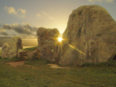
West Kennett Long Barrow submitted by song on 23rd Nov 2006. west kennet, sundown, november 2006
(View photo, vote or add a comment)
Log Text: West Kennet is an impressive long barrow, with huge shielding stones at the entrance end, obscuring the passage leading within. From its top one has a clear view of Silbury Hill to the north.
Glass blocks have been let into the barrow roof to give some light in the barrow rooms, but one has been left entirely dark to show what it would have been like.
Bluestonehenge
Date Added: 11th Sep 2013
Site Type: Stone Circle
Country: England (Wiltshire)
Visited: Yes on 6th Sep 2013
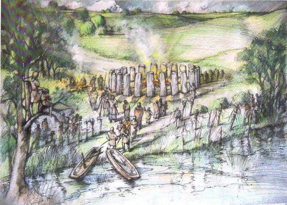
Bluestonehenge submitted by Andy B on 5th Oct 2009. Reconstruction drawing of the stone circle on the bank of the River Avon
Image copyright Peter Dunn, used with permission
(View photo, vote or add a comment)
Log Text: If the Googlemap image is correct then we were on the wrong side of the Avon, but if the small site map here is right we correctly identified the site on the road leading to Lake and Woodford just out of Stonehenge Road, where this henge was sited. It has variously been called West Amesbury henge, River henge and Bluestone henge or Bluehenge.
There is speculation that some of the bluestones were situated here (possibly about 27 of them) before being removed to Stonehenge later. The avenue led to (or was extended to) reach this henge which was very close to the river (Salisbury Avon) which would have been the main thoroughfare in the Neolithic and Bronze Age.
There is little to see or identify today.
Stonehenge.
Date Added: 10th Sep 2013
Site Type: Stone Circle
Country: England (Wiltshire)
Visited: Yes on 5th Sep 2013
Stonehenge. submitted by Feanor on 23rd Jun 2011. Inside the Ring
26 October 2010, ~9.30 AM
Shot inside the Eastern edge of the Circle, looking due north.
We have the NorthEast Trilithon on the left with the morning-shadow of Stones 6/7/107 falling across it.
Bluestone 32-C is in the shadow of Stone 6.
It was a lovely morning!
(View photo, vote or add a comment)
Log Text: The audio guide is good, keeps the visitors moving, but I really missed the opportunity to just stand and drink in the landscape and the relationship between the stones.
Durrington Walls
Date Added: 10th Sep 2013
Site Type: Henge
Country: England (Wiltshire)
Visited: Yes on 5th Sep 2013
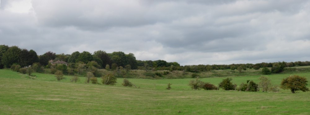
Durrington Walls submitted by TimPrevett on 10th Oct 2006. A composite image of half of Durrington Walls (the western side); compare scale of house to the left with the ring left in the landscape.
(View photo, vote or add a comment)
Log Text: Looking up more details of Durrington Walls I found a reference to it being largely on National Trust land with free access. Wish it had been labelled thus!
Avebury
Date Added: 7th Sep 2013
Site Type: Stone Circle
Country: England (Wiltshire)
Visited: Yes on 3rd Sep 2013
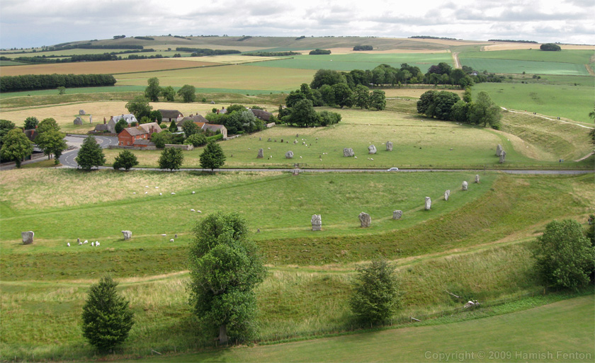
Avebury submitted by h_fenton on 4th Aug 2009. Avebury, Oblique Kite Aerial Photograph
12 July 2009
(View photo, vote or add a comment)
Log Text: We stayed in the Manor Farm within the stone circle, with magnificent views from our front and back windows of the stones of the circle. There is masses to see in the area, and a lovely, relaxed feel to the place, very unlike the much more well-known Stonehenge. The stones reflect the earlier date, much less worked and more primitive. One huge stone appears to have a face engraved on its side, but that is probably coincidence. The circle is huge, and the ditch still impressive although far short of its original 9m depth. Such a shame that the road intersects it, and that many stones were used for local building material, so that one side of the circle is all but gone. A magical place.
Wilsford Cum Lake Bowl Barrow
Date Added: 7th Sep 2013
Site Type: Round Barrow(s)
Country: England (Wiltshire)
Visited: Yes on 4th Sep 2013. My rating: Condition 4
Wilsford Cum Lake Bowl Barrow submitted by SolarMegalith on 1st Jul 2011. A Bronze Age bowl barrow near Wilsford Cum Lake - view from the SW (photo taken on June 2011).
(View photo, vote or add a comment)
Log Text: Visible from gateway and road.
Durrington 68
Date Added: 7th Sep 2013
Site Type: Timber Circle
Country: England (Wiltshire)
Visited: Yes on 5th Sep 2013. My rating: Access 5
Log Text: Small carpark opposite the Woodhenge site, which is fenced. It can become crowded if a local walk meets there, as it did when we went early in the day, although we had the henge to ourselves. Well marked from the A345 about 2 miles north of Amesbury centre. Large grassed picnic area at roadside. Stand on the picnic table and look north you can see the rough grassed bank of Durrington Walls which is fenced off from the sheep grazing, but does not appear to be accessible, although there is a footpath which may run close to it for those with younger legs and fewer blisters than we had by then!
I like the post markers, which give an idea of its layout with its concentric rings of different sized posts. Was any of it roofed? That must be conjectural.
