

<< Our Photo Pages >> Woodhenge (Wiltshire) - Henge in England in Wiltshire
Submitted by sem on Friday, 13 November 2015 Page Views: 61904
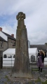
StonehengeSite Name: Woodhenge (Wiltshire)Country: England County: Wiltshire Type: Henge
Nearest Town: Salisbury Nearest Village: Durrington
Map Ref: SU15054338 Landranger Map Number: 184
Latitude: 51.189449N Longitude: 1.786029W
Condition:
| 5 | Perfect |
| 4 | Almost Perfect |
| 3 | Reasonable but with some damage |
| 2 | Ruined but still recognisable as an ancient site |
| 1 | Pretty much destroyed, possibly visible as crop marks |
| 0 | No data. |
| -1 | Completely destroyed |
| 5 | Superb |
| 4 | Good |
| 3 | Ordinary |
| 2 | Not Good |
| 1 | Awful |
| 0 | No data. |
| 5 | Can be driven to, probably with disabled access |
| 4 | Short walk on a footpath |
| 3 | Requiring a bit more of a walk |
| 2 | A long walk |
| 1 | In the middle of nowhere, a nightmare to find |
| 0 | No data. |
| 5 | co-ordinates taken by GPS or official recorded co-ordinates |
| 4 | co-ordinates scaled from a detailed map |
| 3 | co-ordinates scaled from a bad map |
| 2 | co-ordinates of the nearest village |
| 1 | co-ordinates of the nearest town |
| 0 | no data |
Internal Links:
External Links:
I have visited· I would like to visit
Elaria whese001 would like to visit
cliffrich visited on 31st Jan 2020 - their rating: Cond: 2 Amb: 4 Access: 4 Totally disappeared but wood post holes marked by concrete posts. Good ambience. A walk finds a long barrow and the Cuckoo Stone. A cairn in the middle of the circles signifies a grave of a child.
Jansold visited on 24th May 2016 - their rating: Cond: 2 Amb: 3 Access: 5
XIII visited on 13th Aug 2015 - their rating: Cond: 1 Amb: 3 Access: 4
Richard13 visited on 1st Jan 2014 - their rating: Cond: 2 Amb: 3 Access: 4
Estrela visited on 5th Sep 2013 This was well-signed from the road, unlike Durrington Walls. Having found a link here for Durrington Walls an information board is shown which appears to be just where we looked for information unsuccessfully. Local walkers and villagers in Durrington also seemed to have no idea where it was! Woodhenge has concrete markers distinguishing between different sized posts, which I find useful. The cairn marks the spot where a skeleton of a 3 year old child with split skull was found, taken to London for investigation but lost during the Blitz. Was this henge roofed? We will probably never know. The idea of up to 4,000 people being here, in the huge Durrington enclosure for festivals is staggering.
johnstone visited on 29th Jun 2010 - their rating: Cond: 2 Amb: 3 Access: 5
markj99 visited on 17th Aug 2009 - their rating: Cond: 2 Amb: 3 Access: 5 I was disappointed with the unimaginative use of concrete posts substituted for timber posts. Not worth a visit.
Ogham visited on 1st Aug 2009 - their rating: Cond: 2 Amb: 3 Access: 5
Magentawrites visited on 1st Apr 2009 - their rating: Cond: 5 Amb: 4 Access: 5 So glad this was the first place we visited in Wilts, spent a good deal of time in quiet here, enjoyed every minute.
The site is well cared for and easy to access.
ForestDaughter visited on 23rd Sep 2008 - their rating: Access: 5
Woode visited on 20th Dec 2007 - their rating: Cond: 1 Amb: 2 Access: 5
graemefield visited on 1st Jan 1995 - their rating: Cond: 2 Amb: 3 Access: 5
SteveC visited - their rating: Amb: 2 Access: 5
elad13 FrothNinja sem DrewParsons Bladup mark_a moor2moor AngieLake TimPrevett hamish sirius_b myf AnnabelleStar mdensham have visited here
Average ratings for this site from all visit loggers: Condition: 2.1 Ambience: 3 Access: 4.75
 (PID:137380)")
Before seeing Woodhenge, visitors to the area sometimes anticipate that it might partly resemble Stonehenge. But there is actually little of the original structure easily apparent. Indeed, the site was not identified until 1922, after an aerial archaeology survey undertaken by Alexander Keiller and OGS Crawford.
Maud Cunnington excavated the site between 1926 and 1929.
Pottery from the excavation was identified as being consistent with the Grooved ware style of the middle Neolithic, although later Beaker sherds were also found.
The site was understood by Cunnington to consist of a central burial, surrounded first by six concentric rings of postholes, then by a single ditch and finally an outer bank, around 85m wide. The burial was of a child which Cunnington interpreted as a dedicatory sacrifice (now disputed, see comment below - Ed) although it was destroyed in The Blitz and re-examination has not been possible. Cunnington also found a skeleton of a teenager in one of the ditch sections she dug.
Most of the 168 post holes held wooden posts, though there is evidence of a pair of standing stones having been placed between the second and third post hole rings. The deepest holes measured up to 2m and the height of the posts they held has been estimated at up to 7.5m above the ground. This sort of timber would have weighed around 5 tonnes and prompted similar logistical problems as the erection of the bluestones at Stonehenge.
Further comparisons with Stonehenge were quickly noticed by Cunnington; both have entrances oriented approximately on the midsummer sunrise and the diameters of the timber circles at Woodhenge and the stone circles at Stonehenge are similar making the reasons for the name more understandable.
The positions of the postholes are currently marked with modern concrete posts which are either a simple and informative method of displaying the site or a travesty of visitor interpretation and visual amenity.
There are various theories about possible timber structures that might have stood on the site, and about how the axes, etc, of the rings might have aligned with positions of the Sun on the horizon. But opportunities remain for further work in this respect.
The above text is covered by the GNU Free Documentation License.
Note: Sem's 3D model of Woodhenge to try out
You may be viewing yesterday's version of this page. To see the most up to date information please register for a free account.
 (PID:90766)")
 (PID:818)")
 (PID:999)")
 (PID:39957)")
 (PID:4374)")
 (PID:71806)")
 (PID:26524)")
 (PID:2923)")
 (PID:229201)")
 (PID:206451)")
 (PID:108606)")
 (PID:101252)")
 (PID:90804)")
 (PID:85022)")
 (PID:265006)")
 (PID:240766)")
 (PID:239044)")
 (PID:239039)")
 (PID:128740)")
 (PID:117696)")
 (PID:108311)")
 (PID:108310)")
 (PID:90805)")
 (PID:85023)")
These are just the first 25 photos of Woodhenge (Wiltshire). If you log in with a free user account you will be able to see our entire collection.
Do not use the above information on other web sites or publications without permission of the contributor.
Click here to see more info for this site
Nearby sites
Key: Red: member's photo, Blue: 3rd party photo, Yellow: other image, Green: no photo - please go there and take one, Grey: site destroyed
Download sites to:
KML (Google Earth)
GPX (GPS waypoints)
CSV (Garmin/Navman)
CSV (Excel)
To unlock full downloads you need to sign up as a Contributory Member. Otherwise downloads are limited to 50 sites.
![]()
![]()
Turn off the page maps and other distractions
Nearby sites listing. In the following links * = Image available
94m SSE 148° Durrington 68 Timber Circle (SU151433)
279m NNE 21° Durrington Walls South Circle* Timber Circle (SU1515043641)
372m N 354° Durrington Walls* Henge (SU15014375)
386m W 266° Cuckoo Stone (Wiltshire)* Standing Stone (Menhir) (SU1466443353)
1.3km ESE 104° Watergate Long Barrow* Long Barrow (SU1635643051)
1.4km W 263° Amesbury Cursus (E)* Cursus (SU137432)
1.4km S 188° Blick Mead* Ancient Village or Settlement (SU1487242013)
1.4km NW 317° Larkhill Causewayed Enclosure* Causewayed Enclosure (SU14084440)
1.6km WSW 248° Old King Barrows* Barrow Cemetery (SU13604280)
1.6km SSE 152° Ratfyn Barrow* Round Barrow(s) (SU15834194)
1.7km SSW 196° Vespasian's Camp* Hillfort (SU14594173)
1.7km SW 231° The King Barrows Ridge* Barrow Cemetery (SU137423)
1.7km SSW 213° Amesbury 38 Bowl Barrow* Round Barrow(s) (SU14114192)
1.9km S 174° Amesbury History Centre* Museum (SU1526841462)
2.0km SW 234° New King Barrows* Barrow Cemetery (SU13454222)
2.2km SSW 203° Bluestonehenge* Stone Circle (SU14204137)
2.3km E 95° Bulford Stone* Standing Stone (Menhir) (SU17364318)
2.3km SW 235° Amesbury 39 Bowl Barrow* Round Barrow(s) (SU13154204)
2.4km SW 223° Coneybury Henge* Henge (SU134416)
2.5km WSW 252° The Avenue* Ancient Trackway (SU12694262)
2.5km SW 217° King Barrow (Amesbury)* Barrow Cemetery (SU13554137)
2.8km WNW 291° Long Barrow alongside The Packway, Larkhill* Long Barrow (SU12474438)
2.9km WSW 245° Stonehenge Bowl Barrow* Round Barrow(s) (SU12424217)
3.0km WSW 248° Heel Stone* Standing Stone (Menhir) (SU1229142244)
3.0km NW 311° Knighton Down Long Barrow (SU12784535)
View more nearby sites and additional images


 We would like to know more about this location. Please feel free to add a brief description and any relevant information in your own language.
 Wir möchten mehr über diese Stätte erfahren. Bitte zögern Sie nicht, eine kurze Beschreibung und relevante Informationen in Deutsch hinzuzufügen.
 Nous aimerions en savoir encore un peu sur les lieux. S'il vous plaît n'hesitez pas à ajouter une courte description et tous les renseignements pertinents dans votre propre langue.
 Quisieramos informarnos un poco más de las lugares. No dude en añadir una breve descripción y otros datos relevantes en su propio idioma.