Contributory members are able to log private notes and comments about each site
Sites BrownEdger has logged. View this log as a table or view the most recent logs from everyone
Yearnslow
Date Added: 25th Sep 2015
Site Type: Round Barrow(s)
Country: England (Cheshire)
Visited: Would like to visit
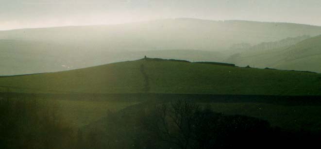
Yearnslow submitted by Vicky on 15th Dec 2001. Yearnslow, Rainow, near Macclesfield, Cheshire GR: SJ96457695
This interesting bowl-shaped mound (on the horizon in the centre of the picture) is situated on a knoll at 1175ft above sea level close to Yearnslow Farm. It was reputedly opened by some Derbyshire explorers in the 19th when some Roman coins, glass beads, and bones were found in it. Today the mound which is around 19m in diameter and just over one metre in height, is covered by ruined dry-stone walls.
(View photo, vote or add a comment)
Wishing Well (nr Tatenhill)
Date Added: 27th Sep 2015
Site Type: Holy Well or Sacred Spring
Country: England (Staffordshire)
Visited: Would like to visit
Windywaycross
Date Added: 12th Aug 2014
Site Type: Early Christian Sculptured Stone
Country: England (Staffordshire)
Visited: Yes on 1st Jun 2012. My rating: Condition 3 Ambience 4 Access 5
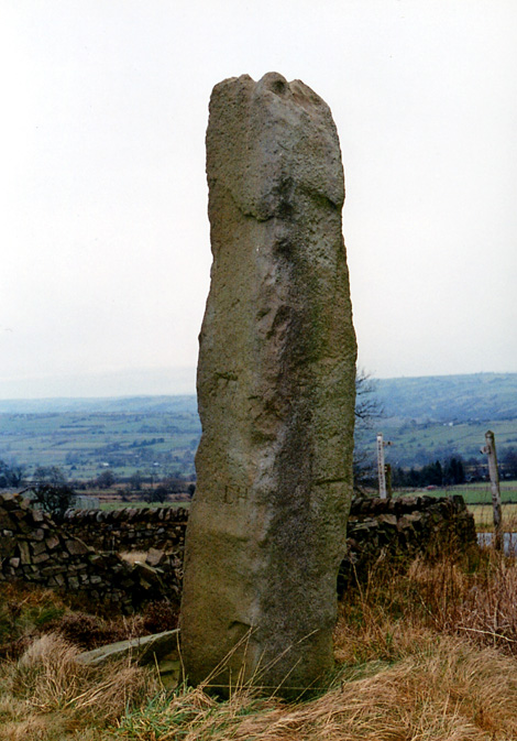
Windywaycross submitted by Astronomer on 18th Mar 2004. Windywaycross, possibly a re-used standing stone on Ippestones Edge at SK056492 at a place called Windywaycross, just off the road branching to Alton Towers, off the Leek-Ashbourne road. Approaching from the north, the stone is 8m off the RH side of the road.
(View photo, vote or add a comment)
Log Text: It has the date it was erected carved into it.
Wetton Hill
Date Added: 26th Sep 2015
Site Type: Round Barrow(s)
Country: England (Staffordshire)
Visited: Would like to visit
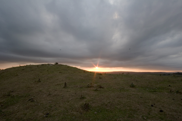
Wetton Hill submitted by twentytrees on 13th Aug 2006. Sunset. The barrow is on the left. Approx. 8m diameter and 1.5m high.
(View photo, vote or add a comment)
Webb Stone
Date Added: 26th Sep 2015
Site Type: Standing Stone (Menhir)
Country: England (Staffordshire)
Visited: Would like to visit
Webb Stone submitted by TimPrevett on 5th Jan 2004. The Webb Stone
SJ881177
There is not one stone in Bradley (pronounced Braid-lee), not two, but three! In the parish church of All Saints (which is on the highest part of the village, and is thought likely to be a Christianised pagan site), there is a local guidebook, "A Chronicle of Bradeley - The Story of an English Village 1000-2000AD" by William & Anne Wilkinson. Despite its subtitle, page 5 does have entries on its monuments prior to 1000AD.
These stones are in fact "glacial erratics...
(View photo, vote or add a comment)
Weaver Hills
Date Added: 26th Sep 2015
Site Type: Barrow Cemetery
Country: England (Staffordshire)
Visited: Would like to visit
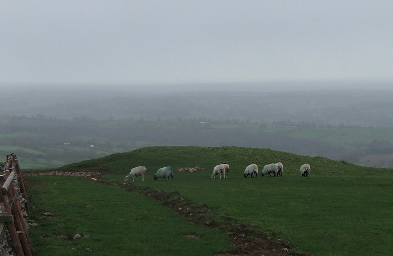
Weaver Hills submitted by postman on 18th Dec 2012. The first barrow reached from the car park
(View photo, vote or add a comment)
Waterfall Low
Date Added: 26th Sep 2015
Site Type: Round Barrow(s)
Country: England (Staffordshire)
Visited: Would like to visit
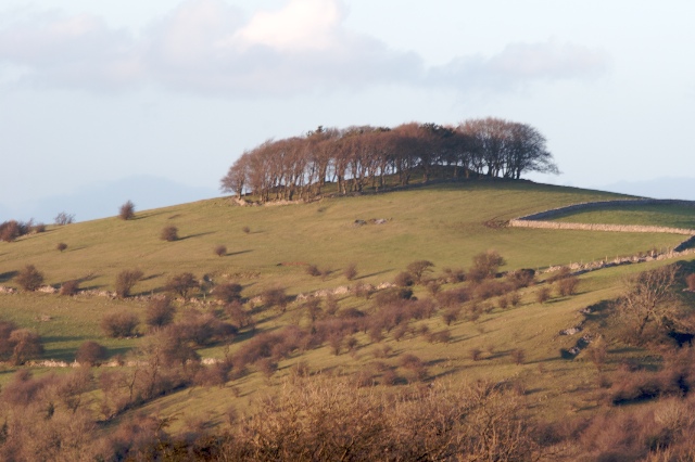
Waterfall Low submitted by twentytrees on 7th Mar 2007. Picture taken from Lamber Low.
(View photo, vote or add a comment)
Warslow Bowl Barrow
Date Added: 26th Sep 2015
Site Type: Round Barrow(s)
Country: England (Staffordshire)
Visited: Would like to visit
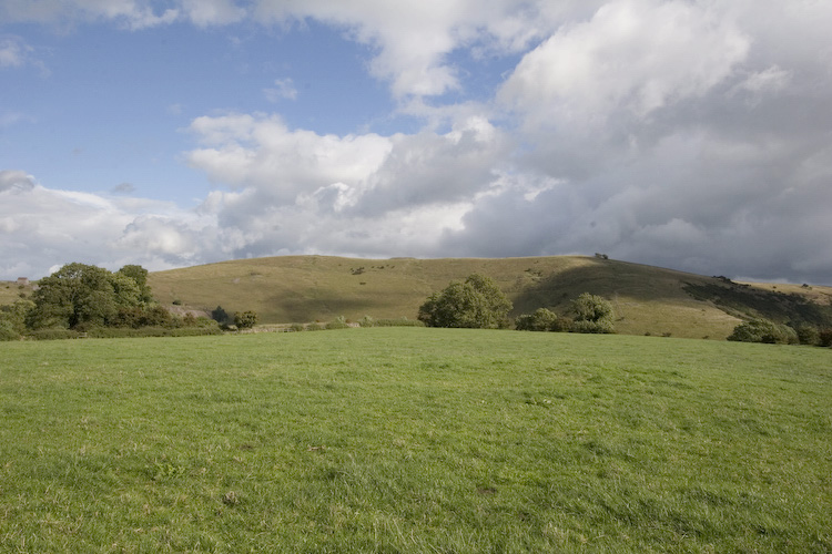
Warslow Bowl Barrow submitted by twentytrees on 29th Aug 2006. The barrow visible in the foreground with Ecton Hill in the backgtound.
(View photo, vote or add a comment)
Town End Barrow
Date Added: 26th Sep 2015
Site Type: Round Barrow(s)
Country: England (Staffordshire)
Visited: Would like to visit
Top Low 2
Date Added: 12th Aug 2014
Site Type: Round Barrow(s)
Country: England (Staffordshire)
Visited: Yes on 5th May 2014. My rating: Condition 3 Ambience 4 Access 4
Log Text: Footpaths run along the hillside above the site and along the valley floor below. Mutilation on the mound reveals natural rock, so the barrow may merge with a natural feature. Sheep using the hollow on the top of the barrow as a bed when I visited.
Top Low 1
Date Added: 12th Aug 2014
Site Type: Round Barrow(s)
Country: England (Staffordshire)
Visited: Yes on 5th May 2014. My rating: Condition 2 Ambience 4 Access 3
Log Text: Site is located on private land with no footpath access to site. However, both sets of field walls between the public footpath lower down the hill and the site are down for some reason there is nothing to prevent anyone from climbing to the top of the hill at the moment.
Toot Hill Barrow (2)
Date Added: 27th Sep 2015
Site Type: Round Barrow(s)
Country: England (Staffordshire)
Visited: Would like to visit
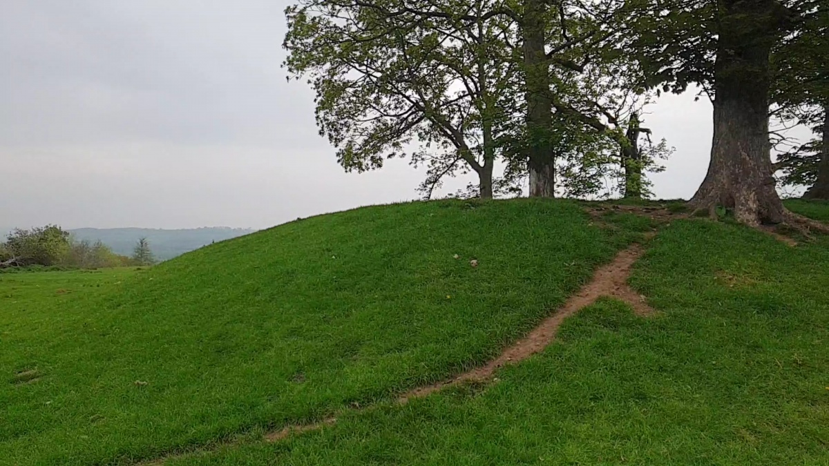
Toot Hill Barrow (2) submitted by elad13 on 3rd May 2022. Toot Hill Barrow, has easy access to the site and is very well preserved even with the mature trees growing on it
2/5/2022
(View photo, vote or add a comment)
Toot Hill Barrow (1)
Date Added: 27th Sep 2015
Site Type: Round Barrow(s)
Country: England (Staffordshire)
Visited: Would like to visit
Thorswood
Date Added: 26th Sep 2015
Site Type: Barrow Cemetery
Country: England (Staffordshire)
Visited: Would like to visit
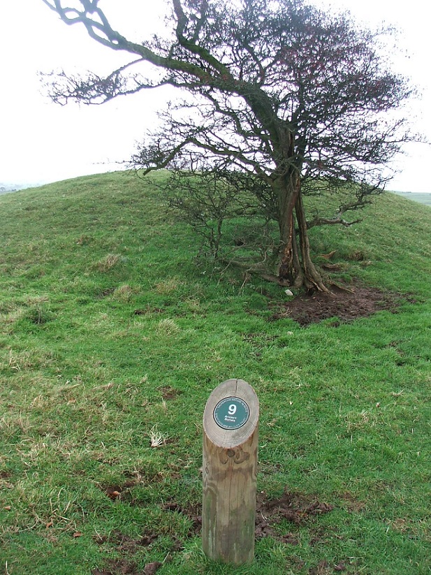
Thorswood submitted by postman on 18th Dec 2012. I know I took more than one photo but strangely this is the only one I have left.
(View photo, vote or add a comment)
Thorncliffe Barrow
Date Added: 26th Sep 2015
Site Type: Round Barrow(s)
Country: England (Staffordshire)
Visited: Would like to visit
Thor's Cave
Date Added: 26th Sep 2015
Site Type: Cave or Rock Shelter
Country: England (Staffordshire)
Visited: Would like to visit
Thor's Cave submitted by TimPrevett on 29th Jul 2006. The magnificent, awe inspiring Thor's Cave, looking out. Only a visit in person can convey the size of the place, and the ambience of looking into the Manifold Valley.
(View photo, vote or add a comment)
The Wrekin
Date Added: 16th Aug 2011
Site Type: Hillfort
Country: England (Shropshire)
Visited: Yes on 14th Aug 2011. My rating: Condition 3 Ambience 4
The Wrekin submitted by TimPrevett on 2nd Jan 2005. Lookin to the North East, between the outer and inner ramparts of The Wrekin.
The path enters the inturned ramparts to the central area; the trig point and toposcope sit upon a Bronze Age Cairn, which is hardly in evidence.
Another, more slight rampart is visible to the left of the picture, before the hill becomes more rounded.
See main entry - click on the blue text to the left of the picture for more information.
(View photo, vote or add a comment)
Log Text: None
The Winking Man
Date Added: 16th Aug 2011
Site Type: Natural Stone / Erratic / Other Natural Feature
Country: England (Staffordshire)
Visited: Yes on 14th Aug 2010. My rating: Condition 4 Ambience 5 Access 4
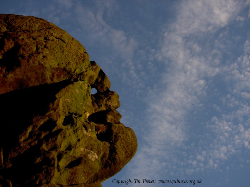
The Winking Man submitted by TimPrevett on 5th Nov 2006. The Winking Man - a natural convincing anthropomorphic rock formation on Ramshaw Rocks at SK 02021 62362. This is in North Staffordshire on the west side of the Leek - Buxton Road. The route immediately below the rock outcrops is on a Roman Road, and remains one of the most accident prone deadly A roads in the country. Parking is to west of the Rocks (good layby at SK 01746 62012), then a fairly easy walk up to near the summit, and the Winking Man is on the east side. Tripping hazards and drops...
(View photo, vote or add a comment)
Log Text: None
The Roaches Barrow
Date Added: 26th Sep 2015
Site Type: Round Barrow(s)
Country: England (Staffordshire)
Visited: Would like to visit
The Plague Stone
Date Added: 21st Aug 2011
Site Type: Ancient Cross
Country: England (Cheshire)
Visited: Yes on 21st Aug 2011. My rating: Condition 3 Ambience 4 Access 5
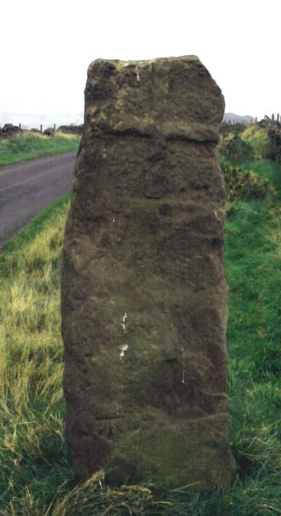
The Plague Stone submitted by Vicky on 18th Oct 2001. THE PLAGUE STONE , Higher Sutton, near Macclesfield SJ9561469227
This wayside cross, possibly a Christianised standing stone, was apparently the place where goods were left by the healthy for sale to the plague-stricken. The latter took the goods and left the money in a pot of water. Interestingly the 1904 OS map shows an isolation hospital located near by.
(View photo, vote or add a comment)
Log Text: None
