Contributory members are able to log private notes and comments about each site
Sites BrownEdger has logged. View this log as a table or view the most recent logs from everyone
The Wrekin
Date Added: 16th Aug 2011
Site Type: Hillfort
Country: England (Shropshire)
Visited: Yes on 14th Aug 2011. My rating: Condition 3 Ambience 4
The Wrekin submitted by TimPrevett on 2nd Jan 2005. Lookin to the North East, between the outer and inner ramparts of The Wrekin.
The path enters the inturned ramparts to the central area; the trig point and toposcope sit upon a Bronze Age Cairn, which is hardly in evidence.
Another, more slight rampart is visible to the left of the picture, before the hill becomes more rounded.
See main entry - click on the blue text to the left of the picture for more information.
(View photo, vote or add a comment)
Log Text: None
Bawd Stone
Date Added: 16th Aug 2011
Site Type: Natural Stone / Erratic / Other Natural Feature
Country: England (Staffordshire)
Visited: Yes on 27th Jun 2010. My rating: Condition 3 Ambience 4 Access 4
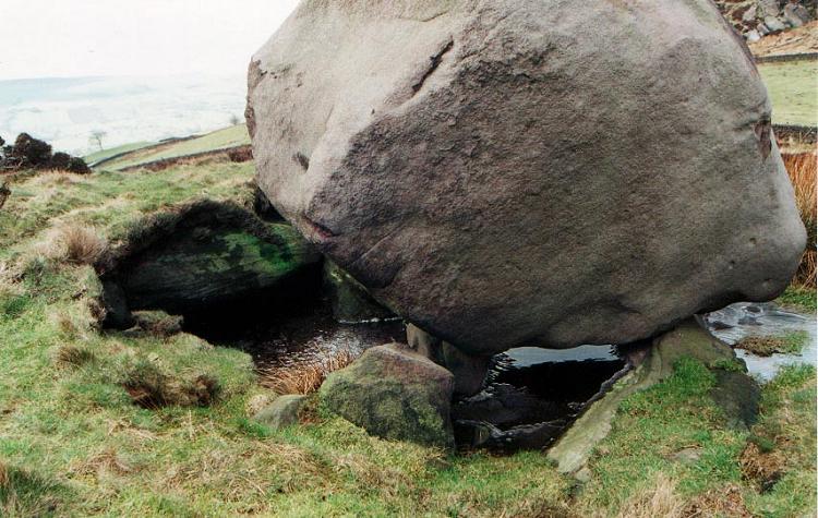
Bawd Stone submitted by vicky on 2nd Sep 2001. The Bawdstone, possible dolmen, near Hen Cloud, The Roaches, Staffordshire GR: SJ009620
This so called ‘dolmen’ was described by antiquarian J.D. Sainter in his book ‘Scientific Rambles Round Macclesfield’ in 1878:
"At a short distance south of Rock Hall, there may be observed on the opposite side of Hen Cloud a block of gritstone, which upon approaching it, is found to be rested or balanced, in the first place, upon a short edge of rock and then upon two upright and pointed pilla...
(View photo, vote or add a comment)
Log Text: None
The Winking Man
Date Added: 16th Aug 2011
Site Type: Natural Stone / Erratic / Other Natural Feature
Country: England (Staffordshire)
Visited: Yes on 14th Aug 2010. My rating: Condition 4 Ambience 5 Access 4
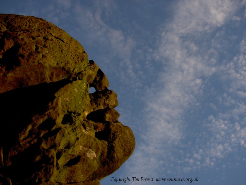
The Winking Man submitted by TimPrevett on 5th Nov 2006. The Winking Man - a natural convincing anthropomorphic rock formation on Ramshaw Rocks at SK 02021 62362. This is in North Staffordshire on the west side of the Leek - Buxton Road. The route immediately below the rock outcrops is on a Roman Road, and remains one of the most accident prone deadly A roads in the country. Parking is to west of the Rocks (good layby at SK 01746 62012), then a fairly easy walk up to near the summit, and the Winking Man is on the east side. Tripping hazards and drops...
(View photo, vote or add a comment)
Log Text: None
Red Cross
Date Added: 16th Aug 2011
Site Type: Ancient Cross
Country: England (Staffordshire)
Visited: Yes on 9th Jun 2011. My rating: Condition 3 Ambience 3
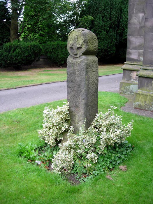
Red Cross submitted by astronomer on 6th Aug 2006. West side of the Red Cross, Knypersley, Staffordshire.
(View photo, vote or add a comment)
Log Text: None
St Edward the Confessor
Date Added: 16th Aug 2011
Site Type: Ancient Cross
Country: England (Staffordshire)
Visited: Yes on 3rd Jun 2011. My rating: Condition 3 Ambience 5
St Edward the Confessor submitted by TimPrevett on 25th Apr 2005. Putting both crosses within context of each other; the 8th Century Cross is nearest, the 7th Century Cross to the rear. Click on the blue highlighted text to the top left of the pic for more information.
(View photo, vote or add a comment)
Log Text: None
Shepherd's Cross
Date Added: 16th Aug 2011
Site Type: Standing Stone (Menhir)
Country: England (Staffordshire)
Visited: Yes on 9th Jun 2011. My rating: Condition 3 Ambience 4
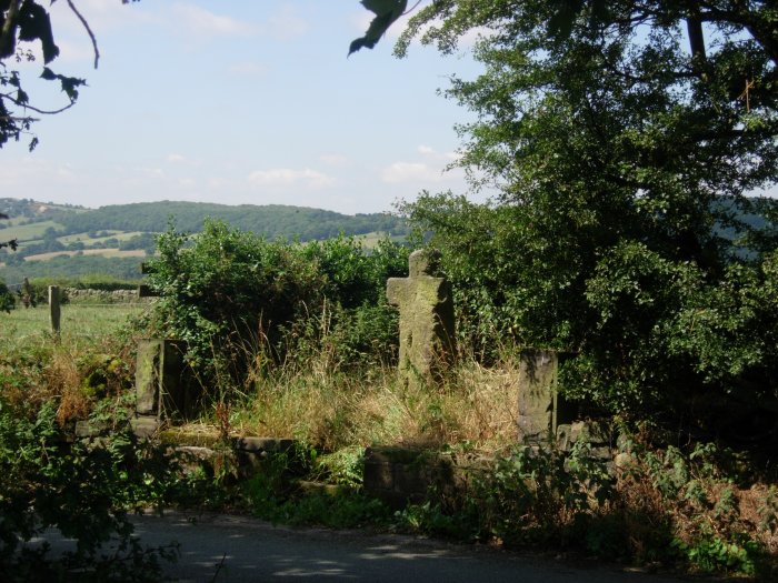
Shepherd's Cross submitted by TimPrevett on 3rd Aug 2006. Viewed from across the road. The west Staffordshire / east Cheshire border runs along the ridge to rear left. See main entry for details - click on blue text to left of picture.
(View photo, vote or add a comment)
Log Text: None
Gawton's Well
Date Added: 16th Aug 2011
Site Type: Holy Well or Sacred Spring
Country: England (Staffordshire)
Visited: Yes on 9th Jun 2011. My rating: Condition 4 Ambience 4
Gawton's Well submitted by TimPrevett on 4th Nov 2008. Got around to visiting here yesterday, and it's brilliant. It's only 16 miles east for me, so returning won't be too much of an issue. Very atmospheric woodland and castle like folly neaby too. I wouldn't be surprised if therein lies a connection with the well.
The spring lies within a large circular wall, in varying states of collapse, and within that is an elipse of yew trees - reminiscent of the ring of trees in "Nightmare Before Christmas". If this were Wales I'd start thinking this was th...
(View photo, vote or add a comment)
Log Text: None
Gawton's Stone
Date Added: 16th Aug 2011
Site Type: Modern Stone Circle etc
Country: England (Staffordshire)
Visited: Yes on 9th Jun 2011. My rating: Condition 3 Ambience 3
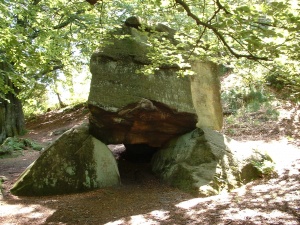
Gawton's Stone submitted by Sunny100 on 12th May 2010. Gawton's Stone at SJ.898554/5
(View photo, vote or add a comment)
Log Text: None
The Bridestones (Cheshire)
Date Added: 8th Aug 2011
Site Type: Chambered Tomb
Country: England (Cheshire)
Visited: Yes. My rating: Access 5

The Bridestones (Cheshire) submitted by astronomer on 15th Apr 2011. Lifting the fallen monolith during the 1936-37 excavation.
Photo taken by the then land owner, Mr. G. Ech Roger Jnr. Previously unpublished image made available by the present owner of the glass negatives, Doug Pickford.
(View photo, vote or add a comment)
Log Text: None
Clulow Cross
Date Added: 21st Aug 2011
Site Type: Round Barrow(s)
Country: England (Cheshire)
Visited: Saw from a distance on 21st Aug 2011. My rating: Condition 3 Ambience 4 Access 3
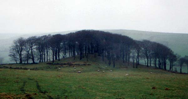
Clulow Cross submitted by vicky on 22nd Jul 2002. Clulow Cross - possibly a prehistoric round barrow surmounted by a more recent cross.
(View photo, vote or add a comment)
Log Text: None
Hurst Low
Date Added: 12th Aug 2014
Site Type: Round Barrow(s)
Country: England (Staffordshire)
Visited: Couldn't find on 7th Apr 2013
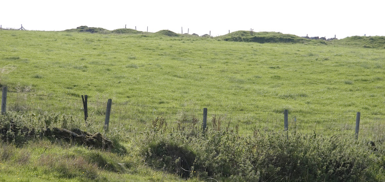
Hurst Low submitted by twentytrees on 9th Sep 2006. Marked as Tumuli on the map but this may refer to nearby Grindon Moor barrow. There appears to be numerous mounds in a line (lined up on nearby Butterton church spire?) but they are in a much denunded state, so difficult to be sure. Not scheduled.
(View photo, vote or add a comment)
Log Text: Saw a huge misshapen mound in the field containing Hurst Low but that looked more like a spoil heap or something. Large agricultural building has been erected nearby in same field too. Whole area very messy with vehicles parked in the field and bits of rusty agricultural equipment lain about. Failed to I.D. the barrow.
Pea Low
Date Added: 29th Sep 2015
Site Type: Chambered Cairn
Country: England (Derbyshire)
Visited: Would like to visit
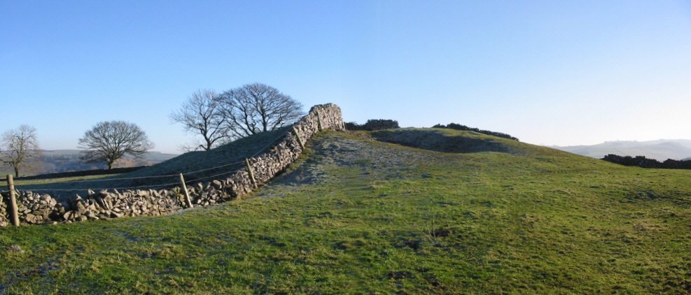
Pea Low submitted by Stu on 8th Jan 2003. Pea Low Barrow
(View photo, vote or add a comment)
Lud's Church
Date Added: 27th Sep 2015
Site Type: Natural Stone / Erratic / Other Natural Feature
Country: England (Staffordshire)
Visited: Would like to visit
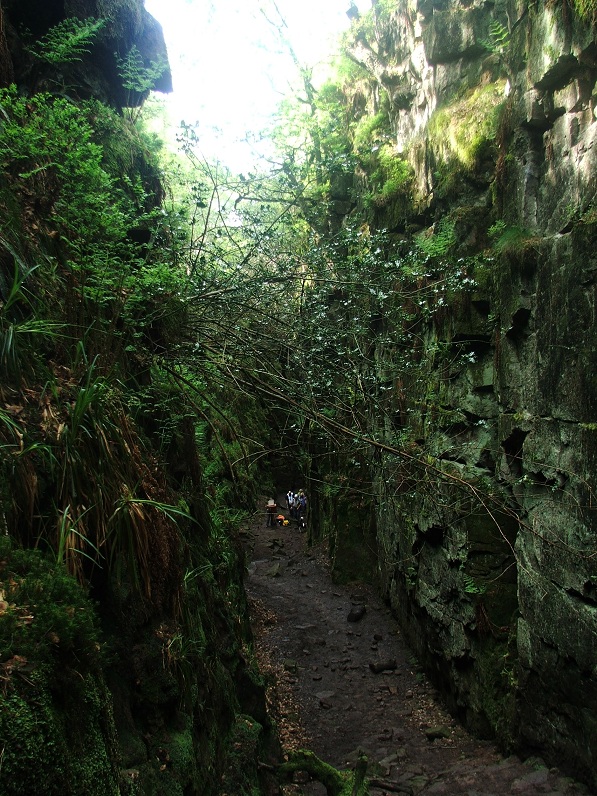
Lud's Church submitted by Postman on 16th Dec 2012. An Artist way back down there is past by a few walkers.
(View photo, vote or add a comment)
Hopestone ; Ipstones/Foxt ; Staffordshire
Date Added: 27th Sep 2015
Site Type: Natural Stone / Erratic / Other Natural Feature
Country: England (Staffordshire)
Visited: Would like to visit
St Mary and All Saints (Checkley)
Date Added: 27th Sep 2015
Site Type: Ancient Cross
Country: England (Staffordshire)
Visited: Would like to visit
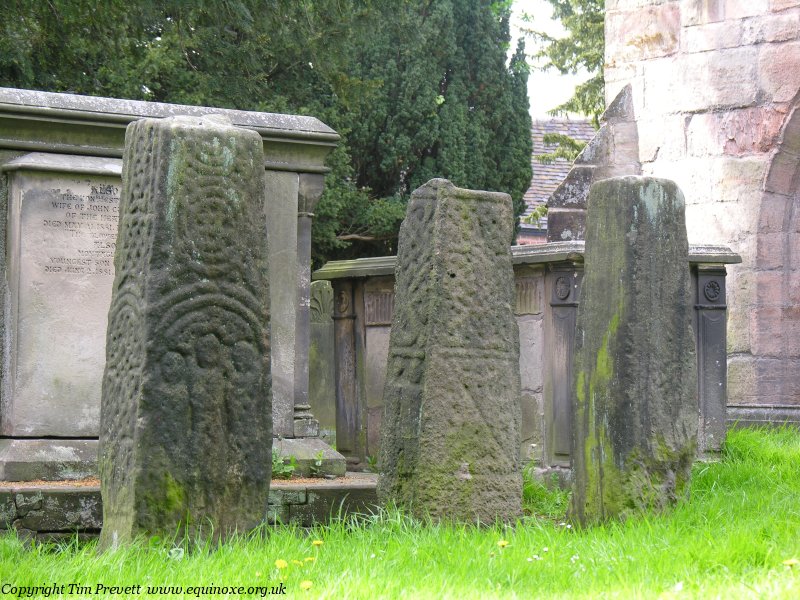
St Mary and All Saints (Checkley) submitted by TimPrevett on 8th May 2007. The three 9th Century Anglo-Scandinavian cross shafts in Checkley Churchyard. One would be fine! A superb group, each around 5 feet tall. The church and churchyard are fascinating. If not open a key is available very nearby - mail me for details. An unusual Saxon font is at the rear of the church, as well as a good guidebook for £2 as of 08/05/07. The churchyard is very nearly completely circled by yew trees, most of them relatively juvenile, but a couple are noticeably larger in girth. On the ...
(View photo, vote or add a comment)
Berryhill Fields
Date Added: 27th Sep 2015
Site Type: Modern Stone Circle etc
Country: England (Staffordshire)
Visited: Would like to visit
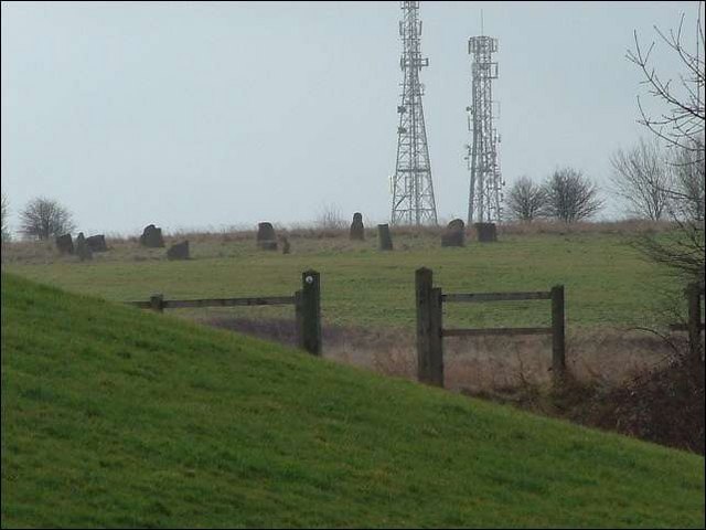
Berryhill Fields modern stone circle and amphitheatre submitted by Creative Commons on 19th Aug 2012. Stone Circle at Berryhill Fields
Berryhill fields - not far from the amphitheatre, on a grass path along from the "breaking the mould stature"
Installed: 2000
Background to the circle: Part of the restoration of the Berryhill fields after they had been saved from opencast mining.
Copyright Steven Birks and licensed for reuse under this Creative Commons Licence.
(View photo, vote or add a comment)
Stoke Minster
Date Added: 27th Sep 2015
Site Type: Ancient Cross
Country: England (Staffordshire)
Visited: Would like to visit

Stoke Minster submitted by TimPrevett on 7th Aug 2006. A view of the cross within its railings, and modern mount.
(View photo, vote or add a comment)
Berth Hill
Date Added: 27th Sep 2015
Site Type: Hillfort
Country: England (Staffordshire)
Visited: Would like to visit
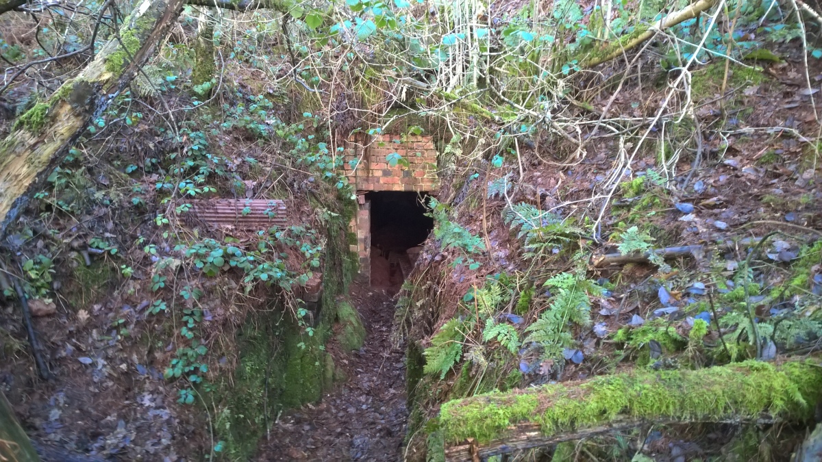
Berth Hill submitted by HarryTwenty on 2nd Oct 2022. Victorian aqueduct built into the eastern side of the hillfort to carry water from the spring to the hall and village of Maer (January 2022)
(View photo, vote or add a comment)
St Mary and All Saints (Trentham)
Date Added: 27th Sep 2015
Site Type: Ancient Cross
Country: England (Staffordshire)
Visited: Would like to visit

St Mary and All Saints (Trentham) submitted by TimPrevett on 23rd May 2007. The believed Anglo Saxon stepped cross base at Trentham Church, with later socket stone and shaft.
(View photo, vote or add a comment)
Bury Bank (Staffordshire)
Date Added: 27th Sep 2015
Site Type: Hillfort
Country: England (Staffordshire)
Visited: Would like to visit
Bury Bank (Staffordshire) submitted by TimPrevett on 20th May 2006. The inner platform with trees following the arc of the rampart. Courses of pebbles can also be traced, forming what must have been walls at some period. See main entry for details.
(View photo, vote or add a comment)
