Contributory members are able to log private notes and comments about each site
Sites Anne T has logged. View this log as a table or view the most recent logs from everyone
St Patrick's Well (Aspatria)
Date Added: 4th May 2015
Site Type: Holy Well or Sacred Spring
Country: England (Cumbria)
Visited: Yes on 1st May 2015. My rating: Condition 4 Ambience 3 Access 4
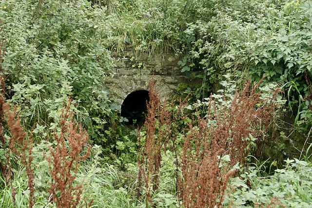
St Patrick's Well (Aspatria) submitted by MisterBus on 25th Sep 2010. St Patrick's Well, Aspatria, Cumbria UK. The well is at the rear of the church in the graveyard. Although the graveyard is well cared for the area around the well is overgrown and in much need of restoration.
(View photo, vote or add a comment)
Log Text: St Patrick's Well, Aspatria. This well can be found in the churchyard of St. Kentigern's Church at Aspatria. Driving into Aspatria along the A596 from Carlisle, the church is on the right hand side of the road with disk parking on both sides of the road. There are steps up from the gate into the churchyard.
We arrived during the annual church flower festival (1st to 4th May). Before going into St. Kentigern’s Church to see the Anglo Saxon Cross and Viking Hogback Tombstone, we’d had a quick scout around the churchyard to see if we could see the well, but no. Asking directions from one of the guides at the church, he told us to “go out of the west door, turn right and it’s 50 yards down – you can’t miss it. Following his directions, where the path around the church turned along the northern corner, all we could see were gravestones and a fenced off area containing shrubs. The path stopped at this point and we had to make our way over the grass, avoiding the humps and bumps of grass-covered graves. Once at the fenced off area and having turned the corner, we saw immediately where the well was, contained within a neat, modern-looking stone walls with a path leading up to it.
The well was dry at the time of our visit, and looked as it if had been for some time. It wasn’t obvious where the water went to – it must have formed a small pool within the confines of the paved area, any overspill running onto the grass beyond. Whilst the well was said to have been used by St. Kentigern for baptisms, I didn’t find it had any atmosphere at all. The Pastcape record (id=9583) says that “The feature consists of a short path, steps, and the rectangular enclosure of a spring, all of Victorian construction. The vicar confirmed the name as St. Patrick's Well but there are no records of a pre-19thc structure, only of a natural spring."
There was a good view of the Anglo Saxon cross at the east end of the church from here, together with the dovecot – the most original and complete of its kind in Cumbria.
Note: St. Kentigern was also known as St. Mungo (meaning ‘dear one’). According tothe church guide booklet, he was “rescued with his mother from a drifting coracle on the Firth of Forth .... was taken into the monastery at Culross in Fife .... The people of Strathclyde revered him for his holiness of life and chose him as a bishop, but in a time of political disorder, he fled south, possibly to Wales. It is believed that on his travels he found the area which is now northern Cumbria to be unevangelised, and the dozen or so churches dedicted to Kentigern or Mungo are thought to have been founded as the result of his preaching.” Kentigern or Mungo is the Patron Saint of Glasgow.
St Bridget's Church (Bridekirk)
Date Added: 9th May 2015
Site Type: Ancient Cross
Country: England (Cumbria)
Visited: Yes on 1st May 2015. My rating: Condition 2 Ambience 4 Access 5
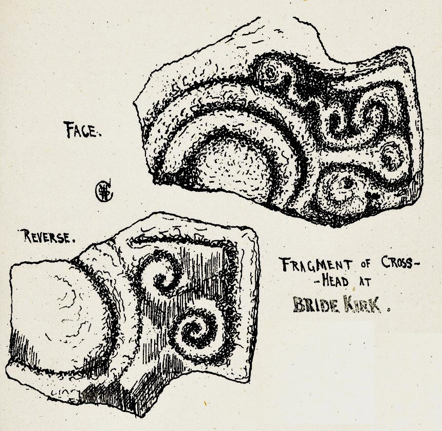
St Bridget's Church (Bridekirk) submitted by Sunny100 on 19th Apr 2011. Illustration of The Cross-Head fragment at St Bridget's Church, Bridekirk, Cumbria, by Rev William Slater Calverley 1847-98.
The above image is from his renowned work 'Early Sculptured Crosses, Shrines and Monuments in the Present Diocese of Carlisle 1899 Ed. by W.G. Collingwood.
(View photo, vote or add a comment)
Log Text: Anglo Scandinavian Cross Arm Piece, St Bridget's Church (Bridekirk): We arrived here just after 4pm. I’m not sure what I expected, but the old church was an enigmatic ruin at the eastern end of the churchyard – no more than a few ivy covered walls left of the chancel with graves contained within.
This church is usually open from morning until dusk. We went into the church and admired the ancient font. We found the remains of the Anglo Scandanavian cross head on the window sill on the north wall and I photographed it, turned it round and photographed the other side. [The Corpus of Anglo Saxon Stone Sculpture web site was off-offline when we visited, but their reference for this stone is Bridekirk 01. The smaller fragment of cable roll moulding to the right hand side of this piece is ref. Bridekirk 02.]
There was also a carved stone piece on a window ledge opposite, on the south wall. The guide describes this as “Opinions differ about the origins of the stone on the opposite windowsill (which was found in the churchyard in 1911) between being part of a Romanesque carved panel, or a genuine piece of Roman sculpture. Those who have claimed it to be Roman consider it to be a dedication to the Romano-British water goddess Coventina”.
As we were walking into the chancel, the door opened and a voice said ‘hello, do you want some lights on?’. The church warden had come down to lock up. Our visit was a little curtailed as she kindly chatted to us throughout, telling us about the old church and that there was thought to be the remains of an older wooden structure underneath.
Because we were now being accompanied, we missed quite a few features we’d really rather have stayed to see. I didn’t really get to appreciate the door into the south transept, which was relocated from the original old church; the arch over the organ in the north transept is also from the old church. There is also in the porch an ancient piece of red sandstone which dates from the 11th or 13th centuries depicting the head of Christ.
Next to the ruined Norman chancel, there is also a modern version of an Anglo-Saxon cross used as a grave marker which dates from 1892. Worth a re-visit when we're next passing.
Ireby Old Church
Date Added: 9th May 2015
Site Type: Ancient Cross
Country: England (Cumbria)
Visited: Yes on 1st May 2015. My rating: Condition 3 Ambience 4 Access 4
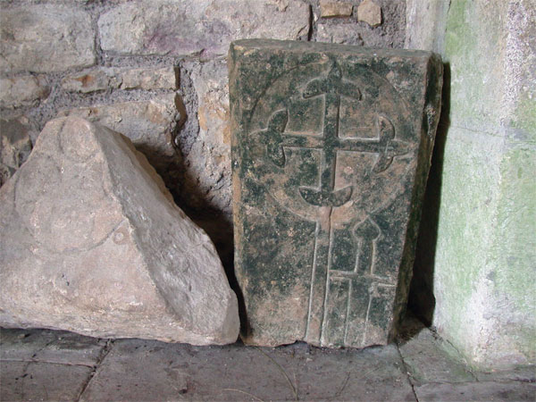
Ireby Old Church submitted by nicoladidsbury on 11th Feb 2005. Carvings inside the church
(View photo, vote or add a comment)
Log Text: Anglo Saxon Cross, Old Chancel, Ireby: Travelling from Bridekirk back towards Carlisle, we took the minor road through Torpenhow (couldn’t spot the pub marked on the map, which would have been a welcome stop at this time of day). Just leaving the village a sign told us the road wasn’t suitable for HGV’s – it was very narrow in parts but not that bad. Funny that the church, although in the care of the Churches Conservation Trust, wasn’t signposted, although it was easily visible across the field to our right hand side. We ended up turning right down the track to New Park farm and parked about 100 yards down on the right hand side at by a gate just past the stream called ‘Church Strand’.
With 5 month old granddaughter in arms (no chance of taking her pushchair) we opened the gate rather than climb over the stile, and walked across the little wooden footbridge over the stream and the 100 yards or so across the picturesque field to the church. Also funny that we had to navigate the paved drain to the south side of the church to enter at the west door as there wasn’t a footpath!
It was cold and damp inside the church, although the internal features more than made up for this. Just made up of the one room, rows of narrow wooden trestles (how uncomfortable to sit on during long sermons) lined either side of the aisle. A narrow table served as the altar. Windows in the south side of the church had been blocked up, although there was no sign of these in the external wall of the church. The pillars which had been relocated in the churchyard were odd and interesting, as was the incised tynpanum over the west door.
We searched for the various bits in the church. There was no church guide to bring away – we took photographs of the CCT sheet left for visitors to use.
As usual, I poked around the overgrown graveyard for unusual grave stones. We didn’t find the two cross bases mentioned in the Portal notes.
A very unusual little church, well worth the visit. I'm keen to revisit without infants and in the autumn when the grass and nettles will have died back so we might be able to find those cross bases.
At the time of writing the Corpus of Anglo Saxon Stone Sculpture website appears to be down so I haven’t been able to check any details of the crosses - I'm keen to find out more. [Note: I've since found this church is not included on their web-site].
St Kentigern (Aspatria)
Date Added: 5th May 2015
Site Type: Ancient Cross
Country: England (Cumbria)
Visited: Yes on 1st May 2015. My rating: Condition 3 Ambience 4 Access 5
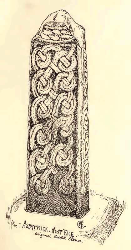
St Kentigern (Aspatria) submitted by durhamnature on 11th Sep 2012. Cross of St Kentigern, Aspatria, from "Early Sculptured Crosses...in the Diocese of Carlisle", 1899, via internet.org
(View photo, vote or add a comment)
Log Text: Anglo Norse Crosses and a Viking Hogback, St Kentigern's Church, Aspatria: Following the A596, signposted to Aspatria, the church is on the right hand side as you drive into the village, set above the road and separated from it from a stone wall.
Parking in a one hour disk parking spot just outside the church, we noticed straight away a tall cross standing at the exterior east end of the church and went straight round to photograph it [according to Wikepedia http://en.wikipedia.org/wiki/Gosforth_Cross “In 1887, the Rev. William Slater Calverley commissioned a replica life-sized copy of this cross and erected it in the churchyard at Aspatria, Cumbria.“ There was also a collection of artefacts with what looked like parts of two Anglo Saxon Cross heads built into the wall.
There was a church festival, with flowers, fairy lights and candles, lots of regular church-goers helping out and many other visitors popping in, so with my camera and flashgun, I felt a bit as if we were intruding.
Enterging the church from the west doorway through the porch, we literally had to walk round another cross at the west end of the church. I asked if it was OK to take photographs using the flash it is was in relative darkness on its western side; the surrounding displays made it a little challenging to take photographs although one of the gentlemen helpers offered to move the flower stand they were using to hold leaflets for visitors, which made it easier.
There was another table with all sorts of reading material displayed on it, including a browning newspaper article saying the cross outside was a copy of the Gosforth Cross [whilst the shape was similar, I questioned whether or not the carving was the same – I’ll need to compare the photographs].
The guide then pointed us in the direction of the unusual and lovely 13th century font and told us there was part of a Viking Hogback displayed. The carvings were intricate. The church guide told me this stone was “found amongst the building material of the Norman church”.
A quick walk around the rest of the flower displays followed, especially as we ended up blocking the aisles with our small granddaughter’s pushchair and no-one could get past! As a result, we missed some of the other crosses within the building, particularly those in the vestry, but we’ll go back again when the festival isn’t on and we can wander around more freely. According to the Pastscape record there is another cross (sans top) 40 yards south of the church.
With directions from one of the guides in the church, we walked to the north side of the church yard to find St. Patrick’s Well.
Leven's Park ringcairn
Date Added: 9th Jun 2015
Site Type: Ring Cairn
Country: England (Cumbria)
Visited: Yes on 4th Jun 2015. My rating: Condition 2 Ambience 4 Access 4
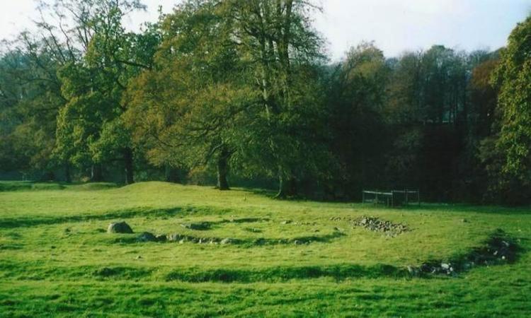
Leven's Park ringcairn submitted by Bladup on 11th Nov 2014. Leven's park (Archers hill) ringcairn.
(View photo, vote or add a comment)
Log Text: Leven's Park/Archer's Hill Ringcairn, Cumbria: This cairn is close to the roundabout where the A590 meets the A591 and A6 just south of Sizergh Castle. My map reading failed, as the junctions were complicated – no proper roundabouts, just adjoining roads with ‘give way’ signs to transfer from one carriageway to the other, which was fun at 5pm with traffic whizzing everywhere as everyone escaped from work to home. After a few wrong turns, eventually we made it onto the minor (brown) road which runs between Sedgwick and Hincaster, stopping at a small car park (enough room for 3-4 cars) outside a stile over a stone wall leading into Leven’s Park. By the stile, a small stream joining the River Kent tumbled over stones downhill and the trees provided welcome shade.
Walking along the dirt track for a couple of hundred yards, the cairn is to your right hand side, not in view from the path, but in a very pleasant spot, next to the River Kent. Between the dirt track and the actual cairn there is a series of four smaller mounds – possibly either cairns in their own right? -but I could find no mention of these anywhere on Pastcape or any other source. We did look for the mentioned field system around the ring cairn, but could find no evidence of it.
Walking round this ring cairn, there are clearly two different rings, which originally intersected, but give the appearance of now being joined into one larger cairn. Trying to capture the two different rings, we headed up the hill to the south west.
Sizergh Settlement
Date Added: 9th Jun 2015
Site Type: Ancient Village or Settlement
Country: England (Cumbria)
Visited: Yes on 4th Jun 2015. My rating: Condition 2 Ambience 4 Access 3
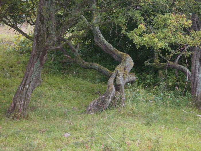
Sizergh Settlement submitted by Alphasmam on 1st Aug 2014. Sizergh Settlement is covered in trees but this tangle of branches adds to the ambience of the place.It is just possible to see the stone outlines in the grass underneath the trees.
(View photo, vote or add a comment)
Log Text: Sizergh Settlement and Cairns, Levens, Cumbria: I’ve spent more time trying to find out more about this intriguing site than all the others we visited today (4th June) as there seems to be so little about it, apart from on the Portal. I’ve tried to visit durhamnature’s ‘archive.org’ to retrieve the “Transactions of the Cumberland Arch Soc” but it’s given me no results (will try again when I’ve got a little more time to spend on this).
Getting here was another challenge for my map-reading skills. It should have been simple enough to reverse directions from Archer’s Hill, returning to the A591 and cutting west towards Levens, but were halted by a ‘no access’ sign. There were plenty of cars coming in the other direction and the road was even two-way, so we took a chance. How wrong could we have been? Almost reaching the end it became apparent that it led onto the dual carriageway heading in the other direction, so a hasty three point turn was made and we ended up following the minor road back past Leven’s Park, through Hincaster and heading back to the A6 to travel north for a short distance before turning off for Levens and heading back east towards Heaves Farm, just north east of Levens.
There was room to park the car by the footpath sign leading up past the western side of Middle Plantation, and we headed up the pleasant grassy track up the hill. To the right hand side there were a couple of gates and footpath signs leading up to the cairns and the circular structure we’d seen on the map. The sign on the first gate told us that the lumps in the grass weren’t grass covering stones as we’d first thought, but ant-hills that were formed on pastures that weren’t mowed. Interesting – never seen these before.
As we walked further up hill, there was a very intriguing (favourite word of the day) circular mound covered in trees (the rest of the fields had no trees at all). As we passed this to our left hand side, the larger of the two cairns rose up at the top of the hillside. There were glorious views over the fells to the north. Heading off to the west, there was a small quarry face with lots of stone chippings. Having photographed this, together with the sheep curled up on the warm limestone, we headed off into the wooded mound. Largely covered in hawthorn trees, it was interesting to navigate the low branches. There was some bedrock peeking through the grass, but also circular structures and also two sides of what had been a rectangular stone building.
Having arranged to meet some friends in Penrith on the way back, we made our way back down the mound to see if we could spot the smaller of the two cairns. Yes, it was there, but rising only 10 to 15 cms above the ground. Our eyes could make out the circular structure but it was difficult to photograph, with no shadows to bring out the mound.
Certainly a lovely spot, and I’m keen to find out more. Getting home and hitting the internet, I ended up getting very confused between this site and a Romano-British Settlement excavated by Oxford Archaeology, but checking the grid references confirmed they were different sites in close proximity. In the end, husband Andrew managed to find the extract below from a free Google book and I found a reference on the British History Online records:Discovering Prehistoric England: A gazetter of prehistoric sites by James Dyer, A Shire Book
Take minor road NE from Levens. The sites are to the N of the road on Sizergh Fell. The site consists of an oval embankment enclosure covering 0.2 hectare, with secondary enclosures to the south. Interior hollows may indicate the sites of hut circles. On the hilltop there is a small round cairn, 7.5 metres across, which contained a collared urn. To the east a further cairn, 9 metres across and 0.9 metres high, covered 5 skeletons."
Great Urswick Cross
Date Added: 25th Jun 2015
Site Type: Ancient Cross
Country: England (Cumbria)
Visited: Yes on 23rd Jun 2015. My rating: Condition 3 Ambience 4 Access 5
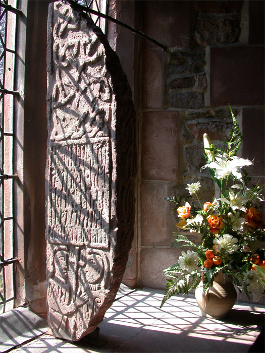
Great Urswick Cross submitted by nicoladidsbury on 5th May 2005. Ancient Cross at St Mary and Michael's Church, Great Urswick.
The stone was found on the site by a turn-of-the-century vicar and was investigated on the site by the respected historian WG Collingwood, and may possibly describe a meeting between two important church leaders, and church rune stone holds the key to a 1600 year-old story that reveals the origins of Christianity in Britain.
(View photo, vote or add a comment)
Log Text: Great Urswick/The Tunwini Cross, Great Urswick, Cumbria: Turning right off the A590 just south of Ulverston/Swarthmoor, along a road signposted only to ‘Urswick’, we headed off on narrow little lanes, just as the sun broke through the clouds. The village of Great Urswick is built round two sides of Urswick Tarn. The church can be found on the left/western side of the tarn, almost at the southern end of the village. A small car park allows visitors to draw up to the gate, where a footpath and stile runs off through the churchyard around the southern side of the tarn. Whilst the church itself is surrounded by trees, walking past the church to the southern boundary of the churchyard gives superb views over to Birkrigg Common.
Inside the church was pretty spooky, as the darkness seemed to suck all the light out. We found the light switches but none worked (must have been on a timer or master switch), so we were left to look around by the light of the few lamps that had been left on at the west end of the church.
Entering the church through the south porch, the Great Urswick/Tunwini Cross is on the first window sill on the south aisle, and is impressive in size. The church guide makes reference to two crosses; we were unable to find another fragment, although there was a drawing of another Viking cross with a knot design on the wall behind the font. The Furness Blog Spot, which I found this morning, tells me that this fragment is not on display in the church, but then doesn’t say where it is housed.
Going through the door to the belfry, we were immediately struck by the thickness of the walls, which was apparently a pele tower used to protect inhabitants and animals in time of war/marauders. In the chancel there are also some fantastic choir stall end carvings, all with cherubs playing different musical instruments.
At the entrance to the south porch there are clear marks on the eastern side where arrows have been sharpened, together with the remains of an old cow chain (the vicar used to apparently have grazing rights in the churchyard, although sheep are kept there now) and the barely visible remains of a mass hour dial on the western side of the porch.
Great Urswick Burial Chamber
Date Added: 26th Jun 2015
Site Type: Burial Chamber or Dolmen
Country: England (Cumbria)
Visited: Yes on 23rd Jun 2015. My rating: Condition 2 Ambience 3 Access 4
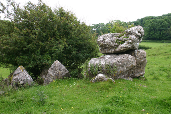
Great Urswick Burial Chamber submitted by ocifant on 26th Jun 2005. Looking south to the road.
(View photo, vote or add a comment)
Log Text: Great Urswick Burial Chamber, Cumbria: There is not much on the web about this site, and nothing (apart from a finger post in the vicinity) on ADS, apart from the fact this site is ‘ruined’ and ‘possibly Bronze age’. Parking on these narrow lanes was dreadful and were also very busy with traffic, so going round a bend you were likely to come bumper to bumper with a vehicle going the other way. When we finally found a grass verge with room for one car there was a large truck and a horse and rider stopped to natter to each other, so we drove around again – it would have been easier to walk from the village (also avoiding the bull in the field - see later).
The first part of the footpath across the meadows from Middle Barrow Lane was easy enough. There was a tumble-down stile, built up by a mound of stones on the far side (at grid reference SD 26018 7483). We then lost the footpath and ended up going through various fields towards the village.
We found a lone gate post sitting in a dip between two small hills. I thought at first it was a standing stone, but it had the remains of a hook embedded in it. Carrying on towards Great Urswick, there is a hill rising to the left hand side with limestone pavement on top. Walking up the slope the chamber comes into view, although I wasn’t convinced at first. The chamber lies within the context of surrounding limestone pavement, on a slope and largely consists of a few larger stones piled on top of each other with a gap between smaller stones lower down the slope. The whole chamber is mostly covered by large hawthorn bushes. I had to call up the photograph on the Portal to make sure we were looking at the right thing!
Walking back to the car, the footpath was clearly visible from this side, walking north westwards along the top of the hill. However, we were stopped dead in our tracks by a very large tan and white bull which splayed its front legs and stared us out. We turned quietly round and went back down into the shallow valley to follow the way we’d come. We found the footpath signs easily on the way back. There was an iron kissing gate in the hedge to our left hand side, followed by a short but steep climb into the field with the bull. Thereafter an easy walk to the burial chamber.
Druids Temple (Cumbria)
Date Added: 23rd Jul 2017
Site Type: Stone Circle
Country: England (Cumbria)
Visited: Yes on 23rd Jun 2015. My rating: Condition 3 Ambience 4 Access 5
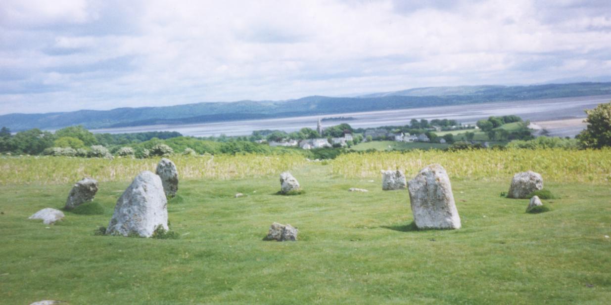
Druids Temple (Cumbria) submitted by Sentinel on 9th Jan 2003. Near Ulverston, Cumbria
overlooking Morecombe Bay.
(View photo, vote or add a comment)
Log Text: Druid's Temple Stone Circle, Cumbria: OK, so we got sidetracked by the splended Furness Abbey, but we then retraced our steps to Great Urswick, skirting round the north side of Urswick Tarn, up and out onto Birkrigg Common. Following the yellow ‘dotted’ road over the common, past Sunbrick Farm, we suddenly came upon the most tremendous views over Morecambe Bay. What a place!
Being a beautiful sunny evening, there were many people about. It felt strange to be in such an ancient spot with a van nearby blasting out music from its radio, runners coming through almost the centre of the circle, and dog walkers continually passing.
Again, the stone circle sits within a landscape of limestone pavement, which confused my attempts to find out if the circle originally had an outer ring. We counted 12 stones in the inner ring, two only just poking out above the grass, with 10 visible upright stones, although I get the impression some of these might have been re-erected for effect. The circle itself certainly looked as if it had a shallow bank around it and a possible ditch between this and what might have been a very broken outer ring.
There is plenty of parking on the hard verges nearby, and stunning walks on grassy paths cut through the longer grass to make it easier for walkers and runners. A little disappointing there were so many others around, but worth the trip.
Copt Howe
Date Added: 25th Aug 2015
Site Type: Rock Art
Country: England (Cumbria)
Visited: Yes on 11th Aug 2015. My rating: Condition 3 Ambience 5 Access 4
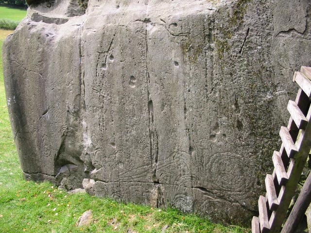
Copt Howe submitted by stu on 12th Oct 2003. NY3140 0582. Great carvings with one of the best views in the country.
(View photo, vote or add a comment)
Log Text: Copt Howe (The Langdale Boulders): When we drove past here on the way to Mickleden further down the Great Langdale valley, we spotted the signpost to Copt Howe but the road was so narrow and busy there was no room to stop. On the way back it was now after 6pm and the roads were quiet apart from one or two cars and cyclists. We parked behind another car in what seemed to be a narrow lay-by almost opposite the gate into the field containing these boulders.
If I thought the Mickleden walk scenery was beautiful (if stark with its tall peaks scree slopes) then this view down the Great Langdale valley was spectacular – green, lush and with rolling hills in the distance. What a location.
The rock art was on the largest boulder which was lowest in the field, sitting below the outcrop in which a tree now grows in the middle of. A very rickety stile climbed the stone wall to the other side, although when I touched this it came away from the wall, so I opted to walk down to the gate lower down in the field.
The early evening light was conducive in helping the motifs spring out of the rock. A few of the ‘cups’ were similar to the double cups on the Twelve Apostles in Dumfries, these being formed through natural erosion rather than pecking. I compared the designs I could see to the interpretation board but couldn’t quite reconcile the two.
In walking back up to the car I went round the left hand side of the tree (facing the road) and spotted a large single cup mark in the centre of the face.
Giants Grave, Penrith
Date Added: 22nd Oct 2015
Site Type: Ancient Cross
Country: England (Cumbria)
Visited: Yes on 10th Oct 2015. My rating: Condition 3 Ambience 4 Access 5

Giants Grave, Penrith submitted by nicoladidsbury on 12th Feb 2005. Giants Grave Viking Crosses and Hogback stones
The 'Giants Grave' is a collection of ancient grave stones comprising two 11' high stone crosses and four hog-back stones. An excavation of the 'Giants Grave' showed a skeleton underneath with a sword. The four hogback stones surrounding the grave are said to represent wild boar he killed in nearby Inglewood Forest.
(View photo, vote or add a comment)
Log Text: Norse Crosses and hogback tombstones (Giant's Grave), St Andrew's Church, Penrith: On our way to Kirkoswald, we stopped off in Penrith for a coffee and a cake. I remembered from some dim and distant memory that there were some Viking Hogbacks and Anglo Saxon crosses in Penrith but couldn’t remember which church they were in, and there was no mobile signal, so as we were opposite the church we walked into the churchyard anyway. And there was the small collection of 2 Norse crosses and 4 Viking hogback tombstones – very worn.
Inside the northern door of the church, to the right of the western-most ‘Giant’s Thumb’ cross there are some line drawings of the patterns on the crosses and the hogbacks. There is also a church guide, the back page of which has a short description of the Giant’s Grave.
Towards the north western end of the churchyard another cross stands on its own. Closer inspection highlights the inscription at its base, showing this is a reconstruction.
Looking at the Anglo Saxon Corpus just now (22nd October) we missed a couple of other stones – 1 built 4 metres up into the north wall of the tower (very worn) and another upside down near the south west corner of the church. As Penrith is a place we pass reasonably frequently, a repeat visit will definitely be in order!
St Oswald's Well (Kirkoswald)
Date Added: 22nd Oct 2015
Site Type: Holy Well or Sacred Spring
Country: England (Cumbria)
Visited: Yes on 10th Oct 2015. My rating: Condition 3 Ambience 4 Access 5
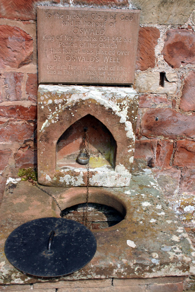
St Oswald's Well (Kirkoswald) submitted by ocifant on 25th Jun 2005. The well sits at the side of the church, against a hillside. The church bell tower is separate and sits at the top of the hill. There are steps and a door leading down to the well, but the door was locked. It is necessary to lower the drinking cup to obtain the water.
Apparently, the church boiler leaked some time ago, and the water was poluted with oil, and is no longer fit to drink, although it is still used for baptisms...
(View photo, vote or add a comment)
Log Text: Anglo Saxon stones and a holy well, Kirkoswald, Cumbria: This church is in a very pretty location, opposite "the college" and boasts not only an Anglo Saxon cross arm fragment and holy well but a separate bell tower on top of what looks like a motte. It is a little difficult to park, as there are narrow roads and high brick walls restricting vehicle access, and on the day we went lots of farmers towing trailers were travelling at relatively high speeds round the bends in the village. This church is in a very pretty location and boasts not only an Anglo Saxon cross arm fragment and well but a separate bell tower on top of what looks like a motte.
The approach to the church is pleasant, along the tree-lined Priest’s walk from the college opposite. The church itself sits at the foot of a steep hill and the wooden porch of 1523 is dark but welcoming. To the left of the porch on the exterior north wall sit a number of stone grave markers; the second from the right has ribs and is described in the church guide as being Saxon.
The church guide is really good, illustrating the development of the church from the 7th century (“when local people were discovered worshipping a God of the spring which issued out of the Bell Tower Hill”), through to the present day.
Inside the church the area immediately inside the door is cramped compared to the rest of the church. The sanctuary and east window, because it nestles at the foot of the hill, is comparatively dark. To your right, immediately to the right of the door is the font. The bowl is very old (described as being from the original Norman building) but the plinth appears modern. On the window ledge to the west, which the church guide says is Tudor, is mounted part of a Saxon cross arm, AS Corpus reference Kirkoswald (no number, as there is just one).
Apart from the well worn and partly destroyed stone effigy of Lady Dacre tucked between pews at the west end of the church, there is no much else to see inside. To the west end of the church outside is the enigmatic St. Oswald’s well. At first glance, it looks like an outside toilet, but on closer examination there is a metal cup on a long chain, a metal cap with handle and remnants of an old roof line over the well. Lifting off the metal lid, the water is free flowing and clear about 8 to 10 feet down. The cup reaches the water and I did draw a little and taste it – nothing exciting. I later read in the church guide that the water is still used for baptism, but drinking it isn’t recommended. At the southern side of the well are some steps with a red door which opens onto the water channel, presumably for clearing. I was surprised to find the water flows under the nave! The church guide says the source of the spring is unknown, but it must come from under Bell Tower Hill.
We missed a consecration cross in the retaining wall at the east end alongside an old sundial.
Walking round the southern end of the church a very narrow stile leads through the stone boundary wall of the churchyard and a path leads up into the Bell Tower Field. Climbing up this steep hill, the Bell Tower is particularly inaccessible as the slope up to the Bell Tower needs clambering up, then there is a sturdy fence with well padlocked gates. I was convinced this hill was an old motte.
Langdale Axe Factory
Date Added: 4th Jun 2017
Site Type: Ancient Mine, Quarry or other Industry
Country: England (Cumbria)
Visited: Yes on 11th Aug 2015. My rating: Condition 3 Ambience 5 Access 3
Langdale Axe Factory submitted by Thorgrim on 15th Nov 2003. The Langdale Pikes in Great Langdale.
(see article on Langdale Axes)
(View photo, vote or add a comment)
Log Text: Mickleden Way, finding pointers to the Pike O'Stickle Axe Factory: I was lucky enough to win a copy of Gabriel Blamires book in a Portal photographic competition. It arrived just in time for our trip over to the Lakes on 10th/11th August. We followed Chapter 4: The Mickleden Way, having parked at the National Trust pay and display car park next to the Old Dungeon Ghyll Hotel, and headed up behind the pub onto the stoney footpath into the hills.
This is a beautiful and easy walk with Mickleden Beck in the valley to the left hand side and Langdale Fell with Pike O’Stickle to our right. We were passed by a number of small climbing parties coming back the other way.
We found boulders 4.1 to 4.7. We had intended finding more but dusk stopped us in our tracks and had us retracing our steps back to the Hiker's Bar at the hotel The Pike O’Stickle Pentagon was perhaps the most dominant and impressive stone. To be found at NY 2738 0640 it stands out proudly on the hillside and is one of the more convincing markers/pointers. There has been some recent activity around both sides of the stone, with gullies being made to channel water off the hillside around it, hence it’s a bit tricky to get up to. From the banks of one of these gullies I picked up a lump of shiny black stone (now dried it is a dull green-grey with light brown inclusions) which was incredibly sharp. We later identified it as a piece of stone used for the axes, so it now sits proudly on my window ledge.
As our walk continued there were so many stones and stony outcrops that we started to wonder how Gabriel Blamires had chosen the pointers he did, as there were others which equally stood out in the landscape. He has obviously done an immense amount of research to check everything out. I did get excited at boulder 4.4 as bending down to retrieve the lens cap for my camera, I noticed that the top profile of the boulder seemed to echo the pattern of the peaks above.
Following the book to the letter, and thankful for our GPS, we got to boulder 4.7 before spotting what looked like an area of cairns.
There are many more boulders detailed in Gabriel's book, along with some stunning walks/ways and I really look forward to finding out more.
I do agree with rich32 that you would have needed ropes and parachutes to attempt to get up to the axe factory!
Anglo Saxon Cross Base, Wetheral Parish Church
Date Added: 12th Apr 2016
Site Type: Ancient Cross
Country: England (Cumbria)
Visited: Yes on 28th Feb 2016. My rating: Condition 3 Ambience 4 Access 5
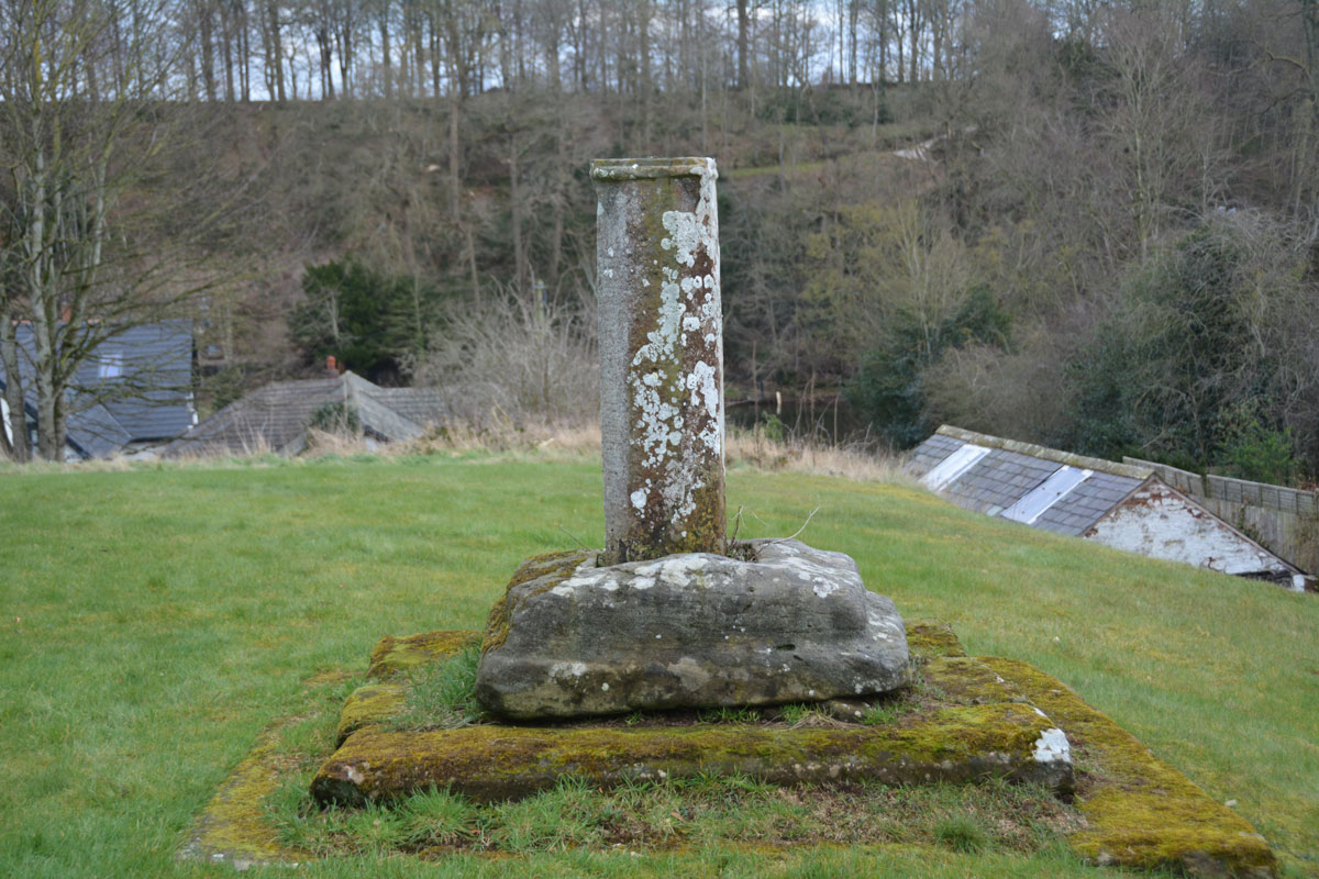
Anglo Saxon Cross Base, Wetheral Parish Church submitted by Anne T on 2nd Mar 2016. Standing to the west of the cross base looking down Ferry Hill towards the River Eden.
(View photo, vote or add a comment)
Log Text: Anglo Saxon Cross Base, Wetheral, Cumbria: A notice in the guard house at the Priory Gatehouse mentioned boundary crosses, so I thought it might be worth investigating whether or not there were any fragments inside the church. As we walked up from the Eden River up Ferry Hill, with the churchyard to my right, there was a fragment of cross shaft with what looked to be an original cross base.
The church itself was locked, although there appeared to be a light on inside, but only in the vestry. A check on the Anglo Saxon Corpus site tells me that only one fragment of cross arm is recorded for Wetheral, and this is now in the possession of H M Calvin of St John’s College, Oxford (see Corpus of Anglo Saxon Stone Sculpture Record Cumbria 169). The cross base isn't recorded on the AS Corpus site, and I'll email for their opinion, but it looks so similar to others that we concluded it must be. I'll update the record when I hear.
St Cuthbert's Holy Well
Date Added: 12th Apr 2016
Site Type: Holy Well or Sacred Spring
Country: England (Cumbria)
Visited: Yes on 28th Feb 2016. My rating: Condition 3 Ambience 3 Access 4
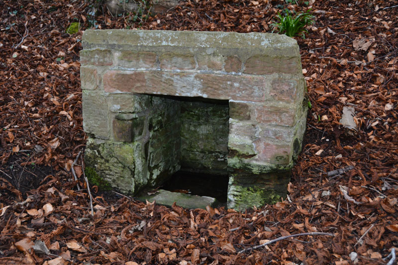
St Cuthbert's Holy Well submitted by Anne T on 2nd Mar 2016. The front and interior of St. Cuthbert's Holy Well. At the time of our visit, whilst the basin inside the well was full of clear water, there was little or no visible flow, unlike the spring opposite Wetheral Priory Gatehouse further up the village.
(View photo, vote or add a comment)
Log Text: St. Cuthbert's Well, Wetheral, Cumbria: I'd tried the (very pretty) walk along the recently flooded River Eden to St. Constantine's Cells, but failed as the path overhangs the river by some 5-6 metres. As a consequence, I was determined to go to this well. Just as you arrive into Wetheral village from the A69, there is a footpath sign leading off to the left, indicating St. Cuthbert’s Well.
There is parking outside the small railway station (there are just a couple of platforms here) and it’s about quarter of a mile down the slope towards the river to the well. A small sign sits to the right of the track as you head towards the river detailing a short history of the well. “According to legend, St Cuthbert’s Well was built long before Norman times when Wetheral Priory was founded. The exact date is not known, but St Cuthbert is thought to have visited Carlisle in 683 and 687.”
From the sign, the well can be seen topped by a concrete slab which has an inscription which reads: “The Holy Well/Called in the 12th century/Fons Sancti Cuthbert/Repaired 1897 and 2001.” A short flight of stone steps leads down to the well itself.
When visiting the village, the Wetheral Priory Gatehouse at the far side of the village is small but worth a visit.
Elvaplain
Date Added: 23rd Jul 2017
Site Type: Stone Circle
Country: England (Cumbria)
Visited: Saw from a distance on 29th May 2016. My rating: Condition 3 Ambience 4 Access 4
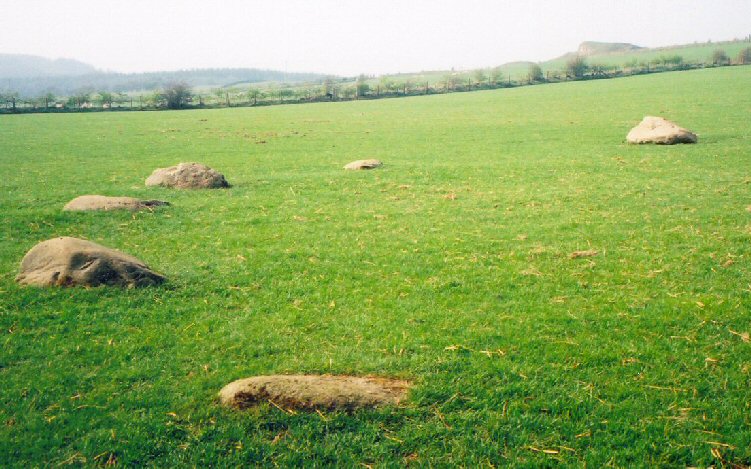
Elvaplain submitted by LizH on 29th Aug 2007. A closer picture of the stones in the circle
(View photo, vote or add a comment)
Log Text: Elvaplain Stone Circle, Setmurthy, Cumbria: After having seen the tumulus and settlements at Aughertree Fell we set off for Elva Hill. With a stunning image on the Visit Cumbria website, which told us this although this stone circle was on private land, it could be approached by a footpath, we found Elva Plain farm and the footpath up to Elva Hill easily enough. With well kept sheep and their large lambs, we enjoyed the sunshine as we walked up the hill. But, and there was a big BUT - the farmer had tied the gates up so strongly with thick twine it was like trying to untie the Gordian knot. With four gates to get through, and some of them wired shut, we could only see this stone circle from afar. Frustrating. If the farmer had been around, I would have asked (nicely) for access to the field. Whilst the stones are largely flat and just visible above ground (between the sheep!), this stone circle is in a stunning location, looking out over Bassenthwaite Lake in the valley to the south west and the fells beyond. Elva Hill (now quarried) lies to the north.
Hadrian's Wall (Poltross Burn)
Trip No.143 Entry No.1 Date Added: 11th Jul 2019
Site Type: Stone Fort or Dun
Country: England (Cumbria)
Visited: Yes on 8th Jul 2019. My rating: Condition 3 Ambience 4 Access 4
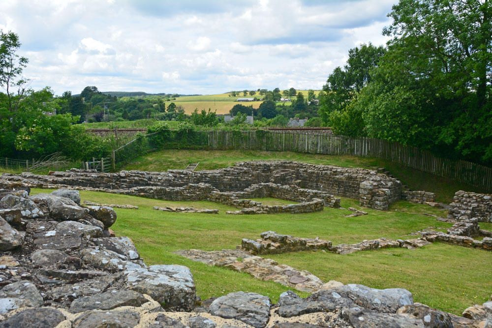
Hadrian's Wall (Poltross Burn) submitted by Anne T on 11th Jul 2019. Standing at the south western corner of the milecastle/small fort, looking towards its north eastern corner.
(View photo, vote or add a comment)
Log Text: Poltross Burn Milecastle: We last visited this site on 27th October 2013, and it hasn’t’ changed at all. Andrew, in typical engineering fashion, went round and talked about the offsets and revetted construction of this small fort. It’s layout is remarkably easy to read.
Andrew recalled reading about a house built right on top of the wall, but we were unable to find it.
Clifton Stones
Trip No.3 Entry No.2 Date Added: 4th Jul 2016
Site Type: Standing Stones
Country: England (Cumbria)
Visited: Yes on 3rd Jul 2016. My rating: Condition 3 Ambience 4 Access 3
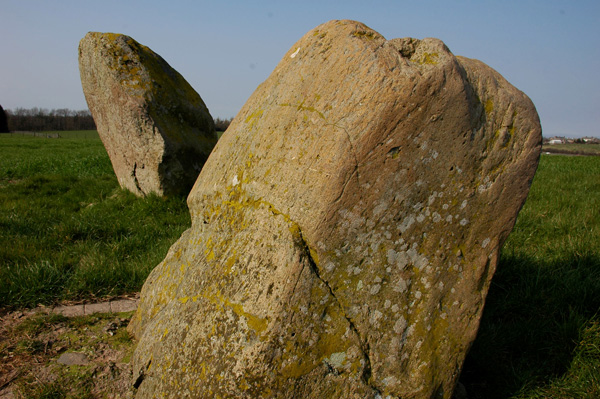
Clifton Stones submitted by nicoladidsbury on 31st Mar 2007. Clifton Standing stones - the smaller stone is set in concrete. Plough marks are visible on its southern side. Buzzards were flying overhead, fantastic :)
(View photo, vote or add a comment)
Log Text: Clifton Stones, near Penrith, Cumbria: These standing stones are only a short distance from Trainford Brow Long Barrow. There is a side road opposite Mount Clifton farm which allows for parking of one car on the grass verge. It was interesting crossing the A6 as cars sped along in both directions; however, sight lines were good. We followed the footpath through Mount Clifton farm (heavily mired with fresh cow dung). This path was gated, as they had a huge (but placid) bull in the barn yard with his ladies. The mire gave onto a tarmacked pathway leading to Tinkler’s Lane Bridge over the M6. It was then easy walking down to the field containing these two standing stones.
With a brilliant view of the North Pennines to the east and the Lake District (complete with notch in the hills) to the west, these stones sit next to the very busy M6 with a view of Penrith to the north. Because of the acoustics on the day, the traffic noise was a distant buzz in the background.
I was a little disappointed as the smaller stone had obviously fallen over in the past and been cemented into the ground.
After enjoying the ambience for a while, we tried to see the Cairn Circle at Leacet Plantation. The first forest track we tried had a Lowther Forestry working locking the gate. We then tried at Chatburn Kennels and Cattery, but the fields were cropped and walking through them heavy going. Being late in the day we decided to retreat to go and see the Countess Pillar then home. We got beeped at by the owners of the kennels who had come down to dump their rubbish exactly where we had parked the car.
St Helen's Well (Great Asby)
Trip No.6 Entry No.3 Date Added: 2nd Oct 2016
Site Type: Holy Well or Sacred Spring
Country: England (Cumbria)
Visited: Yes on 11th Sep 2016. My rating: Condition 3 Ambience 4 Access 5

St Helen's Well (Great Asby) submitted by MisterBus on 12th Oct 2010. The beautifully restored well in the centre of the village is in full flow. The well was restored by villagers in 2008.
(View photo, vote or add a comment)
Log Text: St Helen's Well, Great Asby, Cumbria: This was our third stop of the day. From (confusingly) St Helen’s Well at Newbeggin-on-Lune, we took a right hand turn back onto the A685 then the next turn right taking the minor road between Crosby Garrett Fell and Ravenstone Moor. Turning right at the T-junction at Middle Bank, we followed the road through Little Asby to Great Asby. We parked next to the little alms cottage about 20 metres to the north west of this well. At first, all I could see was a modern stone wall with some horribly concrete shapes on it’s top, with the Asby Beck beyond. Walking towards the modern stone wall, a huge rush of water could be seen running into the beck, coming from no apart source—just straight out of the ground.
The well itself has a square pool into which water emerges. As we watched, the flow of water was sufficient to move the sand forming the base. Most intriguing.
With a village this old, we decided to investigate the local church, St. Peter’s. The modern building is of no great age, although the ‘short account’ of the church says that the site may have been used from the 7th century onwards (as Peter was a common dedication from this time on).
The Pastscape record for this well says this well "was formerly seated round and of great repute for the medicinal properties of its waters. Consists of a deep pool, approximately 4.0m square, contained by a stone wall, with a drain-off channel at its eastern corner. It is not apparent whether the pool is fed by a natural spring or a piped supply, as the point of issue is below water level. A modern wall partially surrounds the well. "
St. Helen's Well (Newbiggin-on-Lune)
Trip No.6 Entry No.2 Date Added: 14th Feb 2017
Site Type: Holy Well or Sacred Spring
Country: England (Cumbria)
Visited: Yes on 11th Sep 2016. My rating: Condition 2 Ambience 3 Access 5
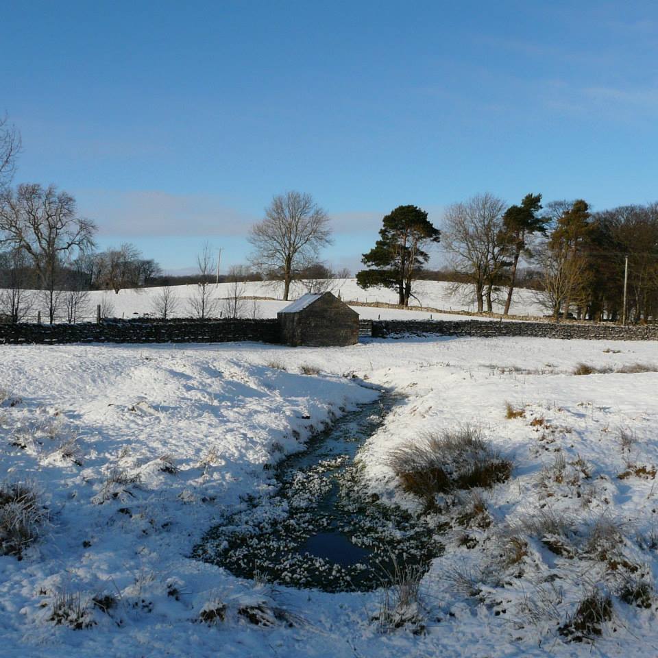
St. Helen's Well (Newbiggin-on-Lune) submitted by HeronEye on 2nd Mar 2014. St Helen's Well, Newbiggin on Lune.
The source of the River Lune.
This well pool is situated next to the mound of chapel that once stood here (picture left).
(View photo, vote or add a comment)
Log Text: St Helen's Well, Newbeggin-on-Lune, Cumbria: After seeing the Loki Stone at Kirby Steven, we followed the A685 south and west to Newbeggin-on-lune. St Helen’s Well is about 50 metres to the north of the A685 (called Fell Lane at this point). It sits almost at the junction where Chapel Butt Lane splits into two. There is parking for about three cars at this junction.
We initially took the left hand fork, walking down to where a footpath sign pointed right over the field containing the well, just before a field gate. Climbing the small stile, walking over the footbridge, we were confused as to where the well was. We understood this well was supposed to be the source of the River Lune, but there are small streams which run to the north/north east which carried a strong flow of water (there must have been a large amount of rain here recently, as the ground was incredibly boggy with large puddles across the paths, as opposed to being dry where we live). Wading through the puddles through the field gate, there was a large boggy area (complete with bull) which appeared to be the lowest point in the area, and the source of the water flow.
Retracing our steps, we asked a local lady who was walking her dog. Despite having visited this area for 34 years, she hadn’t heard of this well. Walking down the right hand lane, the well can be found by walking down the right hand side of Chapel Butt Lane (heading towards Friar Bottom Lane), with the pool becoming visible just after the first bend.
