Contributory members are able to log private notes and comments about each site
Sites Anne T has logged. View this log as a table or view the most recent logs from everyone
St. Gregory's The Great (Kirknewton)
Trip No.41 Entry No.7 Date Added: 28th Aug 2017
Site Type: Sculptured Stone
Country: England (Northumberland)
Visited: Yes on 26th Aug 2017. My rating: Condition 3 Ambience 4 Access 5
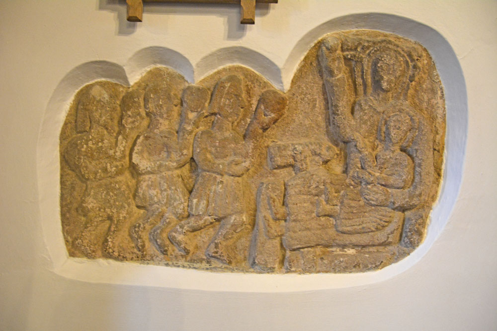
St. Gregory's The Great (Kirknewton) submitted by Anne T on 28th Aug 2017. The unusual Adoration of the Magi, with the Magi in what looks like kilts, but which are probably Roman tunics. Historic England says this dates from the 12th century, but the church thinks it might be several centuries earlier, pre-dating the church.
(View photo, vote or add a comment)
Log Text: The Adoration of the Magi (in Roman tunics): St. Gregory's The Great, Kirknewton: I confess to not being ready to go back home as it was such a nice evening, and this church looked very welcoming, so we stopped off for a look.
The main entrance to the church yard leads over a small, nicely landscaped stream. Immediately facing you to the left hand side of the path are some Commonwealth War Graves, very nicely tended, and all of air force pilots from 1943, mostly in their early 20s; one man was from Brazil. Inside the church there is a lovely sculpture and stained glass dedicated to these men.
There was no church guide to take away, but there were notices all over the church with explanations. There was a stone carving -The Adoration of the Magi, sited in the wall to the north side of the chancel.. The interpretation board near it reads: “The carving is quite amazing as it appear to show the Magi in kilts (but probably Roman tunics). The ancient stone relief is a great treasure of the church, being at least 12th century and could be earlier. There is some evidence to suggest that the style of the Magi “caps” is similar to an example in the Roman catacombs, so there could be the influence of St. Paulinus, himself a Roman (who supposedly preached at Kirknewton) and would date the carving at several centuries earlier, pre-dating the church (where was it prior to that?).”
The chancel and sanctuary look as if they have been fortified and used for defensive purposes (barrel vaulted ceiling and thick walls). I enjoyed walking round this church. It had a very friendly feel and was very well looked after.
St. Helen's on the Lea (Old Cambus)
Trip No.100 Entry No.2 Date Added: 30th Sep 2018
Site Type: Sculptured Stone
Country: Scotland (Scottish Borders)
Visited: Yes on 29th Sep 2018. My rating: Condition 2 Ambience 4 Access 4
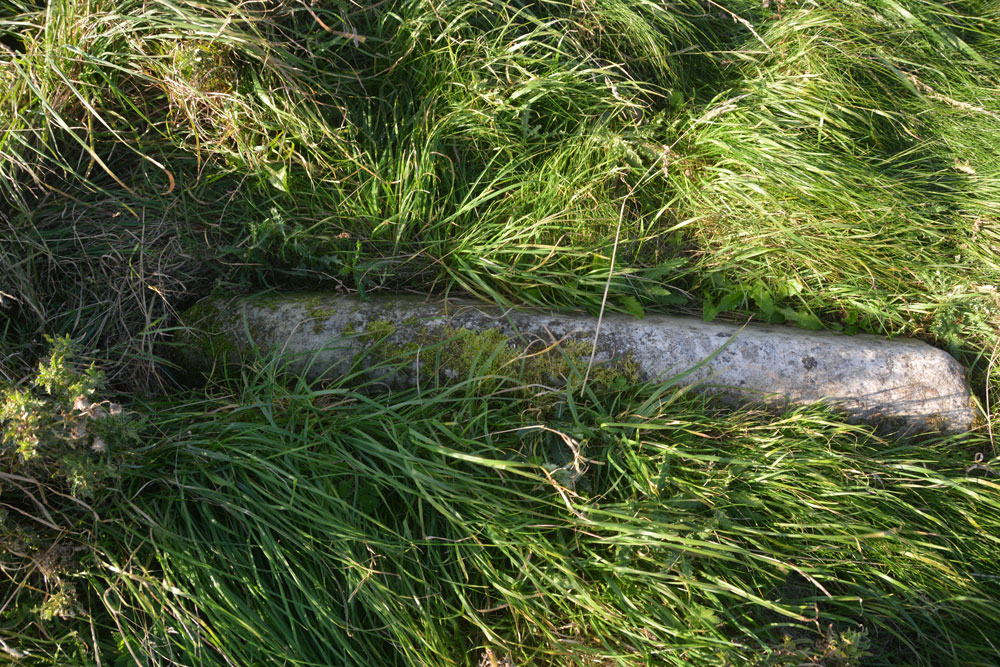
St. Helen's on the Lea (Old Cambus) submitted by Anne T on 30th Sep 2018. The almost complete hogback stone, to be found at the southern side of the eastern gable wall of the church. Canmore 59948 describes some decoration on the hogback, but there was nothing we could see. The stone was almost buried in knee high grass that covered the site.
(View photo, vote or add a comment)
Log Text: Hogback at the ruins of St Helen's Chapel, Old Cambus: We found the first hogback easily – at the northern side of the east gable wall, but the second one we hunted for but were unable to find. The cross incised slab we searched for ages, even matching up the angles of the stone to the masonry behind on the Canmore images, but drew a blank. The site was knee deep in grass, with tumbles of stone underneath, so it could have been anywhere. A strimmer would have helped! Similarly with the fragment of hogback on the southern side of the chancel. We found many tumbled stones in the grass, but even looking closely for the tegulations, we didn’t locate it, which was disappointing.
The information board which sits near the junction of the road to the quarry to the footpath to the chapel and Siccar point reads:
“Proceed from here, through the kissing-gate, past the ruin of St Helen’s Chapel and along the top of the steep sea-braes to Siccar Point, arguably the most important geological site in the world. In 1788 it gave James Hutton final proof of his revolutionary claim that the Earth is eons old He based his claim on painstaking observation of rocks and soil over a period of some 30 years. / James Hutton (1726-1797) farmed locally near Reston and was a self-taught geologist. Having already published his theory, he was on a mission to establish the evidence. Before discovering the proof at Siccar Point, by boat with his friends Sir James Hall and John Playfair, Hutton knew what he was looing for and had an idea of where to find it. He sent Sir James, a local landowner from Dunglass and also a geologist, to review the area before embarking on their boat trip below the braes. Sir James may have done this by observing that the stone used to construct field boundaries in the vicinity was (and still is) a combination of rock from above and below the uncomfority (red sandstone and greywacke). / Hutton’s theory released science and philosophy from limitations of the biblical age of the earth (6,000 years old). Though bitterly disputed at the time, it is now accepted as a fundamental of science. James Hutton also expounded with authority of theories as diverse as the nature of light and methods of education, and was a significant agricultural innovator and improver.”
Just before reaching the ruins of St Helen’s, someone has carved an old tree trunk into an L-shape with a toilet seat on top! Note: the gate to the field was locked, and we had to climb over the rather tall gate.
St. Helen's Well (Newbiggin-on-Lune)
Trip No.6 Entry No.2 Date Added: 14th Feb 2017
Site Type: Holy Well or Sacred Spring
Country: England (Cumbria)
Visited: Yes on 11th Sep 2016. My rating: Condition 2 Ambience 3 Access 5
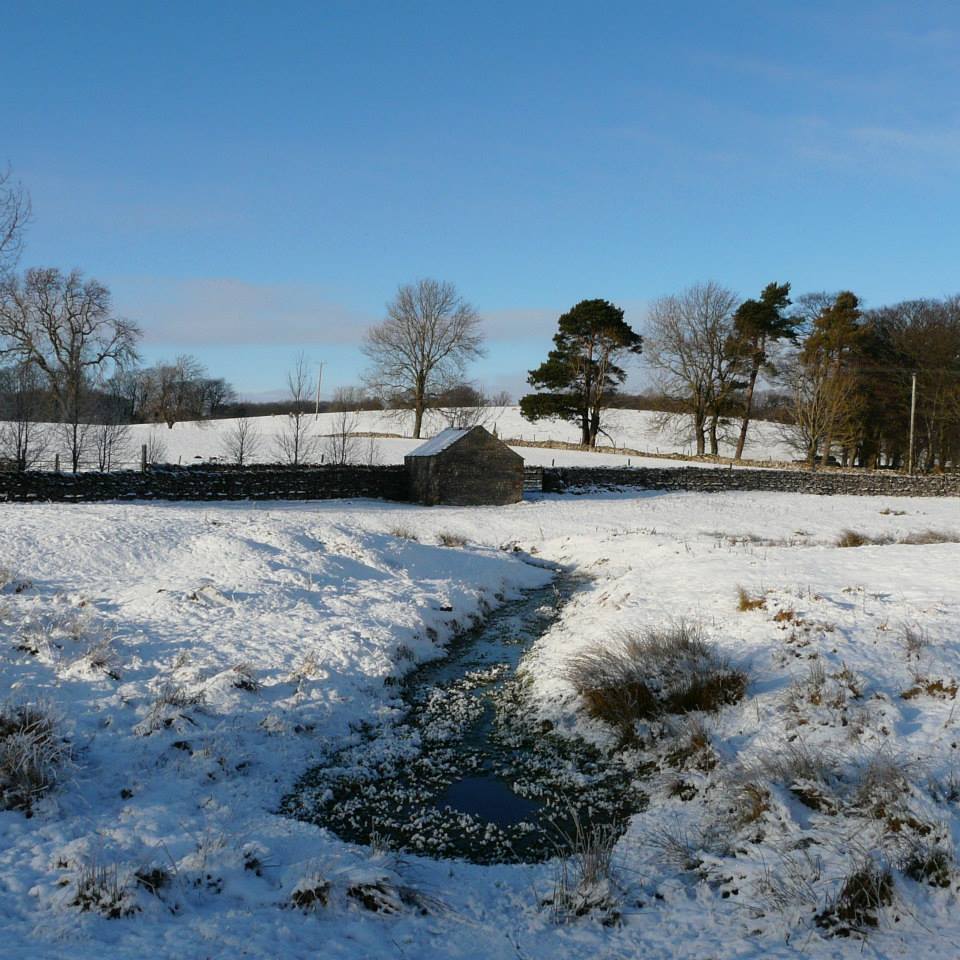
St. Helen's Well (Newbiggin-on-Lune) submitted by HeronEye on 2nd Mar 2014. St Helen's Well, Newbiggin on Lune.
The source of the River Lune.
This well pool is situated next to the mound of chapel that once stood here (picture left).
(View photo, vote or add a comment)
Log Text: St Helen's Well, Newbeggin-on-Lune, Cumbria: After seeing the Loki Stone at Kirby Steven, we followed the A685 south and west to Newbeggin-on-lune. St Helen’s Well is about 50 metres to the north of the A685 (called Fell Lane at this point). It sits almost at the junction where Chapel Butt Lane splits into two. There is parking for about three cars at this junction.
We initially took the left hand fork, walking down to where a footpath sign pointed right over the field containing the well, just before a field gate. Climbing the small stile, walking over the footbridge, we were confused as to where the well was. We understood this well was supposed to be the source of the River Lune, but there are small streams which run to the north/north east which carried a strong flow of water (there must have been a large amount of rain here recently, as the ground was incredibly boggy with large puddles across the paths, as opposed to being dry where we live). Wading through the puddles through the field gate, there was a large boggy area (complete with bull) which appeared to be the lowest point in the area, and the source of the water flow.
Retracing our steps, we asked a local lady who was walking her dog. Despite having visited this area for 34 years, she hadn’t heard of this well. Walking down the right hand lane, the well can be found by walking down the right hand side of Chapel Butt Lane (heading towards Friar Bottom Lane), with the pool becoming visible just after the first bend.
St. Kennera's Cross
Trip No.139 Entry No.3 Date Added: 24th Jun 2019
Site Type: Ancient Cross
Country: Scotland (Dumfries and Galloway)
Visited: Yes on 17th Jun 2019. My rating: Condition 3 Ambience 3 Access 4
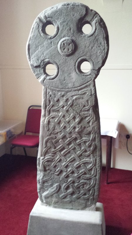
St. Kennera's Cross submitted by Enki on 18th Jan 2016. St. Kennera's Cross inside the parish church in Kirkinner.
(View photo, vote or add a comment)
Log Text: St Kennera's Cross, Kirkinner: It took a little bit of doing to contact the vicar at Kirkinner – numerous phone calls, but no answer, then an email to which there was initially no reply, so I'd crossed this cross slab off our visit list.
An email eventually came through whilst we were near Castle Douglas, travelling down the A75, giving the name and phone number of the church officer. On phoning the number, I was very kindly told the church was open today until 5pm, although it could be arranged to opened it Tuesday if necessary.
We eventually arrived at the church mid-afternoon. The church felt cold, lonely and neglected, the cross slab a mere by-thought in the north eastern corner, by the kettles and cups. We did try and get a photograph from the gallery, but a notice told us the stairs were too dangerous to use.
We later saw similar cross slabs at Whithorn Museum, and were told that the stone these slabs were made of was very difficult to carve as the stone flaked away at an angle from the carving, and they often broke.
It took a little while of looking at it to see the 'armpits' of the cross (carved running into the circular holes of the cross) and to see the shape of the cross itself.
The guide at Whithorn was surprised we managed to get into the church.
St. Mary's Church (Brignall)
Trip No.44 Entry No.3 Date Added: 15th Sep 2017
Site Type: Ancient Cross
Country: England (County Durham)
Visited: Yes on 9th Sep 2017. My rating: Condition 3 Ambience 2 Access 5
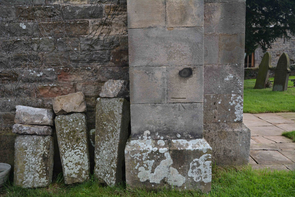
St. Mary's Church (Brignall) submitted by Anne T on 11th Sep 2017. The remains of a cross base, together with a Roman altar, are said to stand against the south wall of the church outside its west end.
This was the only collection of stones we could find on or near the church walls, and these sit against the north western corner of the tower.
(View photo, vote or add a comment)
Log Text: Cross base at St. Mary's New Church, Brignall (not found): After having visited the church in Barnard Castle and Barnard Castle, we set of to Brignall. According to Pastscape, there was a 13th century cross base sitting against the south-west corner of the tower of this church, together with a Roman altar and other stones. These used to be in the rectory gardens, but were re-sited in the churchyard.
No sign of the cross base or the altar existed, unless they are in this collection of stones, all of which are badly worn. These are located against the north west corner of the tower, behind the war memorial. There was nothing against the south west corner/south west wall of the church – I walked right round in case we’d missed anything, or they had been moved.
The church was locked at the time of our visit, so I couldn’t get inside to check if these artefacts had been moved inside for safety. As we parked up, a man in the house next to the church (to its right as photographed) was standing at the window looking at us, talking on the phone. He made no move to come out and talk to us, and made me feel like an intruder.
I will need to phone the Diocesan office to find out when the church is open and if the base and altar have been moved inside the church.
St. Mary's Well (Gainford)
Date Added: 8th Oct 2014
Site Type: Holy Well or Sacred Spring
Country: England (County Durham)
Visited: Yes on 5th Oct 2014. My rating: Condition 3 Ambience 3 Access 4
St. Mary's Well (Gainford) submitted by HOLYWELL on 11th Jan 2011. The area around the well whose never failing water fills the trough.
(View photo, vote or add a comment)
Log Text: St. Mary's Well, Gainford, North Yorkshire: OK, it was fairly dark by the time we arrived here. But when you’ve had a great day out, I’m always reluctant to call an end to it. From Stanwick with it's Viking and Saxon cross fragments, we had to pass through Gainford to get home anyway, but having read how picturesque it was and having seen photographs on the internet, I was surprised to see the main road cutting through it. However, turning right off the main road towards the picturesque village green, the images changed into a pretty, pretty village, and St Mary’s church came into view. It was dusk, and I had the camera on ‘sunset’ settings. Even so, the photograph of the church came out very ‘blue’ tinted. There were still plenty of dog walkers around, coming back from the river side walk. Coming out of the river side of the church yard, there was a path leading down to a little dell at the right hand side. There was St. Mary’s Well – a very pretty spot. In the depths of the trees overhanging the well, it was very dark indeed, and I turned on the flash on the camera. All of a sudden, a voice cut through the gloom: “The fairies are there in the morning you know!” Laughing, I nearly fell into the outflow from the well to find a lady dog walker staring down at us. “I know, we’re just a bit late”, I replied. At this point, it was too dark for even the camera to focus, so we beat a hasty retreat back home. As we’re planning on coming back to Forcett (St. Cuthbert’s) in a few weeks, we might call again to see this well in the daylight, and to take in the other (sulphurous well) elsewhere in the village.
St. Mary's Well (Jesmond)
Trip No.18 Entry No.4 Date Added: 24th Apr 2017
Site Type: Holy Well or Sacred Spring
Country: England (Tyne and Wear)
Visited: Yes on 23rd Apr 2017. My rating: Condition 4 Ambience 4 Access 4
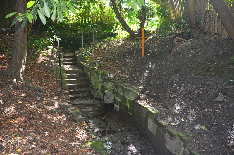
St. Mary's Well (Jesmond) submitted by Anne T on 24th Apr 2017. Standing on the slope above the well pool, looking back at the stone steps leading down to the well.
(View photo, vote or add a comment)
Log Text: St. Mary's Well, Jesmond: From the elusive (non-existent!) Axwell Park Tumulus, we headed off down the Coast Road to Jesmond to find this well. It was a delight – an oasis in the midst of the city.
Parking on Jesmond Dene Road where it meet Grosvenor Avenue, we headed west up The Grove – a shady footpath that runs between The Grove and Red Park Road, in between the back gardens of the houses.
We found the gate to this well to our right hand side, several hundred metres up the path, highlighted by the blue signpost.
Descending into this shady nook, down the stone steps, the first view of the well was of the small statues, tea-lights and mementos left on top of the well covering. As my eyes adapted to the shade, the pool of the well came into view.
The well was full of water, with a steady flow over the cobbles towards the pool. There was a cute copper jug left attached to the side of the well, which I took off and dunked into the water. Andrew and I both tasted the water, and it was completely tasteless, which was a surprise.
After enjoying the peace and calm, we headed off to find St. Mary’s Chapel, now ruined, just down the road. Really enjoyed this visit.
St. Mungo's Well (Simonburn)
Trip No.27 Entry No.1 Date Added: 27th May 2017
Site Type: Holy Well or Sacred Spring
Country: England (Northumberland)
Visited: Yes on 25th May 2017. My rating: Condition 2 Ambience 2 Access 4
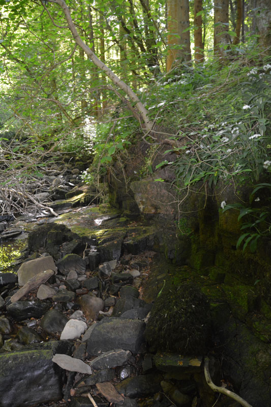
St. Mungo's Well (Simonburn) submitted by Anne T on 27th May 2017. This is the very tumbledown structure at the grid reference for the well. It hasn't been used for a very long time, and my husband wasn't convinced he'd found the right place, but it was the only structure that he could find around.
(View photo, vote or add a comment)
Log Text: St. Mungo's (Mugger's) Well, Simonburn: Our first stop on this hot, sunny day. Parking at Simonburn tea-rooms, we asked if it was OK to leave the car there whilst we walked round the village, and were told it was alright (there is another car park in between the south wall of the churchyard and the forest). I would thoroughly recommend sitting out in the tea-room gardens with a cup of tea and iced water, as they have very comfortable garden furniture and it’s a very quiet spot.
It was a relief to get into the cool of the forest leading down to the Crook Burn, which hardly had any water in it at all after so little rain for weeks and weeks. It was possible to walk on the stream bed.
Following the tracks through the forest to the burn, there is little or no sign of the well. There appears to be an flattened area which might represent an old path, running along the ledge at the top of the burn on its north side, but this has been long out of use. It’s also a three foot plus drop onto the bed of the burn at this point.
Lacking the confidence to walk along the large slippery blocks of stone along the stream bed, I handed the camera to my husband and went exploring the forest tracks. Andrew came back having seen the remains of a structure, long disused, at the grid point indicated for the well, so we are not entirely convinced this is it.
St. Oswald's Well
Trip No.20 Entry No.5 Date Added: 1st May 2017
Site Type: Holy Well or Sacred Spring
Country: England (County Durham)
Visited: Couldn't find on 30th Apr 2017
St. Oswald's Well submitted by HOLYWELL on 15th Jan 2011. St Oswald's Well in the gloom. Some old brickwork can be seen.
(View photo, vote or add a comment)
Log Text: St. Oswald's Well, Durham: From St. Mary’s Well, we headed off along the footpath by the side of the river, on the outer bank of the river Wear as it curves south and east around the cathedral. It is a very pretty path, although with quite a steep drop on the river side at times. We were amused by the ladies rowing on the river who went into the bank once or twice!
Reaching the outer walls of Hatfield College, we climbed some steps onto a path leading us onto Anchorage Terrace and followed the road north towards St. Oswald’s Church. The grid reference as given showed the well to be in the vicinity of the school. After much walking around St. Oswald’s churchyard, I eventually pulled up the description from the Ancient, Healing and Holy Wells of County Durham by Laurence Hunt, which told us that the well was “Situated just below the footpath leading from St Oswald's churchyard to Prebend's Bridge. Reached down a narrow, steep footpath about 20 yards after entering the trees below the church tower.”
Following our steps back to the tower, there is indeed about 20 metres through some trees back to the footpath. Just to our left there was a small, very overgrown track leading down what (to me) looked like a death-defying drop down the cliff to the river below.
Husband Andrew, being intrepid and with absolutely no fear of heights, swung himself onto the footpath, clung onto a tree and leaned over. He said he could see the well. I closed my eyes.
After a few minutes he reported that about 3 metres of the footpath appeared to have slipped down the slope and was missing, and he could reach the well but would like a rope!
We aborted the visit, sadly.
Standing Stone Near Cairn at Head of Drizzlecombe Row 4
Trip No.134 Entry No.16 Date Added: 16th Jul 2019
Site Type: Standing Stone (Menhir)
Country: England (Devon)
Visited: Yes on 15th May 2019. My rating: Condition 2 Ambience 4 Access 3
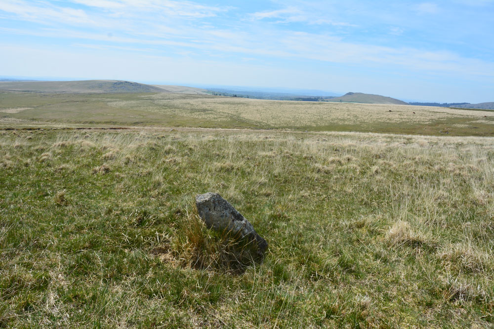
Standing Stone Near Cairn at Head of Drizzlecombe Row 4 submitted by Anne T on 1st Jun 2019. This photo is taken just from the SSW of the stone, showing its north-north-eastern face.
(View photo, vote or add a comment)
Log Text: Drizzlecombe West Standing Stone: Whilst Sandy and the rest of the intrepid "Dartmoor Expedition" were searching lower down the slope for the enigmatic and mysterious Drizzlecome West Stone Row, I'd wandered up slope, stopping at this stone and looking at the nearby cairn. Failing to attract the attention of my fellow explorers, I wandered off to look at the large cairn near the southern and smaller of the two pounds. When I came back, I found Sandy in full 'Bronze Age Mode' with his ranging pole standing by this stone.
We photographed it and took a grid reference with our GPS. More research to be done on this stone - not apparently recorded in Butler or any of the other Dartmoor Archaeology books I now possess. Have asked the rest of the group to contribute to the information on this stone, if they are able. Sandy plans to return in September 2019, so more information to follow.
Standingstone (East Lothian)
Trip No.52 Entry No.5 Date Added: 10th Oct 2017
Site Type: Standing Stone (Menhir)
Country: Scotland (East Lothian)
Visited: Yes on 27th Sep 2017. My rating: Condition 3 Ambience 4 Access 5
Standingstone (East Lothian) submitted by cosmic on 31st May 2008.
Viewed from South
(View photo, vote or add a comment)
Log Text: Standingstone Standing Stone, East Lothian: As we pulled up outside the Standingstone farm house, a lady and her black pug came out of the farmyard. I apologised for turning up out of the blue, but did she know about the standing stone, and she said ‘yes’, asked if I knew where it was, and walked us to it. It was in a little orchard, behind the adjacent cottage. There were glacial striations on the stone, now vertical as the stone had been stood upright.
When talking about the hillfort above us (Tarprain Law) she said “the chieftain was supposed to have thrown his daughter off the top, for falling in love with someone she shouldn’t have. She was supposed to have turned into a robin. The strange thing about here is that we have hundreds and hundreds of robins, and they are here all year. Weird.” She gave a shiver. She told me we were supposed to hug the standing stones.
Standingstone Rigg
Date Added: 18th Jul 2014
Site Type: Stone Row / Alignment
Country: England (Northumberland)
Visited: Yes on 13th Jul 2014. My rating: Condition 4 Ambience 4 Access 2
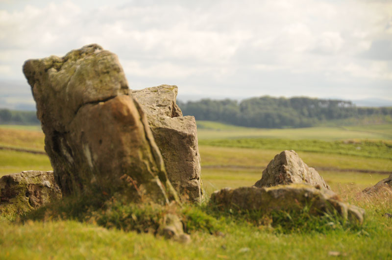
Standingstone Rigg submitted by Anne T on 15th Jul 2014. This photograph is taken from the top of Standingstone Rigg looking south east. The pairing of the stones is identifiable.
(View photo, vote or add a comment)
Log Text: Having first visited Goatstones Four Poster stone circle on 30th June, the farmer from Great Lonbrough Farm further up the track (whom we met on the track as he was coming down from the farm in his Landrover) had mentioned some other standing stones, but was mysterious about the location – we thought it was because they were on his land. I was intrigued.
The quickest route up to Standingstone Rigg is from Ward Lane, using the Bridleway at NY 81632 75077, but the verges had very deep furrows so no parking here, and also the crop had just been harvested, so there was grassy stubble which would have made walking up the hill a little heavy. We decided to turn back to the Manor House, opposite Ravensheugh Crags and use the small layby next to the footpath which led past Goatstones Four Poster stone circle. This meant a slightly longer, but easier, walk past Goatstones and up past Great Lonbrough Farm – a walk of around 7km in all, but easy on a gated farm track. You would have needed a four-wheel drive or a quad bike to drive up this lane, but the walk was across very pleasant countryside, with views of the Cheviots in the far distance, and when we got past the farmhouse, to Hadrian’s Wall country and beyond.
We first came across what looked like a large barrow at the first sheepfold past the farmhouse, about 1km from the farmhouse, at grid reference NY 81783 73355, having had to cross some very boggy ground to reach the tumbled stones. We walked up the ‘barrow’ and turned left, seeing other stones lying the other side of Standingstone Rigg (Ridge), on Harvest Green. This also looked like another barrow, with very definite shaped stones lying around, although these were largely covered by turf and marsh grass.
I confess we struggled to find the stone row, and I was disappointed. We tried to orientate ourselves with a map I’d found on my phone from the Tynedale Archaeology Group, who had carried out a volunteer survey on the site in 2013. We spotted what looked like two gate posts on top of the ridge, so Andrew ploughed his way through the boggy dip and came running back: “Those are the stones, and there a long row, they just go on and on”. There were absolutely beautiful views over towards Hadrian’s Wall, with Halleypike Lough shining in the distance, so we sat back and had a snack and a drink in the sunshine and the warm wind before exploring further.
Once we’d navigated the marshy bits and climbed halfway back up Standingstone Rigg hill, the first stones became apparent. There was a very clear double row of stones climbing up to the ridge, just poking their tops above the turf. Once we’d walked up to the top, the stones just carried on going, down the scarp and turning right round what looks like it might have been a spring or a pond, and back towards what the first ‘barrow’. They looked at first glance to be a single row leading back down the hill.
We probably walked this monument backwards – working from the Harvest Green up to Standingstone Rigg, back towards Great Lonbrough Farm. I felt very much like I’d been on a journey – from death at the first barrow (if it was indeed), up to the ridge, to see over the amazing countryside for miles and miles to look over the Moors and what became Hadrian’s Wall country.
The first double stones we first saw were only about 1 metre apart, so if it was meant to be walked as an avenue, it would have to be done in single file.
On the way back, we stopped at the first ‘barrow’ and looked at the rocks more closely. Some had very definite cup marks in them, and I’ve recorded them in the photographs submitted to the Portal.
The Tynedale Archaeology website states that the stone row has a north-north-east to south-south-west double alignment, which runs for 134 metres north-south up over the scarp of Standingstone Rigg. They also record a cairn on the top of the ridge, which we also saw, but which I didn’t photograph.
On the way back, I managed to turn my ankle by falling between two stones hidden in the grass, and had to hobble 3km back to the car. But I am still amazed by this little known spot, and feel privileged to have been there.
Stanger Spa
Date Added: 8th Sep 2022
Site Type: Holy Well or Sacred Spring
Country: England (Cumbria)
Visited: Yes on 14th Jun 2020. My rating: Condition 3 Ambience 4 Access 3

Stanger Spa submitted by DavidRaven on 13th Dec 2005. The roof-less building that houses the Stanger Spa is hidden away in a copse of birch and poplar. The site isn't easy to find, following ill-defined footpaths through pastureland. It's worth the hunt though. A very quiet place, good to spend time there, not doing much.
(View photo, vote or add a comment)
Log Text: Stanger Spa Well, Embleton: The well is approached by a narrow causeway which runs through a boggy area, terminating at the well house. At the time of our visit, the land around the well was very wet, and in places there were deep puddles of water around the edges of the well house.
Whilst there were lots of other walkers in the area, I didn't see anyone else look at the well house.
An interesting spot and well worth visiting.
Stanlake Settlement
Trip No.133 Entry No.16 Date Added: 17th Jul 2019
Site Type: Ancient Village or Settlement
Country: England (Devon)
Visited: Yes on 14th May 2019. My rating: Condition 2 Ambience 4 Access 4

Stanlake Settlement submitted by AngieLake on 29th May 2019. With the men out of the way we can see the abundance of lovely bluebells inside the hut circle on this sunny, but very windy, 14 May!
(View photo, vote or add a comment)
Log Text: Stanlake Prehistoric Settlement: Walking down slope from the western end of the stone row, we soon came upon a very interesting, complex and intriguing mix of hut circles, dry stone walls and other features. I lagged behind the group a little, trying to determine what I was seeing as I saw it, but failed miserably - there was so much to take in!
Sandy waited for his Intrepid Dartmoor Expedition Group around the spot marked 6 on his plan (taken from his survey report for Meavy Valley Archaeology: site report 1, figure 3, which I've added as a link to Angie's main site page text.
It is interesting that in his report, Sandy links this settlement to the nearby production of tin, with a large tin works just to the south of the Devonport leat.
Having studied point 6 for some time, we wandered over the hut circles and attached compounds, walking to the south and west, and back round to the long house, of which very little now remains, but there are low banks in the ground, partly cut by a modern field wall.
I was sad to leave, as I could have spent at least another couple of hours here. Yet it was to be my last site of the day, as further to the NW along the Devonport Leat, there was a section of steep drops down into the river and the l eat, and I was unable to proceed any further. As it happened, it was a good job we stopped earlier (it was gone 4pm by this time), as Andy B has caught an earlier train and was waiting in Newton Abbott.
Stanwick Crosses
Date Added: 8th Sep 2015
Site Type: Ancient Cross
Country: England (Yorkshire (North))
Visited: Yes on 5th Oct 2014. My rating: Condition 4 Ambience 4 Access 4

Stanwick Crosses submitted by Anne T on 7th Oct 2014. The Viking Ring Cross which is situated at the base of the tower inside the church. This image was taken by flash, as there were no lights in the church during my visit.
(View photo, vote or add a comment)
Log Text: Stanwick Crosses, North Yorkshire (St John The Baptist): 8th August 2015, return visit in daylight. As we were passing close by on the way back from Richmond, we decided to pop in to try and see the rest of the stones in relative daylight (there is no electricity in the church - should have thought to take torches). We saw most of the ones in the outer south wall and some of the ones in the south west corner, although I'm still trying to marry up the text and images in the Stanwick Stones book inside the church with the actual stones I photographed. Despite being a glorious summer evening we needed to use the torch app on my husband's phone to try and photograph the Viking Ring Cross in all its glory, and somewhat failed. Hoping for a repeat visit in early September with the flash gun I can slave to the camera.
Original visit: 5th October 2014: We meant to go to St. Cuthbert’s in Forcett, but as I spotted a signpost saying ‘historic church’, husband wrenched the wheel of the car hard left and we drove the 200 yards down the road to end up at St. John the Baptist Church in Stanwick (so much for my map-reading skills!). This was definitely worth coming to – lots of Saxon and Viking remains, but as there were no lights in the church (there were light switches but they didn't function) and it was very definitely dusk. Definitely needs a repeat visit!
The name Stanwick comes from old Norse (‘stein veggr’ meaning stone walls or building). Settlement at Stanwick dates back to the Iron Age, with the original site of habitation at Tofts, the hill just to the south of the church.
In this small hamlet, the present church of St John The Baptist dates from the 13th century, although there is plenty of evidence for earlier Christian presence on this site. Inside the church, under the tower, is a Viking Ring Cross and built into the walls of the porch are two hog-back fragments. The churchyard is roughly circular which suggests a Saxon burial ground and the shaft of a 9th century Anglo Saxon cross sits at the south east corner of the church. The tower, main doorway, part of the chancel and the eastern window in the south aisle are all 13th century.
The church was declared redundant in 1990 and is in the care of the Churches Conservation Trust, although there appear to be occasional services here and there are some recent burials in the churchyard. As well as the Viking and Anglo Saxon crosses, there is an unusual tomb-chest in the south aisle and a hand-pumped organ.
There were no lights within the church, so a daytime visit seems to be essential to see everything this beautiful church has to offer.
Stanwick Hillfort
Trip No.10 Entry No.3 Date Added: 26th Feb 2017
Site Type: Hillfort
Country: England (Yorkshire (North))
Visited: Yes on 19th Feb 2017. My rating: Condition 3 Ambience 4 Access 5
Stanwick Hillfort submitted by rich32 on 2nd Oct 2006. Stanwick is one huge site, if you could walk round the ramparts you’d cover about 4miles & internally you’ve got 750 acres to get lost in.
The earliest evidence dates the fortifications from the mid to late Iron Age, with occupation waning towards the end of the 1st century AD. It’s likely to have been an important stronghold for the Brigantes & may have been the home of queen Cartimandua, who ruled at the time those chaps from Rome visited.
Theres bundles of evidence from other per...
(View photo, vote or add a comment)
Log Text: Stanwick Iron Age Fortifications:(note: whilst the main entrance of this enclosure can be driven to, getting onto the monument could be difficult because of the short climb to the top of the bank). We'd been in this area before, but to the churches of Stanwick St John and Forcett, to see the Anglo Saxon crosses. It was almost dark at the last visit, so I was glad to be able to see the site properly, although it is so large, it's only possible to glimpse parts. We managed to park opposite the main English Heritage entrance (with signpost), avoiding the myriads of walkers and horse riders who passed the site without seeming to take notice.
There are some quite steep wooden steps up to the top of the bank (the soil around has been eroded, so these (what look like) railway sleepers have been put in to aid walkers). These lead onto the top of the bank which is heavily overgrown with trees and shrubs, with ditches on both sides. About 100 metres into the walk northwards along this embankment, it opens out with a very steep ditch down into what looks like a quarried area. The Pastscape notes say the ditch was built into bedrock, but this looks like a modern quarry.
The bank carries on for quite a way, and from the road, you can trace its line curving round to a farmhouse in the distance, but the tree roots make it quite difficult to walk. On the opposite side of the road, the bank can be seen extending into the far distance, towards Forcett.
We drove slightly further up the road, and at the road junction for Aldbro and Stanwick, you could see more fortifications heading off into the distance. As usual, it was getting to be dusk by this point and we wanted to find the Roman bridge at Piercebridge, so headed off. Shame most of this Iron Age monument was on private land. It really would have been great to wander along/next to these defences. What a huge area it covers!
Steng Cross and Winter's Gibbet
Trip No.119 Entry No.2 Date Added: 25th Feb 2019
Site Type: Ancient Cross
Country: England (Northumberland)
Visited: Yes on 24th Feb 2019. My rating: Condition 3 Ambience 4 Access 4
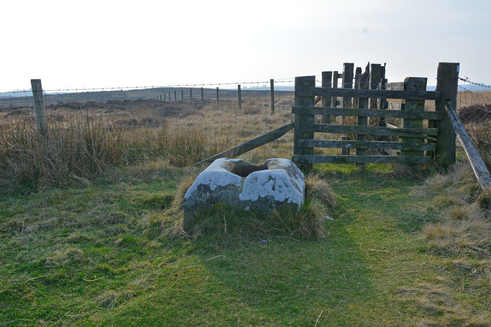
Steng Cross and Winter's Gibbet (Elsdon) submitted by Anne T on 25th Feb 2019. It's not until you walk almost up to the cross base that we realised how much larger it is than others we've seen. Pastscape records: "It measures 0.8m square chamfered down to 0.6m square, and stands to 0.4m above ground level, the socket stone is 0.4m by 0.25m and is 0.2m deep".
(View photo, vote or add a comment)
Log Text: Steng Cross & Winter's Gibbet, near Elsdon: If there was a category for Ambience = Spooky/Very Spooky I would assign it to this site.
This is a remote spot, at the very top of the moor at the western end of the forest which runs along the north side of the road. The thought of anyone being hung in chains and left to rot, murderer or not, doesn't bear thinking about. I expected to turn around and find the ghost of William Winter breathing over my shoulder at any moment. Even the birds seemed silent with the cold wind whistling along the long, straight road nearby. I was glad to escape back to the car and head off to Elsdon.
Just inside Northumberland National Park, St Cuthbert’s Way runs on the south side of the fence next to the cross, although to get to it you have to walk back to the road, a little further west, then onto the marked footpath.
Stewartry Museum
Trip No.183 Entry No.3 Date Added: 22nd Jul 2022
Site Type: Museum
Country: Scotland (Dumfries and Galloway)
Visited: Yes on 19th Jul 2022. My rating: Condition 4 Ambience 4 Access 5
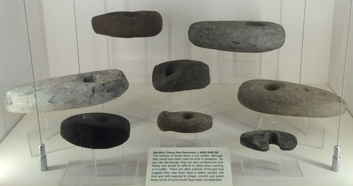
Stewartry Museum submitted by Andy B on 28th Feb 2017. Neolithic Stone Axe Hammers in the Stewartry Museum, Kirkcudbright
(View photo, vote or add a comment)
Log Text: Stewartry Museum: We arrived at the museum with 10 minutes to go until closing, having been to St Cuthbert's Church almost next door, only to discover that the 8th century cross arm was not in that church, but now located in the museum.
Our thanks go to Isla who obtained permission for me to upload photographs to the Portal (she admits to being a keen follower of the Portal, especially stones!), and for her enthusiasm and time in showing us the cross fragments, and also the rock art and rock art impressions they have at the museum.
Would love to come back and spend more time here. A small museum, reminiscent of a smaller Hunterian museum, with lots of things packed into a relatively small ground floor room, some interesting modern sculptures (including Odin's Throne) and impressions of rock art panels stored outside adjacent to the street.
Sticklepath Boundary Marker
Trip No.132 Entry No.11 Date Added: 8th Jun 2019
Site Type: Marker Stone
Country: England (Devon)
Visited: Yes on 13th May 2019. My rating: Condition 3 Ambience 3 Access 4
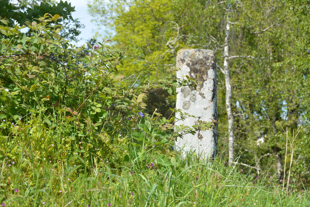
Sticklepath Boundary Marker submitted by Anne T on 8th Jun 2019. The southern face of the cross, which had a cross carved in relief upon it. We were unable to make out any carvings at the time of our visit.
(View photo, vote or add a comment)
Log Text: Sticklepath Inscribed Boundary Stone: This stone is only within 20m of Lady Well, separated by a minor road junction. At the time of our visit, the ambience was spoilt by roadworks which had been set up next to, and almost up to it.
With the stone sitting on top of a retaining wall between the pavement and the main road running through Sticklepath, and a footpath running up slope to its WSW side, Andrew stepped onto the bank and photographed all sides of it for me at close quarters.
Despite peering closely at each side of the stone, we were unable to make out any clear carvings on it at all. The only thing that was clear was the hole for the ball finial which topped the stone at some time in its past.
Sticklepath Methodist Chapel Cross
Trip No.132 Entry No.9 Date Added: 8th Jun 2019
Site Type: Ancient Cross
Country: England (Devon)
Visited: Yes on 13th May 2019. My rating: Condition 3 Ambience 3 Access 5
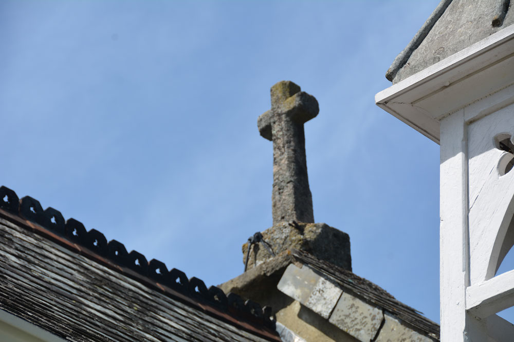
Sticklepath Methodist Chapel Cross submitted by Anne T on 8th Jun 2019. This cross-in-miniature is high up above the road, acting as a finial on the northern side of the Methodist Chapel. Pastscape says it was reused here in approximately 1816 (when the chapel was built). Photo taken from the south eastern side of the chapel 'garden', which is the only place we could get a decent view of the cross.
(View photo, vote or add a comment)
Log Text: Sticklepath Methodist Chapel Cross: A very small cross with socket stone being used as a coping stone on the apex of the roof of the Methodist Chapel.
To see the cross better, we let ourselves into the small ‘garden’ of the chapel (being used as a dump for building materials and rubble), and took a bit of a blurred photo. It does seem like a wayside cross in complete miniature, but instinct tells me it’s just a fancy roof finial which has been reused from another site/location.
Worth stopping off to see, especially with the Lady Well and the Sticklepath pre-Conquest boundary stone just west of the chapel.
