Contributory members are able to log private notes and comments about each site
Sites Anne T has logged. View this log as a table or view the most recent logs from everyone
St Mungo's Well (Bromfield)
Trip No.81 Entry No.2 Date Added: 22nd Jul 2018
Site Type: Holy Well or Sacred Spring
Country: England (Cumbria)
Visited: Yes on 9th Jul 2018. My rating: Condition 3 Ambience 4 Access 4
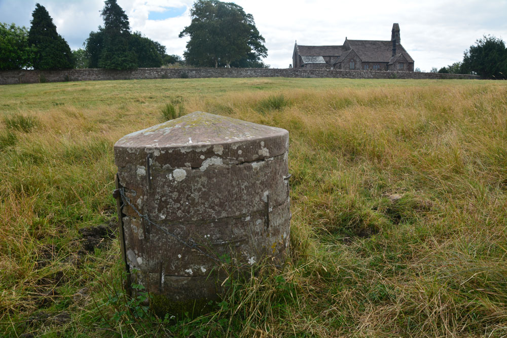
St Mungo's Well (Bromfield) submitted by Anne T on 10th Jul 2018. Standing just to the north of the well, looking back at St Kentigern's Church.
(View photo, vote or add a comment)
Log Text: St Mungo's Holy Well, Bromfield: The kissing gate from the north of the churchyard led down some sandstone gate, although the gate had been wired shut with a cable tie, so we had to clamber over. Even though there had been a long period of dry weather, parts of the ground around the well were still damp and the cattle’s hooves had sunk deep into the ground, creating tussocks and hollows. The well cavity itself was dry. In a very scenic setting, with lazy cattle (and a bull) lazing against a nearby hedgerow, looking over at us, but fortunately too hot to move.
A lovely well in a very nice, tranquil setting.
The Hatching Well (Gilcrux)
Trip No.81 Entry No.3 Date Added: 10th Jul 2018
Site Type: Holy Well or Sacred Spring
Country: England (Cumbria)
Visited: Yes on 9th Jul 2018. My rating: Condition 4 Ambience 3 Access 5
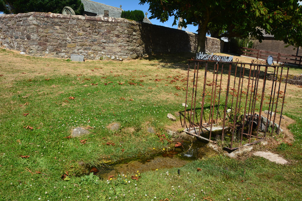
The Hatching Well (Gilcrux) submitted by Anne T on 10th Jul 2018. Standing just to the west of The Hatching Well, looking towards the southern boundary wall of St Mary's churchyard, just behind.
(View photo, vote or add a comment)
Log Text: The Hatching Well, Gilcrux: We arrived here and find this well bubbling away just outside the church - completely unexpected as it's not got any entries on Pastscape or Historic England. Neither is it mentioned in the Wikipedia entry for Gilcrux.
I guess finding this well made up for not being able to get into the church, which was very firmly locked and bolted, despite thinking we'd be able to get in. I'm trying to arrange with the vicar to go back mid-August to see AS Corpus Gilcrux 01.
Seal Howe
Date Added: 9th Sep 2014
Site Type: Cairn
Country: England (Cumbria)
Visited: Yes on 7th Sep 2014. My rating: Condition 3 Ambience 3 Access 4
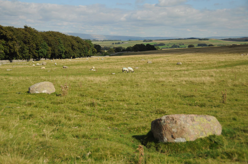
Seal Howe submitted by Anne T on 9th Sep 2014. To the left hand side of the path leading to Seal Howe, we were amazed at the number of red granite rocks lying in the landscape. They stood out clearly from the limestone pavement bedrock.
(View photo, vote or add a comment)
Log Text: Seal Howe Cairn, Oddendale, Cumbria: Having passed Kalmott Cairn Circle by the stone wall next to Oddendale, we made our way to the Bield and Cairn Circle marked on the map.
All around, the limestone pavement/bedrock pushed its way above the grass; it was particularly spectacular on the right hand side of the path. My husband and I were both transfixed and amazed at the number of red Shap Granite stones in the landscape and wished we had a GPS device to map the locations of some of the stones, as there seems to be a much larger prehistoric landscape here. These red granite stones must have been transported up to the site from where they were quarried (which a quick check on the geology of the Lake District indicates just south of Shap).
The modern cairn built on top of Seal Howe wasn’t quite what I was expecting, but the views over to Yorkshire to the east were spectacular. To the north-north-west, the scar of Hardendale Quarry was easily visible.
From Seal Howe, we made our way over the west side of the track to where the map promised us a ‘cairn circle’. This was a treat I wasn’t expecting – the Oddendale Stone Circle.
Oddendale
Date Added: 9th Sep 2014
Site Type: Stone Circle
Country: England (Cumbria)
Visited: Yes on 7th Sep 2014. My rating: Condition 4 Ambience 5 Access 4
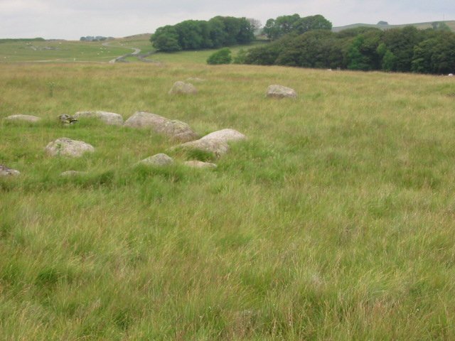
Oddendale submitted by stu on 20th Jul 2002. 592129 NE Lakes Sheet.
Excellent double ringed circle, a must see.
(View photo, vote or add a comment)
Log Text: Oddendales Stone Circle, Oddendale, Cumbria: From Seal Howe, heading directly north west across the pasture to the ‘cairn circle’ was interesting walking, as the ground was lumpy and bumpy with hidden stones underneath. I was not prepared for what we found – a beautiful stone circle of some 34 stones (if I counted correctly) with an inner circle that looked like it had been a cairn or inner mound.
I wish I had a wide-angled lens to capture the beauty of this stone circle in the landscape (if you can successfully ignore the scar of Hardendale Quarry in the background, which we did). Even with my husband perched on top of a nearby stone to get a higher angle, we couldn’t achieve the shot we wanted.
Nearby are also other large red granite stones that we thought might have formed an avenue (but we are quite imaginative people, and would love to have the skills to interpret the prehistoric landscape).
Walking back to the car by the hamlet of Oddendale (according to the Visit Cumbria website, not simply just a farm), the limestone pavement is impressive.
Driving onto Gamelands Stone Circle, it hit me how large the prehistoric landscape is around Shap, and how important an area it must have been in the past.
Iron Hill North
Date Added: 9th Sep 2014
Site Type: Stone Circle
Country: England (Cumbria)
Visited: Yes on 7th Sep 2014. My rating: Condition 3 Ambience 4 Access 4
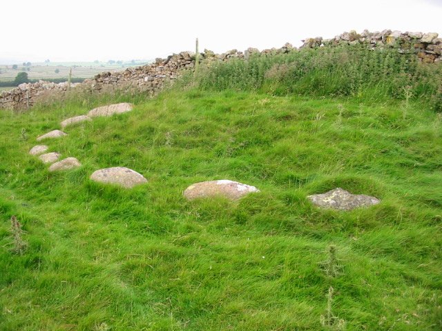
Iron Hill North submitted by stu on 21st Jul 2002. 596147 NE Lakes Sheet.
10 stones remain on one side of a wall.
First stone on right is limestone the rest granite, this is found also at the Gamelands circle, Gunnerkeld and Iron Hill south a few metres away.
(View photo, vote or add a comment)
Log Text: Iron Hill North Cairn/Stone Circle: From Castlehowe Scar Stone Circle, we drove down the single track road towards Hardendale Quarry, with Castlehouse Scar wood on our left hand side. Where the wood ends, the road turns a sharp left and right. Just where the road turns right, there is a marked footpath, walled on both sides, running uphill towards Harberwain Rigg. It is an easy walk despite the path being a little overgrown.
There is a cairn and a cairn circle marked on the Ordnance Survey map. At first all we could see was a limestone scar running to our right, then the first of the stones poked their heads above the grass in front of us, forming a semi-circle around slight mound against a stone wall above us. The stones shone pink in the bright sunlight. If I’m allowed to use the word, this was another ‘cute’ circle and I felt privileged to see it. In the background, the bright water of the lake at the bottom of Hardendale Quarry with its muddy gray ramps and walls contrasted sharply, horribly and incongruously with this wonderful little monument.
Out of interest, we walked a little way up the footpath to where it dissects another running northwards and peered over the gate to see the other side of the circle. I saw one stone peeping (just) above the grass, but couldn’t be sure it was part of the circle.
With a party of walkers making their way down hill towards us, we ventured south to find the other stone circle or cairn at Iron Hill South.
Iron Hill South
Date Added: 9th Sep 2014
Site Type: Stone Circle
Country: England (Cumbria)
Visited: Yes on 7th Sep 2014. My rating: Condition 3 Ambience 4 Access 4
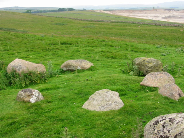
Iron Hill South submitted by stu on 16th Jul 2004. NY596 148.
The small, slightly odd circle of Iron Hill South.
(View photo, vote or add a comment)
Log Text: Iron Hill South Cairn/Stone Circle, near Oddendale, Cumbria: Just 50 metres south of Iron Hill North Cairn/Stone Circle there is another monument, not far from a limestone scar (small modern quarry or crag?). It can be easily seen from Iron Hill North.
Whilst we were looking at this monument, we could hear a party of walkers were coming down the hill towards us. With loud voices, one of the men was proclaiming ‘there’s a stone circle just over here’. Waving his GPS device as he approached us, we were quizzed about which was the cairn and which was the stone circle (both are marked as a cairn and a cairn circle on our OS map), then the walkers left without really taking a look. This amused me greatly, although I wished I had his GPS device.
I couldn’t make up my mind as to whether this was a cairn or another stone circle; instinct said ‘cairn circle’ as there was a grouping of stones in the centre.
After soaking in the atmosphere of this place, we left to go onto Oddendale hamlet, further south along the single track road, and effectively a dead end, to see Seal Howe cairn and the cairn circle nearby.
St Mary's Church (Gilcrux)
Trip No.81 Entry No.4 Date Added: 10th Jul 2018
Site Type: Ancient Cross
Country: England (Cumbria)
Visited: Yes on 9th Jul 2018. My rating: Condition 3 Ambience 4 Access 4
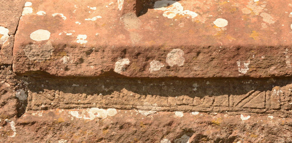
St Mary's Church (Gilcrux) submitted by Anne T on 10th Jul 2018. We may not have been able to see the Viking cross head and shaft fragment, but we did spot this underneath the window in the southern external wall of the sanctuary. The notes inside the church say it is the remains of a grave slab, recut for use as a lintel.
(View photo, vote or add a comment)
Log Text: Viking cross head and shaft fragments, St Mary's Church, Gilcrux: We arrived here to find the outer screen door open, but the door into the church very firmly locked. To say this was disappointing was an understatement, as the building looking fascinating with a lot of history from the outside.
I have since exchanged emails the vicar, who is arranging for the church to be opened for us on either 13th or 14th August.
St Mungo's Dearham
Trip No.91 Entry No.4 Date Added: 16th Aug 2018
Site Type: Ancient Cross
Country: England (Cumbria)
Visited: Yes on 14th Aug 2018. My rating: Condition 3 Ambience 4 Access 5
St Mungo's Dearham submitted by coin on 29th Mar 2017. The Viking Cross at Dearham
(View photo, vote or add a comment)
Log Text: St Mungo's Church, Dearham: AS Corpus Dearham 03 and The Adam Stone: This was a return visit. pre-arranged with the lovely Reverend Mary, who drove from Crosscanonby to very kindly unlock the door of the vestry to show us AS Corpus Dearham 03, part of a cross-head.
We also saw the Adam Stone. Mary moved the knitted figures of Jesus and Peter and invited me to climb on the pew to get a better photograph. We felt so welcome, we didn’t really want to leave!
Chantry Well (Brigham)
Trip No.91 Entry No.6 Date Added: 18th Aug 2018
Site Type: Holy Well or Sacred Spring
Country: England (Cumbria)
Visited: Yes on 14th Aug 2018. My rating: Condition -1 Ambience 2
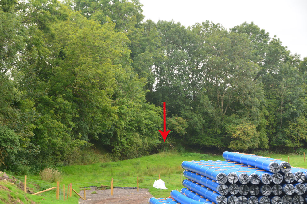
Chantry Well (Brigham) submitted by Anne T on 16th Aug 2018. This is the approximate site of the Chantry Well, as pointed out by the church warden of St. Bridgets, and as recorded by Pastscape Monument 9025 and the Old Cumbria Gazetteer. A new mains water pipeline is being driven through the field, although it was previously recorded the well was destroyed by quarrying. Some marshy ground still remains fenced off in the corner by the red arrow.
(View photo, vote or add a comment)
Log Text: Chantry Well, Brigham (Destroyed) The Reverend Mary told us there was a holy well at Brigham. There are actually 2 listed – Chantry Well and Nun’s Well, next to the A66.
Mr. Furness, the church warden also mentioned the well, but said it was no longer there. In the field opposite the church, a new water pipeline is being constructed. In the field to the south a new housing estate is also being built. There is no access into the field because of the building works, but the grid reference gives a point where the tree line bends.
Bewcastle Cross
Date Added: 11th Oct 2015
Site Type: Ancient Cross
Country: England (Cumbria)
Visited: Yes on 11th Oct 2014. My rating: Condition 3 Access 5
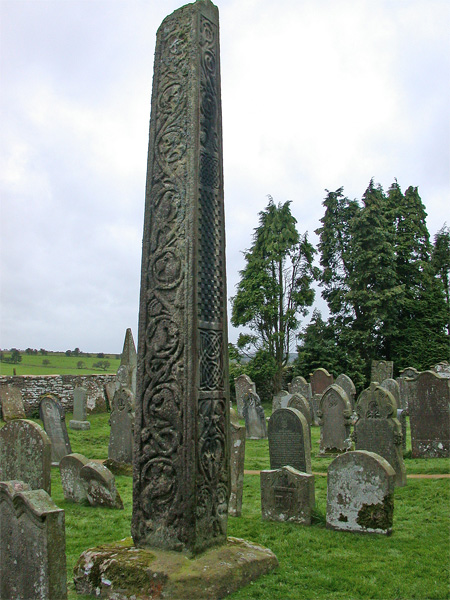
Bewcastle Cross submitted by nicoladidsbury on 20th Sep 2004. Bewcastle Cross, Cumbria
Image shows the detail from the north and east sides of the 15m cross. These sides are very well preserved.
The north side is divided into five compartments. In the highest and lowest are vines running in graceful curves and bearing foliage and fruit. "In the second and fourth divisions are two curiously-devised and intricately-twisted knots." The third division is filled with the chequer work. Between the compartments are lines of Runes which are now so indi...
(View photo, vote or add a comment)
Log Text: Bewcastle Cross. Fourth visit, 22nd August 2015. We first came here back in 1992/1993 not long after we'd moved to Dumfries. Funny, as from dim and distant memory both my husband and I remembered this (falsely) as being the Ruthwell Cross. After having taken a photo of our 3 children gathered round the foot of the cross in the mist and drizzle, for the last couple of years I'd wanted to recreate this photograph, so for my **th birthday, the family (complete with next generation) gathered. The skies were still murky and grey although the cross doesn't appear to have changed one bit.
After taking a photo of the children as they are now, we gathered to whole family, complete with next generation, taking photos with the remote shutter control.
The museum display has improved a lot since our visit in 2014, and I came prepared with printed sheets from the Anglo Saxon Corpus but didn't find any of the Saxon grave covers in their inventory, although there was one on display, very simply carved, which was labelled as being from the 8th to 11th century.
11th October 2014: Third visit. We last came here on 15th August 2013, but I was really quite ill (a bug, not a hangover!) and had to find a quiet corner of the churchyard, so I don’t remember very much of the visit to the church. I do remember walking around the castle with the farmer and his wife gardening nearby so I felt like a trespasser.
Today, as we reached St. Cuthbert’s church, the sun came out and highlighted the cross and many of the carvings showed clearly, especially the worn and weathered runes on the eastern face.
The exhibition has been improved since our visit, with displays about the runes and their meanings and a new painting of what the cross might have looked like when it was first erected.
There were less fragments in the exhibition outbuilding than I remembered.
Waberthwaite Cross
Date Added: 27th Oct 2014
Site Type: Ancient Cross
Country: England (Cumbria)
Visited: Yes on 24th Oct 2014. My rating: Condition 3 Ambience 4 Access 5
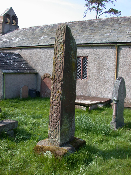
Waberthwaite Cross submitted by nicoladidsbury on 27th Apr 2005. Ancient Anglian/Scandinavian Stone Cross at St John's Church, Waberthwaite.
South and East sides, showing the crisp unweathered carving on the south side.
The Cross Shaft is 2m high, and quite badly weathered, making it difficult to see the carvings on the main panels, however the edges (north and south sides) are still remarkedly clear.
The cross is thought to date from the 9th to 10th centuary, and shows influences of anglican and viking carving styles.
(View photo, vote or add a comment)
Log Text: Ancient crosses, St John the Baptist Church, Waberthwaite: This was our last planned stop of the day and dusk was drawing in. I confess to being a little tired of getting in and out of the car by this time, but a drive down a narrow country lane to reach a cluster of farm houses by the estuary of the River Esk was worth it. Outside the church of St John the Baptist looks derelict and unloved, with the door being guarded by a simple wire frame held shut by a wire closure.
Finding ‘Waberthwaite 02’ cross shaft and basewas easy, as it sat immediately to the east of a tall sundial. ‘Waberthwaite 01’ was a bit more of a challenge until I realised it had been laid flat on the plinth of the sundial (verified by the notes inside the church).
Simple manipulation of the wire frame in the church porch allowed entry, and the door to the church had been left unlocked - inside it is small but cosy, like stepping back into the 18th century. There are box pews put in by the Victorians and the bells are rung from the outside.
Notes in the church read: “The churchyard contains a sandstone sundial, possibly 18th century. Its height is explained by the fact that it was designed to be read by someone on horseback. Behind it is the shaft of an ancient preaching cross. For many years this was part of the lintel of the church porch. The cross head has been lost. It is very worn, but the carving includes interlaced foliage and, on the east face, pictures of a horse and two figures facing one another. Lying on the base of the sundial is another broken cross shaft rescued from the threshold of the porch in the 1800s. Again the cross head is lost. For many years the larger cross was thought to be 9th century or later, but recent archaeological discoveries put it earlier, in the 8th century. This makes the Waberthwaite Cross one of the earliest in West Cumbria. The existence of the crosses is evidence of a very early Christian settlement on this site.”
It wasn’t difficult to imagine early Christians stopping off at the site to worship by the cross.
Irton Cross
Date Added: 27th Oct 2014
Site Type: Ancient Cross
Country: England (Cumbria)
Visited: Yes on 24th Oct 2014. My rating: Condition 4 Ambience 4 Access 5
Irton Cross submitted by Thorgrim on 27th Mar 2004. In the churchyard at Irton is the ancient Irton Cross, which stands 10 feet high and was erected in the early 9th Century, before the Viking invasions. Pevsner declares that this is one of the most important crosses in Cumbria, and unlike the one at Gosforth, bears no figures either human or animal. It contains vine scrolls and rosettes of Irish origin.
(View photo, vote or add a comment)
Log Text: Ancient cross shaft, head and base, St Paul’s, Irto, Cumbria: This cross, apart from the Gosforth Cross, is perhaps the most complete of all those we saw during our day in this part of Cumbria. From the Ordnance Survey map, we weren’t sure if we could drive most of the way, or if we needed to walk some distance along a footpath, but with a school and a church marked in close proximity, we decided to drive as far as we could. From Gosforth, we drove down the A595 through Holmrook, then took a left hand turn onto a minor road, past Gubbergill. A left hand turn is signposted towards ‘church’ and we drove down a single lane road past what had been a school, then through the narrow stone gates to the church, where after a couple of hundred yards, the lane widens out into a reasonably large car park. As we came closer to the church, there were surprisingly spectacular views over Lake District, which loomed impressively gray and large in the near distance.
St. Paul’s church is surprisingly large for its remote location, and obviously well used.
We found this complete cross shaft, head and base in the churchyard south of the church rising high above us. Dating from the first half of the 9th century, the head is edged by fine double roll mouldings. I was fascinated by the head of the cross, which on its west face has a cabled circle enclosing five pellets arranged in a cruciform pattern.
The cross shaft, head and base are referenced as Irton 01. The ASCorpus notes told me that Irton 02, a 10th century cross head, is actually at Muncaster in the churchyard of St. Michael’s and All Angels, cemented onto a plinth in front of Muncaster 01.
St Bee's Priory Crosses
Date Added: 27th Oct 2014
Site Type: Ancient Cross
Country: England (Cumbria)
Visited: Yes on 24th Oct 2014. My rating: Condition 3 Ambience 3 Access 5
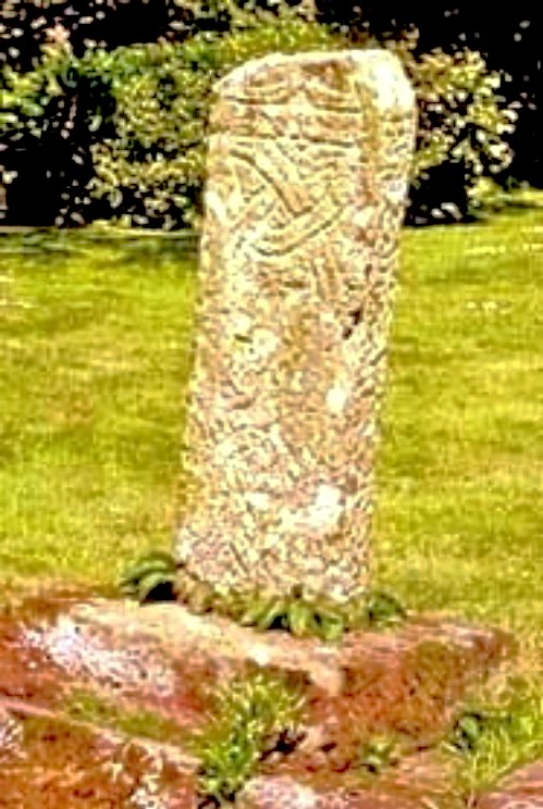
St Bee's Priory Crosses submitted by Sunny100 on 11th Jun 2010. 9th century cross-shaft in St Bees Priory graveyard, Cumbria, at NX.969122
(View photo, vote or add a comment)
Log Text: Ancient Crosses, St. Bees Priory (notes: 1. all the leaflets and books refer to this as ‘St Bees Priory Church’ but the name, according to information plates in the church is ‘St Mary and St. Bega. 2. I record this visit as 'ordinary' as the church was having its complete heating system replaced and was like a building site. Once this is complete, it will be 'good').
This was our first stop on an 'ancient cross hunt' day. Following the A595 from Whitehaven, we turned towards the sea down Mirehouse Road towards St. Bees. We drove past the church at first, as it looked too modern from the road, but on closer inspection, it really is old! Sited near the station, there is car parking for 4-5 cars at the south east corner of the church, with a level pathway to follow to the west door.
Entering the churchyard, we saw St Bees 01, the 10th century cross shaft, in the middle of the churchyard by a large, round bush. The ASCorpus notes say it also has part of the cross head at the top of the shaft, although this wasn’t immediately obvious, although I can now see this in the photographs. According to the little leaflet I bought from the church, this cross stands in the graveyard to symbolise all those who are buried here, rather than there being individual grave markers. This then gives a different meaning to the other similar crosses we saw in other churches, being described as preaching crosses. I wonder who is right? In a history of St. Bees (see source below) this cross is described as being ‘Hiberno-Norse’; ASCorpus dates it to the 10th century.
Many of the grave stones have been cleared away, making the grass easier to cut, and there is a drop between the edge of the churchyard and the church itself, with plenty of bright yellow ‘danger’ notices. Near the lych gate, there is a sundial which dates to 1649, although the top has been broken off.
Having travelled over 90 miles to get here, we arrived at the west door to find a notice to say the church was closed Mondays to Thursdays as they were having the heating pipes replaced. As it was a Friday and someone else had just come out we went in; we were stopped by one of the plumberswho said the church was closed, and I said we’d driven a long way to come here, he said ‘be careful’. The church was covered in plastic lining and plumbing pieces everywhere, including dustpans and brushes placed in the ‘history area’ at the south east end of the church.
This visit was slightly disappointing, as we didn’t find St Bees 06, part of a round shaft or pillar which was supposed to be at the east end of the south aisle of the church, inside. We explored all the other areas, including the ‘new history area’ and poked my head into the rooms being used by the heating engineers, but nothing. Three other pieces (St Bees 03, 04 and 05) were buried under the south aisle of the church, so couldn’t be seen, and St. Bees 07 was in someone else’s possession. St Bees 08 is difficult to find, being placed in the south west arch way, almost buried by ferns. I had to compare it to the photograph on the ASCorpus records very carefully to make sure I’d understood what I’d seen.
Outside the fascinating west door, underneath this same archway, there was another sandstone cross sited underneath an arch. It’s not described in the church guide, but in a frame in the church, it is described as “a cross which stood at the breast of the hill on the main road to Whitehaven. It is variously thought to be a ‘sanctuary cross’, marking the boundary of the parish, or a resting cross on a coffin road. The ‘coffin roads’ date from medieval times when many West Cumbrian parishes did not have the licence to bury, and bodies were brought to St. Bees. These crosses served as symbolic resting places on route.” The archway lintel comprises a “pre-Conquest carved Beowulf Stone, on a lintel between the Church and the Vicarage, showing St Michael killing a dragon.”
St Michaels Church, Muncaster Castle
Date Added: 27th Oct 2014
Site Type: Ancient Cross
Country: England (Cumbria)
Visited: Yes on 24th Oct 2014. My rating: Condition 3 Ambience 3 Access 5
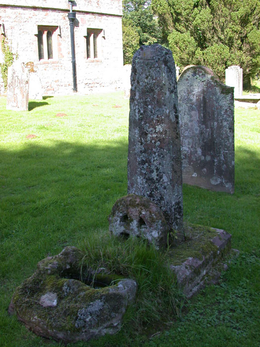
St Michaels Church, Muncaster Castle submitted by nicoladidsbury on 31st Aug 2006. Muncaster Cross, shaft, wheel-head, and cross base
(View photo, vote or add a comment)
Log Text: Ancient cross shaft, head and base at St Michael and All Angels, Muncaster, Cumbria: After Irton, our next stop was Muncaster, further down the A595, where I was intrigued to find what the Corpus of Anglo Saxon Stone Sculptures catalogue refer to as ‘Irton 02’ being cemented to a plinth at the base of Muncaster 01.
We had a slightly eventful journey to get here. A crane had got stuck on the hill going into Muncaster so we had to carefully overtake him on a steep bend, so missing the turn to St. Michael and All Angels, which is at the entrance to Muncaster Castle (as an amusing aside, whilst we were at Muncaster, then Waberthwaite, the crane managed to reverse and turn around in the car park just before Muncaster Castle, so we ended up following him for miles and miles, crawling up hills then speeding up on the ‘flat bits’). There is parking for three or four cars immediately outside the churchyard, so we avoided going into the main castle car park.
We found the cross shaft and cross base easily enough, with ‘Irton 02’ sandwiched between them. The cross shaft (Muncaster 01) dates from the tenth to eleventh centuries. The cross base is believed to be of Saxon-Norman origin, although no precise date is given.
I found these fragments a little sad, with little or no ambience, so we didn’t linger. Stopping to take a few quick photographs, dusk was falling rapidly, so we shot off to Waberthwaite.
Beckermet Ancient Crosses (St Bridget's)
Date Added: 4th Jun 2017
Site Type: Ancient Cross
Country: England (Cumbria)
Visited: Yes on 24th Oct 2014. My rating: Condition 3 Ambience 4 Access 5
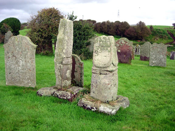
Beckermet Ancient Crosses (St Bridget's) submitted by astronomer on 13th Oct 2006. The squat Saxon cross at Beckermet is stylistically very similar to Eliseg's pillar at Llangollen and to others in the Lyme, the moorlands fringing the eastern border of Cheshire and Staffordshire with the Peak District, especially between Macclesfield and Leek. The western side of the Beckermet cross, shown here, displays a panel thought to carry Viking runes carved on its surface.
(View photo, vote or add a comment)
Log Text: Ancient crosses, St. Bridget’s Church, Beckermet: Despite having been given directions by the vicar of St. John’s, Beckermet, we had several attempts at finding St. Bridget’s, but got there in the end. We need to take a left hand turn off the main road through Beckermet opposite Crofhouse Farm into a small housing estate, then taking the right hand turn marked ‘St. Bridget’s Church’ a few hundred yards down this lane and following this narrow lane down to the church. By this time, the wind had got up and whilst it wasn’t particularly cold, it wasn’t a day to linger.
There was some parking outside the church, which looked virtually derelict, although there were some recent burials in the churchyard, with fresh flowers and containers of water by the church door. The door to the church was open, shut only by a wooden latch which pivoted on a central nail.
Both cross shafts were to the south of the church, looking onto open countryside, with the towers of Seascale/Sellafield in the near distance.
The taller of the two cross shafts, Beckermet St. Bridget 02, dates from the tenth to eleventh century, and is made of St. Bees sandstone. According to the ASCorpus notes, the three encircling mouldings around the cylinder are rare.
I found the shorter of the two cross shafts fascinating, with the remnants of an inscription on its western face.
Apparently, there was a third fragment, part of a cross-head, which is now under plaster in the east wall of the chancel.
Gosforth Cross
Date Added: 27th Oct 2014
Site Type: Ancient Cross
Country: England (Cumbria)
Visited: Yes on 24th Oct 2014. My rating: Condition 4 Ambience 4 Access 5
Gosforth Cross submitted by Thorgrim on 30th Jul 2003. Probably the finest Anglo-Scandinavian carving in the north of England, this red sandstone cross has stood for over a thousand years in the churchyard at Gosforth. Depicting Pagan scenes of Odin, Thor and Loki as well as of Christ crucified, the mixed symbolism is intriguing. Inside the church are fine Viking hog-back tombstones including one showing the famous scene of Thor fishing for the Midgard Serpent. Gosforth in Cumbria is 12 miles from Whitehaven at map ref: NY 072036.
(View photo, vote or add a comment)
Log Text: The Gosforth Cross and Hogbacks, Gosforth, Cumbria: This was a busy, busy little village. By this time, it was 3pm and I was more than ready for a cup of tea, but the cafe above the village store was closing. Away from the main car park for the village, we struggled to park, but in the end managed to get a spot outside the eastern end of the churchyard, where a delivery van had just pulled away.
What a delightful little church, where we were given a very warm welcome.
Rather than walk up to the lych gate, I opened the lower gate into the churchyard, where we were almost immediately greeted by some iron railings round a very unusual tree. We walked over the grass to the Gosforth Cross, and as I was taking photographs, we were greeted by a very jolly gentleman who told us he’d seen us come in through the bottom of the churchyard, and asked if we’d spotted the railings. “As far as we know, this is the most northerly growing cork tree.” He then proceeded to take us into the church and showed us where the Fishing Stone was, together with the light switches to see the other stones and hogback tombstones.
There was a very busy group of ladies who were cleaning the church from top to bottom, using the space between the hogback tombstones to hide their handbags (I gingerly moved them and replaced them to get my photographs.
I picked up a leaflet in the church about the grave covers and was taking (yet more) photographs in the porch. A gentleman with a sweeping brush came out to clear the leaves away and told us about the Grade 1 listed building at north east corner of church yard built out of grave stones, so we went to look. Fascinating! I’m glad I didn’t miss this feature.
Beckermet Ancient Crosses (St John's Church)
Date Added: 28th Oct 2014
Site Type: Ancient Cross
Country: England (Cumbria)
Visited: Yes on 24th Oct 2014. My rating: Condition 3 Ambience 4 Access 5
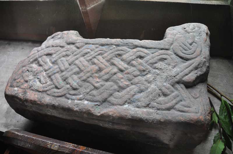
Beckermet Ancient Crosses (St John's Church) submitted by Anne T on 27th Oct 2014. I think this is Beckermet St John 07, part of a cross base showing ring-twists with bar terminals.
(View photo, vote or add a comment)
Log Text: Ancient crosses: St John’s Church, Beckermet, Cumbria: As we arrived, I could hear the buzz of voices coming from inside the church and thought there might be a service on. Sort of. Children kept coming out of the church, and out, and out. It turned out the whole local school had come for a Harvest Festival service so we waited whilst they filed out.
The vicar and another lady were standing in the church porch. I said “I think we’ve arrived at the right time (or the wrong time!). We’ve come to see the Anglo Saxon cross remains” and waved my pages from the ASCorpus at them. The vicar told us the church was left open all day so we weren’t disturbing everyone. He then asked us if we were going to the ‘low church’ and gave vague directions. The lady also mentioned Gosforth. After having cleared up in the vestry, they disappeared and left us to it.
We had to move (carefully) all the flowers from the stones to photograph them, and carefully replaced them. There were also three old fonts in the church yard. I managed to photograph 2 of them; the third was less ornate red sandstone, very near the west door to the church.
All the Anglo Saxon cross shaft fragments were on the window ledges in the north aisle; grave covers on the window ledges in the south aisle.
One additional fragment, not listed on ASCorpus. Could this be fragment 09 returned to the church?
The notes in the church read: “There is evidence of at least 4 churches having been built on this site. The earliest is thought to have been built by Irish monks. We know that in 1262 Sir John le Fleming gave the church to Calder Abbey and tithes were paid to the Abbey. We know of the existence of a 13th century church. Fragments of a crocketed canopy and cross can be found outside the porch doorway. This was ‘a small church with square headed windows and a South Porch approached by steps beginning near the bridge and a little belfry between the chancel and nave’ (The Gosforth District by Dr. C.A. Parker). This was the position of the Sanctus Bell by means of a rope hanging down intot he church at the raising of the host during Mass. This church had an earthen floor with seats being oak forms. It had no door, but there was a hurdle to keep out animals. It also had no ceiling. In January 1811 a faculty was granted to pul down this building which had served as a church for over 600 years. All parishioners had to pay a Compulsory Church Rate and they wished to keep the rate as low as possible. But this church had no foundations!!! They were seen as an unnecessary expense. The walls were whitewashed and the ivy climbing up the outer walls was said to have covered up the cracks and supported the building. It had to be demolished and was rebuilt in 1878. The present church is built of St. Bees sandstone from Bigrigg Quarry and has a roof of Coniston slate. It holds 250. The pews and all other woodwork are made of pitch pine. This church cost £2,406 mainly raised by subscription .... inside the porch are 2 remnants of white freestone crosses thought to be Anglo-Saxon, 700 to 1100 AD. There is also a large graveslab which probably marked the tomb of a le Fleming (Norman) ..... along the south window ledges are the remains of ancient grave slabs dating from 1230 AD.”
Little Meg
Date Added: 10th Dec 2014
Site Type: Stone Circle
Country: England (Cumbria)
Visited: Yes on 30th Nov 2014. My rating: Condition 2 Ambience 4 Access 4

Little Meg submitted by Bladup on 9th Apr 2013. Showing the rock art at Little Meg.
(View photo, vote or add a comment)
Log Text: Little Meg, Little Salkeld, Cumbria: After visiting the Addingham Cross, which is within walking distance, we went in search of Little Meg. Strange, as we've visited Long Meg and Her Daughters on a number of occasions, but somehow managed to overlook this little gem.
Located just to the west of the minor road from Little Salkeld to Glassonby, just north of Tarn House, there is actually no footpath to the stone circle, which can be seen from the gate to the field. There was a local family who were walking along the edge of the field to the stone circle, so we followed them. Their children enjoyed climbing onto the stones and jumping off, and we wondered how many other children in times gone by had done the same!
A few of the stones might be in their original positions, but it looks as if the farmer has re-located the majority to the field edge so he can plough the field, which is a huge shame. However, the stones are welcoming and still worth a visit. One stone has impressive spiral marks on it (I understand there is a second stone with rock art but we couldn't find it).
There is a footpath running from the minor road towards Maughandy Moo, and just inside the car there are some more large stones which look as if they might have been part of this ancient monument at some point.
Lazonby Ancient Cross
Date Added: 12th Mar 2015
Site Type: Ancient Cross
Country: England (Cumbria)
Visited: Yes on 30th Nov 2014. My rating: Condition 3 Ambience 3 Access 4
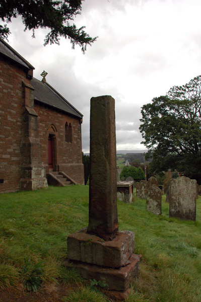
Lazonby Ancient Cross submitted by nicoladidsbury on 13th Oct 2007. A cross in Lazonby churchyard, supposed to date from the 8th centuary - please see Steve Bulmans pages for detail dated 1901
http://www.stevebulman.f9.co.uk/cumbria/1901/lazonby1901_f.html
(View photo, vote or add a comment)
Log Text: Lazonby Cross, Cumbria: At first glance this seems the most unlikely church to have the shaft of a cross, thought to be preaching cross dating from the 8th century, as at first glance it appears to be thoroughly Victorian in origin.
From Kirkoswald, travelling on the B6413 over the Eden Bridge into Lazonby, the church looms on a steep hill on the right hand side of the road and looks very Victorian (the church guide says the foundation stone was laid in 1864, and that "three places of Christian worship have been on this site. Before the Normans came to Cumbria a preaching-cross faced across the River Eden towards the Pennines").
It was hard to spot the cross shaft at first at it lies in the shadow of a tall tree and is the same red colour as the sandstone of the south wall of the church against which it sits near.
There are no discernable markings or carvings on it. The views over the River Eden and the Pennines beyond are impressive.
If you are passing by and are interested in Anglo Saxon crosses, it is worth stopping off for a few minutes to appreciate this ancient spot.
Addingham Cross
Date Added: 12th Mar 2015
Site Type: Ancient Cross
Country: England (Cumbria)
Visited: Yes on 30th Nov 2014. My rating: Condition 3 Ambience 4 Access 4
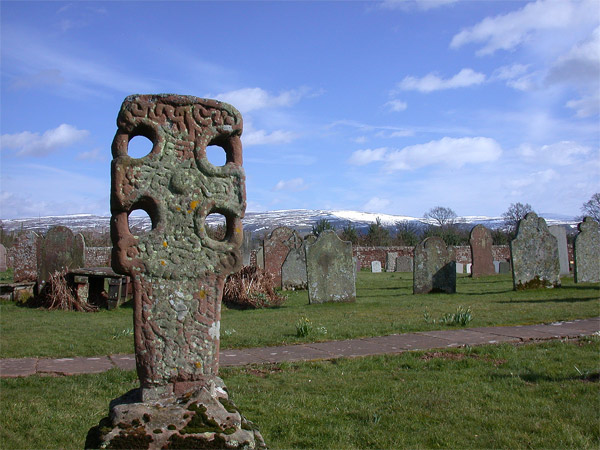
Addingham cross submitted by nicoladidsbury on 15th Mar 2005. Near the entrance stands a well preserved Anglo-Saxon hammer-head cross, with four holes and carved scrolls (right).
In the porch of the Church is a Viking hog-back tombstone, two parts of a 14th Century Viking cross, and two coffin lids decorated with early Christian emblems
More images at http://www.visitcumbria.com/pen/chp24.htm
(View photo, vote or add a comment)
Log Text: Addingham Crosses, Cumbria: This red sandstone church sits on a site which has had a church on it from the 13th century; previously the village of Addingham (home of Adda's people), including its church and churchyard, was washed away by a major flood of the River Eden in the 12th century.
The present church holds fragments of 6 different artefacts dating from between the sixth to ninth centuries. These include the unusual churchyard cross, plus a cross shaft in two pieces dating from the second part of the ninth century, a sixth to eighth century cross-incised slab, a seventh to tenth century cross base a Viking hogback tombstone and part of a cross socket.
The cross socket inside the church, next to the choir stalls, is incised with lines and holes which make it look as if it had been adapted to play the 9-mens Morris game.
It is hard to spot the cross in the churchyard at first, as it is lined up in a row of gravestones just south of the church. It's ringed hammerhead with lateral arms are unusual and I've not seen another cross like this in my travels so far.
Combined with a visit to Little Meg Stone Circle and St Nicholas's Church in Lazonby to see the cross shaft there, this was a pleasant late autumn afternoon, made even more special by hot warming soup with speciality breads at the Watermill Tea Rooms at Little Salkeld (no, they've not paid me to advertise!).
