Contributory members are able to log private notes and comments about each site
Sites Anne T has logged. View this log as a table or view the most recent logs from everyone
St Oswald in Lee (Heavenfield)
Trip No.103 Entry No.1 Date Added: 13th Oct 2018
Site Type: Ancient Cross
Country: England (Northumberland)
Visited: Yes on 11th Oct 2018. My rating: Condition 3 Ambience 4 Access 4
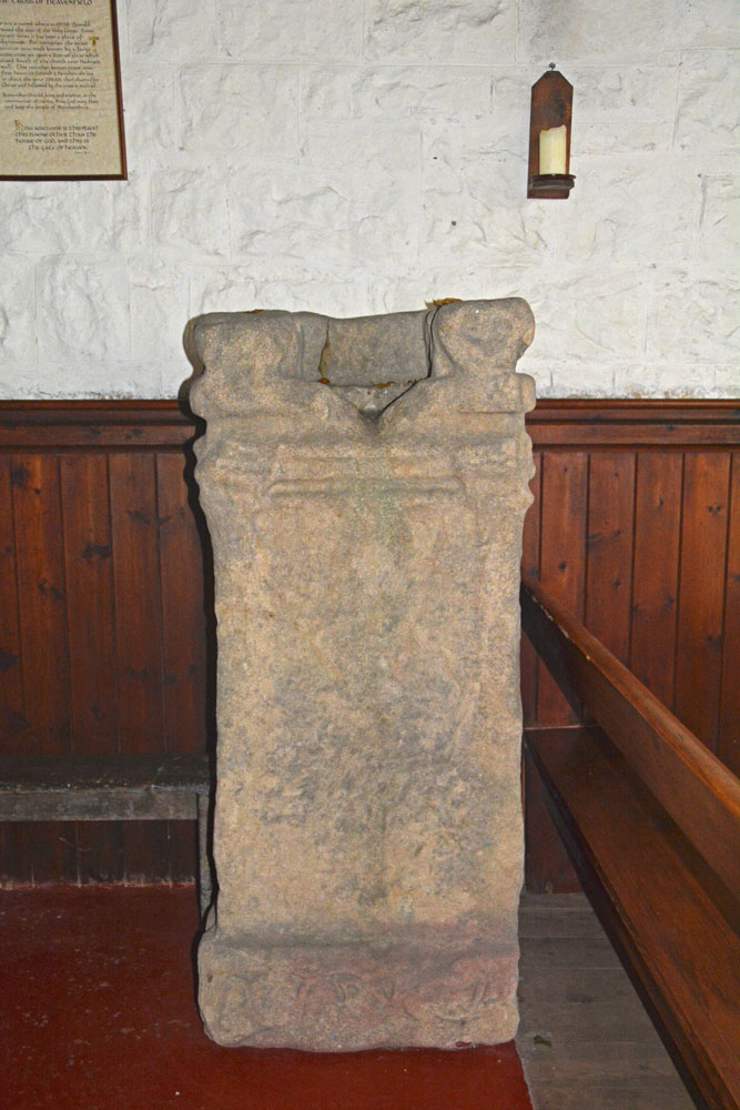
St Oswald in Lee (Heavenfield) submitted by Anne T on 13th Oct 2018. The southern side of the repurposed Roman altar, which is opposite you as you enter from the south door. Recorded as AS Corpus 02, this side has lettering and ornamentation, most of which has been obliterated, but at the base there is a vine trail.
(View photo, vote or add a comment)
Log Text: Heavenfield cross shaft and cross base: We have been to this church before, but didn’t realise the Roman altar had been recut for reuse as a cross base, so decided to revisit it. It is in a really glorious location. The church is set back from the road, so we parked in the layby by the large wooden cross and went through the gate into the field full of enormous sheep. You have to cross the vallum for Hadrian’s Wall to walk to the church, although this is now largely ploughed away.
Inside the porch, on the western shelf/bench, are the two pieces of AS Corpus St Oswald in Lee 01. As you go in through the south door, AS Corpus St Oswald in Lee 02 is straight in front of you. An information ‘board’ is on the wall next to the cross, which reads: “The cross of Heavenfield. The site is sacred where in 635AD Oswald raised the sign of the Holy Cross. From ancient times it has been a place of pilgrimage. For centuries the exact position was made known by a large stone cross set upon a Roman altar which stood south of the church near Hadrian’s Wall. This weather beaten stone was first hewn to furnish a heathen shrine in about the year 200AD, then claimed for Christ and hallowed by the cross it exalted. / Remember Oswald, king and martyr, in the communion of saints. Pray God may bless and keep the people of Northumbria. / How awesome is this place! This is none other than the house of God, and this is the Gate of Heaven. Genesis, 28.17”
On the south wall of the nave is what the church guide refers to as a mason’s mark, but it is very large to be one. It looks like an upside down Templar cross.
Also on the north wall of the nave is a small fragment bearing chevrons and small balls – this is dated to the Norman period.
The churchyard wall is also built with Roman stones.
St Oswald's Church (Dean)
Trip No.184 Entry No.3 Date Added: 31st Jul 2022
Site Type: Rock Art
Country: England (Cumbria)
Visited: Yes on 24th Jul 2022. My rating: Condition 3 Ambience 4 Access 5
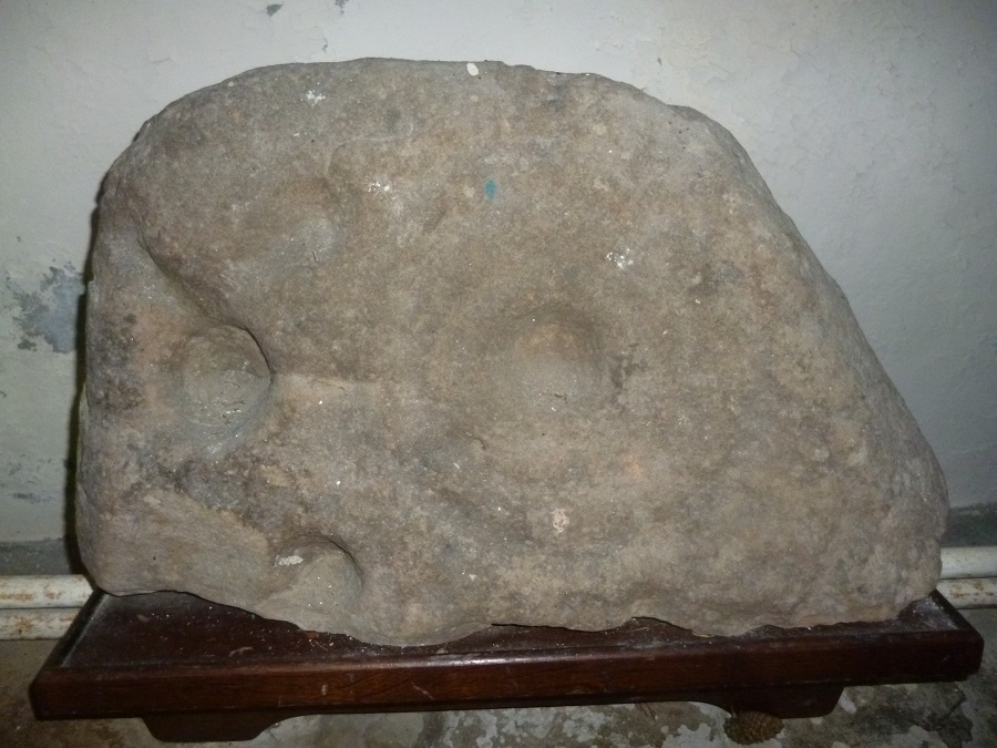
St Oswald's Church (Dean) submitted by SumDoood on 7th Mar 2018. The church is a most unusual and, I'd suggest, attractive building, C12th in origin, or older? Enter through the main door and turn right to find the carved boulder a few yards away. Taken 18-02-2018 and viewed from straight ahead.
(View photo, vote or add a comment)
Log Text: St Oswald's Church (Dean): Having left St Michael and All Angels at Isel, we visited the well in Eaglesfield and tried to find the Singing Well just outside Deanscales. The latter we could see over the hedge, but were unable to gain access to the field it sits in from the road. Parking by the lych gate of the church, walking along the southern side of the church, the preaching cross is easily visible, sitting on what looks like the base of a large market cross, with seven steps. The cross at the top is topped by a 'modern' (18th century) sundial.
We spent some considerable time in the church with the notes provided, tracking and photographing the medieval grave slabs that were visible. Enjoyed this visit.
St Oswald's Church (Lythe)
Trip No.159 Entry No.1 Date Added: 8th Mar 2020
Site Type: Ancient Cross
Country: England (Yorkshire (North))
Visited: Yes on 4th Mar 2020. My rating: Condition 3 Ambience 5 Access 4
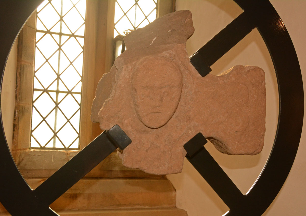
St Oswald's Church (Lythe) submitted by Anne T on 8th Mar 2020. The cross head fragment with its human head in the centre. As displayed in the south window at the west end of the nave.
(View photo, vote or add a comment)
Log Text: St Oswald's Church, Lythe: Our first stop of the day, and one I was very much looking forward to. Parking is available in the small lane to the west of the church (just off the A174 Lythe Lane). A notice put up by the farmer asked cars to park on one side of the lane only, so they had continuous access to their fields behind the church.
I was concerned about if I'd be able to make it down the 'windy stone steps' to the basement, where many of the Anglo Scandinavian and medieval stones were displayed. I needn't have worried, as the steps were modern, and whilst there was no hand-rail, they were easy enough to descend (although I did manage to dislodge small chunks of stone from the south wall as I descended).
We spent an hour and a half here, then needed to move on. I would have liked to have spent another hour (at least) here, with the notes printed from the Corpus of Anglo Saxon Stone Sculpture, and better lighting to take better photos of the stones in the basement.
St Oswald's Well (Kirkoswald)
Date Added: 22nd Oct 2015
Site Type: Holy Well or Sacred Spring
Country: England (Cumbria)
Visited: Yes on 10th Oct 2015. My rating: Condition 3 Ambience 4 Access 5
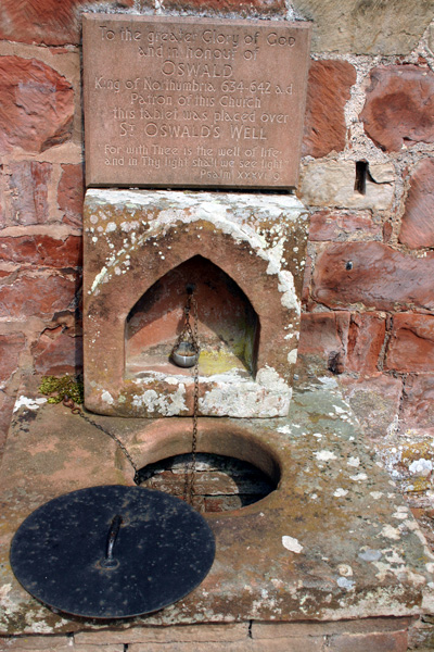
St Oswald's Well (Kirkoswald) submitted by ocifant on 25th Jun 2005. The well sits at the side of the church, against a hillside. The church bell tower is separate and sits at the top of the hill. There are steps and a door leading down to the well, but the door was locked. It is necessary to lower the drinking cup to obtain the water.
Apparently, the church boiler leaked some time ago, and the water was poluted with oil, and is no longer fit to drink, although it is still used for baptisms...
(View photo, vote or add a comment)
Log Text: Anglo Saxon stones and a holy well, Kirkoswald, Cumbria: This church is in a very pretty location, opposite "the college" and boasts not only an Anglo Saxon cross arm fragment and holy well but a separate bell tower on top of what looks like a motte. It is a little difficult to park, as there are narrow roads and high brick walls restricting vehicle access, and on the day we went lots of farmers towing trailers were travelling at relatively high speeds round the bends in the village. This church is in a very pretty location and boasts not only an Anglo Saxon cross arm fragment and well but a separate bell tower on top of what looks like a motte.
The approach to the church is pleasant, along the tree-lined Priest’s walk from the college opposite. The church itself sits at the foot of a steep hill and the wooden porch of 1523 is dark but welcoming. To the left of the porch on the exterior north wall sit a number of stone grave markers; the second from the right has ribs and is described in the church guide as being Saxon.
The church guide is really good, illustrating the development of the church from the 7th century (“when local people were discovered worshipping a God of the spring which issued out of the Bell Tower Hill”), through to the present day.
Inside the church the area immediately inside the door is cramped compared to the rest of the church. The sanctuary and east window, because it nestles at the foot of the hill, is comparatively dark. To your right, immediately to the right of the door is the font. The bowl is very old (described as being from the original Norman building) but the plinth appears modern. On the window ledge to the west, which the church guide says is Tudor, is mounted part of a Saxon cross arm, AS Corpus reference Kirkoswald (no number, as there is just one).
Apart from the well worn and partly destroyed stone effigy of Lady Dacre tucked between pews at the west end of the church, there is no much else to see inside. To the west end of the church outside is the enigmatic St. Oswald’s well. At first glance, it looks like an outside toilet, but on closer examination there is a metal cup on a long chain, a metal cap with handle and remnants of an old roof line over the well. Lifting off the metal lid, the water is free flowing and clear about 8 to 10 feet down. The cup reaches the water and I did draw a little and taste it – nothing exciting. I later read in the church guide that the water is still used for baptism, but drinking it isn’t recommended. At the southern side of the well are some steps with a red door which opens onto the water channel, presumably for clearing. I was surprised to find the water flows under the nave! The church guide says the source of the spring is unknown, but it must come from under Bell Tower Hill.
We missed a consecration cross in the retaining wall at the east end alongside an old sundial.
Walking round the southern end of the church a very narrow stile leads through the stone boundary wall of the churchyard and a path leads up into the Bell Tower Field. Climbing up this steep hill, the Bell Tower is particularly inaccessible as the slope up to the Bell Tower needs clambering up, then there is a sturdy fence with well padlocked gates. I was convinced this hill was an old motte.
St Patrick's Well (Aspatria)
Date Added: 4th May 2015
Site Type: Holy Well or Sacred Spring
Country: England (Cumbria)
Visited: Yes on 1st May 2015. My rating: Condition 4 Ambience 3 Access 4
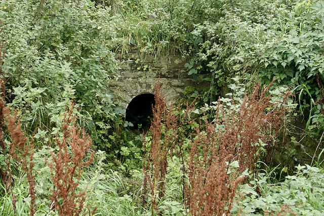
St Patrick's Well (Aspatria) submitted by MisterBus on 25th Sep 2010. St Patrick's Well, Aspatria, Cumbria UK. The well is at the rear of the church in the graveyard. Although the graveyard is well cared for the area around the well is overgrown and in much need of restoration.
(View photo, vote or add a comment)
Log Text: St Patrick's Well, Aspatria. This well can be found in the churchyard of St. Kentigern's Church at Aspatria. Driving into Aspatria along the A596 from Carlisle, the church is on the right hand side of the road with disk parking on both sides of the road. There are steps up from the gate into the churchyard.
We arrived during the annual church flower festival (1st to 4th May). Before going into St. Kentigern’s Church to see the Anglo Saxon Cross and Viking Hogback Tombstone, we’d had a quick scout around the churchyard to see if we could see the well, but no. Asking directions from one of the guides at the church, he told us to “go out of the west door, turn right and it’s 50 yards down – you can’t miss it. Following his directions, where the path around the church turned along the northern corner, all we could see were gravestones and a fenced off area containing shrubs. The path stopped at this point and we had to make our way over the grass, avoiding the humps and bumps of grass-covered graves. Once at the fenced off area and having turned the corner, we saw immediately where the well was, contained within a neat, modern-looking stone walls with a path leading up to it.
The well was dry at the time of our visit, and looked as it if had been for some time. It wasn’t obvious where the water went to – it must have formed a small pool within the confines of the paved area, any overspill running onto the grass beyond. Whilst the well was said to have been used by St. Kentigern for baptisms, I didn’t find it had any atmosphere at all. The Pastcape record (id=9583) says that “The feature consists of a short path, steps, and the rectangular enclosure of a spring, all of Victorian construction. The vicar confirmed the name as St. Patrick's Well but there are no records of a pre-19thc structure, only of a natural spring."
There was a good view of the Anglo Saxon cross at the east end of the church from here, together with the dovecot – the most original and complete of its kind in Cumbria.
Note: St. Kentigern was also known as St. Mungo (meaning ‘dear one’). According tothe church guide booklet, he was “rescued with his mother from a drifting coracle on the Firth of Forth .... was taken into the monastery at Culross in Fife .... The people of Strathclyde revered him for his holiness of life and chose him as a bishop, but in a time of political disorder, he fled south, possibly to Wales. It is believed that on his travels he found the area which is now northern Cumbria to be unevangelised, and the dozen or so churches dedicted to Kentigern or Mungo are thought to have been founded as the result of his preaching.” Kentigern or Mungo is the Patron Saint of Glasgow.
St Peter (Osmotherly)
Date Added: 29th Sep 2014
Site Type: Ancient Cross
Country: England (Yorkshire (North))
Visited: Yes on 26th Sep 2014. My rating: Condition 3 Ambience 4 Access 5
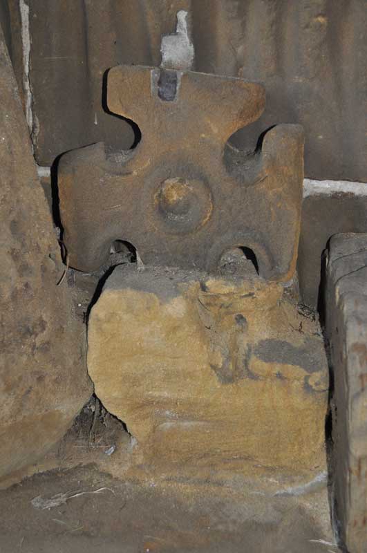
St Peter (Osmotherly) submitted by Anne T on 29th Sep 2014. I was really interested in this Saxon cross head fragment. It is amongst the group on the bench on the western wall of the porch.
(View photo, vote or add a comment)
Log Text: St Peter’s Church, Osmotherley. Saxon cross fragments: Note, whilst there is parking on School Lane immediately by the church, there are steps to negotiate from the road up to the church.
Having failed to get to Mount Grace Priory and St. John’s Well from the northern carriageway of the A19 (there is only access from the southbound carriageway), we went into Osmotherley as I’d seen St. Peter’s and their Saxon cross fragments on the Portal.
St. Peter’s really was ‘the disappearing church’ – coming down North End, it towered over the houses but as we turned to go up West End and got closer to it, it disappeared and we lost our bearings. After two attempts of driving up and down, we turned down School Lane (not Church Lane, as we might have expected!), which, whilst narrow there is parking.
The cross shaft fragments are in the porch of the church, which is open to the weather, so available to visit anytime.
As I was making my way up the steps towards the church porch, there were some ladies coming slowly down the steps towards us. The first lady told us they had just had a choir practice for Harvest Festival, and if I was quick, I could look round the inside of the church.
This church has a lovely atmosphere, and I’d like to go back and have a more leisurely look. The ladies told me that the south nave is Victorian, so the Norman porch must have been moved when this was built.
I saw the cross fragments and photographed them, with the kind ladies surrounding me – all lovely and really interested. They told me about other crosses at Sockburn and St Wilfrid’s Parish Church in South Kilvington to add to my list of places of ‘must see’ sites.
St Peter's (Bywell)
Trip No.151 Entry No.1 Date Added: 27th Sep 2019
Site Type: Early Christian Sculptured Stone
Country: England (Northumberland)
Visited: Yes on 14th Sep 2019. My rating: Condition 3 Ambience 4 Access 5
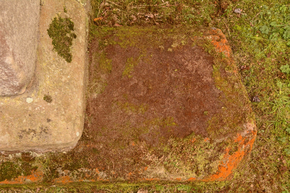
St Peter's (Bywell) submitted by Anne T on 27th Sep 2019. The visible portion of Ryder's Bywell (St Peter's) 13, with a "cross head set within a circle, with sunk lenticular segments between the arms, and a circle at the centre" on the visible section. The small circle can be seen just left of centre of the photograph; the rest of the design is hidden by moss.
(View photo, vote or add a comment)
Log Text: St Peter's, Bywell: Having photographed the cross slabs at St. Andrew's on 10th September 2019, we walked down to St Peter's to try and photograph the slabs Peter Ryder has recorded here. Unfortunately, the church was locked, so we photographed the few slabs on the outside of the building, returning on 14th September, after having ascertained from the vicar the church's opening hours.
This is a really lovely spot, right next to the River Tyne, with the Bywell Village/Market cross and St Andrew's Church, Bywell, with its significant collection of medieval cross slabs and its Anglo Saxon sculptured stones.
St Peter's Church (Bishopton)
Trip No.56 Entry No.1 Date Added: 16th Oct 2017
Site Type: Ancient Cross
Country: England (County Durham)
Visited: Yes on 15th Oct 2017. My rating: Condition 2 Ambience 4 Access 5
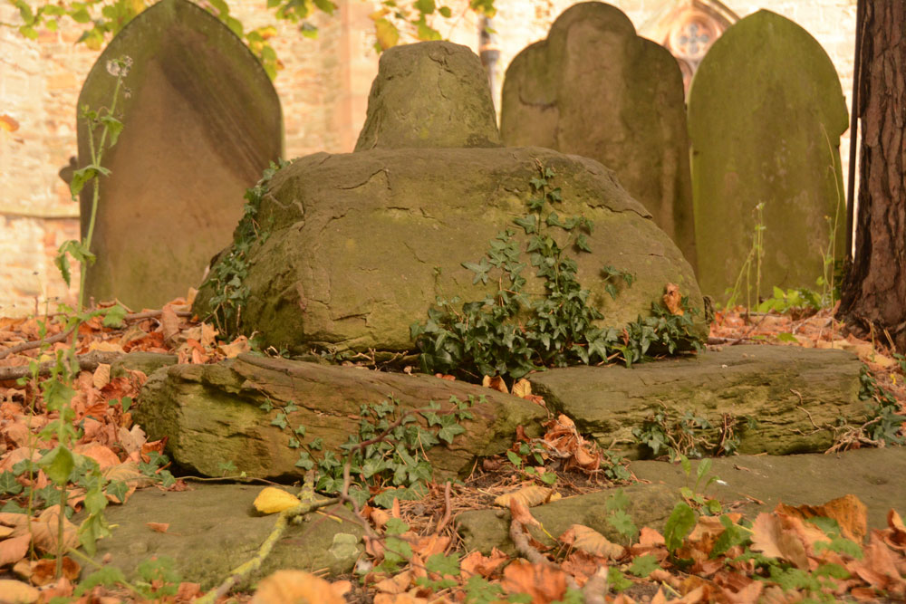
St Peter's Church (Bishopton) submitted by Anne T on 16th Oct 2017. Standing next to the churchyard wall which runs along High Street, looking over the wall to the cross base, socket stone and remains of the shaft.
(View photo, vote or add a comment)
Log Text: Medieval Cross in St. Peter's Churchyard, Bishopton: Driving into Bishopton, I realised looking at the cottages and houses that this was a very old village, and had it not been for all the parked cars, it would have been very picturesque.
The church was locked so we couldn’t go in, but the remains of this cross was visible near the edge of the churchyard. It was easier to photograph it from the road, looking over the wall.
I didn’t photograph the replacement village cross, in the very small village green, near the wall memorial, as I thought it was modern, and we didn’t stop after looking at the earthworks nearby.
St Peter's Church (Croft-on-Tees)
Trip No.186 Entry No.1 Date Added: 12th Aug 2022
Site Type: Ancient Cross
Country: England (Yorkshire (North))
Visited: Yes on 10th Aug 2022. My rating: Condition 3 Ambience 4 Access 4
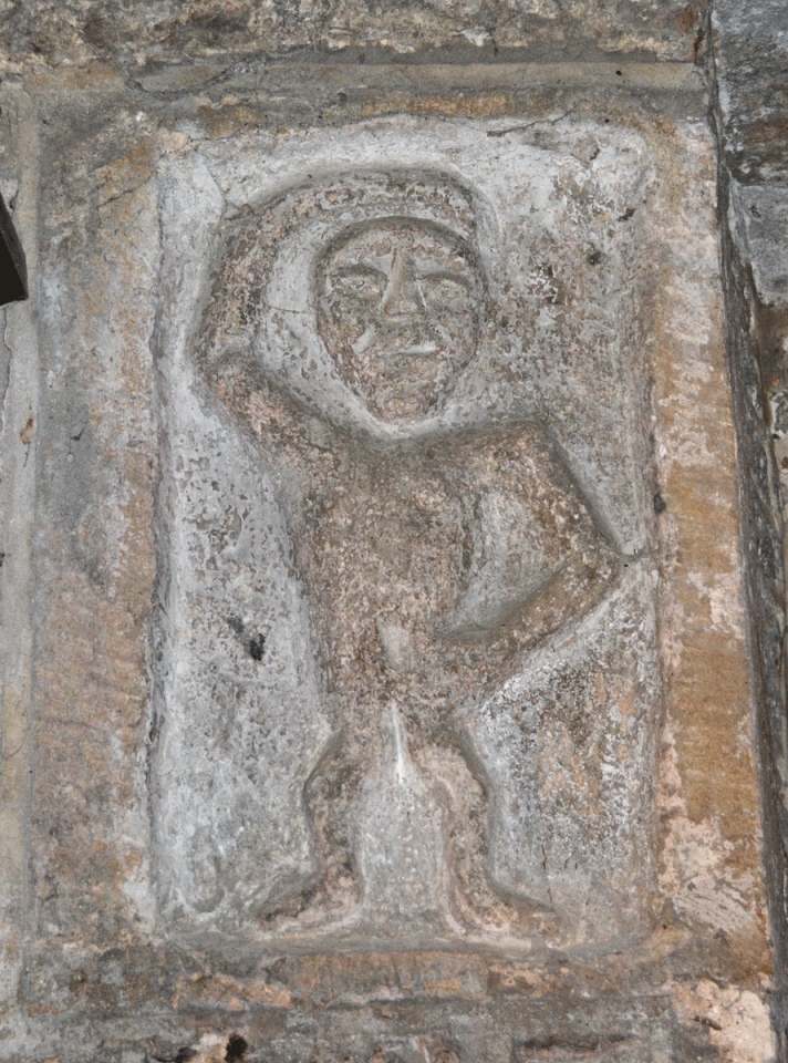
St Peter's Church (Croft-on-Tees) submitted by Anne T on 11th Aug 2022. Whilst I would class this carving, which is built into the wall just to the west of the south door, as a sheela-na-gig, the church guide (and our guide for the day) says this is "a small human figure with right arm raised over his head and left arm down across the body. One authority claims it to be a local water deity of Romano-British origin, circa 1-5 century AD. However this may be a piece of Victorian piety for it is possible to see that a part of the anatomy has been chipped out of the na...
(View photo, vote or add a comment)
Log Text: St Peter's Church, Croft on Tees: The church's wedding co-ordinator kindly opened the church for us at very short notice, and acted as our guide for our brief visit. A very lovely church, right next to the River Tees. Sadly, the stone recorded on the Corpus of Anglo Saxon Stone Sculpture as Croft on Tees 01 had been moved to the Bowes Museum, and was about to be transferred to Newcastle as part of the celebrations of the Lindisfarne Gospels returning to that part of the world. This was disappointing, as this was the stone I most wanted to see.
A couple of bonuses were the additional stones built into the external fabric of the building, which we walked around to see what we could spot.
Our grand-daughter, Alice, was partly named after 'Alice in Wonderland', so it was good to be able to take a photograph of the sculpture which is said to have inspired Lewis Carroll's Cheshire Cat.
St Peter's Church (Heversham)
Trip No.178 Entry No.3 Date Added: 22nd Jun 2022
Site Type: Ancient Cross
Country: England (Cumbria)
Visited: Yes on 21st Jun 2022. My rating: Condition 3 Ambience 3 Access 4
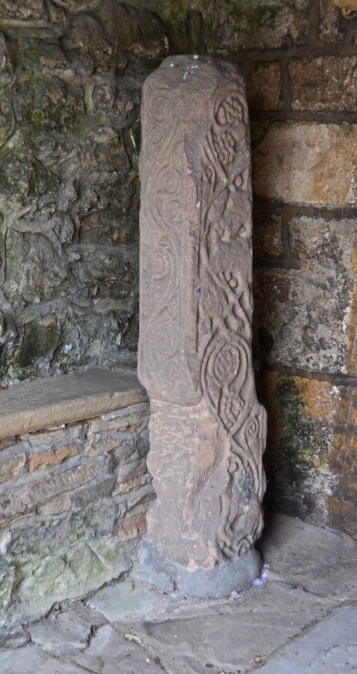
St Peter's Church (Heversham) submitted by Anne T on 22nd Jun 2022. Heversham 01, located in the south porch, near the south door. Dating to the late eighth century. The church guide says that the war memorial in the churchyard is probably a replica of what this cross would originally have looked like.
(View photo, vote or add a comment)
Log Text: St Peter's Church, Heversham: A lovely little village, but so very full of builders with loud radios, which there was no avoiding.
Inside the church was quiet, but a number of other visitors who came and went. We looked at the cross shaft (and the very old south door) in the south porch, and easily found the small fragment in the external wall to the east of the porch, in the south wall.
The church itself was simple and unremarkable, apart from an old wooden pew which was carved with the date 1626, and a huge chest at the east end of the north aisle, which dates from1400.
St Peter's Church (Monkwearmouth)
Trip No.152 Entry No.1 Date Added: 25th Sep 2019
Site Type: Early Christian Sculptured Stone
Country: England (Tyne and Wear)
Visited: Yes on 20th Sep 2019. My rating: Condition 3 Ambience 5 Access 4

St Peter's Church (Monkwearmouth) submitted by Anne T on 25th Sep 2019. Displayed at the top of the case in the 'Exhibition Centre' at the eastern end of the north aisle, this is one of a pair of Consecration Crosses, recorded as Monkwearmouth 29 and Monkwearmouth 28. The latter is still in situ in the west gable of the nave, some 42ft above ground, visible only from the interior of the tower, partly beneath a beam. They are both dated to either the 7th century (original date of consecration) or the 11th century (for the rededication of the monastery after its dest...
(View photo, vote or add a comment)
Log Text: St Peter's Church (Monkwearmouth): This trip was made largely thanks to coming across Guy Points' "Gazetteer of Anglo Saxon and Viking Sites: County Durham and Northumberland" (2012), as we hadn't really appreciated what was here. Our intention was to visit St Peter's, go to Sunderland Minster, then walk round Sunderland Museum, although we spent so much time here, we will need to visit the Minster another time.
We were made extremely welcome as soon as we walked through the door, and given a personal tour of the church. Imagine our surprise towards the end, when the guide revealed himself as none other than Guy Points! I was astonished.
Would love to go back and find some of the stones he mentions in his book that we missed on the day, and also have a closer look at the glass and plaster fragments, and sit and enjoy the ambience of the church. Brilliant afternoon!
St Peter's Church (Redmile)
Trip No.121 Entry No.5 Date Added: 19th Mar 2019
Site Type: Early Christian Sculptured Stone
Country: England (Leicestershire and Rutland)
Visited: Yes on 17th Mar 2019. My rating: Condition 3 Ambience 3 Access 4
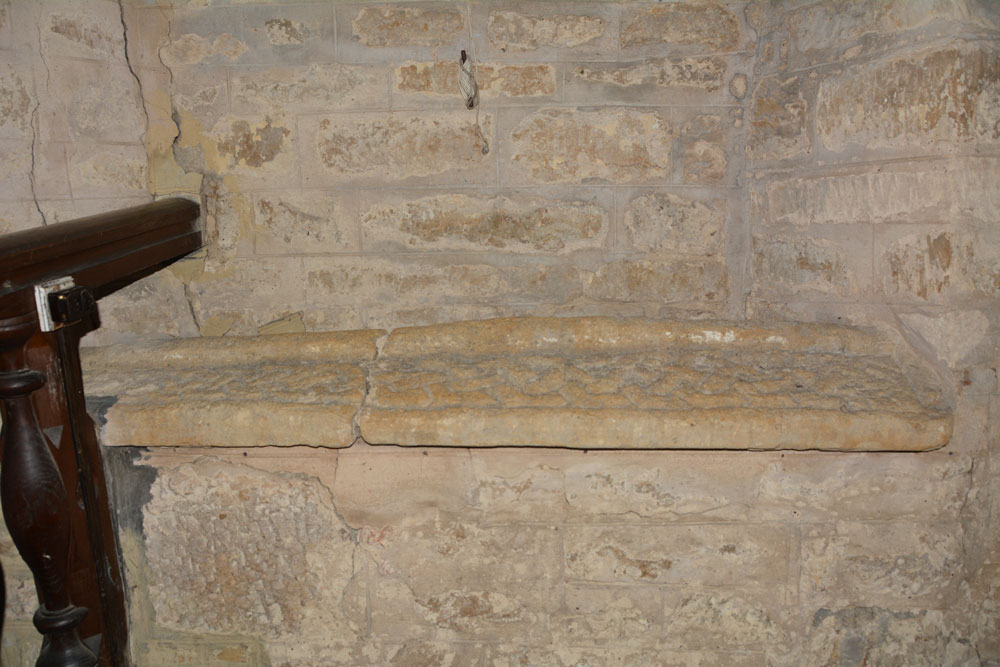
St Peter's Church (Redmile) submitted by Anne T on 19th Mar 2019. Anglo Saxon Carved Stone in Leicestershire and Rutland England. The carved stone, now reused as a windowsill.
(View photo, vote or add a comment)
Log Text: Carved Anglo Saxon Stone, St Peter's Church, Redmile: Our last planned visit before heading off home, and this church didn't disappoint, despite being greeted by "Warning. Falling Masonry" signs on entering the church through the south door! The north western part of the nave was cordoned off, with similar notices.
No two walls of this church were plumb, and the cracking in the north wall was quite spectacular. However, the atmosphere of the church was warm and friendly, and we felt relatively safe knowing there had been a service there only that morning.
We found the stone, reused as a windowsill, easily enough. Placed under a window by the pulpit, it proved a little tricky to photograph, and I could have done with a ladder to photograph all of it from above.
I also spotted what could have been what looked like another fragment in the south wall of the church, and Andrew found 'witches marks' on the eastern external jamb of the south porch.
St Peter's Minster (Conisbrough)
Trip No.17 Entry No.1 Date Added: 18th Apr 2017
Site Type: Sculptured Stone
Country: England (Yorkshire (South))
Visited: Yes on 15th Apr 2017. My rating: Condition 3 Ambience 4 Access 5
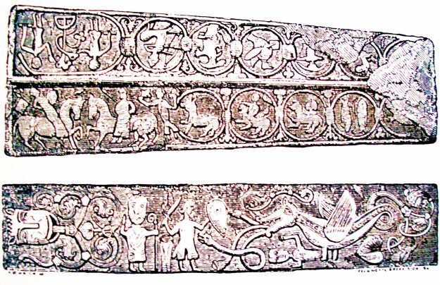
St Peter's Minster (Conisbrough) submitted by Sunny100 on 15th Aug 2010. Detailed illustration of the two early Medieval grave-slabs that are both richly carved with an assortment of mythical characters, beasts and symbols. These stone slabs are said to be the finest example of their kind in England.
(View photo, vote or add a comment)
Log Text: Anglo Saxon Carvings, Conisbrough: Having seen this on the Portal, with only a sepia image of the stones, I had been keen to visit this church for some time as it was only a short detour from my step-father's house; the nearby castle had been my very first ever school trip, over half a century ago (gulp). We managed to park in the (small) free car park outside the community centre, right next to the church.
We arrived just as the children’s Easter Egg hunt/service had ended, and children and parents streamed out of the church. With 2 year old grand-daughter in tow, desperate to join in, one lady coming out of the church saw us waiting and asked if we were visiting. When I said we were, she said we were very welcome, waited until the crowds had lessened, then took us in. Another gentleman took us round to see the grave stones and made sure we had the free history leaflet of the church. Grand-daughter and husband made a great game of finding all the Mouseman mice on the pews.
The church, whilst it looks Victorian from the outside, clearly has some very old parts, evident in the blocked up windows in the arches in the nave, and the tower. The church guide tell us that this is the "oldest building in South Yorkshire and is one of the ten oldest churches in England, with parts dating back to at least 750AD." The church warden was telling us that the church came many years before the castle, and so is sited on the highest part of the town; the castle therefore had to take the second highest spot.
As well as the grave stones, there is the very worn shaft of a cross outside, which the church guide leaflet says dates from the very earliest times of this church, around 750 AD. Lovely welcome and well worth the detour. Carried on to look at the castle before heading off into Doncaster.
St Thomas (Brompton)
Trip No.23 Entry No.4 Date Added: 16th May 2017
Site Type: Ancient Cross
Country: England (Yorkshire (North))
Visited: Yes on 11th May 2017. My rating: Condition 4 Ambience 4 Access 5

St Thomas (Brompton) submitted by Anne T on 16th May 2017. These three hogbacks are truly magnificent. Having been buried in the ground for so long, they look as if they have been carved recently. Well worth a visit just to see these, never mind the other cross fragments.
(View photo, vote or add a comment)
Log Text: Hogbacks and Crosses, Brompton, North Yorkshire: This is a visit I’d arranged some time ago, arranging to meet the church warden at 2pm on 11th May (details on the 'A Church Near You' website). The church is kept locked, as we found out when we’d tried to visit a couple of years ago, and I was much looking forward to this return visit.
We were a little late, having stopped to photograph the remains of the motte at Pickill, and having hit a little traffic in Northallerton, but we found the church wardens sweeping up cherry blossom from the porch of the church. We were certainly made very welcome.
There are three complete hogbacks, the carving of which is very crisp, almost as if they had been done yesterday – preserved after having been buried in the ground for so long.
A further two fragments sit, almost hidden, against the north eastern corner of the nave, wedged between an altar, some heating pipes and the wall.
Sitting to the south of these, against the boundary between the nave and the chancel, was a wheel head cross. Another cross sat on the south wall of the chancel, with a further 3 sitting on the southern window ledge of the western wall.
The Cock Shaft sits almost hidden at the back of the pews, in the south west corner of the church, and is named so because there are three cocks on the southern face.
To my surprise, Doreen said there were three further fragments in the external south and east walls of the church, so we hunted for these whilst she spoke to the man repairing the churchyard wall. There are also the remains of a grave marker, now broken in two, placed in separate parts high up on the eastern wall.
We were given the ‘Village Trail’ and also told much interesting history about the linen factories in the village, and started off on the walk to see the village green, Cockpit Hill and the water splash. A great day out.
St Thomas's Well (Cambusbarron)
Trip No.108 Entry No.5 Date Added: 10th Nov 2018
Site Type: Holy Well or Sacred Spring
Country: Scotland (Stirling)
Visited: Yes on 30th Oct 2018. My rating: Condition 3 Ambience 4 Access 5

St Thomas's Well (Cambusbarron) submitted by peigimccann on 27th Sep 2016. St Thomas's well pond.
(View photo, vote or add a comment)
Log Text: St Thomas's Well, Cambusbarron: St Thomas’s Well is not far from the rock art panel. Going back to the car, we drove further down Douglas Terrace, past the grave yard, to where the road (St Thomas’s Well) turns right. The well is just past it’s junction with the Old Turnpike Road.
This well is in a private garden. It is possible to walk all the way round the well pool, but not to access the garden. The pool still had water in it, but only a relatively small amount. The whole pool was around 30m across. At its western side, there was a paved area with a round well basin built into it, but this looked like a garden feature rather than part of the well structure.
By the names and the old buildings, this is obviously a very old location with history, but no longer has the atmosphere with the modern houses built up around the historical sites. The busy M9 lies almost immediately to the west, although the noise of the traffic was masked to some extent by the buildings between the well and the road.
St Wilfrid (Melling)
Date Added: 18th Jun 2015
Site Type: Ancient Cross
Country: England (Lancashire)
Visited: Yes on 6th Jun 2015. My rating: Condition 3 Ambience 3 Access 4
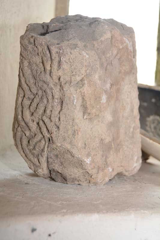
St Wilfrid (Melling) submitted by Anne T on 6th Jun 2015. We turned the stone round very, very carefully to see what the other two sides were like. It has obviously been recut at some point, and the British History Online notes say it was taken out the church wall a few years ago.
(View photo, vote or add a comment)
Log Text: Anglo Saxon Cross, St. Wilfrid's Church, Melling: From seeing the reconstructed cross at Halton, we set off back to Melling, to work our way back towards Levens Park/Sizergh Fell to end the day. Following the A683 back through Hornby, we drove through the village of Melling, with very narrow roads, and with cars and huge trucks trying to pass each other, it was a bit precarious to say the least. The church is on a very narrow section of Main Street, so we ended up parking in Gillison Close, having to turn right just past the church into a road that eventually turns into Lodge Lane. There was no footpath for 200 yards down this small road, which, given the amount of traffic on it, was exciting for pedestrians [note: there are steps up to the church, so disabled access is going to be difficult].
Formerly called St. Peter’s (but I haven’t been able to find out when the dedication changed), this pretty church is Grade 1 listed. The British History Online notes state that the church “stands on the west slope of an elevated plateau, the top of which forms an ancient earthwork known as Castle Mount”. This church looks ancient from outside but deceptively modern inside, apart from the tower. The ADS website was down at the time of writing this, but both Wikipedia and the “A Church Near You” website states that “the earliest fabric in the church dates from around 1300 or earlier ... it is possible that a church has been on the site since the 10th century.”
We found a fragment of Anglo Saxon cross tucked away on a window sill on the west interior wall, alongside a modern ceramic bowl and a piece of medieval grave marker. This short piece of cross shaft has basket-work interlacing which British History Online says was taken out of the churchyard wall a few years ago. Curiously, the on-line records of the Corpus of Anglo Saxon Stone Sculpture has only a one line mention of this stone, saying there are similarities with cross shafts found at Aspatria and Lancaster.
There is apparently a piece of Norman chevron ornament, found below the tower floor, which is now built into the vestry wall, but this was not accessible during our visit.
In the porch there are a couple of medieval grave markers displayed against the east wall. Outside, near the south wall, there is a very tall sundial, which must have been meant to have been read from horseback. It still has it’s (now green) brass plate on the top, but no gnomon. Wikipedia says it probably dates from the 18th century and is Grade II listed.
St Wilfrid's Holy Well
Date Added: 1st Aug 2015
Site Type: Holy Well or Sacred Spring
Country: England (Yorkshire (North))
Visited: Yes on 23rd Jul 2015. My rating: Condition 3 Ambience 3 Access 5
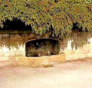
St Wilfrid's Holy Well submitted by Sunny100 on 8th Jun 2010. St Wilfrid's Holy Well at Ripon, N.Yorks. SE.309710.
(View photo, vote or add a comment)
Log Text: St. Wilfrid's Holy Well, Skellgate Road, Ripon: Armed with only a 6 digit grid reference and a GPS device that was rapidly running out of battery, this well took some finding, but in the end we did. St. Wilfrid’s Well is located at the north side of the B6265, some 700 metres west of the city centre, where Skellbank Road becomes Mallorie Park Drive. A few yards east of the well are some steps leading up to Ripon Spa Gardens. The 8 digit grid reference is SE 3085 7102.
The well is located within a stone wall, almost overhung by bushes from the bank above. At the time of our visit there was no water trickling into the well at all. Someone seems to care for it, for there was no litter in or around it.
St Wilfrid is the patron saint of Ripon (the crypt at Ripon Cathedral is purported to be part of his early church, although I’ve yet to verify this). The St Wilfrid’s Day parade takes place on the Saturday before the first Monday of August each year (this year it happens to be 1st August (2015)) in which an actor takes the part of St. Wilfrid. The procession now centres around the Market Square, starting at Studley Road, then Westgate, Market Place West, North Street, North Road, Magdalens Road, Stonebridgegate, Allhallowgate, Market Place East, Kirkgate, Bedern Bank, Bondgate, Southgate, Barefoot Street, Harrogate Road, High Skellgate, Westgate, Blossomgate, Marshall Way, North Street, Market Place East, Kirkgate, ending at Ripon Cathedral.
Worth stopping to look if you are passing by this well.
St Winning's Well (Kirkgunzeon)
Trip No.182 Entry No.1 Date Added: 20th Jul 2022
Site Type: Holy Well or Sacred Spring
Country: Scotland (Dumfries and Galloway)
Visited: Yes on 19th Jul 2022. My rating: Condition 2 Access 4
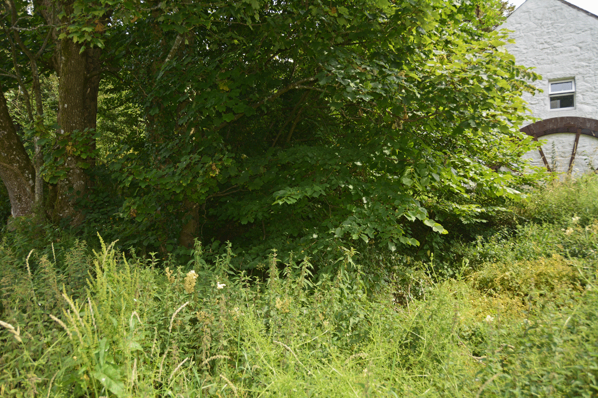
St Winning's Well (Kirkgunzeon) submitted by Anne T on 20th Jul 2022. The stand of trees showing it in context with the small white cottage (now offices) with the rusty remains of a threshing (?) wheel at its end.
(View photo, vote or add a comment)
Log Text: St Winning's Well, Kirkgunzeon: We parked near the telephone kiosk in the village, at about NX 86783 66771, and walked back to the small cross-roads, then north-westwards up the little dead-end lane. A very pretty spot. We had the grid reference of the well, so were looking around, when the owner of the large house round the corner came out to see if we were lost. He also warned us that the person who lived in the cottage at the very end of the lane was very wary of strangers, so helped us find the well. of which he told us there was nothing left. There is a small section of closely mown grass at the end of the white cottage with old threshing (?) wheel at the end, and the stand of trees under which the well is located. We walked up the 10m or so of this path and were able to see into the bowl of what was the well. It was dry at the time of our visit, although some remnants of the stonework forming its crude bowl were visible under the shrubbery. Better, perhaps, to visit in the winter when this has all died down.
St. Cuthbert's Church (Edenhall)
Trip No.68 Entry No.2 Date Added: 6th Apr 2018
Site Type: Ancient Cross
Country: England (Cumbria)
Visited: Yes on 5th Apr 2018. My rating: Condition 3 Ambience 4 Access 5
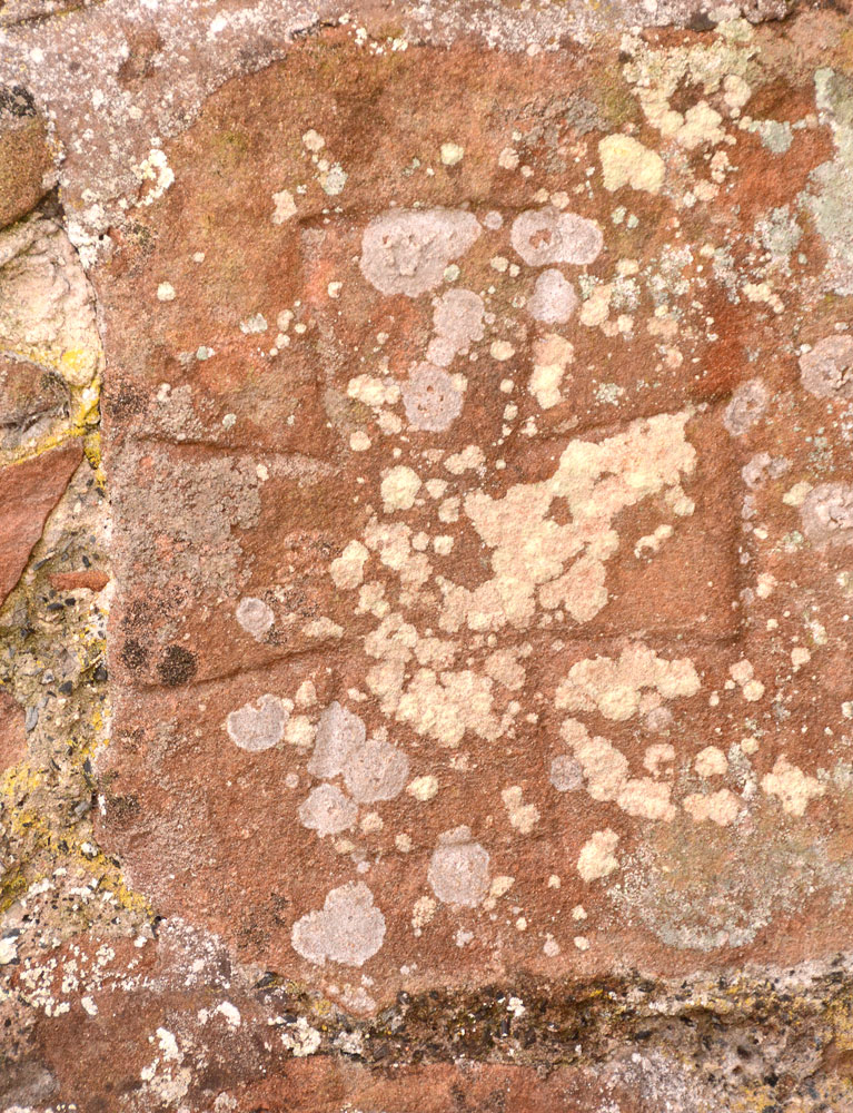
St. Cuthbert's Church (Edenhall) submitted by Anne T on 6th Apr 2018. Close up of the carved Anglo Saxon cross in the exterior north of the wall. Just to its east, and higher up the wall, is a blocked up Anglo Saxon window/window head.
(View photo, vote or add a comment)
Log Text: Anglo Saxon Cross at St. Cuthbert's Church, Edenhall: There is a small car park to the north of the church, and a tall/wide gate with a stile next to it to access the churchyard. This is a pretty, red sandstone building which looks as if it has been extended many times in antiquity.
There was no mention of anything on the Corpus of Anglo Saxon Stone Sculpture, although the church guide book mentions “the chancel appears to be pre-Norman or early Norman origin, and a small blocked up window high up in this wall is of Anglo Saxon type. Moreover, on the same wall, lower down, there is a carved Anglo Saxon cross. Thus the north wall may be the remains of an earlier church.”
The guide also mentions a Mass Dial on the south wall, to the east of the porch. We both spent about 20 mins looking up and down the length of the wall, both east and west of the porch, in strong sunlight which would have brought the markings out, but failed to find this. We did spot what looked like two fragments of carved cross shaft in the south wall of the tower, west of the porch. There was no mention of these in the guide or Pastscape or HE notes.
St. Cuthbert's Well (Farne Islands)
Trip No.30 Entry No.1 Date Added: 14th Jun 2017
Site Type: Holy Well or Sacred Spring
Country: England (Northumberland)
Visited: Yes on 11th Jun 2017. My rating: Condition 2 Ambience 4 Access 3
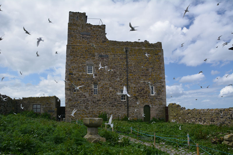
St. Cuthbert's Well (Farne Islands) submitted by Anne T on 14th Jun 2017. The traditional site of St. Cuthbert's well (described as being a fountain of water which emerged from the spring) is believed to be on the ground floor of Prior Castell's Tower. This is my version of the image on the Pastscape record for this site, with Arctic Terns in full flight protecting their chicks. The wardens told me that if you moved their equipment, there is a stone lined chamber with steps leading down, which still contains water.
(View photo, vote or add a comment)
Log Text: St. Cuthbert's Well (site of), Inner Farne: Requires boat trip and short walk from the jetty to see exterior of the building within which it is located. The sea was very calm today, but there were lots of people on the boat – there must have been around 3 to 4 space places. We had a trip around the islands, stopping to see the seals and various colonies of birds in their different nesting places.
Eventually arriving at Inner Farne, the island was full of people with big cameras and enormous lenses, and I felt the ‘poor relation’ with my small lens. The terns were in full flight, protecting their eggs and their chicks.
I took my list of sites with grid references and asked the National Trust Warden who was manning the information point. She said it was not possible to get into the lighthouse compound to look for the cross base, as it was owned by Trinity House and off-limits. She said there was a well in the basement (Pastscape says ground floor) of Prior Castell’s Tower, but as it was used by the wardens for accommodation, the public were not allowed in. She did confirm that there was a door/panel that could be opened, with a few steps leading down to a stone lined chamber containing water, which would be the well.
She also said that they believed what is now called “The Fisherman’s Hut” was the site of St. Cuthbert’s Cell and the place of his death. “There’s a small window where he would watch for people coming to the island, and if he didn’t want to talk to them, wouldn’t open the door.” Pastscape says there is considerable doubt about the position of the cell and there are various theories about its location.
I also had the location for a cross base, but as this was located inside the lighthouse grounds (or on the cliff edge!), this area was out of bounds to tourists.
