Contributory members are able to log private notes and comments about each site
Sites Anne T has logged. View this log as a table or view the most recent logs from everyone
Fontburn a(i)
Date Added: 1st Aug 2015
Site Type: Rock Art
Country: England (Northumberland)
Visited: Yes on 15th Jul 2015. My rating: Condition 3 Ambience 4 Access 3
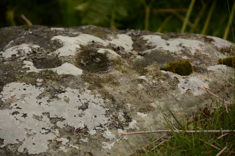
Fontburn a(i) submitted by Anne T on 20th Jul 2015. A close up of some of the cups and weathering marks on the top surface of Fontburn a(i). I counted 6 cups; the rest seemed to be caused by either natural weathering or were heavily eroded cups.
(View photo, vote or add a comment)
Log Text: Fontburn a(i), just off the National Trust Greenleighton Walk, Northumberland: See visit report for Hollinghill Enclosure.
Fontburn a(ii)
Date Added: 1st Aug 2015
Site Type: Rock Art
Country: England (Northumberland)
Visited: Yes on 15th Jul 2015. My rating: Condition 3 Ambience 4 Access 3
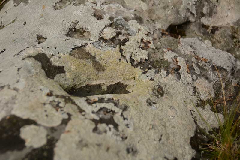
Fontburn a(ii) submitted by Anne T on 20th Jul 2015. There is one large oval shaped cup mark on top of this boulder. The rest of the marks appear to be natural weathering of the sandstone.
(View photo, vote or add a comment)
Log Text: Fontburn a(ii), just off the National Trust Greenleighton Walk, Northumberland: See visit report for Hollinghill Enclosure.
Fontburn a(vii)
Date Added: 1st Aug 2015
Site Type: Rock Art
Country: England (Northumberland)
Visited: Yes on 15th Jul 2015. My rating: Condition 3 Ambience 4 Access 3
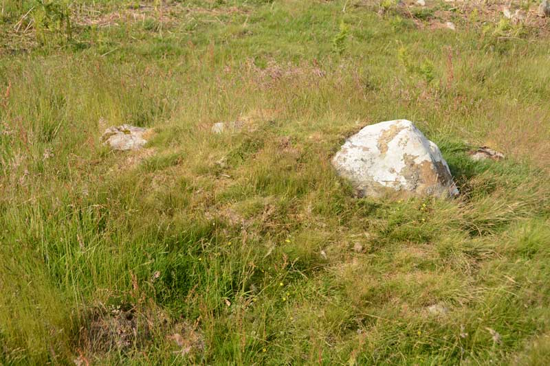
Fontburn a(vii) submitted by Anne T on 20th Jul 2015. Close up of the Fontburn a(vii) boulder, but even now the sun is out, the photo doesn't manage to highlight the two cup marks which are on it. I've posted this so other visitors can identify the right stone.
(View photo, vote or add a comment)
Log Text: Fontburn a(vii), just off the National Trust Greenleighton Walk, Northumberland: See visit report for Hollinghill Enclosure.
Fontburn a(viii)
Date Added: 1st Aug 2015
Site Type: Rock Art
Country: England (Northumberland)
Visited: Yes on 15th Jul 2015. My rating: Condition 3 Ambience 4 Access 3
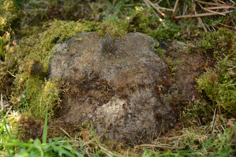
Fontburn a(viii) submitted by Anne T on 20th Jul 2015. This is one good photograph I managed to get of Fontburn a(viii). The ERA-1356 record tells me that the cup mark on the top of the rock is almost certainly artificial, the 'cup' on its lower edge is probably weathering.
(View photo, vote or add a comment)
Log Text: Fontburn a(viii), just off the National Trust Greenleighton Walk, Northumberland: See visit report for Hollinghill Enclosure.
Fallowlees Settlement
Date Added: 1st Aug 2015
Site Type: Ancient Village or Settlement
Country: England (Northumberland)
Visited: Yes on 15th Jul 2015. My rating: Condition 3 Ambience 4 Access 3
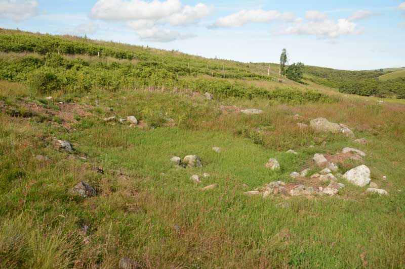
Fallowlees Settlement submitted by Anne T on 20th Jul 2015. This is one of the smaller hut circles, the foundations clearly visible above the turf. Just left of centre within the hut are a mound of stones which we would have liked to have thought of as the hearth.
(View photo, vote or add a comment)
Log Text: Fallowlees Settlement, just off the National Trust Greenleighton Walk, Northumberland: Close to Fontburn a(vi), a(vii) and a(viii). See visit report for Hollinghill Enclosure. From a distance, coming up the quad bike track from Fallowlees Burn, there appear to be standing stones on the slope, but as we got closer, it became apparent these were the foundations of three hut circles, with another disappearing into the plantation to the north. What a lovely site to live in - a sheltered spot with water close by and fertile ground for farming. No wonder our ancestors chose to live here. The boulders with rock art on are just to the south, and appear to be part of cairns. Well worth the walk to see this.
Corbridge Rock Art Panel
Date Added: 24th Jul 2015
Site Type: Rock Art
Country: England (Northumberland)
Visited: Yes on 12th Jul 2015. My rating: Condition 3 Ambience 4 Access 5
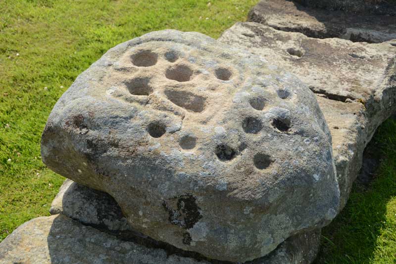
Corbridge Rock Art Panel submitted by Anne T on 13th Jul 2015. Close up of the rock art boulder which sits on the northern side of Stanegate, almost at the eastern end of the Corbridge Roman Fort site.
(View photo, vote or add a comment)
Log Text: Corbridge Rock Art Panel at Corbridge Roman Fort, Northumberland: OK, we've lived in this area for 13 years now, and the nearest we've been to this site is to take my daughter for driving lessons as it was good to practice reversing around corners in the quiet cul-de-sacs around here. Having said that, the Romans generally leave me 'cold' as they as so organised, everything is on a huge, grand scale, and having seen one or two forts, you can generally predict the layout of another. Sceptical? Probably.
However, the purpose of today's visit was to try to find the rock art panel which appears to just have been 'dumped' within the site; no-one seems sure where it comes from, apart from nearby somewhere.
The fort sits on level ground on top of a slope on the north side of the River Tyne, and as there is an old Roman bridge down by the river, this must have been a good place to cross in times gone by.
The staff at the kiosk knew nothing about the stone, until I called up an entry on the Modern Antiquarian (sorry, Portal) to show them, then the lady told me it was mentioned in the guided walks, and told me it was on the north side of the roman road (Stanegate) running through the site. After this, it was easy to find, almost at the far side of the site.
In the distance, across the fields, the church of St. Andrew's in Corbridge, with its anglo-saxon fragments, can be clearly seen.
I did find the strong room, with its set of narrow steps leading down into it, quite fascinating.
Hadrian's Wall (Coria)
Date Added: 3rd Aug 2019
Site Type: Stone Fort or Dun
Country: England (Northumberland)
Visited: Yes on 12th Jul 2015. My rating: Condition 3 Ambience 4 Access 5

Hadrian's Wall (Coria) submitted by Anne T on 3rd Aug 2019. Some of the granary structures in the north western part of the site.
(View photo, vote or add a comment)
Log Text: Corbridge Roman Site: Having lived near here for over 10 years, we'd never visited. We came primarily to see the Corbridge Rock Art panel, but were equally as interested in the well preserved remains of this small fort/town, with great views over to modern-day Corbridge and the Tyne Valley.
Wallington Hall Standing Stone
Date Added: 24th Jul 2015
Site Type: Standing Stone (Menhir)
Country: England (Northumberland)
Visited: Yes on 1st Jul 2015. My rating: Condition 3 Ambience 4 Access 4
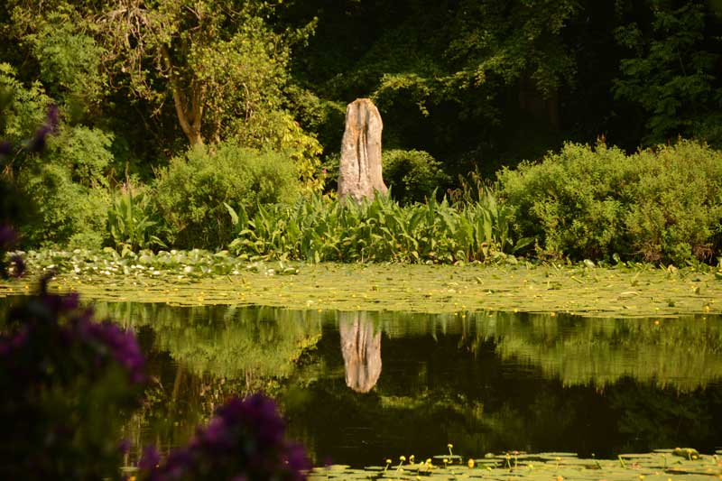
Wallington Hall Standing Stone submitted by Anne T on 6th Jul 2015. The first view of the Wallington Hall Standing Stone from the footpath. The stone sits on the south eastern side of the pond and is easily accessible by paths leading around the pond.
(View photo, vote or add a comment)
Log Text: Wallington Hall Standing Stone, Northumberland: Having been treated to National Trust membership for my birthday, we then sat and wondered how best to make use of this. We'd heard that there was a standing stone at Wallington Hall, but had never found it before. Having tracked down the location (around the China Pond (used to be called the Chinese Pond)), and absolutely loving their walled garden, which is absolutely breathtaking at this time of year, we set up on a Menhir Hunt.
Note to new visitors to Wallington: whereas you could park in the car park near the house then go to the hut to pay admittance, staff are on the entrance to the car park to take entrance money on the way in. I had my cards in the boot of the car, which didn't make me popular with the queue behind, but the less said about that, the better).
This stone, which is said to be the pair to the stone at the Poind and His Man, sits at the far side of the China Pond having been moved here by the famous Mr. Blackett who has built many structures and follys in and around Northumberland. Walking from the house and crossing the busy road to the forest walks, the China Pond is signposted, and it is less than a five minute walk. It certainly sits in a beautiful spot, although I was a little saddened to see it sitting on a concrete/stone base, having been propped up by bits of slates and other stones.
Whilst taking photographs, a couple stopped to watch, saying to each other "they're taking photographs for that Countryfile competition". We assured them we weren't. They were on the look-out for red squirrels, and listened politely when I explained about the standing stone.
Carrying on to the walled garden, I was stunned at the amount of work which goes into keeping this place immaculate. Whilst sipping hot tea at the cafe in the walled garden, the skies got very dark and we were treated to some some spectacular lightening on the way back. Shame the trees blocked the view of the lightening from the standing stone - that would have made a good photo.
The Yarrow Stone
Date Added: 29th Jun 2015
Site Type: Standing Stone (Menhir)
Country: Scotland (Scottish Borders)
Visited: Yes on 27th Jun 2015. My rating: Condition 3 Ambience 4 Access 4
The Yarrow Stone submitted by mafenty on 28th Mar 2007. The Yarrow Stone
(View photo, vote or add a comment)
Log Text: The Yarrow Stone, Yarrow, Scottish Borders: From Selkirk, we took the A708 towards St Mary’s Loch and Moffat. There was a diversion coming out of Selkirk, due to roadworks, so we had to double back to get onto the A708. Passing through the hamlet of Yarrowford, the road runs by Yarrow Water to the left hand side – a very pleasant, fertile valley. Reaching Yarrow, the kirk was signposted to the right hand side of the road, and a small grass-crete area in the centre of a triangle of roads made it possible to stop and get our bearings. Continuing westwards along the A708, we kept our eyes peeled for standing stones which, according to the Canmore notes, were visible from the road, but didn’t see anything. We reached the hamlet of Yarrow Feus before turning back and retracing our steps towards Yarrow.
We found the signpost for Whitefield (a farm) easily enough on the left hand side of the road, and there was a small layby big enough for two cars to park by the side of the A708. From here, a track led up to a gate into a field, where the Yarrow Stone was visible surrounded by a wooden fence to protect it from stock (there were none in the field at the time of our visit). The grid reference was spot on (thank you!) and it was an easy, short walk up the stony track.
There is a small plaque which reads: “The Yarrow Stone. This inscribed stone records the grave of two Christian British princes who lived during the 5th or 6th century AD. It was uncovered around 1803, when up to twenty large stone cairns were removed from a former moor, known as Annan Street, to create arable fields. The inscription is in Latin and can be read as: (+) HIC MEMORIA PE(RP)ETV(A) {I}N LOCO INSIGNISIMI PRINCI PES NVDI DVMNOGENI HIC IACENT IN TVMVLO DVO FILI LIBARALI{S} which translated means “this is the everlasting memorial. In this place lie the most famous princes Nudoss and Dumnogenos. In this tomb lie the two sons of Liberalis.” After the end of Roman Britain, in the 5th century AD, much of the Southern Uplands became part of the British Kingdom of Strathclyde. St. Ninian was the force behind Christian Missionary work in the region, which sought to convert the population through its leaders. This site may already have been a place of ceremonial importance in prehistoric times, but the Yarrow Stone and other burials in stone lined graves (cists) suggest that it was also valued by early Christians.”
From here it was a short hop to find the Warrior’s Rest standing stone.
Warrior's Rest
Date Added: 29th Jun 2015
Site Type: Standing Stone (Menhir)
Country: Scotland (Scottish Borders)
Visited: Yes on 27th Jun 2015. My rating: Condition 3 Ambience 4 Access 4
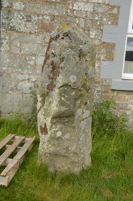
Warrior's Rest submitted by Anne T on 29th Jun 2015. A close up of the Warrior's Rest east face, but no cup marks that I can see. I wonder if the report of these cups got muddled with the Glebe Stone, just down the road, as I could see two cups on its eastern face.
(View photo, vote or add a comment)
Log Text: Warrior Stone, Yarrow, Scottish Borders: The Canmore Site (no. 53054) notes say that this stone is “at the south east corner of the cottage known as Warrior’s Rest, 300 yards west of Yarrow Church, there is a standing stone measuring 5ft 3ins in height, 5ft 9ins round the base and 4ft around the shoulder. The top is pointed.”
As the crow flies, it is just over 700 metres east of the Yarrow Stone, back towards Yarrow village. We spotted the small white signpost to Warrior’s Rest cottage at the left hand side of the road and stopped at the entrance. We couldn’t see any standing stone in the vicinity at all, even climbing the steps to the nearby war memorial just to the west of the cottage to see if we could spot anything. In the end, I walked up the track towards the cottage and spotted what appeared to be the top of a small standing stone peeking out above one of the two cars parked on the driveway.
Having come all this way, I was disappointed not to be able to see the stone, so decided to walk up and knock on the door. The curtains were drawn and the door to the garage was open, but despite knocking and calling out, I got no response, so decided to be cheeky and take a couple of photographs (and if anyone came, I’d explain). The stone literally stand a couple of feet away from the front bedroom window – whether its still in its original place and the cottage was built next to it, or the stone has been relocated next to the cottage was difficult to tell.
The Canmore notes also say there are two, previously unreported, cup marks on the eastern side of the stone, although I did quickly examine the stone for any cup marks, but didn’t see any. Usually my camera can pick up on things the eye finds difficult to differentiate at the time, but examining the photos this morning, I couldn’t see anything. I wonder now, at the time of writing, if this has been confused with the Glebe Stone, as I did see two cup marks on the eastern face of this stone.
Glebe Stone
Date Added: 29th Jun 2015
Site Type: Standing Stone (Menhir)
Country: Scotland (Scottish Borders)
Visited: Yes on 27th Jun 2015. My rating: Condition 3 Ambience 4 Access 4
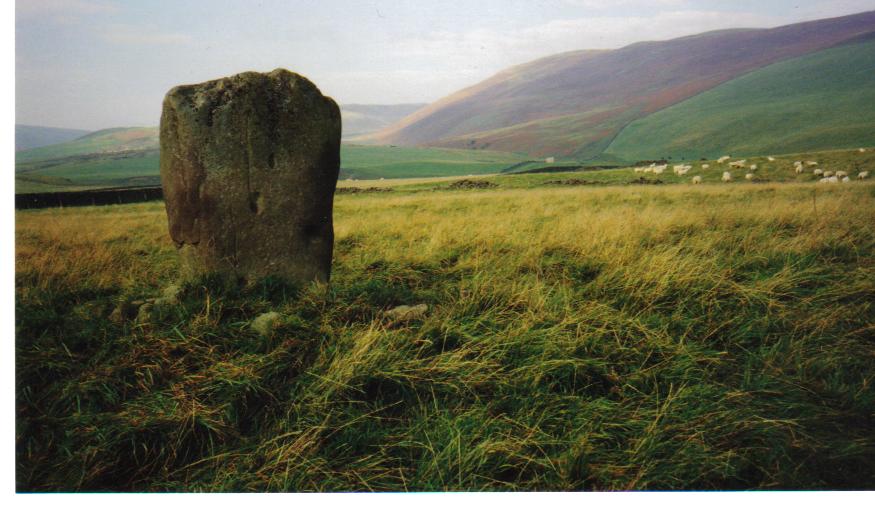
Glebe Stone submitted by mafenty on 6th Feb 2007. The Glebe Stone looking to the west.
(View photo, vote or add a comment)
Log Text: The Glebe Stone, Yarrow, Scottish Borders: parked at NT 35172 27575
Driving back westwards from Warrior’s Rest standing stone, we immediately spotted the Glebe Stone in a field to the north of the road – how had we missed it the first time? With granddaughter’s pushchair in tow, we didn’t dare walk down this narrow, busy, country road, so we parked in the gateway to a barn at grid reference NT 35172 27575. Just as husband got out of the car to see how to access the field, a girl and her dog drove past the car to the barn behind on a quad bike, so I hopped out to explain what we were doing. “No, you’re very welcome to look. There’s a gate a 100 yards or so down the field”, she told me.
This stone, the Canmore Site no. 53061 notes tell me, sits 530 yards ENE of the Yarrow Stone and sits 40 yards north of the main road. These notes say “the stone has been fenced in (although the fence is not now in place) and measures 4ft 6ins in height, from 2ft 7 ins to 3ft 10ins in width and 1ft 4ins in thickness. The broader sides face WNW and ESE. On the latter side, near the base, there are two doubtful cup marks, one measuring 3ins in diameter and ½ inch deep, another 4ins by 5ins and 2 and ½ ins deep. Around the stone there was formerly a large cairn covering a quantity of decomposed bones.”
It was an easy walk up a shallow grassy slope to the stone, and I went all around taking photographs. There is a pleasant view over to Yarrow Water (this stone sits closest of the three stones close together – this stone, the Yarrow Stone & Warrior’s Rest stones) just the other side of the road.
I definitely saw some cup marks on the eastern face of the stone – photographs here to see what others think.
From here, it was back into Selkirk and onto Melrose to see the Abbey before going onto the Kelpies at Falkirk. A great day out!
Great Urswick Cross
Date Added: 25th Jun 2015
Site Type: Ancient Cross
Country: England (Cumbria)
Visited: Yes on 23rd Jun 2015. My rating: Condition 3 Ambience 4 Access 5
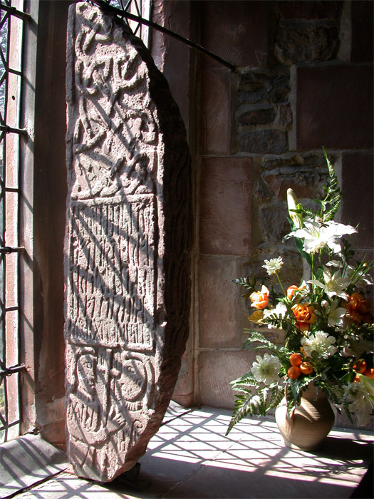
Great Urswick Cross submitted by nicoladidsbury on 5th May 2005. Ancient Cross at St Mary and Michael's Church, Great Urswick.
The stone was found on the site by a turn-of-the-century vicar and was investigated on the site by the respected historian WG Collingwood, and may possibly describe a meeting between two important church leaders, and church rune stone holds the key to a 1600 year-old story that reveals the origins of Christianity in Britain.
(View photo, vote or add a comment)
Log Text: Great Urswick/The Tunwini Cross, Great Urswick, Cumbria: Turning right off the A590 just south of Ulverston/Swarthmoor, along a road signposted only to ‘Urswick’, we headed off on narrow little lanes, just as the sun broke through the clouds. The village of Great Urswick is built round two sides of Urswick Tarn. The church can be found on the left/western side of the tarn, almost at the southern end of the village. A small car park allows visitors to draw up to the gate, where a footpath and stile runs off through the churchyard around the southern side of the tarn. Whilst the church itself is surrounded by trees, walking past the church to the southern boundary of the churchyard gives superb views over to Birkrigg Common.
Inside the church was pretty spooky, as the darkness seemed to suck all the light out. We found the light switches but none worked (must have been on a timer or master switch), so we were left to look around by the light of the few lamps that had been left on at the west end of the church.
Entering the church through the south porch, the Great Urswick/Tunwini Cross is on the first window sill on the south aisle, and is impressive in size. The church guide makes reference to two crosses; we were unable to find another fragment, although there was a drawing of another Viking cross with a knot design on the wall behind the font. The Furness Blog Spot, which I found this morning, tells me that this fragment is not on display in the church, but then doesn’t say where it is housed.
Going through the door to the belfry, we were immediately struck by the thickness of the walls, which was apparently a pele tower used to protect inhabitants and animals in time of war/marauders. In the chancel there are also some fantastic choir stall end carvings, all with cherubs playing different musical instruments.
At the entrance to the south porch there are clear marks on the eastern side where arrows have been sharpened, together with the remains of an old cow chain (the vicar used to apparently have grazing rights in the churchyard, although sheep are kept there now) and the barely visible remains of a mass hour dial on the western side of the porch.
Great Urswick Burial Chamber
Date Added: 26th Jun 2015
Site Type: Burial Chamber or Dolmen
Country: England (Cumbria)
Visited: Yes on 23rd Jun 2015. My rating: Condition 2 Ambience 3 Access 4
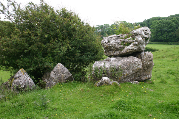
Great Urswick Burial Chamber submitted by ocifant on 26th Jun 2005. Looking south to the road.
(View photo, vote or add a comment)
Log Text: Great Urswick Burial Chamber, Cumbria: There is not much on the web about this site, and nothing (apart from a finger post in the vicinity) on ADS, apart from the fact this site is ‘ruined’ and ‘possibly Bronze age’. Parking on these narrow lanes was dreadful and were also very busy with traffic, so going round a bend you were likely to come bumper to bumper with a vehicle going the other way. When we finally found a grass verge with room for one car there was a large truck and a horse and rider stopped to natter to each other, so we drove around again – it would have been easier to walk from the village (also avoiding the bull in the field - see later).
The first part of the footpath across the meadows from Middle Barrow Lane was easy enough. There was a tumble-down stile, built up by a mound of stones on the far side (at grid reference SD 26018 7483). We then lost the footpath and ended up going through various fields towards the village.
We found a lone gate post sitting in a dip between two small hills. I thought at first it was a standing stone, but it had the remains of a hook embedded in it. Carrying on towards Great Urswick, there is a hill rising to the left hand side with limestone pavement on top. Walking up the slope the chamber comes into view, although I wasn’t convinced at first. The chamber lies within the context of surrounding limestone pavement, on a slope and largely consists of a few larger stones piled on top of each other with a gap between smaller stones lower down the slope. The whole chamber is mostly covered by large hawthorn bushes. I had to call up the photograph on the Portal to make sure we were looking at the right thing!
Walking back to the car, the footpath was clearly visible from this side, walking north westwards along the top of the hill. However, we were stopped dead in our tracks by a very large tan and white bull which splayed its front legs and stared us out. We turned quietly round and went back down into the shallow valley to follow the way we’d come. We found the footpath signs easily on the way back. There was an iron kissing gate in the hedge to our left hand side, followed by a short but steep climb into the field with the bull. Thereafter an easy walk to the burial chamber.
Druids Temple (Cumbria)
Date Added: 23rd Jul 2017
Site Type: Stone Circle
Country: England (Cumbria)
Visited: Yes on 23rd Jun 2015. My rating: Condition 3 Ambience 4 Access 5
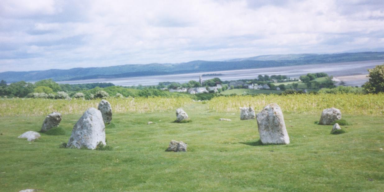
Druids Temple (Cumbria) submitted by Sentinel on 9th Jan 2003. Near Ulverston, Cumbria
overlooking Morecombe Bay.
(View photo, vote or add a comment)
Log Text: Druid's Temple Stone Circle, Cumbria: OK, so we got sidetracked by the splended Furness Abbey, but we then retraced our steps to Great Urswick, skirting round the north side of Urswick Tarn, up and out onto Birkrigg Common. Following the yellow ‘dotted’ road over the common, past Sunbrick Farm, we suddenly came upon the most tremendous views over Morecambe Bay. What a place!
Being a beautiful sunny evening, there were many people about. It felt strange to be in such an ancient spot with a van nearby blasting out music from its radio, runners coming through almost the centre of the circle, and dog walkers continually passing.
Again, the stone circle sits within a landscape of limestone pavement, which confused my attempts to find out if the circle originally had an outer ring. We counted 12 stones in the inner ring, two only just poking out above the grass, with 10 visible upright stones, although I get the impression some of these might have been re-erected for effect. The circle itself certainly looked as if it had a shallow bank around it and a possible ditch between this and what might have been a very broken outer ring.
There is plenty of parking on the hard verges nearby, and stunning walks on grassy paths cut through the longer grass to make it easier for walkers and runners. A little disappointing there were so many others around, but worth the trip.
Jarrow
Date Added: 22nd Jun 2015
Site Type: Ancient Cross
Country: England (Tyne and Wear)
Visited: Yes on 10th Jun 2015. My rating: Condition 3 Ambience 4 Access 5
Jarrow submitted by Thorgrim on 25th Oct 2004. Cross fragments
(View photo, vote or add a comment)
Log Text: Anglo Saxon Fragments, St Paul's Church and St Bede's Monastery, Jarrow: We parked at Bede’s World (a couple of hundred yards away from the church and the monastery) and having decided to start off at St Paul’s Church, we followed (or tried to follow) the signs, which took us across the busy main road to another car park. All the paths seemed to lead into the middle of no-where. After 10 minutes wandering around in circles with granddaughter in pushchair, I finally went inside to ask. The girls at the Bede’s World reception had to go and ask. “It’s straight through the park”, they told me. All the posters up in the reception area said the church was open until 15:30 so we thought we had plenty of time.
Not being able to get the pushchair down the ramp into the park (too overgrown) we followed the pavement along the main road down to the church, where we had to manoeuvre round tree cutters to follow the path up to the west porch. We were greeted by the ruins of St Bede’s Monastery on our right hand side – such an ancient building incongruously topped by modern pylons rising up behind.
It turned out the church was only open until 3pm so we only had 10 minutes to go in, wander round, take photographs and try and appreciate the history of what we were seeing. A volunteer came up to us and I waved the Corpus of Anglo Saxon stone sculpture pages that I’d printed off and explained I was on a ‘treasure hunt for Anglo Saxon cross pieces’. Instead, we got drawn into the old monastery chapel for a guided tour. The rest of the church seems, and feels, pretty ordinary, but this old chapel, dating from AD681 with its dedication plaque above the entry arch, was very moody and special. The lady pointed out the two pieces of original Anglo-Saxon glass in the south windows.
It also turns out that the fragments are now in display cases, rather than being displayed in the porches, which made them incredibly difficult to photograph, as the light coming through the church windows reflected in the glass, as did the flash when I tried to use it. By this point, they were turning the lights off in the church to go home, although they very kindly let us stay an extra 10 minutes so I could photograph some of the artefacts. Definitely a second trip needed when there’s more time to wander round the old church and the ruins of the monastery outside.
St Wilfrid (Melling)
Date Added: 18th Jun 2015
Site Type: Ancient Cross
Country: England (Lancashire)
Visited: Yes on 6th Jun 2015. My rating: Condition 3 Ambience 3 Access 4
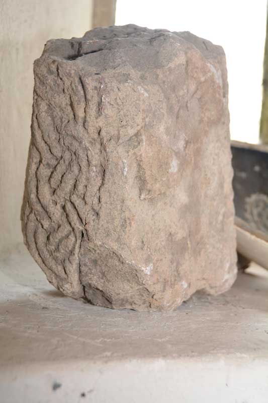
St Wilfrid (Melling) submitted by Anne T on 6th Jun 2015. We turned the stone round very, very carefully to see what the other two sides were like. It has obviously been recut at some point, and the British History Online notes say it was taken out the church wall a few years ago.
(View photo, vote or add a comment)
Log Text: Anglo Saxon Cross, St. Wilfrid's Church, Melling: From seeing the reconstructed cross at Halton, we set off back to Melling, to work our way back towards Levens Park/Sizergh Fell to end the day. Following the A683 back through Hornby, we drove through the village of Melling, with very narrow roads, and with cars and huge trucks trying to pass each other, it was a bit precarious to say the least. The church is on a very narrow section of Main Street, so we ended up parking in Gillison Close, having to turn right just past the church into a road that eventually turns into Lodge Lane. There was no footpath for 200 yards down this small road, which, given the amount of traffic on it, was exciting for pedestrians [note: there are steps up to the church, so disabled access is going to be difficult].
Formerly called St. Peter’s (but I haven’t been able to find out when the dedication changed), this pretty church is Grade 1 listed. The British History Online notes state that the church “stands on the west slope of an elevated plateau, the top of which forms an ancient earthwork known as Castle Mount”. This church looks ancient from outside but deceptively modern inside, apart from the tower. The ADS website was down at the time of writing this, but both Wikipedia and the “A Church Near You” website states that “the earliest fabric in the church dates from around 1300 or earlier ... it is possible that a church has been on the site since the 10th century.”
We found a fragment of Anglo Saxon cross tucked away on a window sill on the west interior wall, alongside a modern ceramic bowl and a piece of medieval grave marker. This short piece of cross shaft has basket-work interlacing which British History Online says was taken out of the churchyard wall a few years ago. Curiously, the on-line records of the Corpus of Anglo Saxon Stone Sculpture has only a one line mention of this stone, saying there are similarities with cross shafts found at Aspatria and Lancaster.
There is apparently a piece of Norman chevron ornament, found below the tower floor, which is now built into the vestry wall, but this was not accessible during our visit.
In the porch there are a couple of medieval grave markers displayed against the east wall. Outside, near the south wall, there is a very tall sundial, which must have been meant to have been read from horseback. It still has it’s (now green) brass plate on the top, but no gnomon. Wikipedia says it probably dates from the 18th century and is Grade II listed.
St John the Evangelist (Gressingham)
Date Added: 6th Jun 2015
Site Type: Ancient Cross
Country: England (Lancashire)
Visited: Yes on 4th Jun 2015. My rating: Condition 3 Ambience 4 Access 5
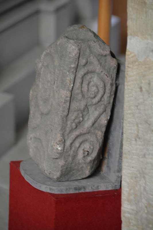
St John the Evangelist (Gressingham) submitted by Anne T on 6th Jun 2015. A photograph showing the side of the cross fragment inside the church. As it was securely fastened to the wall, I was unable to turn it round to photograph the reverse side.
(View photo, vote or add a comment)
Log Text: 9th Century Anglo Saxon Cross Fragments, St John The Evangelist, Gressingham: Having decided upon a day out in Lancashire/Cumbria on an Anglo Saxon Cross hunt, this was our stop of the day. We approached from junction 35 of the M6, taking the B6254 through Over Kellet and taking a right hand turn, named Fall Kirk, down to Gressingham. This is a pretty little village with the church on the junction of Fall Kirk and Back Lane, sited on a hill next to a small stream which joins the River Lune to the south. Not having phoned through before visiting, we were delighted to find the church open, with a lovely Norman arch over the entrance door on the south wall. But whilst it was warm and sunny outside, this Grade 1 listed church was cold inside.
Whilst the Pastscape and Wikipedia notes talk about more than one fragment of 9th cross inside the church, we could only spot one, despite a thorough hunt by both of us. This was strapped into the north-east corner of the nave, just before a large tomb for George Marton, so I was unable to turn it round to photograph the reverse side. The 9th cross shaft built into the external south-west corner of the nave was easy to spot, with the sunlight picking out the decoration nicely [note: having reviewed the Pastscape notes, another fragment might be inside the vestry, which we didn't check].
There was a pulpit of dark wood dated 1714 on the south side of the church, and retained some of the original box pews. There was also a tapestry on hessian against the south wall, opposite the chest tomb and the stone fragment which caught my imagination – someone has put a lot of hard work into this.
St Margaret (Hornby)
Date Added: 6th Jun 2015
Site Type: Ancient Cross
Country: England (Lancashire)
Visited: Yes on 4th Jun 2015. My rating: Condition 3 Ambience 4 Access 5

St Margaret (Hornby) submitted by Anne T on 6th Jun 2015. The smaller fragment contains chevron patterns on its upper part and some form of scroll work on its lower section.
(View photo, vote or add a comment)
Log Text: Anglo Saxon Cross Fragments, St. Margaret's Church, Hornby: From Gressingham, we continued east along the twisty-turny Back Lane, over the narrow bridge over the River Lune, to its junction with the A683. Turning right, we were almost immediately in Hornby. St. Margaret’s sits on the left hand side of the road, before the main road takes a right hand turn. There is ample parking on the right hand side of the road opposite the church which is distinctive with its octagonal tower.
Opening the gate from Main Street, you fall into the porch of the church, which is very dark. Inside, the church appears very modern and (to me) without personality, although there is evidence of much older structures such as the traces of old roof lines in the interior west wall; Pastscape records it as having building having started in 1514, with the nave being rebuilt in 1817 with clerestorey being added in 1889.
There was no church guide, just one board with an A4 sheet of notes. This told us that: “Under the tower are two fragments of 9th century crosses, one showing the five loaves and two fishes; this is unique in England, though there are two in Ireland. They both came from the Priory ...”, although the Pastscape record says they are 8th to 9th century and that both fragments had been reused in a 19th century barn wall at Priory Farm before coming to the St. Margaret’s. The church notes continued: “The churchyard contains a huge cross base, which may be pre-Conquest or Norman. The original cross could have been twelve feet high. Its presence is something of a mystery.”
The Anglo Saxon Cross Fragment with the carving of the five loaves and two fishes was impressive, and definitely worth stopping to see. Alongside it, to the right, was a much smaller fragment with chevrons.
The churchyard is beautifully kept, with well mown grass and shrubs being clipped into amazing shapes and kept low to the ground. The cross base is huge in comparison to others that I’ve seen – I had to climb on top of a stone to photograph the top, which has a slot for a cross to go into on top.
Halton St Wilfrid's Churchyard
Date Added: 6th Jun 2015
Site Type: Ancient Cross
Country: England (Lancashire)
Visited: Yes on 4th Jun 2015. My rating: Condition 3 Ambience 3 Access 5
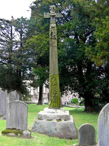
Halton St Wilfrid's Churchyard submitted by LivingRocks on 18th Apr 2005. The partially restored high cross in St Wilfrid's Churchyard.
(View photo, vote or add a comment)
Log Text: Ancient Cross, St. Wilfrid's, Halton: From St. Margaret’s in Horby, we followed the busy A683, turning off onto the road to Halton just south of Caton. Although only a side road, this road seemed busier than the main road.
This must be one of the most dangerous sites I’ve visited. The church is located on a bend on this busy, busy road and the gate into the church is less than a foot from the edge of the road with no pavement, and it’s quite stiff to open – nearly got run over trying to get into the church and had to be very careful exiting, as you couldn’t see what was coming round the bend to the right.
The church looks more like a house with a stone tower, and unfortunately was locked, which was a shame, because the Pastscape record tells us there are pieces of 5 Anglo Saxon stones built into the interior of the tower.
According to the Pastscape record 41153, the pre-Norman cross (restored in 1890) tells the story of the Sigurd legend (which I’ll need to find out about), although to my eye not all the pieces matched and must be several crosses amalgamated together. A bit of a disappointment really.
St John the Baptist (Tunstall)
Date Added: 7th Jun 2015
Site Type: Early Christian Sculptured Stone
Country: England (Lancashire)
Visited: Yes on 4th Jun 2015. My rating: Condition 3 Ambience 3 Access 5
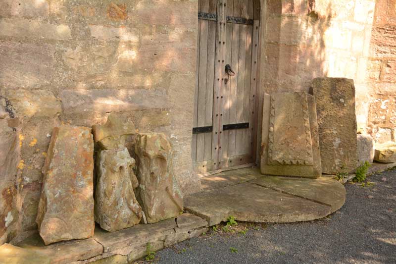
St John the Baptist (Tunstall) submitted by Anne T on 7th Jun 2015. We searched and searched for the Roman altar, but couldn't find it. Outside the west door, there is a display of architectural stones, including medieval grave markers and what looked like a very worn Anglo Saxon Cross Head/Finial.
(View photo, vote or add a comment)
Log Text: Votive Stone, St. John The Baptist, Tunstall: Driving from St. Wilfrid’s, Melling, we continued north along the A683. Just mile or so along the road, the A683 becomes a ‘minor road’ splitting off to the left, whilst the main carriageway continues as the A687. Following the A683 into Tunstall village, Church Lane is the last turn to the right hand side, almost at the end of the village. This road disappears into green fields with a few large houses along the way. After about 600 metres, the church appears to your left hand side, with parking places outside the entry stile. This is a glorious country setting with a beautifully looked after churchyard.
The ADS web site was down at the time of writing, but the British History Online notes are really helpful, telling me that this church, now named St. John The Baptist, used to be dedicated to St. Michael, and is largely of “15th century date .... there are some remains, however, of a 13th century structure, fragments of which have been used in the rebuilding”.
The church guide was £5, so we didn’t buy it, but quickly looked through it to find it mentioned a Roman altar as well as the votive stone, but no clues as to the whereabouts of either - I had to use my phone to find out where the votive stone was; we found no suggestion of the Roman altar, although there was a display of architectural pieces and medieval grave markers by the west door which included what looked like a very worn Anglo Saxon cross head.
To assist future visitors, the votive stone is on the eastern-most of the three windows (nearest to the organ), on the left hand side of the window surround. Curiously, it has been placed on its side.
At the east end of the south aisle there is a small chapel which contains a much broken effigy, said to be of Sir Thomas Tunstall. There is also an ancient chest just outside the south chapel and outside a sundial shaft which stands on three octagonal steps.
