Contributory members are able to log private notes and comments about each site
Sites Anne T has logged. View this log as a table or view the most recent logs from everyone
Three Boys
Trip No.135 Entry No.16 Date Added: 1st Aug 2019
Site Type: Standing Stone (Menhir)
Country: England (Devon)
Visited: Yes on 16th May 2019. My rating: Condition 3 Ambience 2 Access 3
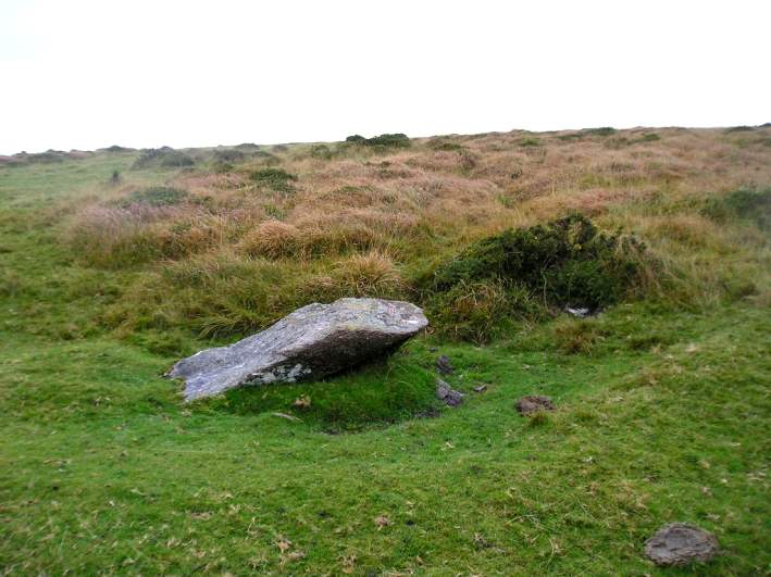
Three Boys submitted by thecaptain on 15th Oct 2004. Nearly 2 metres long, this fairly large, almost fallen stone was probably once a blocking stone at the southern end of Shovel Down row 6.
Viewed looking northwest with a row 6 stone under the gorsebush
(View photo, vote or add a comment)
Log Text: Three Boys: This was our last stop of the three days, and a lot of a let-down as someone had very recently used this stone as a toilet and left a great deal of white toilet paper around it. Yeuk! I think Gordon and/or Dave may have reported this to the authorities to clear up.
After this, we walked steadily back to the car park, took a few final photographs of the group altogether, using Janet and Gordon’s camera on my tripod on a timed setting. Then Andy, Dave, Andrew and myself headed back to Princetown to look inside the Visitor Centre.
Drizzlecombe menhir 1
Trip No.134 Entry No.5 Date Added: 2nd Aug 2019
Site Type: Standing Stone (Menhir)
Country: England (Devon)
Visited: Yes on 15th May 2019. My rating: Condition 3 Ambience 4 Access 3

Drizzlecombe menhir 1 submitted by thecaptain on 1st Feb 2008. Drizzlecombe menhir 1 viewed from the southwest, with the row running away to the left.
(View photo, vote or add a comment)
Log Text: Drizzlecombe Menhir 1: I counted this pillar stone as part of the stone row, although Prehistoric Dartmoor Walks and Pastscape record it separately. I have switched some of my photographs over to this site page. Beautiful stone, and lovely location.
Drizzlecombe menhir 2
Trip No.134 Entry No.7 Date Added: 2nd Aug 2019
Site Type: Standing Stone (Menhir)
Country: England (Devon)
Visited: Yes on 15th May 2019. My rating: Condition 3 Ambience 4 Access 3
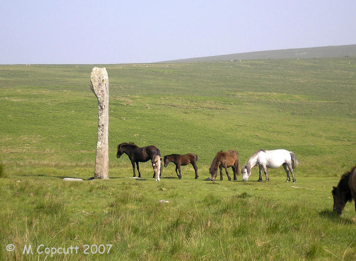
Drizzlecombe menhir 2 submitted by TheCaptain on 13th Jun 2007. This magnificent menhir at the downhill end of row 2 (or C) at Drizzlecombe is the largest on Dartmoor, and said to be "by far the finest in the west of England".
I wouldnt argue with that.
(View photo, vote or add a comment)
Log Text: Drizzlecombe Menhir 2: I took this to be an integral part of Drizzlecombe Stone Row 2, so have moved a couple of my photos over to this site page.
Drizzlecombe menhir 3
Trip No.134 Entry No.10 Date Added: 2nd Aug 2019
Site Type: Standing Stone (Menhir)
Country: England (Devon)
Visited: Yes on 15th May 2019. My rating: Condition 3 Ambience 4 Access 3
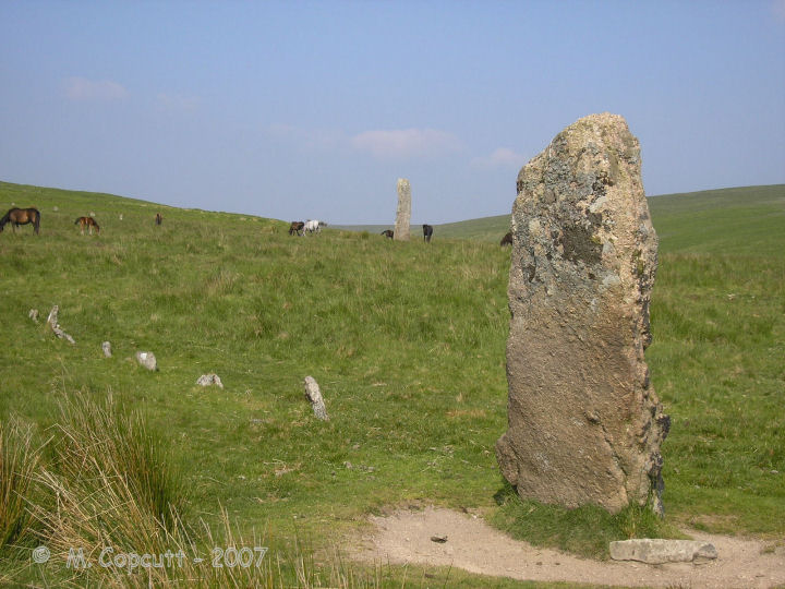
Drizzlecombe menhir 3 submitted by thecaptain on 15th Feb 2008. Drizzlecombe menhir 3 seen from the west.
Many of the stones of row 3 can be seen running away from this terminal longstone to the left.
In the background is the glorious menhir 2.
(View photo, vote or add a comment)
Log Text: Drizzlecombe Menhir 3: Again, I took this to be an integral part of Drizzlecombe Stone Row 3, so I've swapped some of my photos to this site page. I've duplicated the trip/order number with row 3 to match my walk/photo journal.
Beetor Cross
Trip No.129 Entry No.3 Date Added: 22nd May 2019
Site Type: Ancient Cross
Country: England (Devon)
Visited: Yes on 10th May 2019. My rating: Condition 3 Ambience 3 Access 5
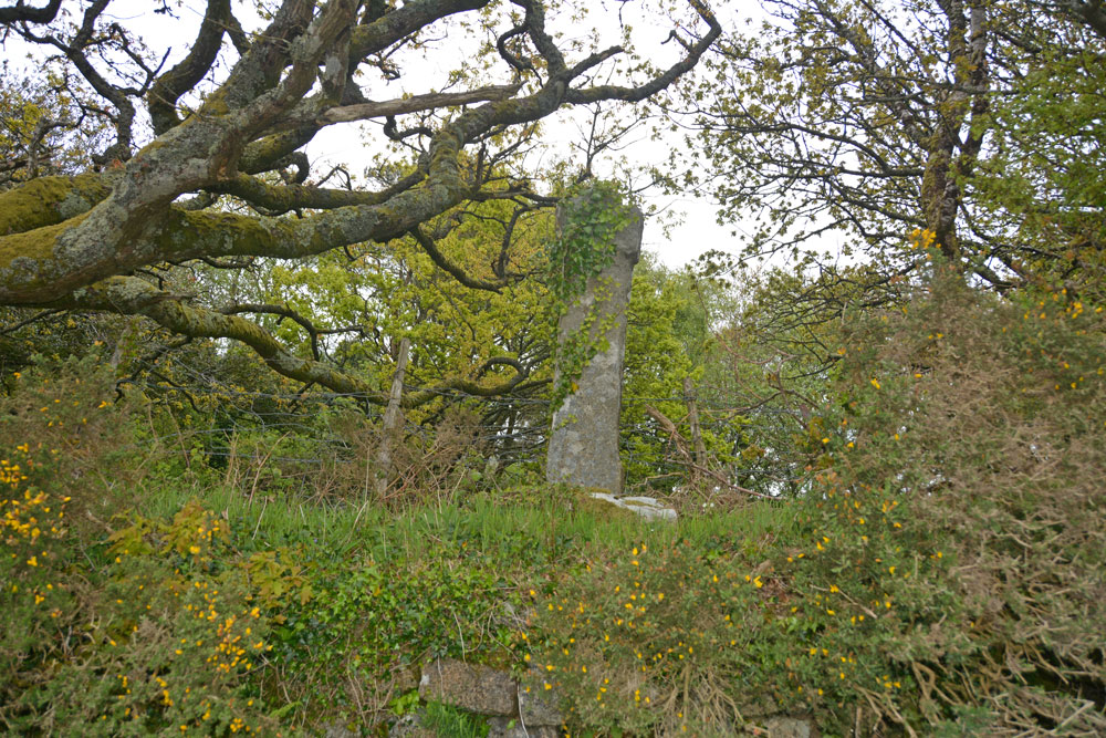
Beetor Cross submitted by Anne T on 22nd May 2019. Getting closer, this cross with its very narrow head and arms rises high out of the bank above you. Historic England says: "The primitive style of this cross, with its short head and arms, makes it a candidate for being a Christianised prehistoric standing stone".
(View photo, vote or add a comment)
Log Text: Beetor Wayside Cross, North Bovey: Our first trip out on the evening we arrived in Devon and having unpacked our things at the barn. This cross was less than a mile from the barn we were staying in.
I was really confused when I read the entries for this cross at first, not realising that it had been moved from its original spot just round the corner, opposite a crossroads. That original spot is now marked by a boundary marker.
This cross is very overgrown with ivy. It is in part of a private garden, used as part playground, part rubbish dump, but with no-one around, we opened the gate to see if there was a better view of the cross from the side opposite the road, but in fact because the cross was at the top of the bank and there was so much shrubbery around it, the view was worse.
Having worked out the original location of the cross and the significance of the nearby boundary marker, we made the boundary marker our first stop the next morning.
Hele Cross
Trip No.129 Entry No.4 Date Added: 23rd May 2019
Site Type: Ancient Cross
Country: England (Devon)
Visited: Yes on 10th May 2019. My rating: Condition 3 Ambience 4 Access 5

Hele Cross submitted by Anne T on 23rd May 2019. Standing 'behind' the cross on the farm track, putting the location of the cross into its context with the cross roads and the farm buildings opposite. We did look for remnants of the old chapel which once stood here/near here, thinking perhaps the farm buildings might have incorporated part of it into the current structure, but as Pastcape says, there are no signs (that we could see).
(View photo, vote or add a comment)
Log Text: Hele Cross, Devon: This cross is not far from the Beetor Cross – some 850m to the east, measured from UK Grid Reference Finder. The lane was narrow and a little windy, but a good introduction to the driving around this part of the world. There were few places to park, so we bumped up on the verge next to the farm, at about SX 72084 84153, where they had already parked one of their vehicles.
This area was heavily shaded by trees, with a (narrower) lane running east from the cross (eventually joining up with Yard Hill), and to the south a drop down to a stream.
The cross was again raised up above the road and was clearly visible once we’d walked onto the road junction. A tractor track up to a field gate allowed us to walk up ‘behind’ the cross and take photos. The socket stone was completely covered in ivy and brambles, so we didn’t really see this at all. (Later research using Crossing's Ancient Stone Crosses of Dartmoor (1902) says the chapel was by the stream).
North Bovey
Trip No.129 Entry No.5 Date Added: 23rd May 2019
Site Type: Ancient Cross
Country: England (Devon)
Visited: Yes on 10th May 2019. My rating: Condition 3 Ambience 3 Access 5
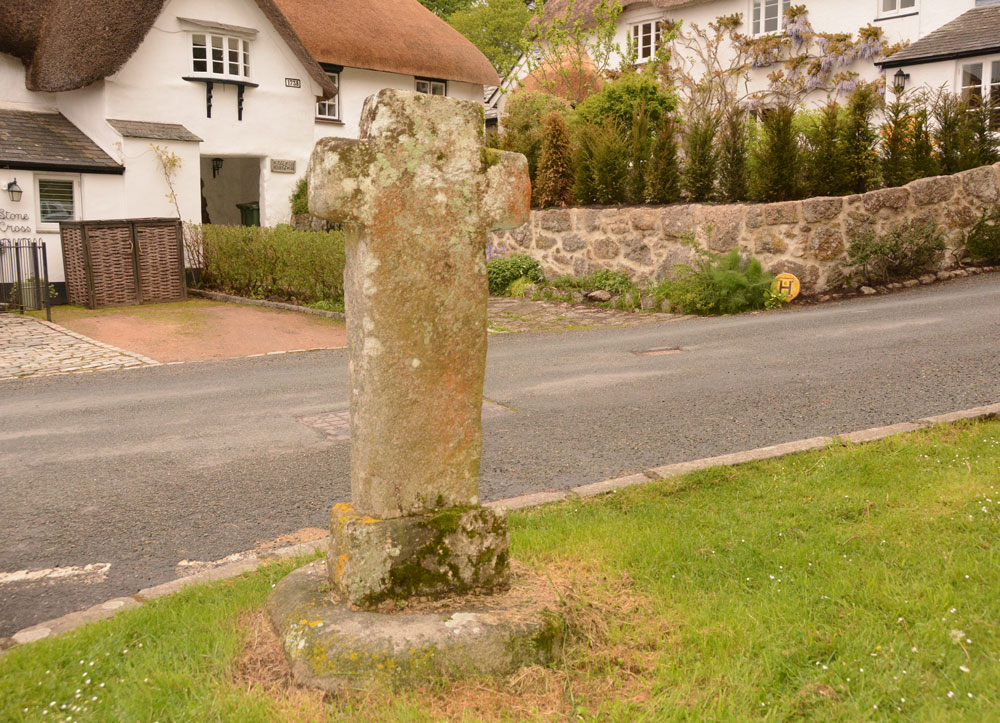
North Bovey submitted by Anne T on 23rd May 2019. Standing just to the north east of the cross, on the green, looking across at Stone Cross Cottage and the other thatched cottages which abut the churchyard. I managed to get this photo, taken in the few minutes between one car left and another parked up, on 11th May, the day after our original visit.
(View photo, vote or add a comment)
Log Text: North Bovey Wayside Cross: We’d booked into the local hostelry, The Ring O Bells, for supper, but arrived a little early. As well as seeing the cross on the village green, we wanted to see the local church, St John The Baptist. However, the church (given the time of the evening!) was firmly locked.
I was somewhat dismayed to find how close all the cars parked to the cross on the village green, but then there is so little parking in the village with narrow lanes and a small public car park, that I guess this is the easiest option for residents and visitors alike.
The different socket stone and shaft are clear, as is in the inserted piece of granite at the base of the shaft, inserted after the cross was knocked down by a vehicle in 1951 to help it fit the base better.
I almost had to sit on the bonnet of the car next to the cross to get a decent photo of the ‘front’ of the grass, facing back across the village green. On the green there is also a village pump, which attracted the numerous children playing on the green.
Leeper Cross
Trip No.130 Entry No.2 Date Added: 24th May 2019
Site Type: Ancient Cross
Country: England (Devon)
Visited: Yes on 11th May 2019. My rating: Condition 2 Ambience 3 Access 4
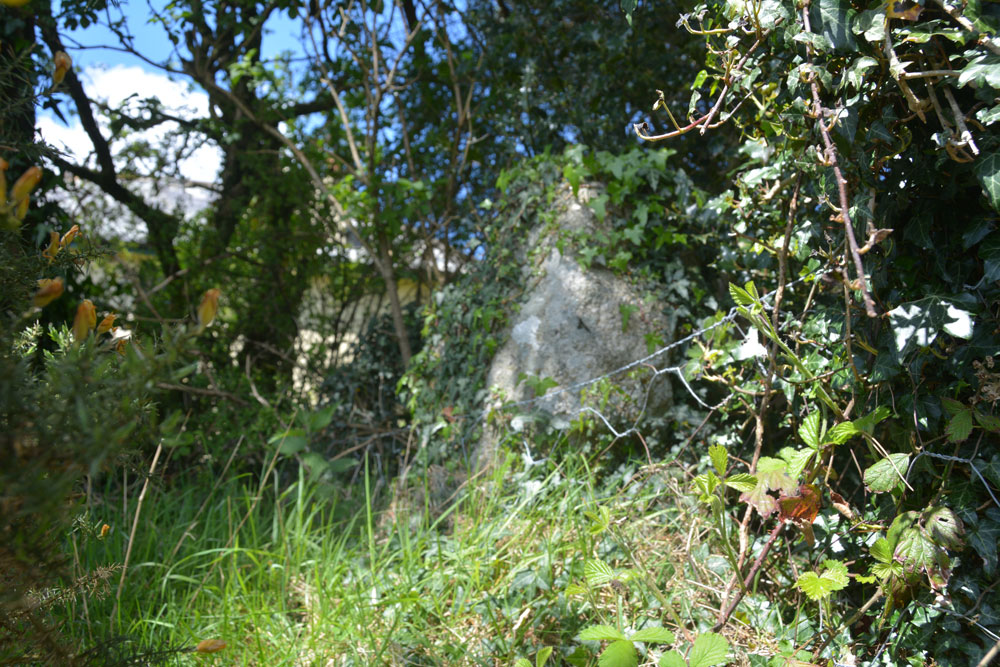
Leeper Cross submitted by Anne T on 24th May 2019. Trying to get a good close up of the south face of the Leeper/Leapra Cross, although it was deep in shade at this time, and I used the flash.
(View photo, vote or add a comment)
Log Text: The Leeper/Leapra Wayside Cross: We had problems locating this cross, so I ended up walking up the driveway up to Moorgate Farm. Just to the right hand side of the gate, I thought I identified an ivy covered cross head shape. Andrew didn’t believe me, so I let myself through the gate and had a closer look. Now I wasn’t convinced.
I heard voices through the hedge, so went in search of the voices, and ended up speaking to a young man who lived in the cottage. He said he knew where the cross was, and took us to the corner of the wall where my ivy covered shape was. This was indeed the Leeper Cross.
He told me that the cross had been moved from where it had been found at Moorgate Farm to Bovey Castle (“which isn’t a castle”), but there had been dissention so it had been moved back to this spot. His family had tried to get the cross located back to its original spot (at Moorgate Farm?) but “there doesn’t seem to be an appetite for it”.
He was happy to leave me to photograph the very ivy covered cross whilst he went back to erecting his new greenhouse.
Challacombe Cross Settlement
Trip No.130 Entry No.3 Date Added: 24th May 2019
Site Type: Ancient Village or Settlement
Country: England (Devon)
Visited: Yes on 11th May 2019. My rating: Condition 3 Ambience 4 Access 4

Challacombe Cross Settlement submitted by TheCaptain on 5th Mar 2017. A photo of what I have called Shapley Common Hut, taken during a walk at Easter 1988.
I dont believe this would be at the location given on the Portal sitepage, but more to the northeast, around SX697830, as our walk first took us south along the ridge to Hookney Tor and Grimspound
(View photo, vote or add a comment)
Log Text: Challacombe Cross/Shapley Common Hut Circles: Having seen quite a few hut circles in Northumberland, I wasn’t expecting much from this site – a few stony-outlined circles in the bracken, but what a lovely surprise this site was – hut circles with very large boulders making up the perimeter. It turned out this was just a taster of the sites we saw around Merrivale, Stanlake and Kestor.
From the Leeper/Leapra Cross, we walked WSW along the B3212 to SX 70049 83251, where an old hollow way/track leads up onto the moor. Armed with the GPS for the first part of the walk,
The hut circles can be clearly seen on UK Grid Reference Finder. The HE entry gives a location just to the west of the line of hut circles – they run from SX 69750 83029 in the south to SX 69779 83133 in the north. Unfortunately the GPS attachment for my camera seems to have stopped working, so I’m waiting for a plan of this site to arrive, so I can assign grid references to each of the hut circles.
Walking to the top hut circle, looking down towards the viewpoint just off the B3212 Princetown Road at SX 69834 83454, it was possible to get a photo of the hut circles all in a line down the hill. Whilst we saw many people head off northwards across the moor, there was no-one else on or near this site at all.
We must have spent a good hour photographing the hut circles and looking at the medieval banks and ditches, some of which cut the hut circles.
Horspit Cross
Trip No.130 Entry No.5 Date Added: 24th May 2019
Site Type: Ancient Cross
Country: England (Devon)
Visited: Yes on 11th May 2019. My rating: Condition 3 Ambience 4 Access 5
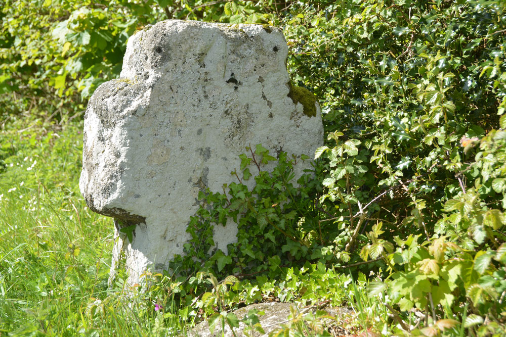
Horspit Cross submitted by Anne T on 24th May 2019. The eastern side of this short, stumpy cross. If there was an initial carved on this face, it was not visible (to us) on the day, or from looking at the photographs later. This is a bench mark on the front of this cross. The top of it is in the centre of the front, and just peeps out above the vegetation growing around its base.
(View photo, vote or add a comment)
Log Text: Horspit Cross, North Bovey: This was to be an afternoon of ‘cross sighting’, with the weather gradually turning from a bright, sunny day to a dull, almost misty day by the time we’d finished.
This squat, small cross sits right on a road junction, with a large boulder immediately adjacent. We managed o park in the entrance way to a new, but abandoned house, which had a tarmacked driveway next to the road, but large, padlocked gates to stop intruders.
The large boulder in front of the cross on the Pastscape photograph I thought looked like part of the cross shaft is in fact just a boulder. The cross has a bench mark on it, which we tried to find; Andrew eventually find it on the ‘front’ of the cross, the top of it showing only just above the vegetation that had grown up around the cross.
Sanduck Cross
Trip No.130 Entry No.6 Date Added: 25th May 2019
Site Type: Ancient Cross
Country: England (Devon)
Visited: Yes on 11th May 2019. My rating: Condition 3 Ambience 4 Access 4

Sanduck Cross submitted by Anne T on 25th May 2019. Getting a bit closer to the cross, it slopes a little. Historic England says this is probably due to disturbance by tree roots around it. The cross was moved to its current location after a fire at Sanduck Farmhouse in 1901, and has been fitted into a modern socket stone.
(View photo, vote or add a comment)
Log Text: Sanduck Wayside Cross: We were going past this spot to get to the next cross on our list, when we spotted this on the OS map, so decided to stop and look for it. We parked outside a very lovely house built around a courtyard; as the road was very narrow, we pulled into a small tarmacked area opposite the house, thinking we’d only be there for a couple of minutes. As we stopped, a lady came out of the house and into her garden. The cross was on a bank at the top of the grass verge, just to the western end of her garden. We said hello to the lady and she replied, and wandered back to the house.
Because the cross was immediately adjacent to private land and against a hedgerow with tall trees around, we didn’t ask to get into the field behind as the back of the cross would have been hidden by the hedge.
Datuidoc's Stone
Trip No.130 Entry No.8 Date Added: 30th May 2019
Site Type: Early Christian Sculptured Stone
Country: England (Devon)
Visited: Yes on 11th May 2019. My rating: Condition 3 Ambience 3 Access 4
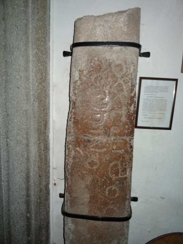
Datuidoc's Stone submitted by AngieLake on 5th May 2018. Another view of the stone in Lustleigh Church today, during the May Day celebrations. (Not to be missed on such a sunny, lovely, day!)
(View photo, vote or add a comment)
Log Text: The Writhelstan inscribed stone, St John The Baptist, Lustleigh: Expecting this to be the prettiest village in Devon, I was a little surprised to find I didn’t agree. The church is right in the middle of the village, and we managed to park by the south wall of the churchyard, immediately opposite the village pub.
Going into the church, the Writhelstan stone was stuck on the west wall of the nave in between, and partly hidden by, a gas heater on its south side, and wooden stacking chairs to its northern.
We couldn’t ascertain if the churchyard was oval/circular as a road had been cut to its northern side.
Some lovely old grave slabs in the floor of the chancel, northern chapel and nave. Interesting rood screen with pomegranates and heads. Whilst we were in the church, there were around four to five other sets of visitors, none of whom looked at this inscribed stone, which I thought was odd, but then it was well hidden unless you knew what to look for.
There was also a cross on the village green, which looked to be modern. Could not find this on Pastscape.
There was a photo frame with some information about this stone, which must have been on the wall, but had recently fallen off and the glass had shattered. I carefully moved it from the floor onto the top of the heater and photographed it.
“This ancient stone was removed from a position in the paving below the inner doorway of the church porch on March 13th 1979, in order to preserve it from further wear. It belongs with a well recognised series of commemorative stones erected in the post-Roman period between about AD 450 to AD 600.
The inscription probably read:
“DATUIDOCI CONHINOCI FILIUS”
The language is Latin, although the personal names involved are British. Both the names are in the genitive case, so that the whole inscription requires to be understood as “The stone of DATUIDOC the son of CONHINOC”. Nothing is known of either man, but it is likely that Datuidoc was a Christian, and was buried in the already existing graveyard here about AD 550 to 600, where the stone was erected to mark his grave. It can be assumed that Datuidoc at least, and probably his father also, were men of local importance in this area of eastern Dartmoor during the sixth century AD”.
Lustleigh is one of only four church sites in Devon with an inscribed stone
J.C. Wallace Kemp & A.P.W. Robertson (Churchwardens).
After walking around the church, and photographing the modern cross on the church green, we adjourned to the pub, The Cleave, opposite the church. As it was such as warm evening, we sat in the garden around the back of the pub, listening to the myriad of bird song.
Chagford Druid's Well
Trip No.131 Entry No.1 Date Added: 3rd Jun 2019
Site Type: Holy Well or Sacred Spring
Country: England (Devon)
Visited: Yes on 11th May 2019. My rating: Condition 3 Ambience 4 Access 5
Chagford Druid's Well submitted by cazzyjane on 9th May 2012. Druid's Well, Chagford. Looks like a tiny quoit but has lots of clear water running from it.
(View photo, vote or add a comment)
Log Text: Druid's Well, near Chagford: Our first stop of the day, with bright sunshine and deep shadows. As we approached the well, this was our first of several encounters with a very friendly Granny looking after granddaughter on skittish, but beautiful, horse. Granny was following both round in a car, making sure horse and rider were OK on these narrow lanes. We passed them several times, and met Gran again later in the day outside her farm, when we were driving towards the burial chamber, when we needed to get past a large tractor and trailer going down the narrow, and very potholed lanes.
This well is just outside a property called Wellpark. At first it looks like a grass covered mound, but looking closer there is a well chamber, a large capstone and an exit water channel. On looking at the Pastscape entry, they mention another well recorded on the OS maps, only 9m away, built of an iron post and slate structure, now infilled. We didn't see this, although there was plenty of farm machinery and piles of stones and grit at the sides of the road.
Week Down Cross
Trip No.131 Entry No.3 Date Added: 3rd Jun 2019
Site Type: Ancient Cross
Country: England (Devon)
Visited: Yes on 12th May 2019. My rating: Condition 3 Ambience 4 Access 4
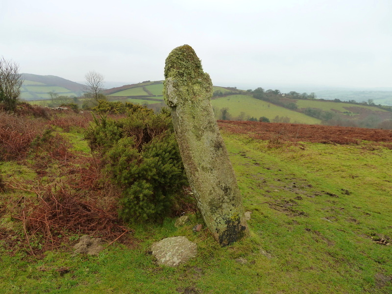
Week Down Cross submitted by Bladup on 3rd Mar 2016. Week Down cross at SX71168653.
(View photo, vote or add a comment)
Log Text: Week Down Cross: We left the car by the Shorter Cross and continued the 250m up the road by foot; in actual fact there is a large grassy area on the moor here, and another car with a disabled passenger pulled onto the grass whilst we were there. Whilst the cross itself is only 9m from the road, there is a bank immediately at the edge of the road to step up to the common.
This cross is in a really lovely location, sitting by the edge of the common/moor, with great views over the moors to Chagford.
I had to be careful about photographing this cross, as to the west there was a camp site with some really brightly coloured tents which took over the photo, so I aligned myself to these were either hidden behind the cross, or behind the gorse bushes!
F H Starkey in his 1983 book “Dartmoor Crosses & Some Ancient Tracks” describes this cross as :”it consists of a tall rectangular shaft of granite, six feet nine inches tall. It has a rounded head and two very short arms have been cut out of the shaft. A Maltese Cross is cut on each face; one of these is in line with the shaft of the cross which is inclined at an angle to the ground, the other is at right-angles to the ground. This rather strange fact led Ormerod (who described the cross in 1874, having know it from at least 1859) to conjecture the crosses had been carved after the cross was erected and had settled down to its out of perpendicular stance Ormerod also tells us that the cross was in danger of falling in 1867 and that it was moved back from the road a little but that its original angle of inclination was repeated when it was re-erected. He says too, that there was a project afoot to move the cross and use it to make a foot-bridge; happily it was spared this fate”.
Meacombe Cist
Trip No.131 Entry No.5 Date Added: 4th Jun 2019
Site Type: Burial Chamber or Dolmen
Country: England (Devon)
Visited: Yes on 12th May 2019. My rating: Condition 3 Ambience 4 Access 4
Meacombe Cist submitted by hamish on 14th Nov 2004. A fine little chambered tomb, found by chance.
(View photo, vote or add a comment)
Log Text: Meacombe Cist: We'd arrived in Devon in a torrential downpour, although this had cleared in the evening. The sheer amount of rain might have contributed to ripping away the road surface at the edge of the road leading to this burial chamber.
The roads to this burial chamber were atrocious, with very deep potholes and a centre ‘bank’ of earth and grass, which at times tickled the underneath of the car - we debated about turning back at one point. The road was so narrow and parking so difficult that we parked in the next field gate to the north of the cist. Andrew stayed with the car whilst I let myself into the adjacent field, which also looked as if it had archaeology (but are just rocky outcrops, nothing on Pastscape or HE), but didn’t stop as Andrew needed to move the car. Took some quick photos, then ran back.
I was worried about trespassing, but there was a well worn tractor track into an open gate into the next field, then a track from the gate to the burial chamber.
We had hoped to see the enclosure and hut circle to the south west, but no way of stopping, nor could we see any sensible places to stop.
Note: I only found this a 'short walk on the footpath' from the adjacent field.
Standing Stone Near Cairn at Head of Drizzlecombe Row 4
Trip No.134 Entry No.16 Date Added: 16th Jul 2019
Site Type: Standing Stone (Menhir)
Country: England (Devon)
Visited: Yes on 15th May 2019. My rating: Condition 2 Ambience 4 Access 3
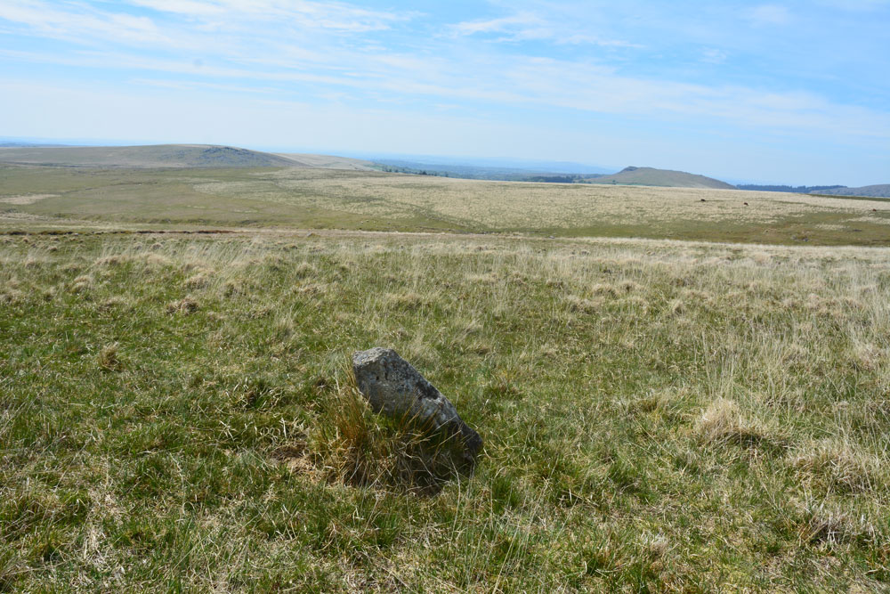
Standing Stone Near Cairn at Head of Drizzlecombe Row 4 submitted by Anne T on 1st Jun 2019. This photo is taken just from the SSW of the stone, showing its north-north-eastern face.
(View photo, vote or add a comment)
Log Text: Drizzlecombe West Standing Stone: Whilst Sandy and the rest of the intrepid "Dartmoor Expedition" were searching lower down the slope for the enigmatic and mysterious Drizzlecome West Stone Row, I'd wandered up slope, stopping at this stone and looking at the nearby cairn. Failing to attract the attention of my fellow explorers, I wandered off to look at the large cairn near the southern and smaller of the two pounds. When I came back, I found Sandy in full 'Bronze Age Mode' with his ranging pole standing by this stone.
We photographed it and took a grid reference with our GPS. More research to be done on this stone - not apparently recorded in Butler or any of the other Dartmoor Archaeology books I now possess. Have asked the rest of the group to contribute to the information on this stone, if they are able. Sandy plans to return in September 2019, so more information to follow.
Hunter's Tor Fort
Trip No.131 Entry No.6 Date Added: 4th Jun 2019
Site Type: Hillfort
Country: England (Devon)
Visited: Yes on 12th May 2019. My rating: Condition 2 Ambience 4 Access 3

Hunter's Tor Fort submitted by Creative Commons on 8th Feb 2012. The gorse bushes are on the degraded bank of the hilltop fort above the northern end of Lustleigh Cleave. Beyond the wall and gate can be seen Moretonhampstead.
Copyright Derek Harper and licensed for reuse under the Creative Commons Licence
(View photo, vote or add a comment)
Log Text: Hunter's Tor Iron Age Hillfort: A very pleasant walk from the end of the lane at SX 75702 83203, up a public bridlepath, the path cutting through a farmyard higher up the hill. Continuing up the hill, we eventually reached a long stone wall with a gate leading into the fort. At its northern end (SX 76043 82474) there was a large rocky outcrop with a balanced rock.
Most of the ramparts and banks, whilst ruined, are still visible, and there are glorious views over to the west from most of the hillfort.
To its south eastern side, there appear to be rows of stones/banks which might be the remains of old field systems.
Some of the outer banks are cut by a long dry stone wall on its eastern side; looking over these continue in the field behind. We let ourselves out of the gate into the fort at its north eastern side then let ourselves into the gate into the field to take a quick photo of the continuing banks.
There were lots of walkers and mountain bikers walking through the fort. Only one other couple we saw actually appeared to be looking for the features within the fort; others either sat and picnicked by the outcrop, or simply rode through.
Ring Hill Cross
Trip No.132 Entry No.3 Date Added: 5th Jun 2019
Site Type: Ancient Cross
Country: England (Devon)
Visited: Yes on 13th May 2019. My rating: Condition 1 Ambience 2 Access 4
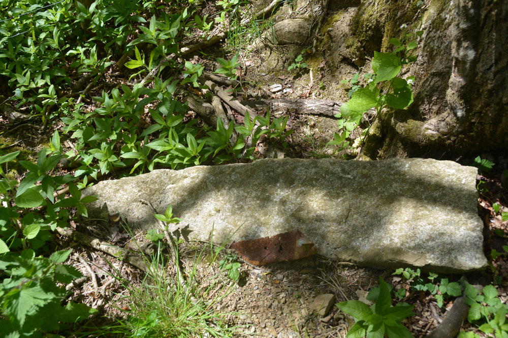
Ring Hill Cross submitted by Anne T on 5th Jun 2019. A closer look at this tapered stone, lying close to the grid reference point. The fact it had been left (carefully?) by the tree, as opposed to having been deposited roughly with other lumps of stone nearby indicated it might have been important and set aside for a reason.
(View photo, vote or add a comment)
Log Text: Possibly the Ring Hill Wayside Cross?: From the Pastscape description, and armed with our GPS, this cross should have been relatively easy to find, but was actually the hardest. We spotted the old footpath coming down the slope and joining the minor road to South Zeal, but the fence posts and gates have been renewed in very recent years. The cross was perhaps 5m to the west of its given grid reference.
There were a few old gateposts lying around near the fence line, so we thought we’d take a very sneaky look. Letting ourselves cautiously in through the gate, we spotted an old granite gate post at the foot of a tree, which matched the description given by Pastscape, so I photographed it. Nearby was the remains of a brick structure, which looked a bit like an old fireplace back, but which is marked as ‘W’ (well) on the HE map.
Oxenham Arms
Trip No.132 Entry No.8 Date Added: 7th Jun 2019
Site Type: Standing Stone (Menhir)
Country: England (Devon)
Visited: Yes on 13th May 2019. My rating: Condition 3 Ambience 4 Access 4
Oxenham Arms submitted by TheCaptain on 26th Apr 2004. Oxenham Arms, South Zeal, Devon SX651935.
An enormous and magnificent menhir built into the wall of a tremendous pub on the main street in the village of South Zeal, Devon.
In fact, the pub is believed to have been built by monks in the twelfth century around the menhir. As the pub website says "A very interesting part of the house is the small lounge behind the bar. In this room, set in the wall, is a monolith and the theory of archaeologists is that the monastic builders placed the...
(View photo, vote or add a comment)
Log Text: Oxenham Arms Menhir & Roman Stone: We originally headed off to the wrong pub, at the north western end of the village, but having thought the name of the pub wasn't what we remembered, we found the Oxenham Arms just down the hill from the village cross.
Walking into the pub from the bright sunshine of the street took my eyes some time to adjust, but we welcomed the coolness and the opportunity of a long, cold, icy drink.
I asked the barman if I could ask a cheeky question, and he said “on the scale of 1 to 10, how cheeky?” I replied “4”. He said “that’s not cheeky”. He very patiently told us where to find the standing stone, and also told us about the Roman pillar in the restaurant at the back. He very kindly said it was OK for me to take photos.
He also added (tongue in cheek?) that they thought it had taken 40 years to carve the granite standing stone, although how he knew, I don’t know. The stone apparently continues in one of the rooms upstairs.
Lovely atmosphere here. If we go back to Devon, I’d like to go for a meal here. A chance to see a couple of fine stones and have a drink at the same time - only the second time ever (the first being at the Templar Preceptory at Rothley).
There are several notices hanging on the wall and I’ve typed this up.
South Zeal Cross
Trip No.132 Entry No.7 Date Added: 7th Jun 2019
Site Type: Ancient Cross
Country: England (Devon)
Visited: Yes on 13th May 2019. My rating: Condition 3 Ambience 4 Access 5
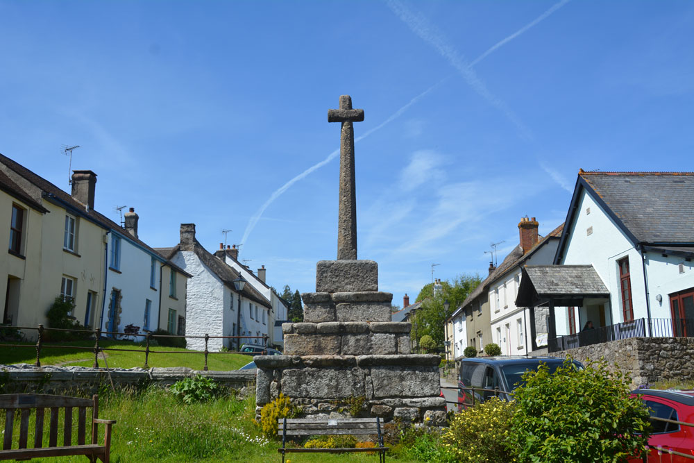
South Zeal Cross submitted by Anne T on 7th Jun 2019. The cross, as seen from the small communal garden next to the small but lovely Chapel of Ease, just to its south east. Historic England says: "(The cross) is an integral part of the South Zeal townscape. It is very special being one of the few medieval boroughs in Devon where a significant number of its late medieval houses survive to a greater or lesser extent".
(View photo, vote or add a comment)
Log Text: South Zeal Cross: Driving the short distance from Moon’s Cross into South Zeal, this is a busy little working village, not just a place for tourists to travel to Oh the cars that were parked up and down the street, but we managed to find a space just south of the village cross.
This is a tall, imposing monument, standing just north east of the small, but quaint St Mary’s Chapel and a small, beautifully kept communal garden. As we drove south east down the main road through the village (towards the Oxenham Arms) the cross dominated the village; standing further south east, as the village is on a hill, the cross towered above us.
Whilst visiting the cross, it's worth popping into the tiny, but welcoming St Mary's Chapel next door. Now turned into a place of rest and contemplation for modern day pilgrims.
