Contributory members are able to log private notes and comments about each site
Sites Anne T has logged. View this log as a table or view the most recent logs from everyone
St Bee's Priory Crosses
Date Added: 27th Oct 2014
Site Type: Ancient Cross
Country: England (Cumbria)
Visited: Yes on 24th Oct 2014. My rating: Condition 3 Ambience 3 Access 5
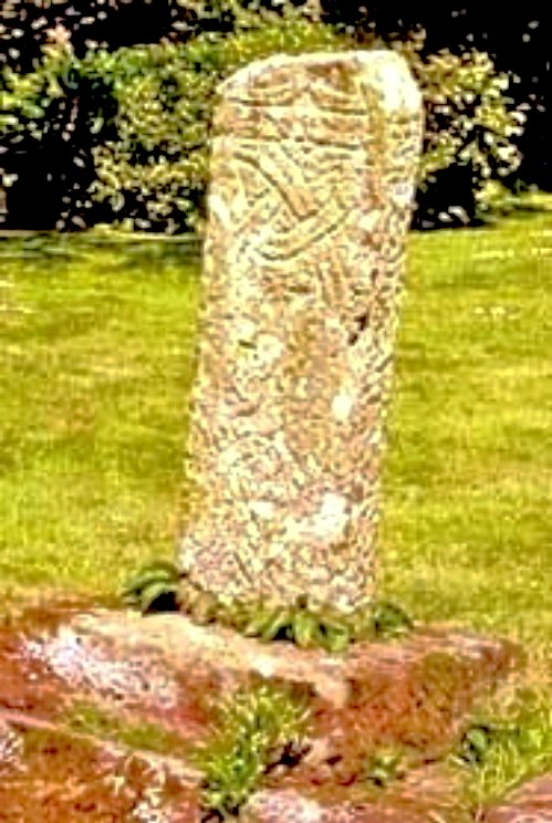
St Bee's Priory Crosses submitted by Sunny100 on 11th Jun 2010. 9th century cross-shaft in St Bees Priory graveyard, Cumbria, at NX.969122
(View photo, vote or add a comment)
Log Text: Ancient Crosses, St. Bees Priory (notes: 1. all the leaflets and books refer to this as ‘St Bees Priory Church’ but the name, according to information plates in the church is ‘St Mary and St. Bega. 2. I record this visit as 'ordinary' as the church was having its complete heating system replaced and was like a building site. Once this is complete, it will be 'good').
This was our first stop on an 'ancient cross hunt' day. Following the A595 from Whitehaven, we turned towards the sea down Mirehouse Road towards St. Bees. We drove past the church at first, as it looked too modern from the road, but on closer inspection, it really is old! Sited near the station, there is car parking for 4-5 cars at the south east corner of the church, with a level pathway to follow to the west door.
Entering the churchyard, we saw St Bees 01, the 10th century cross shaft, in the middle of the churchyard by a large, round bush. The ASCorpus notes say it also has part of the cross head at the top of the shaft, although this wasn’t immediately obvious, although I can now see this in the photographs. According to the little leaflet I bought from the church, this cross stands in the graveyard to symbolise all those who are buried here, rather than there being individual grave markers. This then gives a different meaning to the other similar crosses we saw in other churches, being described as preaching crosses. I wonder who is right? In a history of St. Bees (see source below) this cross is described as being ‘Hiberno-Norse’; ASCorpus dates it to the 10th century.
Many of the grave stones have been cleared away, making the grass easier to cut, and there is a drop between the edge of the churchyard and the church itself, with plenty of bright yellow ‘danger’ notices. Near the lych gate, there is a sundial which dates to 1649, although the top has been broken off.
Having travelled over 90 miles to get here, we arrived at the west door to find a notice to say the church was closed Mondays to Thursdays as they were having the heating pipes replaced. As it was a Friday and someone else had just come out we went in; we were stopped by one of the plumberswho said the church was closed, and I said we’d driven a long way to come here, he said ‘be careful’. The church was covered in plastic lining and plumbing pieces everywhere, including dustpans and brushes placed in the ‘history area’ at the south east end of the church.
This visit was slightly disappointing, as we didn’t find St Bees 06, part of a round shaft or pillar which was supposed to be at the east end of the south aisle of the church, inside. We explored all the other areas, including the ‘new history area’ and poked my head into the rooms being used by the heating engineers, but nothing. Three other pieces (St Bees 03, 04 and 05) were buried under the south aisle of the church, so couldn’t be seen, and St. Bees 07 was in someone else’s possession. St Bees 08 is difficult to find, being placed in the south west arch way, almost buried by ferns. I had to compare it to the photograph on the ASCorpus records very carefully to make sure I’d understood what I’d seen.
Outside the fascinating west door, underneath this same archway, there was another sandstone cross sited underneath an arch. It’s not described in the church guide, but in a frame in the church, it is described as “a cross which stood at the breast of the hill on the main road to Whitehaven. It is variously thought to be a ‘sanctuary cross’, marking the boundary of the parish, or a resting cross on a coffin road. The ‘coffin roads’ date from medieval times when many West Cumbrian parishes did not have the licence to bury, and bodies were brought to St. Bees. These crosses served as symbolic resting places on route.” The archway lintel comprises a “pre-Conquest carved Beowulf Stone, on a lintel between the Church and the Vicarage, showing St Michael killing a dragon.”
St Bernard's Well
Date Added: 30th Dec 2015
Site Type: Holy Well or Sacred Spring
Country: Scotland (Midlothian)
Visited: Yes on 17th Dec 2015. My rating: Condition 3 Ambience 2 Access 4
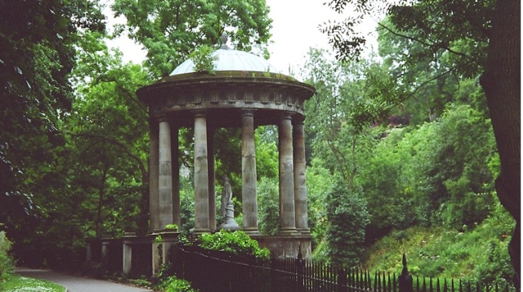
St Bernard's Well submitted by KiwiBetsy on 5th Dec 2004. One for the birds.
(View photo, vote or add a comment)
Log Text: St Bernard's Well, Edinburgh: This was by far the most attractive of the three wells we saw in Edinburgh today, although again I wouldn’t have known it was a well but for the plaque next to it telling us it had been refurbished in Victorian times. It sits at the base of a steep hill with housing and private gardens above, with the Water of Leith running below. It is apparently possible to get inside the structure during ‘Doors Open’ day, although the gate and door were very well padlocked, and the number of vodka bottles and cans inside the temple indicates its well used by drinkers who hop over the gate. We did intend going up to Arthur's seat to see 2 other wells and the hill fort but the wet and windy weather drove us indoors to get warm.
St Blane's Chapel (Isle of Bute)
Trip No.51 Entry No.3 Date Added: 8th Oct 2017
Site Type: Ancient Cross
Country: Scotland (Isle of Bute)
Visited: Yes
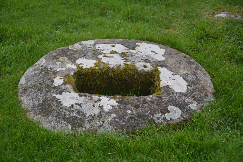
St Blane's Chapel (Isle of Bute) submitted by Anne T on 8th Oct 2017. This cross-base/socket stone is embedded within the ground in the lower (southern part) of the graveyard. There is apparently another cross base 70m north of the chancel, although we were unable to find this.
(View photo, vote or add a comment)
Log Text: Cross base/socket stone, St. Blane's Chapel, Isle of Bute: Whilst I was wandering through the ruins of the chapel and photographing it, husband Andrew was in search of this sandstone socket in the lower churchyard. In the end, it was easy to find – head south out of the ruins, into the upper churchyard, down the steps, and it is virtually in front of you to your left hand side. I confess that without the Canmore record, I might have very well missed this, as I’m used to seeing socket stones that are sitting on the ground, not buried within it.
St Blane's Well
Trip No.51 Entry No.2 Date Added: 8th Oct 2017
Site Type: Ancient Cross
Country: Scotland (Isle of Bute)
Visited: Yes on 25th Sep 2017. My rating: Condition 3 Ambience 4 Access 4
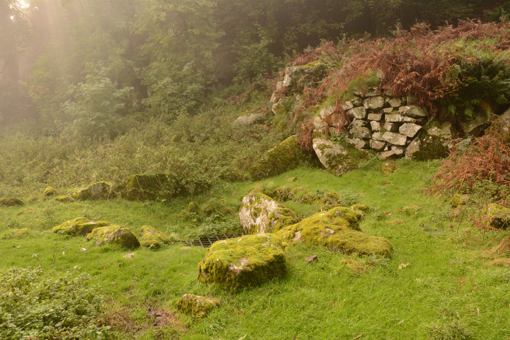
St Blane's Well submitted by Anne T on 8th Oct 2017. View of this well from the north. By this time of the afternoon, the sea haar was coming in with a vengeance, and with the last of the sun's rays coming through, this site was very atmospheric.
(View photo, vote or add a comment)
Log Text: St. Blane's Well, Isle of Bute: After St. Mary’s Chapel and Well, we made our way to the south end of the island, by which time the mist was starting to come in from the sea. There is a layby at NS 09299 53076 for around 6 cars at the start of the path uphill to the chapel. I was very disappointed to find quite a few other visitors there. They must have done what we did, and made their way straight to the south end of the island to work their way back. Should have timed it better.
At this site, as well as the chapel, there is a holy well, a hogback and a cross shaft. This whole place is very ancient and it was atmospheric in the mist.
St Boswell's Old Church
Trip No.50 Entry No.4 Date Added: 7th Oct 2017
Site Type: Ancient Cross
Country: Scotland (Scottish Borders)
Visited: Yes on 24th Sep 2017. My rating: Condition 2 Ambience 3 Access 4
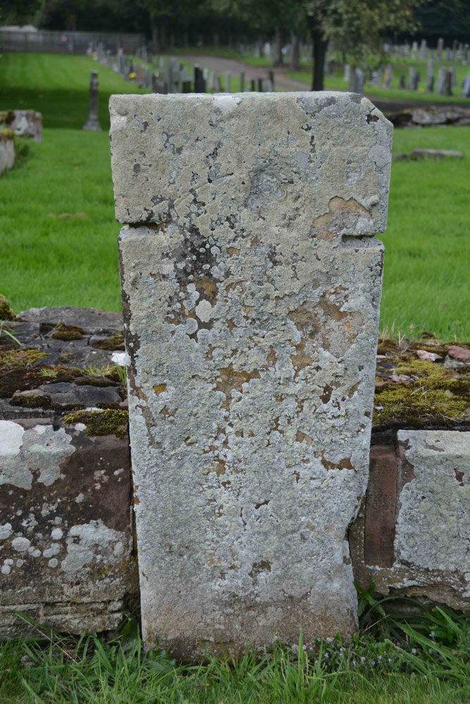
St Boswell's Old Church submitted by Anne T on 7th Oct 2017. Close up of the slab, which is supposed to bear an incised, equal limbed, cross within a circle. It is very worn. The other artefacts associated with the church of pre-1153 are built into the fabric of the present St. Boswell's church, located in the village.
(View photo, vote or add a comment)
Log Text: St Boswell's Old Church, Incised Cross Slab: I was expecting much more from this site, lying in a corner tucked between the River Tween to the east and Boswell Burn to the south. The ruins of the old church have been taken down to only a couple of courses, whilst the graveyard is still in use today.
Not very atmospheric. It turns out, pulling the Canmore record up on site, that there was only 1 tombstone with incised cross standing against the south wall of the church, which is supposed to have: “A tombstone, measuring 5ft 8in in length and tapering in width from 1ft 7 1/2in to 1ft 2in, is attached to the S wall of the church. It bears a slightly incised, equal-limbed cross within a circle.” No date is given for this. The rest of the interesting old stones have been built into the modern church, which we didn’t bother to find, as it presumably would be locked, and we had a lot more sites we particularly wanted to see.
St Bridget's Church (Bridekirk)
Date Added: 9th May 2015
Site Type: Ancient Cross
Country: England (Cumbria)
Visited: Yes on 1st May 2015. My rating: Condition 2 Ambience 4 Access 5
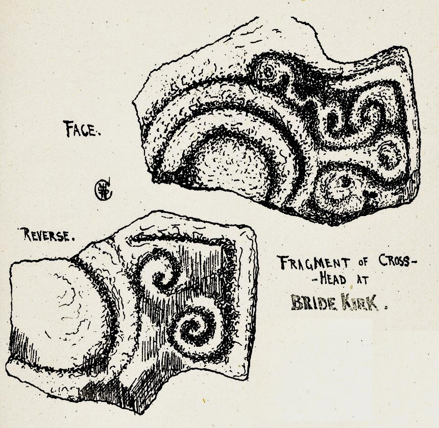
St Bridget's Church (Bridekirk) submitted by Sunny100 on 19th Apr 2011. Illustration of The Cross-Head fragment at St Bridget's Church, Bridekirk, Cumbria, by Rev William Slater Calverley 1847-98.
The above image is from his renowned work 'Early Sculptured Crosses, Shrines and Monuments in the Present Diocese of Carlisle 1899 Ed. by W.G. Collingwood.
(View photo, vote or add a comment)
Log Text: Anglo Scandinavian Cross Arm Piece, St Bridget's Church (Bridekirk): We arrived here just after 4pm. I’m not sure what I expected, but the old church was an enigmatic ruin at the eastern end of the churchyard – no more than a few ivy covered walls left of the chancel with graves contained within.
This church is usually open from morning until dusk. We went into the church and admired the ancient font. We found the remains of the Anglo Scandanavian cross head on the window sill on the north wall and I photographed it, turned it round and photographed the other side. [The Corpus of Anglo Saxon Stone Sculpture web site was off-offline when we visited, but their reference for this stone is Bridekirk 01. The smaller fragment of cable roll moulding to the right hand side of this piece is ref. Bridekirk 02.]
There was also a carved stone piece on a window ledge opposite, on the south wall. The guide describes this as “Opinions differ about the origins of the stone on the opposite windowsill (which was found in the churchyard in 1911) between being part of a Romanesque carved panel, or a genuine piece of Roman sculpture. Those who have claimed it to be Roman consider it to be a dedication to the Romano-British water goddess Coventina”.
As we were walking into the chancel, the door opened and a voice said ‘hello, do you want some lights on?’. The church warden had come down to lock up. Our visit was a little curtailed as she kindly chatted to us throughout, telling us about the old church and that there was thought to be the remains of an older wooden structure underneath.
Because we were now being accompanied, we missed quite a few features we’d really rather have stayed to see. I didn’t really get to appreciate the door into the south transept, which was relocated from the original old church; the arch over the organ in the north transept is also from the old church. There is also in the porch an ancient piece of red sandstone which dates from the 11th or 13th centuries depicting the head of Christ.
Next to the ruined Norman chancel, there is also a modern version of an Anglo-Saxon cross used as a grave marker which dates from 1892. Worth a re-visit when we're next passing.
St Bridget's Church (Bridekirk)
Trip No.91 Entry No.5 Date Added: 18th Aug 2018
Site Type: Ancient Cross
Country: England (Cumbria)
Visited: Yes on 14th Aug 2018. My rating: Condition 3 Ambience 4 Access 5

St Bridget's Church (Bridekirk) submitted by Sunny100 on 19th Apr 2011. Illustration of The Cross-Head fragment at St Bridget's Church, Bridekirk, Cumbria, by Rev William Slater Calverley 1847-98.
The above image is from his renowned work 'Early Sculptured Crosses, Shrines and Monuments in the Present Diocese of Carlisle 1899 Ed. by W.G. Collingwood.
(View photo, vote or add a comment)
Log Text: Font with Runic inscription, St. Bridget's, Bridekirk: We had an hour to fill between appointments between churches, so headed off to Bridekirk to see the font with runic inscription, which we'd missed during our last visit on 1st May 2015. The notice said the church was "normally open during daylight hours" but on this occasion the main door appeared to be bolted at the top from the inside, so we couldn't get in. This time, not having a six month old granddaughter with us, we walked round the outside of the church and noticed a collection of old grave slabs displayed against the exterior of the apse at the east end of the church, including an old cross base. None of these in mentioned on Pastscape.
Checking back in my photos, I had taken a photograph of the font. The middle band (when enlarged) does indeed have a runic inscription on it.
St Bridget's Church (Brigham)
Trip No.91 Entry No.7 Date Added: 18th Aug 2018
Site Type: Ancient Cross
Country: England (Cumbria)
Visited: Yes on 14th Aug 2018. My rating: Condition 3 Ambience 4 Access 5
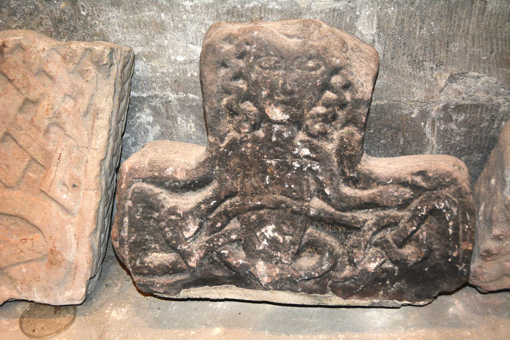
St Bridget's Church (Brigham) submitted by Anne T on 18th Aug 2018. This is Brigham 05, part of a cross-head dating to the 10th century. It was first recorded in 1881, presumed to have been found in restorations of 1864 or 1875-6. Note the curly haired naked figure, with his right hand and a snake (or interlace) bound across his stomach. His left hand is described as having an open palm, lying above the interlace of the right arm.
(View photo, vote or add a comment)
Log Text: St Bridget's, Brigham (Anglo Saxon Stones): Whilst this church looks very austere from outside, and the entrance doors dark and foreboding, once inside the church, it is a completely different picture – this church is light, airy and welcoming. The painted ceilings are fantastic.
The church warden turned up as arranged, and was so welcoming. He sought out a guide to the church and old postcards for information, then left me photographing the stones whilst Andrew walked round the church with him.
Time was all too short here, and I could have spent another hour, but we knew the church warden needed to get home, and the evening traffic was building up outside. In our haste, we missed Brigham 13, a cross base at the west end of the church (I thought I’d photographed it, as we went through all the AS Corpus pages I’d brought with me, but realised (too late) it wasn’t the correct stone).
After looking at the Fletcher family grave (now very worn and held together with large staples, I walked over to the west end of the churchyard to look at the farmhouse, which used to be the rectory for the farm).
We also looked for the site of Nun's Well, but were unable to see anything.
St Colmac Cottages Stone Circle
Trip No.50 Entry No.7 Date Added: 9th Oct 2017
Site Type: Stone Circle
Country: Scotland (Isle of Bute)
Visited: Saw from a distance on 9th Oct 2017. My rating: Ambience 2 Access 4
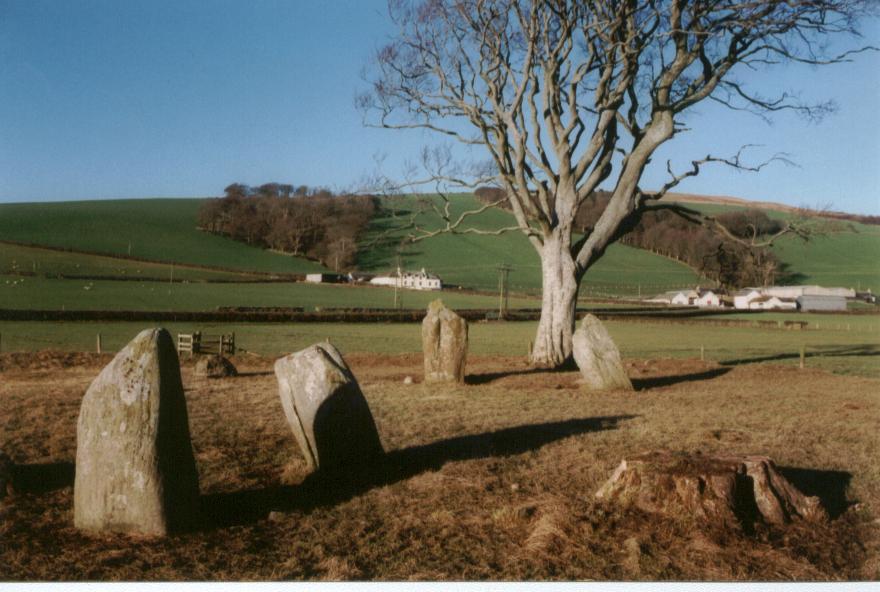
St Colmac Cottages Stone Circle submitted by saille on 20th Jan 2004. Stone Circle at Ettric bay.
NS044668
(View photo, vote or add a comment)
Log Text: St Colmac Cottages Stone Circle: Defeated by a pond between us and the stone circle, a large heap of cow dung by the gate, heavy mist, and running out of time before our ferry back, we stopped at the gate and photographed this from a distance.
We had tried to see the standing stone near Calmac Bridge, but the farmers were moving a large herd of cattle into the field, and we would have had to wait for ages. Rapidly running out of time before we needed to get back to Rounsay for the ferry, we pressed on to St. Colmac Cottages, where we parked at the entrance to the field with the stone circle. Here, the farmer has created a fenced walkway along the side of the road.
The walkway, however, was deep in wet slurry from the cows having just been moved down this path, and the field was sodden. Arriving at the gate into the field, the farmer had also dumped a whole load of cow manure just the other side of the gate, making it incredibly uninviting to walk to the stone circle, which we could just see through the mist in the field.
At this point, not having wellies, I realised I’d rather see the standing stone inscribed with a cross before we left the island, so we waded back to the car and set off just down the road to the ruined church at Calmac Bridge.
St Colmac's Cross
Trip No.50 Entry No.8 Date Added: 9th Oct 2017
Site Type: Standing Stone (Menhir)
Country: Scotland (Isle of Bute)
Visited: Couldn't find on 25th Sep 2017
Log Text: St Colmac's Cross, Isle of Bute: I really, really wanted to find this standing stone with incised Latin Cross, but we couldn't work out a way to get behind the barn at East St. Colmac Farm to view it. The Canmore records show this intriguing stone in a wooden enclosure, which was built round it after it was damaged in recent times (the top was knocked off).
By the time we'd had several attempts to find this stone, we were seriously running out of time to get back for our ferry back to Wemyss Bay. We needn't have worried, however, as the ferries were suspended because of the heavy fog. This necessitated a drive up to Rhubodach to get a shorter ferry ride across to Colintraive, then a very hairy mountain drive on a single track road with dense fog back to Dunoon. A not to be forgotten trip!
St Cuthbert (Forcett)
Date Added: 20th Oct 2014
Site Type: Ancient Cross
Country: England (Yorkshire (North))
Visited: Yes on 17th Oct 2014. My rating: Condition 3 Ambience 4 Access 5
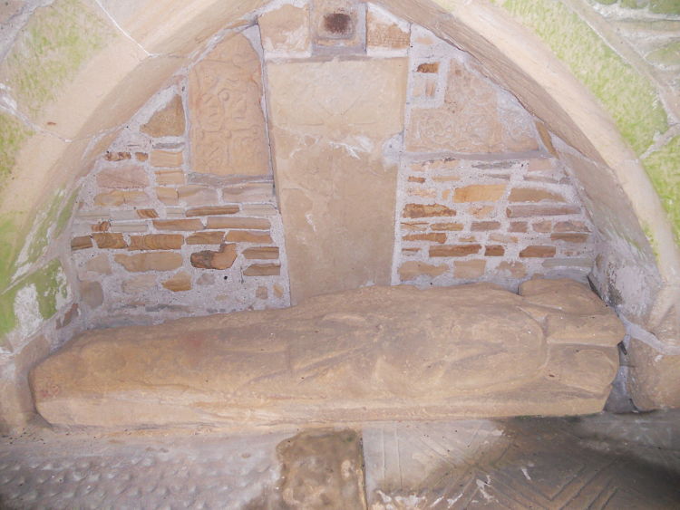
St Cuthbert (Forcett) submitted by hadrian on 4th Aug 2011. Internal wall.
(View photo, vote or add a comment)
Log Text: St Cuthbert (Forcett): Anglo Saxon Cross Shafts and Cross Arms in Porch: From Piercebridge, it is only 4 and half miles south west to Forcett, via the B6275 and Greystone Lane (although the road in Piercebridge was closed so I had to detour - thankfully I had my son’s SatNav to help, otherwise complete panic would have set in!).
I found the church easily enough, on the edge of the village, but there didn’t seem to be anywhere to park. In the end, I bumped up on the pavement by the cottages opposite. One of the resident’s came out and asked me if I knew the church; when I replied ‘no’ and asked if there was a proper parking area, he told me I’d be OK where I was for a short while (note: whilst it is possible to stop by the gate to the church, there are steps up the slope to the church).
The inside of the church is very Victorian and unremarkable, but the porch is something special. I had to gain entry to the porch first by untangling a piece of wire which held the wire gates shut, but once inside the more I looked, the more I saw, and was very impressed.
Different sources say there are between 5 and 8 Anglo Saxon cross fragments, varying in date between the 8th and 10th century. I certainly saw at least 6, and took photographs of all the fragments and grave covers that I saw so I can sit and unpick what I saw at a more leisurely pace in the next few days.
Apparently there is another fragment on the outside of the porch, but whilst I walked slowly around the whole exterior of the church I didn’t find this one.
St Cuthbert's Church (Bedlington)
Trip No.103 Entry No.3 Date Added: 13th Oct 2018
Site Type: Sculptured Stone
Country: England (Northumberland)
Visited: Yes on 11th Oct 2018. My rating: Condition 3 Ambience 4 Access 4
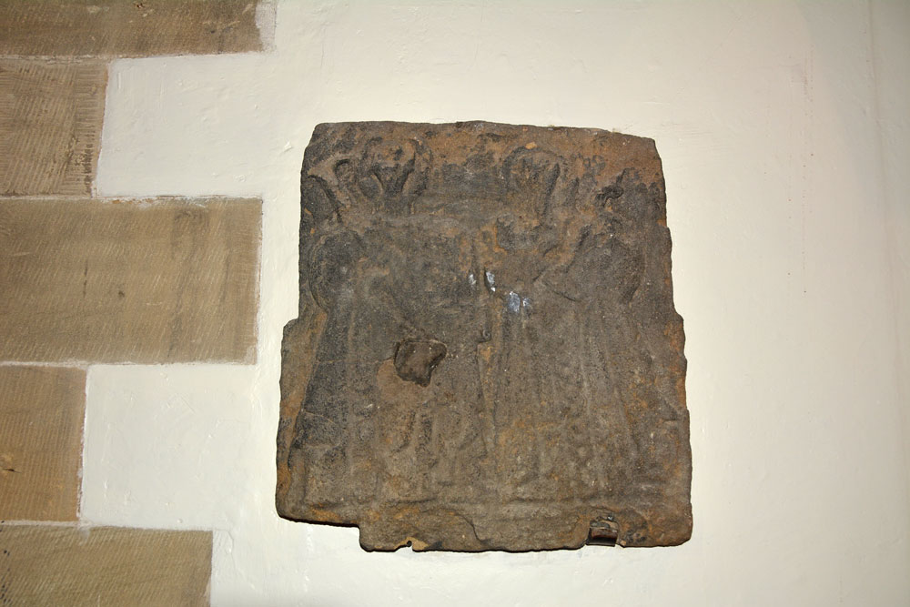
St Cuthbert's Church (Bedlington) submitted by Anne T on 13th Oct 2018. This carved stone, AS Corpus Bedlington 01, has now been built into the west wall of the nave, inside. The lighting is not brilliant, as it is sited immediately underneath the floor of the organ loft, and even with a flash, this was almost beyond my photographic skills. Dated to the tenth century, this worn slab has two figures, both with halos, the right hand figure holding a rod and with its right hand raised in blessing.
(View photo, vote or add a comment)
Log Text: St Cuthbert's Church, Bedlington: The Corpus told us the stone we were looking for was on the external east face of the nave. We were joined by a group of four boys who wandered into the churchyard and wondered what we were doing, so I told them, showed them the image, but none of us could find it. Looking through the architectural assessment I found it had been moved into the church and were on the west wall of the nave.
There were lights on in the church but the doors were locked. On our second try, the door opened and the Brownie Leader popped her head out. She very kindly let us into the church for a look around.
The south wall of the church is very old, but the rest of the exterior is Victorian. The nave of the church inside is incredible. Most of the grave markers were hidden behind the spiral staircase leading up to the organ, but I tried my best to photograph them.
St Cuthbert's Church (Billingham)
Trip No.58 Entry No.1 Date Added: 9th Nov 2017
Site Type: Ancient Cross
Country: England (County Durham)
Visited: Yes on 8th Nov 2017. My rating: Condition 3 Ambience 4 Access 5
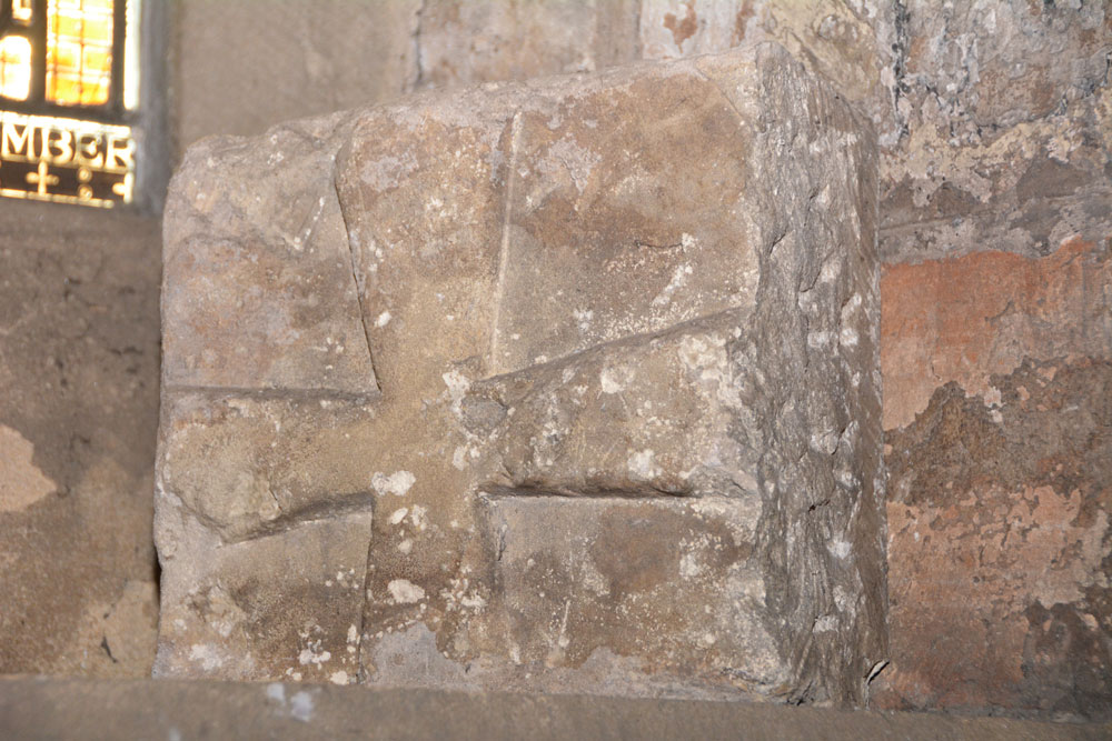
St Cuthbert's Church (Billingham) submitted by Anne T on 9th Nov 2017. AS Corpus Billingham 15, which dates from the late tenth to early eleventh century.
(View photo, vote or add a comment)
Log Text: Anglo Saxon Stones, St. Cuthbert's Billingham: We’d arranged to meet the verger, at the church at 12 noon. We arrived 10 minutes early, and found the south door didn’t have a keyhole, so wondered how we’d get in. It turns out there’s an entrance from the north side of the church. We wandered around the tower looking for the Anglo Saxon cross pieces built into the church tower. Some of these took some spotting, then we heard the verger calling us in.
The church is large, a fusion of 11th century and 1930s extension. The churchyard is huge – a surprise for somewhere so industrial as Billingham, but then this is Billingham Green.
I much enjoyed this visit. The verger spent over an hour taking us round, and took delight in showing us the stones, even one hidden behind a noticeboard against the west wall.
St Cuthbert's Church (Corsenside)
Trip No.149 Entry No.3 Date Added: 9th Sep 2019
Site Type: Ancient Cross
Country: England (Northumberland)
Visited: Yes on 8th Sep 2019. My rating: Condition 3 Ambience 4 Access 4
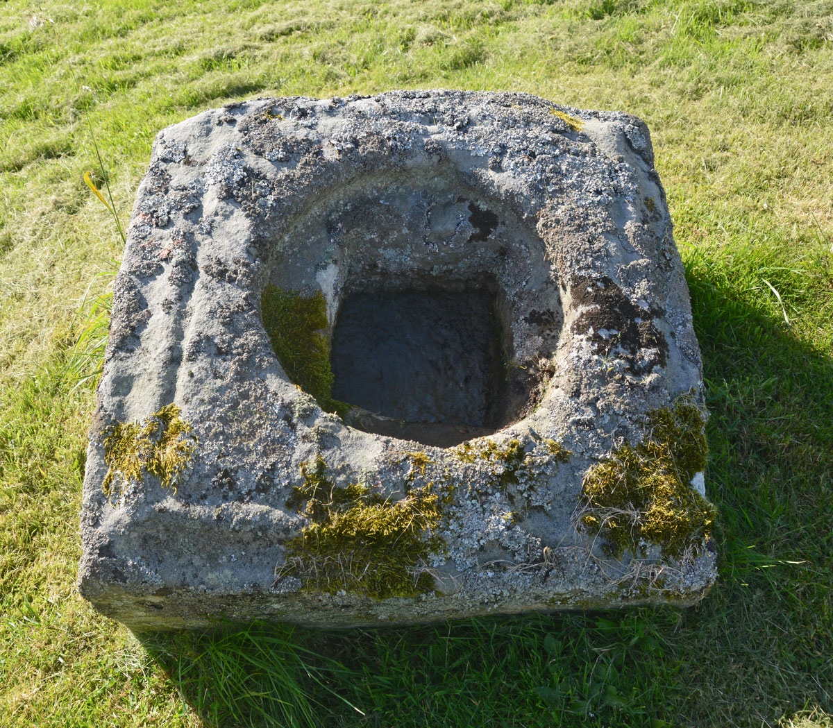
St Cuthbert's Church (Corsenside) submitted by Anne T on 9th Sep 2019. A look down into this 0.8m square socket stone, which has a shallow rectangular socket hole at the bottom of a circular depression. The top of the stone has a single roll moulding around its edge.
(View photo, vote or add a comment)
Log Text: Cross base at St Cuthbert's, Corsenside: This church is a little gem. After having let ourselves in through 2 gates (one by the A68, the other near the church), the views around the church are lovely. The church was open, and we were surprised to find out how old the chancel and sanctuary are. There were some very interesting grave markers inside the church, including one which was possibly a Tudor wayside cross.
The socket stone is exactly where described, and is one of the most ornate we’ve seen. Although a simple rectangle in shape, the rectangular socket stone as a circular depression above it, and in turn a small gully running just inside the top surface.
St Cuthbert's Church (Darlington)
Trip No.57 Entry No.1 Date Added: 25th Oct 2017
Site Type: Ancient Cross
Country: England (County Durham)
Visited: Yes on 25th Oct 2017. My rating: Condition 3 Ambience 4 Access 5

St Cuthbert's Church (Darlington) submitted by Anne T on 25th Oct 2017. AS Corpus Darlington 1 and Darlington 2, displayed in the nave, against the second pier of the south arcade.
(View photo, vote or add a comment)
Log Text: Ancient crosses, Saxon sundials and a hogback in Darlington: Originally due to go out for the whole day, we suddenly found ourselves having to rush back for an engineer arriving at our house after lunch. As we had an appointment to be at the church for 10.30am, to look round whilst there was a service in the chancel, we decided there was time enough to get to Darlington and back.
We met the church wardens we'd been liaising with very briefly to say ‘hello and thanks’ to. It was amusing as at least 3 people came into the church wanting to know where the church office was, so I pointed them in the general direction. It was odd wandering around the church with a communion service taking place in the chancel and sanctuary, and I was careful not to use the flash on the camera, although parts of the church were very dark, especially around the hogback.
We couldn’t find a couple of the catalogued items from the Corpus, and I struggled to identify which of the three cross heads we were seeing against those the Corpus lists. I looked through the Information for Guides folder and found an Architectural Assessment by Petr F. Ryder, Historic Buildings Consultant, dated 1997, part of which read:
“Pre Conquest Sculpture: Six pieces of Pre-Conquest sculpture are listed by Cramp (1984, 62-3). Of these one cross head, with the top of the shaft, dated to the late 10th or early 11th century, and an incomplete cross head of the early 11th century, are displayed in the nave, against the second pier of the south arcade; in a corresponding position on the opposite side of the nave is a supposedly Saxon sundial. In the north transept aumbry is part of a hogback, seen as a ‘crude copying of a type more elegantly represented at Brompton, Yorkshire’, and dated to the second quarter of the 10th century. Another fragment, seen as part of a large recumbent slab of the second half of the 10th century, lies in the south transept along with medieval cross slabs. A fifth stone which formerly lay outside the south transept, seen as possibly part of a dedication or ‘station’ slab from within the church, is now lost.”
St Cuthbert's Church (Milburn)
Trip No.66 Entry No.3 Date Added: 10th Feb 2018
Site Type: Ancient Cross
Country: England (Cumbria)
Visited: Yes on 9th Feb 2018. My rating: Condition 2 Ambience 4 Access 5
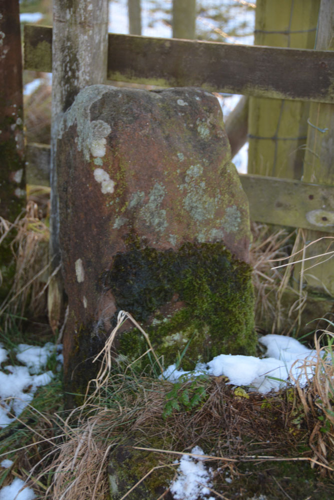
St Cuthbert's Church (Milburn) submitted by Anne T on 10th Feb 2018. Looking at the eastern face of the cross shaft. No carvings were visible on this face, and being so close to the fence and gate, it was difficult to get a clear look at the western and northern sides.
(View photo, vote or add a comment)
Log Text: Ancient cross and pre-Conquest sundial, Milburn, Cumbria: We scouted all around the churchyard for this cross, only to realise it was at the head of the access road from the village, so back-tracked to find it. It sits right by the northern gate post and we had mistaken it for part of the gate/fence structure, then we checked the grid reference and saw the hole in the top of the shaft, presumably either for another section or a smaller cross.
Going back down to the church, I found the pre-Conquest sundial, which is low down on the exterior stone door jamb of the western side of the south door. Thankfully I was able to pull up the Corpus of Anglo Saxon stone sculpture photograph to help me in the growing dusk.
The churchyard is really nicely kept and the Crowdundle Beck/Milburn Beck runs by the western side of the churchyard. A remote, by lovely spot.
St Cuthbert's Church (Norham)
Trip No.95 Entry No.1 Date Added: 9th Sep 2018
Site Type: Ancient Cross
Country: England (Northumberland)
Visited: Yes on 6th Sep 2018. My rating: Condition 3 Ambience 5 Access 5
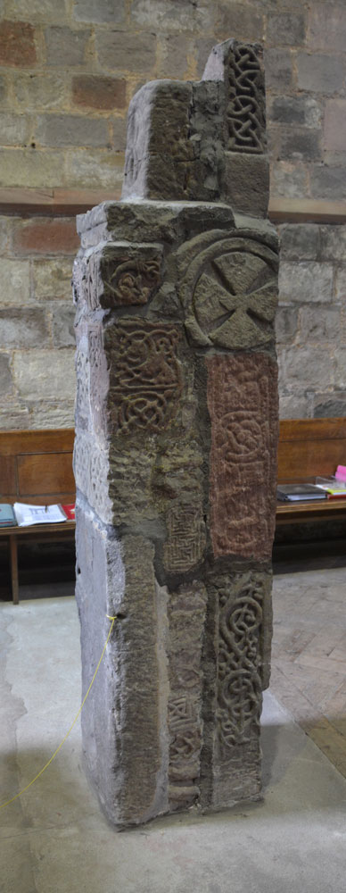
St Cuthbert's Church (Norham) submitted by Anne T on 9th Sep 2018. This is the side of the pillar which faces the south door into the church.
(View photo, vote or add a comment)
Log Text: Anglo Saxon Pillar, Norham: The journey seemed to take a lot longer than anticipated, and we didn’t arrive here until almost 3pm. At first, keeping the tower of the church in view, we went the wrong way, past the village cross and the first school, then turned round, travelling back along West Street (the B6470), turning down North Way to Church Lane. We spotted the churchyard first; the church is at the bottom of Church Lane, so we ended up parking near the gate at the bottom at NT 89710 47356 and walking up to the south porch along the path.
Andrew thought there were originally 25 stones here, but there are actually only 18, built into a ‘pillar’, with different sides showing, some recorded separately on the Corpus. A few of the fragments have been lost between their finding in 1833 and today, but the Corpus holds some drawings from the 19th century.
After photographing the Saxon pillar, we looked around outside, spotting the musket ball holes where Oliver Cromwell’s army had shooting practice, and looked at the site of the original Saxon church, which is on a mound slightly higher than the modern church.
St Cuthbert's Church (Wamphray)
Trip No.124 Entry No.4 Date Added: 5th Apr 2019
Site Type: Ancient Cross
Country: Scotland (Dumfries and Galloway)
Visited: Yes on 4th Apr 2019. My rating: Condition 3 Ambience 3 Access 4
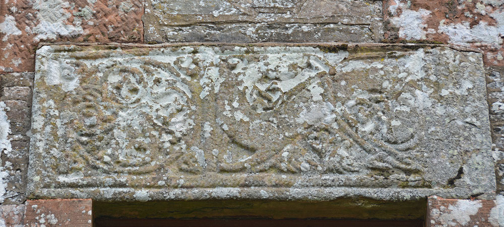
St Cuthbert's Church (Wamphray) submitted by Anne T on 5th Apr 2019. The Anglo Scandinavian cross slab above the west door of Wamphray Parish church, which is dedicated to St Cuthbert. Canmore tells us: "The front of the slab is divided into two panels by a cable moulding. The left panel is filled with a symmetrical knot formed by the interlacing of four plant scrolls, and that on the right by a backward-biting quadruped".
(View photo, vote or add a comment)
Log Text: Anglo Scandinavian Cross Slab, St Cuthbert's Church, Wamphray: This seemed far too modern a church to incorporate any old stones, but I was to be surprised. The churchyard was quite spectacular, with a large walled mausoleum and two very large monuments, one being a replica of a churchyard cross.
We found the stone over the west door of the church. It was an interesting exercise to photograph this, as the ground sloped down very steeply to the river. The stone was carved on its wide face, and also some interlacing on its underside, next to the door.
Sadly, the church was very firmly padlocked and doors locked, so we were unable to get to see the reverse side of the slab. There was a modern, recreation of a churchyard cross at the south side of the church, near the gate into the churchyard.
St Cuthbert's Holy Well
Date Added: 12th Apr 2016
Site Type: Holy Well or Sacred Spring
Country: England (Cumbria)
Visited: Yes on 28th Feb 2016. My rating: Condition 3 Ambience 3 Access 4
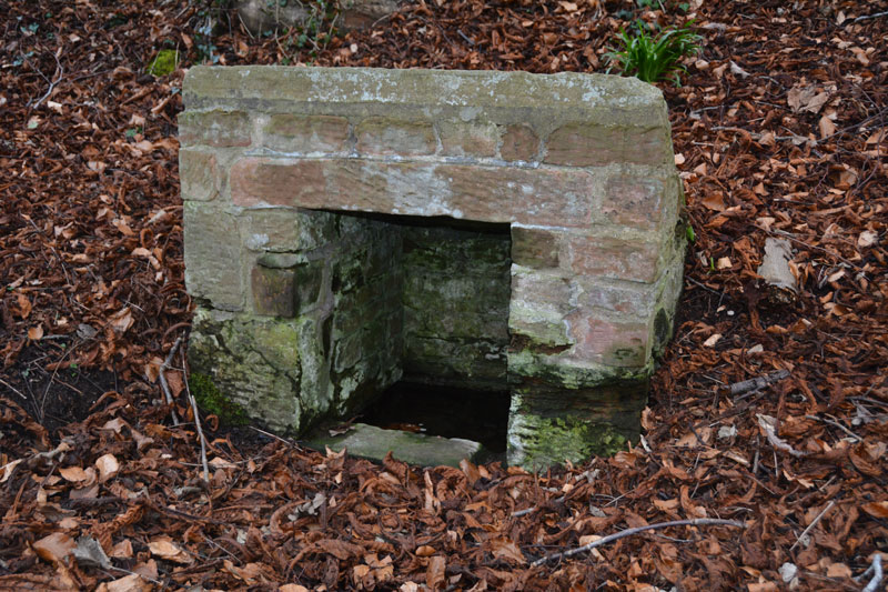
St Cuthbert's Holy Well submitted by Anne T on 2nd Mar 2016. The front and interior of St. Cuthbert's Holy Well. At the time of our visit, whilst the basin inside the well was full of clear water, there was little or no visible flow, unlike the spring opposite Wetheral Priory Gatehouse further up the village.
(View photo, vote or add a comment)
Log Text: St. Cuthbert's Well, Wetheral, Cumbria: I'd tried the (very pretty) walk along the recently flooded River Eden to St. Constantine's Cells, but failed as the path overhangs the river by some 5-6 metres. As a consequence, I was determined to go to this well. Just as you arrive into Wetheral village from the A69, there is a footpath sign leading off to the left, indicating St. Cuthbert’s Well.
There is parking outside the small railway station (there are just a couple of platforms here) and it’s about quarter of a mile down the slope towards the river to the well. A small sign sits to the right of the track as you head towards the river detailing a short history of the well. “According to legend, St Cuthbert’s Well was built long before Norman times when Wetheral Priory was founded. The exact date is not known, but St Cuthbert is thought to have visited Carlisle in 683 and 687.”
From the sign, the well can be seen topped by a concrete slab which has an inscription which reads: “The Holy Well/Called in the 12th century/Fons Sancti Cuthbert/Repaired 1897 and 2001.” A short flight of stone steps leads down to the well itself.
When visiting the village, the Wetheral Priory Gatehouse at the far side of the village is small but worth a visit.
St Cuthbert's Stone and Well (Waverbridge)
Date Added: 4th Jun 2022
Site Type: Holy Well or Sacred Spring
Country: England (Cumbria)
Visited: Yes on 14th Jun 2020. My rating: Condition 2 Ambience 3 Access 4
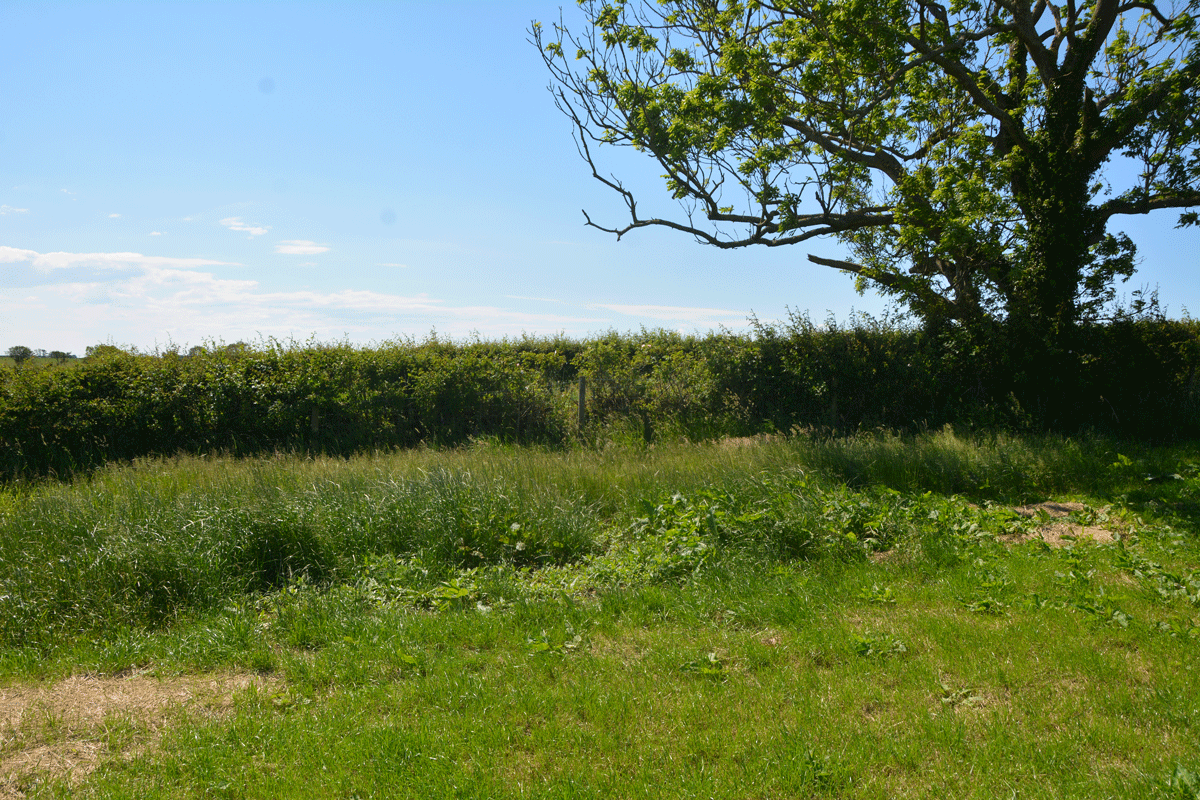
St Cuthbert's Stone and Well (Waverbridge) submitted by Anne T on 4th Jun 2022. Looking at the un-mown section of grass where the site of the well is shown. No water was showing in the field, but there was a pipe under the roots of the tree leading into the drainage ditch at the far side of the tree in the photograph.
(View photo, vote or add a comment)
Log Text: St Cuthbert's Stone & Well: We were making our first (and only for a long time) essential trip out, and passed within 400m of this well, so screeched to a halt at the entrance to the track (Watergate Lonning) at its junction with the B5302 at NY 21277 49139, and took our daily exercise walking down slope towards the well.
There is some sign of the well - in the field as an un-mown area of grass and in the hedge-line under the tree are remnants of a stone structure between the tree roots and along the bank of the ditch. All along the left hand side of the track (eastern side) is a drainage ditch, which we presume took the water from the fields, then when you get to the well, the water from the well joins the ditch. The well was dry at the time of our visit.
The stone was marked on the OS map, but was several fields away, with no gates in sight, so with time pressing, I photographed the well and we set off for our destination. So very odd to be out-and-about after months at home, but lots of other cars on the road, and difficult to rejoin the main road due to the high speed traffic.
