Contributory members are able to log private notes and comments about each site
Sites Anne T has logged. View this log as a table or view the most recent logs from everyone
Belstone Boundary Marker
Trip No.132 Entry No.12 Date Added: 9th Jun 2019
Site Type: Marker Stone
Country: England (Devon)
Visited: Yes on 13th May 2019. My rating: Condition 3 Ambience 3 Access 5

Belstone Boundary Marker submitted by Anne T on 9th Jun 2019. Having parked down the narrow lane just to the west of this boundary stone, this was my first view of it as I approached the road junction.
(View photo, vote or add a comment)
Log Text: Belstone Boundary Marker: Only 1km from the Sticklepath Boundary Stone, this supposedly pre-Conquest stone at the junction of the B3260 and a minor dead-end road which goes north east to a farm.
I got some strange stares from the cars as I photographed this stone, which is no longer on the parish boundary, presumably to accommodate road improvements. Had it not been for the busy road, this would have been in a gloriously peaceful countryside location, with lovely views northwards (the hedge to the south was too tall to see over).
I think the description in the Pastscape entry has been confused with the Sticklepath BS, near Lady Well, as this stone is triangular in shape and the only marking we could see was a partial bench mark on its front.
The acute angle of the minor road junction with the B3260 made the turn right out of the busy road a little tricky, but possible after waiting for a sufficiently large gap in the traffic.
Belstone Ring Cross
Trip No.132 Entry No.13 Date Added: 9th Jun 2019
Site Type: Ancient Cross
Country: England (Devon)
Visited: Yes on 13th May 2019. My rating: Condition 3 Ambience 4 Access 4
Belstone Ring Cross submitted by hoya105 on 23rd May 2019. Inside St Marys Church, in the lovely village of Belstone with its Holy Well and great pub!
(View photo, vote or add a comment)
Log Text: Ring headed cross at St Mary The Virgin, Belstone: A lovely little village, with not only the ring headed cross in the church but the Coronation Stone and the old stocks on the village green.
The church has a lovely atmosphere, tucked away to the west of the little village shop cum pub. The church had a slim guide book which made interesting reading, and I went through it during our visit to make sure we didn’t miss anything special.
The ring-headed cross is against the south wall of the church, near where the nave and sanctuary join. It’s base had been covered with an Easter scene.
We wandered back to the village green and had tea and cake in the Old Schoolroom Tearooms. This was to be my first experience of “toilet twinning” – there were photos of toilets in other countries that the tearoom toilet had been twinned with – brilliant!)
Bendor Stone
Trip No.41 Entry No.1 Date Added: 27th Aug 2017
Site Type: Standing Stone (Menhir)
Country: England (Northumberland)
Visited: Yes on 26th Aug 2017. My rating: Condition 3 Ambience 4 Access 5
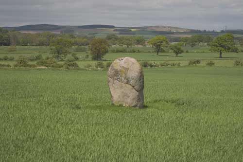
Bendor Stone submitted by kelpie on 16th May 2004. Standing stone found at NT96814 29428. Clearly visible from the road this stone is also known as The Battle stone as it is associated with the Battle of Homildon Hill in 1402, however, the stone itself was likely to have been erected in the Bronze Age.
(View photo, vote or add a comment)
Log Text: The Battle Stone, Bendor: The A697 was busy with holiday traffic today, and with a longish walk ahead of us, we stopped off in a very busy Wooler for refreshments, we headed off towards Kilham and Ring Chesters. As we whizzed along the A697 westwards, I spotted this stone standing in the middle of a field to the north of the road. Husband immediately turned right down the minor road leading to Bendor, a small hamlet just off the road. There was no parking here, just large private forecourts and it seemed the whole village was standing round talking, swinging round to look at us as we turned the car around.
Andrew had spotted a very narrow gateway which sloped down to the gate into the field at NT 96838 29400; this was litter-strewn and not suitable to take the car down. Pulling as far off the road as he could, I took the opportunity to clamber out and walk down to the gate. There was nothing in the field apart from a few curious sheep. Andrew said it was too dangerous to get out of the car, so I did something I wouldn’t normally do and let myself into the field and walked the 20 metres or so to the stone, telling myself if someone noticed me I’d ask permission.
Quickly taking photographs, particularly one with Yeavering Bell in the background (a bit difficult as the light was brightest in that direction and the camera was compensating), I headed back to the car and we turned around ready to resume our journey to Kilham.
Bennet's Cross
Trip No.134 Entry No.1 Date Added: 22nd Jun 2019
Site Type: Ancient Cross
Country: England (Devon)
Visited: Yes on 15th May 2019. My rating: Condition 3 Ambience 4 Access 4
Bennet's Cross submitted by thecaptain on 2nd Aug 2006. This is a lovely cross, believed to have been carved from a prehistoric menhir.
It stands about 1.7 metres tall, and is just beside the B3212 road near its high point as it crosses the moor between Moretonhampstead and Postbridge.
(View photo, vote or add a comment)
Log Text: Bennet's Cross, Devon: Not on our schedule for the day, but as we drove right past this cross, we pulled over in the small car park just to the eastern side of the B3212to take a closer look at this cross and to take some photographs. A slight problem on the morning, as the car park, even before 9.30am was chock-a-block with a party of ‘twitchers’, so as our car was blocking some of theirs in, Andrew stayed with the car and I ran over to the cross.
The early morning sunshine was really bright, so parts of the cross were in deep shade. I did see the carved WB on the cross, but the shadows were really deep. The intention was to stop on the way back and photograph the cross in a different light, but we were so tired at the end of the day, I forgot.
Berry Well
Trip No.161 Entry No.4 Date Added: 8th Jun 2021
Site Type: Holy Well or Sacred Spring
Country: England (Yorkshire (West))
Visited: Yes on 31st May 2021. My rating: Condition 3

Berry Well submitted by jamesrattue on 23rd Oct 2008. Berry Well at Swinton, photographed 18th October 2008.
(View photo, vote or add a comment)
Log Text: Berry Well, Swinton Park Hotel: After St Michael's Well in Well, we stopped off in Masham for refreshments, stopping to photograph the water troughs/Renton Well in Masham before setting off to find Berry Well.
We parked at SE 21443 79735, just to the south of the hotel lodge gates. As I stepped out of the car, I immediately noticed the trough.
The area of grass verge up to the well from the hotel gates has been recently strimmed. The sound of running water can be clearly heard. The well basin is well under the current ground level, and largely hidden by the weed trimmings. The water is piped under the road, although there is no indication that we could find of where the water goes to.
There is a pond on the other side of the wall, which feeds the well. There is a small, lively, very clear stream which wends its way down a very gentle slope in the grounds of the Swinton Park Hotel. (The gates of the hotel were open, so we popped in and followed the wall along).
There is another section of trough on the hotel side of the wall.
Bessie's Hill Fort
Date Added: 11th Apr 2015
Site Type: Hillfort
Country: Scotland (Dumfries and Galloway)
Visited: Yes on 6th Apr 2015. My rating: Condition 3 Ambience 4 Access 3

Bessie's Hill Fort submitted by Anne T on 11th Apr 2015. This is a panorama (4 photos stitched together) of Bessie's Hill Fort from the forest track which ran north west along the western edge of the fort.
(View photo, vote or add a comment)
Log Text: Bessie’s Hill Hill Fort, Eskdalemuir: Travelling on from the enigmatic earthworks and cemetery at the foot of Holm Craig (which I haven’t been able to find anything out about – yet), by the time we arrived here it was gone 5pm and the forest was deserted, apart from one other car in the visitors car park (no sign of its occupants anywhere). It was a very pleasant walk in the early evening sunlight up a soft, springy mossy path through the forest up to the fort, if a little steep in one place where there were steps to aid visitors. Once onto the top of this first hill, another trail led into the fort itself.
Unusually, we could hear the sound of rabbits thumping in their burrows as well as the call of the curlews as we followed this trail, at one point squelching over an area of grass and reeds (a spring? the water source for the fort?) just before the first double ditch/bank. The construction of this fort reminded me so much of Maiden Castle in North Yorkshire (but without the heather in bloom). I drew my breath in at the steepness of the drop on the south eastern side, where the land drops steeply down to the White Esk valley, although we were unable to see much of the river because of the tall pine trees in between.
We walked to the far end of the fort where the interpretation board was, but this was in very bad repair.
As the light was going and my husband was keen to see Castle O’Er before dark we didn’t venture further up the hill to the settlement, but will come back another time. There really is so much to see in this part of the world.
Bessygarth Well (King's Meaburn)
Trip No.90 Entry No.5 Date Added: 31st Jul 2018
Site Type: Holy Well or Sacred Spring
Country: England (Cumbria)
Visited: Yes on 30th Jul 2018. My rating: Condition 3 Ambience 4 Access 4
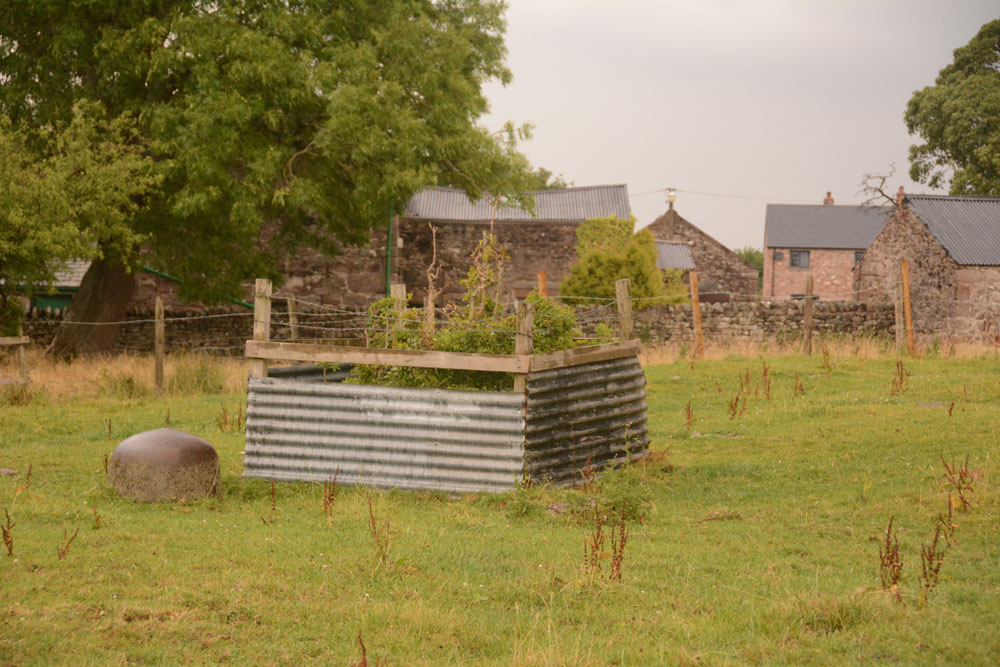
Bessygarth Well (King's Meaburn) submitted by Anne T on 31st Jul 2018. Getting closer, the peculiar cast iron 'bowl' (the cap for an old pump?) can be seen to the left hand side of the well. Thinking this was a drinking bucket for cattle/sheep, I tried to overturn it to look closer, only to find it was deeply embedded in the ground, and very heavily constructed.
(View photo, vote or add a comment)
Log Text: Bessygarth Well, King's Meaburn: This is a very old village, with a scheduled 17th century barn opposite the bus stop next to the village hall where we parked. The village runs in a long ribbon along both sides of the road, with an incongruous caravan park tucked behind the village hall.
Despite being marked on the OS map, we couldn’t find this well at first, so asked someone who’d pulled up outside one of the cottages opposite. He was only visiting, but was kind enough to ask inside the house, and relayed a message, saying that “if there’s some old tin in the field, that’s the well”. We were told it was OK to go into the field, providing we ensured the gate was shut.
Andrew dropped a stone down it, and it sounded deep! There was a most peculiar solid cast iron ‘bowl’ deeply embedded into the ground next to the well. Was this the cap of an old pump?
The field behind the well is covered in lumps and bumps. Researching it when I got home, found it was the site of the medieval settlement.
Bewcastle Cross
Date Added: 11th Oct 2015
Site Type: Ancient Cross
Country: England (Cumbria)
Visited: Yes on 11th Oct 2014. My rating: Condition 3 Access 5
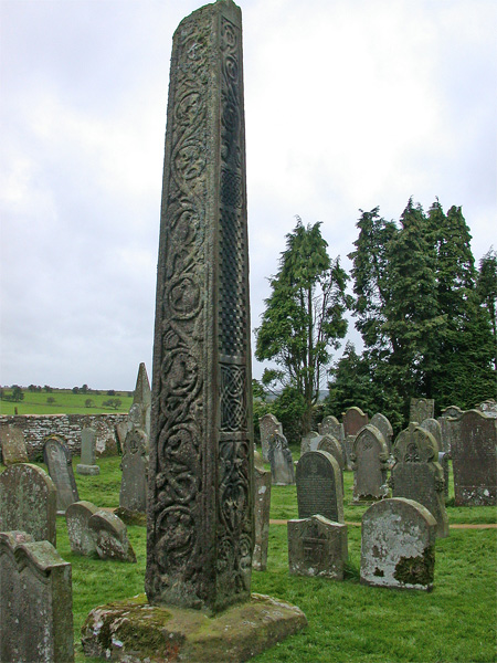
Bewcastle Cross submitted by nicoladidsbury on 20th Sep 2004. Bewcastle Cross, Cumbria
Image shows the detail from the north and east sides of the 15m cross. These sides are very well preserved.
The north side is divided into five compartments. In the highest and lowest are vines running in graceful curves and bearing foliage and fruit. "In the second and fourth divisions are two curiously-devised and intricately-twisted knots." The third division is filled with the chequer work. Between the compartments are lines of Runes which are now so indi...
(View photo, vote or add a comment)
Log Text: Bewcastle Cross. Fourth visit, 22nd August 2015. We first came here back in 1992/1993 not long after we'd moved to Dumfries. Funny, as from dim and distant memory both my husband and I remembered this (falsely) as being the Ruthwell Cross. After having taken a photo of our 3 children gathered round the foot of the cross in the mist and drizzle, for the last couple of years I'd wanted to recreate this photograph, so for my **th birthday, the family (complete with next generation) gathered. The skies were still murky and grey although the cross doesn't appear to have changed one bit.
After taking a photo of the children as they are now, we gathered to whole family, complete with next generation, taking photos with the remote shutter control.
The museum display has improved a lot since our visit in 2014, and I came prepared with printed sheets from the Anglo Saxon Corpus but didn't find any of the Saxon grave covers in their inventory, although there was one on display, very simply carved, which was labelled as being from the 8th to 11th century.
11th October 2014: Third visit. We last came here on 15th August 2013, but I was really quite ill (a bug, not a hangover!) and had to find a quiet corner of the churchyard, so I don’t remember very much of the visit to the church. I do remember walking around the castle with the farmer and his wife gardening nearby so I felt like a trespasser.
Today, as we reached St. Cuthbert’s church, the sun came out and highlighted the cross and many of the carvings showed clearly, especially the worn and weathered runes on the eastern face.
The exhibition has been improved since our visit, with displays about the runes and their meanings and a new painting of what the cross might have looked like when it was first erected.
There were less fragments in the exhibition outbuilding than I remembered.
Biddlestone
Trip No.12 Entry No.3 Date Added: 7th Mar 2017
Site Type: Ancient Cross
Country: England (Northumberland)
Visited: Yes on 5th Mar 2017. My rating: Condition 3 Ambience 4 Access 4
Biddlestone submitted by vagabondnma on 11th Mar 2007. The Biddle Stones - only two stones just next to the private road up to the chapel. The map reference is wrong. I'd say it should be NT958082.
(View photo, vote or add a comment)
Log Text: The Biddle Stones, Northumberland: From Castle Hill, Alnham, we returned to Alnham Village and took the minor road towards Biddlestone. Also a cycle route, the road was gated and very muddy. Being twisty and with numerous side roads joining, it was sometimes a little difficult to keep to the main road!. Nevertheless, we ended up at the entrance to Biddlestone Chapel, where the gate up the track was shut. We parked by the entrance and walked up the hill. The chapel was closed, but a list of keyholders is given on the noticeboard at the entrance to the track.
Having no real clue as to where the Biddle Stones were, we came upon them half way up the track to the chapel on the left hand side of the track. One is definitely a socket for a cross; the other has been paired with it.
We walked up to the chapel. The chapel is strange, being in a defensive position, with a ravine to its north, with a drop of some 60 to 70 feet down to the stream below. To the south looks like a building platform of some kind The numerous mole hills had brought up lots of small pieces of brick, so something had been demolished.
There was a lovely view over to the Netherton Burn valley below, with a farmer and his three dogs herding a flock of beautifully cream, fat sheep. No sign of the stone circle by the burn from here.
Billey Keld
Trip No.161 Entry No.6 Date Added: 8th Jun 2021
Site Type: Holy Well or Sacred Spring
Country: England (Yorkshire (West))
Visited: Yes on 31st May 2021. My rating: Condition 3 Ambience 3 Access 4
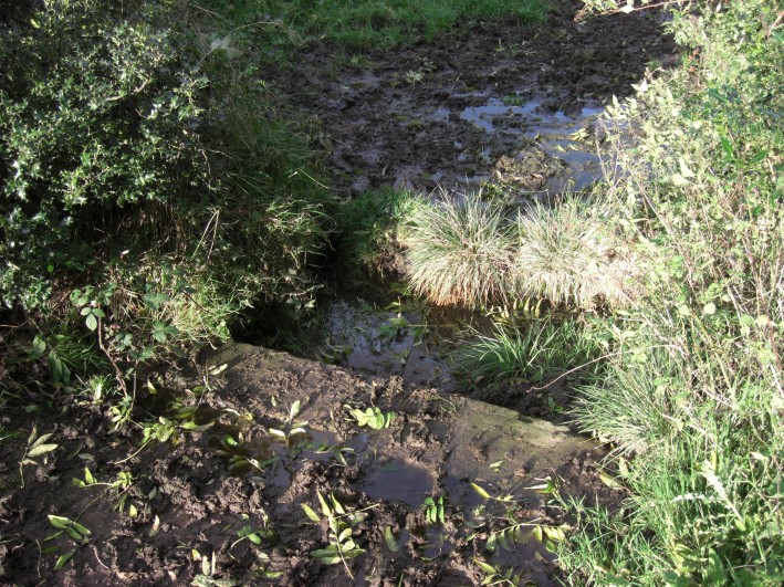
Billey Keld submitted by jamesrattue on 23rd Oct 2008. Billey Keld at Grewelthorpe, photographed 15th October 2008.
(View photo, vote or add a comment)
Log Text: Billey Keld Well, Grewelthorpe: With some very lively bullocks in the field, we decided not to venture into the field through the gate to look at well. However, we managed to see some of the structure from the roadside.
A local lady walking her dog stopped to talk to us and say she remembers visiting the well to collect water when she was a child.
Birrens Roman Fort
Trip No.190 Entry No.3 Date Added: 18th Sep 2024
Site Type: Stone Fort or Dun
Country: Scotland (Dumfries and Galloway)
Visited: Yes on 13th Sep 2024. My rating: Condition 2 Ambience 3 Access 4

Birrens Roman Fort submitted by Anne T on 18th Sep 2024. Standing just inside the gate into the field containing the fort, looking south along the minor road from Middlebie.
(View photo, vote or add a comment)
Log Text: Birrens Roman Fort: I didn't even know this fort existed until we spotted it on the OS map and it was on our way home, so we stopped to look. My hip wouldn't allow me to climb over the stile, but the farmer had left the gate unpadlocked, so we let ourselves carefully in and out.
The field had been heavily churned up by cattle, so walking across it was difficult. Would like to return to this site with some of the reports mentioned in the Canmore record and in better weather.
Birtley Iona Cross
Date Added: 7th Oct 2014
Site Type: Ancient Cross
Country: England (Northumberland)
Visited: Yes on 2nd Oct 2014. My rating: Condition 4 Ambience 4 Access 5
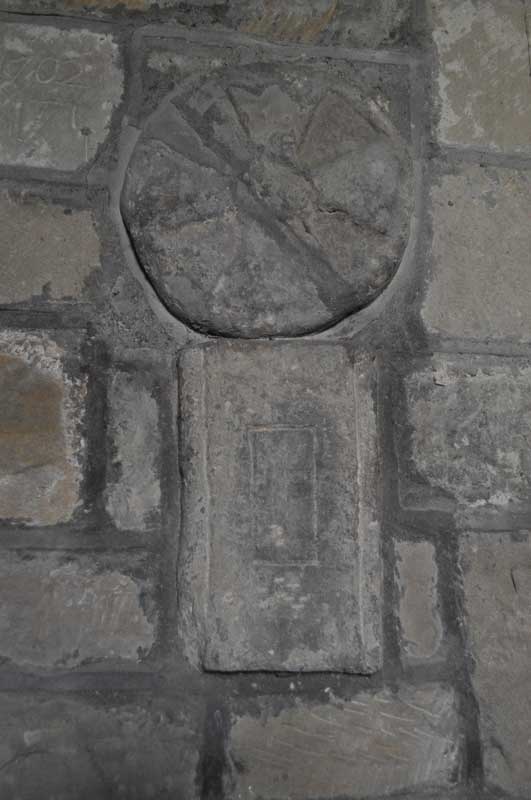
Birtley Iona Cross submitted by Anne T on 6th Oct 2014. An undated Saxon cross-shaft fragment and circular grave marker/dedication cross from the second half of the 11th century are built into the northern wall of the nave near the font.
(View photo, vote or add a comment)
Log Text: Iona Cross, Birtley (St. Giles, Birtley): From St. Giles in Chollerton, this church is easy to find, being only 6 miles away. To reach it, drive down the small road to the left hand side of the church and continue on down through Barrasford, turning right just before reaching the village of Wark (signpost says Birtley is 2 miles). The church is then on your right hand side as you enter the village. It sits with it’s narrowest (west side) next to the road and is hidden under trees, so it’s only when I saw the grave yard that I realised I’d arrived. I drove up into the village to turn around (been here for a walk years ago and parked at the top end of the village) and bumped up onto the pavement to park by the gate to the church.
The present church was rebuilt in the 18th century and renovated in the 19th century, and has a wonderful feel the minute you step through the door.
Opening the porch, there are grave covers built into the wall, and glorious flower arrangements left to welcome visitors as you enter.
Rev. Slade had told me about the Iona cross before my visit, so I left this until last to find. Three of the fragments are built into the north wall (two of them together, these near the font). The Iona cross is in the chancel. The fourth was high up on a ledge in the porch (I would have missed this had I not looked a third time to find it – didn’t think to look up).
Bishop's Stone (Lustleigh)
Trip No.130 Entry No.9 Date Added: 1st Jun 2019
Site Type: Ancient Cross
Country: England (Devon)
Visited: Yes on 11th May 2019. My rating: Condition 3 Ambience 3 Access 5
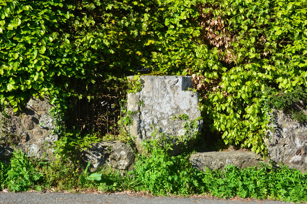
Bishop's Stone (Lustleigh) submitted by Anne T on 1st Jun 2019. The Bishop's Stone, seen from part way across this busy, minor road. The Pastscape photograph shows the stone set against an iron railing; a substantial hedge has since grown up around it.
(View photo, vote or add a comment)
Log Text: Bishop's Stone, Lustleigh: This stone is on a corner of a busy road junction of three minor roads– I needed to pick my time to step part way across the road to photograph the stone from the front. The metal railing shown in the Pastscape photo is now largely hidden by a beech hedge. The stone goes about around a metre or so back into the garden of the house. It’s a lot bigger than it looks at first glance. We were also lucky that the bright sunlight also helped to show up the incised shield.
Black Hill Cross (Glaisdale Rigg)
Trip No.32 Entry No.7 Date Added: 5th Jul 2017
Site Type: Ancient Cross
Country: England (Yorkshire (North))
Visited: Yes on 2nd Jul 2017. My rating: Condition 3 Ambience 4 Access 5
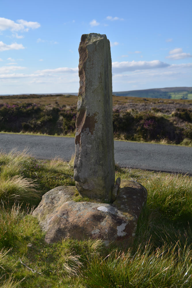
Black Hill Cross (Glaisdale Rigg) submitted by Anne T on 5th Jul 2017. This wayside cross must have been a welcome sight in the middle of this isolated (but beautiful) moorland, especially in the winter months. The base is crudely carved; the shaft looks like a modern addition.
(View photo, vote or add a comment)
Log Text: Black Hill Cross, Glaisdale Rigg: From Danby Rigg, we made our way to Glaisdale Rigg. I’ve been to some surprisingly beautiful parts of England before, but this was Pretty with a capital ‘P’. We needed the map to follow the surprisingly windy (and hilly) roads through Street village to Glaisdale Rigg.
Whilst described as a standing stone on the OS map this is clearly an old cross base with a more recent cross shaft wedged in. It must have been a very welcome sight to travellers, especially during winter months, in this very isolated piece of moorland. Well worth stopping to appreciate the views, especially as it was on our way to Hart Leap.
Black Howe (Rawcliffe)
Trip No.7 Entry No.4 Date Added: 2nd Oct 2016
Site Type: Cairn
Country: England (Yorkshire (North))
Visited: Yes on 1st Oct 2016. My rating: Condition 2 Ambience 2 Access 5
Black Howe (Rawcliffe) submitted by vagabondnma on 13th Mar 2007. The bracken covered Black Howe. I have another picture that is even less clear!
(View photo, vote or add a comment)
Log Text: Black Howe round barrow, west of Newton-on-Rawcliffe, North Yorkshire: Just 800 metres from Rawcliffe Howe, travelling east along Rawcliffe Road, Black Howe round barrow can be found.
There is a small layby (which says no parking) but was large enough for several cars, so we parked and hopped out to look.
The barrow was visible as a mound through the bracken, but the farmer had blocked the entrance to the field with harvesting machinery, so it was not possible to access the site to see the barrow from the other side (sadly). There were great views across the Pickering valley.
The only information I can (currently) find out about this barrow is from the Ancient Monuments website, which says: "Traces of an earthwork were noted in the field west of Black Howe in 1949. Field investigation in 1974 found no trace of the feature, the field under pasture", although there is a clear, bracken covered mound at the edge of the field.
Black Knowe (Borders)
Date Added: 24th Apr 2015
Site Type: Standing Stone (Menhir)
Country: Scotland (Scottish Borders)
Visited: Yes on 23rd Apr 2015. My rating: Condition 3 Ambience 4 Access 3
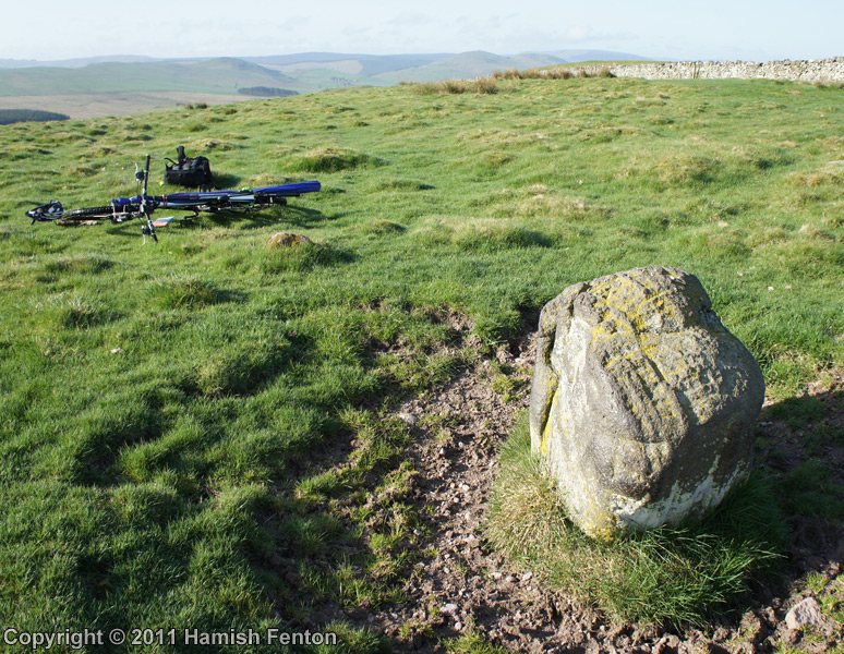
Black Knowe (Borders) submitted by h_fenton on 17th Aug 2011. Black Knowe Standing Stone viewed from roughly north. although known as a standing stone it is better described as a boulder and may have once been part of the nearby Black Knowe Cairn.
27 April 2011
(View photo, vote or add a comment)
Log Text: Black Knowe Standing Stone, Scottish Borders: Continuing on northwards from the Falla Knowe Cairn the path becomes more of a grassy footpath with evidence of ditches at either side in parts, so we knew we were following the old Roman road of Dere Street (funny, as this Roman road continues south down through Corbridge just a few miles from where we live). Climbing the gentle slope, to the left hand side the Black Knowe Cairn comes creeping into view. On the right hand side of Dere Street are what might be other archaeological features (look like a mixture of rectangular remains of old walls and sunken waterlogged patches with reeds).
Suddenly the land flattens out slightly and there is what looks like a free-standing boulder sitting almost next to the path. Interestingly the RCAHMS records “contradicts” itself – for Site NT71NE 44/Canmore ID 57960 the 1973 visit records it as a natural erratic boulder; the 1979 visit report says “its size and shape suggest that it may be a companion to the outlying stones of the adjacent cairn”. We’ve come across these solitary standing stones next to Roman Roads before, as if they were used as markers/waypoints or to pass and respect sites that were ancient when these roads were built.
Looking more closely there are actually three boulders, one just to the south and another just to the north. My opinion is that it is either a small cairn in its own right or is associated with Black Knowe Cairn, but the stone wall/dyke in between the two features makes it difficult to ascertain. Even though my husband went up to the stone wall to line himself up with the larger cairn behind to see if we could make any connections between the two monuments it was difficult to tell. Oh to have an octo-copter with camera!.
The views from here are spectacular, particularly as we were just under the edge of a weather front, with big dark rain clouds coming down from the north and the sunlight hills all around the other compass points.
As there were no gates in the long, long stone wall (I never know what to call these – when we lived in Dumfries the locals referred to them as dykes; where I was brought up in Yorkshire, dykes were ditches!), we continued up the hill to Trestle Cairn.
Black Tor (Meavy)
Trip No.133 Entry No.14 Date Added: 17th Jul 2019
Site Type: Multiple Stone Rows / Avenue
Country: England (Devon)
Visited: Yes on 14th May 2019. My rating: Condition 3 Ambience 4 Access 4
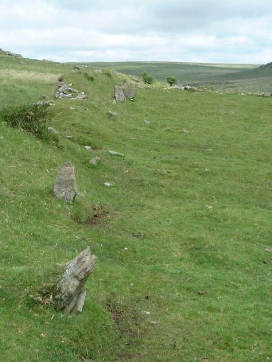
Black Tor (Meavy) submitted by Brian Byng on 7th Feb 2002.
(View photo, vote or add a comment)
Log Text: Stanlake Stone Row (aka Black Tor): Our second stop of the afternoon, and our hope was that as we crossed the road and descended from the slopes that we'd be more sheltered from the wind. Not a chance! However, this did not spoil my enjoyment of the next few sites.
From the Leeden Tor stone row, we crossed the main road, ending up in what -after a spell of wet weather - would have been a boggy dip, but at the time of our visit was relatively dry. Even so trying to find a way across that I, and my wonky knees could manage, was a little amusing. Angie stopped to have her photographs taken against the Tors and woodland behind.
This double stone row is partly hidden by a dry stone wall/earthen bank, put up when the landowner enclosed his land, telling his workers to ‘enclose up to and including the stone row’ according to Sandy.
We had intended to come back and photograph this stone row on the way back, but because I couldn’t make it to the sites we'd planned to go to later in the afternoon because of the steep drops by the leat, we didn’t return this way.
Black Tor Stone Row Cairns (Stanlake)
Trip No.133 Entry No.15 Date Added: 17th Jul 2019
Site Type: Cairn
Country: England (Devon)
Visited: Yes on 14th May 2019. My rating: Condition 2 Ambience 3 Access 4
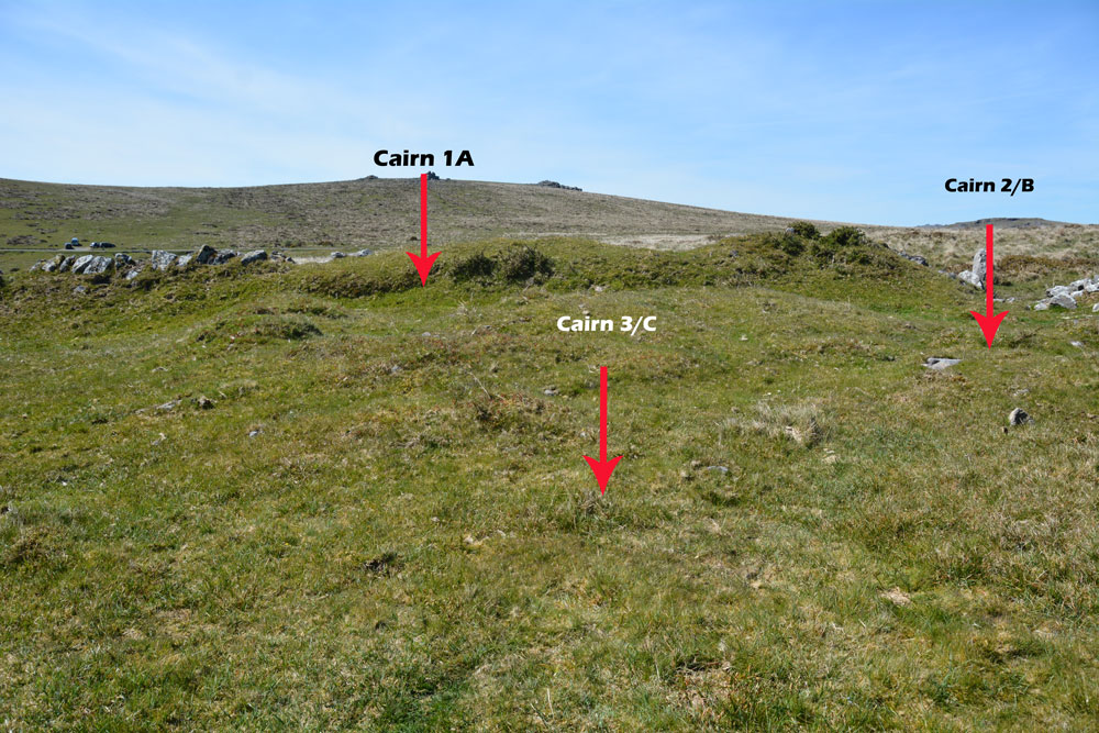
Black Tor Stone Row Cairns (Stanlake) submitted by Anne T on 10th Jul 2019. The three cairns which can be found at the south western end of the Black Tor/Stanlake Stone Row.
(View photo, vote or add a comment)
Log Text: Black Tor, cairns at south-western end of the stone row: These cairns lie just to the south western end of the stone row, to the south of the field boundary containing the northern side of the stone row and just to the west of another field boundary which runs NNW-SSE. Whilst I vaguely recognised these as cairns, without Dave Parks and his magic GPS, and Sandy G coming to give us an explanation, I might have dismissed these as being relatively unimportant. Wrong!
These cairns are recorded on Sandy’s Site Report 4 for the stone row (diagram 6, page 12) but again it was too windy to get these out and study them in any detail. I would really have loved to have spent more time here on a lovely, bright sunny day.
These run just to the west of another field boundary which runs NNW to SSE and just south of the field boundary containing the stone row.
Blackpark
Trip No.50 Entry No.4 Date Added: 9th Oct 2017
Site Type: Stone Circle
Country: Scotland (Isle of Bute)
Visited: Yes on 25th Sep 2017. My rating: Condition 3 Ambience 4 Access 4

Blackpark Stone Circle submitted by saille on 14th Jan 2004. At NS 091556, the stone circle in Blackpark Plantation has only three stones left standing, the remains of a larger complex of seven stones.
Now surrounded by forestry plantation.
Towards the west of the road, between Kingarth and Largizean farm, there are three more standing stones which are more in-line with each other than Blackpark.
(View photo, vote or add a comment)
Log Text: Blackpart Standing Stone, Isle of Bute: About 2.3 km north of St. Blane’s Chapel, still on Plan Road. There is a small car park just off the road, north of the stones, at NS 09160 55716. The ground was very boggy, with large pools of water both on the path to them and in between, so we had to pick our way very careful.
These three stones are some of the most mis-matched I’ve seen. The northern and southern most stones are made of a reddish conglomerate, a little like cement. The third stone looks like whinstone, which has split down the middle, and is the oddest of shapes, morphing what it looks like completely as you walk around it.
Thankfully the mist had thinned by the time we arrived here, and the sun was just starting to show throw the pine trees of the surrounding forest.
I was very intrigued by the southernmost stone, on a mound – is this a cairn? No mention of this on Canmore, although as I was walking around it I spotted graffiti, including what looked like a misshapen cross.
Bladnoch
Trip No.139 Entry No.4 Date Added: 24th Jun 2019
Site Type: Standing Stone (Menhir)
Country: Scotland (Dumfries and Galloway)
Visited: Yes on 17th Jun 2019. My rating: Condition 3 Ambience 3 Access 5
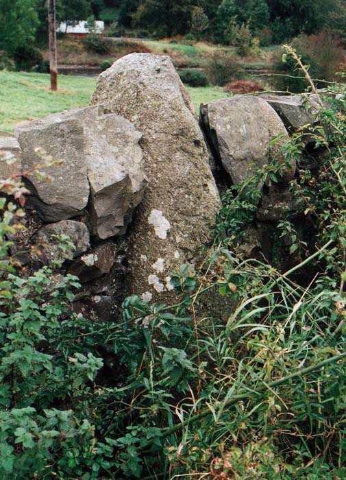
Bladnoch Standing Stone submitted by PaulM on 29th Oct 2002. This standing stone is marked on the OS Explorer Map 311 (Wigtown, Whithorn & The Machars) and can be found in the drystone wall flanking the A714 and directly opposite the house called Ashleigh in Bladnoch. The whisky distillery is only a short stagger away.
NGR: NX 423542.
(View photo, vote or add a comment)
Log Text: Bladnoch Standing Stone: We found this stone very hard to spot, eventually parking outside the cottages opposite the dry stone wall the stone was in and walked up and down the road with our GPS. We eventually spotted it by looking along the drystone wall and seeing where the tallest stone poking out of the wall was.
The stone was almost completely covered by wild roses, nettles and brambles, but we managed to push them gently to one side to take a photograph.
We did look for an entrance into the field by the river to look at the other side, but did not see one.
