Contributory members are able to log private notes and comments about each site
Sites Anne T has logged. View this log as a table or view the most recent logs from everyone
Sleights Pasture Propped Stone
Trip No.144 Entry No.2 Date Added: 13th Aug 2019
Site Type: Rock Outcrop
Country: England (Yorkshire (North))
Visited: Yes on 8th Aug 2019. My rating: Condition 3 Ambience 4 Access 4
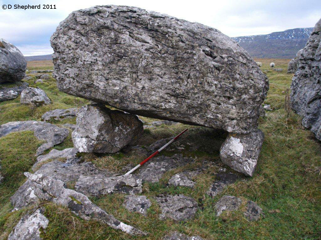
Sleights Pasture Propped Stone submitted by DavidShepherd on 10th May 2018. Sleights Pasture Propped Stone, photo by David Shepherd
(View photo, vote or add a comment)
Log Text: Sleights Pasture Propped Stone: We parked at SD 75081 78117, just beyond the cattle grid on this single-tracked public road (there is room for a couple of cars between the road and the stone wall) then along the very busy, and fast, B6255 Low Sleights Road, walking NE towards the Ribblehead Viaduct, then crossing the road to the footpath leading to this limestone scar, then heading SE along another minor footpath, marked on the map, but barely visible on the ground.
As there were several possibilities of which this propped stone might be, I made doubly sure I had the correct GPS and we were within 1m of the reading. We also compared it with the photograph on the Portal and the diagram (figure 7, in David’s paper “Propped Stones: The Modification of Natural Features and the Construction of Place” (Time and Mind, November 2013)) - I'd taken a copy with me, just in case.
Sorry, but I’m really sceptical about this being a propped stone. I would have been convinced if the propping stones were of a different material to the top stone. It looked like a ‘happy accident’ of glacial deposits and erosion. Another large boulder to its west was placed almost symmetrically on top of a ‘base pad’ of bed rock, and we spotted another couple of stones that also might have been taken as being propped. It reminded me very much of the ‘Guide Stones to the Great Langdale Axe Factory’, where it was difficult to pick one guide stone out of so many on the ground.
I also wasn’t convinced about the double propping, unless I have misinterpreted what David means about this. The boulder at the western end of the stone appeared to be cracked through, viewed from the north, rather than being two separate boulders on top of each other. Both propping stones were placed/located onto top of a bed of limestone.
There was also a very mysterious wall at SD 75748 78030, which Andrew pointed out, partly built with limestone pavement blocks for its ends. Looked like a sheep shelter to me.
Keld Bank (Ingleborough)
Trip No.144 Entry No.3 Date Added: 13th Aug 2019
Site Type: Rock Art
Country: England (Yorkshire (North))
Visited: Yes on 8th Aug 2019. My rating: Condition 3 Ambience 4 Access 3
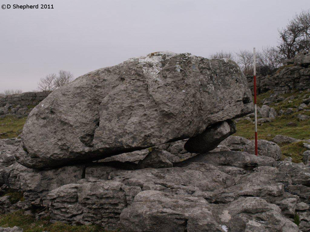
Keld Bank (Ingleborough) submitted by DavidShepherd on 10th May 2018. Keld Bank Propped Stone, photo taken by David Shepherd.
Top stone seems to have come from the adjacent collapse feature on the scar. There is an enlarged joint beneath blocked with a flake.
(View photo, vote or add a comment)
Log Text: Keld Bank Propped Stone: We parked in the small car park for Great Douk Caves on the northern side of the B6255, Low Sleights Road, and began by following the footpath up to the caves, passing the lime kiln on the way. We then largely followed a quad bike track SSE up the slope to the first limestone scar, then headed north east towards the grid reference given by David Shepherd.
The piece of land this propped stone sits on is a nature reserve, managed by Natural England, so we assumed we were safe to walk up over the limestone ridges or scars, of which I counted three. There were easy routes up over each raised section of scar, so I made the walk to the stone easily. Again, we needed to use the GPS and David’s photograph to confirm we were looking at the correct stone, as there were a number of possibilities in the area, including one nicely ‘balanced’ stone nearby.
My comments about this propped stone as the same as above. Even Andrew was less convinced this time, given there were so many other stones around that could also have been counted as ‘propped’ or ‘balanced’.
We ‘called off’ the walk for the third stone as a result of this visit, opting to go and find the stone circle at Casterton.
Keld Bank Settlement
Trip No.144 Entry No.4 Date Added: 13th Aug 2019
Site Type: Ancient Village or Settlement
Country: England (Yorkshire (North))
Visited: Yes on 8th Aug 2019. My rating: Condition 2 Ambience 4 Access 3
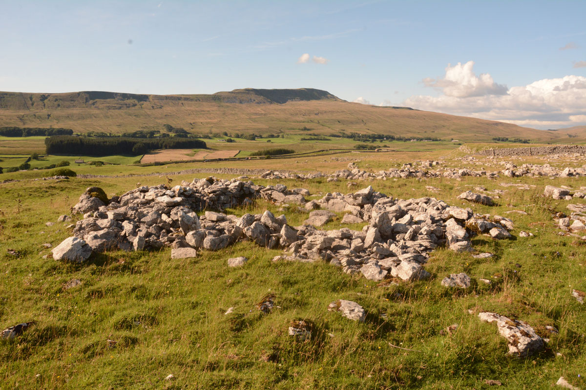
Keld Bank Settlement submitted by Anne T on 13th Aug 2019. The remains of the roundhouse, with an attached enclosure, on the western edge of the settlement. This view looks NW. On the terrace below, there are the remains of clearance cairns and the low banks of field systems
(View photo, vote or add a comment)
Log Text: Keld Bank Settlement: Sitting down in the sunshine, recording the photographs I’d taken for the Keld Bank Propped Stone, I picked up the OS map and realised there was a settlement here. In fact, where I’d chosen to sit, on the edge of a scar, was right on the eastern edge of it.
This settlement is marked on the HE map of the area, but not recorded or scheduled. It was very reminiscent of the Whittenknowles Rocks settlement on Dartmoor, where the walls and hut circles had been built round the natural stones/boulders. Built on the terrace just below the propped stone, extending to the terrace below. The sharp ‘edges’ of the terrace by the hut circle made it look a little like a hill fort – natural defences.
Towards the northern side, I identified a clear hut circle with an enclosure attached; this is clearly visible on UK Grid Reference Finder. There were other clearance cairns and the remains of old buildings and field systems in the terrace below the propped stones.
Casterton
Trip No.144 Entry No.5 Date Added: 13th Aug 2019
Site Type: Stone Circle
Country: England (Cumbria)
Visited: Yes on 8th Aug 2019. My rating: Condition 2 Ambience 3 Access 3
Casterton submitted by WindC on 26th Feb 2012. Looking eastwards, a moment when the cloud base lifted..
26/2/12
(View photo, vote or add a comment)
Log Text: Casterton Stone Circle and Settlement: I found this walk VERY difficult once we were in the field containing the stone circle, largely due to the steepness of the slope, but mainly due to all the stones and boulders hidden under the turf. I did not enjoy this visit at all, despite having really wanted to visit this stone circle.
We parked at SD 64084 79316 and walked northwards up the lane towards Brownthwaite Pike, a steady uphill plod, passing a spring which emerged from just the other side of the wall, and piped under the footpath to the field beyond.
Reaching the gate into the field with the stone circle, which the farmer allows access to, we had to wade through the first 10-15m, as water was trickling down the slope from across the footpath and pooling around the gate. I was quite astonished at all the heaps of stones (clearance cairns) and part-walls all across the field. It reminded me of the ‘5,000 tons of stones’ site in County Durham that Time Team looked at but couldn’t work out what it was.
On (finally) reaching the stone circle, which took the best part of 40 minutes, my interpretation was that this was a ring cairn, not a stone circle.
On the way back up the slope, did we find a boulder with cup mark? The interior was very smooth, unlike the solution holes, which have a rim. There was also another boulder with a large ‘solution hole’ on its side – an odd location for a solution hole.
Askrigg Cross
Trip No.144 Entry No.6 Date Added: 13th Aug 2019
Site Type: Ancient Cross
Country: England (Yorkshire (North))
Visited: Yes on 8th Aug 2019. My rating: Condition 3 Ambience 3 Access 5
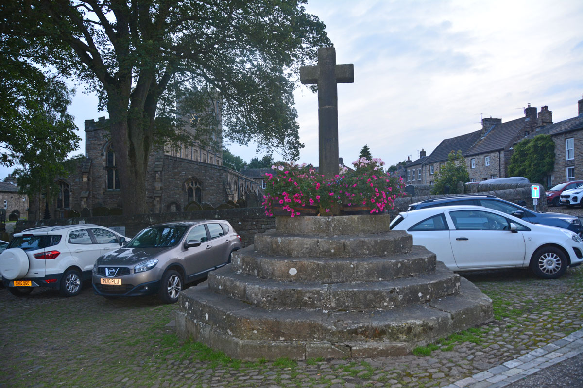
Askrigg Cross submitted by Anne T on 13th Aug 2019. The market cross, looking west towards the church in Askrigg. The shaft dates from 1830, but the steps are 16th century, possibly earlier. Picture taken as dusk was rapidly falling, so not brilliant!
(View photo, vote or add a comment)
Log Text: Askrigg Market Cross and Water Pump: It was dusk by the time we arrived back in Askrigg, and just as I started to take photographs, a large Tesco ‘click and collect’ van pulled up right next to the cross. Typical. With all the cars parked around what must have been the old village green, it wasn't a brilliant spot to linger.
Hunterian Museum
Trip No.145 Entry No.1 Date Added: 29th Aug 2019
Site Type: Museum
Country: Scotland (North Lanarkshire)
Visited: Yes on 21st Aug 2019. My rating: Condition 4 Ambience 3 Access 4
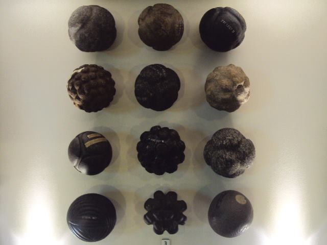
Hunterian Museum submitted by cosmic on 9th Jul 2013. The Hunterian Museum has one of the largest collections of carved stone balls in the country.
(View photo, vote or add a comment)
Log Text: Hunterian Museum: A (very) rainy day in Glasgow stopped us from going out on my 'well hunt', so we found our way to the Hunterian Museum, which I've always wanted to visit. The displays were nicely done, although the museum as a whole was a lot smaller than I anticipated.
I found the display on the Antonine Wall fascinating, along with some of the medical and scientific items on the first floor. At the time of our visit, the Royal College of Surgeon's building was closed (the website said until 2021, for redevelopment).
Unlike most museums, where you need to seek approval to post photographs, the Hunterian says: Photograph Policy: Our visitors are welcome to take photographs and video for personal, non-commercial use. We hope you will share them on your social networks! #hunterian (note: see their copyright statement on the line re works of art).
Note: the stone balls were not on display at the time of our visit.
Gilsland Spa Well
Trip No.146 Entry No.1 Date Added: 28th Aug 2019
Site Type: Holy Well or Sacred Spring
Country: England (Northumberland)
Visited: Yes on 27th Aug 2019. My rating: Condition 3 Ambience 3 Access 4
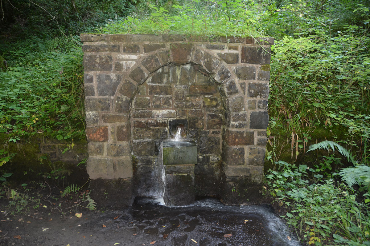
Gilsland Spa Well submitted by Anne T on 28th Aug 2019. Standing between the well structure and the river Irthing. The spring emerges from the base of a tall cliff, and smells strongly of sulphur. The plinth, basin and pipe/spout were rebuilt in 1964.
(View photo, vote or add a comment)
Log Text: Gilsland Spa Well: From the hotel car park, we followed the signs for the Sulphur Spa, leading on a path with a steep drop to our right hand side down to the River Irthing below. The path winds round to the left, then splits just above the southern side of the footbridge across the river. Take the right hand fork, walk about 20m, then take the small flight of steps down to the well, which can be smelt well in advance of reaching it!
The ground was very wet, with a steady flow of water coming out of the well spout. The eastern side of the well basin was covered with a white sulphurous stain, which carried on with the flow of water overflowing from the basin down to the river. I did dip my finger into the running water and had a quick taste. Very sulphurous, but not really unpleasant
As we approached the well, another couple were making a beeline from the well, coming from a path to the east. We fell into conversation, and it turned out they were from Doncaster (which is where I lived my early life), and lived near the race course. They were staying at the hotel for a week, returning home on Friday.
The path leading west from the well and the footbridge had been eroded away by the river. We got to within 120m of the sulphur spring, but not even Andrew wanted to walk this section of path; he said it would have been easier to walk along the river bed. We did try and see it from the other side of the river, but it was too heavily wooded to see anything.
This well is mentioned only briefly in the Springs of Living Water book by Fr John Muster, page 80, under the small section headed ‘Spa Wells’: “Though called holy wells, none are ever found identified with a saint. A good example is the one at Gilsland”. They have a photo on page 86.
No entries on Pastscape or HE, although if you type in the grid reference to the HE map search, it shows a circle where this well is located, and calls the general area to the west of the well a ‘Sulphur Spring’.
Gilsland Spa Sulphur Spring
Trip No.146 Entry No.2 Date Added: 28th Aug 2019
Site Type: Holy Well or Sacred Spring
Country: England (Cumbria)
Visited: Couldn't find on 27th Aug 2019
Log Text: Gilsland Spa Sulphur Spring: We tried to find this well from both sides of the river. Continuing west along the river walk for about 20m, we found the path had been washed away, and not even husband-cum-mountain-goat Andrew felt comfortable walking this section of the river (he said it would have been easier to walk in the river).
We did cross the footbridge and made our way along the side of the river to within what should have been 'sighting distance' of the well, but the banks were too heavily wooded to see. Shame, as I really wanted to find this well-in-a-grotto. May return and have a second look from the Irthing Gorge walk path.
St Anne's Well (Cotehill)
Trip No.146 Entry No.3 Date Added: 28th Aug 2019
Site Type: Holy Well or Sacred Spring
Country: England (Cumbria)
Visited: Yes on 27th Aug 2019. My rating: Condition 3 Ambience 3 Access 4
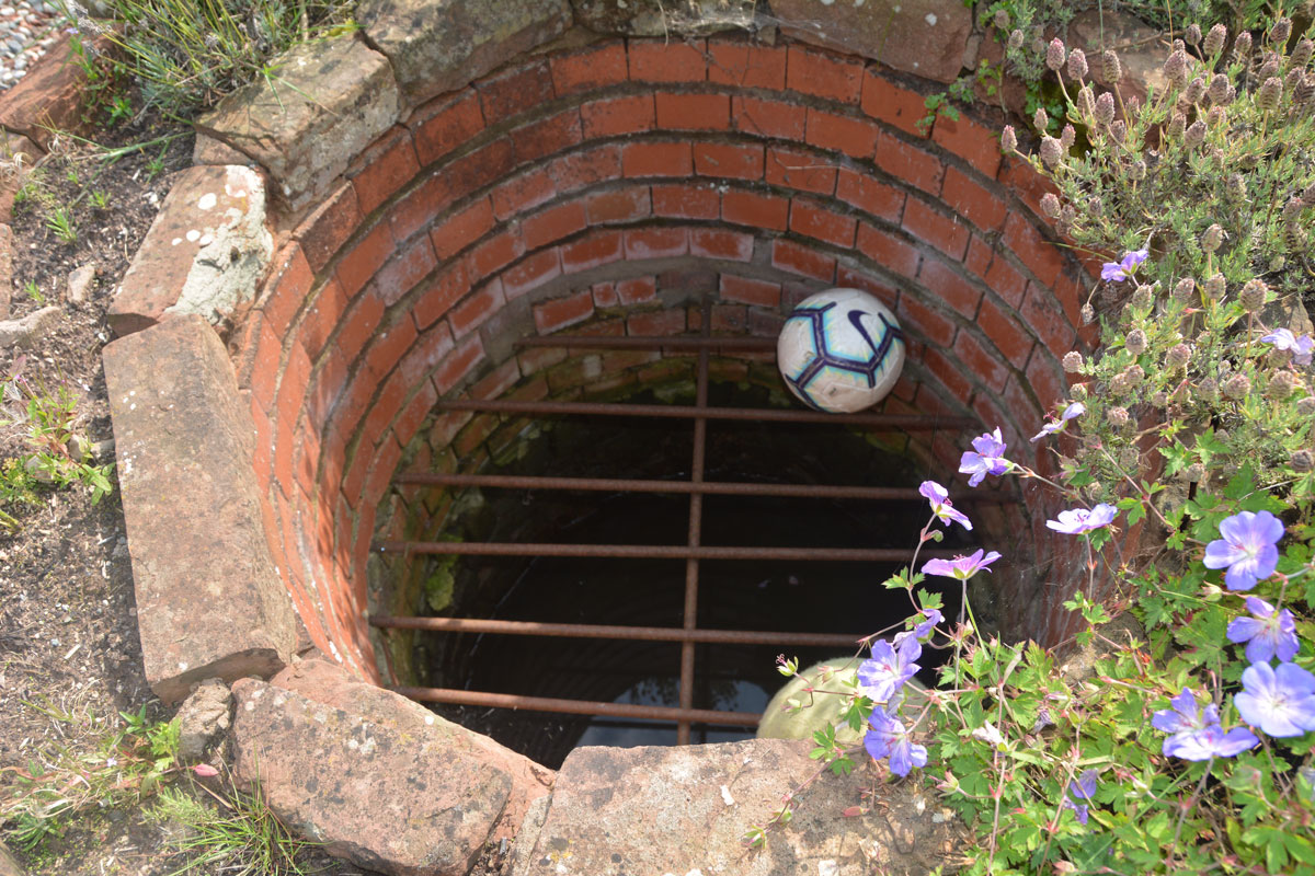
St Anne's Well (Cotehill) submitted by Anne T on 28th Aug 2019. Taking a closer look, there is a proper, brick-lined well, topped with a substantial metal grille.
(View photo, vote or add a comment)
Log Text: St Anne's Well, Cotehill: We squeezed on the odd little road junction that led to a small, new housing development, under the footpath sign.
We followed the footpath sign, which led straight through someone’s garden. We got a bit lost at this point, as several tracks through the grass had been mown flatter than others. Andrew followed two of them but could not see the well structure at all. As we were standing looking more closely at the map, the lady of the house and her children came out. I asked her if she knew where St. Anne’s Well was, and she said she had never heard of it.
Looking more closely, Andrew said the circle for the well was on the edge of the courtyard enclosed by the houses, before the footpath went through the garden of the house, so we retraced our steps a few metres.
There, in the house to our right hand side (facing the footpath and the meadows/open farmland beyond), was a circular brick flower bed. Andrew pronounced “that’s it”. I said ‘surely not’.
The structure was about 10m on private property within the garden, and I was to go up and knock on the door of the house and ask for permission to take photographs, but there no signs of life. “Who can run quickest?” I asked Andrew jokingly, and took a few steps into the garden, feeling very guilty.
There, inside the circular brick structure was a heavy iron grate, with a pool of water inside. This was definitely a well. I took three photographs very quickly, retreating back to the courtyard.
No mention in Pastscape or Historic England, although the well is shown as a blue circle on the HE map.
Wetheral Village Cross
Trip No.146 Entry No.3 Date Added: 29th Aug 2019
Site Type: Ancient Cross
Country: England (Cumbria)
Visited: Yes on 27th Aug 2019. My rating: Condition 3 Ambience 4 Access 4

Wetheral Village Cross submitted by Anne T on 29th Aug 2019. Standing just to the south east of the cross, looking north west towards the main part of the village, over the B6263 Steele's Bank. The cross head appears far older than the 'modern' shaft and steps.
(View photo, vote or add a comment)
Log Text: Wetheral Village Cross: a very pretty village. The steps and shaft of this cross are relatively modern, erected sometime between 1838 to 1844. The head of the cross is much weathered and appears older than the rest of the cross, although neither Pastscape nor Historic England mention this.
The cross is less than 150m to the west of the church and the River Eden. At the church, there is the remains of an Anglo Saxon cross shaft.
St Cuthbert's Well (Clifton)
Trip No.146 Entry No.4 Date Added: 29th Aug 2019
Site Type: Holy Well or Sacred Spring
Country: England (Cumbria)
Visited: Yes on 27th Aug 2019. My rating: Condition 3 Ambience 3 Access 5
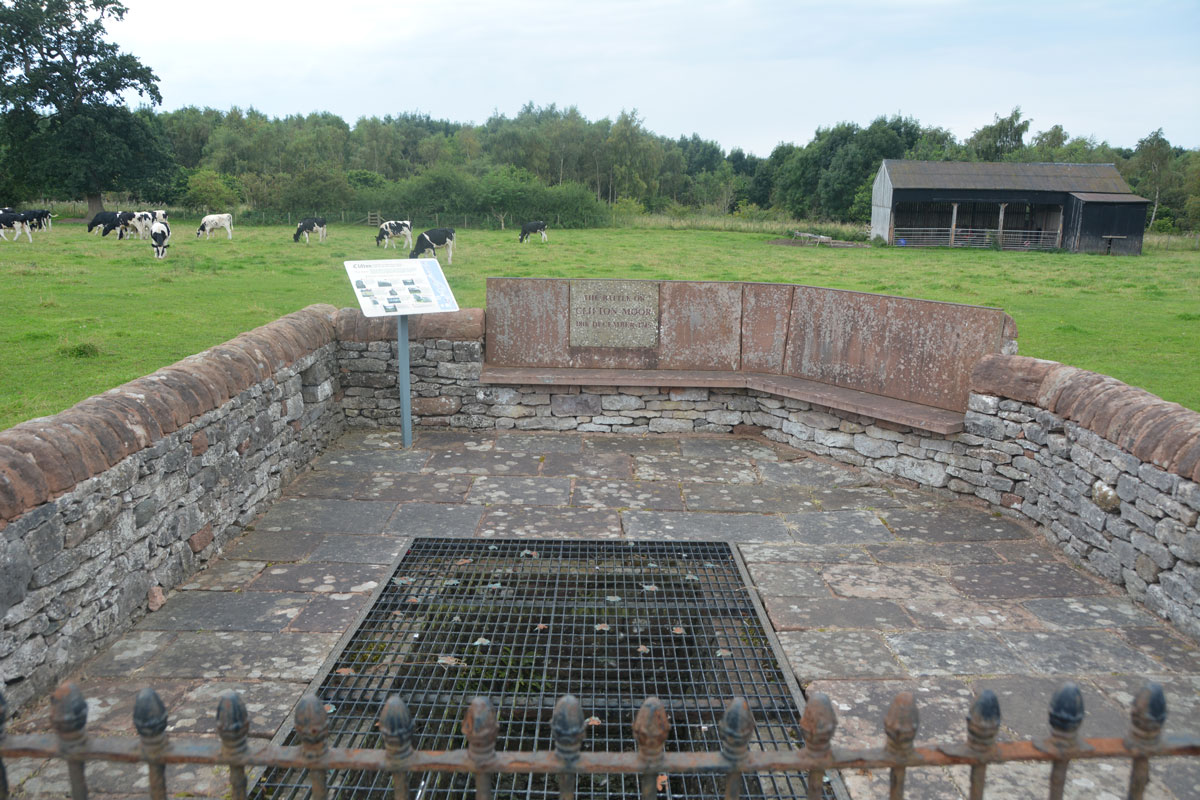
St Cuthbert's Well (Clifton) submitted by Anne T on 29th Aug 2019. The spring/well now covered by a close metal grille, which made taking photographs of the steps and water channel somewhat difficult, despite using manual focus. The enclosure commemorates the last battle on English soil between the Jacobite army and Government troops on 18th December 1745.
(View photo, vote or add a comment)
Log Text: St Cuthbert's Well (or Kelter Well), Clifton: The enclosure for this well is to the western side of the A6, towards the southern end of Clifton village. In some ways, this well is very disappointing, as the grid over it does not allow you to see very much, apart from some stone steps leading down to what appears to be a culvert with a strong flow of water running through it.
The well has been built into an enclosure which commemorates the last battle on English soil between the retreating Jacobite army and Government troops. This took place on 18th December 1745 (the battle of Clifton Moor).
No entry on either Pastscape or Historic England, although a well is shown on their map if you enter the grid reference above.
Eye Keld Well
Trip No.146 Entry No.5 Date Added: 29th Aug 2019
Site Type: Holy Well or Sacred Spring
Country: England (Cumbria)
Visited: Yes on 27th Aug 2019. My rating: Condition 2 Ambience 3 Access 4
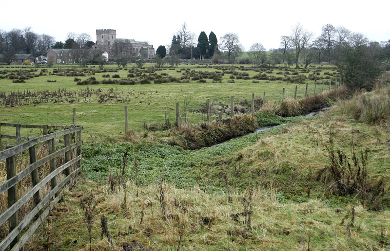
Eye Keld Well submitted by MisterBus on 28th Nov 2010. Eyekeld well, Greystoke, Cumbria, UK. The spring is in the foreground but is a neglected state. In the background is St Andrews Church, Greystoke
(View photo, vote or add a comment)
Log Text: Eyekeld Well, Greystoke: On the eastern side of the B5288 Icold Road which runs south from the village centre. The spring is only visible by peering over the dry stone wall, and the channel is covered with weeds and bracken, although there is a plentiful supply of water running from it, judging by the sounds of trickling water. There is also a long, straight water channel which runs east from the spring.
The Springs of Living Water, page 22 (with a photograph on page 25) has a couple of references to two wells in Greystoke, telling us they are dedicated to St Kentigern (aka St Mungo):
“The site of the well at Greystoke is on the roadside when entering the village from the south. This could well have been the place of a preaching stop … There was a well to the north of Greystoke, called Thanet Well after the name of St. Kentigern’s mother St. Tenue. The well is now covered by a concrete slab in a barn/garage belonging to the house next to the holiday park. The name of the well is preserved in the name of the park”.
In McIntire's "Holy Wells of Cumbria", he mentions a visit by Bishop Nicholson on 26th July 1705: "In ye morning we walk'd out to view (and taste) several extraordinary springs about the Town of Greystock; one of which they call Eye-Keld, Mary-Keld, Tolly-Keld." McIntire notes: "Eye Cold Spring still exists as Icold spring; "Mary-Keld" has had its name corrupted to Marigold. It rises in the park. "Tolly Keld" is a small stream discharging into the Petteril."
Sanctuary Stone (Greystoke)
Trip No.146 Entry No.6 Date Added: 30th Aug 2019
Site Type: Early Christian Sculptured Stone
Country: England (Cumbria)
Visited: Yes on 27th Aug 2019. My rating: Condition 2 Ambience 3 Access 5
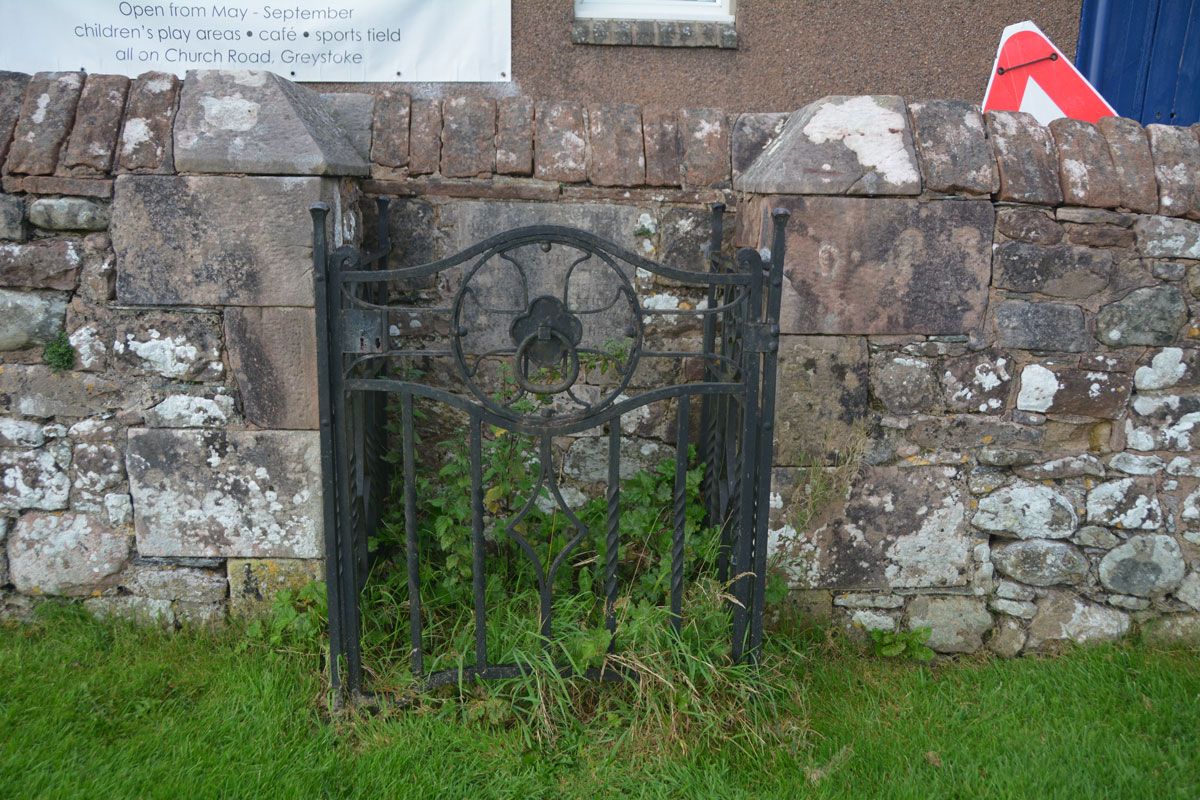
Sanctuary Stone (Greystoke) submitted by Anne T on 29th Aug 2019. Nothing could be seen of the actual sanctuary stone, which lies virtually flat to the ground within in a concrete base. It used to lie some 10 feet south of its current position. With a very busy heated, outdoor swimming pool, I didn't dare lean over and pull the nettles away (perhaps I should have asked permission at the swimming pool).
(View photo, vote or add a comment)
Log Text: Greystoke Sanctuary Stone: We didn't know this stone was here until I read the church guide book as we walked around the church. There is also a plaque stone somewhere, but we'd almost run out of time today. This stone was disappointing, as it wasn't visible underneath a dense covering of nettles and weeds. I'm now kicking myself for not asking at the swimming pool reception a few metres away if it was possible to pull a few of these away to take a closer look. There was a photograph of the cleared enclosure on the Old Cumbria Gazetteer.
Greystoke Village Cross
Trip No.146 Entry No.7 Date Added: 30th Aug 2019
Site Type: Ancient Cross
Country: England (Cumbria)
Visited: Yes on 27th Aug 2019. My rating: Condition 3 Ambience 4 Access 5
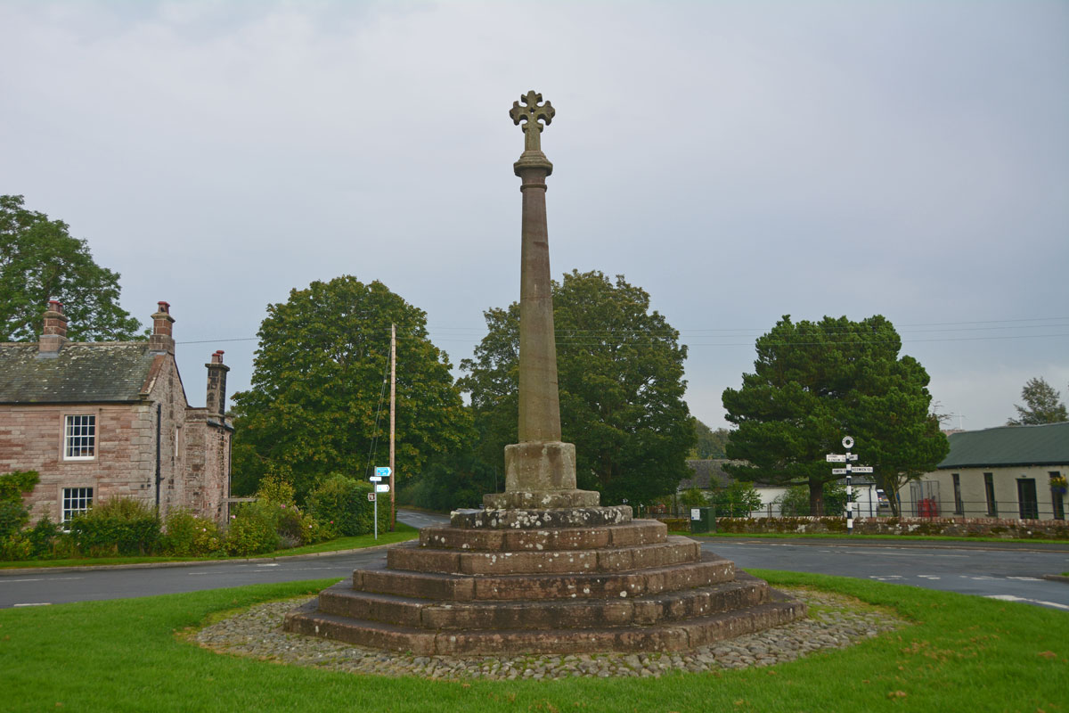
Greystoke Village Cross submitted by Anne T on 30th Aug 2019. Looking eastwards across the village green and the cross, along the B5288 which goes to Click Em and Pallethill.
(View photo, vote or add a comment)
Log Text: Greystoke Village Cross: We've been to this area before, on the hunt for the possible Newbeggin Stone Rows, but never driven into this very pretty little village. We left this until the last stop of the day (just before the rain started to hurl down), after having seen the Eyekeld Well, the village Church and the Sanctuary Stone.
There are parts of the original medieval cross built into this largely 'modern' structure. Whilst Pastscape and HE say the socket stone is original, it looked like the top three steps were original (the new socket stone had chamfered and shaped corners and was a much brighter/less weathered stone than the rest).
Crag House Cross Base
Trip No.147 Entry No.1 Date Added: 4th Sep 2019
Site Type: Ancient Cross
Country: England (Northumberland)
Visited: Yes on 3rd Sep 2019. My rating: Condition 3 Ambience 4 Access 5
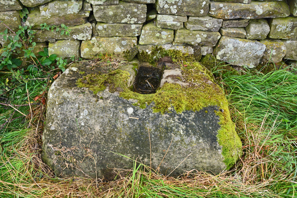
Crag House Cross Base submitted by Anne T on 4th Sep 2019. Close up of the cross base, showing its slightly inclined top surface, but the socket hole is cut vertically. Pastscape says this indicates the cross base may have been cut in situ.
(View photo, vote or add a comment)
Log Text: Crag House Cross Base, north of Acomb: There have been many times I’ve done a search for sites to visit in this area, but found nothing. Now, having recently done a search for holy wells near Hexham, this cross base appeared on the list. Not only was it on Pastscape, but it was also scheduled on HE.
As I was photographing the small stone by the gatepost, a four-by-four pulled up and wound the window down. “Are you looking at the monument?” the lady in the car asked us. “We’ve come to photograph the cross base”, I replied. “Yes, that’s what we call The Monument. We’ve never seen anyone visit it before”.
It turned out they live in Crag House, and are turning the adjacent land into a nature reserve to be handed over to a Wildlife Conservation Trust. The gentleman said he’d never been able to find out what the small stone was for, but we all thought it was some sort of boundary marker.
The lady said she keeps a blog of the work they are doing to their nature reserve, so she was going to say she’d met us photographing the monument.
In Acomb, the name of the cross is heavily reflected in road names leading up to the cross: Cross Bank, etc. The cross base sits at the top of the hill, not far south of the Military Road (B6318), with St. Oswald’s Church at Heavenfield just across the road (within 500m of the cross base). It has amazing views over Hexham.
Eastern Sanctuary Cross (Hexham)
Trip No.147 Entry No.2 Date Added: 6th Sep 2019
Site Type: Ancient Cross
Country: England (Northumberland)
Visited: Yes on 3rd Sep 2019. My rating: Condition 2 Ambience 2 Access 5
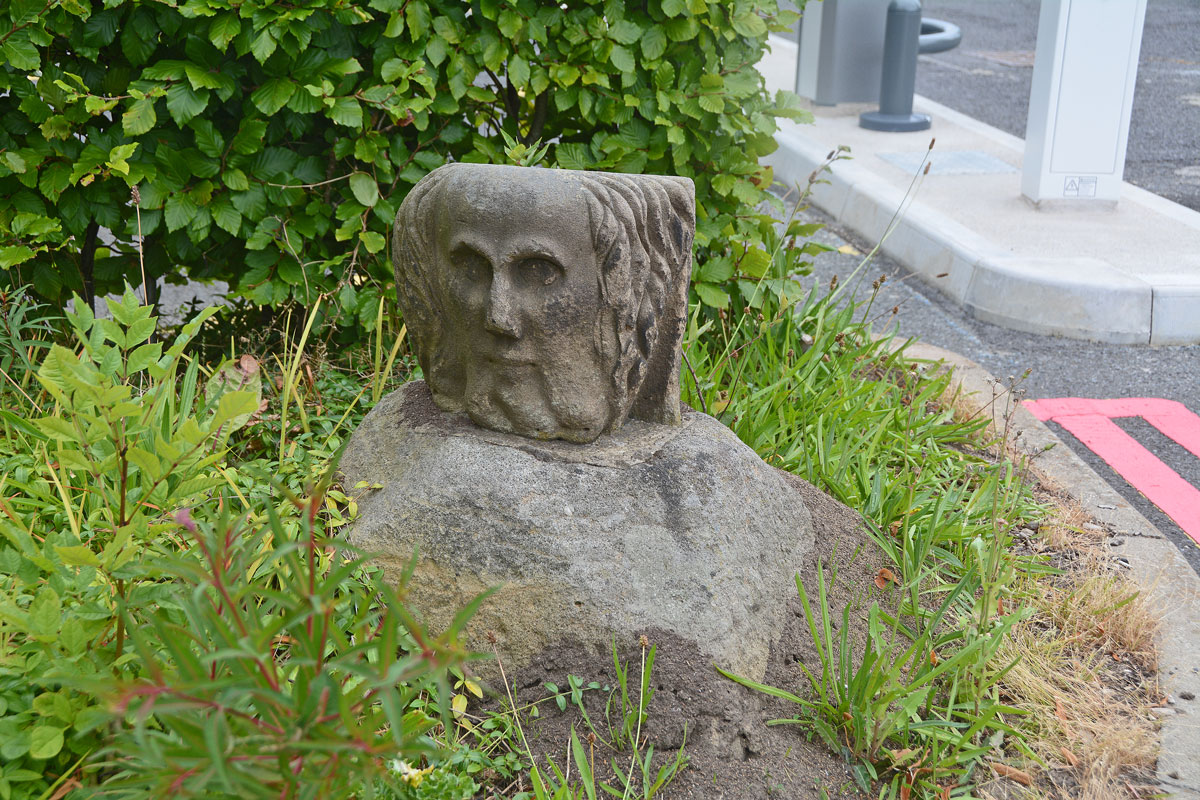
Eastern Sanctuary Cross (Hexham) submitted by Anne T on 5th Sep 2019. Cross base or top of a gate post (with a carved stone head inserted into the socket hole)? Really strange. Hodges, writing in 1897, appeared to confirm this was indeed the base of the eastern sanctuary cross of Hexham Priory.
(View photo, vote or add a comment)
Log Text: Eastern Sanctuary Cross of Hexham Priory (or just the top of a gate post??): We stopped to photograph the scheduled Glover's Pant before making our way to the eastern side of Hexham. We were incredibly surprised to find this cross base, which we’ve looked for before, but at the old grid reference. On this visit, I spotted it straight away, and took its current grid location with our GPS. It is now sited at the eastern entrance to the car park. Andrew walked right past it, and I might have too, had I not remembered about the carved stone head being in the socket hole! I almost got myself run over trying to take photographs from various angles.
I also found Hodges’ 1897 paper listed in the Pastcape reference (copied in the text below). He reports that the locations of all four of Hexham Priory Sanctuary Crosses were now known. He reports the location of the northern one is at Cross Bank. I’m wondering if this is the one at Crag House, north of Acomb, although this is some 5km from the location of this cross base.
Seal Well (Hexham)
Trip No.147 Entry No.3 Date Added: 6th Sep 2019
Site Type: Holy Well or Sacred Spring
Country: England (Northumberland)
Visited: Yes on 3rd Sep 2019. My rating: Condition 2 Ambience 3 Access 4
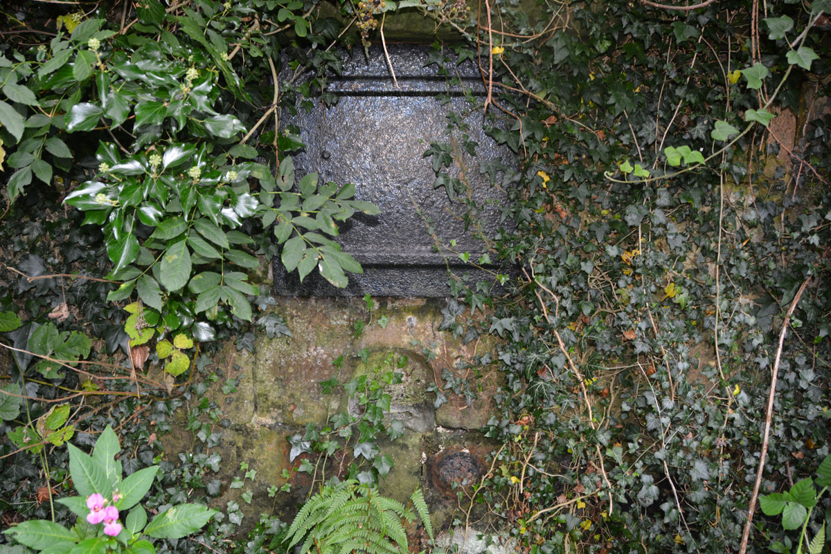
Seal Well (Hexham) submitted by Anne T on 5th Sep 2019. There was a vague path through the weeds to the well (we tried to reach it by a path a few metres to the west of the well, but it was far too overgrown to walk down), so I carefully made my way through the nettles and brambles to take a closer look.
(View photo, vote or add a comment)
Log Text: The Seal/Sele Well, Hexham: Walking into a part of Hexham we’d never been to before, we came across the Cock Shaw Burn which runs SW-NE along the western side of the Sele. We passed a gloriously ornate drinking fountain (now dry) next to the southern side of the school, right next to the footpath. At the western side of the Sele, a footpath turned to our right, downhill. At the bottom, a footbridge crosses the Cock Shaw Burn. We turned left along the footpath running along its southern side, and about 30m along, spotted a stone and cast iron structure behind the nettles.
We managed to trample down the nettles to get a closer look. I unhooked some of the ivy from the ring in the indentation in the middle of the well to get a closer look at the underlying well structure. No-one has seen this well in some time, but it was very nice to find it.
This is a really old part of Hexham, and one we’d never explored before. Nearby, a second burn (presumably the Cowgarth Burn) runs along a cobbled road through Tanner’s Yard.
We went onto find, and photograph, Wine's Well (to the west of Hexham) and the Park Well (to the east). These are recorded as just 'wells' on Pastscape, and have no holy or healing characteristics that I'm aware of.
White Cross (Newcastle)
Trip No.148 Entry No.1 Date Added: 9th Sep 2019
Site Type: Ancient Cross
Country: England (Tyne and Wear)
Visited: Yes on 7th Sep 2019. My rating: Condition -1 Ambience 3 Access 4
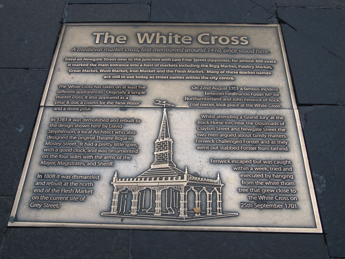
White Cross (Newcastle) submitted by Anne T on 9th Sep 2019. The metal plaque set into the pavement showing the location of the White Cross, first recorded in local history in 1410. The image shows how was rebuilt in 1783, having been a simple market cross, then a pillar and dial, then a cistern for water, then a stone pillar. We know in 1701 a white thorn tree grew nearby, as a man named John Fenwick was hanged from this tree after murdering a local MP called Fernando Forster.
(View photo, vote or add a comment)
Log Text: Site of the White Cross (Newcastle): Having typed 'Cross' and 'Newcastle' into Pastscape, I was surprised to find two crosses come up. So, armed with my GPS I set off to try and find these sites.
This cross used to be located at the corner of Newgate Street and Low Friar Street, north west of the junction of Clayton Street and Newgate Street.
I cross the road regularly here to walk through the lane to the side of the Gate, down towards West Walls and Akhbar’s, but this is a part of the pavement I’ve never been on. About 30m to the south east (following the pavement), outside what is now Debenham’s, a large metal plaque is set into the pavement.
The plaque reads: The White Cross. A medieval market cross, first mentioned around 1410, once stood here. / Sited on Newgate Street near to the junction with Low Friar Street (opposite), for almost 400 years, it marked the main entrance into a host of markets including the Bigg Market, Poultry Market, Groat Market, Wool Market, Iron Market and the Flesh Market. Many of the market names are still in use today as street names within the city centre. / The ‘White Cross’ has taken on at least five different appearances. Originally a simple market cross, it also appeared as a pillar & dial, a cistern for the ‘New Water’ and a stone pillar. / In 1783 it was demolished and rebuilt to the design shown here by David Stephenson, a local Architect who also designed the original Theatre Royal in Mosley Street. It had a pretty little spire, with a good clock, and was ornamented on the four sides with the arms of the Mayor, Magistrates and Sheriff. / In 1808 it was dismantled and rebuilt at the north end of the Flesh Market on the current site of Grey Street. / On 22nd August 1701 a famous incident between Ferdinando Forster MP for Northumberland and John Fenwick of Rock, coal owner, took place at the White Cross. / Whilst attending a ‘Grand Jury’ at the Black Horse Inn, near the crossroads of Clayton Street and Newgate Street the two men argued about family matters. Fenwick challenged Forster and as they went out stabbed Forster from behind. Fenwick escaped but was caught within a week, tried and executed by hanging from the white thorn tree that grew close to the White Cross on 25th September 1701.”
Cale Cross (Newcastle)
Trip No.148 Entry No.2 Date Added: 9th Sep 2019
Site Type: Ancient Cross
Country: England (Tyne and Wear)
Visited: Yes on 7th Sep 2019. My rating: Condition -1 Ambience 3 Access 5
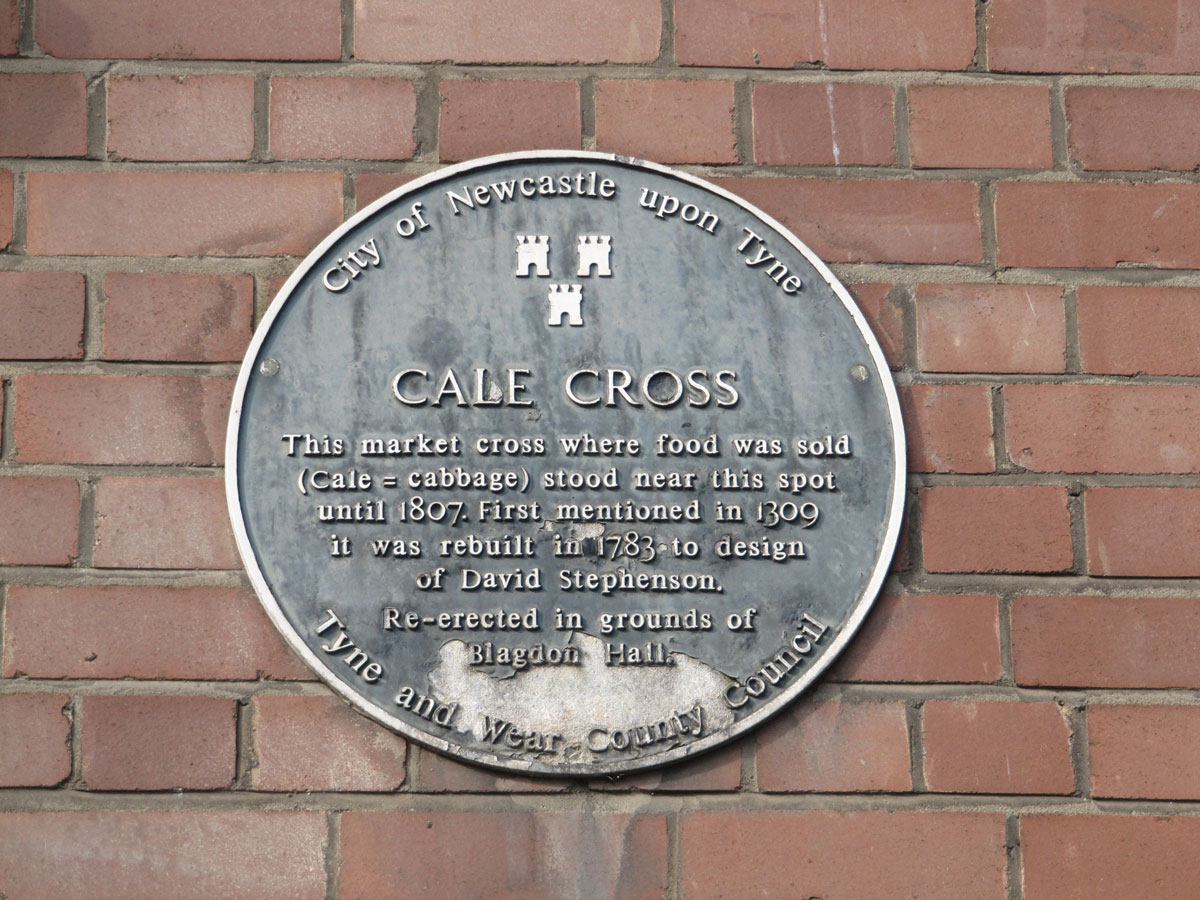
Cale Cross (Newcastle) submitted by Anne T on 9th Sep 2019. The blue plaque is currently the only sign that the Cale (or Cabbage) cross stood at or near this location.
(View photo, vote or add a comment)
Log Text: Site of Cale Cross (Newcastle): The plaque commemorating this cross is attached the eastern wall of what I think is 3, Akenside Hill (or possibly Akenside House), on the Quayside, just to the west of the A167 where it is about to go south over the Tyne Bridge, and just north-north-east of the Swing Bridge.
The building sits at the junction of Dean Street and Queen Street, just before Dean Street meets Sandhill (the B1600) and Quayside. I imagine in olden times, this would have been the ideal place for a market.
It was the afternoon before the main Great North Run and Quayside was hugely busy with other races starting and finishing. What a crowd, but a lively, friendly atmosphere. I had great fun finding my way back up the hill through tiny lanes I didn’t know existed, passing the Church of All Saints, a huge viaduct, some of the old city walls and Castle Keep.
The plaque reads: “City of Newcastle upon Tyne. Cale Cross. This market cross where food was sold (cale = cabbage) stood near this spot until 1807. First mentioned in 1309 it was rebuilt in 1783 to design of David Stephenson. Re-erected in the grounds of Blagdon Hall Tyne and Wear County Council”.
If the original cross had gone to Blagdon Hall, I would have set off in search of it, but this is only the 1783 re-design.
Old Prior Manor House Well (Corbridge)
Trip No.149 Entry No.1 Date Added: 12th Sep 2019
Site Type: Holy Well or Sacred Spring
Country: England (Northumberland)
Visited: Yes on 8th Sep 2019. My rating: Condition 3 Ambience 3 Access 5
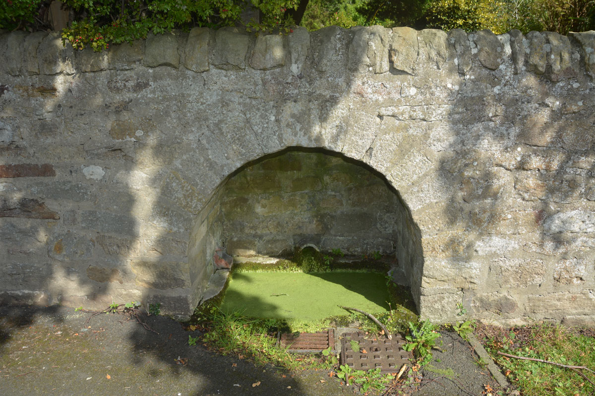
Old Prior Manor House Well (Corbridge) submitted by Anne T on 12th Sep 2019. A glimpse into the well chamber. It has two pottery pipes feeding into it, and a modern drain in front which takes away any overflow. The water, after a long period of very warm and wet weather, was full of bright green weed.The well lies at the eastern side of what would have been the grounds of the old Trinity Church, which was demolished in the 18th century after falling into ruins.
(View photo, vote or add a comment)
Log Text: We have driven past this well so many times and said “we need to stop and photograph this” and today we did. I thought it was just a hollow in the wall, with a dry pipe coming through the wall, but no, it is a real well, with water, although no water flowed through the pipe and the water was stagnant and full of vibrant green weed.
Looking over the wall, it had a stone domed well house.
The well is located outside the Old Prior Manor House, at the corner of the B6529, Stagshaw Road and St Helen’s Lane, with the junction with Corchester Lane, which runs to the Corbridge Roman site, diagonally opposite to the south west.
The OS map of 1895 shows the well being sited opposite Trinity Church. The house, also known as Prior Mains, was formerly the Corbridge Rectory.
