Contributory members are able to log private notes and comments about each site
Sites Anne T has logged. View this log as a table or view the most recent logs from everyone
Druids Temple (Cumbria)
Date Added: 23rd Jul 2017
Site Type: Stone Circle
Country: England (Cumbria)
Visited: Yes on 23rd Jun 2015. My rating: Condition 3 Ambience 4 Access 5
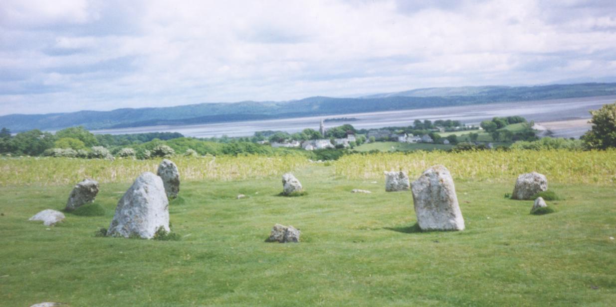
Druids Temple (Cumbria) submitted by Sentinel on 9th Jan 2003. Near Ulverston, Cumbria
overlooking Morecombe Bay.
(View photo, vote or add a comment)
Log Text: Druid's Temple Stone Circle, Cumbria: OK, so we got sidetracked by the splended Furness Abbey, but we then retraced our steps to Great Urswick, skirting round the north side of Urswick Tarn, up and out onto Birkrigg Common. Following the yellow ‘dotted’ road over the common, past Sunbrick Farm, we suddenly came upon the most tremendous views over Morecambe Bay. What a place!
Being a beautiful sunny evening, there were many people about. It felt strange to be in such an ancient spot with a van nearby blasting out music from its radio, runners coming through almost the centre of the circle, and dog walkers continually passing.
Again, the stone circle sits within a landscape of limestone pavement, which confused my attempts to find out if the circle originally had an outer ring. We counted 12 stones in the inner ring, two only just poking out above the grass, with 10 visible upright stones, although I get the impression some of these might have been re-erected for effect. The circle itself certainly looked as if it had a shallow bank around it and a possible ditch between this and what might have been a very broken outer ring.
There is plenty of parking on the hard verges nearby, and stunning walks on grassy paths cut through the longer grass to make it easier for walkers and runners. A little disappointing there were so many others around, but worth the trip.
Beanley Moor Enclosure
Trip No.34 Entry No.4 Date Added: 22nd Jul 2017
Site Type: Ancient Village or Settlement
Country: England (Northumberland)
Visited: Yes on 18th Jul 2017. My rating: Condition 1 Ambience 2 Access 4

Beanley Moor Enclosure submitted by Anne T on 22nd Jul 2017. The robbed out rampart can be seen as a shallow double ditch in the south west of the enclosure. This location has lovely views down to the River Breamish valley.
(View photo, vote or add a comment)
Log Text: Beanley Moor Iron Age Defended Settlement, Northumberland: We had an abortive attempt to find the Fawdon Cross Base at NU 0281 1591 (nowhere anywhere nearby to park) and Beanley Plantation Hillfort. The tracks to the latter were either waterlogged (husband said we needed diving equipment – a slight exaggeration, I think!), although we could have tried from the paths through the forest from the south (but didn’t). We then made our way to the Beanley Moor settlement/enclosure just to its north. This is a short hop up the field. There is a path leading up the slope (it’s all access land here) which brings you to the southern edge of the enclosure, although having spotted a slight bank popping up out of the grass, we made a more direct bee-line up the slope.
Curious how the landscape has changed in just a few miles. The area is completely sandy – like a beach, which it must have been at one point in the dim and distant path, although higher up the slope it becomes more of a loam.
Very, very little remains of this possible Iron Age settlement, although there was enough left of two parallel shallow ditches for us to follow their line round in a circle. Thought we spotted a possible entrance in the south west of the enclosure, a possible roundhouse partly built into the bank (although heavily disguised by tussocks and bracken in parts) and a hollow way leading north-west/south-east along the north eastern edge of the settlement, leading up to the Beanley Plantation Hillfort.
Brilliant views down to the River Breamish Valley, but that’s as much as can be said for this site. Glad we stopped off, though.
Haystack Hill (Ingram)
Trip No.34 Entry No.3 Date Added: 21st Jul 2017
Site Type: Ancient Village or Settlement
Country: England (Northumberland)
Visited: Yes on 18th Jul 2017. My rating: Condition 2 Ambience 4 Access 3
Haystack Hill (Ingram) submitted by SolarMegalith on 16th Mar 2013. Remains of a stone wall - view from the NE (photo taken on March 2013).
(View photo, vote or add a comment)
Log Text: Haystack Hill Settlement Complex, Ingram, Northumberland: Having stopped off at North Haystack Hill, it was getting hot by this point, although there was a pleasant breeze. The path was levelling out now and there was an electric fence to our left hand side. Where this had dropped down to the grass at one point, we made our way across to the gate at the north western part of the field. The ground here was very boggy, descending into deep puddles at various points, so we picked our way around. A sign on the gate said ‘end of access land’ although there is a permissive footpath around the edge of the field leading into the south western corner of this complex settlement.
This site is huge. I wish I’d printed off an aerial photograph to take with me, so I could have understood it better – a good excuse for a return visit.
We first explored the rectangular enclosure with its row of hut circles in, then made our way between the B2 (the southern most of the two B enclosures) and C.
Wow. Although deep in bracken, it was still possible to make out tall banks and circular features I felt very priviledged to have come here, as I did at Burdhope last week. A brilliant, brilliant site. With the other hillforts all around, it was very atmospheric.
North Haystack Hill
Trip No.34 Entry No.2 Date Added: 21st Jul 2017
Site Type: Ancient Village or Settlement
Country: England (Northumberland)
Visited: Yes on 18th Jul 2017. My rating: Condition 2 Ambience 4 Access 3

North Haystack Hill submitted by Anne T on 21st Jul 2017. Stepping over the medieval bank and walking some 30 metres into the enclosure, this circular bank came into view.
(View photo, vote or add a comment)
Log Text: North Haystack Hill, Ingram, Northumberland: After Ingram Hill Enclosure, we took the permissive footpath to its east, walking up between Turf Knowe to our east and Wether Hill to the west. From this point on, for the next quarter of a mile, we seemed to be constantly moving out of the way of a tractor and a small four-wheel drive van and trailer mowing bracken (they seemed to target us with every turn!), up until the division of footpaths just before this earthwork, which appeared as a low stone and earth mound, about 1 metre wide and 80cm high, running to the left of the footpath. It ran for several hundred metres with the occasional bank peeping out of the bracken to the east. By this time, we were 800 metres from Ingram Hill Settlement, and a couple of hundred yards from the main Haystack Hill complex. We stepped over the low electric wire that was keeping the sheep in a particular area and went to investigate.
What a view to have from your front door, down the Middledean Burn valley to the west and the Breamish Valley and Ingram below.
Getting back home and opening up Pastcape, I was surprised to find this is a recorded Iron Age/Roman enclosed settlement. Although the long bank is medieval, the settlement is described as ‘much mutilated’ with a number of scooped hut circles. It can be seen on UK Grid Reference Finder aerial images, with ridge and furrow ploughing cutting over the top.
Making our way back to the path, which by now was levelling off, we continued up the slope towards the larger Haystack Hill settlement.
Ingram Hill
Trip No.34 Entry No.1 Date Added: 21st Jul 2017
Site Type: Ancient Village or Settlement
Country: England (Northumberland)
Visited: Yes on 18th Jul 2017. My rating: Condition 2 Ambience 4 Access 4
Ingram Hill submitted by SolarMegalith on 18th Mar 2013. Course of the rampart in the eastern part of Ingram Hill settlement (photo taken on March 2013).
(View photo, vote or add a comment)
Log Text: Ingram Hill Settlement, Breamish Valley: Making the most of a warm, sunny day we set off to the Ingram in the Beamish Valley, not to walk the Hillfort Trail this time, but to look at some settlements marked on the OS map. Taking supposedly ‘the shortest route’ the roads were so twisty and windy that it took forever, and I ended up feeling travel sick for most of the afternoon.
I had forgotten how beautiful and calm this little valley is. There were a dozen or so cars parked on the grass by the river, with people picnicking. Passing the car park just outside Ingram, there was only one car – in Northumberland I expect to see more sheep than people on a day out. Setting off west out of Ingram, we parked just outside the village on a wide grass verge that people had obviously used before us. Walking the 100 metres or so to where the stony footpath climbed gently up to Turf Knowe, we had the old field boundary and modern wire fence to our left. Where the footpath meets the access land at the south western corner of the field, another permission footpath/stone covered track branched off to the south east towards Wether Hill. Typically, we didn’t use the path but tramped through the knee high grass and bracken, surprising the sheep who’d sought shade.
The circular banks of this settlement rose gently out of the turf. Some of the sheep were grazing on top. I walked all the way round the bank, which is 160 feet in diameter. There is a clear two roomed rectangular house on the interior northern bank, looking down to the River Breamish below.
Another circular feature, which I thought was a small roundhouse, was to be found towards the middle of the settlement. Pastscape says this is the remains of some shielings.
After taking a short break to make the most of the sunshine, we took the permissive path and headed up towards Haystack Hill.
Cow and Calf Rocks
Date Added: 16th Jul 2017
Site Type: Rock Outcrop
Country: England (Yorkshire (West))
Visited: Yes on 30th Jun 2014. My rating: Condition 3 Ambience 4 Access 4
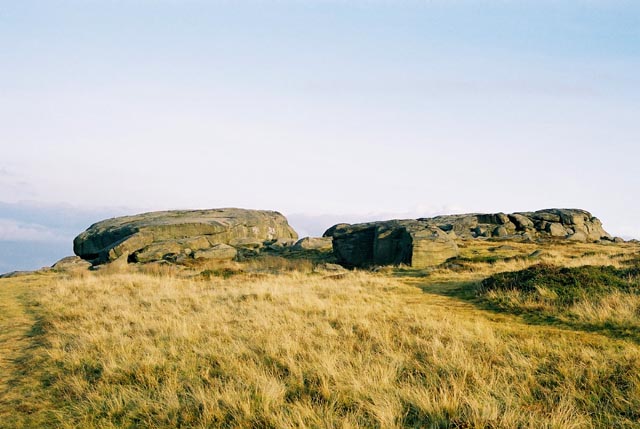
Cow and Calf Rocks submitted by andy_h on 10th Nov 2003. The most prominent landmark for miles around. There are no visible megalithic remains at this huge rock outcrop, but local folklore refers to this being a place worthy of strong consideration.
I've always found it a little strange that as the most prominent landmark for miles around, the Cow n' Calf didn't bear any cup n' ring marks as they can be found both to the left and the right of the outcrop. It is possible that any that may have been on the rock could have been lost under the onslaugh...
(View photo, vote or add a comment)
Log Text: Cow & Calf Rocks, Ilkley: We visited here on a very blustery day after having seen Maiden Castle hill fort. By now rain was threatening and the moorland bleak. Parking at the café down below, we walked up the footpath. The view from the Cow and Calf over to Ilkley was great, although there were lots of people around. Walking into the horseshoe shaped quarry next to these crags there were groups of climbers roped up to the rock face.
Yatesfield (Otterburn)
Trip No.33 Entry No.6 Date Added: 11th Jul 2017
Site Type: Ancient Village or Settlement
Country: England (Northumberland)
Visited: Yes on 8th Jul 2017. My rating: Condition 2 Ambience 2 Access 5
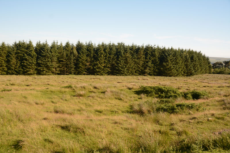
Yatesfield (Otterburn) submitted by Anne T on 11th Jul 2017. One of the roundhouses in the middle of the site can be seen by a change in vegetation, ringed around with bracken.
(View photo, vote or add a comment)
Log Text: Yatesfield Settlement, Otterburn Ranges: By this time, it was 6pm, and rather than face another long walk over rough ground to the Roman Tombs at Lamb Crag, we decided to save our feet and drive to this site up on the Otterburn Ranges. We spotted the two ‘archaeological area’ signs at the south and north ends of the site. It has obviously been split by the military tarmacked road. Standing at the western edge of the site, looking down over the gentle south east slope, it took a few minutes to ‘get my eye in’ and start to see the possible hut circles and lumps and bumps of various structures. In the end, I walked to the northern end and walked across the site, photographing as I went.
Parts of the ground were very boggy and I disturbed a hare sunning itself against the back wall, partly sunk into the bank (part earth, part stone) of one of the round houses nearest the road.
Yatesfield Hill (Otterburn)
Trip No.33 Entry No.7 Date Added: 11th Jul 2017
Site Type: Standing Stone (Menhir)
Country: England (Northumberland)
Visited: Yes on 8th Jul 2017. My rating: Condition 3 Ambience 4 Access 5
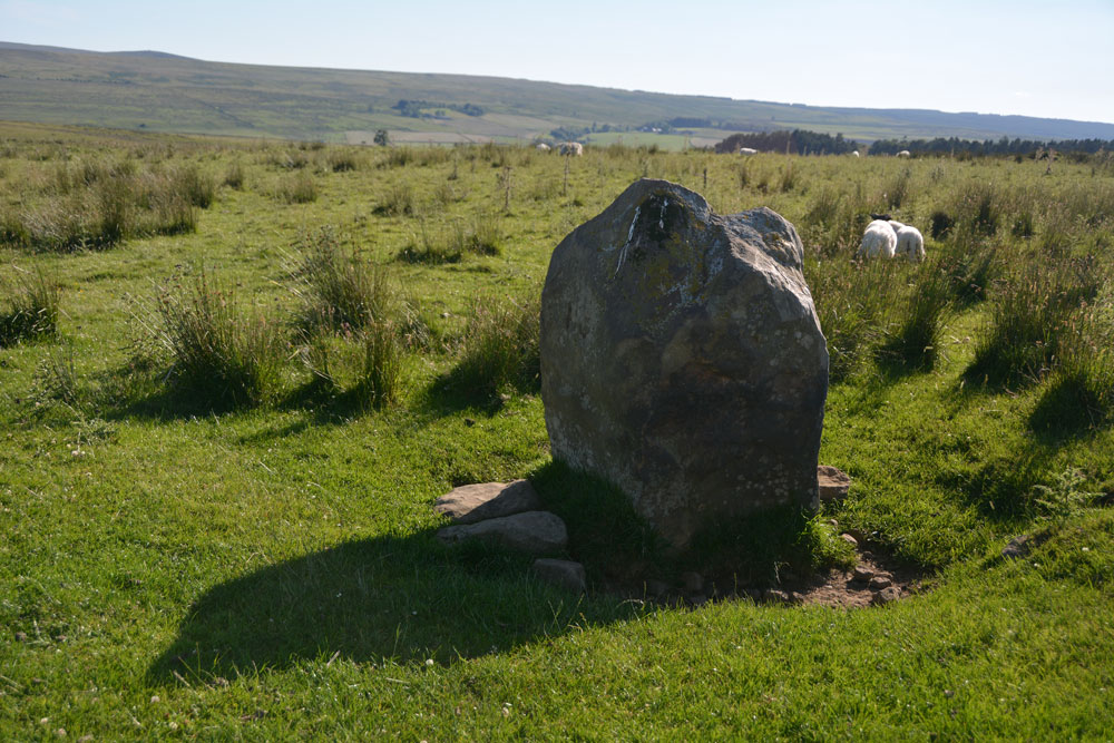
Yatesfield Hill (Otterburn) submitted by Anne T on 11th Jul 2017. This standing stone (rubbing post? way marker?) is sited just south of the top of Yatesfield Hill, on the way up to Yatesfield Settlement which is 650 metres to the north east.
(View photo, vote or add a comment)
Log Text: Yatesfield Hill Standing Stone, Otterburn Ranges: Driving up to Yatesfield Hill, I noticed this stone by the side of the road. There is no mention of it on Pastscape, English Heritage or the OS maps.
It might be a marker stone or a rubbing stone, as it is sited by the junction of Yatesfield Hill road and a trackway west, but looks as if it has been here for some time, as it is deeply embedded in the ground and has small stones and boulders packed around its base.
There was a lovely military Port-a-loo nearby!
Burdhope (Rochester)
Trip No.33 Entry No.5 Date Added: 11th Jul 2017
Site Type: Ancient Village or Settlement
Country: England (Northumberland)
Visited: Yes on 8th Jul 2017. My rating: Condition 2 Ambience 5 Access 3
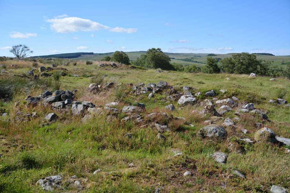
Burdhope (Rochester) submitted by Anne T on 11th Jul 2017. Standing almost at the middle, eastern edge of the site looking west across it. I interpreted this as one of the smaller round structures (hut?) with the bank of an enclosure in the foreground.
(View photo, vote or add a comment)
Log Text: Burdhope Hill Village, Rochester, Northumberland: After having stopped at the Camien Café for refreshments, we headed off into the hot sun again. This time it was only a few hundred metres up the road. There was a small layby at the side of the road opposite Woolaw Farm entrance. Crossing the road was fun as you could hear the roar of the motorbikes and cars coming from a fair distance, then they zoomed past, the rush of air lifting my hair. A quick run across the road was safely achieved.
Andrew had found out from friends who visit Trig Points that the only footbridge across the river was at Woolaw Farm, so we walked down the track and joined the footpath just west of the farm house.
The grass is tussocky and some parts of the field are boggy, other parts cut by modern field drains, but it wasn’t too challenging a walk (for me).
The monument is on access land, although it has been fenced off to protect it. As the gate into the field was at the top of the hill, we took a short cut by climbing through the barbed wire fence. We must have spent an hour wandering around, trying to interpret the different bits. Fascinating!
Brownrigg (Rochester)
Trip No.33 Entry No.4 Date Added: 10th Jul 2017
Site Type: Ancient Cross
Country: England (Northumberland)
Visited: Yes on 8th Jul 2017. My rating: Condition 3 Ambience 3 Access 4
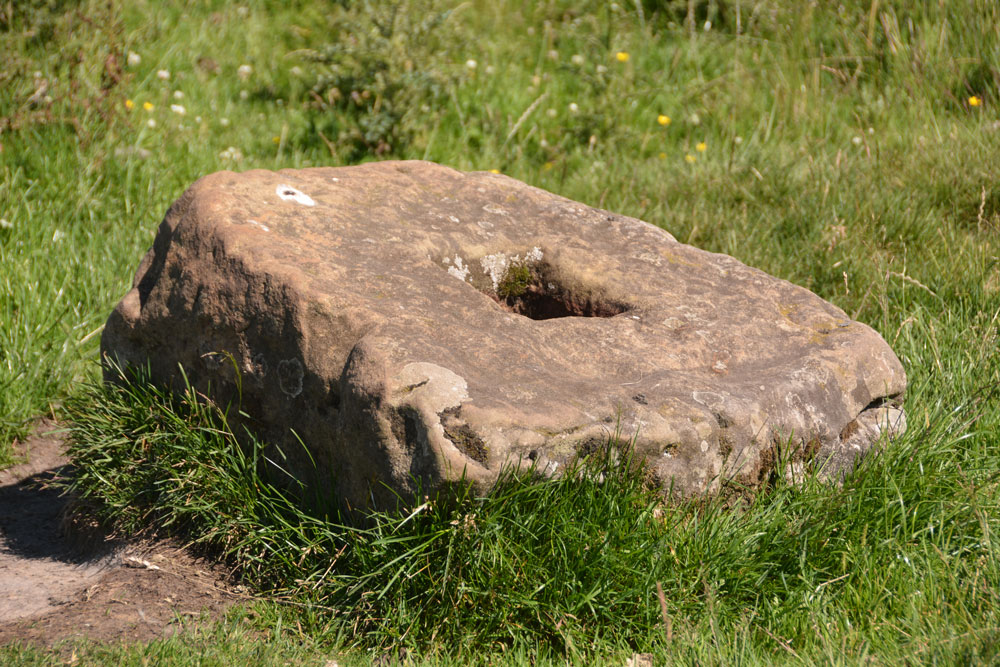
Brownrigg (Rochester) submitted by Anne T on 10th Jul 2017. The cross base doesn't quite sit at the centre of the slight hollow in which it is located. There is a build up of earth on one side and the sheep have been rubbing against one side.
(View photo, vote or add a comment)
Log Text: Brownrigg Ancient Cross Base, Rochester, Northumberland: Two cross bases in one day, although this one isn’t marked on the map. Husband, Andrew, found it by doing a location search on Pastscape before we set off (he gets to look at settlements and Roman forts he's interested in whilst I get the cross bases and tumuli!).
Again, just off a layby on the A68 just before it meets the A696, where a footpath goes north west towards Rattenraw. The layby was being used by a solitary motorbiker who looked at us curiously as we drove up and parked up.
Letting ourselves in through the farmgate to the footpath, which is signposted Rattenraw and Bagraw, we first of all tried to follow the ditch and mound of the line of Dere Street, but this was very boggy and the GPS was telling me we were getting further away.
Wading back to the farm track, the metres on the GPS dropped rapidly, then we suddenly came across the cross base, sitting slightly to the north of the farm track, some 30 metres short of where the official gps reading says it should be. I made the grid reference NY 85668 94716. On UK grid reference finder, the line of Dere Street crossing the field can be clearly seen, as can one of the banks/ditches which matches the line on the OS map.
The cross base is well buried in the grass and sits in a slight dip, just east of some old mine workings. Nothing terribly remarkable about this except the socket hole seemed really small, measuring only 10 cms square.
Worth stopping off to look, as no-one else seems to have spotted this, but nothing hugely exciting about this site. The next stop was most certainly the best of the last few months!
Woodhouse (West Woodburn)
Trip No.33 Entry No.3 Date Added: 10th Jul 2017
Site Type: Cairn
Country: England (Northumberland)
Visited: Yes on 8th Jul 2017. My rating: Condition 3 Ambience 4 Access 5
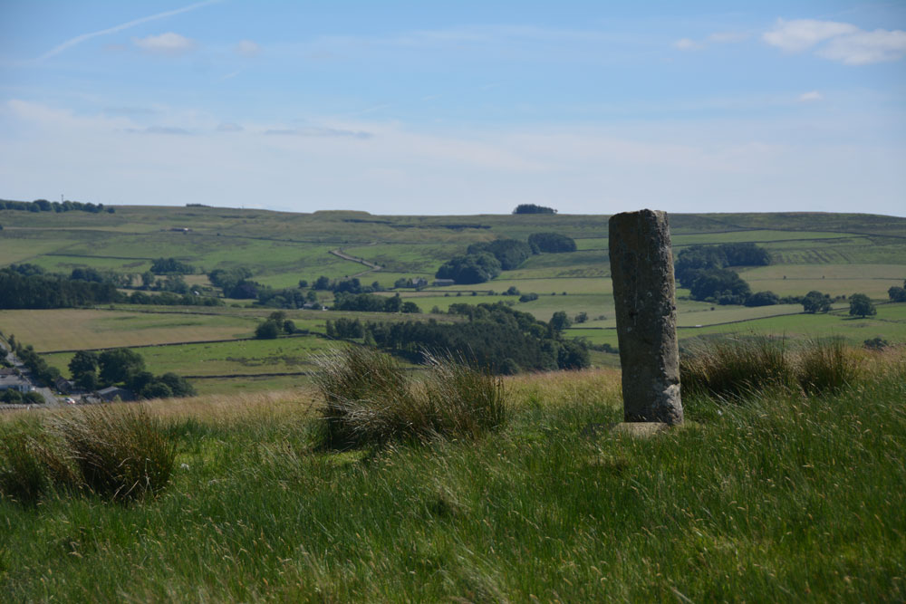
Woodhouse (West Woodburn) submitted by Anne T on 10th Jul 2017. This being England, we didn't climb the barbed wire fence for a closer look, but used the zoom lens on the camera. There are great views to the east across the Rede Valley.
(View photo, vote or add a comment)
Log Text: Woodhouse Round Cairn and Roman Milestone, Northumberland: How many times have we driven up and down this road and never spotted anything? Today I saw the stone peering above the stone wall to the west of the A68, where the Sandstone Way crosses it.
There was a tumulus marked on the map, so I started to look out for it. “There’s a standing stone,” I observed as we approached the spot, and as there was somewhere to pull in, we did. I hopped out of the car with the camera, seeing two boys with go-carts just inside the gate. I asked them if they lived there and we talked at cross purposes for a couple of minutes until one of them said ‘this is a bridleway’ so I felt free to open the gate, go in and have a closer look at the tumulus.
There is a distinct mound, with brilliant views over the Rede Valley to the east. I thought the ‘standing stone’ was in fact a gatepost as I thought there was a metal bracket in the stone on its northern side. It wasn’t until we got home and looked it up that we realised it was a Roman milestone which has been erected in this spot by the (yes, again!) The Redesdale Society.
Well worth stopping to have a look. Can’t believe we haven’t spotted this before.
Woodburnhill (East Woodburn)
Trip No.33 Entry No.2 Date Added: 10th Jul 2017
Site Type: Ancient Cross
Country: England (Northumberland)
Visited: Yes on 8th Jul 2017. My rating: Condition 3 Ambience 4 Access 4
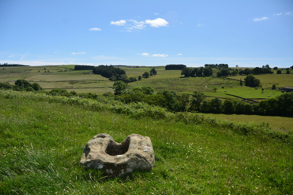
Woodburnhill (East Woodburn) submitted by Anne T on 10th Jul 2017. Looking south east across the Lisles Burn valley towards Stidlehill Common.
(View photo, vote or add a comment)
Log Text: Cross base near Woodburnhill Farm, Northumberland: Trying to find the footpath near Parkhead Farm to Robin of Risingham, I spotted the ‘cross (rems of)’ on the OS map just outside East Woodburn at Chairford Bridge.
As this wasn’t far away, we decided to explore. Parking at the northern side of the hamlet of Chairford Bridge, opposite the gate and track to Woodburnhill Farm, we let ourselves into the field and walked up towards the farm.
The cross base is sited on a small mound some 150 metres west of the farmhouse, not quite at the top of the hill. There are lovely views back to Chairford Bridge, south over the Lisles Burn valley and north to Darney Crag quarries and Hartside.
The cross base is roughly hewn but the socket is more substantial (larger) than others we’ve seen recently. The cross shaft would have been visible from a good way around.
Having found this spot, there are cairns and enclosures nearby which it would be nice to come back to.
Danby Rigg Marker Stone (Crossley Gate)
Trip No.32 Entry No.5 Date Added: 10th Jul 2017
Site Type: Marker Stone
Country: England (Yorkshire (North))
Visited: Yes on 2nd Jul 2017. My rating: Condition 3 Ambience 4 Access 3
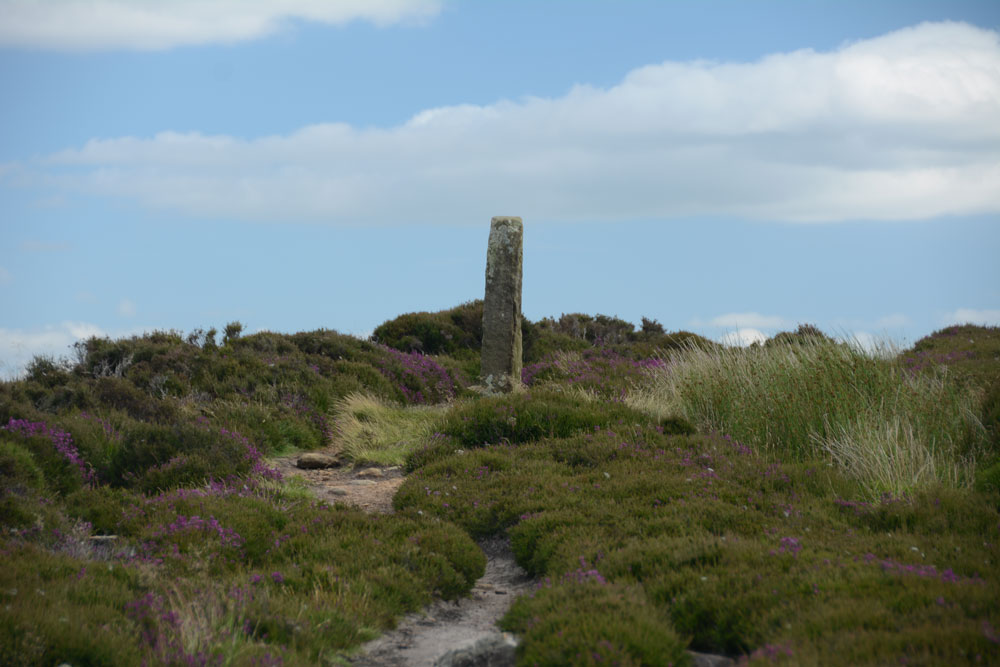
Danby Rigg Marker Stone (Crossley Gate) submitted by Anne T on 9th Jul 2017. Having walked about 100 metres down the track towards the ring cairn with standing stone, I turned back to look at this marker/standing stone, which is very visible to walkers on the horizon.
(View photo, vote or add a comment)
Log Text: Danby Rigg Marker Stone (Crossley Gate), North Yorkshire: this isn't marked on the OS map, but it is scheduled and listed on Pastscape. It is in a beautiful spot looking east to Lower Fryup Dale and marks the junction of two paths - one which comes up from the valley to the east, the track that runs along the eastern side of the rigg, and the northern most track that leads across the rigg from Lower Fryup Dale to Danby Dale, leading past the ring cairn with standing stone.
The stone working markings on the stone make it look like a modern replica, although Pastscape says it's medieval. Being so close to the nearby cross-dyke and round cairn, it is very much like walking in the footsteps of the people who lived on the ridge all those many years ago.
Danby Rigg Marker Stones
Trip No.32 Entry No.2 Date Added: 10th Jul 2017
Site Type: Marker Stone
Country: England (Yorkshire (North))
Visited: Yes on 2nd Jul 2017. My rating: Condition 3 Ambience 4 Access 4
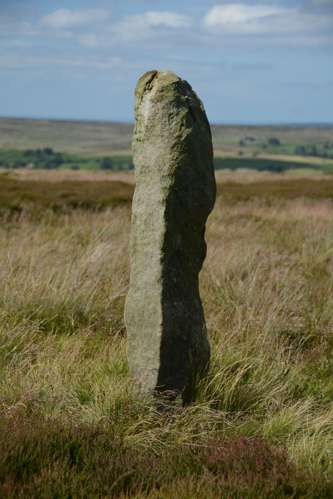
Danby Rigg Marker Stones submitted by Anne T on 9th Jul 2017. This is the same stone from a different angle, looking north east across the moorland towards Ainthorpe village. It s a lonely spot, which could be very wild in winter months.
(View photo, vote or add a comment)
Log Text: Danby Rigg Marker Stones, North Yorkshire: I was really surprised to find these marker stones on top of the moor, running from the Standing Stone and trig point in line with Slate Hill to Danby Dale.
We didn't walk to all of them, as we wanted to get across to the cross dyke, round cairn and ring cairn on the northern side of the ridge.
As an olden-day traveller, particularly in winter months, I would have been grateful to have seen these stones marking the way. Beautiful views.
Robin of Risingham (Woodburn)
Trip No.33 Entry No.1 Date Added: 10th Jul 2017
Site Type: Carving
Country: England (Northumberland)
Visited: Yes on 8th Jul 2017. My rating: Condition 3 Ambience 3 Access 4
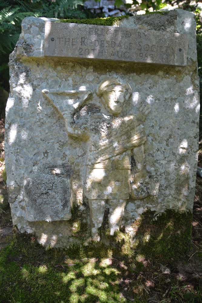
Robin of Risingham (Woodburn) submitted by Anne T on 9th Jul 2017. The carving (a half sized modern replacement put here by Redesdale Society in 1983). Behind this carved stone there is a gap of a few inches then a huge, odd shaped boulder. Despite numerous searches on the internet we've been unable to find where the remains (the legs) of the original carving are currently kept. They didn't appear to be on the boulder - we looked long and hard.
(View photo, vote or add a comment)
Log Text: Robin of Risingham, West Woodburn: Our first stop of the day, just south of West Woodburn on the A68. The sun was shining, it was warm and there was barely a breeze apart when the many motorbikes whizzed past at high speed.
Conveniently, there is a layby next to the start of the footpath leading from the A68 to Parkhead Farm at NY 90466 85463. Letting ourselves in through the gate into the field, the view was picturesque with views across the River Rede Valley to the west and pretty sheep and their large lambs.
We were keen to see this as the Historic England entry says this is the only known Roman statue carved from rock in Northumberland.
Making our way to the southern edge of the farm, there was a track leading through the field just to its east, just above their driveway. Following this to the end of the field, there was no way out – no stile, no sign, nothing. We retraced our steps and tried to find a different way past the farm buildings and ended up in a barn with some wonderful horses. In the end, we let ourselves into the farmyard and walked down the driveway, hoping to come across someone so we could ask where the proper path was.
There are some 3 to 4 houses along your left hand side here. Walking past the last one, Robin can be found about 100 metres further along the driveway. Husband Andrew then headed up the short tree covered slope to the wall separating the farm drive from the quarries above and found the carving hidden amongst the trees.
The dappled sunlight coming through the trees made this tricky to photograph. All the literature we’ve read said only the legs remain. We hunted for ages to see if they were on the rock behind the modern replica, or on the surrounding stone walls.
The intention later was to find the Roman Tombs on Otterburn Ranges which weren’t being used for military training this weekend, but we spent so long on other sites that we left this for another day.
Hart Leap Stones
Trip No.32 Entry No.9 Date Added: 6th Jul 2017
Site Type: Misc. Earthwork
Country: England (Yorkshire (North))
Visited: Yes on 2nd Jul 2017. My rating: Condition 2 Ambience 4 Access 5
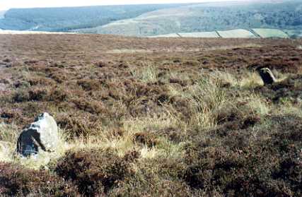
Hart Leap Stones submitted by kelpie on 7th Jul 2002. Said to mark the dying leap of a hunted hart these are probably the remains of a stone row. NZ 73476 03555
(View photo, vote or add a comment)
Log Text: Hart Leap, Glaisdale Rigg: From the Black Hill Cross/Standing Stone, despite having the grid references for this site, we drove past it twice and had to park up and get out and explore. Fortunately there was a moorland track heading eastwards across the moor with room to pull up in. In driving further north along the road, there is another trig point, TP3365 (Glaisdale Rigg).
Exploring first to the east of the road, we spotted two stones lying low in the grass. The earthwork is barely discernible on the eastern side of the road, but is much clearer on the west. We walked the bank on the western side. The Historic England entry mentions a third stone on the eastern side of the road, but we didn’t spot this.
I’m certainly pleased to have been ‘out and about’ with the archaeology group, as at least I could start to interpret what I was seeing on the ground. The site has superb views over Great Fryup Dale.
Glaisdale Rigg (Hill Top)
Trip No.32 Entry No.10 Date Added: 6th Jul 2017
Site Type: Marker Stone
Country: England (Yorkshire (North))
Visited: Yes on 2nd Jul 2017. My rating: Condition 3 Ambience 4 Access 5
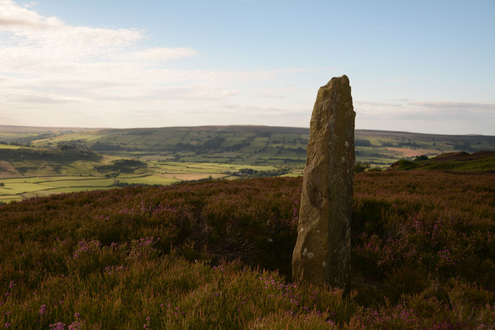
Glaisdale Rigg (Hill Top) submitted by Anne T on 6th Jul 2017. This stone stands proudly at the western side of the moorland road running northwards along Glaisdale Rigg. It is not far from the trig point and about 700 metres from Black Hill Cross. There are splendid views westwards across Great Fryup Dale.
(View photo, vote or add a comment)
Log Text: Glaisdale Rigg Standing Stone: From Hart Leap, we were making our way home. Spotting this, I got my husband to virtually do an emergency stop as I spotted this stone at the side of the road. There is nothing on Pastscape or Historic England about this stone, but it lies just under 700 metres north north east of Black Hill Cross/Standing Stone.
It stands proudly at the western side of Glaisdale Rigg, about a metre or so from the western side of the moorland road, virtually in line with Hill Top Farm in the valley below. It has great views over Great Fryup Dale, and looking south west to where Great and Little Fryup Dales meet.
It was a nice find to end the evening with.
Danby Rigg Cairn With Standing Stone
Trip No.32 Entry No.6 Date Added: 5th Jul 2017
Site Type: Ring Cairn
Country: England (Yorkshire (North))
Visited: Yes on 2nd Jul 2017. My rating: Condition 2 Ambience 4 Access 3
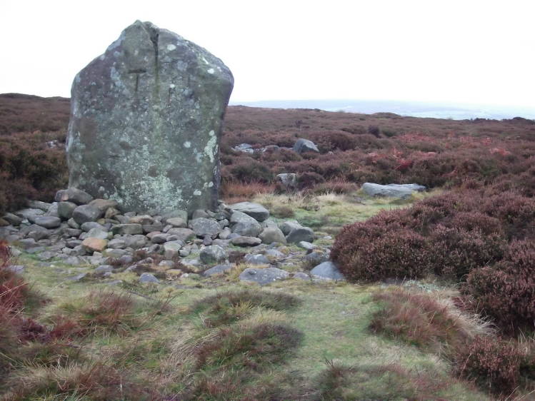
Danby Rigg submitted by tlgreen on 11th Sep 2011. Standing stone on Ainthope Rigg, remnant of a former stone circle.
(View photo, vote or add a comment)
Log Text: Danby Rigg Ring Cairn with Standing Stone, North Yorkshire: Of all the sites on Danby Rigg, this was the one I wanted to see most of all, especially after seeing the photos on the Portal, and I wasn't disappointed, although rather than a stone circle, I found a ring cairn with standing stone. The views to the west to Danby Dale and Little Fryup Dale were lovely on this cloudy, but warm, afternoon.
I was very aware of being in a very ancient landscape and there appeared to be many cairns popping out of the ground (where the heather had been burnt away) and vegetation covered low mounds everywhere.
The cairn is recorded on Pastscape (Monument ID 28809) and also Historic England, where the whole Danby Rigg landscape is recorded 'en masse'. The latter says: "The northernmost, which incorporates a standing stone, was excavated by Atkinson in 1863 and re-excavated in 1986-89. At the centre of the ring cairn there was a 1.7m by 1.1m pit containing two Bronze Age cremation urns and a large quantity of burnt bone. The stones of the ring bank were uncovered but not removed during the excavation and further archaeological remains are expected to survive underneath."
There was a further way marker along the track to the west towards Danby Dale.
Danby Rigg Cross Dyke (Crossley Side)
Trip No.32 Entry No.3 Date Added: 5th Jul 2017
Site Type: Misc. Earthwork
Country: England (Yorkshire (North))
Visited: Yes on 2nd Jul 2017. My rating: Condition 2 Ambience 4 Access 4
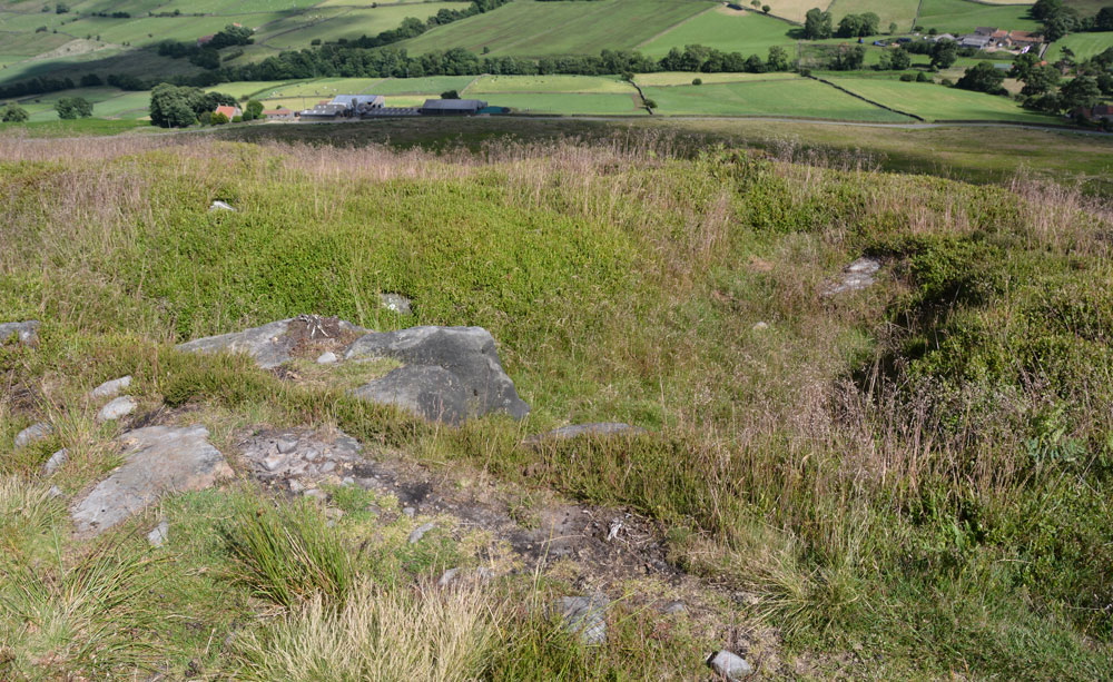
Danby Rigg Cross Dyke (Crossley Side) submitted by Anne T on 5th Jul 2017. Standing some 10 metres from the footpath in the middle of the cross dyke looking down into Little Fryup Dale with Crossley House Farm below.
(View photo, vote or add a comment)
Log Text: Danby Rigg Cross Dyke (Crossley Side), North Yorkshire: From the standing stone (marker stone) and trig point, we walked along the footpath leading approx. north east along the eastern side of the ridge towards the large round cairn. I confess to having walked past this at first, almost reaching the round cairn, but turned round and spotted the long, low hump rising out of the heather.
Walking along the earthwork, it is made of earth and stones and feels substantial under the feet. What a view down to Lower Fryup Dale and Crossley House Farm below.
I was keen to photograph this and the cairn and move onto the 'stone circle'. So much to see on this ridge - it's a very complex Bronze Age landscape. I had no idea how much was here until we started walking. A very beautiful part of the world.
Black Hill Cross (Glaisdale Rigg)
Trip No.32 Entry No.7 Date Added: 5th Jul 2017
Site Type: Ancient Cross
Country: England (Yorkshire (North))
Visited: Yes on 2nd Jul 2017. My rating: Condition 3 Ambience 4 Access 5
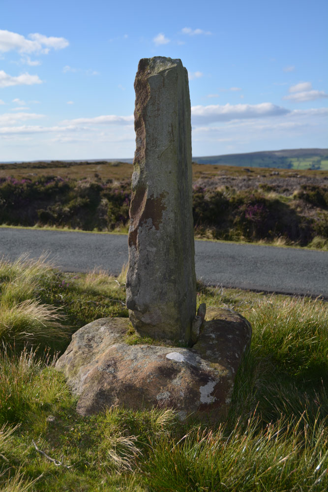
Black Hill Cross (Glaisdale Rigg) submitted by Anne T on 5th Jul 2017. This wayside cross must have been a welcome sight in the middle of this isolated (but beautiful) moorland, especially in the winter months. The base is crudely carved; the shaft looks like a modern addition.
(View photo, vote or add a comment)
Log Text: Black Hill Cross, Glaisdale Rigg: From Danby Rigg, we made our way to Glaisdale Rigg. I’ve been to some surprisingly beautiful parts of England before, but this was Pretty with a capital ‘P’. We needed the map to follow the surprisingly windy (and hilly) roads through Street village to Glaisdale Rigg.
Whilst described as a standing stone on the OS map this is clearly an old cross base with a more recent cross shaft wedged in. It must have been a very welcome sight to travellers, especially during winter months, in this very isolated piece of moorland. Well worth stopping to appreciate the views, especially as it was on our way to Hart Leap.
